Virtual Council
Meeting
Held via Zoom
on
Monday 20 September 2021
at 7:00pm
Members: Cr
Munroe (Mayor), Cr Barker, Cr Carr (Deputy Mayor), Cr Cutts,
Cr
Davenport, Cr Lane, Cr Liu, Cr McNeill, Cr Massoud, Cr Skilbeck, Cr
Stennett
Mr Simon McMillan
Chief
Executive Officer
|
Recording of Meeting and Disclaimer
Please
note every Council Meeting (other than items deemed confidential under
section 3 (1) of the Local Government Act 2020) is being recorded and
streamed live on Whitehorse City Council’s website in accordance with
Council's Live Streaming and Recording of Meetings Policy. A copy of the
policy can also be viewed on Council’s website.
The recording will be archived and made publicly
available on Council's website within 48 hours after the meeting on
www.whitehorse.vic.gov.au for a period of three years (or as otherwise agreed
to by Council).
Live streaming allows everyone to watch and listen to
the meeting in real time, giving you greater access to Council debate and
decision making and encouraging openness and transparency.
All
care is taken to maintain your privacy; however, as a visitor in the public
gallery, your presence may be recorded. By remaining in the public gallery,
it is understood your consent is given if your image is inadvertently
broadcast.
Opinions expressed or
statements made by individual persons during a meeting are not the opinions
or statements of Whitehorse City Council. Council therefore accepts no
liability for any defamatory remarks that are made during a meeting.
|
Council Minutes 20
September 2021
Meeting opened at 7:00pm
Present: (Mayor) Cr Munroe, Cr Barker, Cr
Carr (Deputy Mayor), Cr Cutts, Cr Davenport, Cr Lane, Cr Liu, Cr McNeill, Cr Massoud,
Cr Skilbeck, Cr Stennett
Officers: S McMillan, S Cann, J Green, L
Letic, S White, S Sullivan, V Ferlaino, C Altan, J Russell, R Johnston
1 PRAYER
1a Prayer
for Council
We give thanks, O God, for the Men and
Women of the past whose generous devotion to the common good has been the
making of our City.
Grant that our own generation may build
worthily on the foundations they have laid.
Direct our minds that all we plan and
determine, is for the wellbeing of our City.
Amen.
1b Aboriginal
Reconciliation Statement
“Whitehorse City Council
acknowledges the Wurundjeri Woi Wurrung people of the Kulin Nation as the
traditional owners of the land we are meeting on and we pay our respects to
their Elders past, present and emerging and Aboriginal and Torres Strait
Islanders from communities who may be present today.”
2 WELCOME
AND APOLOGIES
The Mayor welcomed all
APOLOGIES: Nil
3 DISCLOSURE
OF CONFLICT OF INTERESTS
The Mayor Cr Munroe declared a
direct conflict of interest in Item 9.1.5 Request to Occupy Council Owned Land
from Telstra Corporation Limited as he is employed by Telstra.
4 CONFIRMATION
OF MINUTES OF PREVIOUS MEETINGS
Minutes of the Council and Confidential Council
Meeting 16 August 2021.
5 RESPONSES TO QUESTIONS
|
5.1
|
Mr
P Derham, submitted two questions on behalf of the Joint Parks Advisory Committees within the City of
Whitehorse
Question
1.
Will the Whitehorse City
Council’s support for the existing Parks Advisory Committees’
format (of volunteers undertaking pre-agreed park maintenance, other
environmental activities, and with the Whitehorse City Council providing
insurance cover for registered Parks Advisory Committee members and
on-the-day registered volunteers, when they are undertaking those pre-advised
and pre-agreed working bees), continue until June 30, 2022 while the current
situation about their format is resolved?
Mr Steven White Director
Infrastructure read out the question and responded on behalf of Council:
The existing Parkland Advisory
Committees will continue to be supported whilst Council works through the
current issues surrounding insurances, there will be some alternative
arrangements in place to ensure adequate protection and safety for volunteers
to mitigate any insurance risks.
Question 2.
Will the Whitehorse City Council
set up an in-person workshop with Councillors, Senior Whitehorse City Council
staff and representatives of the Parks Advisory Committees to identify the
problems with the current Parks Advisory Committee setup, the Council’s
needs of that volunteer activity, and Parks Advisory Committee
volunteers’ needs?
The workshop would be to develop
an appropriate model for Whitehorse City Councillors’ consideration at
their February 2022 meeting, with implementation of that format to begin on
July 1, 2022.
Mr Steven White Director
Infrastructure read out the question and responded on behalf of Council:
The consultation period on
possible changes to Parkland Advisory Committees recently closed. The
information received is currently being collated and reviewed. Further
information is being sought on some of the issues that have been raised, and
it is planned that a further meeting with Parkland Advisory Committee members
will be held to discuss the consultation outcomes.
|
|
5.2
|
Mr P Carter, Box Hill North,
submitted two questions on Vicinity Centres’
proposals for a 51 Storey Residential Tower and 28 Storey Commercial
Building.
Question 1.
Vicinity
Centres has proposals for a 51 Storey Residential Tower and 28 Storey
Commercial Building. In accompanying documentation, it refers to its Master Plan
for Box Hill Metropolitan Activity Centre, and meetings with Whitehorse, VicTrack,
and Department of Transport officers. The Masterplan was discussed with many
at these meetings and provide context for development. Plan Melbourne is the
State Government’s policy for Melbourne’s development and
presents the vision of the 20 minute neighbourhood, of which Strategic
Cycling Corridors are a key element. Does the Masterplan include
reference to the two Strategic Cycling Corridors that serve Box Hill
Metropolitan Activity Centre, including how Vicinity envisages where
it’s aligned and developed within the Box Hill Metropolitan Activity
Centre?
Mr Jeff Green Director City
Development read out the question and responded on behalf of Council:
The Vicinity Master Plan only
relates to a small section of the Box Hill Metropolitan Activity Centre, that
being the land occupied by the existing northern shopping centre owned by
Vicinity. Where applicable reference is made to the Strategic Cycling
Corridors in the Master Plan.
Question
2.
The
Department of Transport ‘Strategic Cycling Corridor’ shows the
indicative location of the two Strategic Cycling Corridors in Box Hill
Metropolitan Activity Centre.
https://transport.vic.gov.au/getting-around/walking-and-cycling/strategic-cycling-corridors
If
Vicinity does show the two Strategic Cycling Centre in their Masterplan, are
those locations different to that shown in the Department of Transport map?
Mr Jeff Green Director City Development
read out the question and responded on behalf of Council:
The reference to the Strategic
Cycling Corridors are consistent with the Department of Transport Map..
|
|
5.3
|
Mr
J Maxwell, Mitcham, submitted a question on Vicinity Linkages both for the
Rail Trail and for North-South Link.
Question
1.
COVID
has highlighted that good active transport connections for travelling around
Whitehorse are very, very important. Council has made a great start with its
Easy Ride routes, research here in Australia and overseas has shown that
connectivity is crucial for the majority of people to use such
infrastructure. One of the most important links is the Box Hill CBD, both for
the Rail Trail and for a North-South link. I have tried to read the Vicinity
applications for redevelopment, I cannot find any satisfactory linkage for
either of these. Will Council commit to ensuring that Vicinity includes these
linkages?
Mr Jeff Green Director City
Development read out the question and responded on behalf of Council:
Reference has been made to these
linkages in the Vicinity Master Plan where applicable. Council is
committed to the Vicinity Master Plan not precluding the delivery of these
linkages.
|
|
5.4
|
Mr
G Stone, Blackburn, submitted a question on future development works by
Vicinity
Question
1.
Hello
Councillors, I am a local cyclist regularly using the ‘goods
delivery’ bridge connecting the Mall to Prospect Street and Thurston Street
to Aqualink. I understand that this critical link may be removed in future
development works by Vicinity. I am extremely concerned at such an action as
it is critical to the Box Hill to Hawthorn Proposed Rail Trail and serves the
linking of the existing Box Hill to Ringwood Rail Trail which stops at
Station Street.
Are Council developing plans to
meet these important North-South and East-West connections for people who aim
to be active in their transport options?
Mr Jeff Green Director City Development read out the
question and responded on behalf of Council:
Council has engaged a consultant to undertake a feasibility
study for a rail overpass, cycling connection linking Nelson Road and Thurston
Street. Such connection would compensate for any loss of the ‘goods
delivery’ bridge.
|
6 Notices
of Motion
6.1 Notice
of Motion No. 152 Cr Liu
|
Motion
Moved by Cr Liu,
Seconded by Cr Cutts
That Council write to
the Minister for Transport and the State Member for Box Hill requesting that
the Department of Transport review its new process for the issuing of
Accessible Parking Permits due to the impact on the ability for charitable
community/not-for-profit groups, for example the Chinese Cancer and Chronic
Illness Society of Victoria, to obtain permits and the adverse effect this
has on such groups to deliver their important services to the community.
|
|
Amendment
Moved by Cr Barker,
Seconded by Cr Davenport
That Council write to
the Minister for Transport and the State Member for Box Hill, Forest Hill,
Burwood and Ringwood requesting that the Department of Transport review its
new process for the issuing of Accessible Parking Permits.
Lost
|
|
Council Resolution
Moved by Cr Liu, Seconded
by Cr Cutts
That Council write to
the Minister for Transport and all State Members of Parliament in Whitehorse
requesting that the Department of Transport review its new process for the
issuing of Accessible Parking Permits due to the impact on the ability for
charitable community/not-for-profit groups, for example the Chinese Cancer
and Chronic Illness Society of Victoria, to obtain permits and the adverse
effect this has on such groups to deliver their important services to the
community.
Carried UnanimouslY
|
6.2 Notice
of Motion No 153: Cr Stennett
|
That Council Officers:
1. Write
to the Department of Transport providing a background of traffic conditions
along Alwyn St, Mitcham including the formal resident petition and Council
response.
2. Advise
the Department of Transport of the community concerns relating to trucks
using Alwyn St and causing damage to street trees.
3. Request
approval from the Department of Transport for Council to implement a truck
ban along Alwyn St, between Mitcham Rd and Rooks Rd
4. Seek
approval from the Department of Transport for the implementation of a reduced
30km/h speed limit for Alwyn St, between Mitcham Rd and Rooks Rd.
5. Replace
all trees damaged and lost along Alwyn St with Pin Oaks.
|
|
MOTION
Moved by Cr Stennett,
Seconded by Cr Cutts
That Council Officers:
1. Write
to the Department of Transport providing a background of traffic conditions
along Alwyn St, Mitcham including the formal resident petition and Council
response.
2. Advise
the Department of Transport of the community concerns relating to trucks
using Alwyn St and causing damage to street trees.
3. Request
approval from the Department of Transport for Council to implement a truck
ban along Alwyn St, between Mitcham Rd and Rooks Rd.
4. Seek
approval from the Department of Transport for the implementation of a reduced
30km/h speed limit for Alwyn St, between Mitcham Rd and Rooks Rd.
5. Replace
all Pin Oak trees damaged and lost along Alwyn St with Pin Oaks.
|
|
AMENDMENT
Moved by Cr Davenport, Seconded Cr Barker
That Council Officers:
1. Write
to the Department of Transport providing a background of traffic conditions
along Alwyn St, Mitcham including the formal resident petition and Council
response.
2. Advise
the Department of Transport of the community concerns relating to trucks
using Alwyn St and causing damage to street trees.
3. Request
approval from the Department of Transport for Council to implement a truck ban
along Alwyn St, between Mitcham Rd and Rooks Rd
4. Seek
approval from the Department of Transport for the implementation of a reduced
30km/h speed limit for Alwyn St, between Mitcham Rd and Rooks Rd.
5 Replace
all Pin Oak trees damaged and lost along Alwyn St with indigenous trees
recommended by the Tree Education Officer which are consistent with
Whitehorse Urban Biodiversity Strategy.
LOST
|
|
A Division was called.
Division
|
For
Cr
Barker
Cr
Davenport
Cr
Munroe
|
Against
Cr
Carr
Cr
Cutts
Cr
Lane
Cr Liu
Cr
Massoud
Cr
McNeill
Cr
Skilbeck
Cr
Stennett
|
On
the results of the Division the motion was declared lost
|
|
The
Mayor indicated he would put the Substantive Motion of 6.2 Notice of Motion
No. 153 to the vote in two parts - points 1-4, and point 5.
|
|
The Mayor put points
1 to 4 to the vote which was CARRIED UNANIMOUSLY
|
|
The Mayor put point
5 to the vote which was LOST
|
|
A Division was called on point 5.
Division
|
For
Cr
Carr
Cr
Cutts
Cr
Lane
Cr McNeill
Cr
Stennett
|
Against
Cr
Barker
Cr
Davenport
Cr Liu
Cr Massoud
Cr
Munroe
Cr
Skilbeck
|
On
the results of the Division the motion was declared LOST
|
|
COUNCIL RESOLUTION
Moved by Cr Stennett, Seconded by Cr Cutts
That Council Officers:
1. Write
to the Department of Transport providing a background of traffic conditions
along Alwyn St, Mitcham including the formal resident petition and Council
response.
2. Advise
the Department of Transport of the community concerns relating to trucks
using Alwyn St and causing damage to street trees.
3. Request
approval from the Department of Transport for Council to implement a truck
ban along Alwyn St, between Mitcham Rd and Rooks Rd.
4. Seek
approval from the Department of Transport for the implementation of a reduced
30km/h speed limit for Alwyn St, between Mitcham Rd and Rooks Rd.
CARRIED UNANIMOUSLY
|
Attendance
Cr Davenport left the virtual meeting at 8:10pm and
returned at 8:11pm.
7 Petitions
7.1 Simpson
Park, Mitcham
A petition signed by 122 signatories has been received
requesting Council to abandon the proposal to construct an enclosed (fenced)
dog park for Simpson Park and to retain the grass area north of the oval as
open space for the benefit of all park users.
|
COUNCIL RESOLUTION
Moved by Cr McNeill,
Seconded by Cr Lane
That
the Council accept an Item of Urgent Business.
Carried
Unanimously
|
|
8.1 Suburban Rail Loop
|
|
|
COUNCIL RESOLUTION
Moved by Cr Barker, Seconded by Cr McNeill
That
Council:
1. Notes
that the Suburban Rail Loop Bill 2021 passed a third reading in the Victorian
lower house.
2. Develop
a graphic representation document showing the extent of areas (1.6 km radius
for the proposed Box Hill and Burwood stations) that the state government
will have authority to assume planning control for.
3. Develop
an accessible summary of Council’s concerns regarding the Suburban Rail
Loop Bill/Act.
4. Resolves
to publish the graphic representation and summary document in the Whitehorse
news, website and on social media channels.
|
|
|
The
Mayor indicated he would put points 1 and 3, and 2 and 4 of the motion to the
vote in parts
|
|
|
The Mayor put
points 1 and 3 of the motion to the vote which was CARRIED UNANIMOUSLY
|
|
|
The Mayor put
points 2 and 4 of the motion to the vote which was CARRIED
|
|
|
A Division was called.
Division
|
For
Cr
Barker
Cr
Carr
Cr
Cutts
Cr
Davenport
Cr
Lane
Cr
Massoud
Cr
McNeill
Cr
Munroe
Cr
Skilbeck
Cr
Stennett
|
Against
Cr Liu
|
On
the results of the Division the motion was declared carried
|
Council Minutes 20
September 2021
9 Council
Reports
9.1 City
Development
9.1.1 Infrastructure
and Development Contributions Framework (Stage One)
FILE NUMBER:
SF20/1071
ATTACHMENT
SUMMARY
This report provides an update
on the Infrastructure and Development Contributions Framework. Stage One of
this work has culminated in a report that provides an overarching information
base for Council to consider how infrastructure funding and delivery mechanisms
can be used to meet infrastructure needs over time. A thorough review of
Council’s strategies and policies relating to development and
infrastructure provision has determined that Council has a sound basis for the
introduction of an infrastructure funding mechanism. It is recommended that Council
proceed with the preparation of a municipal wide Development Contributions Plan
(DCP) which has the potential to recover around 20% of the total cost to
Council of all projects listed in the DCP from new development.
|
Council
Resolution
Moved by Cr McNeill,
Seconded by Cr Davenport
That Council endorse the Infrastructure and
Development Contributions Framework, July 2021, prepared by HillPDA shown in
Attachment 1 as the basis for the next stage of the project involving the
preparation of a Development Contributions Plan for the municipality.
Carried
Unanimously
|
background
The need to investigate a development contributions
mechanism for City of Whitehorse was identified some time ago.
Most recently, the need for Council to further explore
development contributions systems was reinforced by the Managing Development
Contributions, March 2020 report from the Victorian Auditor-General’s
Office (VAGO). The VAGO report noted that Council was missing out on
development contributions from the significant development that has occurred in
the municipality, particularly in Box Hill. The VAGO report highlighted the
complexity of the development contributions system in Victoria and the
challenges, rigour and resources required for councils that seek to implement
such a system.
In 2017, strategic work was undertaken to inform a suitable
development contribution mechanism for the Box Hill Metropolitan Activity
Centre (MAC). This work recommended investigating the application of an
Infrastructure Contributions Plan (ICP) for the Box Hill MAC. The ICP mechanism
was established by the State Government in response to a detailed review of the
Development Contributions System in 2012, which recommended the introduction of
a standardised system. At the time of this strategic work and at present, the
ICP mechanism is only available to greenfield growth areas. The ICP system was
intended to apply to strategic development areas, such as the Box Hill MAC, but
this has not yet eventuated. In its absence, a Development Contributions Plan
Overlay (DCPO) remains as the primary mechanism available through the
Whitehorse Planning Scheme.
In recognition of a need to explore development
contributions mechanisms in Whitehorse, Council allocated funding for a new
project in the 2020/21 and 2021/22 financial years.
In October and November 2020 Council publicly advertised a
tender that sought the services of a consultant to prepare an Infrastructure
and Development Contributions Framework (the Framework) for the municipality.
After a detailed evaluation process, HillPDA was appointed as the lead
consultant and work commenced in late January 2021.
The Framework report prepared in Stage 1 of the
project is intended to provide an overarching analysis and review of the
factors that drive change and development in the municipality, including growth
projections. It will determine the infrastructure needs of the municipality
over approximately the next two decades and how these needs may be partly
funded through contributions from new development.
Stage 2 will build on the work completed in Stage 1
and involve the preparation of the development contributions mechanism,
including its strategic basis and further refinement of the infrastructure
projects list. Stage 3 will involve an implementation plan that details
the Council systems and procedures needed to support the agreed framework and
meet legislative requirements, and Stage 4 will comprise drafting of the
planning scheme amendment documentation. It is anticipated that the
current project with HillPDA will be completed in January 2022.
DISCUSSION
Stage 1 of the project has
culminated in the Infrastructure and Development Contributions Framework Report
(the Report) prepared by HillPDA shown in Attachment 1. The report provides an
overarching information base that considers the demand for infrastructure
across the municipality and how Council can use infrastructure funding and
delivery mechanisms to meet needs over time.
The report includes an extensive
review of Council policies and strategies at Section 8.0. This review
highlights that Council has a significant body of information relating to
strategic planning for future development and infrastructure needs to support
existing and new development. This information can form the basis of
infrastructure funding mechanisms. The Report includes a small number of
policies and strategies that are in draft format and have not yet been
presented to the Councillor group. It is envisaged that these strategies and
policies will be removed from the Report prior to it being presented to the
Councillors.
For a funding mechanism to be
supported, a specific list of projects is required and must include the
location, cost and an accurate description of the works. HillPDA has reviewed
Council’s infrastructure project plans, including the 10-year Capital
Works Plan, and provided an overview of potential projects for a funding
program, such as a Development Contributions Plan (DCP) at Section 10.0 of the
Report. A project list is also attached at the end of the Report. It is noted
that this list is a work in progress and will be refined and updated in the
next stage of work.
It is recommended that Council
pursue a DCP funding mechanism which is implemented through a DCPO in the
Whitehorse Planning Scheme. A Planning Scheme Amendment would be required if
this recommendation is pursued.
A DCP would
collect levies based on residential and non-residential development that
requires a planning and / or building permit. It would not collect levies from
development that has been constructed (and obtained required permits) prior to
the DCP becoming operational via gazettal of an amendment to include the DCPO
in the Planning Scheme. The DCP levies can vary across the municipality with
‘charge areas’ applying specific levies based on the catchment
areas of the infrastructure projects listed in the DCP. It is anticipated that
a municipal wide DCP in Whitehorse may include 17 different charge areas.
The cost recovery
from a municipal wide DCP will depend on which projects are included in the DCP
project list, the location and catchment area of the projects, and the extent
of new development anticipated in the catchment areas. This will be assessed in
the next stage of the work however, HillPDA has suggested that cost recovery
could be around 20% as a municipal wide average. It is noted that the Box Hill
Metropolitan Activity Centre would have a higher cost recovery rates of up to
approximately 50% given the extent of development anticipated.
The Framework recommends that
Council proceed with preparing a DCP as this is a wide reaching tool that can apply
to the entire municipality and help deliver essential infrastructure.
CONSULTATION
Extensive internal consultation has
occurred across a wide range of internal departments. This consultation and
information sharing has assisted with the identification of potential projects
that could be funded by a development contributions mechanism and the
projections that would inform such a system. Internal consultation is ongoing
and will assist in refining the project list and broadening the organisation’s
understanding of the development contribution system in preparation for its
potential implementation.
No external consultation has
occurred to date. Once the work from the project is publicly available, the
project will be profiled on the Council website to inform the community. This
information will set out the next steps of the project.
Consultation with the community
will occur as part of any future planning scheme amendment process that
proposes to implement a Development Contributions Plan Overlay in the municipality.
During this process the community will be invited to provide feedback on the
proposed planning scheme amendment, including any proposed Development
Contributions Plan.
Engagement with the Department and
Environment, Land, Water and Planning is also occurring during the project.
FINANCIAL IMPLICATIONS
|
|
Budget
|
Expenditure
|
|
|
|
|
|
2020/21
|
200,000
|
59,400 -
as at 30 June 2021
|
|
2021/22
|
200,000
|
|
|
|
|
|
|
Sub
Total
|
400,000
|
59,400
|
|
|
|
|
|
Total
|
400,000
|
59,400
|
The tendering process was delayed in 2020 due to the
caretaker period before the Council elections. HillPDA were appointed in early
January 2021 and commenced the project at the end of the month.
The project timeframes set out in the request for tender
were ambitious given the complexity of the project and the extent of
information required from numerous departments within Council. Collation of
property data and project information has required considerable input and time
from Council officers. HillPDA has progressed the project as much as possible
with the information that has been provided and issued a Draft Stage 1 Report
before the end of the 2020/21 year.
As an important budget initiative, there is a desire to keep
this project progressing into the subsequent stages. It is noted that some of
the work in stages 2, 3 and 4 can proceed simultaneously.
POLICY IMPLICATIONS
The Infrastructure and Development
Contributions Framework supports the following Council Plan 2017-2021 strategic
directions:
· Maintain
and enhance our built environment to ensure a liveable and sustainable city.
· Strategic
leadership and open and accessible government.
Plan Melbourne 2017-2050 is the
metropolitan planning strategy and identifies areas expected to accommodate
significant growth and change, in particular the Box Hill Metropolitan Activity
Centre and a further four Major Activity Centres. This anticipated growth and
change in Whitehorse has subsequent impacts on local infrastructure needs and
demands.
The following State Policies in the
Planning Policy Framework of the Planning Scheme are of relevance to the
Framework and the steps that will follow.
Clause 19.03-1S (Development and
infrastructure contributions plans) contains the following objective,
“To facilitate the timely
provision of planned infrastructure to communities through the preparation and
implementation of development contributions plans and infrastructure
contributions plans”.
Clause 19.03-1S also states the
following strategies of relevance to this project:
· Prepare
development contributions plans and infrastructure contributions plans under
the Planning and Environment Act 1987, to manage contributions towards
infrastructure.
· Collect
development contributions on the basis of approved development and
infrastructure contributions plans.
· Require
annual reporting by collecting and developing agencies to monitor the
collection and expenditure of levies and the delivery of infrastructure.
The Local Planning Policy Framework
(LPPF), includes the following strategy under Clause 21.08 (Infrastructure):
· Obtaining
developer contributions toward cumulative infrastructure needs to which
development will add further demand.
To support this, the ‘further
strategic work’ clause at 21.08-6 recommends, “Investigate
appropriate tools and locations for requiring Development Contributions across
the municipality. This project is a direct response to this further work
direction.
Attachment
1 Infrastructure
and Development Contributions Framework 
Council Minutes 20
September 2021
9.1.2 Amendment
C220 Residential Corridors Built Form Study Planning Scheme Amendment
Authorisation
FILE NUMBER: SF19/379
ATTACHMENT
SUMMARY
Council engaged planning consultants Ethos Urban to
undertake the Residential Corridors Built Form Study (the Study). The Study
provides built form guidelines for those areas in the municipality along key
road corridors envisaged for substantial housing growth that interface with
less intense residential development. At the meeting on 29 January 2019 Council
resolved to seek authorisation from the Minister for Planning to undertake a
planning scheme amendment to implement the Study.
This report provides a summary of the conditions of
authorisation imposed by the Department of Environment, Land, Water and
Planning in order to proceed with the planning scheme amendment. This report
recommends that Council progress the amendment by submitting a revised Design
and Development Overlay to the Minister for Planning for re-authorisation to
exhibit the controls
|
COUNCIL
RESOLUTION
Moved by Cr Skilbeck, Seconded by Cr Massoud
That Council submit a revised planning scheme
amendment as shown in Attachment 1 to the Minister for Planning for
re-authorisation to exhibit in accordance with section 17 (3) of the Planning
and Environment Act 1987.
Carried
|
|
A Division was called.
Division
|
For
Cr
Barker
Cr
Cutts
Cr Liu
Cr
Massoud
Cr
Munroe
Cr
Skilbeck
|
Against
Cr
Carr
Cr
Davenport
Cr
Lane
Cr
McNeill
Cr
Stennett
|
On
the results of the Division the motion was declared carried
|
background
Council engaged planning
consultants Ethos Urban in late 2017 to undertake the Residential Corridors
Built Form Study, which was a new budget initiative in the 2017/2018 Council budget.
The Study produced draft built form guidelines for those areas in the
municipality along key east-west road corridors (Burwood Highway and Whitehorse
Road) where land in the Residential Growth Zone (RGZ) interfaces with land in
the Neighbourhood Residential Zone (NRZ) and the General Residential Zone
(GRZ).
At the Council meeting on 29
January 2019, Council resolved to:
1. Adopt the Draft Residential Corridors
Built Form Study at Attachment 1.
2. Seek
authorisation from the Minister for Planning under the Planning and Environment
Act 1987 (Section 8a) to prepare and exhibit an amendment to the Whitehorse
Planning Scheme to implement the recommendations of the Study.
3. Advise
all submitters to the Residential Corridors Built Form Study consultation of this
resolution.
Council officers submitted the request for authorisation on
11 October 2019 following an extensive review of the proposed controls,
including legal input. A request for further information was issued by the
Department of Environment, Land, Water and Planning (DELWP) on 16 December
2019. Following a meeting between representatives from DELWP and Council in
early January 2020, a response to the further information request was submitted
by Council on 24 January 2020. Council officers liaised with DELWP on numerous
occasions and a letter of authorisation, with conditions, was issued by DELWP
under delegation from the Minister for Planning on 17 February 2021 (Attachment
2).
DISCUSSION
DELWP has authorised Council to prepare
Amendment C220 for exhibition subject to the following conditions:
Table 1: Amendment C220 – Conditions of
Authorisation
|
Minister’s condition
|
Officer response
|
|
1. Revise
the DDO11 to ensure that:
|
|
|
a) It is consistent with the Ministerial Direction on the
Form and Content of Planning Schemes.
|
Condition
addressed
Officers have
reviewed the draft controls to ensure it is consistent with all relevant
Ministerial Directions.
Council officers engaged a legal
practitioner to undertake a review of the proposed changes to the DDO in
response to Minister’s conditions of authorisation. The legal review
concluded that the updated DDO is written according to the Minister’s
Direction on the Form and Content of Planning Schemes.
|
|
b) The side and rear setback requirements are
discretionary, not mandatory.
|
Condition
not supported
Tall buildings with no spacing between
buildings would be very imposing along the narrow RGZ corridors, both
limiting long distance views to the east, as well as dominating the immediate
low rise development in the adjoining residential zones and potentially
appearing as an almost continual and dominating built form to those
interfaces. Increased side and rear setbacks will make buildings less
imposing along the corridor and to adjoining land.
Mandatory setbacks allow for greater
opportunities for deep soil planting, landscaping and space between buildings
to minimise the need for screening measures and resulting poor built form
outcomes. If consistently applied through mandatory controls, a minimum 4.5
metre side setback equates to 9 metres between buildings. This is generally
considered sufficient for privacy without needing screening, which could be
considered a compromised built form outcome.
The use of consistent setbacks will
provide certainty to landowners and neighbouring properties and remove the
possibility of inequitable setbacks impacting on future developments. The
mandatory separations will also facilitate sizeable tree planting, and more
successful tree retention, between buildings and to rear interfaces with
other zones, which in itself will improve privacy and outlook.
Mandatory controls are only proposed
where deemed necessary to prescribe a strategically justified built form
outcome. The proposed mandatory controls will apply to a relatively small
percentage of land in the municipality affected by the RGZ along these
corridors, which will provide certainty for landowners along the corridor. As
such, Council officers do not recommend any changes to the mandatory
controls.
|
|
Minister’s
condition
|
Officer
response
|
|
c) Provisions are worded consistently with the head
provision.
|
Condition
addressed
Officers have reviewed the draft
provisions to ensure they are consistent with the head controls.
|
|
d) The design objectives (i) remove reference to equitable
development rights and (ii) include an objective in relation to lot
consolidation.
|
Condition (i) not supported; Condition
(ii) addressed
Equitable development rights are an
important concept that has been approved in other DDOs, including DDO10 in
the Melbourne Planning Scheme, where a design objective states “to
ensure that new buildings provide equitable development rights for adjoining
sites and allow reasonable access to privacy, sunlight, daylight and outlook
for habitable rooms”. This was included through Amendment C270melb in
2016.
The legal review also concurred with officers that
equitable development rights are an important concept and the design
objective should be retained. As
such, Council officers do not recommend removing the reference to equitable
development rights in the design objectives.
It
is acknowledged that consolidated sites have potential to achieve better
built form and amenity outcomes and that a number of new developments in the
corridors have assembled adjoining sites. An objective supporting
consolidation of lots therefore has merit and it is recommended that an
objective relating to lot consolidation be added.
|
|
e) Permit exemptions for small scale buildings and
works are included.
|
Condition addressed
As
discussed at a meeting with DELWP on 7 January 2020 and included in the
subsequent written response provided on 24 January 2020, Council officers do
not have any concerns with exempting smaller applications for minor buildings
and works e.g. outbuildings, however DELWP suggested that the proposed DDO
exempts development 4 storeys and under. Officers do not consider such
development to be small scale buildings and works. Officers recommend that
developments 3 storeys and under are exempt from the permit requirements of
the DDO11. This means that developments 3 storeys and under would be assessed
against ResCode.
|
|
f) It is clear that the shadowing requirement relates
to ‘additional’ shadowing of adjacent ‘public’ open
space.
|
Condition addressed
DELWP
stated that ‘public’ open space should be added to distinguish
the type of open space. They also recommended to add ‘additional’
as it is quite impossible to not have any overshadowing to the west facing
open space during the time specified (being between 12pm and 2pm on 22
September). The DDO has been updated to reflect this condition.
|
|
2. Revise
the drafting of the explanatory report to reflect any changes made to the
amendment in response to the authorisation conditions.
|
Condition
addressed
The updated
explanatory report is at Attachment 1.
|
In the letter of authorisation, Council has also been encouraged
to consider whether the proposed height controls are implementable, the
implications for lot consolidation and the requirements of Clause 58 (Apartment
Developments).
Height and setback controls
The DDO submitted for authorisation
included a preferred maximum building height of 13 metres (4 storeys) along
Burwood Highway, east of Springvale Road and a preferred maximum building
height of 16 metres (5 storeys) in all remaining areas. A mandatory maximum
building height of 19 metres (6 storeys) applied in all areas.
DELWP is
seeking to understand if the proposed DDO encourages developments of 5 storeys
or greater (noting that a maximum height of 6 storeys is proposed), when it was
Council’s original intention that ResCode standards apply to development
4 storeys and less.
Council officers note DELWP’s concerns about the
proposed mandatory height and whether this will result in any unintended
outcomes, such
as limiting the development potential of sites. The planning system and
DELWP’s practice notes provide the ability to identify areas for growth,
but also to have parameters around that growth. DDO11 will allow Council
to manage the form of development above the 4 storey objective specified in the
RGZ, by applying mandatory building height and setback requirements to
developments that exceed the 4 storey objective specified in the zone.
A mandatory maximum height of 6 storeys is intended to
apply across all locations covered by the DDO. This is to maintain a sense of
openness and access to the sky views along the road corridors, as well as
maximise solar access to the low scale residential development of the adjacent
residential areas. It will also assist in the transition between the different
scales of adjoining development and minimise built form impacts such as visual
bulk.
The built form testing of recent planning permit approvals
undertaken in the Study established that the development capacity is maintained
and potentially increased with the proposed height and setback controls within
the RGZ corridors. The potential built form typologies reflect a varied built
form response that provide greater opportunities for deep soil planting, large
canopy trees and landscaping.
The provision of opportunities for planting large canopy
trees is consistent with the Whitehorse Neighbourhood Character Study 2014
which states that “vegetation is generally the most significant
determinant of neighbourhood character” in Whitehorse. The controls will
assist in the promotion and growth of the urban tree canopy and therefore the
DDO11 is aligned with objectives in Plan Melbourne, Living Melbourne and
the Planning Scheme to promote urban tree canopy.
Officers recommend Council retain the mandatory maximum
building height of 6 storeys across all areas where the DDO is intended to
apply, but remove the preferred maximum building heights. Currently there are
buildings which exceed the preferred height along Burwood Highway, such as the
development at 5 Stanley Road, Vermont South. This will also provide a more
straightforward approach to building heights along the corridors and is more
likely to be supported by DELWP. However, officers recommend inclusion of the
preferred heights as guidance in the local planning policy (see Attachment 1).
In the authorisation letter DELWP also had concerns as to
whether the proposed DDO can encourage a 4-storey preferred
height for buildings on Burwood Highway, east of Springvale Road. DELWP has
subsequently suggested that Council could consider not requiring a permit under the proposed DDO to construct a
building or carry out works for a development up to 3 storeys. This would
enable Council to apply requirements of the DDO to developments 4 storeys and
above, but only those elements relating to landscaping, overshadowing and
pedestrian interface.
Council’s legal review concluded
that DELWP’s advice would be a pragmatic way forward, whereby the
interfaces to the NRZ and GRZ of buildings up to 3 storeys in the RGZ (e.g.: on
single, unconsolidated lots) would be adequately dealt with via Clause 55
(ResCode). The table below highlights different development scenarios and
what controls would apply if the updated DDO was ultimately approved. Officers
therefore recommend the inclusion of this permit requirement in the proposed
DDO.
|
Development scenario
|
Controls that would apply
|
|
3 storeys and under
|
ResCode (Clause 55)
|
|
4 storeys
|
ResCode (Clause 55) and landscaping,
overshadowing and pedestrian interface elements of the proposed DDO
|
|
5 storeys and above
|
Clause 58 (Apartment Guidelines) and
proposed DDO in full
|
Lot consolidation
DELWP seeks to understand if the
requirements of DDO11 make development of unconsolidated sites feasible. Council
officers acknowledge DELWP’s concerns that most sites require
consolidation to be able to develop under the proposed controls, however
consolidation of lots is already occurring throughout the corridor with two lot
consolidations being sufficient to provide a superior development site of
1200-1500m2. Of the permit applications that were considered as part
of the Study (applications received and permits issued for multi-unit
development within the Study area over the last 5 years), approximately 80% of
applications included the consolidation of two or more lots. Three applications
did not involve site consolidation, two of those sites were large existing
sites (1201m2 and 7421m2).
While the Study pointed to a
limited number of sites where the DDO11 might apply, this related to the
existing lot configurations. Council anticipates further consolidation of lots
into the future and identified 17 instances of two adjoining sites and two
instances of three adjoining sites to have the same property owner along
Burwood Highway (at October 2020).
Concern that the controls will
hamper development of narrower or irregular sites is unfounded as the vast
majority of sites are standard lots of 600-800m2 and very few
‘special cases’ exist. If a site is not of a sufficient size then
landowners may not be able to achieve the allowable height which would result
in a ResCode outcome or more likely (based on the existing trends) a 3 storey
townhouse arrangement. This is already the case without the proposed DDO.
Clause 58 of the Planning Scheme
(Better Apartment Design Standards)
Clause 58 contains standards for
apartment development 5 storeys and above. Specifically it includes standards
relating to maximum room depth and cross ventilation, both of which impact
floor plate design. The requirement that a habitable room not exceed 9 metres
in depth generally results in back-to-back apartment layouts with a floor plate
width of no more than 20 metres, although it is recognised that floor plate
designs can differ depending on the layout of the apartment and recessive and
projective elements. This modified requirement discourages deep building blocks
and (building on the above discussion on consolidation of lots) means a common
two lot consolidation with a width of 30 metres is able to meet the DDO11
setbacks. Clause 58 therefore encourages development that maintains internal
and external amenity of sites and adjoining sites, which will be enhanced by
the DDO11.
The DDO seeks to balance change and
amenity by increasing setbacks to achieve more space for canopy tree planting
and retention, as well as more generous landscaping between buildings and at
the zone transition. This is aligned with the landscaping provisions of Clause
58. The DDO seeks a minimum deep soil area relative to tree height, being 800mm
(for small trees) and 1200mm (for large trees). This minimum soil depth
complements the minimum widths of planting areas indicated in Clause 58, being
a minimum of 3m (small tree) or 6m (large tree).
Council officers understand that DELWP has undertaken a
review of Clause 58 and is proposing to make changes to, amongst other
standards, the landscaping and wind provisions. Council officers accept that
these provisions may need to be amended or removed from the proposed DDO11 if
they are in conflict with any amended State provisions.
Next steps
There is a risk that DELWP will not
support the proposed changes made to the DDO shown in Attachment 1, as they do
not fully align with the Minister’s conditions of authorisation as
outlined in Table 1.
Officers have had discussions with
DELWP about the proposed changes to the DDO and the conditions of
authorisation. DELWP has provided suggested wording for Council to consider, as
discussed above. DELWP has confirmed that if Council does not agree with all of
the conditions of authorisation, then there would need to be a new
authorisation request lodged for consideration. Council could accept the
conditions of authorisation, however officers believe that this would be
contrary to the intention of the proposed DDO based on the Study adopted by
Council in 2019 that underpins the amendment.
It is therefore recommended that
Council pursue the application of the proposed revised DDO, with the changes
discussed in this report and fully outlined in Attachment 1. This will require
Council to submit the revised controls for the Minister for Planning to
re-authorise the amendment for exhibition.
CONSULTATION
The project was introduced to the
community within the study area in late March 2018 and included a short survey
to identify what resident’s value about their area, which was collated as
part of the background analysis to the Study. The second phase of engagement
was held from mid-July to mid-August 2018, and included two drop-in information
sessions which were attended by 92 people.
The community will be able to provide formal comment during
the statutory exhibition period for Amendment C220. The timing of the proposed
exhibition will be subject to authorisation by the Minister for Planning. If
authorisation is given, the exhibition period could commence shortly after.
FINANCIAL
IMPLICATIONS
The Study was included as a new
budget initiative in the 2017/2018 Council budget. Costs associated with the
planning scheme amendment process, such as exhibition costs and statutory fees,
are typically covered by the ongoing operational budget of Council. Charges for
the independent panel vary depending on the duration of the panel hearing and
the number of Panel members appointed. Charges typically cover any travel or
accommodation required by panel members and project support from Planning
Panels Victoria. If a planning panel is required, legal representation and
advice, and expert witnesses would be covered by Council’s operational
budget. Refer to the table below for financial details:
|
Budget
Item
|
Budget
(excl.
GST)
|
Expenditure:
Existing & Future Estimates
(excl. GST)
|
|
1. Consultant
fees 2017/2018
|
$80,000
|
$80,000.
|
|
2. Future
exhibition costs (operational budget)
|
|
Direct notification
|
|
$6,000
|
|
Publicity material and social
media
|
|
$2200
|
|
Government Gazette & The Age
notice
|
|
$2500
|
|
3. Future
statutory fees (operational budget)
|
|
Consideration by the Minister of a request to approve the
amendment
|
|
$488
|
|
4. Future
planning panel charges (operational budget)
|
|
Charges
from Planning Panels Victoria, including panel member fees, travel, accommodation
and project support
|
|
$40,000
|
|
5. Future
council planning panel representation (operational budget)
|
|
Includes
expert witness, legal representation and advice
|
|
$40,000
|
|
TOTAL
|
$80,000
(Excl. operational) budget items)
|
$171,188
(Incl. operational) budget items)
|
POLICY IMPLICATIONS
In October 2014 new residential
zones came into effect with gazettal of Amendment C160. Council had originally
included a 3 storey (11 metres) mandatory maximum for RGZ1 and a 4 storey (13.5
metres) mandatory maximum for RGZ2. The mandatory heights were removed by the
Minister when approving Amendment C160 and therefore the current controls do
not reflect the Council’s intentions.
Since the introduction of the new
zones, concern has been raised about the planning outcomes in these areas,
particularly where the RGZ interfaces with more traditional residential
development in the NRZ, and to a lesser extent the GRZ. Where a 3 or 4 storey
outcome was intended, VCAT has been approving developments greater than this,
and in some cases, with unsympathetic built form and limited landscaping.
The project supports Strategic
Direction 2 within the current Council Plan 2017-2021, which is to “Maintain
and enhance the built environment to ensure a liveable and sustainable
city”. In particular it supports 2.1.1 “Development which
respects our natural and built environments and neighbourhood character while
achieving a balanced approach to growth in accordance with relevant legislation”.
The proposed DDO11 will seek to achieve Council’s and the
community’s aspirations for the city and the local neighbourhood
character through a set of planning controls that provide greater certainty to
residents, property owners and developers along, and interfacing with, the growth
corridors along Burwood Highway and Whitehorse Road. It proposes built form
controls that seek to ensure high quality development that respects adjoining
development and does not comprise the character and amenity of adjacent
low-rise residential development.
The proposed DDO will also give
further expression to Clause 21.06 Housing and Clause 22.03 Residential
Development intended for the residential growth corridors, where substantial
change areas interface with other housing change areas.
Attachment
1 Amendment C220
Whitehorse Draft Authorisation 
2 Amendment C220
Whitehorse DELWP Conditions of authorisation
Attendance
The
Virtual Council meeting adjourned at 8:58pm for a five minute break, resuming
at 9:03pm.

Council Minutes 20
September 2021
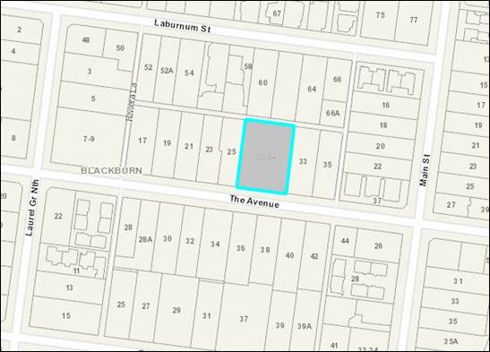
9.1.3 27-29
The Avenue, Blackburn (Lots 50 & 51 LP 3212 B) Amendment to Permit for
Partial demolition and relocation of existing dwelling, buildings and works for
alterations and additions to a heritage dwelling, front fence and tree removal.
FILE NUMBER:
WH/2019/1029/A
ATTACHMENT
SUMMARY
This application was advertised,
and a total of 16 objections were received. The objections raised issues with
application history, inadequate landscaping opportunities, inconsistent with
preferred neighbourhood character, heritage impacts, inconsistent with Policy,
excessive site coverage and environmental impacts. An Online Consultation Forum
was held on 11 August 2021 chaired by Councillor Munroe. All issues
raised were explored, however no resolution was reached between the parties.
This report assesses the application against the relevant provisions of the
Whitehorse Planning Scheme, as well as the objector concerns. It is
recommended that the application be supported, subject to conditions.
|
SUBSTANTIVE
Motion
Moved by Cr Barker,
Seconded by Cr Davenport
That Council:
A. Being the Responsible Authority, having
caused Application WH/2019/1029/A for 27-29 The Avenue, BLACKBURN (Lots 50
& 51 LP 3212 B) to be advertised and having received and noted the
objections is of the opinion that the granting of a Notice of Decision to
Grant an Amended Planning Permit for the Partial demolition and relocation of
existing dwelling, buildings and works for alterations and additions to a
heritage dwelling, front fence and tree removal, is acceptable and should not
unreasonably impact the amenity of adjacent properties.
B. Issue a Notice of Decision to Grant an
Amended Planning Permit under the Whitehorse Planning Scheme to the land
described as 27-29 The Avenue, BLACKBURN (Lots 50 & 51 LP 3212 B), which
allows the ‘Partial demolition and relocation of existing dwelling,
buildings and works for alterations and additions to a heritage dwelling,
front fence and tree removal’, subject to the following changes:
New
Condition 1h)
· The pool, to the satisfaction of the Responsible Authority, relocated
such that it is directly adjacent to the rear dining / living area decking,
and the landscape strip currently located in between, instead repositioned
immediately to the rear of the pool.
New
Condition 1i)
· The decking currently immediately north and north-west of the
pool, deleted, and reinstated as landscaping.
New Condition 1j)
· The proposed lightwood wattle currently behind the patio decking,
instead relocated back to a central location within the north-western corner
of the rear yard, to the satisfaction of the Responsible Authority.
New Condition 1k)
· The proposed lightwood wattle along the eastern property boundary
in the rear yard, with a minimum eastern side boundary setback of 2 metres
from any internal or boundary fencing, to the satisfaction of the Responsible
Authority.
New Condition 1l)
· A minimum of 3 shrubs at a minimum height of 3-4 metres with
varied ground covers below (not grass) planted in front of the current rear
boundary proposed landscaping screen, to the satisfaction of the Responsible
Authority.
Old Condition 1h
renumbered
C. Has made this decision having particular
regard to the requirements of Sections 58, 59, 60 and 61 of the Planning and
Environment Act 1987.
|
|
Amendment
Moved
by Cr Massoud, Seconded by Cr Skilbeck
That
Council:
A.
Being the Responsible Authority,
having caused Application WH/2019/1029/A for 27-29 The Avenue, BLACKBURN
(Lots 50 & 51 LP 3212 B) to be advertised and having received and noted
the objections is of the opinion that the granting of a Notice of Decision to
Grant an Amended Planning Permit for the Partial demolition and relocation of
existing dwelling, buildings and works for alterations and additions to a
heritage dwelling, front fence and tree removal, is acceptable and should not
unreasonably impact the amenity of adjacent properties.
B.
Issue a Notice of Decision to
Grant an Amended Planning Permit under the Whitehorse Planning Scheme to the
land described as 27-29 The Avenue, BLACKBURN (Lots 50 & 51 LP 3212 B),
which allows the ‘Partial demolition and relocation of existing
dwelling, buildings and works for alterations and additions to a heritage
dwelling, front fence and tree removal’, subject to the following
changes:
New Condition 1h)
·
The pool, to the satisfaction of the
Responsible Authority, relocated such that it is directly adjacent to the
rear dining / living area decking, and the landscape strip currently located
in between, instead repositioned immediately to the rear of the pool.
New Condition 1i)
·
The decking currently immediately north
and north-west of the pool, deleted, and reinstated as landscaping.
New Condition 1j)
·
The decking with patio and arbor framing
immediately west of the rear dining / living area decking, deleted, and
reinstated as landscaping.
New Condition 1k)
·
The proposed lightwood wattle currently
behind the patio decking, instead relocated back to a central location within
the north-western corner of the rear yard, to the satisfaction of the
Responsible Authority.
New Condition 1l)
·
The proposed lightwood wattle along the
eastern property boundary in the rear yard, with a minimum eastern side
boundary setback of 2 metres from any internal or boundary fencing, to the
satisfaction of the Responsible Authority.
New Condition 1m)
·
A minimum of 3 shrubs at a minimum height
of 3-4 metres with varied ground covers below (not grass) planted in front of
the current rear boundary proposed landscaping screen, to the satisfaction of
the Responsible Authority.
Old
Condition 1h renumbered
C.
Has made this decision having
particular regard to the requirements of Sections 58, 59, 60 and 61 of the
Planning and Environment Act 1987.
Carried
|
|
The
Substantive Motion, Moved by Cr Barker, Seconded by Cr Davenport, as amended
was then put and CARRIED UNANIMOUSLY
|
|
COUNCIL
RESOLUTION
Moved by Cr
Barker, Seconded by Cr Davenport
That
Council:
A. Being the Responsible Authority,
having caused Application WH/2019/1029/A for 27-29 The Avenue, BLACKBURN
(Lots 50 & 51 LP 3212 B) to be advertised and having received and noted
the objections is of the opinion that the granting of a Notice of Decision to
Grant an Amended Planning Permit for the Partial demolition and relocation of
existing dwelling, buildings and works for alterations and additions to a
heritage dwelling, front fence and tree removal, is acceptable and should not
unreasonably impact the amenity of adjacent properties.
B. Issue a Notice of Decision to
Grant an Amended Planning Permit under the Whitehorse Planning Scheme to the
land described as 27-29 The Avenue, BLACKBURN (Lots 50 & 51 LP 3212 B),
which allows the ‘Partial demolition and relocation of existing
dwelling, buildings and works for alterations and additions to a heritage
dwelling, front fence and tree removal’, subject to the following
changes:
New Condition 1h)
·
The pool, to the satisfaction of the
Responsible Authority, relocated such that it is directly adjacent to the
rear dining / living area decking, and the landscape strip currently located
in between, instead repositioned immediately to the rear of the pool.
New Condition 1i)
·
The decking currently immediately north
and north-west of the pool, deleted, and reinstated as landscaping.
New Condition 1j)
·
The decking with patio and arbor framing
immediately west of the rear dining / living area decking, deleted, and reinstated
as landscaping.
New Condition 1k)
·
The proposed lightwood wattle currently
behind the patio decking, instead relocated back to a central location within
the north-western corner of the rear yard, to the satisfaction of the
Responsible Authority.
New Condition 1l)
·
The proposed lightwood wattle along the
eastern property boundary in the rear yard, with a minimum eastern side
boundary setback of 2 metres from any internal or boundary fencing, to the
satisfaction of the Responsible Authority.
New Condition 1m)
·
A minimum of 3 shrubs at a minimum
height of 3-4 metres with varied ground covers below (not grass) planted in
front of the current rear boundary proposed landscaping screen, to the
satisfaction of the Responsible Authority.
Old
Condition 1h renumbered
C. Has made this decision having
particular regard to the requirements of Sections 58, 59, 60 and 61 of the
Planning and Environment Act 1987.
CARRIED UNANIMOUSLY
|
MELWAYS REFERENCE 47
J10
|
Applicant: Fulcrum
Urban Planning Pty Ltd
Zoning: Neighbourhood
Residential Zone Schedule 1 (NRZ1)
Overlays: Significant
Landscape Overlay Schedule 2 (SLO2)
Heritage
Overlay Schedule 210 (HO210)
Relevant Clauses:
Clause 11 Settlement
Clause 12 Environmental
and Landscape Values
Clause 15 Built
Environment and Heritage
Clause 16 Housing
Clause 21.05 Environment
Clause 21.06 Housing
Clause 21.10 Environmentally
Sustainable Development
Clause 22.01 Heritage
Buildings and Precincts
Clause 22.03 Residential
Development
Clause 22.04 Tree
Conservation
Clause 32.09 Neighbourhood
Residential Zone, Schedule 1
Clause 42.03 Significant
Landscape Overlay, Schedule 2
Clause 43.01 Heritage
Overlay, Schedule 210
Clause 52.06 Car
Parking
Clause 65 Decision
Guidelines
Ward: Central
|
BACKGROUND
History
On 27th July 2020,
Planning Permit WH/2019/1029 was issued for partial demolition and relocation
of existing dwelling, buildings and works for alterations and additions to a
heritage dwelling, front fence and tree removal. Development plans subsequently
endorsed on 16th September 2020.
On 16th February 2021,
Secondary Consent approval was given to incorporate minor changes to the
endorsed plans. The approval changes consisted of raising the internal ceiling
height by 100mm, extending the rear timber deck, and reducing the rear boundary
setback by 500mm respectively, along with minor modifications to windows and
skylights.
The Site and Surrounds
The subject site is located on the
north side of The Avenue, in Blackburn, approximately 88 metres west of the
junction with Main Street. The site includes numbers 27 (western lot: Lots 50
LP 3212 B) and 29 (eastern lot: Lots 51 LP 3212 B) The Avenue, and whilst
currently existing as one large lot, comprises the two individual titles,
thereby presenting as a lot effectively double the size of surrounding land
parcels.
The site has a combined southern
frontage width of 36.58 metres to The Avenue, a maximum depth of 50.29 metres,
and a total site area of 1840m², when including both Lots 50 (vacant lot)
and 51 (will accommodate the relocated heritage dwelling). Lot 51 is however
most applicable to this amendment application, which specifically has a
frontage width of 18.29 metres, a site depth of 50.29 metres, and a total site
area of 920m². The land slopes a maximum of 2 metres in a north direction
to the rear boundary. The site is not encumbered by any easements, covenants or
agreements.
Planning Controls
The proposal triggers the need for
a planning permit under the following clauses contained within the Whitehorse
Planning Scheme:
Neighbourhood Residential Zone,
Schedule 1
Pursuant to Clause 32.09-6 of the
Whitehorse Planning Scheme; a permit is not required to construct a dwelling on
a lot greater than 500m² in area. The 35% mandatory minimum garden area
requirement is however applicable.
Significant Landscape Overlay
– SLO2
A permit is required under Clause
42.03-2 of the Whitehorse Planning Scheme to remove, destroy or lop a tree, to
construct a building or construct or carry out works (including a front fence)
within 4 metres of a tree protected under this SLO. A permit is also required
for building works if: (a) the ground floor site coverage exceeds 33% of the
site area; (b) the pool site coverage exceeds 17% of the site area; and (c),
that the site coverage (including pool works) exceeds a total site coverage of
50%.
The proposed amendments result in
the proposal still meeting the 17% pool site coverage, and the 50% total site
coverage, permit exemptions. The proposed amendments will not result in any
additional trees being removed; or additional buildings and works being located
within 4 metres of a tree protected under the SLO2, to what was originally
approved. Despite the ground floor site coverage remaining unchanged, at 38.3%,
it will however continue to exceed the 33% permit exemption.
Heritage Overlay (Clause 43.01)
– HO210
Applicable to the proposal,
pursuant to Clause 43.01 of the Whitehorse Planning Scheme a planning permit is
required for demolition, alterations and additions to a heritage building.
PROPOSAL
The proposal seeks to include a new pool and associated
decking, window and modifications to fencing and landscaping respectively. The
following specific detail is provided:
Pool & Decking
· The
pool will be 7.4 metres wide, 3.4 metres long, 1.9 metre deep, and have a total
area of 25.4m².
· The
pool will be setback 4.19 metres (west boundary), 3.8 metres (north boundary),
6.5 metres (east boundary), 0.6 metres behind the living & dining rear
decking and 3 metres behind the rear wall of the dwelling.
· The
pool will require excavation up to 1.5 metres in depth, retaining walls above
ground level up to 0.9 metres from the west elevation.
· Additional
decking to the rear of the pool and patio areas.
Landscaping
· Landscaping
modified to accommodate the pool and decking, including a reduced grass area,
reduced deep soil area for canopy tree planting along the rear and western side
boundaries.
· The
informal footpath connecting within street setback area modified.
Fencing
· The
addition of a 600mm high woven trellis above the currently approved 2 metre
high paling fence along the eastern side boundary fence, (2.6 metre total
height), for the boundary’s entire length except for the street setback.
· The
east side paling fence reduced from 2 metres to 1.2 metres within the street
setback area.
· A
new 1.8 metre internal paling fence to enclose the utility / clothesline area
on the east side of the dwelling.
· Inclusion
of pool fencing, including a gate to the patio area.
Window
· West
side-facing bath window added to elevations.
CONSULTATION
Public Notice
The application was advertised by
mail to the adjacent and nearby property owners & occupiers, and those
objectors to the original application. Following the advertising period a total
of sixteen (16) objections were received. The key issues were raised:
1. Application History
a) Undermines Planning Process
b) Contravene circumstance under which
original proposal was approved
c) Landscape Opportunity
d) Increased site coverage
e) Reduction in permeability
2. Inadequate Landscaping
Opportunities
a) No. of canopy trees
b) Extent of tree canopy
c) Insufficient unencumbered area
for tree regeneration
d) Inadequate native specifies
selection
3. At odds with preferred bushy
environment
a) Inconsistent with Preferred
Character
4. Heritage Impacts
5. Inconsistent with Policy
a) 21.05 (Environment)
b) 21.06 (Housing)
c) 22.03 (Residential
Development)
d) 22.04 (Tree Conservation)
e) 42.03 (SLO2)
6. Excessive Site coverage
7. Environmental impacts
a) Impact
on natural systems and ecosystems
Consultation Forum
An Online Consultation Forum
Meeting [referred as ‘Consultation Forum’ throughout this report]
was held on 11th August 2021. Sixteen (16) objectors attended
the meeting, in addition to Ward Councillor Munroe, planning officers and the
applicant. The Consultation Forum meeting was chaired by Councillor Munroe, and
concerns/objections with the proposal were grouped under broad categories with
all parties afforded the opportunity to provide commentary on each concern. The
permit applicant was also given an opportunity to respond to objector concerns.
All parties left the meeting better
informed in the process, the context behind the objection grounds, and the
rationale of the applicant behind the proposal. However, no resolution being
reached between the parties was reached.
Referrals
|
Planning Arborist
|
The application was referred to
Council’s Planning Arborist who consented to the proposal.
|
DISCUSSION
State Planning Policy
The State Planning Policy framework
is a relevant consideration, however it is relevant to acknowledge that the
merits of the dwelling itself and the works associated with the modifications
to the dwelling have largely been debated and accepted through the
consideration and approval of the planning permit in its original form. The
scope for consideration in this amendment therefore, is narrowed to the
construction of the pool, decking and associated modifications to the
landscaping within the rear yard.
The proposed amendments continue to
accord with State Planning Policies which seek to ensure housing stock matches
changing demand by widening housing choice;; and that new development respects
the neighbourhood character and appropriately responds to its landscape, valued
built form and cultural context.
The proposal will also continue to
adequately conserve the site as a place of heritage significance. Permit
conditions to ensure that the attributes in the citation of the HO210 that make
the dwelling significant are retained, restored and protected, will remain and
continued to be given effect through the conditions of the permit and any
amendments considered through this proposal.
Subject to permit conditions, the
appropriate bush setting achieved from the original determination will not be
undermined by the proposed amendments, and will ensure that the heritage
dwelling still maintains an inconspicuous profile to the streetscape, and the
objectives of the SLO2 are achieved
Local Planning Policy
Character
Local planning policy at Clause
21.05 (Environment) identifies issues of natural, visual and built environment.
Clause 21.06 acknowledges that The City of Whitehorse is a ‘middle
ring municipality providing housing for a wide range of household types, ages
and cultural groups’ and that it is ‘under increased
pressure to accommodate more people who are attracted to the area due to its
strategic location, high amenity residential areas and quality services and
facilities’.
The Council seeks to accommodate
and facilitate this change through its Housing Strategy 2014 and Neighbourhood
Character Study 2014; which identify various neighbourhood character areas
(Bush Environment, Bush Suburban and Garden Suburban) and areas appropriate for
substantial, natural and limited change. The site is located within a
‘Bush Environment’, ‘Limited Change’ residential area as
confirmed by Clause 22.03 (Residential Development). This represents the lowest
scale of intended residential growth in Whitehorse to enable the preservation
of its significant landscape character and environmental integrity, as the
highest priority to be protected over new housing development.
As approved, the original proposal
would provide consistency with the character of the immediately surrounding
area by retaining the single storey relocated heritage dwelling centrally
within the eastern lot (Lot 51). Approved front boundary setbacks ensured that
the heritage dwelling both, followed the prevailing street setback, and
protected the views of heritage dwellings both on the site and adjoining the
site at No 33 The Avenue.
Approved side boundary setbacks
ensured there was sufficient separation between both heritage dwellings
mentioned above, and the future dwelling on currently vacant Lot 50 (No 27 The
Avenue). Approved rear boundary setbacks allowed for the replanting of canopy
trees to provide a genuine landscaped background to the subject dwelling from
the street.
The proposed amendments would not
materially change how the heritage dwelling presents to the street, nor modify
the semi-bush landscaping approved within the street setback.
From a backyard character
perspective, there are no additional dwellings or outbuildings proposed in the
rear yard and thus, the building pattern will remain unchanged from what was
originally determined. However, from a preferred character perspective, the
rear yard now include characteristics that are consistent with a Garden
Suburban or Bush-Suburban preferred character precinct, rather than that of
‘Bush Environment’. The extent of the rear yard dedicated to
building and works, the limited western side and northern rear boundary
setbacks, the reductions in rear yard permeability for the replanting of canopy
trees, all combined together do not provide a suitable semi-bush, substantial
landscape boundary interface.
However, as discussed under
‘SLO2’ further below in this report, subject to conditions,
modifications to the pool location, the decking behind the pool, the
landscaping, can still achieve an appropriate response to the preferred
character and landscape character of the area, but as is called for under the
applicable controls, does require a compromise to be made to what the applicant
is seeking, to achieve this. Subject to conditions, this will be in accordance
with the Bush Environment preferred character statement and the limited change
objectives of Clauses 15.01 (Urban Design), 21.05 (Environment) and 22.03
(Residential Development).
Significant Landscape Overlay
– Schedule 2 (SLO2)
The Significant Landscape Overlay
is recognised as an important part of the Whitehorse Planning Scheme, and as
such considerable weight is placed upon an application’s ability to meet
the objectives and decision guidelines of this overlay. The presence of the
SLO2 does not negate the ability of a site to be developed for residential
purposes. However, the hierarchy of the SLO2 control does require a more
sensitive approach and places higher levels of expectation on how a site is to
respond to built form, landscape and environmental values.
The SLO2 identifies the site as
being located within Blackburn whereby the following statement of significance
is outlined below:
‘The significance of the
area is attributed to the quality of the environment, which includes vegetation
notable for its height, density, maturity and high proportion of Australian
native trees. This in turn contributes to the significance of the area as a
valuable bird and wildlife.’
Tree Removal
The proposed amendments will not
result in the removal of any additional trees than what was considered as part
of the original determination. Additionally, the proposed amendments will not
result in buildings and works encroaching any further into the tree protection
zones of any trees being retained, to what was originally determined.
Landscaping
The proposed amendments will result in the removal of
approximately the northern half of the rear yard grassed area to accommodate
the pool and decking. This will result in subsequent reductions in unencumbered
deep soil areas for the replanting of canopy trees. There will be the following
changes to site coverage, site permeability and garden area:
|
Element
|
Relevant Permit
Trigger
|
Approved Proposal
|
Amended Proposal
|
|
Ground level site coverage (excluding pools)
|
less than 33%
|
38.3%
|
38.3% (no change)
|
|
Site impervious area excluding buildings (including
decking, paving & pools):
|
less than 17%
|
6.9%
|
10.2% (+3.3%)
|
|
Total site coverage (buildings and impervious
surfaces):
|
less than 50%
|
44.2%
|
48.6% (+4.4%)
|
|
Garden
Area
|
|
47.4%.
|
47.4% (unchanged)
|
A common concern raised in the
objections and through the Consultation Forum suggested that the proposal did
not meet a number of the permit triggers relevant to site coverage and site
permeability, specifically hard surfacing. The proposed amendments however
continue to meet the permit exemptions for site coverage and site permeability.
Importantly though, it is the landscape character objectives and decision
guidelines that are relevant on whether the proposed amendments ultimately
achieve the requirements of the SLO2. Also noted is that a pool is allowed to
be located with the mandatory garden area as required by the Neighbourhood
Residential Zone, and so the garden area thereby remains unchanged.
The key themes of the landscape
character objectives and decision guidelines are retention and regeneration of
native vegetation and providing sufficient unencumbered space across the site
for canopy tree replanting. Achieving these measures will allow for a tree
dominated landscape (dwelling in turn having an inconspicuous profile),
resulting in the development being compatible with the character of the area.
As stated earlier, the
‘bush-environment’ preferred character statement detailed in Clause
22.03 (Residential Development) further articulates what the preferred
landscape character is, and the role development has in maintaining and
protecting the landscape. As reflected below, landscape instead of buildings
should dominate the site appearance. A dominant native bush-like landscape, low
site coverage, generous building setbacks and low street fencing, are all
important preferred outcomes to provide an acceptable response to the preferred
character of the area. The Bush Environment Preferred Character Statement
includes the following key wording:
The streetscapes will be
dominated by vegetation with subservient buildings frequently hidden from view
behind vegetation and tall trees. The buildings will nestle into the topography
of the landscape and be surrounded by bush-like native and indigenous gardens,
including large indigenous trees in the private and public domains.
Buildings and hard surfaces
will occupy a very low proportion of the site. They will be sited to reflect
the prevailing front, rear and side setbacks. The larger rear setbacks will accommodate
substantial vegetation including large canopy trees. The bushy environs are
complemented by street trees and a lack of front fencing. Properties abutting
and close to creeks and lake environs will contain more indigenous trees and
shrubs that act in part as wildlife corridors.
As stated earlier, building
setbacks to all boundaries, building appearance and form, remain unchanged from
what was original determined. The key changes relate to works within the rear
yard and the relative impact on unencumbered space in determining whether
‘substantial vegetation including large canopy trees’ can
still be achieved in the rear yard, to continue to provide a bushy environment
as preferred by Clause 22.03.
In defining what an appropriate
space for canopy tree replanting within ‘Bush Environment’
preferred character area, Clause 22.04 (Tree Conservation) prefers that 50m2
of open ground with a minimum dimension of 5 metres that is free of buildings
and impervious surfaces and of other tree canopies, is provided to minimise
competition and facilitate normal growth.
As currently approved, within the
rear yard, three large 15 metre high canopy trees are proposed, along with an 8
to 9 metre small tree / tall shrub landscape screen along both side and rear
boundaries. Under the proposed amendments, both the number of large canopy
trees, and the extent of perimeter landscape screening proposed, does not
change. The locations of some of the canopy trees proposed for replanting are
however marginally altered.
Under the current amendments, the
proposed buildings and works will noticeably reduce the site permeability and
the western side and northern rear boundary setbacks. 2 replacement canopy
trees along the western half of the rear boundary in particular will be more
heavily encumbered by works (pool, retaining wall and decking).
More specifically, the additional
decking immediately north and north-west of the pool will result in reduced
combined western boundary setbacks that vary between 900mm and 2.5 metres. Northern
rear boundary setbacks for the western half of the site also will be reduced
down to 1.4 metres. This response is inadequate for the planting of large
canopy trees in the north-west corner of the site and raises concerns on
whether the 2 large canopy trees proposed in the amended landscape plan will
successfully reach their mature height.
The modified 1.4 metre northern
rear boundary setbacks proposed for the additional decking will also be located
immediately adjacent to the proposed 9 metre high Blueberry ash landscape
screen that runs along the rear boundary. Given the raised nature of the pool
and decking is supported by a 1.7 metre to 2.1 metre wall (0.9m high retaining
wall plus a 1.2 metre high vertical screen), which presents little opportunity
for carrying out necessary maintenance to this perimeter landscape screen. It
also heavily limits the ability of these plants to receive adequate daylighting
for growth in reaching their mature heights.
Additionally, the pool will be
located close to a number existing and proposed canopy trees both within and
adjoining the rear yard. This could present a future nuisance to the land
owners, with the potential prospect of regular tree debris (twigs, leaves etc.)
falling into the pool. The proximity of the nearest trees may also heavily
limit the pool’s ability to gain access to sunlight, which in turn could
result in a number of these trees being removed to facilitate this.
The lack of encumbered open space,
the limited opportunities for maintenance and daylighting from a plant growth
perspective, and the nuisance consideration from the fall of debris, are all
contributing considerations of whether the trees proposed for replanting will
ultimately reach their mature height in reality or be removed in future. This
was a ground also raised by objectors.
Notwithstanding, also observed are
the extent of raised finished levels proposed for the decking despite the
gentle land slope to the rear boundary. Finished levels appear to be raised up
to 1 metre above ground level, which consequently require vertical screening to
address overlooking particularly to the western adjoining property (No 27 The
Avenue or Lot 50). The proposed screening provisions extend to a total height
of 2.1 metres (0.9m high retaining wall plus a 1.2 metre high vertical screen)
and appear unnecessary and out of character with the semi-bush appearance of
the surrounding area. It also will not adequately address overlooking as the
vertical screen does not reach 1.7 metres above floor level (an additional
500mm would be required, resulting in a total wall height of 2.6 metres).
To address the above issues, it is
firstly recommended that relocating the pool closer to the dwelling so as to be
flush with the living/dining area rear decking is required, and the affected
row of shrubs in between to be relocated immediately north of the pool. It is
also warranted to delete the section of decking currently proposed north and
north-west of the pool. Both required changes will greatly improve the extent of
unencumbered space for landscaping and associated maintenance. This change
would reflect the extent of compromise required when seeking to provide
additional encumbrances to a dwelling within an SLO2 area. Such modifications
may not be required on a residential lot not covered by an SLO2, however a
higher bar is set by the SLO2 that requires preference to be given to tree
canopy protection and provision and permeability, over design.
These changes represent a reduction
of 16.3m² in area, which would reduce the pool/decking site coverage
(10.2% down to 8.5%), and the total site coverage (48.6% down to 46.9%). The
mostly notable change, however, are the increased boundary setbacks for
replanting. The west boundary setbacks would increase from 900mm to 2.52
metres) beyond the patio deck, while the northern rear boundary setback would
increase from 1.4 metres to approximately 5.5 metres, for the north-western
rear corner of the site.
These modified boundary setbacks
will provide the best chance of achieving successful growth of planted canopy
trees and perimeter screening shrubs. This result will also provide a generous
rear boundary setback that better aligns with the preferred ‘Bush
Environment’ character principals. These principals include providing a
dominant semi-bush rear boundary interface that visually encloses the dwelling
from the adjoining properties. Additionally, it will address additional
overlooking generated from the additional decking.
Overall, while the proposal meets
most of the permit exemptions of the SLO2 as indicated by the applicant, the
proposed amendments do not go far enough in addressing the key landscape
objectives and design guidelines of the SLO2. Subject to conditions in carrying
out the various required modifications discussed above, the proposal can
address most of the provisions of the SLO2, as well as Clauses 22.03
(Residential Development) and 22.04 (Tree Conservation).
Heritage
Impacts
The site is identified as a
heritage place protected by Heritage Overlay (HO210) ‘Elmore Houses’.
The citation of HO210 indicates that Algernon Elmore was well known in
Blackburn being an inaugural member of the Shire of Blackburn and Mitcham
Council in 1925. 29 Elmore houses were ultimately constructed as part of the
Arts and Crafts and Fresh Air movements. Many of these houses exist in the
immediately surrounding area, particularly in Laburnum Street, Laurel Grove,
The Avenue (including the eastern adjoining property at No 33 The Avenue
(HO211) and Main Street. The HO210 heritage citation provides detailed analysis
on the heritage aspects of the existing dwelling on site within its statement
of significance.
It was originally determined that,
subject to permit conditions, the proposed relocation, and alterations and
additions to the dwelling can be carried out without ultimately undermining the
heritage significance of this building. As part of the original determination,
the heritage advice provided indicated that the front third of the heritage
dwelling that is most visible to the streetscape (the front lounge, master
bedroom and walk-in-robe (in part), and front portion of the verandah), is the
key portion of the building that contributes to its heritage significance.
As part of the proposed amendments,
an additional west-facing master bedroom ensuite window is proposed to be
included on the western elevation plan outside the significant part of the
building referred to above. This window was previously detailed in the original
determination ground-floor plan that were ultimately endorsed under Condition 1
of the permit. This window inclusion was an error that applicant wishes to
correct to ensure that the elevations are consistent with the floor plans. This
amendment is considered acceptable.
Concerning the rear pool, decking
and fencing, all these elements are to the rear of the dwelling and will have
no bearing on the heritage significance of the dwelling.
From a landscaping perspective, the
modifications to the footpath within the street setback is of the same
material, and does not materially formalise the front landscape theme. This
change will not have any significant impact on any trees being retained, nor
the space provided for the replanting of canopy trees. Concerning the street
setback area, the modifications to the proposed landscaping, will not undermine
the heritage values of this heritage place.
Within the western half of the rear
yard, the loss of permeable area to provide for canopy tree replanting, is
noticeable. Under the HO210, the statement of heritage significance includes
the relevant paragraph:
The house is important as one of
a number of bungalows designed and constructed by Algernon Elmore and located
in the former “Paddock” area of Blackburn. It is significant for
its demonstration of the character and development of Blackburn during the
1900s. With its bush setting and expansive style house the property
represents the early character of Blackburn. The siting and planning also
demonstrate the ‘Fresh Air’ movement, which encouraged middle-class
people to live in well-ventilated cottages in semi-rural or seaside areas. The
residence and shed still sit on a large site giving an indication of the
original setting for Elmore houses and the early character of Blackburn.
In context to the proposal, the
above statement emphasises the importance of ensuring that the proposed
dwelling can still be encased within a semi-bush setting, which is achieved via
generous setbacks dominated by multi-layered landscaping, and in particular the
replanting of large canopy trees. The combination of the generous front setback
and associated landscaping, is a reasonable design response in delivering a
semi-bush setting site street appearance that predominantly relieves the visual
presence of the dwelling from the street.
The rear yard, under the current
proposal however, does not achieve a similar semi-bush setting to both the
western side and norther rear boundary interfaces.
Under the currently endorsed plans,
the limited western boundary setback of the rear patio decking was balanced
with a small 5 metre high canopy tree close to the dwelling. This is supported
with a large unencumbered space in the north-west corner of the site to
accommodate a large 15 metre high canopy tree. Along the rear boundary the land
is largely unencumbered to accommodate a continuous 8-15 metre high landscape
screen that wraps around to the eastern side boundary. This outcome was
determined to provide a sufficient semi-bush interface to side and rear
boundaries that enclosed the rear yard.
Concerning the current amendment proposal, both the pool and
additional decking immediately behind essentially encumber the western half of
the rear yard, preventing the replanting of a meaningful continuous landscape
screen along both western side and rear boundaries with large canopy trees and
thereby, not achieving a suitable semi-bush boundary interface to the
north-western corner of the site. This will raise the visual profile of the
dwelling and rear additions to both boundary interfaces and adjoining
properties, which is not consistent with the citation for heritage overlay
HO210.
As indicated under the subheading
‘landscaping’ above, the deletion of the decking behind the pool,
relocating the pool closer to the dwelling, while providing generous
unencumbered space for canopy trees, will correct this outcome. Consequently,
subject to conditions, the important semi-bush setting of this heritage place
can be adequately conserved and thereby, address the objectives of the Heritage
Overlay HO210.
External Amenity
All external amenity impacts were
considered appropriately mitigated under the original proposal. Concerning the
heritage dwelling, the amended proposal will not introduce any additional
amenity impacts to any adjoining property concerning the heritage dwelling
(visual amenity, overlooking, overshadowing and daylight access perspective).
Concerning the proposed rear
dwelling additions, the additional decking contains raised finished levels of
up to 1 metre despite the site’s gentle slope towards the rear boundary.
With vertical screening extended only up to 1.2 metres above this finished
level, overlooking to the western vacant adjoining property (no 27 or Lot 50
The Avenue) will not be addressed.
However, increasing the vertical
screen to 1.7 metres above floor level will result in a combined 2.6 metre wall
along this boundary interface (currently proposed wall is up to 2.13 metres
high). This design element appears unnecessary as the floor levels could
potentially be dropped given the nature of the slope. As discussed under the
subheadings ‘Character’ and ‘SLO2 – Landscaping’
above, the deletion of the decking behind the pool will address this issue as
conditions on any amended permit issued.
Notwithstanding, the proposal does
include increased fence heights along the eastern side boundary with an
additional 600 woven trellis being erected above the 2 metre high proposed
boundary fence (maximum height is 2.6 metres). This boundary fence modification
was a specific request of the neighbour at No. 33 The Avenue, which resulted in
the withdrawal of his objection. On this basis, the raised fencing will not
prove fatal to the proposal.
All other amended landscape and
fencing elements will have no bearing on the external amenity impacts of any
adjoining property or person.
Objectors Concerns not
Previously Addressed
Application History
A common theme within the objection
grounds raised by residents related to the history of the application, and the
circumstances the led to the original proposal ultimately being approved.
As part of the original application
process, the pool and associated decking elements formed part of the proposal
at the start of the planning process, and then removed from the proposal
subsequent to the original Consultation Forum. This was considered a genuine
and reasonable compromise by objectors, and one that enabled some of the
concerns regarding extensive site coverage being addressed.
Now returning the pool and
associated decking elements to the subject amended proposal has been raised as
being disingenuous to, and going against what was agreed at the original Consultation
Forum. It is also submitted that, had the applicant left the pool and decking
in the original proposal, a different position may have been reached by
officers and Councillors in determining the application.
These concerns are understood and
acknowledged by officers. Despite these concerns, there is no legislative or
planning scheme imperative disabling an applicant’s ability to seek to
have changes reconsidered through an amendment process. Ultimately, in making
changes, an applicant will be open to assessment of the changes and further
scrutiny by interested and affected parties, as has occurred here.
Inadequate Landscape
Opportunities
This issue has been largely
discussed in detail earlier in this report. Those items not covered will now be
discussed. One concern related to an inadequate provision or composition of
native species selected as part of the proposed landscape theme. When reviewing
the plant selection in the landscape plan, 34 out of 40 proposed trees and 89
out of 108 proposed shrubs are native to Victoria. This indicates that there is
a large percentage of plant species types that are native to Victoria, which is
considered acceptable and meets the intent of the SLO2 and Clause 22.03.
Another concern related to the
proposal not achieving an average density of one 15 metre high canopy tree to
each 150 square metres of site area. This is the desired outcome within the
design guidelines of the SLO2. With a total site area of 920m², this
expectation seeks the provision of six large canopy trees over 15 metres in
height. The proposal provides a total of six 15 metre high canopy trees (3
trees each in the front and rear yards), which will satisfy this requirement.
Additional discussion that occurred
at the August Consultation Forum however suggested that due to the highly
encumbered land in the rear yard, and the perimeter locations of these trees,
there was a high chance that numerous trees would not reach their mature
heights. This included two 15 metre high canopy trees (1x Lightwood Wattle and
1x Water Gum) in the north-western corner of the site. If correct, this means
that the 6 large canopy tree expectation could not be met. It is considered
that the recommended changes as detailed under ‘Landscaping’ and
Heritage Impacts’ earlier in this report, will provide the necessary
unencumbered space to ensure the longevity of these proposed 15 metre high
canopy trees proposed.
Inconsistent with Bushy
Environment & Environmental Impacts
The resident objectors are
referring to the ‘Bush Environment’ preferred character statement
that applies to the site and surrounding area. This issue has been discussed in
detail earlier in this report.
Concerning impacts on the
environment (ecosystems, habitat, wildlife) there is limited scope to consider this
matter given that Clause 52.17 (Native Vegetation) is not applicable to this
application, and that the SLO2 is intended to achieve landscape outcomes as
opposed to biodiversity outcomes. Having said this, subject to conditions, the
proposal will provide a sufficient number of larger canopy trees across the
site to contribute to the habitat of the area in time.
Heritage Impacts
Impacts to the heritage
significance of the existing heritage dwelling and heritage place as defined by
Heritage Overlay HO201 have also been discussed in detail earlier in this
report.
Inconsistent with Policy
As discussed earlier, it is
considered that, subject to conditions, the proposed amendments will continue
to comply with Clauses 21.05 (Environment), 21.06 (Housing), 22.03 (Residential
Development), 22.04 (Tree Conservation), and 42.03 (SLO2).
Assessment of
Amended Permit Conditions
The modifications to permit
conditions are officer recommendations that solely focus on making changes to
the development plans under Condition 1.
The relocation of the pool closer
to the dwelling, and the row of landscaping in between, will translate as new
Condition 1h). The deletion of the decking currently proposed behind the pool
will form as new Condition 1i). Additionally, it is recommended that the 15
metre high lightwood tree, currently proposed behind the rear patio decking, be
relocated further to the rear and more centrally within the north-western
corner of the site. This will greatly reduce surface level encumbrances within
its TPZ and provide stronger change of this tree reaching is full mature
height. This requirement will form as new Condition 1j).
It was also noted that the proposed
location of the 15 metre high lightwood tree along the eastern side boundary
within the rear yard, is too close to the eastern boundary fence and the
internal fence enclosing the clothesline etc. It is recommended that this tree
be replanted more centrally at least 2 metres away from any fencing (new
Condition 1k). Additional low-level shrubs (with ground cover below) will also
be required (new Condition 1l) to strengthen the rear boundary landscape screen
to provide a semi-bush landscape to the rear boundary interface and the
backyard character in general.
The current Condition 1h) relating
to updating the Relocation Management Plan & Tree Removal Management Plan
can then be renumbered accordingly.
Subject to the above conditions
changes, it is considered that the proposed amendments can still ensure that
the proposed development meets the requirements of the Planning Scheme.
CONCLUSION
The proposed amendments will ensure
that the development remains consistent with the relevant planning controls and
policies, including the Local Planning Policies and provisions of the
Significantly Landscape (SLO2) and Heritage (HO210) Overlays. The changes being
considered under this amendment have been further assessed and are considered
an improved outcome to the development originally approved.
The proposed development has
adequately addressed all objection grounds.
It is the application should be
approved.
Attachment
1 History: Permit
and Currently Endorsed Plans
2 Amended Plans 
Council Minutes 20
September 2021
9.1.4 34
Shepherd Street, Surrey Hills (LOT 2 LP 47558 37B, Lot 17 PS 447961W)
Development of a double storey dwelling to the rear of the existing dwelling,
alterations and additions to the existing dwelling and associated tree removal
FILE NUMBER: WH/2020/1213
ATTACHMENT
SUMMARY
This application was advertised, and a total of 27
objections were received. The objections raised issues relating to
neighbourhood character, amenity impacts, car parking, traffic, laneway access
and landscaping. An Online Consultation Forum was held on 29 July, 2021 chaired
by Councillor McNeill, at which the issues were explored, however no resolution
was reached between the parties. This report assesses the application against
the relevant provisions of the Whitehorse Planning Scheme, as well as the objector
concerns. It is recommended that the application be supported, subject to
conditions.
|
RECOMMENDATION
That Council:
A. Being the Responsible Authority, having
caused Application WH/2020/1213 for 34 Shepherd Street, SURREY HILLS (LOT 2
LP 47558 37B, Lot 17 PS 447961W) to be advertised and having received and
noted the objections is of the opinion that the granting of a Planning Permit
for the Development of a double storey dwelling to the rear of the existing
dwelling, alterations and additions to the existing dwelling and associated
tree removal is acceptable and should not unreasonably impact the amenity of
adjacent properties.
B. Issue a Notice of Decision to Grant a Permit
under the Whitehorse Planning Scheme to the land described as 34 Shepherd Street,
SURREY HILLS (LOT 2 LP 47558 37B, Lot 17 PS 447961W) for the development of a
double storey dwelling to the rear of the existing dwelling, alterations and
additions to the existing dwelling and associated tree removal, subject to
the following conditions:
1. Before the development starts, or vegetation is removed,
amended plans in a digital format must be submitted to and approved by the
Responsible Authority. When approved, the
plans will be endorsed and will then form part of the permit. The plans
must be drawn to scale, with dimensions, and be generally in accordance with
the plans submitted with the application but modified to show:
a) The
locations of Tree Protection Zones described in condition 5, with all
nominated trees clearly identified and numbered on both site and landscape
plans, and the requirements of conditions 5 and 6 to be annotated on the
development and landscape plans.
b) The
plans and elevations to show no fill within more than 10% of the TPZs of
Trees 16-18 on the adjoining lot to the south.
c) The
sealed area of the laneway serving the subject site be realigned southwards,
in part, in order to provide a pedestrian seclusion zone in front of the gate
to No. 36 Shepherd Street.
d)
Remove the waste bin collection point from the laneway
e) The
street number for Dwelling 2 to be prominently displayed on the masonry
plinth supporting the letterbox for this dwelling.
f) The
provision of free-standing lattice screening above the west and south
boundary fences to screen views from the Dwelling 2 ground level habitable
room windows and the deck to a height of 1.7 metres above finished floor
level.
g) Deletion
of the Dwelling 2 balcony on the west elevation, and the west facing bedroom
2 windows of Dwelling 2 to be screened or obscure glazed to 1.7 metres above
finished floor level to prevent overlooking in accordance with Standard B22.
h) The
upper level bathroom and ensuite windows on the east and west elevations
respectively of Dwelling 2 to be obscure glazed to a height of 1.7 metres
above the finished floor level.
i) The
location of all service trenches to serve the new dwelling and the
constructed laneway (for example: gas, water, electricity, stormwater,
sewerage, telecommunications), including the extent of trenching required in
easements over adjoining lots (if any) and the locations of protected trees
within 4 metres of these trenches (if any).
j) Notation
on site plans indicating that all obscured glazing be manufactured obscured
glass.
k) The
landscape plan amended to show:
i. The species of the new upper canopy tree within
the secluded private open space area of Dwelling 2 to be updated to a species
from the preferred species list in the Permit Notes below. This tree is
to have a minimum height of 1.5 metres at the time of planting, and must be
planted clear of the easement, a minimum 3.5 metres away from dwellings and a
minimum 1.5 metres from property boundaries.
All
of the above requirements must be to the satisfaction of the Responsible
Authority.
Once
approved these plans and documents become
the endorsed plans of this permit.
2. The layout of the site
and the size, design and location of the buildings and works permitted must
always accord with the endorsed plan and must not be altered or modified
without the further written consent of the Responsible Authority.
Landscaping
3. All landscaping and
tree planting in accordance with the endorsed landscape plan must be
completed prior to the occupation of the development to the satisfaction of
the Responsible Authority.
4. The garden areas shown
on the endorsed plan and schedule must only be used as gardens and must be
maintained in a proper, tidy and healthy condition to the satisfaction of the
Responsible Authority. If any planted trees or shrubs die or are
removed, they must be replaced within two months and maintained to the satisfaction
of the Responsible Authority.
Tree Protection
5. Prior to
the commencement of any building and or demolition works on the land, a Tree
Protection Zone (TPZ) must be established and maintained on the subject land
(and nature strip if required) during and until completion of all buildings
and works including landscaping, around the following trees in accordance
with the distances and measures specified below, to the satisfaction of the
Responsible Authority:
a) Tree
Protection Zone distances:
i. Tree
1 - Pittosporum euginoides 'Variagata' – 3.1 metre radius from the
centre of the tree base.
ii. Tree
5 - Acer negundo– 3.9 metre radius from the centre of the tree base.
iii. Tree
6 - Camellia japonica– 2.0 metre radius from the centre of the tree base.
iv. Tree
7 - Pittosporum tenuifolium– 2.0 metre radius from the centre of the
tree base.
v. Tree
9 - Photinia robusta– 3.4 metre radius from the centre of the tree
base.
vi. Tree
10 - Pittosporum tenuifolium – 2.0 metre radius from the centre of the
tree base.
vii. Tree
11 - Callistemon citrinus x viminalis 'Kings Park Special' – 2.0 metre
radius from the centre of the tree base.
viii. Tree
15 - Ulmus procera – 4.3 metre radius from the centre of the tree base.
ix. Tree
16 - Ulmus procera – 3.4 metre radius from the centre of the tree base.
x. Tree
17 - Acer palmatum – 2.4 metre radius from the centre of the tree base.
xi. Tree
18 - Eucalyptus cladocalyx – 3.8 metre radius from the centre of the
tree base.
xii. Tree
20 - Ficus macrophylla – 5.4 metre radius from the centre of the tree
base.
xiii. Tree
21 - Photinia robusta – 2.0 metre radius from the centre of the tree
base.
xiv. Tree
22 - Rhododendron x hybrida – 2.0 metre radius from the centre of the
tree base.
xv. Tree
23 Pittosporum tenuifolium – 2.0 metre radius from the centre of the
tree base.
b) Tree
Protection Zone measures are to be established in accordance to Australian
Standard 4970-2009 and including the following:
i. Erection
of solid chain mesh or similar type fencing at a minimum height of 1.8 metres
in height held in place with concrete feet.
ii. Signage
placed around the outer edge of perimeter the fencing identifying the area as
a TPZ. The signage should be visible from within the development, with the
lettering complying with AS 1319.
iii. Mulch
across the surface of the TPZ to a depth of 100mm and undertake supplementary
watering in summer months as required.
iv. No
excavation, constructions works or activities, grade changes, surface
treatments or storage of materials of any kind are permitted within the TPZ
unless otherwise approved within this permit or further approved in writing
by the Responsible Authority.
v. All
supports and bracing should be outside the TPZ and any excavation for
supports or bracing should avoid damaging roots where possible.
vi. All
sub surface utilities and utility connection points, inspection pits and
associated infrastructure trenching and installation are to be designed so
that they are located outside the TPZs of retained trees, to the satisfaction
of the Responsible Authority. Utility conduits can be located beneath
TPZs but must be installed using trenchless excavation (eg: boring) and
installed to a minimum depth of 0.6 metres below natural grade.
vii. Where
construction is approved within the TPZ, fencing and mulching should be
placed at the outer point of the construction area.
viii. Where
there are approved works within the TPZ, it may only be reduced to the
required amount by an authorised person only during approved construction
within the TPZ, and must be restored in accordance with the above
requirements at all other times.
6. During the construction of any
buildings or works, the following tree protection requirements must be
carried out to the satisfaction of the Responsible Authority:
a) The driveway where within the TPZ of
Tree 16 must be constructed above the existing soil grade using porous
materials that allows water to penetrate through the surface and into the
soil profile. There must be no grade change within the TPZ, and no roots are
to be cut or damaged during any part of the construction process.
b) All buildings and works for the
construction of the sleeper retaining wall adjacent to Trees 21 as shown on
the endorsed plans must not alter the existing ground level or topography of
the land within 1.2m of the west boundary fence where within the TPZs of
these Trees.
c) All buildings and works for the
construction of the sleeper retaining wall and garage of Dwelling 2 adjacent
to Trees 9, 10 and 11 as shown on the endorsed plans must not alter the
existing ground level or topography of the land within 1.0m of the east
boundary fence where within the TPZs of these Trees.
d) For
Trees 1, 6, 7, 9, 10, 11, 15, 17, 18, 21, 22 and 23, no roots greater than
40mm in diameter are to be cut or damaged during any part of the construction
process.
e) All buildings and works for the
demolition of the site and construction of the development (as shown on the
endorsed plans) must not alter the existing ground level or topography of the
land (which includes trenching and site scrapes) within greater than 10% of
the TPZs of Trees 1, 6, 7, 9, 10, 11, 15, 21, 22 and 23.
f) No
trenching is allowed within the TPZs of Trees 1, 6, 7, 9, 10, 11, 15, 16, 17,
18, 21, 22 and 23 for the installation of utility services. All utility
services must be bored to a depth of 600mm below natural ground level where
within the TPZs of these trees and the entering points for the boring works
must be outside the TPZs.
g) The builder / site manager must
ensure that any buildings and works within or adjacent to the TPZs of Trees
1, 6, 7, 9, 10, 11, 15, 16, 17, 18, 21, 22 and 23 do not adversely impact the
health and / or stability of the trees now or into the future.
h) The
builder / site manager must ensure the TPZ Fencing Conditions and the Tree
Protection Conditions for Trees 1, 6, 7, 9, 10, 11, 15, 16, 17, 18, 21, 22
and 23 are being adhered to throughout the entire building process, including
site demolition, levelling, and landscape works.
i) Any tree pruning is to conform
to AS4373-2007 Pruning of Amenity Trees and the work is to be performed by a
suitably qualified arborist (AQF Level 3, minimum).
7. The existing street tree must not be removed or damaged.
Asset
Engineering
8. Prior to the occupation of Dwelling 2, the
laneway connecting the south-east corner of the subject site to Beech Street
must be constructed, sealed and drained to the satisfaction of the
Responsible Authority.
9. All stormwater drains and on-site
detention systems are to be connected to the legal point of discharge to the
satisfaction of the Responsible Authority prior to the occupation of the
building/s. The requirement for on- site detention will be noted on
your stormwater point of discharge report, or it might be required as part of
the civil plans approval.
10. Detailed stormwater drainage and/or civil
design for the proposed development are to be prepared by a suitably
qualified civil engineer and submitted to the Responsible Authority for
approval prior to occupation of the development. Plans and calculations
are to be submitted with the application with all levels to Australian Height
Datum (AHD). All documentation is to be signed by the qualified civil
engineer.
11. Stormwater that could adversely affect
any adjacent land must not be discharged from the subject site onto the
surface of the adjacent land.
12. Prior to works commencing the
Applicant/Owner is to submit design plans for all proposed engineering works
external to the site. The plans are to be submitted as separate
engineering drawings for assessment by the Responsible Authority.
13. The Applicant/Owner is responsible to pay
for all costs associated with reinstatement and/or alterations to Council or
other Public Authority assets as a result of the development. The
Applicant/Owner is responsible to obtain all relevant permits and consents
from Council at least 7 days prior to the commencement of any works on the
land and is to obtain prior specific written approval for any works involving
the alteration of Council or other Public Authority assets. Adequate
protection is to be provided to Council’s infrastructure prior to works
commencing and during the construction process.
14. The qualified civil engineer when
undertaking civil design must ensure that the landscape plan/s and drainage
plan/s are compatible. The stormwater drainage and on site detention
system must be located outside the tree protection zone (TPZ) of any trees to
be retained.
15. No building or works are to be
constructed over any easement without the written consent of Council and the
relevant Authorities.
Waste
Management
16. Prior to the commencement of any
buildings or works, a Waste Management Plan must be submitted to and approved by the
Responsible Authority. This Waste Management Plan must address the following
requirements:
a) For
Dwelling 1- Council waste collection as per existing arrangements.
b) For
Dwelling 2, waste must be collected on site by an external private waste
collection service, or other arrangement, to the satisfaction of Council.
c) Swept
path diagrams for the private waste collection vehicle entering and egressing
Dwelling 2, demonstrating compliant vehicle movements.
Once
submitted and approved to the satisfaction of the Responsible Authority, the
Waste Management Plan will form part of the endorsed plans under this permit.
The
requirements of the Waste Management Plan must be implemented by the dwelling
owners and occupiers of the site for the life of the dwellings, to the
satisfaction of the Responsible Authority. Any revision of the Waste
Management Plan or changes to the approved waste system of the development
require Council approval.
Construction
Management Plan
17. Prior to the commencement of buildings or
works on the land, a Construction Management Plan must be submitted to and
approved by Council, detailing:
a) How the owner will manage the
environmental and construction issues associated with the development,
b) Management of potential conflicts
with safe pedestrian access to the gate to 36 Shepherd Street from the laneway
accessing the subject site.
The
Construction Management Plan must be prepared and managed by a suitably
qualified person who is experienced in preparing Construction Management
Plans in accordance with the City of Whitehorse Construction Management Plan
Guidelines.
When
approved the Construction Management Plan will form part of this permit and
must be complied with, to the satisfaction of the Responsible
Authority. The owner of the land is to be responsible for all costs
associated with the works to be undertaken in accordance with the
requirements of the Construction Management Plan.
General
Requirements
18. The
development must be provided with external lighting capable of illuminating
access to each garage and car parking space. Lighting must be located,
directed and shielded and of limited intensity that no nuisance or loss of
amenity is caused to any person within and beyond the site.
19. Prior to the occupation of the
development, all walls on site boundaries facing adjoining properties must be
constructed, cleaned and finished to the satisfaction of the Responsible
Authority.
20. All treatments to prevent overlooking
must not include ‘Translucent film’ on windows and must be in
accordance with Standard B22 of Clause 55.
Expiry
21. This permit will
expire if one of the following
circumstances applies:
a) The
development is not commenced within two years from the date of issue of this
permit,
b) The
development is not completed within four years from the date of this permit.
The Responsible Authority
may extend the periods referred to if a request is made in writing pursuant
to the provision of Section 69 of the Planning and Environment Act 1987.
Permit
Notes:
General
Notes
A. The granting of this permit does not
obviate the necessity from compliance with the requirements of any other
authority under any act, regulation or local law.
B. The construction or reinstatement of
crossovers is to be to Council standards and at the full cost of the permit
holder.
C. The design and construction of letterboxes
is to accord with Australian Standard AS-NZ 4253-1994.
D. The lot/unit numbers on the
“Endorsed Plan” are not to be used as the official street address
of the property. All street addressing enquiries can be made by contacting
our Property Team on 9262 6470.
Asset
Engineering
E. The design and construction of the
stormwater drainage system up to the point of discharge from an allotment is
to be approved by the appointed Building Surveyor. That includes the design
and construction of any required stormwater on-site detention system. The
Applicant/Owner is to submit certification of the design of any required
on-site detention system from a registered consulting engineer (who is listed
on the Engineers Australia National Professional Engineer Register or
approved equivalent) to Council as part of the civil plans approval process.
F. The requirement for on-site
detention will be noted on the stormwater point of discharge report, or it
might be required as part of the civil plans approval.
G. Report and consent – Any
proposed building over the easement is to be approved by the Responsible
Authority prior to approval of the building permit. If Report and Consent
contradicts with the Planning Permit, amendment of the Planning Permit might
be required.
H. The Applicant/Owner is to accurately
survey and identify on the design plans all assets in public land that may be
impacted by the proposed development. The assets may include all public
authority services (i.e. gas, water, sewer, electricity, telephone, traffic
signals etc.) and the location of street trees or vegetation. If any changes
are proposed to these assets then the evidence of the approval is to be
submitted to Council and all works are to be funded by the
Applicant/Owner. This includes any modifications to the road reserve,
including footpath, naturestrip and kerb and channel.
I. The Applicant/Owner must
obtain a certificate of hydraulic compliance from a suitably qualified civil
engineer to confirm that the on-site detention works have been constructed in
accordance with the approved plans, prior to Statement of Compliance is
issued.
J. There is to be no change to
the levels of the public land, including the road reserve or other Council
property as a result of the development, without the prior approval of
Council. All requirements for access for all-abilities (Disability
Discrimination Access) are to be resolved within the site and not in public
land.
K. No fire hydrants that are servicing
the property are to be placed in the road reserve, outside the property
boundary, without the approval of the Relevant Authority. If approval
obtained, the property owner is required to enter into a S173 Agreement with
Council that requires the property owner to maintain the fire hydrant”
L. No excavation and/or fill is
permitted within the easement.
M. A further Planning Permit is
required for works near significant trees. Please contact Council
Planning Department on 9262 6303 for information.
Waste Management
N. Mobile Garbage Bin usage is based on
individual usage by the occupiers of the development.
O. Every rateable tenement is liable to
pay for municipal charges irrespective of the level of collection services
provided by Council.
P. All aspects of the waste management
system including the transfer on bins for collection is to be the
responsibility of the occupiers, caretaker, manager and/or the body corporate
– not the collection contractor.
Preferred
Tree Species
Q. It is recommended the trees proposed
for replanting are selected from the list below:
|
Large canopy trees, greater than 12m in height at
maturity
|
|
Botanical Name
|
Common Name
|
Origin
|
|
Angophora costata
|
Smooth-barked Apple
|
AN
|
|
Angophora floribunda
|
Rough-barked Apple
|
AN
|
|
Cedrus deodara
|
Himalayan Cedar
|
Ex.
|
|
Eucalyptus baxteri
|
Brown Stringybark
|
VN
|
|
Eucalyptus cephalocarpa
|
Mealy Stringybark
|
VN
|
|
Eucalyptus globoidea
|
White Stringybark
|
VN
|
|
Eucalyptus goniocalyx
|
Long-leaved Box
|
VN
|
|
Eucalyptus leucoxylon
|
Yellow Gum
|
VN
|
|
Eucalyptus melliodora
|
Yellow Box
|
VN
|
|
Eucalyptus polyanthemos
|
Red Box
|
VN
|
|
Liriodendron tulipifera
|
Tulip tree
|
Ex.
|
|
Quercus palustris
|
Pin Oak
|
Ex.
|
|
Medium sized trees, 8 - 12m in height at maturity
|
|
Botanical Name
|
Common Name
|
Origin
|
|
Acacia dealbata
|
Silver Wattle
|
VN
|
|
Acacia mearnsii
|
Black Wattle
|
VN
|
|
Allocasuarina torulosa
|
Forest She-oak
|
AN
|
|
Betula pendula
|
Silver Birch
|
Ex.
|
|
Corymbia eximia
|
Yellow Bloodwood
|
AN
|
|
Eucalyptus scoparia
|
Wallangara white gum
|
AN
|
|
Eucalyptus yarraensis
|
Yarra Gum
|
VN
|
|
Eucalyptus leucoxylon subsp. connata
|
Melbourne Yellow Gum
|
VN
|
|
Fraxinus excelsior 'Aurea'
|
Golden Ash
|
Ex.
|
|
Fraxinus ornus
|
Manna Ash
|
Ex.
|
|
Nyssa sylvatica
|
Tupelo
|
Ex.
|
|
Tilia cordata
|
Small-leaved Lime
|
Ex.
|
|
Ulmus parvifolia
|
Chinese Elm
|
Ex.
|
|
Waterhousea floribunda
|
Weeping Lilly Pilly
|
AN
|
|
Zelkova serrata
|
Japanese Zelkova
|
Ex.
|
Or other species to the Satisfaction of the Responsible Authority
VN – Victorian Native;
AN – Australian Native; Ex. – Exotic
C. Has made this decision having particular
regard to the requirements of Sections 58, 59, 60 and 61 of the Planning and
Environment Act 1987.
|
|
COUNCIL RESOLUTION
Moved by Cr McNeill,
Seconded by Cr Cutts
That Council:
A. Being the Responsible Authority, having caused Application
WH/2020/1213 for 34 Shepherd Street, SURREY HILLS (LOT 2 LP 47558 37B, Lot 17
PS 447961W) to be advertised and having received and noted the objections is
of the opinion that the granting of a Planning Permit for the development of
a double storey dwelling to the rear of the existing dwelling, alterations
and additions to the existing dwelling and associated tree removal is not
acceptable and will unreasonably impact the amenity of adjacent properties.
B. Issue a Notice of Refusal to Grant a Permit under the Whitehorse
Planning Scheme to the land described as 34 Shepherd Street, SURREY HILLS
(LOT 2 LP 47558 37B, Lot 17 PS 447961W) for the development of a double
storey dwelling to the rear of the existing dwelling, alterations and
additions to the existing dwelling and associated tree removal, on the
following grounds:
1.
The proposal is contrary to the
Local Planning Policy Framework contained in the Whitehorse Planning Scheme,
particularly in relation to the following Clauses:
a) Clause
21.05 (Environment);
b) Clause
21.06 (Housing);
c) Clause
22.03 (Residential Development);
d) Clause
22.04 (Tree Conservation)
2.
The proposed development will
not adequately respect the neighbourhood character and amenity of the area,
failing to meet the purpose and decision guidelines of the Neighbourhood
Residential Zone.
3.
The proposal fails to meet the
landscape character objectives and the decision guidelines of the Significant
Landscape Overlay Schedule 9.
4.
The development fails to meet
the following Objectives and Standards of Clause 55 (including Standards as
varied by Schedule 5 to the Neighbourhood Residential Zone):
a) Neighbourhood
character
b) Landscaping
c) Parking
location
d) Walls
on Boundaries
e) Overlooking
f) Solar
Access to Open Space
5.
The proposed new dwelling and
garage will result in building bulk and visual impacts to the surrounding
residential lots.
6.
The proposed site layout does
not provide sufficient tree planting opportunities around the proposed
dwelling.
7. The proposed vehicle access
for the new dwelling lacks visibility and does not provide for suitable
driver sight lines.
Carried
|
|
A Division was called.
Division
|
For
Cr
Carr
Cr
Cutts
Cr
Lane
Cr
Massoud
Cr
McNeill
Cr
Stennett
|
Against
Cr
Barker
Cr
Davenport
Cr Liu
Cr
Munroe
Cr
Skilbeck
|
On
the results of the Division the motion was declared carried
|
MELWAYS REFERENCE 60 K1
|
Applicant: DD
Planning
Zoning: Neighbourhood
Residential Zone Schedule 5
Overlays: Significant
Landscape Overlay Schedule 9
Relevant Clauses:
Clause 11 Settlement
Clause 12 Environment
and Landscape Values
Clause 15 Built
Environment and Heritage
Clause 16 Housing
Clause 21.05 Environment
Clause 21.06 Housing
Clause 22.03 Residential
Development
Clause 22.04 Tree
Conservation
Clause 32.09 Neighbourhood
Residential Zone Schedule 5
Clause 42.03 Significant
Landscape Overlay Schedule 9
Clause 52.06 Car
Parking
Clause 55 Two
or More Dwellings on a Lot or Residential Buildings
Clause 65 Decision
Guidelines
Ward: Kingsley
|
BACKGROUND
History
There are two previous Planning
Permit Applications issued that have included the subject site, relating to the
closure of a laneway that formerly ran to the south of this site, and now forms
part of the subject land:
· WH/2001/12341
issued 28 August 2001, allowing subdivision of the reserve on LP1468 and the
discontinued roads on LP 1468 and LP 1511 in accordance with PS 447961W
· WH/2001/12342
issued 28 August 2001, allowing removal of reserve and subdivision of land into
one lot and a road as shown on PS446740U
The Site and Surrounds
The subject site is located on the
south side of Shepherd Street, 100 metres west of the intersection with Oak
Street. The site comprises two titles: the original residential lot (Vol
8287 Fol 305) and a portion of the former laneway to the south (Vol 10606 Fol
959). The site is rectangular in shape with a frontage to Shepherd Street
of 17.37 metres, a depth of 50.44 metres and comprises an overall area of 875m2.
The rear portion of the east
boundary abuts and has access to an 8 metre long and 4 metre wide laneway (road
reserve), which adjoins a cul de sac at the northern end of Beech Street.
The site contains a double storey
brick dwelling with a vehicle crossover and driveway located adjacent to the
west boundary. The site slopes down from the front (north) to the rear (south,
falling approximately 4.3 metres down the length of the lot. A 3 metre
wide sewerage easement runs along the rear (south) boundary.
The arborist report submitted with
the application, prepared by Landscapes by Design, provides an assessment of 26
trees, of which Trees 3-5, 8, 12-14, 19, 20 and 24-26 are located within the
subject site. Trees numbered 1, 2, 4, 8-11, 14, 15, 17-20, and 23 are protected
under the Significant Landscape Overlay Schedule 9. The protected trees
and permit triggers associated with the proposal are summarised in the table in
the planning controls section below. It is noted that trees which are not
protected by the SLO9 were also assessed in the submitted arborist report and
have been considered, where required, as part of this application.
The adjoining lot to the east, at
36 Shepherd Street, accommodates a double storey brick dwelling setback 2.6
metres from the common boundary with the subject site, and including a single
garage constructed on the common boundary. Trees 1, 6, 7, and 9-11
are located on this lot.
The adjoining lot to the west, at
32 Shepherd Street, accommodates a double storey weatherboard dwelling setback
3 metres from the subject site, with Trees 21-23 and a vehicle accessway
located beside the common boundary.
To the rear (south), the subject
site abuts 25 Beech Street, which includes a carport built to the common
boundary, and secluded private open space supporting several trees located
adjacent to the subject site. This lot accommodates protected Trees 15,
17 and 18, and also Tree 16, which is 4 metres high and not SLO9 protected.
Tree 15 is located beside the laneway that serves the subject site.
The surrounding dwellings are set
within established gardens. In the vicinity of the subject site, the area
comprises a mix of single and double storey detached dwellings interspersed
with some in-fill medium density residential development. More broadly,
the topography of the area slopes downwards from Shepherd Street in a
south-east direction, towards a low point on Beech Street.
Planning Controls
The proposal triggers the need for
a Planning Permit under the following Clauses of the Whitehorse Planning
Scheme:
Neighbourhood Residential Zone
Schedule 5
Pursuant to Clause 32.09-6 a permit
is required for the construction of two or more dwellings on a lot.
Under Clause 32.09-4 a development
must meet a minimum garden requirement of 35% (given the site area). The
development plans indicate a garden area of 361m2 or 45.5%.
Significant Landscape Overlay
Schedule 9
Under Clause 42.03-2 a permit is
required for the removal of protected trees and buildings and/or works within 4
metres of protected trees as summarised in the table below, including the
condition of the trees as assessed by the applicant’s Arborist.
|
Tree No.
|
Species and Common Name
|
Height
|
Condition
|
Location
|
Permit Trigger
|
|
1
|
Pittosporum euginoides
'Variagata'
Variagated Lemonwood
|
5m
|
Average
|
Adjoining lot to east
|
N/A
|
|
2
|
Platnus x acerifolia
London Plane Tree
|
12m
|
Average
|
Street tree in Shepherd Street
|
N/A
|
|
4
|
Jacaranda mimosifolia
Jacaranda
|
6m
|
Average
|
Subject site
|
Driveway
works within 4 metres
|
|
8
|
Lagerstroemia faureii x
indica
Crepe Myrtle
|
7m
|
Average
|
Subject site
|
Remove
|
|
9
|
Photinia robusta
Photinia
|
5m
|
Average
|
Adjoining lot to east
|
Garage
construction within 4 metres
|
|
10
|
Pittosporum tenuifolium
Hedge Pittosporum
|
6m
|
Average
|
Adjoining lot to east
|
Garage
construction within 4 metres
|
|
11
|
Callistemon citrinus x
viminalis 'Kings Park Special'
Kings Park Bottlebrush
|
6m
|
Average
|
Adjoining lot to east
|
Garage
construction within 4 metres
|
|
Tree No.
|
Species
and Common Name
|
Height
|
Condition
|
Location
|
Permit
Trigger
|
|
14
|
Callistemon citrinus
Scarlet Bottlebrush
|
6m
|
Average
|
Subject site
|
Remove
|
|
15
|
Ulmus procera
English Elm
|
10m
|
Average
|
Adjoining lot to south
|
Laneway
works within 4 metres
|
|
17
|
Acer palmatum
Japanese Maple
|
5m
|
Average
|
Adjoining lot to south
|
Metal
batten fence construction within 4 metres
|
|
18
|
Eucalyptus cladocalyx
Sugar Gum
|
7m
|
Poor
|
Adjoining lot to south
|
Metal
batten fence construction within 4 metres
|
|
19
|
Acacia boormanii
Snowy River Wattle
|
6m
|
Average
|
Subject site
|
Remove
|
|
20
|
Ficus macrophylla
Moreton Bay Fig
|
7m
|
Average
|
Subject site
|
Shed and
works within 4 metres
|
|
23
|
Pittosporum tenuifolium
Hedge Pittosporum
|
5m
|
Average
|
Adjoining lot to west
|
Shed
within 4 metres
|
PROPOSAL
The application proposes to
construct two double storey dwellings, comprising a new double storey dwelling
to the rear of the existing dwelling. The key features of the proposal
include:
Dwelling 1 (Existing dwelling)
· Retention
of the existing two storey dwelling facing Shepherd Street.
· Retention
of the existing (lower) ground level, comprising two bedrooms, rumpus room and
storage.
· Retention
of the existing first floor, comprising living, dining, kitchen, family/meals,
second living area, bathroom, laundry and master bedroom suite.
· Construction
of a new single car garage beside the dwelling abutting the west boundary,
including a wall on the boundary 7.9 metres long and average 3.05 metre high
and maximum 3.5 metres high. This garage will be served by the existing
crossover and a new exposed aggregate accessway to the west of the lot,
providing a second tandem car space. The new garage will include front
and rear roller doors, with works (fill) for a new ramp to be constructed up to
the rear (south) roller door.
· Addition
of a new 19.8m2 timber deck within the rear (south) secluded private
open space, set back 1.6 metres from the adjacent lot to the east.
· This
dwelling is served by two secluded private open space areas: area to the east,
containing the new deck and with a minimum dimension of 5.5 metres having an
area of 41m2, plus a further area of secluded open space beside the
west boundary to the rear of the new garage, having a minimum dimension of 4.6
metres and a total area to 48m2. This dwelling also has the
benefit of the approximately 150m2 open space within the Shepherd
Street frontage.
· A
1.6 metre setback to the proposed internal boundary, to the lot accommodating
Dwelling 2.
Dwelling 2 (New dwelling)
· Sole
access from the laneway adjoining Beech Street, which is proposed to be sealed
and drained for a 3 metre wide roadway to the satisfaction of Council. A
1 metre wide strip along the south side of the laneway appears to be proposed
to remain permeable.
· Construction
of a 2 metre high sliding metal picket gate (minimum 50% openings) at the site
frontage to the laneway, with a 0.9 metre wide and 2 metre high rendered
masonry fence containing a letterbox and street number located on the
subject site at the southern end of the laneway entrance.
· Construction
of an open accessway along the south boundary, supporting an uncovered car
space and vehicle turning area, with a 1.8 metre high metal batten fence
including double pedestrian gates located at the western end of this accessway,
4.9 metres from the west boundary of the lot.
· The
ground level of the new dwelling including a single garage constructed 1 metre
from the east boundary, and the front door presenting to the internal
accessway. The ground floor comprises open plan kitchen, dining and
family areas, walk in pantry, laundry and guest bedroom suite.
· The
first floor includes a master bedroom suite, two further bedrooms, family
bathroom and leisure area. A 7.44m2 balcony is proposed on the west
elevation, accessed from bedroom 2.
· Ground
level setback a minimum 1.2 metres from the west boundary and 5.1 metres from
the south boundary. First floor minimum setbacks: 4 metres to the west
boundary (balcony 2.5 metre setback), 5.7 metres to the south, 2.3 metres to
the east boundary and 1.8 metres to the proposed (internal) north boundary.
· An
area of secluded open space located at the south-west corner of the lot with a
minimum dimension of 4.8 metres and an overall area of 55m2.
Other key features include:
· External
materials for the new dwelling include dark grey face brickwork to the ground
level, grey render and dark grey vertical cladding to the upper level, and a
pitched dark grey tiled roof.
· Dwelling
1 garage to be clad with dark grey face brickwork and a flat grey metal roof.
· A
maximum building height for Dwelling 2 of 8.8 metres.
· A
site coverage of 41.3%.
· A
permeable area of 47.7%.
CONSULTATION
Public Notice
The application was advertised by
mail to the adjacent and nearby property owners and occupiers and by erecting
notices to the both the Shepherd Street and rear laneway frontages.
Following the advertising period 27 objections were received. The issues
raised are summarised as follows:
· Amenity
impacts:
o Overlooking from windows
and balcony
o Overshadowing,
exacerbated by the slope of the land
o The existing dwelling
will overshadow the new dwelling and limit access to northern light
o Amenity impacts to
adjacent backyards
o Increased noise
· Neighbourhood
Character:
o Building bulk and form
o Visual bulk impacts to
surrounding lots, exacerbated by the fall of the subject site down towards the
rear.
o Owing to the fall of the
land, the proposed dwelling will be substantially elevated above some
surrounding dwellings, presenting as three storeys above the lower portions of
Beech Street
· Car
parking and traffic:
o Increased on-street
parking. This is already a problem on Beech Street and causes traffic
delays
o Waste trucks currently
cannot do U-turns at the end of Beech Street as cars parked on street restrict
the turning area. Waste trucks currently only collect bins from one side
(south) of the Beech Street cul-de-sac. The proposed waste bin location
is inaccessible to a garbage truck.
o Increased traffic
congestion
o Traffic safety impacts
on the street
o Access to the new
dwelling via a laneway is hazardous. The laneway is too narrow to allow
for kerbs to be provided, and adjacent high fencing restricts the required
driver sight lines.
o No swept path diagrams
have been provided to demonstrate access to and from the subject site.
o Obstruction of
pedestrian access to properties on Beech Street
· Landscaping:
o Tree removal (in
particular a large Wattle - Tree 19) and associated environmental and health
impacts, including greenhouse gas emissions, global warming, the urban heat
island effect and loss of habitat
o Insufficient open space,
landscape areas and tree planting
o Development impacts on
the TPZs and health of retained trees on the site and surrounding lots
o The submitted arborist
report incorrectly attributes Low retention value to several good quality trees
o Existing trees on the
site are not currently being maintained and their health is suffering due to
neglect
o Private open space to
the front dwelling is not “private” as it is screened from the
street by only a 0.6 metre high wall, and this area is not conveniently
accessible from a living room.
o Loss of “backyard
wscape”
o No guarantee that
planted trees will be maintained in the long term.
· Planning
controls:
o Contrary to ResCode and
Planning Scheme requirements and Council’s Sustainability Strategy and
Climate Adaptation Plan.
o Insufficient notice to
Beech Street residents.
· Use
of the laneway:
o When the bulk of the
laneway was sold in 2001, the remaining portion was not proposed to be used for
regular vehicle access or pedestrian access.
· Non-planning
matters:
o Negative impact on
surrounding property values
o Loss of views
o Set an undesirable
precedent
o Increased water runoff
from the site and laneway, onto adjoining lots. This is already a
problem.
o The 65 metre outfall
drain to the legal point of discharge will damage neighbouring trees and
properties
o There is asbestos in an
existing garden structure proposed for removal, and this must be dismantled
safely and notice must be given to neighbours ahead of time.
o The existing boundary
fence is in good repair and neighbours will not pay for it to be replaced
o Impact to
objector’s health
o Construction impacts,
including noise, mud, rubbish (including nails and glass), and construction
vehicle parking
Consultation Forum
An Online Consultation Forum was held
on 29 July 2021. Thirteen objectors and their representatives, the land
owner, two representatives from the applicant (planning consultant and
designer) and two planning officers attended the meeting which was chaired by
Ward Councillor McNeill.
The Forum followed an issues-based
discussion expanding on the concerns raised in the objections received. Key
points included:
· The
elevated subject site exacerbating the visual bulk and overshadowing impacts to
nearby, lower lots.
· The
proposed Garage 1 wall on the west boundary exceeds the allowed height and
length.
· The
adjoining residents at No. 32 Shepherd Street adjacent to the west submitted
that the proposed development would intrude on the most sensitive areas of
their private open space (BBQ area).
· There
are no other two storey dwellings constructed in rear yards of lots facing
Shepherd Street.
· The
new dwelling would not have any street frontage or visibility, owing to the
configuration of the lot.
· Concerns
raised in relation to the use of the laneway to access the subject site
included:
o The laneway is currently
used both by nearby residents for parking and by vehicles doing three-point
turns at the end of Beech Street.
o Vehicles utilising the
laneway, which could be reversing, could conflict with pedestrians accessing
the laneway from a gate at No. 36 Shepherd Street, as there is no pedestrian
seclusion zone separating the existing pedestrian gate from the proposed paved
accessway in the laneway. If vehicles parked on the laneway, the
pedestrian gate to 36 Shepherd Street would be inaccessible.
o Visitor parking
location.
· Concern
that there is insufficient on-street parking available in Beech Street for
construction vehicle parking during the construction process.
· The
waste collection location and bin storage were queried.
· The
proposed extent of tree removal, potential impacts and lopping to trees on
neighbouring lots overhanging the site and laneway, the condition of trees on
site, and the maintenance of proposed landscaping.
· Overall,
one critical concern for the objectors was the two storey form of the proposal,
however the applicant and owner advised that a single storey configuration was
not possible for them.
· The
applicant noted that many of the concerns raised by objectors regarding
traffic, parking and the laneway were already problematic under the existing
conditions. In addition, they stated that the arborist report for the
site was obtained prior to designing the proposal, and the design was
responsive to the existing and surrounding trees.
Referrals
External
The application was not required to
be referred externally.
Internal
Engineering and Environmental
Services Department
· Transport
Engineer
The access into Dwelling 2’s
parking space and garage is satisfactory, and there is no objection to the
reversing movements (either in or out) required to the open car space.
The proposed development is supported.
· Waste
Engineer
A Waste Management Plan for Dwelling
2 is required to be submitted, to Council for assessment.
· Assets
Engineer
No objection to the proposed laneway
access, noting that the plans show that the laneway is to be sealed and drained
to Council’s satisfaction. Standard conditions are required.
Planning Arborist
There is no objection to the
proposed removal of trees on the subject site. Replacement tree species
should be chosen from the recommended list. In relation to trees on
adjoining lots, only Trees 16-18 and 21 will be affected by buildings or works
affecting over 10% of their TPZ. All other trees will have no or
allowable (less than 10%) encroachments into their TPZs.
Council’s Planning Arborist
has advised that the plans require amendment to demonstrate that there will be
no fill (associated with the vehicle accessway) within the TPZs of Trees 16-18,
located on the adjoining lot to the south. Tree protection
conditions will be required to protect the retained trees (including Tree 21)
from unreasonable impacts during the construction process
DISCUSSION
Consistency with State and Local
Planning Policies
The construction of two dwellings
on this site is consistent with State and Local Planning Policies which
encourage higher density development within established residential areas that
have good access to shops, recreation facilities and public transport.
The proposal accords with State Planning Policies which seek to ensure housing
stock matches changing demand by widening housing choice; encourage the
development of well-designed medium-density housing that makes better use of
existing infrastructure; and that respects the neighbourhood character and
appropriately responds to its landscape, valued built form and context.
Clause 21.06 (Housing) of the Local Planning Policy
Framework is informed by Council’s Housing Strategy 2014, and
identifies the site within a Limited Change Area. New development within
Limited Change Areas should reinforce the preferred future neighbourhood
character of the area, and some medium density development is anticipated.
Whitehorse’s
Residential Development Policy at Clause 22.03, applies to all applications for development within the residential zones.
This policy is used to supplement the neighbourhood
character and residential policy requirements of Clause 55 (ResCode). The
relevant objectives of Clause 22.03
are as follows:
· To
ensure that residential development within the City of Whitehorse is consistent
with the built form envisaged for the relevant category of housing change.
· To
ensure development contributes to the preferred neighbourhood character where
specified.
· To
ensure that new development minimises the loss of trees and vegetation.
· To
ensure that new development provides adequate vegetation and gardens consistent
with the preferred neighbourhood character.
The Neighbourhood Character
Study 2014 further defines the preferred future character of precincts
within the City. The preferred character statements for each character
precinct are defined under Clause 22.03-5. The subject site is located within
the Garden Suburban Precinct 2.
This proposed development is in
keeping with the preferred and prevailing built form and scale of developments
in the area, and the proposed design and siting is consistent, subject to
conditions, with the objectives and intent of Council’s Residential
Development Policy for developments within Limited Change and
Garden Suburban Precinct 2 Areas, where the following outcomes are preferred:
The combination of heritage and
quality older style dwellings and well-designed contemporary buildings set
within large gardens will continue to form the key characteristics of this
area. New dwellings will be sited in generous gardens to reflect the
spacious qualities and the dominance of planting in the streetscape.
Buildings or extensions will respect neighbouring properties from earlier
periods, in scale and siting.
The vegetated character of the
area will be maintained by retaining consistent front setbacks that allow for
trees and shrubs. Buildings will be setback from side boundaries to
provide a visual separation reflecting the typical rhythm of the
streetscapes. Low or open style front fences will allow private gardens
to contribute to the leafy character of the area.
Areas with good access to trams
and train stations will accommodate more dwellings with slightly more compact
siting than the remaining residential areas, but with the continued
incorporation of trees and gardens, and high quality, responsive design.
Given the
limited visibility of Dwelling 2 from either Shepherd Street or Beech Street,
the proposed development and front gate will have limited presentation to the
streetscape. The proposed site layout will provide for the planting of
trees to contribute to the landscape character of the area. Variations to
Clause 55 to address the relevant requirements of the Garden Suburban Precinct
2 Guidelines, are set out in the applicable Schedule 5 to the Neighbourhood
Residential Zone.
The proposed
development has been fully assessed against and is considered, subject to
conditions discussed below, to satisfy the relevant standards and objectives of
Clause 55 (Two or more dwellings on a lot) of the Whitehorse Planning Scheme.
The following
discussion covers the key issues raised during the application process.
Access from
the Existing Laneway
A key issued identified through the
objections, and raised at the consultation forum was that of access to the new
dwelling through the laneway at the end of Beech Street.
The short laneway connecting the
rear south-east corner of the subject site to the end of Beech Street appears
as a road on the title of the subject land, and as such provides legal road
access to the subject site. The site’s rear laneway access has
provided an opportunity to the new dwelling to the south of the lot to be
solely accessed from Beech Street.
This laneway is a road, and as such
must be kept clear for traffic at all times, be that for vehicles accessing the
subject site or for vehicles performing three point turns at the end of Beech
Street. The occupiers of the subject site will not have sole use of the
laneway and will not be able to park in the laneway, so access to the
pedestrian gate serving No 36 Shepherd Street should not be blocked; this was a
concern expressed through the consultation.
The proposed sealed area of the
laneway to serve the subject site has been aligned with the northern edge of
the laneway reserve, where it is most likely to cause conflict with pedestrian
access to the gate to No. 36 Shepherd Street. Council’s Transport
Engineer has advised that this roadway could be realigned in order to provide a
pedestrian seclusion zone in front of the gate to No. 36. This is a reasonable
requirement and will be required as a condition of Permit.
Although the subject site has a
very limited presentation to Beech Street, the proposed use of a visually
permeable front gate with the front door of Dwelling 2 visible from the laneway
provides the best sense of address possible for a dwelling in this
location. The access arrangement will be unusual but by no means unique,
as there are a number of examples in Whitehorse where infill development has
sole frontage and address to a laneway. Although the proposed street
numbering for the new dwelling will not be determined until the subdivision
stage, it is anticipated that the street number will be consistent with the
Beech Street numbering, and a condition of permit will require that the street
number is prominently displayed on the masonry plinth supporting the letterbox
for Dwelling 2.
Waste Collection
A Waste Management Plan is required
to be submitted. Dwelling 2 has no direct street frontage and will
therefore would either require bin placements on the nature strip of another
property in Beech Street or private waste collection. The applicant
has indicated that a private waste collection, servicing bins stored on site,
is acceptable, and conditions will reflect this.
Design and Built Form
Given the unusual site access, the
eastern boundary of the subject site is already set back behind the average
building frontage for properties on the west side of Beech Street.
Therefore the proposed dwelling location is appropriate as it continues the
line of dwellings facing Beech Street. It is noted that objectors are
concerned that the location of the two storey Dwelling 2 interrupts a
consistent ‘backyard-scape’, however it is noted that many of the
lots in the vicinity on the south side of Shepherd Street have been developed
for medium density housing, and Planning Permit WH/2018/395 allows the
development of two double storey dwellings at No. 46 Shepherd Street.
The proposed new dwelling is
partially (up to 0.9 metres) cut into the slope at the high (north) end of the
subject site, so that the ground floor finished floor levels southern
façade is 0.6 metres above the natural ground level (NGL) at the
building line, and approximately 0.9 metres above the NGL at the southern
boundary. This is a reasonable outcome which ensures that the proposed
building height is minimised.
Although it is noted that the
subject site is elevated above much of the land to the south on Beech Street,
the proposed dwelling is setback a minimum of 5 metres from the south boundary,
and this setback will assist with to provide a good transition to the adjacent
lot to the south.
As such, the two storey built form
of Dwelling 2 is acceptable, and will not result in unreasonable building bulk,
in accordance with the requirements of Clause 55 that relate to Boundary
setbacks (Standards B6 and B17), and broader neighbourhood character
Objectives.
Standard B18 as modified by
Schedule 5 of the Neighbourhood Residential Zone states that any new garage
wall constructed on a side boundary should not abut the boundary for a length
more than 7 metres; the proposed Dwelling 1 garage wall on the east boundary is
7.97 metres long. Although this is a minor non-compliance, with the
proposed garage 0.97 metre longer than the preferred length of wall on
boundary, it is noted that the vehicle accessway and open parking area is located
on the adjacent lot beside the proposed garage, and the adjoining dwelling is
set back 3 metres from the shared boundary opposite the proposed garage. As
such, the proposed garage wall will have limited overshadowing and building
bulk impacts to the adjacent lot, which are reasonable measures to determine if
a wall length that exceeds the standard, is an acceptable outcome.
In addition, the new garage serving
Dwelling 1 is setback 10.8 metres from Shepherd Street, 1.9 metres further back
than the Dwelling 1 front setback. This garage has a flat roof and owing
to the slope of the land, down from Shepherd Street, the roof of the garage
will be a maximum of 2.9 metres above the Shepherd Street footpath, ensuring it
presents as a recessive built form within the streetscape. The proposed
Dwelling 1 garage therefore complies with the Walls on Boundaries Objective to
respect the neighbourhood character and limit amenity impacts to existing
dwellings.
The provision of a rear roller door
to the garage and a ramp linking the garage floor level to the ground level of
the open space to the south will allow for vehicle access to the rear of the
subject site, when required. The proposed ramp is 3 metres long and it
will not detract from the additional 10.5 metre length (excluding the ramp) of
the landscaped secluded private open space provided on the balance of the
southern interface.
The side and rear (south) boundary
setbacks of Dwelling 2 either meet or exceed the minimum boundary setbacks
allowed by Standard B18 Side and Rear Setbacks of Clause 55, and the upper
level of the new dwelling is well-articulated. The use of a pitched roof
with eaves enhances the articulation between ground and upper levels, and the
varied setbacks of the upper floor and window positions further improve the
articulation of the proposed upper level and the building transitions to the
surrounding residential lots.
The proposed site (building)
coverage of 41.3% is well below the preferred maximum 50% and the proposed
permeable area of 47.7% generously exceeds the preferred minimum 30% within the
Neighbourhood Residential Zone Schedule 5, indicating that the site layout
allows for generous landscaping areas.
The 8.8 metre overall building
height is well below the 10 metre building height allowed on sloping land such
as the subject site. Therefore the proposed Dwelling 2 will sit comfortably
within the neighbourhood context and maintain the preferred Garden Suburban
Precinct 2 character.
The proposed 2 metre front fence is
acceptable as it will predominantly comprise a metal picket gate which will be
visually permeable and enable views into the subject site and of the front door
of Dwelling 2. As the site frontage supporting the fence and gate is
located at the end of the short 13 metre laneway serving the property, the
height of this front fence will have limited visibility within the streetscape
and will be set well back from the alignment of dwellings fronting Beech
Street. As such, the proposed 2 metre fence height exceeding the
preferred 1.2 maximum height specified by Schedule 5 to the Neighbourhood
Residential Zone is acceptable, as the site frontage is not aligned with other
sites in the Beech Street.
Landscaping
Clause 21.05 Environment, Clause
22.04 Tree Conservation Policy and Clause 42.03 Significant Landscape Overlay
Schedule 9 (SLO9) identify trees as being an integral aspect of an existing and
preferred character. The Statement of Nature and key elements of landscape
under the SLO9 recognises that:
Trees are significant to the
landscape character of the City of Whitehorse. The tree cover
simultaneously delivers multiple benefits to the community, including defining
neighbourhood character, providing visual amenity, reducing the urban heat
island effect in more urbanised areas, improving air quality and energy
efficiency, providing habitat for fauna, and increasing the wellbeing of people
and liveability of neighbourhoods.
The Overlay includes the objectives:
· To
retain and enhance the canopy tree cover of the Garden and Bush Suburban
Neighbourhood Character Areas.
· To
encourage the retention of established and mature trees.
· To
provide for the planting of new and replacement canopy trees.
· To
ensure that development is compatible with the landscape character of the area.
The Decision Guidelines of the SLO9
at Clause 42.03, require consideration to be given to ‘the need to retain
trees that are significant due to their species, health and/or growth
characteristics’, while further outlining, ‘If retention cannot be
achieved, or a tree is considered appropriate for removal, consider whether the
site provides adequate space for offset planting of trees that can grow to a
mature height similar to the mature height of the tree to be removed’.
The application proposed the
removal of a total of eight trees, of which three (Trees 8, 14 and 19) are
protected by the SLO9. The remaining trees proposed for removal,
comprising Trees 12 and 13 (Pittosporum tenuifolium) 24 (Camellia
japonica), 25 (Rhododendron) and 26 (Prunus 'Cheal's Weeping')
do not achieve the 5 metre height requirement for protection under the
SLO9. Council’s Planning Arborist has not raised any objection to
the proposed tree removal, however has specified a list of appropriate
replacement tree species. The landscape concept plan submitted with the
application proposes the planting of one tree to be located in the south-west
corner of the subject site.
Standard B13, as modified by the Neighbourhood
Residential Zone Schedule 5, requires the planting of two 8 metre high trees
per dwelling, and the proposed landscape plan exceeds this requirement, with
the retention of four trees: Trees 3 (Pittosporum undulatum), 4 (Jacaranda
mimosifolia), 5 (Acer negundo) and 20 (Ficus macrophylla) on
the site, and the planting of one new tree (Hymenosporum flavum) within
the secluded private open space area of Dwelling 2. This species is not
listed in Council’s Arborist’s preferred species list, and a condition
will require the species of the new tree to be updated with a preferred
species.
In relation to trees on the
surrounding lots, Council’s Planning Arborist has only raised concern
regarding the proximity of fill within the TPZs of Trees 16-18 on the adjoining
lot to the south, and a condition will require there to be no fill within more
than 10% of the TPZs of these trees, in line with the requirements of
Australian Standard 4970 – 2009 – Protection of Trees on
Development Sites. The proposed buildings and works will be generally
clear of the TPZs of other surrounding trees, and a permit condition will
require any pruning of overhanging branched to be undertaken by a qualified arborist in accordance with AS4373-2007 Pruning
of Amenity Trees.
The landscape concept plan also
proposes a hedge with a mature height of 3 metres along most of the south
boundary beside the accessway, which will soften this interface and provide
suitable planting over the rear easement. A mix of 3-4 metre high hedging
shrubs are also proposed along the west boundary beside the new dwelling
which will screen and soften the presentation of the new dwelling to the
sensitive secluded private open space area on the adjacent lot. A hedge
of 3 metre shrubs is proposed between the dwellings and along the east boundary
beside the new deck serving Dwelling 1, which will protect the privacy of this
area. The majority of the existing trees and garden plantings to the
north of Dwelling 1 will be retained.
The objectors have raised concerns
that the trees on the subject site are not currently being maintained and that
trees required to be planted also may not be maintained. Although
Planning controls are limited in relation to existing property maintenance,
Conditions will require planted trees to be retained and maintained, and the
SLO9 protects many of the existing trees on the subject site from removal or
lopping.
Overall, the proposed landscape
plan will achieve a complete garden scheme that will allow the development to
blend with the existing Garden Suburban landscape character of the area.
Car Parking and Traffic
Both dwellings provide the required
two car spaces, including one covered car space, on site, as required by Clause
52.06 Car Parking. There is no requirement for visitor parking to be
provided on site for a development of only two dwellings. The application
has been reviewed by Council’s Engineering Transport Team, who have
generally supported the proposal on traffic and car parking grounds.
It is noted that increased vehicle
movements in the laneway and increased on-street parking were significant
concerns raised by objectors. Existing pressures on on-street parking
were communicated to Council’s Transport Engineers over the course of
this application, and consideration of these has been made by the Engineers in
concluding that the additional traffic and parking demand can be absorbed by
the local street network.
Given the location of the access to
Dwelling 2 at the end of the Beech Street cul-de-sac, and the lack of site
frontage to Beech Street, a Construction Management Plan will be required as a
condition of Permit, in particular to manage construction vehicle access and
construction worker parking. A requirement of this Construction
Management Plan will include management of potential conflicts with:
· Safe
pedestrian access to the gate to 36 Shepherd Street from the laneway.
· Vehicles,
including waste collection vehicles, utilising the laneway for three point
turns at the end of Beech Street.
Amenity
Overlooking
The proposed development shows the
retention of the existing 2 metre high paling fences along the eastern and
southern boundaries of the subject site, and a new 2 metre high fence along the
western boundary. In order to protect the adjacent lots to the west and
south from unreasonable overlooking, these fences will require extension to
screen views from ground level habitable room windows and the new Dwelling 2
deck to a height of 1.7 metres above finished floor level. A
condition will require the addition of free-standing lattice screening or
alternative screening measures to Council’s satisfaction. The
new deck serving Dwelling 1 will be suitably screened by the existing east
boundary fence.
At the upper level, the master
bedroom is the only habitable room window on the east elevation, and this will
be screened by fixed louvres with a maximum transparency, in accordance with
the requirements of Standard B22 Overlooking of Clause 55.
To the west, a balcony is proposed,
accessed from bedroom 2. Although this balcony is proposed to be screened
to 1.7 metres above finished floor level, the elevation of this balcony has the
potential to exacerbate noise impacts to the surrounding lots. Given that
Dwelling 2 is provided with ample secluded private open space, the proposed
balcony is not necessary and will be required to be removed as a condition of
permit. In addition, the west facing bedroom 2 windows of Dwelling 2 will
be required to be screened or obscure glazed to 1.7 metres above finished floor
level to prevent unreasonable overlooking in accordance with Standard B22.
Dwelling 2 has no upper level
habitable room windows facing south or north to Dwelling 1. The
non-habitable upper level east bathroom and west-facing ensuite windows of
Dwelling 2 will also be required to be obscure glazed to a height of 1.7 metres
above the finished floor level.
Overshadowing
The proposed Dwelling 2 setbacks
from the south boundary ensure there is no overshadowing to the adjacent lot to
the south adjacent lot to the south between 9am and 3pm at the Equinox.
The submitted shadow diagrams show that there will be some overshadowing from
Dwelling 2 and the new Dwelling 1 garage beyond the existing fence shadows to
the adjacent lot to the west at 9am on the Equinox, but the proposed
overshadowing will not significantly overshadow the adjacent secluded private
open space area in accordance with the requirements of Standard B21
Overshadowing Open Space of Clause 55.
To the west, Dwelling 2 will result
in increased shadowing at 3pm at the Equinox of the secluded private open space
of No. 36 Shepherd Street, however the increased shadows will fall mainly over
existing trees and the extent of overshadowing complies with Standard
B21.
Internal Amenity
Dwelling 1 includes secluded
private open space areas located beside both the east and west side boundaries
to the rear of this dwelling. The western portion of the secluded private open
space (48m2 with a minimum dimension of 4.6 metres) will receive
good solar access in accordance with the requirements of Standard B29 Solar
Access to Open Space, and although this area is slightly less than the
preferred minimum 5 metre width, given the generous overall size of this area,
this is satisfactory.
The eastern portion of the Dwelling
1 secluded private open space will be significantly overshadowed by the two
levels of Dwelling 1 immediately to the north, and this is an existing
condition. Although the ground level secluded private open space serving
Dwelling 1 is not conveniently accessible from a living room, it can be
accessed from the rumpus room, and this is an existing circumstance, which is
acceptable.
The Dwelling 2 is predominantly
single storey in height directly to the north of the secluded private open
space area serving this dwelling, which will therefore ensure compliant solar
access into this area in accordance with Standard B29. Two high metal
fences screen the secluded private open space area of Dwelling 2 from the
street, and this area is set back 12 metres from the property boundary.
Given these circumstances, it is considered that the private open space serving
Dwelling 2 will achieve reasonable seclusion.
Objectors Concerns not
Previously Addressed
· Increased
noise
Residential noise associated with a
dwelling is considered normal and reasonable in an urban setting. Any future
issues of amenity, if they arise, should be pursued as a civil matter. Some
noise and other off site impacts are inevitable when any construction
occurs. The developer will be required to meet relevant Building and EPA
regulations regarding construction practices to ensure these impacts are mitigated.
· Insufficient
notice to Beech Street residents.
Notice was undertaken in accordance
with the requirements of Section 52 of the Planning and Environment Act 1987,
by mailing letters to the owners and occupiers of adjacent lots and erecting
notices on both of the site frontages to Shepherd Street and to the rear
laneway. In addition, letters were sent to the owners and occupiers of
nearby surrounding properties, above and beyond the requirements of the
Act.
· Negative
impact on surrounding property values
The Victorian Civil
and Administrative Tribunal and its predecessors have generally found
subjective claims that a proposal will reduce property values are difficult, if
not impossible to gauge and of no assistance to the determination of a planning
permit application. It is considered the impacts of a proposal are best
assessed through an assessment of the amenity implications rather than any
impacts upon property values. This report provides a detailed assessment of the
amenity impact of this proposal.
· Loss
of views
Views are not protected by the Planning Scheme, although built form setbacks offer a way of
managing how close buildings are to those on adjoining lots, and therefore what
space is available around and above.
· Set
an undesirable precedent
Each planning permit application is
decided on its own merits and against the relevant planning
policies and provisions and cannot be considered against precedent.
· Increased
water runoff from the site and laneway, onto adjoining lots.
This is already an issue and assets
conditions require no further impact on drainage infrastructure.
· The
65 metre outfall drain to the legal point of discharge will damage neighbouring
trees and properties.
Standard drainage conditions will be
included on any permit issued, which will require the site to
be properly drained to the satisfaction of Council’s Asset
Engineers. A standard condition references additional planning approvals
which may be required if drainage works are required in proximity to protected
trees.
· There
is asbestos in an existing garden structure proposed for removal, and this must
be dismantled safely and notice must be given to neighbours ahead of time.
Asbestos removal is not considered
through the planning process, but is managed under separate legislation. The
onus is on the land owner to meet the relevant legislative obligations and
manage a safe construction site.
· The
existing boundary fence is in good repair and neighbours will not pay for it to
be replaced.
Although the height of boundary
fences will be a requirement of any planning permit, the construction details
and process is a civil matter to be negotiated by the neighbouring lots under
the Fences Act 1968 and the Fencing Amendment Act 2014.
· Impact
to objector’s health
The Planning and Environment Act
1987 does not allow for consideration of the health or personal
circumstances of neighbours when deciding planning applications. As
discussed above, the use and development of the proposed dwellings will be
conducted to ensure no unreasonable impacts to surrounding lots, with various
planning, building and civil enforcement mechanisms in place to regulate this.
CONCLUSION
The proposed development of a
double storey dwelling to the rear of the existing dwelling, alterations and
additions to the existing dwelling and associated tree removal is an acceptable
response that satisfies the relevant provisions contained within the Whitehorse
Planning Scheme, including the State and Local Planning Policies, the Neighbourhood
Residential Zone Schedule 5, Significant Landscape Overlay Schedule 9 and
Clause 55. The proposed development form, siting and overall design is
considered to be acceptable and will integrate with the existing neighbourhood
and landscape character of the area.
A total of 27 objections were
received as a result of public notice and all of the issues raised have been
discussed as required.
It is considered that the
application should be approved.
Attachment
1 Development
Plans 
2 Landscape Plan
Attendance
The Mayor Cr Munroe having declared
a Conflict of Interest in 9.1.5 - Request to
Occupy Council Owned Land from Telstra Corporation Limited, was removed from
the virtual meeting at 9.40pm and placed in the virtual waiting room prior to
discussion on the item.
The Deputy Mayor Cr Carr assumed
the Chair.
Council Minutes 20
September 2021
9.1.5 Requests
to Occupy Council Owned Land from Telstra Corporation Limited
SUMMARY
This report advises Council regarding two requests from
Telstra Corporation Limited, via their agents, to locate telecommunication
facilities on Council owned land.
|
RECOMMENDATION
That Council:
1. Resolves,
in its capacity as the public land manager, to grant conditional permission
in accordance with “The Code of Practice for Telecommunication
Facilities in Victoria” to Telstra Corporation Limited’s request
to co-locate with the existing tenant, Axicom Pty Ltd, on the Council owned
land known as 636 Burwood Highway, Vermont South (AKA Lookout Trail Park);
conditions being:
· Permission
is limited to a land area of 30 square metres (6.0m x 5.0m) to accommodate an
equipment shelter or equipment cabinets along with associated boundary
fencing and landscaping.
· A
land only lease between Council and Telstra Corporation Limited is required
to be fully executed prior to site access being granted by Council.
· The
lease term between Council and Telstra Corporation Limited will be confined
to the remaining lease term of the current lease between Council and Axicom
Pty Ltd; that lease, after a four year option period, expires on 26 March
2027.
· The
rent payable by Telstra Corporation Limited in year one of the lease is not
less than the rent currently being paid by Axicom Pty Ltd, that being $40,114
excluding GST.
· Any
easement/s over Council owned land required to facilitate installation of
Telstra Corporation Limited infrastructure must comply with Section 114 of
the Local Government Act 2020.
· Site
access and lease negotiations are withheld until all required town planning
obligations in accordance with the Whitehorse Planning Scheme are met by
Telstra Corporation Limited.
2. Authorise
the Manager Property and Leasing to undertake community engagement in
accordance with Council’s Community Engagement Policy, if Telstra
Corporation Limited accepts the conditional permission contained within
resolution one.
3. Resolve,
in its capacity as the public land manager, to decline granting Telstra
Corporation Limited permission to locate a monopole, equipment shelter and
ancillary facilities on the Council owned land known as 85-103 Springfield
Road, Blackburn North (AKA Koonung Park).
4. Resolve,
in its capacity as the public land manager, to withhold granting Telstra
Corporation Limited permission to obtain a Town Planning Permit in accordance
the Whitehorse Planning Scheme for a monopole, equipment shelter and
ancillary facilities on the Council owned land known as 85-103 Springfield
Road, Blackburn North (AKA Koonung Park).
5. Authorise
the Manager Property and Leasing to advise Telstra Corporation Limited, via
their appointed agents, of Council’s decisions.
|
|
COUNCIL
RESOLUTION
Moved by Cr Davenport, Seconded by Cr Barker
That
Council:
1. Resolves,
in its capacity as the public land manager, to grant conditional permission
in accordance with “The Code of Practice for Telecommunication
Facilities in Victoria” to Telstra Corporation Limited’s request
to co-locate with the existing tenant, Axicom Pty Ltd, on the Council owned
land known as 636 Burwood Highway, Vermont South (AKA Lookout Trail Park)
conditions being:
·
Permission is limited to a land area of 30 square metres
(6.0m x 5.0m) to accommodate an equipment shelter or equipment cabinets along
with associated boundary fencing and landscaping.
·
A land only lease between Council and Telstra Corporation
Limited is required to be executed prior to site access being granted by
Council.
·
The lease term between Council and Telstra Corporation
Limited will be confined to the remaining lease term of the current lease
between Council and Axicom Pty Ltd; that lease, after a four year option
period, expires on 26 March 2027.
·
The rent payable by Telstra Corporation Limited in year
one of the lease is not less than the rent currently being paid by Axicom Pty
Ltd, that being $40,114 excluding GST.
·
Any easement/s over Council owned land required to
facilitate installation of Telstra Corporation Limited infrastructure must
comply with Section 114 of the Local Government Act 2020.
·
Site access and lease negotiations are withheld until all
required town planning obligations in accordance with the Whitehorse Planning
Scheme are meet by Telstra Corporation Limited.
2. Authorise
the Manager Property and Leasing to undertake community engagement in
accordance with Council’s Community Engagement Policy, if Telstra
Corporation Limited accepts the conditional permission contained within
resolution one.
3. Resolve,
in its capacity as the public land manager, to defer a decision regarding
Telstra Corporation Limited application to locate a monopole, equipment
shelter and ancillary facilities on the Council owned land known as 85-103
Springfield Road, Blackburn North (AKA Koonung Park).
4. Authorise
the Manager Property and Leasing to undertake further discussions with
Telstra Corporation Limited, via their appointed agent (if required),
regarding location options for the monopole, equipment shelter and ancillary
facilities on the Council owned land known as 85-103 Springfield Road, Blackburn
North (AKA Koonung Park).
5. Request
that at the conclusion of discussions with Telstra Corporation Limited
regarding the location options at the Council owned land known as 85-103
Springfield Road, Blackburn North (AKA Koonung Park), that the Manager
Property and Leasing provide Council with a report for its consideration.
6. Authorise
the Manager Property and Leasing to advise Telstra Corporation Limited, via
their appointed agents, of Council’s decisions.
Carried
Unanimously
|
background
There are essentially three types
of telecommunications facilities applications possible and these are as
follows:
· TYPE
1 Facilities Applications: a notice under Schedule 3 of the Telecommunications
Act 1997 which relies on the 'carriers powers and immunities' set out in
Schedule 3 of the Telecommunications Act 1997 in respect of what
are known as 'Low Impact Facilities';
· TYPE
2 Facilities Applications: an application for telecommunications
facilities which meet the requirements of A Code of Practice for
Telecommunications Facilities in Victoria 2004 (also known as the Victorian
Code of Practice); or
· TYPE
3 Facilities Applications: an application for other
telecommunications facilities (General Application) with a Town Planning Permit
being required.
Council in its capacity as the
“Public Land Manager” has received two separate Type 3 (General)
applications from Telstra Corporation Limited (Telstra) and the details of
these applications are shown in Table#1 below.
Table#1: Summary of General Applications:
|
Applicant
|
Details
|
Application Type
|
|
Service Stream Network
Communications (on behalf of Telstra)
|
Request for a land only lease for
an area measuring approx. 6m x 5m for an equipment shelter or cabinets at 636
Burwood Highway, Vermont South (AKA Part Lookout Trail Park)
Proposal to co-locate facilities
on existing Axicom monopole.
|
TYPE 3
Facilities Application.
|
|
Kordia Solutions Pty Ltd (on
behalf of Telstra)
|
Request for a land only lease for
the installation of monopole, equipment shelter and ancillary facilities at
85-103 Springfield Road, Blackburn North (AKA Koonung Park).
(Request is for a new Mobile Base
Station).
|
TYPE 3
Facilities Application.
|
DISCUSSION
As mentioned above, Council has
received two “General Applications” from Telstra that
required officer assessment relating to the two sites and a summary is provided
below.
Please note that the summaries
below are assessments of the property merits in accordance with Section 52.19-3
of the “Code of Practice for Telecommunications Facilities in
Victoria” and do not assess the planning merits of the two “General
Applications” below.
General Application #1:
Address: 636
Burwood Highway, Vermont South
Zoning: Public
Conservation & Resource Zone (PCRZ)
Planning Overlay: Land
Subject to Inundation Overlay (LSIO)
Existing Site
Use: Public park
known as the Lookout Trail Park; with a sealed access road to Council’s
Waste Transfer Station, a leased Moto Cross venue and an existing mobile base
station leased to Axicom Pty Ltd (Axicom).
Axicom Lease: Land
only lease commenced 27 March 2018 with an initial 5 year lease term and a
single 4 year option term. Expires, after option period, on 26 March
2027. Current passing rent is $40,114 excluding GST.
Location Plan: 636 Burwood
Highway, Vermont South
Officer Assessment of
Application #1:
The existing mobile base station
with monopole that is leased by Council to Axicom at Lookout Trail Park is
located between 250 metres to 300 metres from the closest residential
dwellings.
The request by Telstra proposes a
co-location arrangement which utilises the existing Axicom monopole. This
approach removes the risk of any visual impact created by a second monopole in
the Vermont South area.
Even though the proposed location
has minimal impact on the surrounding amenity, it is recommended that Council
only provide permission that is conditional.
Refer Resolution 1 for conditional
permissions.
General Application #2:
Address: 85-103
Springfield Road, Blackburn
Zoning: Public
Park Recreation Zone (PPRZ)
Planning Overlay: Not
Applicable
Existing Site
Use: Public park
known as Koonung Park, with two sporting fields and an adjoining pavilion, a
leased bowling club and a leased tennis club.
Location Plan: 85-103
Springfield Road, Blackburn
Officer Assessment of
Application #2:
Koonung Park abuts residential
properties on its eastern and western boundaries, while a primary school abuts
the northern boundary.
Additionally, Koonung Park is
located opposite a high school.
The exact location of the mobile
base station (including monopole) at Koonung Reserve is unknown. However,
assuming a central location at Koonung Park; the base station would be located
between 110 to 120 metres (both east and west) to the abutting residential
properties, approximately 130 metres to the primary school and approximately
170 metres to the secondary school.
Owing to proximity uses surrounding
Koonung Park it is considered an inappropriate site for a mobile base station;
it is therefore recommended that Council decline granting Telstra permission to
locate a new monopole, equipment shelter and ancillary facilities (a mobile
base station) on the Koonung Park.
Additionally, it is recommended
that Council withhold granting Telstra permission to obtain a Town Planning
Permit in accordance the Whitehorse Planning Scheme.
It is also noted that surrounding
Koonung Park are other (non-Council owned) landholdings that provide Telstra
with alternate location options.
CONSULTATION
Council’s Property &
Leasing Department has reviewed the applications and made the property related
recommendations mentioned above after discussions with Council’s Leisure
and Recreation Services Department.
Community engagement in accordance
with Council’s Community Engagement Policy will be undertaken if Telstra
consents to all the conditions underpinning the conditional permission offered
by Council in resolution one.
FINANCIAL IMPLICATIONS
If Telstra accept the terms of
Council’s conditional permission relating to 636 Burwood Highway, Vermont
South (General Application#1 mentioned above) Council will receive a base rent
of $40,114 excluding GST indexed at 2.5% per annum for the lease term.
Additionally, if a lease agreement
is required, Council will seek reimbursement from Telstra of any legal costs
incurred in the preparation of that lease agreement.
POLICY IMPLICATIONS
Council’s Community Engagement
Policy and Council’s Property Lease & Licence Policy will apply.
Attendance
The Mayor Cr Munroe was readmitted to
the virtual Meeting at 9.49pm following discussion on item 9.1.5 and resumed
the Chair.
Council Minutes 20
September 2021
9.2 Corporate
Services
9.2.1 In
Principle Approval of the 2020/21 Annual Financial and Performance Statements
ATTACHMENT
SUMMARY
Council is required to complete and forward to the
Minister for Local Government its Annual Report by 30 September 2021. The Annual
Report contains audited annual financial statements and the audited performance
statement. Council cannot submit the financial statements or the performance
statement to its auditor or the Minister unless it has passed a resolution
giving its approval in principle to the financial statements and performance
statement. It is recommended that the Annual Financial Statements and
Performance Statement, be approved in principle and upon completion of the
audit forwarded to the Minister as part of the Annual Report.
|
Council
Resolution
Moved by Cr Barker,
Seconded by Cr Skilbeck
That Council receive the report and that:
1. The
Annual Financial Statements and Performance Statement for 2020/21 be approved
in principle.
2. The
Principal Accounting Officer be authorised to make minor amendments to the
Annual Financial Statements and Performance Statement for 2020/2021 to meet
the Victorian Auditor General’s requirements.
3. Cr
Massoud and Cr Skilbeck be authorised to sign the Annual Financial Statements
and Performance Statement for 2020/2021.
4. The
Chief Executive Officer be authorised to sign the Annual Financial Statements
and Performance Statement for 2020/2021.
5. The
final audited Annual Financial Statements and audited Performance Statement
for 2020/2021 be forwarded to the Minister for Local Government as part of
the Annual Report by 30 September 2021.
6. Public
notice be given of:
a) The
availability of the report of the auditor under Section 9 of the Audit Act 1994.
b) A
meeting to be held for the purpose of discussing the Annual Report under Section
134 of the Local Government Act 1989 at 7:00 pm on 18 October
2021.
7. Officers
and Victorian Auditor General’s Office (VAGO) are thanked for their
efforts in the timely and quality production of the financial statements and
performance statement
8. Victorian
Auditor General’s Office (VAGO) intend to provide an unmodified opinion
of the financial statements and performance statement.
Carried Unanimously
|
BACKGROUND
The Council is required under Local Government Act 1989 to
complete an annual report each year and forward it to the Minister by 30
September 2021. The annual report comprises:
• A report of its operations during the financial year
• Audited financial statements
• Audited performance statement
• A copy of the auditor’s reports on the financial
statements and performance statement, and
• Any other matter required by the regulations.
The Council cannot submit the financial statements or the
performance statement to its auditor or the Minister unless it has passed a
resolution giving its approval in principle to the financial statements and
performance statement.
The financial statements and
performance statement are required to be certified by Council’s Principal
Accounting Officer, by two Councillors on behalf of Council and the Chief
Executive Officer prior to Council’s Auditor signing the Audit Report.
The annual report is then required to be forwarded to the Minister for Local Government
by 30 September 2021.
The Audit Advisory Committee, at
its meeting on 30 August 2021, discussed the annual financial statements and
performance statement with representatives of the Victorian Auditor General.
DISCUSSION
The legislation requires Council to resolve to approve in
principle the annual financial statements and performance statement prior to
these statements being forwarded to the Victorian Auditor General. The
Victorian Auditor General conducted the final phase of the audit process in
late August 2021 at Council. In conjunction with the audit, the Victorian
Auditor General requires copies of Council resolutions to authorise the signing
and approval in principle of the statements.
The Audit Advisory Committee reviewed the Annual
statements, in conjunction with representatives of the Victorian Auditor
General, at its meeting held on 30 August 2021.
Certification
Two Councillors and the Chief Executive Officer are
required to sign the certification of the annual financial statements and performance
statement once clearance is obtained from the Victorian Auditor General and
after the Principal Accounting Officer has signed their certification. It is
proposed that the Councillors on the Audit Advisory Committee be authorised to
sign the certification on behalf of the Council after the necessary clearance
has been obtained. In the eventuality that there may be some late changes made
to the financial statements, it is also proposed that the approval given to the
Councillors be extended to enable them to sign the certification after these
necessary changes have been made.
After the annual report has been submitted to the Minister,
Council must give public notice that the annual report has been prepared and
can be inspected on Council’s website.
The Act requires a meeting to consider the annual report.
The Council must consider the annual report at a meeting of Council. The
meeting must be held as soon as practicable but within the time required by the
regulations, after the Council has sent the annual report to the Minister.
Attachment
1 2021 Annual
Financial Report
2 Annual Report
2020-21 Performance Statement 
Council Minutes 20
September 2021
9.2.2 Review
of Council's Public Transparency Policy
ATTACHMENT
SUMMARY
At the time of
adopting its initial Public Transparency Policy (24 August 2020), Council
endorsed that the Policy would be reviewed after 12 months of operation. There
has been no reported issues with the Policy during its first year of operation.
The review has however identified a number of required secondary changes to
reflect anticipated changes to Council’s meeting cycle, changes to
organisational position tittles and legislative changes.
|
SUBSTANTIVE
MOtion
Moved by Cr Massoud,
Seconded by Cr Liu
That Council:
1. Receive and note the report.
2. Resolves that the proposed changes to its
Pubic Transparency Policy, as reflected in Attachment A, be presented to the
Whitehorse community for a 21 day community consultation period.
3. Receive
a further report, at the conclusion of its community consultation period.
|
|
Amendment
Moved by Cr Davenport,
Seconded by Cr Barker
That
Council:
1. Receive and note the report.
2. Resolves that the proposed changes to its
Pubic Transparency Policy as reflected in Attachment A, be presented to the
Whitehorse community for a 21 day community consultation period.
3. Resolves
to amend the draft policy to include:
a) The
use of the “Privileged and Confidential” disclaimer on
presentations and papers not be used when information is already in the
public domain.
b) That
information on Council’s website allows for easy text search.
c) The
Agenda for Councillor Briefing Sessions be made publically available prior to
the briefing session.
4. Receive a further report, at the conclusion of its community
consultation period.
|
|
The Mayor indicated he would move Items
3a), b), and c) of the Amendment to the vote in parts
|
|
The Mayor put Item
3a) of the Amendment to the vote which was CARRIED UNANIMOUSLY
|
|
The Mayor put Item
3b) of the Amendment to the vote which was CARRIED UNANIMOUSLY
|
|
The Mayor put Item
3c) of the Amendment to the vote which was LOST
|
|
The Substantive Motion
moved by Cr Massoud, Seconded by Cr Liu as amended was then put and CARRIED
UNANIMOUSLY
|
|
COUNCIL
RESOLUTION
Moved by Cr Massoud, Seconded by Cr Liu
That Council:
1. Receive and note the report.
2. Resolves that the proposed changes to its
Pubic Transparency Policy, as reflected in Attachment A, be presented to the
Whitehorse community for a 21 day community consultation period.
3. Resolves to amend the draft policy to
include:
a) The
use of the “Privileged and Confidential” disclaimer on
presentations and papers not be used when information is already in the
public domain.
b) That
information on Council’s website allows for easy text search.
4. Receive a further report, at the conclusion of its community
consultation period.
CARRIED
UNANIMOUSLY
|
background
When Council adopted its Public
Transparency Policy on 24 August 2020, it determined that the policy would be
reviewed after 12 months of operation. This report is presented in response to
Council’s previous determination.
This Policy defines Council’s
commitment to the Public Transparency Principles of the Local Government Act
2020 and describes the ways in which identified Council information will be
publicly available.
DISCUSSION
As a starting point for this
review, Council’s Public Transparency Policy has operated seamlessly
without any recorded issues for the Whitehorse community. This is probably not
surprising, given the level of care shown to the structure and content of the
policy itself, when it was first drafted.
Whilst this review has not
identified any structural or application issues with the policy, a number of
required secondary changes have been identified. Such changes have been
captured and highlighted (underlined) in Attachment A. A summary
of these changes are as follows:
a) Removal
of reference to Delegated or Special Committee Meetings - 5 entries;
b) Amendment
to public submission entry to reflect change to public presentations - 1 entry;
c) Amendment
to reflect changes to legislative provisions - 3 entries;
d) Amendment
to organisational positional titles - 3 entries; and
e) Update
of next Review Date - 1 entry.
Given the importance of this policy
and the reality that our community remains continually concerned and impacted
by the COVID 19 pandemic, it is recommended that the community consultation
period should extend for at least 21 days. This will hopefully help some
community members to participate in this community engagement opportunity.
CONSULTATION
No consultation was required in the
preparation of this report, but subject to Council endorsement, it is proposed
that a 21 day community consultation process will be undertaken in response to
the suggested changes to this key policy document.
FINANCIAL
IMPLICATIONS
There are no financial implications resulting from the
preparation of this report.
POLICY IMPLICATIONS
Council’s
Public Transparency Policy forms a key pillar of Council’s Governance
Framework. Given its important standing, it critical that the Policy remains
totally accurate and continues to accord with Council’s policy platform.
Attachment
1 Draft Public
Transparency Policy August 2021 
Council Minutes 20
September 2021
9.3 Infrastructure
9.3.1 Whitehorse
Urban Forest Strategy
ATTACHMENT
SUMMARY
Trees and vegetation contribute to the natural character
of Whitehorse and deliver important environmental and social benefits to the
community. Current data shows that canopy cover is in decline across both
public and private land. Without a robust strategy in place, we risk a
continual loss of canopy cover.
The Whitehorse Urban Forest Strategy 2021-2031 (Strategy)
(Attachment 1) has been developed in consultation with community groups,
residents and Council officers. The Strategy seeks to reverse the decline of
vegetation cover with the key target of achieving 27% canopy cover by 2031 with
the following vision and objectives:
Vision: A diverse, healthy and resilient urban forest
Objective 1: Protect the
urban forest across private and public land.
Objective 2: Expand the
urban forest and adopt to climate change.
Objective 3: Enhance
biodiversity.
Objective 4: Build
community capacity to learn from each other, protect and enhance the urban
forest.
Objective 5: Build on
Council’s knowledge base.
An Urban Forest Strategy Action Plan (Action Plan)
(Attachment 2) identifies the actions and estimates the funding required with
timeframes to commence delivery.
It is recommended that Council adopts the Strategy to set
the desired future state and endorses the Action Plan to guide the actions of
Council to achieve that future state.
|
Attendance
Cr Stennett left the virtual
meeting at 10:09pm prior to discussion on Item 9.3.1.
|
|
Council
Resolution
Moved by Cr Cutts,
Seconded by Cr Liu
That Council adopts the
Whitehorse Urban Forest Strategy (Attachment 1) and endorses the Urban Forest
Strategy Action Plan (Attachment 2).
Carried
Unanimously
|
background
Whitehorse City Council
recognises the value of an extensive well-managed urban forest. Trees and
vegetation provide many environmental, social and health benefits for the
municipality. Council committed to the sustainable management of trees and
vegetation across the Municipality through the endorsement of an interim Urban
Forest Strategy in 2018. The actions contained within the interim Strategy were
for two years only to allow time to gain better data and analysis to undertake
a longer term strategy and action plan.
Since 2018, collaboration with
40 other councils, Resilient Melbourne and the Nature Conservancy led to the
development of Living Melbourne: Our Metropolitan Urban Forest Strategy. In
partnership, the evidence base was consolidated with actions determined to
connect, extend and enhance urban greening across the metropolitan area.
Whitehorse City Council endorsed this strategy in 2019 which seeks to
coordinate actions across Melbourne councils to reach the target of 30% canopy
cover by 2050.
With this new data and analysis,
the Whitehorse Urban Forest Strategy Background Document 2021 was developed.
The Background document identified key challenges and opportunities to better
manage vegetation in Whitehorse across land tenures and formed the basis for
engaging with the community and key stakeholder groups.
Founded on the evidence analysed
in the Urban Forest Strategy Background document and insights gained from two
rounds of community engagement, a finalised Strategy is ready for
Council’s consideration. The Strategy is supported by a 10 year Action
Plan aligned with Local, State and Federal Government policies.
DISCUSSION
This Strategy sets a clear vision,
five objectives with key actions aimed at meeting the canopy cover target of
27% by 2031. This target is outlined below. The Strategy seeks to maximise the
health and vigour of vegetation; build urban resilience; enhance biodiversity
and adapt to climate change.
The urban forest is defined as all
the trees, shrubs and other vegetation across public and private land. Whilst
the urban forest includes the soil, fungi, microorganisms, the water and the
wildlife that supports it, the trees and vegetation management is the primary
focus of this Strategy.
Changes in canopy cover
The City of Whitehorse faces a number of challenges resulting
in a decline in canopy cover. Densified urbanisation, growing population,
increasing power line clearance requirements and climate change place
increasing pressure on the health and extent of the urban forest.
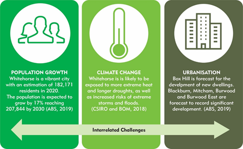
It has been difficult to analyse changes in canopy cover due
to inconsistencies in data collection methodologies. Data collected by DELWP in
2014 and again in 2018 has shown that Whitehorse has experienced 2% canopy loss
over those 4 years from 20% canopy cover to 18% canopy cover. The loss in
canopy cover is observed to be across both private and public land.
The Strategy proposes a vision with objectives that melds
community aspirations, existing policies and strategies to guide Council to
better protect, enhance and connect Whitehorse’s natural assets presented
as follows:
A diverse, healthy and resilient urban
forest.
Objectives
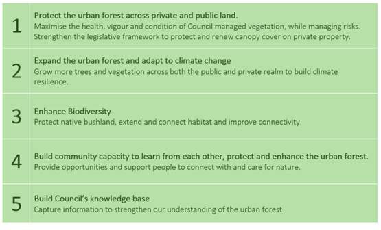
The Action Plan identifies tasks to be undertaken by Council
to be commenced within a specified timeframe. Indicators are set against each
action as a measure of action completed.
Growing the urban forest takes time, effective management
and substantial resourcing. Collective effort across sectors and land
tenure will be vital to successfully protect and extend the urban forest. As
understanding of the urban forest improves, innovation will find new ways to
optimise the urban forest. It is hoped that in the long term Council will reach
a 30% canopy cover.
CONSULTATION
The vision,
objectives and actions have been influenced by feedback received from community
members and stakeholder groups. A community engagement process was carried out
between November 2020 and February 2021. This included gaining feedback and
ideas from online surveys and small group discussions. The Strategy has further
been informed by Council’s staff, as well as relevant legislation and
policy. During the first phase:
|

|

|

|

|

|

|
|
596
|
270
|
222
|
37
|
11
|
95
|
|
People visited the
Whitehorse Urban Forest and My Favourite Tree online platforms hosted
by Oursay.
|
Community members
provided feedback in some form.
|
Online surveys were
completed.
|
People attended an
online/in person environmental community group meeting.
|
Residents sent open
ended Email responses.
|
Images were submitted
into the “My Favourite Tree” photo competition.
|
A second phase of
community consultation was carried out in May 2021 with the purpose of checking
that:
· The
strategy reflects adequately the feedback from the first round of consultation.
· The
vision, objectives and proposed objections are suitable, clear and easy to
understand.
|
|
|
|
|
|
|
426
|
119
|
104
|
28
|
15
|
|
People visited the
Whitehorse Urban Forest online platform hosted by Oursay.
|
Community members
provided feedback in some form either via direct email or online survey.
|
Online surveys were
completed.
|
People attended a
webinar presentation of the Urban Forest Strategy.
|
Residents or community
groups sent open ended Email responses.
|
Through online
surveys we found that those who were surveyed were mostly highly supportive of
the Strategy. Most people rated their support for the Vision with either a 4 or
a 5 out of 5.
· 98%
said that they were overall supportive of the draft Strategy.
· Over
90% were in support of the Vision and thought it was clear and easy to
understand.
· Only
3 people were either unsupportive or unsure of their support for the strategy.
· 90%
said that that were highly
supportive of the Action Plan.
Common themes
of uncertainty and concern raised by people surveyed were:
· Loss of canopy cover on private
property.
· Would the actions be adequately funded
by Council?
· Would Council be able to fully implement
the Strategy?
· Need to emphasis other vegetation
heights not just trees.
· Lack of public open space and available
planting opportunities.
The themes of uncertainty did not generate a change in the
Strategy and are relevant to how the Strategy is implemented.
FINANCIAL
IMPLICATIONS
Implementation of the Urban Forest Strategy
Action Plan can mostly be funded through existing operational budgets
particularly in the first year of adoption. However, some elements will require
seeking new capital funding such as:
· Extending canopy cover, habitat and improving connectivity.
· Ongoing monitoring and evaluation of the urban forest.
· Ongoing Implementation and enforcement of SLO9.
Capital works project budgets will include
installation of trees and vegetation and ongoing maintenance funding as
appropriate to the project. This would include costs for irrigation, tree pits
and soil as per landscape design.
The Council Budget 2021/22 includes
increased allocations for street tree maintenance and management to ensure
powerline clearances are maintained while seeking to minimise the negative
impact on tree canopy and neighborhood amenity.
The proposed green corridors program would
include extensive planting within the identified ecological corridors along
creek lines within the Gardiners Creek, Koonung Creek, Mullum Creek and
Dandenong Creek sub-catchments. Scoping of this project is identified as an
action in the draft strategy. Grant funding opportunities are likely to be
available for these types of programs.
Any actions that require additional funding
associated with implementing the Action Plan will be considered by Council each
year as new initiatives and allocations made based on the priorities at the
time.
Establishing vegetation in different
settings has different cost implications for new plantings. As canopy is
established on public land more operational expenditure may be needed in order
to maintain healthy canopy and manage the risk of new vegetation in the long
run. This cost may be offset by innovations in service delivery and will be
dependent on climatic conditions, for example, more expenditure will likely be
required if there is an extended dry spell or drought.
POLICY IMPLICATIONS
This Strategy aligned with the Whitehorse
2040 Community Vision and key priorities:
· Whitehorse is a resilient community where everyone belongs.
· We are active citizens who value our natural environment, history
and diversity.
· We embrace sustainability and innovation.
· We are dynamic. We learn, grow and thrive.
The Urban Forest Strategy 2021-2031 will
supersede the Interim Whitehorse Urban Forest Strategy along with the
Whitehorse Urban Biodiversity Strategy when it comes to an end.
The development of an Urban Forest Strategy
2021-2031 is an action within the Whitehorse Climate Response Plan.
Attachment
1 Urban Forest
Strategy 2021-2031
2 Urban Forest
Strategy Action Plan 2021 -2031 
Council Minutes 20
September 2021
9.3.2 Integrated
Water Management Forums
ATTACHMENT
SUMMARY
This report recommends that
Council authorises the Chief Executive Officer to endorse the Yarra Catchment
Integrated Water Management (IWM) Plan as shown in Attachment 1 and the
Dandenong Catchment Integrated Water Management (IWM) Plan as shown in
Attachment 2.
In August 2018, the Chief
Executive Officer endorsed the respective Strategic Directions Statements
for the Yarra Catchment IWM Forum and the Dandenong Catchment IWM Forum. The
State government has established Integrated Water Management (IWM) Forums to
identify, coordinate and prioritise opportunities that would most benefit from
collaborative water cycle planning and management. The Yarra Integrated Water
Management Forum has developed its Yarra Catchment Integrated Water Management
(IWM) Plan and the Dandenong Integrated Water Management Forum has developed
its Dandenong Catchment Integrated Water Management (IWM) Plan.
|
Council
Resolution
Moved by Cr Lane,
Seconded by Cr Skilbeck
That Council authorise the Chief Executive
Officer to endorse the Yarra Catchment Integrated Water Management Plan as
shown in Attachment 1 and the Dandenong Catchment Integrated Water Management
Plan as shown in Attachment 2.
Carried
Unanimously
|
background
This report relates to the Yarra
Catchment Integrated Water Management (IWM) Forum and the Dandenong Catchment
IWM Forum established by the Victorian Government to provide a structure for
collaborative efforts to deliver IWM solutions for a geographical catchment
region. The IWM Forum is a mechanism for State government, local government
authorities and water sector organisations to work together to achieve water
related outcomes that improve the resilience and liveability of our
communities. IWM Forums were established in late 2017 to help facilitate the
agreement for an IWM Vision for an area and develop a pathway to achieve this
shared vision, including identifying and prioritising projects for
implementation through a Catchment Integrated Water Management Plan.
Five IWM Forums have been
established for Metropolitan Melbourne based on the primary waterway catchments
and a further eleven forums were identified in regional Victoria based around
urban water corporation boundaries. The Department of Environment, Land, Water
and Planning (DELWP) is assigned to facilitate this process and provide
secretariat support.
The Port Phillip
and Western Port Region covers an area of approximately 13,000 square
kilometers and includes nearly all the land that drains to Port Phillip Bay and
Western Port. It includes the greater Melbourne metropolitan.
The region is made
up of five primary waterway catchments – Werribee, Maribyrnong, Yarra,
Dandenong and Western Port. The greater majority of the City of Whitehorse is
located in the Yarra Catchment. A smaller part of the municipality along its
eastern boundary is located in the Dandenong Catchment.
Participation in the IWM Forums has
provided an opportunity to achieve the water targets set in Council’s
Water Plan. This is particularly so for Council’s Water Plan targets that
require collaboration with other water sector organisations. The IWM Forums
provide an opportunity to advance strategic water issues that Council feels
should be a priority for the State Government and the water sector.
The Yarra IWM Forum Area
encompasses Victoria’s capital, Melbourne, the economic and employment
hub of the state. One third of Victorians reside in the Yarra catchment. It is
home to one of Australia’s most iconic and culturally significant waterways,
the Yarra River, which flows from its near natural upper reaches in the
forested Yarra Ranges down to Port Phillip Bay. The Yarra Forum Area will
continue to experience substantial population and economic growth in the coming
years. The preservation and management of the catchment’s landscapes will
have a positive impact on the region’s world-renowned liveability and the
long-term health and security of its waterways.
The Dandenong IWM Forum Area
includes catchments flowing into Port Phillip Bay from Port Melbourne to Point
Nepean. The region covers some of Victoria’s fastest urbanising areas and
will be the site of substantial sub-metropolitan population growth and economic
development in the coming years. Situated in the foothills of the Dandenong Ranges
and stretching to the coast of Port Phillip Bay, the Dandenong catchment
contains a breadth of iconic Victorian landscapes ranging from cool temperate
rainforests and wet heathlands to sandy bay beaches. Preservation and
management of the catchment’s landscapes will have a positive impact on
the long-term health and security of the region’s waterways.
DISCUSSION
The Victorian Government released
its “Water for Victoria” Plan in October 2016, which outlines the
role of water in creating resilient and liveable cities and towns in the
context of population growth and climate change now and into the future. Water
for Victoria commits to putting Integrated Water Management (IWM) into
practice.
Strategic Directions Statement
(SDS)
The Yarra and Dandenong IWM Forums each
developed a SDS that articulates the regional context and comprised of a shared
vision statement, strategic forum objectives, a summary of IWM opportunities
under investigation and a range of strategic enablers to address barriers to
IWM in Victoria. The SDSs were endorsed by Council in August 2018.
Catchment Integrated Water
Management Plan
The collective effort of Forum
Partners over the last few years has culminated in comprehensive Catchment
Scale Integrated Water Management (IWM) Plans for the Yarra and Dandenong
Catchments.
The IWM Plans set out clear
indicators and measures to assess progress towards the delivery of the vision
and strategic outcomes for the Yarra and Dandenong Catchments. They provide the
launching pad and guiding framework for implementation of IWM, with Forum
partners continuing to work together to identify opportunities where IWM can
best enable the optimal use and management of water and land.
The following key messages outline
the purpose and status of the IWM Plans:
1. The
IWM Plans are the keystone projects of the Yarra IWM Forum and the Dandenong
IWP Forum. The IWM Plans provide Forum partners with meaningful scientific
evidence to guide decision-making and prioritise investment in sustainable
water and land use planning, management and policy.
2. Creating
a resilient and liveable future is a shared responsibility, which is why IWM
Plans were developed through robust, Forum-endorsed collaborative processes.
The IWM Plans draw on the expertise of more than 50 stakeholder organisations.
3. The
IWM Plans reflect rigorous scientific analysis and compelling technical
evidence to determine performance targets for Forum Partners to consider and
adopt at their organisations. The shorter term 2030 targets are grounded in
practicality and serve to inspire action that can be delivered, while the
longer term 2050 targets are aspirational and more challenging to realise, but
are nevertheless credible and necessary to drive real change.
4. Performance
targets are geographically and spatially unique, reflecting the unique needs of
each catchment or local area. Some targets remain undefined (1.1a and 4.3), as
they have been deferred to strategic planning processes underway, such as the
Greater Melbourne Urban Water System Strategy. Other targets (6.1a and 6.1b)
remain as draft and serve as placeholders until further conversations with
Traditional Owners can be had.
5. As
a highly complex area, touching on many different functions and
responsibilities, it is likely that the path to implementation will have to be
adaptive and responsive to new evidence and opportunities that come to light.
Accordingly, the IWM Plans will be a dynamic, living document.
6. Forum
Partners have been asked to endorse the IWM Plans. In this context,
“endorse” means to “express support for” the IWM Plan
as a basis for inclusion in Forum Partner organisations’ strategies,
plans and processes that contribute to the delivery of IWM outcomes. Forum
Partners will also be asked to support ongoing processes of monitoring, review,
and implementation.
CONSULTATION
Extensive collaboration and
consultation has been carried out to develop the guiding Strategic Direction
Statements (SDSs) and now the IWM Plans for the Yarra IWM Forum and Dandenong
IWM Forum areas. The process undertaken has included the collaboration of 28
Council CEO’s and Managing Directors of key water-sector organisations in
the Yarra Catchment and 23 from the Dandenong Catchment, which includes water
corporations, catchment management authorities, the Victorian Planning
Authority and representatives of Bunurong and Wurundjeri Traditional Owner
interests. Furthermore, the Department of Environment, Land, Water and Planning
(DELWP) facilitated the development process and provided secretariat support.
As considered appropriate, the IWM
Forum Chairpersons invited relevant stakeholders to attend Forum
meetings. These have included:
· Department
of Economic Development, Jobs, Transport and Resources
· Department
of Health and Human Services
· VicRoads
· Regional
Development Victoria and
· Parks
Victoria.
FINANCIAL IMPLICATIONS
Endorsement of the Yarra Catchment
IWM Plan by Council does not commit Council to deliver a priority project, or
to fund identified IWM opportunities as a lead organisation or collaborative
partner.
The IWM program clearly
acknowledges that each participating organisation may have different funding
processes and these would need to be followed if a co-contribution to any
project or opportunity.
Attachment
1 Yarra Catchment
Summary 
2 Dandenong
Catchment Summary
Council Minutes 20
September 2021
9.3.3 Tender
Evaluation (Contract 30244) Provision of Kerbside Waste and Recycling
FILE NUMBER: 21/219180
The purpose of
this report is to award Contract 30244 – Provision of Kerbside Waste and
Recycling to commence on 1 July 2022 for ten years. Council’s current
contracts for the kerbside collection of household garbage, recyclables, garden
organics and hard waste will expire on 30 June 2022.
At its meeting
on 16 March 2020, Council endorsed the services to be provided under the
Contract for a new suite of kerbside waste and recycling services, including a
new food organics and garden organics (FOGO) service. After a detailed tender
evaluation process, it is recommended that Council awards contracts for the
collection of garbage, recyclables and FOGO bins to JJ Richards and Sons Pty
Ltd, trading as JJ’s Waste and Recycling; the collection of hard and bundled
green waste to Cleanaway Pty Ltd; and the kerbside bin inspections to JJ
Richards and Sons Pty Ltd, trading as EnviroCom Australia.
|
RECOMMENDATION
That Council:
1. Accepts
the tender and awards a schedule of rates Contract 30244/1 for the kerbside
garbage, recycling and food organics and garden organics (FOGO) bin
collection services to JJ Richards and Sons Pty Ltd (ABN 40 000 805 425) of
50 Elliott Road, Dandenong South, trading as JJ’s Waste and Recycling,
for a ten year period from 1 July 2022 to 30 June 2032;
2. Accepts
the tender and awards a schedule of rates Contract 30244/2 for the booked
hard waste and bundled green waste collection and disposal service (based on
in property collection where possible) to Cleanaway Pty Ltd (ABN 79 000 164
938) of level 4, 441 St Kilda Road, Melbourne for a ten year period from 1
July 2022 to 30 June 2032;
3. Accepts
the tender and awards a schedule of rates Contract 30244/3 for the kerbside
bin inspections to JJ Richards and Sons Pty Ltd (ABN 40 000 805 425) of 6/100
Monash Drive, Dandenong South, trading as EnviroCom Australia for a ten year
period from 1 July 2022 to 30 June 2032; and
4. Accepts
the tender and conditionally awards a schedule of rates Contract 30244/4 for
the kerbside glass recycling bin collection service to JJ Richards and Sons
Pty Ltd (ABN 40 000 805 425) of 50 Elliott Road, Dandenong South, trading as
JJ’s Waste and Recycling, nominally from 2026 until 30 June 2032,
subject to subsequent Council consideration of the viability and community
benefit of introducing a separate glass bin recycling service.
|
|
AMENDED OFFICER RECOMMENDATION
That Council:
1. Accepts
the tender and awards a schedule of rates Contract 30244/1 for the kerbside
garbage, recycling and food organics and garden organics (FOGO) bin
collection services to JJ Richards and Sons Pty Ltd (ABN 40 000 805 425) of
50 Elliott Road, Dandenong South, trading as JJ’s Waste and Recycling,
for a ten year period from 1 July 2022 to 30 June 2032;
2. Accepts
the tender and awards a schedule of rates Contract 30244/2 for the booked
hard waste and bundled green waste collection and disposal service to
Cleanaway Pty Ltd (ABN 79 000 164 938) of level 4, 441 St Kilda Road,
Melbourne for a ten year period from 1 July 2022 to 30 June 2032;
3. Accepts
the tender and awards a schedule of rates Contract 30244/3 for the kerbside
bin inspections to JJ Richards and Sons Pty Ltd (ABN 40 000 805 425) of 6/100
Monash Drive, Dandenong South, trading as EnviroCom Australia for a ten year
period from 1 July 2022 to 30 June 2032; and
4. Accepts
the tender and conditionally awards a schedule of rates Contract 30244/4 for
the kerbside glass recycling bin collection service to JJ Richards and Sons
Pty Ltd (ABN 40 000 805 425) of 50 Elliott Road, Dandenong South, trading as JJ’s
Waste and Recycling, nominally from 2026 until 30 June 2032, subject to
subsequent Council consideration of the viability and community benefit of
introducing a separate glass bin recycling service.
|
|
Attendance
Cr Stennett returned to the virtual
meeting at 10:23pm.
|
|
Procedural Motion (AT 10:29pm)
Moved by Cr Barker,
Seconded by Cr Massoud
In accordance with clause
16 of Council’s Governance Rules, the virtual Council meeting be
extended for 30 minutes beyond 10:30pm.
Carried BY
MAJORITY
|
|
MOTION
Moved by Cr Barker,
Seconded by Cr Davenport
That Council:
1. Defers
consideration of this matter for up to three months to allow further
negotiations with the shortlisted companies for the kerbside bin collection
services regarding:
a) Continuous
improvement targets and undertakings regarding emissions;
b) Developing
a more thorough understanding of any potential contract exit costs during the
course of the contract should Council choose to terminate early and how these
might be mitigated;
c) Developing
more price adjustment clauses that enable lower costs where further
innovation, scale and efficiency can be realised; and
2. Seeks
to engage in Ministerial dialogue to enable the current contracts to be
extended for a short period should that be necessary.
Lost
|
|
A Division was called.
Division
|
For
Cr
Barker
Cr
Davenport
|
Against
Cr
Carr
Cr
Cutts
Cr
Lane
Cr Liu
Cr
Massoud
Cr
McNeill
Cr
Munroe
Cr
Skilbeck
Cr
Stennett
|
On
the results of the Division the motion was declared lost
|
|
Council
Resolution
Moved by Cr Lane,
Seconded by Cr Massoud
That Council:
1. Accepts
the tender and awards a schedule of rates Contract 30244/1 for the kerbside
garbage, recycling and food organics and garden organics (FOGO) bin
collection services to JJ Richards and Sons Pty Ltd (ABN 40 000 805 425) of
50 Elliott Road, Dandenong South, trading as JJ’s Waste and Recycling,
for a ten year period from 1 July 2022 to 30 June 2032;
2. Accepts
the tender and awards a schedule of rates Contract 30244/2 for the booked
hard waste and bundled green waste collection and disposal service to
Cleanaway Pty Ltd (ABN 79 000 164 938) of level 4, 441 St Kilda Road,
Melbourne for a ten year period from 1 July 2022 to 30 June 2032;
3. Accepts
the tender and awards a schedule of rates Contract 30244/3 for the kerbside
bin inspections to JJ Richards and Sons Pty Ltd (ABN 40 000 805 425) of 6/100
Monash Drive, Dandenong South, trading as EnviroCom Australia for a ten year
period from 1 July 2022 to 30 June 2032; and
4. Accepts
the tender and conditionally awards a schedule of rates Contract 30244/4 for
the kerbside glass recycling bin collection service to JJ Richards and Sons
Pty Ltd (ABN 40 000 805 425) of 50 Elliott Road, Dandenong South, trading as
JJ’s Waste and Recycling, nominally from 2026 until 30 June 2032, subject
to subsequent Council consideration of the viability and community benefit of
introducing a separate glass bin recycling service.
Carried
|
|
A Division was called.
Division
|
For
Cr
Carr
Cr
Cutts
Cr
Lane
Cr Liu
Cr
Massoud
Cr
McNeill
Cr
Munroe
Cr
Skilbeck
Cr Stennett
|
Against
Cr
Barker
Cr
Davenport
|
On
the results of the Division the motion was declared carried
|
background
Council’s kerbside waste and recycling collection
services are a much valued and important Council service, operating on a daily
basis across the entire municipality. In the 2021 Customer Satisfaction Survey,
waste management was the highest rated service in terms of importance.
Whitehorse performed significantly higher than the State-wide and Metropolitan
group averages on the performance of waste management. The specifications under
this Contract seek to provide improved services.
Council’s current kerbside waste and recycling
services includes the collection of garbage bins, garden organics bins,
recycling bins and hard waste including bundled green waste. The three bin
collection services are currently undertaken by two different contractors and
the bookable hard waste collection (with two available each financial year) by
a third contractor.
The kerbside waste and recycling collection services are
long-term service contracts that have been aligned so that they all end at the
same time, allowing Council to tender aggregate the service for all three
kerbside bin collections and hard waste to allow economies of scale under one
contract. The services under the contract require significant investment from
the successful contractors. The services have been specified to commence with
new trucks that comply with industry best practice including noise reduction
measures. New trucks minimise the risk of breakdowns to allow for collections
to be undertaken on a reliable basis throughout the duration of the contract.
New contracts therefore need to be awarded in advance of the current contract
expiry date to allow time for the contractor to source new trucks and to
complete the detailed logistic planning necessary to ensure services are
delivered in accordance with all regulations and contract specifications.
On 16 March 2020 Council endorsed the services to be
provided under the new contracts the public tender and evaluation process for
kerbside waste and recycling collection contracts. This Contract has been
tendered in accordance with that decision.
The kerbside
waste and recycling service contracts were originally due to expire on 30 June
2021. These complex waste tenders require considerable resources from the
tenderers and COVID-19 impacted the ability for the waste industry to respond
to public tenders at that time. Councils were advised by Metropolitan Waste and
Resource Recovery Group not to go to tender in 2020 as a result of the COVID-19
impact and the risk of not receiving an appropriate tender response.
Council
received approval from the Minister for Local Government for a 12 month
extension to the existing kerbside waste and recycling collection contracts.
The contracts now expire on 30 June 2022. The plans for the FOGO introduction
were subsequently delayed in line with the revised start date for the new
contracts to 1 July 2022 as the processing contractor was delayed in its
ability to recycle food.
DISCUSSION
Tendering options
In the lead up to preparing the
tender specification and Contract documents, consideration was given to whether
there would be benefit in tendering the kerbside waste services in
collaboration with neighbouring Councils. Unlike waste disposal and processing
contracts where Councils have regional shared needs and specifications, waste
collection contracts are very Council specific to suit the local landscape,
challenges and community needs. Following discussions with other councils,
barriers to a collaborative tender included aligning start dates and contract
duration times, agreement on service standards and integration with different
Council systems. Kerbside waste services for each Council have dedicated
resources of fleet and personnel. While a collaborative kerbside collections
contract was not be viable, information was shared to inform best practice to
tender for Whitehorse Council only services.
It was assessed that the scale of
services tendered for Whitehorse alone was sufficient to attract a competitive
price with further discounts and value-added initiatives from tenderers.
On 16 March 2020 Council endorsed
the services to be provided under the new contracts and a public tender and
evaluation process for kerbside waste and recycling collection contracts.
Tender Process
Tenders were advertised in The Age
newspaper and closed on Wednesday 12 May 2021.
Tenderers were invited to tender
for the provision of wastes services which included:
· Kerbside
garbage bin collection service;
· Kerbside
recycling bin collection service;
· Kerbside
food organics and garden organics (FOGO) bin collection service and one off
implementation costs (kitchen caddies and compostable bags);
· Kerbside
glass bin (future) collection service;
· Booked
hard and bundled garden waste collection and disposal service; and
· Kerbside
waste mobile bin inspections.
Tenderers were advised they may
submit tenders for all services or individual components and that Council may
award all waste collection services to one provider or may split the services
between a number of service providers depending on the financial benefits,
contractor capability and value-added services.
The contract length advertised was
seven years with options to extend to ten years at Council’s discretion.
The tenders were evaluated against
the following criteria:
· The
Tender offer;
· Capability;
· Credibility;
· Value-added
options; and
· Sustainability.
Eight tender submissions were
received in total, including one tender submission for the provision of all
components of the contract. Two submissions included all four kerbside bin
collection services, three submissions included the booked hard and bundled
green waste service only, and three submissions for the mobile bin inspections
only.
Tender Options
In February 2020, the Victorian
Government announced a plan to require councils to implement four kerbside bin
services as part of its kerbside reform policy. This includes a separate glass
recycling collection by 2027 as well as a food organics and garden organics
(FOGO) service by 2030. A kerbside glass bin collection service was included in
the new kerbside waste service tenders to allow Council to better understand
costs associated with of a future service, as Council is yet to consider the
introduction of a separate glass recycling service.
The tender specification includes a
potential starting date for a separate collection of glass via a fourth bin
service on 1 July 2026, subject to a Council decision. This potential start
date will enable Council time to consider future recycling processing
contracts, the impacts of the Victorian Container Deposit Scheme from 1 July
2023, and allow for community consultation.
Due to the changing nature of
services that will likely be required over the contract term, such as a
possible change to collection frequencies and the timing of a separate glass
recycling service, a number of different service and pricing options were
sought from the tenderers to allow the cost of potential future service
frequency changes to be assessed including:
· Delivery
of kitchen caddies and compostable liner bags for FOGO service
· Weekly
or fortnightly collection of FOGO bins
· Weekly
or fortnightly collection of garbage bins
· Weekly
or fortnightly collection of recycling bins
· Monthly
or fortnightly collection of glass bins
· Collection
of hard waste from within property boundaries or at the kerbside (kerbside is
the current arrangement)
Tender Evaluation
Tenders for the bin related
services were evaluated using a number of scenarios including awarding the
kerbside bin collections to a single contractor compared to separately awarding
the collection contracts. The option of awarding the contract for seven years
compared to ten years was considered.
The recommended approach is:
· Award
JJ’s Waste and Recycling Contract 30244/1 for the kerbside garbage,
recycling and FOGO bin collection services;
· Award
Cleanaway Pty Ltd for Contract 30244/2 for the booked hard waste and bundled
green waste collection and disposal service based on an in property collection
where possible.
· Award
EnviroCom Australia for Contract 30244/3 for the kerbside waste mobile bin
inspections;
· Conditionally
award JJ’s Waste and Recycling for Contract 30244/4 for the kerbside
glass recycling bin collection service; and
1.
JJ’s Waste and Recycling scored
highest for the kerbside bin collection services. The tender evaluation found
that JJ’s Waste and Recycling has proven capability of delivering
services safely and reliably, its on-board truck technology is leading edge,
and the support services and in-house teams offered in the submission will
result in an improved level of service under the new contracts. A discount has
been offered if a ten year contract is awarded rather than a seven year
contract.
Cleanaway Pty Ltd scored highest for
the hard waste and bundled green waste collection service. The tender
evaluation demonstrated Cleanaway has proven capability to deliver the required
services safely and reliably, its booking system is comprehensive, and the
support services offered will deliver this complex service at a high level.
Collection from within the property where possible is proposed.
EnviroCom Australia was evaluated
as the preferred contractor for the kerbside bin inspections. Its tender
demonstrated that EnviroCom Australia has proven capability in delivering the
required services and its team provides strong added value in community
education experience.
Kerbside Bin Collection Services
In addition to the cost advantages,
significant logistical and administrative benefits are expected by awarding all
four kerbside bin-based collection services to the same contractor. It has been
assessed that this approach will streamline current arrangements and provide a
single point of contact for all bin services. It will ensure consistency for
bin collections to deliver a safer and higher quality of service for the
community compared to the current arrangement of using multiple contractors. It
will also be easier to introduce innovations or continuous improvement across
the entire bin collection services and to make future changes to service
frequency if that is ever to be required over the next ten years.
JJ’s Waste and Recycling is a
highly experienced and well-resourced company that specialises in the
collection of waste. It is the current contractor for the collection of garbage
and garden organics bins for Council and provides this service to a high level.
This is demonstrated by the 2021 Customer Service Survey results where
Whitehorse performed significantly higher than the State-wide and Metropolitan
group averages on the performance of waste management.
There will be new collection trucks
for the new contract. The vehicles that have been specified comply with the
industry best practice guidelines with the latest in brake and engine noise
reduction. The contractor is committed to use and trial electric waste vehicles
when these become available and viable. The collection trucks will have more
cameras installed, enabling the driver to have a 360 degree views for added
safety. The technology has the ability to photographically record any kerbside
site issues and Council will have access to live data from the bin collection
trucks. There will be integration between the contractor’s systems with
Council’s systems enabling a high level of customer service.
It is recommended that the contract
be awarded for a period of ten years, compared to seven years with the option
of extension. A discount has been offered by the contractor if the contract is
awarded initially for the full ten years. This allows the contractor to
consider how it procures trucks, equipment and personnel in a more cost
effective way.
Food Organics and Garden
Organics (FOGO) Service
The specification for kerbside bin
collection services included the introduction of Council’s FOGO service.
This aligns with the approach endorsed by Council at its meeting on 16 March
2020. The service will commence in July 2022, starting with the approximately
46,000+ households that have (or opt to have) a Council garden organics bin.
Those wanting to participate in the service have the option to add food waste
to their current garden bin service.
Households that have a Council
garden organics bin by June 2022 will be issued with a kitchen caddy and
compostable caddy liners around three months before the service starts. This
will assist with and maximise capturing food scraps from kitchen to the kerbside
FOGO bin. Information about how to use the FOGO service will also be provided
in the lead up to the service and along with the distribution of caddies and
liners. The caddy/liner roll-out to the approximately 46,000 current garden bin
users will be a one-off set up cost for the FOGO service.
The tender also allows for the
transition of the FOGO service to a core recycling service for all households
nominally in 2024/25, subject to Council approval. This is ahead of the
Recycling Victoria Policy which requires Councils to provide a municipal-wide
FOGO service by 2030.
Hard and Bundled Green Waste
A key assessment of the hard and
bundled green waste service tenders was comparison of the different service
options and methodologies proposed by the tenderers. Each tenderer took a
different approach to how they would achieve Council’s required service
standards.
Tenderers were requested to
indicate if their prices would change if Council took on the responsibility for
paying separately for the cost of disposing of any non-recyclable materials.
The current arrangement is the cost of disposal is the responsibility of the
contractor to provide an incentive for the contractor to maximise the amount of
materials that can be separated and recycled. It was assessed that the relative
cost comparison between the different tenderers did not change the evaluation
outcome. If Council was to pay separately for disposal it takes away some of
the incentive for the contractor to recycle and exposes Council to the risk of
the fluctuating cost of waste disposal so it is proposed that the contractor
remain responsible for all disposal coats, as it the case under the existing
contract.
The recommended tenderer, Cleanaway
Pty Ltd is the largest service provider for waste and recycling services in
Australia. It undertakes a number of similar contracts with Victorian councils
and is very well resourced to provide this service for Council. Cleanaway Pty
Ltd has well developed systems and processes to take bookings and to provide
live data to Council on collection services.
The evaluation panel considered the
value-added option for collecting hard and bundled green waste from inside
private property boundaries compared with the current practice where hard waste
is placed on the nature strip. This option comes at a price premium but has
benefits including improving the appearance of the roadside by not having piles
of waste for collection, it would reduce incidents of booked hard waste piles
being added to by others, it would reduce scavenging and items that are put out
that are not suitable for collection will remain in private properties. It is
noted that some kerbside collection will still be required from properties that
do not have sufficient ‘front yard’ space.
Several other Councils operate a
successful hard and bundled green waste service from inside the property
boundary, so the protocols in setting up and collecting are established. Not
every property such as multi-unit dwellings will be suitable for collections
inside their property boundary and they will need to continue to use the
naturestrip.
It is recommended that Cleanaway
Pty Ltd be contracted to provide the hard and bundled green waste collection
service, be responsible for disposal costs, manage the bookings and provide the
service with the requirement to collect from within the private property
boundary where that collection model is possible.
It is recommended that this portion
of the contract also be awarded for a period of ten years, compared to seven
years with the option of extension. This ensures that the contract period
remains aligned to the other kerbside waste contracts.
Bin Inspections
The contract for kerbside mobile
bin inspections is an expansion of the existing recycling bin contamination
education program (known as Gold Star) to include the FOGO bins and possibly
future separate glass bins. The service involves the regular inspection of what
is placed in various bins so that there can be targeted waste education and
data on how waste and recycling materials are put in each bin.
It is recommended that EnviroCom
Australia be awarded the bin inspection service. EnviroCom Australia is part of
JJ Richards & Son Pty Ltd, however it operates as a separate entity. It is
well resourced and has considerable experience in providing similar services to
Whitehorse and other councils.
It is recommended that the contract
be awarded for a period of ten years to be consistent with the waste collection
service contracts, as its delivery makes an important contribution to the overall
management of the kerbside bin services.
Glass Collection Service
It is recommended that a contract
be conditionally awarded to provide kerbside glass bin collection services to
JJ’s Waste and Recycling.
JJ’s Waste and Recycling
understands that Council is yet considered or resolved on the details or timing
for introducing a separate glass bin recycling service, as required under the
State Government’s Recycling Victoria Policy. There are still many
factors for Council to take into consideration before the finalisation of a
separate glass recycling collection service. It is recommended at this stage,
that Council conditionally accepts the tender from JJ’s Waste and
Recycling for a future glass recycling collection service.
Including this future service as
part of the new suite of kerbside waste contracts awarded to JJ’s Waste
and Recycling will enable a more seamless and efficient introduction of any
glass service.
CONSULTATION
Extensive community consultation
was undertaken in developing Council’s Waste Management Strategy
2018-2028. The Strategy confirms the kerbside services and there was strong
community endorsement for introducing a food organics and garden organics
service and reducing the impacts of illegal dumping which the new contracts will
address.
Consultation occurred with other
Councils to inform the tender specifications and best practices for the tender
process.
Internal consultation has been
conducted to provide in depth input into the tender process by Council teams
including from Community Laws, Cleansing, Communications and Customer Service.
There will be detailed community
engagement undertaken up to when the new contracts commence on 1 July 2022. The
objective is that residents experience a seamless change to the new contracts
with the added option to put food waste into the garden organics bin, and that
hard waste collection will be within private property providing there is
suitable space.
In this report there is reference
to FOGO, being the abbreviation for food organics and garden organics. The
latest research shows that the term FOGO is not well recognised by the
community. In external consultation with the community this service will be
referred to as ‘food and garden waste’, instead of FOGO.
FINANCIAL
IMPLICATIONS
Kerbside Bin Waste and Recycling
Services
The kerbside waste and recycling
collection services covered by this suite of contracts currently costs Council
approximately $9.4M per annum (ex GST). In the new contracts there are cost
impacts associated with:
· Adding
collection of hard waste from within private properties. While the portion of
the cost relating to collection will increase for the inside property
collections, the increased recycling and lower landfill costs result in an
overall cost reductions for this service. In addition there will be a reduction
in overall costs for Council in managing dumped rubbish.
· Adding
a glass recycling service in the future, subject to further consideration.
· One-off
costs associated with the provision of kitchen caddies and compostable bin
liners.
Throughout the ten year period for
the contracts there may be changes to the scope of services and potentially
changes to the collection frequency. This is because of a combination of
needing to satisfy State Government policy and legislative changes for waste
services, as well as the desire to divert more waste from landfill that is
becoming increasingly expensive.
Sensitivity analysis using
different scenarios was undertaken to model costs for any value-added services
provided, or discounts offered by the tenderers. For example, two tenderers for
the main kerbside bin-based collection services offered a price discount if
Council awarded a ten year contract up front rather than add on optional years
at the end of the initial seven year contract term. The savings for committing
to a ten year contract from the start are in the order of $2.1M over the life
of the contract.
The cost modelling assessed
scenarios such as awarding multiple contracts to one tenderer compared with
awarding contracts individually should a particular provider be cheaper for one
aspect of the service. The modelling showed that it was cheaper to award all
the bin-based kerbside waste and recycling services to one contractor.
The following summary tables show indicative annual costs for
2022/23 based on the recommended tenderer’s prices for each service,
compared with the equivalent current contract cost in the 2021/22 Council
budget. Note that the 2022/23 tenderer costs have been estimated based on the
same number of bins or hard waste bookings as the current service, whereas the
budget figures for 2022/23 will be based on the actual bin numbers and hard
waste booking numbers as at July 2022. As this is a schedule of rates contract,
the costs per collection are fixed each year (subject only to CPI changes), but
the number of collections will grow over time as the population and number of
dwellings in Whitehorse increases.
Table 1 Garbage, recycling and
FOGO services:
|
Services
|
Current service costs 2021/22 ex-GST
|
Recommended tenderer costs 2022/23 ex-GST
|
|
Garbage
collection
|
$3,518,495
|
$3,389,827
|
|
Recycling
collection
|
$2,054,189
|
$2,478,024
|
|
Garden
organics or FOGO collection
|
$1,456,827
|
$1,351,051
|
|
Total
|
$7,029,511
|
$7,218,902
|
|
FOGO
implementation (caddies and compostable liners)
|
|
$904,621
|
The introduction of a new FOGO
service in 2022/23 includes one-off costs to deliver kitchen caddies and
compostable liners for every FOGO bin user. The tender included two options for
paying for the one-off cost to roll out caddies and liners to the expected
46,000 initial users of the service. One option was to pay the full cost of the
caddy/liner roll-out as a lump sum in July 2022 on satisfactory completion of
delivery. The second option was to spread the roll-out cost over seven years
(initial contract length in tender) with Council repaying the cost in monthly
instalments. The second option is recommended.
The increase in the cost of
recycling collections under the new contract reflects the heavily discounted
tender price for recycling collections in the current kerbside recycling
contract, which was a result of Council awarding a combined collection and
processing contract to the one contractor back in 2012. The current contractor
did not submit a tender for bin collection services.
The like-for-like comparison for
the three bin services is $7,218,902 compared to the current service cost of
$7,029,511, a 2.69% cost increase and comparable to the expected CPI increase
on 1 July 2022. It was forecast that there could have been a step increase in
costs of these services.
Table 2 Hard and bundled green waste service:
|
Services
|
Current service costs 2021/22
ex-GST
|
Recommended tenderer costs 2022/23 ex-GST
|
|
Hard
waste collection from kerbside and disposal
|
$2,268,637
|
N/A
|
|
Hard
waste collection from inside property and disposal
|
N/A
|
$2,117,309
|
As indicated in Table 2, an
improved hard and bundled green waste service with collections from inside the
property can be delivered under the new contract at a saving to current hard
waste costs.
Bin Inspections
An indicative annual cost of
$79,811 ex-GST has been estimated for a bin inspection program based on the
assumptions of:
· 96
days of bin inspections per annum for the first 4 years of the contract until
the introduction of a separate glass recycling service nominally in 2026; and
· 132
bin inspection days per annum for the remainder of the contract.
Glass Collection Service
(nominally commencing in 2026)
An indicative annual cost of
$1,478,374 ex-GST has been estimated for a separate glass recycling bin
collection based on the service assumption of 40,000 new kerbside bins and
fortnightly collections.
Table 3 Total annual service costs without glass recycling:
|
Services
|
Recommended tenderer costs 2022/23 ex-GST
|
Service provider
|
|
Garbage
collection
|
$3,389,827
|
JJ’s
Waste and Recycling
|
|
Recycling
collection
|
$2,478,024
|
JJ’s
Waste and Recycling
|
|
FOGO
collection, excluding caddy/liner costs
|
$1,351,051
|
JJ’s
Waste and Recycling
|
|
Hard
and bundled green waste
|
$2,117,309
|
Cleanaway
Pty Ltd
|
|
Bin
inspection program
|
$ 79,811
|
EnviroCom
Australia
|
|
Total
|
$9,416,022
|
|
Table 4 Total annual service costs with glass recycling:
|
Services
|
Recommended tenderer costs 2022/23 ex-GST
|
Service provider
|
|
Garbage
collection
|
$3,389,827
|
JJ’s
Waste and Recycling
|
|
Recycling
collection
|
$2,478,024
|
JJ’s
Waste and Recycling
|
|
FOGO
collection, excluding caddy/liner costs
|
$1,351,051
|
JJ’s
Waste and Recycling
|
|
Hard
waste & bundled prunings
|
$2,117,309
|
Cleanaway
Pty Ltd
|
|
Bin
inspection program
|
$ 79,811
|
EnviroCom
Australia
|
|
Glass
recycling service
|
$1,478,374
|
JJ’s
Waste and Recycling
|
|
Total
|
$10,894,396
|
|
The overall value of this contract
will vary on an annual basis depending on factors such as population and
tenement growth rate in Whitehorse, the CPI, the timing and degree of any
service changes to collection frequency, and the volume of materials placed out
for collection.
POLICY IMPLICATIONS
Council adopted
the ten year Rubbish to Resource! Waste Management Strategy 2018-2028 in December
2018. The Strategy identifies actions for minimising waste to landfill,
maximising resource recovery, and the need for continual improvements to the
kerbside waste and recycling services. The Strategy includes the implementation
of a kerbside food organics and garden organics (FOGO) service. The new FOGO
service, in addition to the existing kerbside services will contribute to
meeting Council’s target of 60% diversion of waste from landfill by 2023.
A FOGO service
aligns with Council’s Sustainability Strategy 2016-2022 and emissions
reduction efforts to be carbon neutral by 2022.
|
Procedural Motion (AT 10:59pm)
Moved by Cr Massoud, Seconded by Cr Stennett
In accordance with clause 16 of Council’s
Governance Rules, the virtual Council meeting be extended for 30 minutes
beyond 11:00pm.
Carried
|
|
Attendance
The virtual meeting adjourned at 11:01pm for a four
minute break, resuming at 11:05pm.
|
|
Council Resolution
Moved by Cr Lane,
Seconded by Cr Carr
That in accordance with Section 61 (1) and 66
(2)(a)of the Local Government Act 2020 the Council should resolve to go into
camera and close the virtual meeting for the consideration of this item, as
the matter to be discussed is confidential information for the purposes of
section 3 (1) (g) (ii) of the Local Government Act 2020, that relates
to Private Commercial Information, being information provided
by a business, commercial or financial undertaking that if released, would
unreasonably expose the business, commercial or financial undertaking to
disadvantage. This ground applies because the matter concerns a contractual
arrangement.
Carried
|
|
Attendance
The virtual meeting closed to the public at 11:06pm
|
|
Council
Resolution
Moved by Cr Cutts,
Seconded by Cr Skilbeck
That the virtual meeting move out of camera and be
reopened to the public.
Carried
Unanimously
|
|
Attendance
The virtual meeting was reopened to the public at 11:13pm.
|
Council Minutes 20
September 2021
Council’s consideration of this item was
deferred to a virtual Council meeting to be called for Thursday 23 September
2021 at 7.45pm.
9.3.4 Tender
Evaluation (Contract 30303) Novated Design and Construction of the Whitehorse
Performing Arts Centre
FILE NUMBER:
ATTACHMENT
SUMMARY
To consider tenders received for the novated design and
construction of the Whitehorse performing arts centre, and to recommend the
acceptance of the tender received from Kane Constructions Pty Ltd, trading as Kane Constructions for the amount of $52,629,600 excluding GST as part
of the overall project budget of $78,000,000 excluding GST.
|
MOTion
Moved by Cr Carr,
Seconded by Cr Stennett
That Council:
1. Accept
the tender and sign the formal contract document for Contract 30303 for the novated
design and construction of the Whitehorse performing arts centre received
from Kane Constructions Pty Ltd (ABN 49 007 354 396), of 658
Church Street, Richmond, VIC 3121, for the
tendered amount of $52,629,600 excluding GST; as part of the overall project
budget of $78,000,000 excluding GST;
2. Authorises
expenditure of the construction contingency in accordance with amounts and
authorisations detailed in Confidential Attachment 1.
|
|
Amendment
Moved by Cr Davenport,
Seconded by Cr Barker
That:
1. Council
accept the tender and sign the formal contract document for Contract 30303
for the novated design and construction of the Whitehorse performing arts
centre received from Kane Constructions Pty Ltd (ABN 49 007 354 396), of 658
Church Street, Richmond, VIC 3121, for the
tendered amount of $52,629,600 excluding GST; as part of the overall project
budget of $78,000,000 excluding GST.
2. Council
halve the proposed contingency amount.
3. Council
modify the authorisation as per procurement policy up to $1 million, with the
CEO to have delegation to $3 million for any one variation.
4. Value
engineering occur prior to contingency spend.
5. Council
receive quarterly reporting of project progress, risks and contingencies to the
Major Project Councillor Reference Group.
|
|
Procedural Motion
Moved by Cr Massoud,
Seconded by Cr Stennett
That the motion be put.
The
procedural motion was not put to the vote and therefore lapsed.
|
|
The Mayor put the
Amendment to the vote which was LOST
|
|
Suspension of Standing Orders
Moved by Cr Massoud,
Seconded by Cr Stennett
That Standing Orders be
suspended in order for the Mayor to seek advice from
officers.
Carried
|
|
Standing orders were suspended at 11:29pm.
|
|
Resumption of Standing Orders
Moved by Cr Massoud,
Seconded by Cr Cutts
That Standing Orders be resumed.
Carried
Unanimously
|
|
Standing Orders were
resumed at 11.32pm.
At 11.32pm, the Mayor advised
that as the virtual meeting failed to conclude all items on the agenda, an
additional meeting will be called for consideration of tender reports:
·
Tender Evaluation (Contract
30303) Novated Design and Construction of the Whitehorse Performing Arts
Centre
·
Tender
Evaluation (Contract 30325) Heatherdale Reserve Pavilion Redevelopment
The Mayor closed the meeting at 11.32pm.
|
background
In 2017, Council endorsed the complete redevelopment of the
Whitehorse Centre and allocated project funding for the design, demolition of
the existing Whitehorse Centre and construction of a new performing arts
centre, new open double storey car park and other associated works.
In May 2019, a lead design team was engaged by Council to
design the new Whitehorse performing arts centre (WPAC) through a novated
design and construct methodology with the architects and design team novating
to a main works contractor at around 80% of contract documentation.
The WPAC project is being
delivered under three separate packages:
· Package
A - Demolition of the existing Whitehorse Centre. This package was completed in
December 2020.
· Package
B - Construction of a new open double storey car park with associated civil and
landscape works. This package was completed in September 2021.
· Package
C - The design and construction of the new WPAC with associated civil and
landscape works.
This tender evaluation report is to engage a main works
contractor for Package C - design and construction of the new WPAC.
DISCUSSION
The procurement of a main works contractor for the design
and construction of the WPAC was a two stage process; Stage 1: a public
Expression of Interest (EOI) followed by Stage 2: a Request for Tender (RFT) to
invited shortlisted contractors.
EOI Process and Evaluation
The EOI was advertised in The Age newspaper and closed on
Monday 19 April 20201. Ten EOI submissions were received and evaluated by the
Tender Evaluation Panel (TEP).
The EOI submissions were evaluated against the following
criteria:
· Capability
– 50%;
· Credibility
– 40%;
· Social
and Environmental Sustainability (general) – 5%;
· Local
Content (general) – 5%; and
· Occupational
Health & Safety, Equal Opportunity and Business viability –
Pass/Fail.
The TEP came together on 4 May 2020 to review and score the
submissions. The TEP agreed consensus scores against each of the criteria for
each submission and the TEP shortlisted five contractors. These five
shortlisted contractors were further evaluated by checking references and
business viability. The business viabilities were reviewed and approved by the
Director of Corporate Services. The TEP met again on 21 May 2021 to confirm and
recommend the five shortlisted contractors as:
· ADCO
Constructions (VIC) Pty Ltd
· Building
Engineering Pty Ltd
· Buxton
Constructions (VIC) Pty Ltd
· Kane
Constructions Pty Ltd
· SJ
Higgins Pty Ltd
The shortlisted
contractors were subsequently invited to tender.
Request for Tender Process and Evaluation
RFT documentation was issued to the shortlisted contractors
on Saturday 5 June 2021 and closed on Thursday 15 July 2021. Five tenders were
received and evaluated by the TEP.
The tenders were evaluated against the following criteria:
· Tender
Offer - 40%
· Capability
- 30%
· Credibility
- 20%
· Local
Content (project specific) – 5%
· Social
and Environmental Sustainability (project specific) – 5%
The TEP came together on Friday 30 July 2021 to review and
score the submissions. The TEP agreed consensus scores against each of the
criteria for each tender submission and two tenderers were shortlisted.
The two shortlisted tenderers were issued with post tender
clarifications and Council’s response to the tenderers proposed contract
departures. A Credit Rating report was also obtained for each shortlisted
tenderer which has been reviewed and approved by the Director of Corporate
Services. The TEP met again on Monday 16 August 2021 to further evaluate based
on the post tender clarifications, contract departures and the endorsed Credit
Rating report.
On Wednesday 18 August 2021, interviews were conducted with
the two shortlisted tenderers and further post tender clarifications were
sought and contract departures negotiated. The TEP met again on Thursday 19
August 2021 to further evaluate based on the interviews.
On Monday 23 August 2021, the TEP met to further discuss the
Post Tender Clarifications and contract departures. Following this, the
tenderers were issued with further Post Tender Clarifications. On Thursday 26
August 2021, the TEP met to discuss the Post Tender Clarification responses and
revised the evaluation scoring. Following this, tenderers were issued with a
set of final Post Tender Clarifications and a request for a Best and Final
Offer (BAFO). On Tuesday 31 August 2021 and Wednesday 1 September 2021, the TEP
met to undertake a final evaluation based on the final Post Tender
Clarifications and BAFO.
The resultant tender evaluation indicates that both
shortlisted tenderers have the capability and credibility to deliver the design
and construction of the WPAC, however it also shows there are risks with both
tenderers. The TEP has reached a consensus that the tender submission from Kane
Constructions Pty Ltd is best value for money and is the recommended tender.
The following observations are relevant to the tender submission prepared by
Kane Constructions Pty Ltd:
· The
final tender offer is under the allocated budget for Package C.
· The
construction program is aggressive, finishing earlier than all other tenderers
and within the completion date nominated by Council. An independent peer review
has confirmed this assessment and there is a risk that the completion date
nominated by Kane Constructions Pty Ltd may not be achieved as programmed.
· The
tender offer provides a Contractor resource allocation greater than any other
tenderer that may provide greater capacity to manage the project and mitigate
the risks of not achieving the program.
Kane Constructions Pty Ltd has significant experience on
similar projects with significant learnings on theatre construction including
construction of the fly tower, acoustics, air tightness and fire engineering.
CONSULTATION
The design of the WPAC has
undergone extensive community and stakeholder engagement to ensure a functional
design to suit the needs of its users now and into the future.
The Procurement Plan was developed
in consultation with the procurement team and project consultants to ensure the
appropriate criteria and weightings are applied to achieve the best outcome for
the project and for Council.
Council’s Procurement and
Contracts Department and Council’s lawyers have been involved to ensure a
compliant and conforming tender and contract process. Contract departures have
been approved by the authorised officer, the Director of Infrastructure.
The Procurement and Contracts
Department has provided probity advice throughout the procurement process and a
probity auditor has been engaged to ensure compliance with procurement
processes and tender conditions.
FINANCIAL
IMPLICATIONS
|
|
Budget
|
Expenditure
|
|
Capital
Works Funding Account No. Y597 6708
|
$78,000,000
|
|
|
Total
Budget
|
$78,000,000
|
|
|
Budget
allocation for Package A and B
|
$4,465,033
|
$3,246,855
|
|
Budget
allocation for Package C (This Contract)
|
$53,658,474
|
|
|
Consultants
|
$9,401,740
|
$6,643,035
|
|
Preferred
tenderer’s lump sum offer (excluding GST)
|
|
$52,629,600
|
|
Other
costs relevant to this project
|
$10,474,753
|
$1,019,290
|
|
Future
Forecast / Committed Expenditure
|
|
$14,461,220
|
|
|
|
|
|
Total
Expenditure
|
|
$78,000,000
|
Please refer to the Confidential Attachment 1 for the
recommended construction contingency expenditure delegations for this
project.
Attachment
1 WPAC
Contingency
Whitehorse City Council designates this attachment and
the information contained in it as CONFIDENTIAL INFORMATION pursuant to
Section 3 (1) (g(ii)) of the Local Government Act 2020, that relates to Council
or (ii) if released, would unreasonably expose the business, commercial or
financial undertaking to disadvantage. This ground applies because the matter
concerns a contractual arrangement.
Council Minutes 20
September 2021
Council’s consideration of this item was
deferred to a virtual Council meeting to be called for Thursday 23 September
2021 at 7.45pm
9.3.5 Tender
Evaluation (Contract 30325) Heatherdale Reserve Pavilion Redevelopment
SUMMARY
To consider tenders received for the redevelopment of
Heatherdale Reserve Pavilion and to recommend the acceptance of the tender
received from Melbcon Pty Ltd, for the amount
of $4,547,006.20, including GST and to consider the overall project
expenditure.
|
RECOMMENDATION
That Council accept the tender
and sign the formal contract document for Contract 30325 for the Heatherdale
Reserve Pavilion Redevelopment received from Melbcon Pty Ltd (ABN 89 094 370
457), of 333 Maroondah Highway, Croydon Victoria 3136, for the tendered amount
of $4,547,006.20, including GST; as part of the total expected project
expenditure of $6,822,206.82, including GST.
|
BACKGROUND
The Heatherdale Reserve Pavilion has been identified as an
ageing facility that no longer meets the growing needs of the tenant sporting
clubs and the community.
The existing pavilion services three football ovals
(winter), two cricket ovals (summer), cricket nets and playground facilities
and is supported by car parking, pedestrian paths and established native
vegetation landscapes. It is used by the Heathmont Jets Junior Football
Club during the winter months and the Heatherdale Cricket Club during the
summer months under seasonal licence agreements.
It is proposed to demolish the existing pavilion and replace
it with a new pavilion in the approximate location of the existing footprint. The new pavilion will be
elevated to meet Melbourne Water flood level requirements and support views to
the ovals. The design provides covered spectator viewing areas, multi-purpose
space, kitchen and canteen, player and referee amenities, store rooms, a public
accessible toilet and embedded ESD features.
The tenant clubs have successfully
secured a $2,000,000 Federal Government grant, while Council has secured a
State Government Sport and Recreation Victoria grant for $200,000 to support
provision of female friendly facilities
The playing ovals will remain fully
utilised by tenant sporting clubs during the construction period for both
winter and summer sports. Temporary amenities will be provided for use.
DISCUSSION
Five pre-qualified Contractors were
selected from the State Government’s Construction Supplier Register to
tender for the project based on project experience and accreditation in ISO4801
(safety), ISO9001 (quality) and ISO14001 (environment).
Tenders closed on the 20 July 2021.
All five shortlisted Contractors submitted conforming tenders.
The tenders were evaluated against
the following criteria aligned with Council’s Procurement Policy:
· The
Tender Offer – 50%;
· Project
Methodology ( Capability) – 25%;
· Resources
and Previous Relevant experience (Credibility) – 15%;
· Local
Content – 5%
· Social
and Environmental – 5%; and
· Occupational
Health & Safety, Equal Opportunity and Business Viability (Pass/Fail).
Following the detailed evaluation,
the Tender Evaluation Panel concluded that the tender received from Melbcon Pty
Ltd is considered to provide the best value for money for this Contract.
Melbcon Pty Ltd. is a well-established building contractor that has undertaken many
similar projects both in Whitehorse and in other local government areas.
It is anticipated that construction
works will commence in October 2021 with completion of the new pavilion
expected in October 2022
CONSULTATION
Representatives from the existing
sporting tenant clubs as well as internal Council stakeholders have been
consulted extensively during the pavilion design process. Councils’
Procurement team have overseen the procurement process and the preferred
tenderer’s business viability has been checked and approved by the
Finance Department.
In 2019 a Project Working Group was formed comprising the
tenant clubs, the architect and council officers from the Leisure and
Recreation Services and the Buildings Project Management teams. The
tenant clubs have been consulted throughout the design, design development and
up to the completion of tender documentation.
The concept design was completed and stakeholder sign-off
was received in February 2020. The tender documentation was completed in
June 2020.
Broad community consultation on the
project was also completed in June 2021. As the planning, design and documented
for this project was undertaken prior to the endorsement of the Community
Engagement Policy the community consultation fell under ‘Informing the
Community’ within the policy. Residents abutting the reserve as
well as Heatherdale Creeklands Advisory Committee, Heatherdale Community Action
Group, Heatherdale Tennis Club and Heatherdale Bowls Club were all sent a
notification letter and external elevation drawings of the proposed pavilion.
Prior to construction commencing,
signs will be erected in the park to inform the community of the works.
Abutting properties will be advised of the works and provided with the contact
details of Council’s project manager.
FINANCIAL IMPLICATIONS
Following detailed tender evaluation, Council Officers
recommend, Melbcon Pty Ltd as best value for Council based on its financial
capability, capacity to deliver to time, quality and allocated resources.
|
|
Budget
|
Expenditure
|
|
Capital Works Funding Account No
(Y595)
|
$ 4,027,000.00
|
|
|
Federal Government Grant
|
$ 2,000,000.00
|
|
|
State Government Grant
|
$ 200,000.00
|
|
|
Total
Adopted Budget
|
$ 6,227,000.00
|
|
|
Preferred tenderer’s lump sum
offer (including GST)
|
|
$ 4,547,006.20
|
|
Less GST
|
|
-$ 413,364.20
|
|
Net cost to Council
|
|
$ 4,133,642.00
|
|
Provisional Sum - Design
Scope
|
|
$ 250,000.00
|
|
Provisional Sum - Latent Conditions
|
|
$ 250,000.00
|
|
Substation Works Cost (estimate)
|
|
$ 150,000.00
|
|
Provisional Sum – Landscaping
|
|
$
50,000.00
|
|
Loose Furniture (Multipurpose Room)
|
|
$
15,000.00
|
|
Project Preliminaries, Permits,
Authority Fees and Charges
|
|
$ 340,000.00
|
|
Consultant Professional Fees
|
|
$ 400,000.00
|
|
Project Management Fees
|
|
$ 200,000.00
|
|
Construction Contingency 10%
|
|
$ 413,364.20
|
|
|
|
|
|
Total
Expenditure (excl. GST)
|
|
$ 6,202,006.20
|
|
Project
Budget Surplus (excl. GST)
|
$24,993.80
|
|
Council Minutes 20
September 2021
10 Reports
from Delegates, Delegated Committee Recommendations and Records of Informal
Meetings of Councillors
10.1 Reports
by Delegates
(NB: Reports only from Councillors appointed by Council as
delegates to community organisations/committees/groups)
Held over to next Council meeting 18 October 2021.
10.2 Recommendation
from the Delegated Committee of Council Meeting of 13 September 2021
10.3 Records
of Informal Meetings of Councillors
Held over to next Council
meeting 18 October 2021.
11 Reports
on Conferences/Seminars Attendance
Held over to next Council
meeting 18 October 2021.
12 Close
Meeting
Meeting closed at 11:32pm
Confirmed this 18th day
of October 2021
_______________________________
CHAIRPERSON