Ordinary
Council Meeting
Held in the
Council Chamber
Nunawading Civic Centre
Monday 19 March 2018
379 Whitehorse Road Nunawading
on
at 7:00pm
Members: Cr
Andrew Davenport (Mayor), Cr Blair Barker, Cr Bill Bennett,
Cr Raylene Carr, Cr Prue Cutts, Cr Sharon Ellis, Cr Tina Liu,
Cr
Denise Massoud, Cr Andrew Munroe, Cr Ben Stennett
Ms Noelene Duff
Chief Executive Officer
|
Audio Recording of Meeting and Disclaimer
Councillors and members
of the public please note that in order to provide greater access to Council
debate and decision making and encouraging openness and transparency:
- Formal Public Committee and
Council meetings are audio recorded and the recordings (except for
Confidential meetings) are uploaded and available on Council’s
website
- Opinions expressed or statements
made by individual persons during a meeting are not the opinions or
statements of Whitehorse City Council and therefore Council accepts no
liability.
|
Ordinary Council Minutes 19
March 2018
Meeting opened at 7.00pm
Present: Cr Davenport (Mayor), Cr Barker, Cr
Bennett, Cr Carr, Cr Cutts, Cr Ellis, Cr Liu,
Cr
Massoud, Cr Munroe, Cr Stennett
1 PRAYER
1a Prayer
for Council
We give thanks, O God, for the Men and Women of the past whose
generous devotion to the common good has been the making of our City.
Grant that our own generation may build worthily on the foundations
they have laid.
Direct our minds that all we plan and determine, is for the
wellbeing of our City.
Amen.
1b Aboriginal
Reconciliation Statement
“In the spirit of reconciliation Whitehorse City Council
acknowledges the Wurundjeri people as the traditional custodians of the land we
are meeting on. We pay our respects to their Elders past and present.”
2 WELCOME
AND APOLOGIES
The Mayor welcomed all
APOLOGIES: Nil
3 DISCLOSURE
OF CONFLICT OF INTERESTS
None disclosed
4 CONFIRMATION
OF MINUTES OF PREVIOUS MEETINGS
Minutes of the Ordinary Council Meeting 19 February
2018 and Confidential Ordinary Council Meeting 19 February 2018
5 RESPONSES
TO QUESTIONS
|
5.1 Mr
Chris White, Nunawading asked a question in relation to Item 9.1.4
Council’s Approach to becoming Carbon Neutral by 2022.
|
|
|
The
Chief Executive Officer, Ms Noelene Duff responded to the question on behalf
of Council.
|
|
5.2 Ms
Carolyn Hall, Box Hill North asked two questions in relation Notice of Motion
106 – Cr Bennett: Yarra Valley Water Doncaster Hill Recycled Water
Project (or Sewage Treatment Plant) 11 December 2017 and Notice of Motion 108
19 February 2018.
|
|
|
The
Chief Executive Officer, Ms Noelene Duff responded to the questions on behalf
of Council.
|
|
5.3 Ms
Allison Hall, Box Hill North asked two questions in relation Notice of Motion
108 – Barker: Yarra Valley Water (YVW) Sewage Treatment Plant Eram Park
19 February 2018.
|
|
|
The
Chief Executive Officer, Ms Noelene Duff responded to the questions on behalf
of Council.
|
6 Notices
of Motion
6.1 Notice of Motion No 109 -
Cr Cutts
|
Motion
Moved
by Cr Cutts, Seconded by Cr Stennett
That Council:
1. Authorise
the placement of a half page feature
advertisement in the Whitehorse Leader and the Manningham Leader with an
open letter from Whitehorse Council conveying Council’s strong
opposition to North East Link Authority (NELA) Option A.
2. Express and detail in the open letter all the issues
which will impact detrimentally on the amenity of the area and residents.
3. Replicate the same letter to Whitehorse residents as a half page advertisement in the next available
edition of Whitehorse News.
4. Write to NELA requesting a response to Council queries
made on 22 January 2018 with regard to traffic modelling studies performed on
north south roads in the Whitehorse municipality connecting to the
Eastern Freeway from the south prior to Option A being chosen, and
5. To provide information on subsequent traffic modelling
studies performed after the decision was made.
6. Request that NELA publishes these traffic modelling
studies on its website and other publications.
7. Write and address a personalised letter to all 9
Manningham Councillors signed by the Mayor on behalf of all Whitehorse
Councillors, outlining the actions taken by Whitehorse Council and seeking
their support.
|
|
Amendment
Moved by Cr Liu
That Council:
1. Authorise
the placement of a half page feature
advertisement in the Whitehorse Leader and the Manningham Leader with an
open letter from Whitehorse Council conveying Council’s strong
opposition to North East Link Authority (NELA) Option A.
2. Express and detail in the open letter all the issues
which will impact detrimentally on the amenity of the area and residents.
3. Replicate the same letter to Whitehorse residents as a
half page advertisement in the next available edition of Whitehorse News.
4. Write to NELA requesting a response
to Council queries made on 22 January 2018 with regard to traffic modelling
studies performed on north south roads in the Whitehorse municipality
connecting to the Eastern Freeway from the south prior to Option A being
chosen, and
5. To provide information on subsequent traffic modelling
studies performed after the decision was made.
6. Request that NELA publishes these traffic modelling
studies on its website and other publications.
7. Write and address a personalised letter to all the North
East Link affected Councils signed by the Mayor on behalf of all Whitehorse
Councillors, outlining the actions taken by Whitehorse Council and seeking
their support.
The
Amendment lapsed for want of a Seconder
|
|
The Motion moved
by Cr Cutts, seconded by Cr Stennett was then put and LOST ON THE CASTING
VOTE OF THE MAYOR
|
|
A Division was called.
Division
|
For
Cr
Barker
Cr
Carr
Cr
Cutts
Cr Liu
Cr
Stennett
|
Against
Cr
Bennett
Cr
Davenport
Cr
Ellis
Cr
Massoud
Cr
Munroe
|
On
the results of the Division the Motion was declared LOST ON THE CASTING VOTE
OF THE MAYOR
|
7 Petitions
7.1 Petition to increase
Parking Time Limit along Laburnum Shopping Village
A petition signed by 131 signatories
has been received requesting Council increase parking time limit along Laburnum
Shopping Village from 30 minutes to 2 hours.
|
That the petition be received and
referred to the General Manager City Development for appropriate action and
response.
|
7.2 Petition
relating to 199 Canterbury Road, Blackburn (LOT 1 LP 114506)
Cr Massoud tabled a petition signed
by 253 signatories requesting that Coucil refuse the proposed development at
199 Canterbury Road, Blackburn (LOT 1 LP 114506).
That Council receive the
petition for consideration as part of Council’s deliberation on Item
9.1.2 199 Canterbury Road, Blackburn (LOT 1 LP 114506) Use and Development of
Land for a Child Care Centre, associated tree removal and works beneath trees
and alterations to access a road in a Road Zone, Category 1 and that it be
referred to the General Manager City Development for appropriate action and
response.
PROCEDURAL MOTION
Moved by Cr Massoud, Seconded by
Cr Ellis
That the Petition items 7.1
and 7.2 be considered together and the Recommendations adopted.
CARRIED
UNANIMOUSLY
8 Urgent
Business
Nil
Ordinary Council Minutes 19
March 2018
9 Council
Reports
9.1 City
Development
Statutory Planning
9.1.1 310-312 Springvale
Road, FOREST HILL (LOT 1 LP 64077 & LOT 1 LP 17289) – Construction
and use of a two storey childcare centre with basement parking and alteration
of access to a road in a Road Zone, Category 1
FILE NUMBER: WH/2017/108
ATTACHMENT
SUMMARY
This application was advertised,
and a total of ten objections were received. The objections raised issues with
traffic impacts, basement car parking, impacts to neighbourhood character,
noise, overlooking, light spill and commercial use of residential property. A
Consultation Forum was held on 18 December 2017 chaired by
Councillor Cutts, at which the issues were explored, however no resolution was
reached between the parties. This application has been called in by Councillor
Cutts. This report assesses the application against the relevant provisions of
the Whitehorse Planning Scheme, as well as the objector concerns. It is
recommended that the application be supported, subject to conditions.
|
RECOMMENDATION
That Council:
A Being the Responsible Authority, having
caused Application WH/2017/108 for 310-312 Springvale Road, FOREST HILL (LOT
1 LP 64077 & LOT 1 LP 17289) to be advertised and having received and
noted the objections is of the opinion that the granting of a Planning Permit
for the Construction and use of a two storey childcare centre with basement
parking and alteration of access to a road in a Road Zone, Category 1 is
acceptable and should not unreasonably impact the amenity of adjacent
properties.
B Issue a Notice of Decision to Grant a
Permit under the Whitehorse Planning Scheme to the land described as 310-312
Springvale Road, FOREST HILL (LOT 1 LP 64077 & LOT 1 LP 17289) for the
construction and use of a two storey childcare centre with basement parking
and alteration of access to a road in a Road Zone, Category 1, subject to the
following conditions:
1. Before
the use and development starts, or any trees or vegetation removed, amended
plans (two copies in A1 size and one copy reduced to A3 size) shall be
submitted to and approved by the Responsible Authority. The plans must be
drawn to 1:100 scale, with dimensions, and be generally in accordance with
the plans submitted with the application but modified to show:
a) The location of Tree Protection Zones
described in Condition 5, with all nominated trees clearly identified and
numbered on both ground floor plan and landscape plan, and the requirements
of Condition 5 to be annotated on the development and landscape plans.
b) Basement columns to be dimensioned in
accordance with Clause 52.06-9 Diagram 1 Clearance to car parking spaces.
c) Details of any necessary letterboxes in
accordance with Australian Standard AS-NZ 4253-1994.
d) Provision of screening measures to the play
area(s) and windows to address overlooking in accordance with Standard B22 of
Clause 55 as accepted industry standards for overlooking.
e) The accessible pedestrian access ramp to have
gradients of 1:14.
f) All air conditioning units to be
located within the basement.
g) A landscape Plan in accordance with Condition
3, including the following:
i. Four indigenous canopy trees capable of
reaching a minimum mature height of 12 metres.
ii. No trees to be planted within the
easement.
h) An amended Waste Management Plan (WMP) and
any alterations as required by the amended WMP in accordance with Condition
14.
i) All sustainability features indicated
in the submitted, amended and approved Sustainability Management Plan (SMP)
in accordance with Condition 15. Where features cannot be visually shown,
include a notes table providing details of the requirements (i.e. energy and
water efficiency ratings for heating/cooling systems and plumbing fixtures,
etc.). The plans are to be generally in
accordance with the plans submitted with the application but modified to
show:
i. Water-sensitive urban design measures
as required to achieve a STORM Rating of at least 100% or equivalent,
including a rainwater tank capacity of at least 20,000 litres, plumbed to all
toilets, irrigation and bin area wash down, as well as, indicative pump and
maintenance access.
ii. Design measures as identified in the BESS
Report, as required to legitimately exceed an overall score of 50% and exceed
the ‘pass’ marks in the categories of Water, Energy Stormwater
and IEQ (Indoor Environment Quality).
iii. All operable windows, doors, winter garden
openings and vents in elevation drawings.
iv. Shadows as per actual sun angles on all elevation
drawings.
v. Exterior shading for all east, north and west
windows greater than 1.5 square metres, to shade at least 30% of windows from
11am to 3pm on 1 February.
vi. All exterior building services equipment,
including any heating, cooling, ventilation and hot water systems.
vii. An annotation of the timber species intended for use as
decking or outdoor timber, noting that unsustainably harvested imported
timbers (such as Merbau, Oregon, Western Red Cedar, Meranti, Luan, Teak etc.)
must not be used.
j) Any modifications or details
recommended in the acoustic report required by Condition 17, including
details of proposed acoustic fencing to north, south and west boundaries.
k) A Functional Layout Plan (FLP) in accordance
with Condition 27.
l) Any necessary changes to the crossover
to comply with Condition 30.
m) Deletion of existing crossover in accordance with
Condition 31.
All of
the above must be to the satisfaction of the Responsible Authority. Once
approved these plans become the endorsed plans of this permit.
2. The
layout of the site and the size, design and location of the buildings and
works permitted must always accord with the endorsed plan and must not be
altered or modified without the further written consent of the Responsible
Authority.
3. No
building or works must be commenced (and no trees or vegetation shall be
removed) until a landscape plan prepared by a suitably qualified and
experienced person or firm has been submitted to and endorsed by the
Responsible Authority. This plan when endorsed shall form part of this
permit. This plan shall show:
a) A survey of all existing vegetation, abutting
street trees, natural features and vegetation.
b) Buildings, outbuildings and trees in
neighbouring lots that would affect the landscape design.
c) Planting within and around the perimeter of
the site comprising trees and shrubs capable of:
i. Providing a complete garden scheme,
ii. Softening the building bulk,
iii. Providing some upper canopy for landscape
perspective,
d) A schedule of the botanical name of all trees
and shrubs proposed to be retained and those to be removed incorporating any
relevant requirements of condition No. 1.
e) The proposed design features such as paths,
paving, lawn and mulch.
f) A planting schedule of all proposed
vegetation (trees, shrubs and ground covers) which includes, botanical names,
common names, pot size, mature size and total quantities of each plant.
Landscaping
in accordance with this approved plan and schedule shall be completed before
the addition to the building is occupied. Once approved these plans become
the endorsed plans of this permit.
4. The
garden areas shown on the endorsed plan must only be used as gardens and must
be maintained in a proper, tidy and healthy condition to the satisfaction of
the Responsible Authority. Should any tree or shrub be removed or
destroyed it may be required to be replaced by a tree or shrub of similar
size and variety.
5. Prior to commencement of any building
or demolition works on the land, all Tree Protection Zones (TPZs) must be
established on the subject site (and nature strip if required) and maintained
during, and until completion of, all buildings and works including
landscaping, around the following trees in accordance with the distances and
measures specified below, to the satisfaction of the Responsible Authority:
a) Tree protection zone
distances:
i. Tree
1 (street tree) (Eucalyptus sp.) – 7.2 metres radius.
ii. Tree
2 (Camelia) – 2.0 metres radius.
iii. Tree
3 (Pittosporum tenuifolium) – 2.0 metres radius.
iv. Tree
4 (Photinia) – 2.0 metres radius.
v. Tree
5 (Magnolia) – 2.0 metres radius.
vi. Tree
6 (Camelia) – 2.0 metres radius.
vii. Tree
7 (Lilly pilly) – 4.2 metres radius.
b) Tree protection zone
measures are to be established in accordance to Australian Standard 4970-2009
and including the following:
i. Erection
of solid chain mesh or similar type fencing at a minimum height of 1.8 metres
held in place with concrete feet.
ii. Signage
placed around the outer edge of perimeter fencing identifying the area as a
TPZ. The signage should be visible from within the development, with the
lettering complying with AS 1319.
iii. Mulch
across the surface of the TPZ to a depth of 100mm and undertake supplementary
watering in summer months as required.
iv. No
excavation, constructions works or activities, grade changes, surface
treatments or storage of materials of any kind are permitted within the TPZ
unless otherwise approved within this permit or further approved in writing
by the Responsible Authority.
v. All
supports and bracing should be outside the TPZ and any excavation for
supports or bracing should avoid damaging roots where possible.
vi. No
trenching is allowed within the TPZ for the installation of utility services
unless tree sensitive installation methods such as boring have been approved
by the Responsible Authority.
vii. Where
construction is approved within the TPZ, fencing and mulching should be
placed at the outer point of the construction area.
viii. Where
there are approved works within the TPZ, it may only be reduced to the
required amount by an authorised person only during approved construction
within the TPZ, and must be restored in accordance with the above
requirements at all other times.
6. A
maximum of 96 children are permitted at the centre at any one time.
7. Unless
with the prior written consent of the Responsible Authority, the hours of
operation are:
a) Monday to Friday – 6:30am to 7:00pm.
Unless
with the prior written consent of the Responsible Authority, all waste
collection and the loading and unloading of any goods or materials must only
be during the hours between 10:00am to 2:30pm (Monday to Friday).
8. No external floodlighting shall be
installed without the written consent of the Responsible Authority.
9. No equipment, services and
architectural features other than those shown on the endorsed plan shall be
permitted above the roof level of the building unless otherwise agreed to in
writing by the Responsible Authority.
10. All air conditioning units must be located within
the basement.
11. Prior to any
excavation occurring onsite the developer must erect a timber paling fence to
replace the brick wall that is required to be removed along the south
boundary.
12. Prior to the
commencement of buildings or works on the land, a Construction Management
Plan, detailing how the owner will manage the environmental and construction
issues associated with the development, must be submitted to and approved by
Council.
The
Construction Management Plan must be prepared and managed by a suitably
qualified person who is experienced in preparing Construction Management
Plans in accordance with the City of Whitehorse Construction Management Plan
Guidelines.
When
approved the Construction Management Plan will form part of this permit and
must be complied with, to the satisfaction of the Responsible Authority, to
the extent that this is in the control of the owner of the land. The owner of
the land is to be responsible for all costs associated with the works to be
undertaken in accordance with the requirements of the Construction Management
Plan.
13. Prior to the
commencement of any buildings or demolition works, an amended Waste
Management Plan (WMP) must be submitted to and approved by the Responsible
Authority. This WMP must be generally in accordance with the plan submitted
with the application, but amended to address issues raised in the memorandum
from Council’s Engineering and Environmental Services dated 17 October
2017.
The Waste
Management Plan must be implemented to the satisfaction of the Responsible
Authority.
14. Prior to the
commencement of any buildings or demolition works, an amended Sustainability
Management Plan (SMP) must be submitted to and approved by the Responsible
Authority. This SMP must be generally in accordance with the SMP submitted
with the application, but amended to include the following changes:
a) A STORM Rating Report with a score of at
least 100% or equivalent.
b) A complete, published BESS Report, with an
overall score that legitimately exceeds 50% and exceed the ‘pass’
marks in the categories of Water, Energy Stormwater and IEQ (Indoor
Environment Quality).
c) Provide a Preliminary BCA Section J Energy
Efficiency Report including information regarding artificial lighting,
daylighting and ventilation.
d) Control car park ventilation with CO sensors.
e) Control car park lighting (at least 75% of
lighting fixtures) with motion sensors.
f) Commit to controlling all common,
service and lift area lighting with occupancy sensors.
g) Commit to controlling common, service and
lift area ventilation with occupancy sensors.
h) Commit to the inclusion of improved energy
efficient heating and cooling systems indicating the associated COP and EER
values and/or star ratings.
i) Commit to the inclusion of renewable
energy technologies including photovoltaic.
j) Commit to the inclusion of water
efficient fixtures and appliances indicating the associated WELS ratings.
k) Connect the rainwater tanks to all toilet
flushing, irrigation and bin wash-down areas.
l) Commit to diverting at least 80% of
construction/demolition waste from landfill.
m) Submit a water balance calculation justifying the
rainwater tank capacity, based on long-term average rainfall data, collection
areas and expected end uses, which is in compliance with the AS/NZS 6400:2016
standard of 1 full- and 4 half-flushes per person per day (giving 17.5
L/person/day for 4 star WELS rated toilet). A rainwater tank size
should be selected based on the revised calculations, ensuring adequate
reliability of supply is maintained given that the rainwater is proposed to
cater for all toilets and recommended to facilitate irrigative and bin
wash-down areas. The size of the rainwater tank is recommended to
increase to 20 kL or collection area increased (if possible), which would
enable a longer period of water security.
Once
submitted and approved to the satisfaction of the Responsible Authority, the
SMP will form part of the endorsed plans under this permit.
15. The
requirements of the SMP must be implemented by the building manager, owners
and occupiers of the site when constructing and fitting out the building, and
for the duration of the building's operation in accordance with this permit,
to the satisfaction of the Responsible Authority.
16. Prior to the
commencement of any buildings or demolition works, an acoustic report
assessing noise impacts to surrounding residential properties must be
submitted to and approved by the Responsible Authority. The requirements of the acoustic report must be implemented by
the building manager, owners and occupiers of the site when constructing and
fitting out the building, and for the duration of the building's operation in
accordance with this permit, to the satisfaction of the Responsible
Authority.
17. The car parking areas and accessways as shown on the endorsed plans
shall be formed to such levels so that they may be used in accordance with
the plan, and shall be properly constructed, surfaced, drained and
line-marked (where applicable). The car park and driveways shall be
maintained to the satisfaction of the Responsible Authority.
18. The amenity
of the area shall not be detrimentally affected by the use or development,
through:
a) Transportation of materials, goods or
commodities to or from the land,
b) Appearance of any building, works or
materials,
c) Emission of noise or artificial light,
e) In any other way.
19. Any alarms
must be directly connected to a security service and must not produce noise
beyond the premises.
20. All
stormwater drains and on-site detention systems are to be connected to the
legal point of discharge to the satisfaction of the Responsible Authority
prior to the occupation of the building/s. The requirement for on- site
detention will be noted on your stormwater point of discharge report, or it
might be required as part of the civil plans approval.
21. Detailed stormwater
drainage and/or civil design for the proposed development are to be prepared
by a suitably qualified civil engineer and submitted to the Responsible
Authority for approval prior to occupation of the development. Plans
and calculations are to be submitted with the application with all levels to
Australian Height Datum (AHD). All documentation is to be signed by the
qualified civil engineer.
22. Stormwater
that could adversely affect any adjacent land shall not be discharged from
the subject site onto the surface of the adjacent land.
23. Prior to
works commencing the Applicant/Owner is to submit design plans for all
proposed engineering works external to the site. The plans are to be
submitted as separate engineering drawings for assessment by the Responsible
Authority.
24. The
Applicant/Owner is responsible to pay for all costs associated with
reinstatement and/or alterations to Council or other Public Authority assets
as a result of the development. The Applicant/Owner is responsible to
obtain all relevant permits and consents from Council at least 7 days prior
to the commencement of any works on the land and is to obtain prior specific
written approval for any works involving the alteration of Council or other
Public Authority assets. Adequate protection is to be provided to
Council’s infrastructure prior to works commencing and during the
construction process.
25. The
qualified civil engineer when undertaking civil design must ensure that the
landscape plan/s and drainage plan/s are compatible. The stormwater
drainage and on site detention system must be located outside the tree
protection zone (TPZ) of any trees to be retained.
VicRoads
26. Before the
development starts, a Functional Layout Plan (FLP) must be submitted to and
approved by the Roads Corporation (VicRoads). When approved by VicRoads, the
FLP must be endorsed by the Responsible Authority and will then form part of
the permit. The FLP must be drawn to scale with dimensions and show:
a) Fully
dimensioned right-turn lane and extended median provided on the southbound
approach of Springvale Road at the Glen Valley Road intersection generally in
accordance with AustRoads guidelines designed to provide:
i. Storage
for at least two vehicles in a manner which provides separation from through
traffic travelling southbound and does not obstruct vehicles turning right
out of Glen Valley Road
ii. Appropriate
relocation of the amber/red lanterns and associated signs
iii. Appropriate
signage/line marking.
b) Swept
path analysis for all relevant movements associated with the right-turn lane
and median break.
27. Subsequent
to the approval of the FLP and prior to the commencement of any roadworks
within the arterial road reserve the applicant must submit the detailed
engineering design plans to VicRoads for review and approval. The detailed
design plans must be prepared generally in accordance with the approved FLP.
28. Prior to the
commencement of the use hereby approved, all works associated with the
right-turn lane must be completed in accordance with the approved detailed
engineering design plans and FLP, to the satisfaction of VicRoads and the
Responsible Authority (RA) and at no cost to VicRoads or the RA.
29. Prior to the
commencement of use or occupation, a sealed access crossover as at least 6.1
metres wide at the property boundary with the edges of the crossover angled
at 60 degrees to the road reserve boundary, at least for the first 3 metres
from the edge of the road must be constructed to the satisfaction the RA and
at no cost to VicRoads or the RA.
30. Prior to the
commencement of the use or occupation of the development, all disused or
redundant vehicle crossings must be removed and the area reinstated to the
satisfaction of the Responsible Authority (RA) and at no cost to VicRoads or
the RA.
31. Prior to the
commencement of the use or the occupation of the buildings or works hereby
approved, the access crossover and associated works and right-turn lane must
be provided and available for use.
32. Vehicles
must enter and exit the land in a forward direction at all times.
Expiry
33. This permit
will expire if one of the following circumstances applies:
a) The development is not commenced within two
(2) years from the date of issue of this permit;
b) The development is not completed within four
(4) years from the date of this permit.
c) The use does not commence within six (6)
months of the completion of the development.
The
Responsible Authority may extend the periods referred to if a request is made
in writing pursuant to the provisions of Section 69 of the Planning and
Environment Act 1987.
PERMIT
NOTES
Environmental
Health
A. Food operations and premises must be
registered under the Food Act 1984 with Council’s Environmental Health
department.
Asset
Engineering
B. The design and construction
of the stormwater drainage system up to the point of discharge from an
allotment is to be approved by the appointed Building Surveyor. That includes
the design and construction of any required stormwater on-site detention
system. The Applicant/Owner is to submit certification of the design of any
required on-site detention system from a registered consulting engineer (who
is listed on the Engineers Australia National Professional Engineer Register
or approved equivalent) to Council as part of the civil plans approval
process.
C. The requirement for on-site
detention will be noted on your stormwater point of discharge report, or it
might be required as part of the civil plans approval.
D. All proposed changes to the
vehicle crossing are to be constructed in accordance with the submitted
details, Whitehorse Council’s – Vehicle Crossing General
Specifications and standard drawings
E. Report and consent –
Any proposed building over the easement is to be approved by the Responsible
Authority prior to approval of the building permit. If Report and Consent
contradicts with the Planning Permit, amendment of the Planning Permit might
be required.
F. The Applicant/Owner is to
accurately survey and identify on the design plans all assets in public land
that may be impacted by the proposed development. The assets may include all
public authority services (i.e. gas, water, sewer, electricity, telephone,
traffic signals etc.) and the location of street trees or vegetation. If any
changes are proposed to these assets then the evidence of the approval is to
be submitted to Council and all works are to be funded by the
Applicant/Owner. This includes any modifications to the road reserve,
including footpath, naturestrip and kerb and channel.
G. The Applicant/Owner must
obtain a certificate of hydraulic compliance from a suitably qualified civil
engineer to confirm that the on-site detention works have been constructed in
accordance with the approved plans, prior to Statement of Compliance is
issued.
H. There is to be no change to
the levels of the public land, including the road reserve or other Council
property as a result of the development, without the prior approval of
Council. All requirements for access for all-abilities (Disability
Discrimination Access) are to be resolved within the site and not in public
land.
I. No fire hydrants that
are servicing the property are to be placed in the road reserve, outside the
property boundary, without the approval of the Relevant Authority. If
approval obtained, the property owner is required to enter into a S173
Agreement with Council that requires the property owner to maintain the fire
hydrant”.
J. No trees, excavation
and/or fill permitted within the easement.
VicRoads
K. The preparation of the detailed engineering
design and the construction and completion of all work must be undertaken in
a manner consistent with current VicRoads’ policy, procedures and
standards and at no cost to VicRoads. In order to meet VicRoads’
requirements for these tasks the applicant will be required to comply with
the requirements documented as “Standard Requirements - Externally
Funded Projects” and any other requirements considered necessary
depending on the nature of the work.
L. No
work must be commenced in, on, under or over the road reserve without having first
obtaining all necessary approval under the Road Management Act 2004, the Road
Safety Act 1986, and any other relevant acts or regulations created under
those Acts.
C Has made this decision having particular regard to the requirements
of Sections 58, 59, 60 and 61 of the Planning and Environment Act 1987.
|
|
COUNCIL RESOLUTION
Moved by Cr Cutts, Seconded by Cr Stennett
That Council:
A Being
the Responsible Authority, having caused Application WH/2017/108 for 310-312
Springvale Road, FOREST HILL (LOT 1 LP 64077 & LOT 1 LP 17289) to be
advertised and having received and noted the objections is of the opinion
that the granting of a Planning Permit for the construction and
use of a two storey childcare centre with basement parking and alteration of
access to a road in a Road Zone, Category 1 is unacceptable and should
not be supported.
B Issue
a Refusal to Grant a Permit under the Whitehorse Planning Scheme to the land
described as 310-312 Springvale Road, FOREST HILL (LOT 1 LP 64077 & LOT 1
LP 17289) for the construction and use of a two storey
childcare centre with basement parking and alteration of access to a road in
a Road Zone, Category 1, on the following grounds:
1. The
proposal fails to comply with the State Planning Policy Framework and the
Local Planning Policy Framework, including the Municipal Strategic Statement,
particularly Clause 21.06-7 – Non-Residential Uses, and Clause 22.05
– Non-Residential Uses in Residential Areas with respect to causing
detriment to the amenity of the surrounding residential area.
2. The
proposed vehicle access from Springvale Road will be hazardous given both the
speed and volume of traffic, which will encourage parents to park in nearby
residential streets.
C Has
made this decision having particular regard to the requirements of Sections
58, 59, 60 and 61 of the Planning and Environment Act 1987.
CARRIED
|
MELWAYS REFERENCE 62 E1
|
Applicant: The
Ellis Group Architects
Zoning: Neighbourhood
Residential Zone, Schedule 3 (NRZ3)
Overlays: Significant
Landscape Overlay, Schedule 9 (SLO9)
Relevant Clauses:
Clause 11 Settlement
Clause 15 Built
Environment and Heritage
Clause 21.05 Environment
Clause
22.03 Residential Development
Clause 22.04 Tree
Conservation
Clause
22.05 Non-Residential Uses in Residential
Areas
Clause 32.09 Neighbourhood
Residential Zone
Clause 42.03 Significant
Landscape Overlay
Clause 52.06 Car
Parking
Clause
52.29 Land Adjacent to a Road Zone,
Category 1
Clause 65 Decision
Guidelines
Ward: Springfield
|
|
|
|
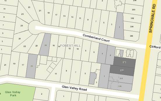
Subject site
|
|
10 Objector Properties
|
é
North
|
BACKGROUND
History
Planning permit WH/2014/760 for
construction of five dwellings including three double storey dwellings and two
single storey dwellings and alteration of access to a road in a road zone,
category 1, was issued on 8 May 2015. An extension of time to the permit was
granted with an expiry of 8 May 2019.
The Site and Surrounds
The subject site occupies two lots
on the west side of Springvale Road in Forest Hill, 230 metres north of the
intersection with Canterbury Road. The sites have a collective frontage
of 32 metres to Springvale Road, a depth varying from 41.15 metres to 45.9
metres and a total site area of 1390m2. The site has a slope of 2.42
metres falling from east to west (front to back) across the site. A 2.44
metre wide drainage easement is located along the rear (western) boundary of
the northern lot and a 1.83 metre drainage easement along the rear (western)
boundary of the southern lot. The site currently contains two single storey
brick detached dwellings. The subject site does not contain any significant
vegetation.
The surrounding properties are
residential, comprising a mix of single and double storey dwellings. There are
a number of medium density developments evident in the area. There are two
moderately sized trees within 2 Cumberland Court to the west of the subject
site.
Planning Controls
Zone:
The site is within the
Neighbourhood Residential Zone Schedule 3 (NRZ3). The purpose of Clause
32.09 (Neighbourhood Residential Zone) includes:
· To
implement the State Planning Policy Framework and the Local Planning Policy
Framework, including the Municipal Strategic Statement and local planning
policies.
· To
recognise areas of predominantly single and double storey residential
development.
· To
manage and ensure that development respects the identified neighbourhood
character, heritage, environmental or landscape characteristics.
· To
allow educational, recreational, religious, community and a limited range of
other non-residential uses to serve local community needs in appropriate locations.
A planning permit is required for
use of the land for a childcare centre pursuant to Clause 32.09-2 (Table of
uses). It is noted that as the use is not listed within the table it
automatically becomes a Section 2 – permit required use.
A planning permit is required for
the construction of buildings and works associated with a Section 2 use
pursuant to Clause 32.09-8.
Overlay:
On 8 February 2018, the Minister
for Planning approved Amendment C191 to the Whitehorse Planning Scheme on an
interim basis until 31 December 2018.The Amendment implements a municipal wide Significant
Landscape Overlay Schedule 9 (SLO9) to all residential land not currently
included in a SLO, except for land within the Mixed Use Zone. There are
no transitional provisions, so the amendment came into effect immediately and
applies to all current Planning Permit Applications that are under
consideration.
There is one protected trees within
the vicinity of the site - Tree 7 (Lilly Pilly). In this instance there are no
protected trees on the site and no buildings or works within 4 metres of
protected trees and therefore no permit is required under this clause.
Clause 52.06 – Car Parking
Clause 52.06 requires 0.22 parking
spaces per child to be provided for a child care centre. This equates to a
requirement for 21 car parking spaces as the proposal seeks a 96 place child
care centre.
The proposal is not seeking a
reduction in the car parking rate and therefore no permit is required under
this clause.
Clause 52.29 – Land adjacent
to a Road Zone, Category 1.
Clause 52.29 required a permit to
alter access to a road in a road zone, Category 1. A permit is required under
the provisions of this clause.
PROPOSAL
Use:
It is proposed to demolish the two
dwellings on the combined sites and construct a child care centre. The proposed
child care centre will offer a maximum of 96 places. A total of 21 car spaces
are provided on site within a basement with access from Springvale Road.
Proposed
hours of operation:
The proposed childcare centre is to
operate during weekdays: Monday – Friday: 6:30am to 7pm.
Development:
The proposed
childcare centre is characterised by a contemporary design and utilises a
mixture of building materials, including different colour brick walls and
claddings.
The proposed
building will be two storeys with a pitched roof form. The proposed front
setback to Springvale Road is 6.0 to 8.0 metres, which is consistent with the
6m and 9.7m setbacks of the adjoining properties. A minimum 3m setback is
provided to the north boundary (including basement), with setbacks to the south
boundary of 1m for the basement and 7.4m for the ground and first floors, and
approximately 4.2m and 9.1m setbacks are provided to the western boundary.
The proposed
overall height is 8.7m, which is less than the maximum height of 9m allowed for
a dwelling or residential building. The total building coverage is
approximately 51% of the total site and permeability of 37%.
The building
details are:
Basement
Level:
· 21
car parking spaces, including a minimum of 6 tandem spaces for staff and one
disabled space.
· Laundry,
waste storage and water tanks.
Ground Floor
Level:
· An
entry foyer accessed from the pedestrian path including alternative disabled
and pram access ramp;
· A
front reception area, office, kitchen and staff room;
· Lift
and stair; and
· 4
children’s rooms (including a cot room) catering for 52 children each
provided with access to amenities and outdoor play areas (decking/garden area);
· 3
bicycle parking hoops within the frontage.
First Floor
Level:
· 2
children’s rooms catering for 44 children each provided with access to
amenities and outdoor play area (balconies area).
Advertising Signs
It is noted that no signage is
proposed under this application.
CONSULTATION
Public Notice
The application was advertised by
mail to the adjacent and nearby property owners and occupiers and by erecting
notices to the Springvale Road frontage of each lot. Following the
advertising period 10 objections were received.
The issues raised are summarised as
follows:
Neighbourhood Character
· Inconsistent
with objectives of the NRZ.
· Excessive
site coverage.
· Insufficient
permeability.
· Commercial
use is inconsistent with residential use of the area.
Traffic and Car Parking
· Insufficient
parking provision.
· Increased
on-street parking.
· Traffic
safety impacts:
Amenity impacts:
· Noise
impacts.
· Insufficient
detail regarding proposed acoustic fence.
· No
details of air conditioning units.
· Construction
impacts.
· Overlooking.
· Light
spill from security lighting.
· Excavation
adjacent to adjoining property.
· Removal
of brick wall on boundary.
Landscaping:
· Impacts
to neighbouring trees.
· Insufficient
landscape areas
Non-planning matters:
· Negative
impact on surrounding property values.
· Facility
is not required due to other recently approved local centres.
· The
existing approval of five dwellings is more appropriate for the site.
Consultation Forum
A Consultation Forum was held on 18
December 2017, chaired by Cr Cutts. Nine objectors attended the meeting,
as well as the planning officer and permit applicant.
Matters discussed at the
Consultation Forum included:
· Car
parking provision.
· Amenity
impacts, including noise, overlooking, light spill and overshadowing.
· Details
of proposed acoustic fences.
· Requirement
for ongoing landscaping maintenance.
· Removal
of the brick wall on the south boundary.
As a result of the discussion,
clarification was given on the delivery times and waste collection with the
applicant advising that all deliveries and waste collection would occur during
non-peak times during opening hours.
The applicant also agreed to the
following, as part of any approval granted:
· All
air conditioning units would be located within the basement.
· A
review of noise impacts as a condition of approval.
· The
side boundary fence replacing the brick wall to be erected at the start of the
construction process.
Referrals
External
VicRoads
No objection subject to conditions,
including provision of a U-turn lane in Springvale Road and modifications to
the crossover to address ingress and egress to the arterial road.
Internal
Engineering and Environmental
Services Department
· Transport
Engineer
No objection to the provision of
car parking within the basement subject to conditions regarding columns.
· Waste
Engineer
The proposed development plans and
Waste Management Plan (WMP) have been reviewed by Council’s Waste
Management team, who had no objection subject to an amended WMP.
· Assets
Engineer
No objection subject to conditions.
ESD Advisor
The proposal has been reviewed by
Council’s ESD Advisor, who stated that the application does not meet
Council’s ESD standards because it is incomplete. It was recommended an
amended Sustainability Design Assessment (SDA) be requested by a condition of
any permit issued.
Early Childhood Services
Advised that food operations and
premises must be registered under the Food Act 1984.
DISCUSSION
Consistency with State and Local
Planning Policies
Proposed child care centre use
There is broad support within both
the SPPF and LPPF, such as at Clause 11 (Settlement), Clause 19
(Infrastructure) and Clause 21.07 (Economic Development) for land uses that
contribute to social and community infrastructure. These provisions emphasise the
importance of planning for social and physical infrastructure in an efficient,
equitable and timely manner, and that planning is to recognise social needs by
providing land for a range of accessible facilities for the community.
Further, objectives contained
within Clause 11.04-4 (Liveable Communities and Neighbourhoods), Clause 15.01-1
(Urban Environment), Clause 21.06-7 (Non-Residential Uses) and Clause 22.05
(Non-Residential Uses in Residential Areas) stress the importance of ensuring
development, and particularly non-residential development, responds to its
context and is designed in a way that enhances the neighbourhood character and
streetscape of the area.
The purpose (as relevant) of the
Neighbourhood Residential Zone states:
· To
allow educational, recreational, religious, community and a limited range of
other non-residential uses to serve local community needs in appropriate
locations.
In terms of Clause 22.05
(Non-Residential Uses in Residential Areas Policy), key objectives of Clause
22.05 (Non-Residential Uses in Residential Areas) include:
· To
make provision for services and facilities demanded by local communities in a
way that does not detract from the amenity of the area;
· To
avoid the concentration of non-residential uses where it would:
o Have off-site effects
which are detrimental to residential amenity.
o Create a defacto
commercial area.
o Isolate residential
properties between non-residential uses; and
· To
ensure that the design, scale and appearance of non-residential premises reflects
the residential character and streetscape of the area.
The use of the site for a child
care centre is supported by policy which encourages non-residential uses being
located on a corner site and abutting a Road Zone, Category 1 and 2. The site
has a main road interface (Springvale Road – Road Zone, Category 1) and in
this instance it is preferable that the use not be located on a corner site as
to do so would encourage parking in the secondary residential street.
Policy also states that non-residential
uses are discouraged from locating in residential zones if there are suitable
sites in nearby commercial centres and are encouraged to be in a location where
there is a demonstrable need for the proposed facility or service. VCAT has in
recent times been consistently critical of these policies, stating in Intabuild
Pty v Whitehorse CC [2017] VCAT 234 ‘
[17] I have quoted extensively
from the above decision because I consider that the same comments are relevant
for this site in Highbury Road. To consider need based on a small geographic
area or on vacancy rates takes too narrow perspective of need and demand when
choices about using a childcare centre are based on the whole range of
factors referred to in paragraph 30 quoted above.’
[30] I have
previously made comment about locational policy set out in Clause 22.05-3 and
been critical of the policy asking about suitable sites in nearby commercial
centres.
Similarly, in Holland Road Holdings
Pty Ltd v Whitehorse CC [2017] VCAT 314, the member stated:
[59] As with
the earlier cases, I find it inconceivable that a permit applicant experienced
in the childcare industry would seek to set up a centre if there was no demand.
I also make the point that the childcare centre is providing a service whether
it is provided by the community or a private company.
Notwithstanding the above
criticisms from VCAT, being on a main road it is likely that the facility will
cater for both local residents and working people who frequently use the road.
It is also common for child care centres to be located within residentially
zoned land, rather than commercially zoned land, as this land often becomes
available more frequently, and is usually less expensive and larger in size
than land located within a commercial area.
The predominant criterion for
assessment, other than the policy context, relates to the potential for any
off-site amenity impacts on the surrounding residential area. An amenity issue
raised by objectors was that of noise. Many VCAT decisions have viewed
noise emanating from child care centres as being reasonable within a
residential area and particularly accepted as a necessary trade-off in
providing community facilities. That said, the VCAT decision of Petzierides
v Hobsons Bay CC (Red Dot) [2012] VCAT 686 (28 May 2012) identifies that
whilst the noise of children playing is reasonable, this does not mean that a
centre can obviate the need to act responsibly and appropriately by not
ensuring any noise impact is of an acceptable level. Accordingly, permit conditions
are proposed to address noise impacts.
Other amenity concerns that often
stem from the location of a child care facility within a residential zone
relate to built form overshadowing and, where a two storey building is
concerned, overlooking. The proposal has reasonably managed these two factors
through the use of setbacks, screens around play areas and window location and
type. It is also noted that shadow diagrams indicate that there will be limited
impacts from overshadowing. To ensure that any unforeseen issues don’t
arise, further conditions are also proposed to cover off on overlooking.
It is considered that the concerns
from objectors that there will be amenity impacts from an overflow of parking
on local residential streets cannot be substantiated, given that the proposal
meets onsite car parking requirements. Whilst officers understand the
perception of car parking concerns with a child care facility, the mechanism to
control this through the planning scheme is through the provision of car parking,
and in this regard, the proposal provides the number of spaces required by the
scheme. It is therefore anticipated that all car parking demands will be
satisfied onsite and it is unlikely that parents will choose to park in nearby
streets given that, other than on Springvale Road which is a clearway between
the hours of 6:30 to 9:30 am and 4 to 6:30 pm, the closest street parking is a
minimum of 60 metres away.
Design and Built Form
Policy objectives, under
‘Design’ of Clause 22.05 (Non-Residential Uses in Residential
Areas) include:
· Existing
residential buildings are encouraged to be retained and converted to suit the
use in preference to a purpose-built premises.
· The
design, scale and appearance of the non-residential use are encouraged to
harmonise with the housing styles and general character of the area.
· Front
setbacks are encouraged to be consistent with abutting residences.
The objectives of the Neighbourhood
Residential Zone also include:
· To
manage and ensure that development respects the identified neighbourhood
character, heritage, environmental or landscape characteristics.
The subject site is identified by
Clause 22.03 (Residential Development) as being within Bush Suburban Precinct 3
(BSP3), which encourages building detailing that reflects, without mimicking,
the details of buildings within the area by articulating the facades of
buildings with the use of recesses, verandahs, balconies, window openings and
variations in materials and colour. When viewed from the street (east elevation),
the proposed development will read as a building of modest scale and form with
detailing consistent with the character of the area.
While the development proposes a
two-storey building, the first-floor coverage of 17.8% is significantly less
than the overall building coverage of 51%, and although there is an additional
first-floor play area, on balance the overall scale and intensity of the
proposal is an appropriate response to the subject land and its immediate
context.
Landscaping
The BSP3 also has an objective to
strengthen the garden setting of dwellings and the tree canopy of the
neighbourhood. Although this proposal is not for a dwelling, the intent of the
objective remains valid. On this issue it is acknowledged that the building
site coverage of 51% exceeds the preferred site coverage of 40% within the
BSP3. This is acceptable in this instance as the site permeability of 37% is
close to the preferred permeability of 40%, and the landscape plan demonstrates
that there is adequate room for the provision of the necessary four native
canopy trees (preferably indigenous) capable of reaching a minimum mature
height of 12 metres on the consolidated site. This requirement is included in
permit conditions.
Overall the proposed landscape plan
offers screen planting at the interfaces to soften the visual amenity impacts
of the built form and provide a vegetated response consistent with the
objectives of the Bush Suburban area.
The application includes an
arborist report which identifies the street tree and a number of trees on
abutting properties which will require protection by tree protection fencing
during construction. This is addressed in permit conditions.
It appears that the disabled/pram
ramp is unnecessarily long, which will be both inconvenient to users and
increases hard surfaces, and therefore reduces garden beds within the frontage.
A condition of approval will require that the ramp length be reviewed with
gradients of 14%, which is the maximum gradient for disabled access.
Objectors Concerns not
Previously Addressed
· Traffic
safety impacts – safety concerns were raised in regards to accessing the
site from an arterial road with a speed limit of 80 kmph. The application was
referred to VicRoads, who is the road authority for Springvale Road. VicRoads
resolved this issue by requiring a permit condition which makes the vehicle
access and crossover to be at least 6.1 metres wide at the property boundary
with the edges of the crossover angled at 60 degrees to the road reserve
boundary.
· Construction
impacts, including from excavation adjacent to the adjoining property – A
Construction Management Plan is required as a condition of approval, with
potential impacts from excavation near boundaries being the responsibility of
the Registered Building Surveyor.
· Negative
impact on surrounding property values – VCAT and its predecessors have
generally found subjective claims that a proposal will reduce property values
are difficult, if not impossible to gauge and of no assistance to the
determination of a planning permit application. It is considered the impacts of
a proposal are best assessed through an assessment of the amenity implications
rather than any impacts upon property values.
· The
existing approval of five dwellings is more appropriate for the site –
Council as the responsible authority is required to consider the merits and
suitability of the current proposal, not whether an alternative proposal would
be more suitable.
CONCLUSION
The proposal for construction and
use of a two storey childcare centre with basement parking and alteration of
access to a road in a Road Zone, Category 1, is an acceptable response that
satisfies the relevant provisions contained within the Whitehorse Planning
Scheme, including the State and Local Planning Policies, and the Neighbourhood
Residential Zone.
The application meets objectives to
appropriately provide community infrastructure on a main road location, where
it will have minimal impacts on the residential hinterland. Furthermore, the
scale of the development appropriately responds to both the built form and
landscape values of the area and will not prejudice the amenity of the
locality.
A total of 10 objections were
received as a result of public notice and all of the issues raised have been
discussed as required.
It is considered that the
application should be approved.
Attachment
1 Plans ⇨ 
Ordinary Council Minutes 19
March 2018
9.1.2 199
Canterbury Road, Blackburn (LOT 1 LP 114506) - Use and development of
land for a child care centre, associated tree removal and works beneath trees
and alterations to access to a road in a Road Zone, Category 1
FILE NUMBER: WH/2016/1193
ATTACHMENT
SUMMARY
The original application was advertised
on 30 March, 2017 and a total of seventy-eight (78) objections were
received. The objections raised issues with regard to neighbourhood
character including landscape character, parking and traffic, amenity impacts,
vegetation removal, safety, impact on property values, fauna impacts and the
number of existing childcare centres in the area. A Section 57A Amendment
to the application was lodged on 13 July, 2017 and the re-advertising of the
application was in process when Council received notice from VCAT advising that
an appeal against Failure to Determine had been received. As part of the
Application for Review, the applicant was required to re-advertise the
application and subsequently, forty-five (45) Statements of Grounds were lodged
with VCAT by property owners/residents. As part of the VCAT process, a
Compulsory Conference was held on 13 February, 2018 and a second Compulsory
Conference occurred on 6 March, 2018. At this second Compulsory
Conference, VCAT advised that Notice of any amended plans be given by 14 March,
2018. Furthermore, additional Statements of Grounds (for any new parties
wishing to become party to the appeal) must be lodged by 21 March, 2018.
It is noted that four additional
objections to the proposal have been received by Council since the Compulsory
Conference of 13 February, 2018 and, while the concerns included in these
objections have been noted, Council officers have advised these objectors that
the matter now sits with VCAT and that submissions should be directed to it.
As part of the Compulsory Conference
agreement, amended ‘without prejudice’ plans were circulated on 28
February, 2018, incorporating the majority of the agreed amendments however,
the VicRoads-related requirements have not yet been resolved. It is noted that
under the VCAT operating procedures, any matter subject to a current Compulsory
Conference, including tabled materials, is a confidential process and cannot be
distributed outside of the proceeding.
The VCAT Merits Hearing is scheduled for
five days from 9 April, 2018.
Based on the above-noted Section 57A
Amendment, Council officers prepared a delegate report recommending refusal of
the application. However, the amended ‘without prejudice’
plans are considered to reflect significant improvements to the proposal
demonstrating how the proposal can be achieved appropriately taking into
account all relevant planning controls and objector concerns. As a
result, Council officers now seek the support of Council for the proposal,
subject to conditions and VicRoads approval.
This report assesses the application
against the relevant provisions of the Whitehorse Planning Scheme, as well as
the objector concerns. The Section 57A Amendment introduced a number of
positive changes to the proposal, namely reduced floor area/site coverage
related in part to the relocation of the car parking area to below the main
level of the child care centre, increased side setbacks, increased canopy tree
planting and generally reduced building bulk, which render the application
improved. Notwithstanding these positive changes, there remain some
outstanding matters with regard to tree planting, and number of children, which
can be addressed through permit conditions.
It is noted that VicRoads, as a Referral
Authority pursuant to Section 55 of the Planning and Environment Act, 1987, has
objected to the application on the basis of requiring further information in
order to identify the extent of improvement works required to mitigate traffic
impacts relating to the proposal. Their position to date has not changed.
This matter has now been
‘called-in’ to Council for a decision by Councillor Massoud.
|
RECOMMENDATION
That Council:
A Being
the Responsible Authority, having caused Application WH/2016/1193 for 199
Canterbury Road, BLACKBURN (Lot 1 LP 114506) to be advertised and having
received and noted the objections is of the opinion that had the matter not
been before VCAT, that the granting of a Planning Permit for the use and
development of land for a child care centre, associated tree removal and
works beneath trees and alterations to access to a road in Road Zone,
Category 1 is acceptable (subject to below conditions), however given the current
VicRoads objection, the Responsible Authority cannot support the proposal
until such time as VicRoads consent is provided.
B Being the Responsible Authority, having caused Application
WH/2016/1193 for 199 Canterbury Road, BLACKBURN (Lot 1 LP 114506) to be
advertised and having received and noted the objections is of the opinion
that had the matter not been before VCAT, that the granting of a Planning
Permit for the use and development of land for a child care centre,
associated tree removal and works beneath trees and alterations to access to
a road in Road Zone, Category 1 is acceptable subject to the following
conditions:
1. Before
the development starts, or vegetation is removed, amended plans (two full
size copies) must be submitted to and approved by the Responsible
Authority. When approved, the plans will be endorsed and will then form
part of the permit. The plans must be drawn to scale, with dimensions,
and be generally in accordance with the plans submitted with the application
but modified to show:
a) The
locations of Tree Protection Zones described in Condition 5, with all
nominated trees clearly identified and numbered on both site and landscape
plans, and the requirements of Conditions 5 and 6 to be annotated on the
development and landscape plans.
b) The
correct location of Tree 7 (Melaleuca linariifolia – Snow in Summer).
c) No
encroachment greater than 10 per cent into the TPZ of Tree 2 (Eucalyptus
leucoxylon – Yellow Gum unless it can be demonstrated that the tree
will not be impacted as a result of cut starting approximately 2.8 metres
from the east boundary fence, or any other activity/development within the
TPZ.
d) For
Tree 5 (Syzygium paniculatum – Magenta Cherry), Tree 8 (Cedrus deodara
– Himalayan Cedar) and Tree 10 (Grevillea robusta – Silky Oak),
details of the level of encroachment into the related TPZs/SRZs by the
proposed fence and any associated path.
e) A
reduction to the footprint of the building, with no reduction to the front or
side setbacks, to allow for the planting of at least five (5) new canopy
trees on the site, each with a minimum mature height of fifteen (15) metres
and a minimum height of 1.5 metres at the time of planting generally in
accordance with Clause 22.04 (Tree Conservation) of the Whitehorse Planning
Scheme.
The planting of these five (5) trees is to be
reflected on the landscape plan in accordance with Condition 3
f) Compliance
with the requirements of VicRoads.
g) A
reduction in the total number of children attending the centre to 120 children.
h) All
building/site features required by the Waste Management Plan to be submitted
in accordance with Condition 12.
i) All
building features/alterations required by the Arborist Report to be submitted
in accordance with Condition 5, 6 and 7.
j) The
available sight distance at access driveways is to be in accordance with
Clause 52.06 of the Whitehorse Planning Scheme.
k) The
circulation roadway ramp width in compliance with Clause 52.06-8 of the
Whitehorse Planning Scheme and/or Australian Standard AS 2890.1, Section 2.5
and Figure 2.8.
l) Suitable
acoustic treatments to be installed above the existing/proposed boundary
fence on the western boundary from the start of the outdoor play area to the
north-west corner of the site and along the east boundary from the serve yard
to the north-east corner of the site as recommended by a suitably qualified
acoustic engineer
All of the above requirements must be to the
satisfaction of the Responsible Authority.
Once approved these plans and documents become the
endorsed plans of this permit.
2. The
layout of the site and the size, design and location of the buildings and
works permitted must always accord with the endorsed plan and must not be
altered or modified without the further written consent of the Responsible
Authority.
3. No
building or works shall be commenced (and no trees or vegetation shall be
removed) until a landscape plan prepared by a suitably qualified and
experienced person or firm has been submitted to and endorsed by the
Responsible Authority. This plan when endorsed shall form part of this
permit. This plan shall show -
a) A survey
of all existing vegetation, abutting street trees, natural features and
vegetation.
b) Buildings,
outbuildings and trees in neighbouring lots that would affect the landscape
design.
c) Planting
within and around the perimeter of the site comprising trees and shrubs
capable of:
i. Providing a
complete garden scheme,
ii. Softening the
building bulk,
iii. Providing some upper
canopy for landscape perspective,
d) A schedule
of the botanical name of all trees and shrubs proposed to be retained and
those to be removed incorporating any relevant requirements of condition No.
1.
e) The
proposed design features such as paths, paving, lawn and mulch.
f) A
planting schedule of all proposed vegetation (trees, shrubs and ground
covers) which includes, botanical names, common names, pot size, mature size
and total quantities of each plant.
Landscaping in accordance with this approved plan
and schedule shall be completed before the building is occupied.
Once approved these plans become the endorsed
plans of this permit.
4. The
garden areas shown on the endorsed plan and schedule shall only be used as
gardens and shall be maintained in a proper, tidy and healthy condition to the
satisfaction of the Responsible Authority. Should any tree or shrub be
removed or destroyed it may be required to be replaced by a tree or shrub of
similar size and variety.
5. Prior
to the commencement of any building and or demolition works on the land, a
Tree Protection Zone (TPZ) must be established on the subject site and
maintained during and until completion of all buildings and works including
landscaping, around the following trees in accordance with the distances and
measures specified below, to the satisfaction of the Responsible Authority:
a) Tree
Protection Zone distances:
i. Tree
2 (Eucalyptus leucoxylon – Yellow Gum) – 4.1 metre radius from
the centre of the tree base.
ii. Tree
3 (Pittosporum undulatum – Sweet Pittosporum) – 2.0 metre radius
from the centre of the tree base.
iii. Tree
5 (Syzygium paniculatum – Magenta Cherry) – 3.7 metre radius from
the centre of the tree base.
iv. Tree
7 (Melaleuca linariifolia – Snow in Summer) – 2.4 metre radius
from the centre of the tree base.
v. Tree
8 (Cedrus deodara – Himalayan Cedar) – 5.4 metre radius from the
centre of the tree base.
vi. Tree
10 (Grevillia robusta – Silky Oak) – 5.1 metre radius from the
centre of the tree base.
vii. Tree
13 (Eucalyptus cephalocarpa – Silver Stringybark) – 5.8 metre
radius from the centre of the tree base.
viii. Tree
14 (Eucalyptus ovata – Swamp Gum) – 3.7 metre radius from the
centre of the tree base.
ix. Tree
16 (Eucalyptus ovata – Swamp Gum) – 5.7 metre radius from the
centre of the tree base.
x. Tree
17 (Eucalyptus ovata – Swamp Gum) – 5.6 metre radius from the
centre of the tree base.
xi. Tree
18 (Pittosporum undulatum – Sweet Pittosporum) – 2.0 metre radius
from the centre of the tree base.
xii. Tree
21 (Eucalyptus ovata – Swamp Gum) – 5.6 metre radius from the
centre of the tree base.
xiii. Tree
25 (Eucalyptus sp.) – 2.0 metre radius from the centre of the tree
base.
xiv. Tree
26 (Eucalyptus sp.) – 2.0 metre radius from the centre of the
tree base.
xv. Tree
27 (Melaleuca linariifolia – Snow in Summer) – 2.8 metre radius
from the centre of the tree base.
xvi. Tree
28 (Eucalyptus botryoides – Southern Mahogany) – 2.1 metre radius
from the centre of the tree base.
xvii. Tree
29 (Acacia floribunda – Gossamer White) – 2.0 metre radius from
the centre of the tree base.
xviii.Tree
32 (Corymbia citriodora – Lemon – 8.4 metre radius from the
centre of the tree base.
b) Tree
Protection Zone measures are to be established in accordance to Australian
Standard 4970-2009 and including the following:
i. Erection
of solid chain mesh or similar type fencing at a minimum height of 1.8 metres
in height held in place with concrete feet.
ii. Signage
placed around the outer edge of perimeter the fencing identifying the area as
a TPZ. The signage should be visible from within the development, with the
lettering complying with AS 1319.
iii. Mulch
across the surface of the TPZ to a depth of 100mm and undertake supplementary
watering in summer months as required.
iv. No
excavation, constructions works or activities, grade changes, surface
treatments or storage of materials of any kind are permitted within the TPZ
unless otherwise approved within this permit or further approved in writing
by the Responsible Authority.
v. All
supports and bracing should be outside the TPZ and any excavation for
supports or bracing should avoid damaging roots where possible.
vi. No
trenching is allowed within the TPZ for the installation of utility services
unless tree sensitive installation methods such as boring have been approved
by the Responsible Authority.
vii. Where
construction is approved within the TPZ, fencing and mulching should be
placed at the outer point of the construction area.
viii. Where
there are approved works within the TPZ, it may only be reduced to the
required amount by an authorised person only during approved construction
within the TPZ, and must be restored in accordance with the above
requirements at all other times.
6. During
the construction of any buildings or works, the following tree protection
requirements must be carried out to the satisfaction of the Responsible
Authority:
a) All
buildings and works for the demolition of the site and construction of the
development (as shown on the endorsed plans) must not alter the existing
ground level or topography of the land within 2.8m of the east boundary fence
where within the TPZ of Tree 32.
b) All
buildings and works (soft landscaping allowable), including soil level
changes, must be setback 2.8m from the east boundary fence where within the
TPZ of Tree 32.
7. A
Tree Management Plan prepared in accordance with AS4970-2009 must be
submitted to Council detailing how Trees 13, 14, 16, 17 and 21 will be
protected pre, during and post construction. The Tree Management Plan
must also show any level changes (in the form of a diagram and written
description) and fence footings and detail how the tree will be managed in
association with these changes.
Once submitted to and approved by the Responsible
Authority, the Tree Management Plan will form part of the documents endorsed
as part of this planning permit.
The requirements of the Tree Management Plan must
be implemented by the building manager, owners and occupiers of the site for
the duration of the building’s operation in accordance with this
permit, to the satisfaction of the Responsible Authority.
8. Only
Trees 1, 4, 6, 12, 15, 19, 20, 22, 23, 24, 30 and 31 are allowed to be
removed or destroyed.
9. No
other vegetation on site, shown as an existing tree or shrub on the endorsed
plan, is to be destroyed, felled, lopped or uprooted without the written
consent of the Responsible Authority (other than in accordance with a Notice
given pursuant to the Local Government Act or vegetation with a trunk
circumference of less than 0.5 metre when measured at a point 1 metre above
ground level). The on-going maintenance of the retained and planted
trees must be undertaken to the satisfaction of the Responsible Authority. If
any planted trees die or are removed, they must be replaced within two months
and maintained to the satisfaction of the Responsible Authority.
10. Council's
Compliance Officer must be advised of the completion of all tree planting
required by this permit so that a site inspection can be carried out. A
further inspection will be carried out 6 months after the completion of the
landscaping to ensure that species has been adequately maintained.
11. Prior
to the commencement of buildings and works a Traffic Management Plan, and any
other relevant approvals, must be submitted and approved to the satisfaction
of Council’s Transport Team, Engineering and Environmental
Services. Once approved, the Traffic Management Plan will be endorsed
as part of this planning permit.
12. Prior
to the commencement of buildings and works, a Waste Management Plan must be
prepared to the satisfaction of the Responsible Authority. The Waste
Management Plan must provide details in relation to:
a) Private collection of all wastes
generated on the site,
b) On-site waste storage capacity:
including justification based on similar uses and developments operating
elsewhere that the on-site waste storage capacity will be sufficient for the
likely tenants and options to increase capacity if required.
c) Bin storage areas: their
location, accessibility and number, size and capacity of bins that can be
accommodated.
d) An on-going commitment to
recycling.
e) The separation of garbage from
recyclables and other wastes (such as green waste): including ease of
separation by residents, and separate collections by waste contractors, to
ensure that separation of recyclables is facilitated and not hindered by the
site layout.
f) Delivery of bins to waste
collection points and retrieval of bins to nominated storage areas within the
building: including access to secure basement areas and management of potential
conflicts between vehicles accessing the site and waste collection
arrangements.
g) Waste collection arrangements:
including collection frequency, collection location, collection vehicle
access arrangements, including clearance and turning movements, appropriate
collection standards including collection cleanliness and spill management,
hours of access, noise impacts and other amenity related issues, and any
signage required to facilitate these arrangements.
h) Litter and green waste management.
The
requirements of the Waste Management Plan must be demonstrated on the plans
and elevations submitted for endorsement.
Once
submitted to and approved by the Responsible Authority, the Waste Management
Plan will form part of the documents endorsed as part of this planning
permit.
The
requirements of the Waste Management Plan must be implemented by the building
manager, owners and occupiers of the site for the duration of the
building’s operation in accordance with this permit, to the
satisfaction of the Responsible Authority.
13. Prior
to the commencement of any buildings or works, a Sustainability Management
Plan must be submitted to and approved by the Responsible Authority. In
particular, this should address the need to protect the internal amenity of
the upper levels from the thermal impacts of the west facing windows.
Once submitted and approved to the
satisfaction of the Responsible Authority, the Sustainability Management Plan
will form part of the endorsed plans under this permit.
The requirements of the
Sustainability Management Plan must be demonstrated on the plans and
elevations submitted for endorsement, and the requirements of this plan must
be implemented by the building manager, owners and occupiers of the site when
constructing and fitting out the residential building, and for the duration
of the building’s operation in accordance with this permit, to the
satisfaction of the Responsible Authority.
Prior to the occupation
of the development, the development must be constructed in accordance with
the approved Sustainable Environmental Management Plan to the satisfaction of
the Responsible Authority.
14. Prior
to the commencement of buildings or works on the land, a Construction
Management Plan, detailing how the owner will manage the environmental and
construction issues associated with the development, must be submitted to and
approved by Council.
This plan is to be to
the satisfaction of the Responsible Authority and must be prepared in
accordance with the City of Whitehorse Construction Management Plan
Guidelines.
Once submitted to and
approved by the Responsible Authority the Construction Management Plan will
form part of the documents endorsed as part of this planning permit.
When approved the
Construction Management Plan will form part of this permit and must be
complied with, to the satisfaction of the Responsible Authority, to the
extent that this is in the control of the owner of the land. The owner of the
land is to be responsible for all costs associated with the works to be
undertaken in accordance with the requirements of the Construction Management
Plan.
15. The
amenity of the area must not be detrimentally affected by the use or
development, through:
a) Transportation
of materials, goods or commodities to or from the land,
b) Appearance
of any building, works or materials,
c) Emission
of noise, artificial light, vibration, smell, fumes, smoke, vapour, steam,
soot ash, dust, waste water, waste products, grit or oil,
d) Presence
of vermin
e) In
any other way.
16. Any
alarms must be directly connected to a security service and must not produce
noise beyond the premises.
17. All
external lights must be of a limited intensity to ensure no nuisance is
caused to adjoining or nearby residents and must be provided with approved
baffles, so that no direct light or glare is emitted outside the site.
18. Signage
is only to be displayed in accordance with Clause 52.05 – Advertising
Signs of the Whitehorse Planning Scheme, unless with the further written
consent of the Responsible Authority.
19. Not
more than 20 staff are to be present on the premises at any one time.
20. Not
more than 120 children are allowed to be cared for on the site at any one
time.
21. Except
with the prior written consent of the Responsible Authority, the use hereby
permitted must only operate between the hours of 6.30am and 6.30pm, Monday to
Friday.
22. The
external playground areas must not be used before 8.00am or after 6.00pm
weekdays and at no time during weekends.
23. The
collection of refuse must not cause disturbance to any nearby residential
properties and is to be restricted to between the hours of 7.00am and 6.00pm
on weekdays. Refuse must be stored and screened from public view to the
satisfaction of the Responsible Authority.
24. Deliveries
to the centre hereby approved must be within 9.30am and 4.00pm on the days
the centre is open. These hours must not be exceeded without the
further written consent of the Responsible Authority.
25. The
car parking areas and accessways as shown on the endorsed plans shall be
formed to such levels so that they may be used in accordance with the plan,
and shall be properly constructed, surfaced, drained and line-marked (where
applicable). The car park and driveways shall be maintained to the
satisfaction of the Responsible Authority.
26. Parking
areas, loading bays and access lanes must be kept available for these
purposes at all times.
27. No
equipment, services and architectural features other than those shown on the
endorsed plan are to be permitted above the roof level of the building unless
otherwise agreed to in writing by the Responsible Authority.
28. The
Applicant/Owner shall be responsible to meet all costs associated with reinstatement
and/or alterations to Council or other Public Authority assets deemed
necessary by such Authorities as a result of the development. The
Applicant/Owner shall be responsible to obtain an "Asset Protection
Permit" from Council at least 7 days prior to the commencement of any
works on the land and obtain prior specific written approval for any works
involving the alteration of Council or other Public Authority assets.
29. All
stormwater drains and on-site detention systems are to be connected to the
legal point of discharge to the satisfaction of the Responsible Authority
prior to the occupation of the building/s. The requirement for on- site
detention will be noted on your stormwater point of discharge report, or it
might be required as part of the civil plans approval.
30. Detailed
stormwater drainage and/or civil design for the proposed development are to
be prepared by a suitably qualified civil engineer and submitted to the
Responsible Authority for approval prior to occupation of the development.
Plans and calculations are to be submitted with the application with all
levels to Australian Height Datum (AHD). All documentation is to be
signed by the qualified civil engineer.
31. Stormwater
that could adversely affect any adjacent land shall not be discharged from
the subject site onto the surface of the adjacent land.
32. Prior
to works commencing the Applicant/Owner is to submit design plans for all
proposed engineering works external to the site. The plans are to be
submitted as separate engineering drawings for assessment by the Responsible
Authority.
33. The
qualified civil engineer when undertaking civil design must ensure that the
landscape plan/s and drainage plan/s are compatible. The stormwater
drainage and on site detention system must be located outside the tree
protection zone (TPZ) of any trees to be retained.
34. No
building or works shall be constructed over any easement without the written
consent of Council and the relevant Authorities.
Permit Expiry
35. This
permit will expire if one of the following circumstances applies:
a) The
development is not commenced within two (2) years from the date of issue of
this permit;
b) The
development is not completed within four (4) years from the date of this
permit;
c) The
use is not commenced within twelve (12) months of the completion of the
development.
The Responsible Authority may extend the
periods referred to if a request is made in writing pursuant to the provision
of Section 69 of the Planning and Environment Act 1987.
Permit Notes
1. The
design and construction of the stormwater drainage system up to the point of
discharge from an allotment is to be approved by the appointed Building
Surveyor. That includes the design and construction of any required
stormwater on-site detention system. The Applicant/Owner is to submit
certification of the design of any required on-site detention system from a
registered consulting engineer (who is listed on the Engineers Australia
National Professional Engineer Register or approved equivalent) to Council as
part of the civil plans approval process.
2. The
requirement for on- site detention will be noted on your stormwater point of
discharge report, or it might be required as part of the civil plans
approval.
3. All
proposed changes to the vehicle crossing are to be constructed in accordance
with the submitted details, Whitehorse Council’s – Vehicle
Crossing General Specifications and standard drawings.
4. The
Applicant/Owner is to accurately survey and identify on the design plans all
assets in public land that may be impacted by the proposed development. The
assets may include all public authority services (i.e. gas, water, sewer,
electricity, telephone, traffic signals etc.) and the location of street
trees or vegetation. If any changes are proposed to these assets then the
evidence of the approval is to be submitted to Council and all works are to
be funded by the Applicant/Owner. This includes any modifications to
the road reserve, including footpath, nature-strip and kerb and channel.
5. The
Applicant/Owner must obtain a certificate of hydraulic compliance from a
suitably qualified civil engineer to confirm that the on-site detention works
have been constructed in accordance with the approved plans, prior to
Statement of Compliance is issued.
6. There
is to be no change to the levels of the public land, including the road
reserve or other Council property as a result of the development, without the
prior approval of Council. All requirements for access for all-abilities
(Disability Discrimination Access) are to be resolved within the site and not
in public land.
7. No
fire hydrants that are servicing the property are to be placed in the road
reserve, outside the property boundary, without the approval of the Relevant
Authority. If approval obtained, the property owner is required to enter into
a S173 Agreement with Council that requires the property owner to maintain
the fire hydrant.
8. The
applicant must construct a stormwater drain to the legal point of discharge
which is external to the site. The stormwater drainage system must be
approved by Council prior to any works commencing and be financed by the
developer.
9. You
are advised that a qualified civil engineer must undertake a flood analysis
to determine if the property is in an area liable to flooding. The
qualified engineer must set floor levels for the development. Any flood
analysis must be certified by the qualified engineer.
10. No
trees are permitted to be planted within the easement.
|
|
COUNCIL
RESOLUTION
Moved by Cr Massoud, Seconded by Cr Munroe
That Council:
A Being
the Responsible Authority, having caused Application WH/2016/1193 for 199 Canterbury Road, BLACKBURN (LOT 1 LP114506)
to be advertised and having received and noted the objections is of the
opinion that the proposed use and development
of land for a child care centre, associated tree removal and works beneath
trees and alterations to access to a road in a Road Zone, Category 1 is
unacceptable and should not be supported.
B Has
formed a position to oppose the application in relation to the land described
as 199 Canterbury Road, BLACKBURN (LOT 1
LP114506) for the use and development of land for a child care centre,
associated tree removal and works beneath trees and alterations to access to
a road in a Road Zone, Category 1, on the following grounds.
1. The
proposal is contrary to policy at Clause 22.05 (Non-residential uses in
Residential Areas) as it has not ensured that the landscaping, setbacks and
amenity reflects the residential character of the area. In addition, the
use has not considered appropriately the role and function of the surrounding
road network.
2. The
proposal is contrary to the purpose of Clause 32.09 (Neighbourhood
Residential Zone) due to the lack of appropriate landscaping and safety,
efficiency and amenity effects of traffic to be generated by the proposal.
3. The
proposal fails to respond appropriately to the landscape character objectives
of Schedule 2 to Clause 42.03 (Significant Landscape Overlay), namely in terms
of siting, tree conservation, site coverage, tree planting and compatibility
with the local character.
4. The
development fails to retain sufficient, or protect appropriately, existing
trees on the subject and adjoining sites, contrary to the preferred landscape
character of the Significant Landscape Overlay, Schedule 2 and Clause 22.04 (Tree
Conservation Policy).
5. The
proposed site layout fails to provide sufficient and appropriate landscaping
opportunities to conform to the preferred and prevailing Bush Environment
character of the site and surrounds.
6. In
terms of traffic management treatments in Canterbury Road, the likely
requirements of VicRoads will result in adverse traffic impacts, namely
congestion, on surrounding streets on the north and south sides of Canterbury
Road.
Carried
Unanimously
|
Applicant: Ausco
Group
Zoning: Neighbourhood
Residential Zone, Schedule 1
Overlays: Significant
Landscape Overlay, Schedule 2
Relevant Clauses:
Clause 11 Settlement
Clause12 Environment
and Landscape Values
Clause 15 Built
Environment and Heritage
Clause 17 Economic
Development
Clause 21.05 Environment
Clause 21.06 Housing
Clause 21.07 Economic
Development
Clause 22.03 Residential
Development
Clause 22.04 Tree
Conservation
Clause 22.05 Non-residential
Uses in Residential Areas
Clause 32.09 Neighbourhood
Residential Zone
Clause 42.03 Significant
Landscape Overlay
Clause 52.06 Car
parking
Clause 52.29 Alterations
of access to a Road Zone, Category 1
Clause 65 Decision
Guidelines
Ward: Central
|
|
|
Subject site
|
|
78
Objector Properties
(Some
outside area shown on map)
|
é
North
|
background
History
Two (2) planning permit
applications were previously lodged with Council in relation to the subject
site (the site), as summarised below.
· WH/2008/294
proposed the removal of nine trees and the pruning of four trees and was
approved subject to conditions. This application was later amended
(WH/2008/294/A) to reduce the number of trees to be retained on the site from
twelve (12) to eight (8).
· WH/2015/346
proposed the use and construction of a childcare centre, vegetation removal and
the alternation of access to a Road Zone, Category 1. Council refused
this application and this decision was upheld by VCAT in October, 2015 (VCAT
Reference: P2261/2015). The key reasons for this VCAT determination
relate to landscaping and character implications and are summarised in the
following excerpts from the report / findings of the presiding VCAT member.
- “The
response may be tempered by the immediate context to a degree, but it should
still reasonably provide for the creation of a landscape setting which reflects
a bush environment.
- In
combination, the building’s footprint and the extent of hard pavement
associated with the car parking area present as a development outcome which
fails to respond acceptably to the area’s landscape character. I agree
with the submissions that the proposal is too large and too intense for the
site.
- The
car parking is extensive. It occupies a substantial portion of the
site. The outcome is not consistent with policy. In addressing car
parking and access, Clause 22.05 discourages parking at the front of
sites. The Bush Environment Precinct Guidelines include an objection of
minimising the loss of front garden space and the dominance of car parking
structures….A related design response is that hard paving for car parking
be minimise and substituted with permeable surface where possible.
Excessive areas of hard paving and driveways are discouraged.
- …the
building’s footprint and car parking area do not result in a reasonable
proportion of the site being available for planting, landscaping and open
space.
- The
spaces within which the proposed trees are to be planted do not achieve the
area specified in the policy (Clause 22.04). Notwithstanding, the
evidence is that the trees will establish and reach their anticipated mature
height. Given that I have determined to refuse the application, I do not
need to make a finding on whether the non-compliance with this policy (Clause
22.04) is acceptable. However, the inability to provide the nominated
area of ‘open space’ in almost every instance where a new tree is
proposed is, perhaps, a further indicator that the development is too intense
for this site.” (VCAT Reference: P2261/2015)_
With regard to the subject planning
permit application (WH/2016/1193) for the use and development of the site for a
childcare centre, tree removal and the alteration of access to a road in a Road
Zone, Category, it is noted that it was initially determined that, had a VCAT
appeal against Failure to Determine not been lodged, refusal of the application
would have been recommended by Council officers. This assessment was
based on the amended (Section 57A) development plans submitted just prior to
the appeal being lodged. However, during the subsequent VCAT Compulsory
Conference, amended ‘without prejudice’ plans were circulated,
which have substantially addressed outstanding officer concerns. As a
result, officers are now seeking the support of Council, subject to planning
permit conditions and VicRoads approval.
The Site and Surrounds
The subject site is located on the
north side of Canterbury Road in Blackburn approximately 260 metres east of the
intersection with Blackburn Road and 1.1 metres west of the intersection with
Springvale Road. The Forest Hill Chase Shopping Centre is located on
Canterbury Road approximately 265 metres to the east of the site.
The site has an area of 2537 square
metres, a frontage of 36.58 metres to Canterbury Road and a maximum depth of 80
metres. The site has a slope of over 3 metres from south to north (above
from the Canterbury Road frontage of the site). A 2.44 metre wide
drainage easement runs along the north (rear) boundary of the site and along
the east (rear) boundaries of 1A and 3 Lagoona Court to the immediate west of
the site.
The site currently contains a
double storey brick, detached dwelling along with a number of mature
trees. The Mason Road Flood Retarding Basin adjoins the site to the
immediate north (rear) comprising a significant open space area running from
Lagoona Court on the west to Forest Road. The Mason Road Flood Retarding
Basin is heavily vegetated.
The surrounding properties are
residential containing a mix of single and double storey dwellings. A
number of canopy trees are located on adjoining residential properties.
Planning Controls
The proposal triggers a planning
permit under the following clauses within the planning scheme.
Neighbourhood
Residential Zone (Clause32.09)
Pursuant to Clause32.09-1, a permit
is required for use as a childcare centre. In addition, pursuant to Clause
32.09-7, a permit is required for buildings and works associated within a
childcare centre.
Significant
Landscape Overlay (Clause42.03)
Pursuant to Clause 42.03-2, a
permit is required to remove, destroy or lop a tree and to construct a building
or construct or carry out works.
Access
to a Road Zone, Category 1 (Clause52.29)
Pursuant to Clause 52.29, a permit
is required to create or alter access to a Road Zone, Category1.
PROPOSAL
The proposal, involves the use and
development of the site for a childcare centre, tree removal and the alteration
of access to a road in a Road Zone, Category 1. In summary, the proposal
includes the following.
· A
maximum capacity of 130 children.
· A
maximum of twenty (20) staff.
· Hours
of operation are between 6.30am to 6.30pm, Monday to Friday.
· A
basement level car parking area comprising twenty-eight (28) car parking
spaces.
· Ground
floor level, with an area of 888.1 square metres, includes a waiting area,
reception area, staff room, meeting rooms, kitchen, laundry, store room, lift
lobby, seven (7) childcare rooms with shared amenities and access to a 918
square metres outdoor play area.
In
addition, it is noted that the proposal involves the following.
· A
minimum front setback of 13.150 metres to Canterbury Road.
· A
maximum building height of 5.334 metres.
· Minimum
side setbacks of 6.871 metres to the west, 4.4 metres to the east and 9.055
metres to the north/rear.
· Site
coverage of 35 per cent.
· Site
permeability of 53.3 per cent.
· A
lower roof form than that originally proposed.
· Open
style fencing along the Canterbury Road frontage of the site.
· Removal
of nine (9) trees, three of which require permit approval pursuant to Clause
42.03-2 of the Whitehorse Planning Scheme (Significant Landscape Overlay
– Schedule 2).
· Buildings
and works within 4 metres of three (3) trees, which trigger a planning under
the SLO.
· The
planting of six (6) new trees of between eight (8) and eighteen (18) metres in
height.
Refer to plans prepared by Point
Architects Pty Ltd, Drawing no. TP01 to TP07, dated 8 August, 2017 and a
Landscape Planting Plan prepared by Urbis Pty Ltd, dated 2 August, 2017.
CONSULTATION
Public
Notice
The original application was
advertised by mail to the adjacent and nearby property owners and occupiers and
by erecting notices at the Canterbury Road frontage. Following the
advertising period, seventy-eight (78) objections were received.
The
issues raised are summarised as follows.
Neighbourhood
Character
· Appropriateness
of commercial development in a residential area
· Overdevelopment
· Bulk
and massing
Traffic
and Car parking
· Pedestrian
and driver safety
Vegetation
Removal
· Fauna
impacts
· Neighbourhood
character impacts
· Non-compliance
with the relevant Significant Landscape Overlay and Bush Environment Precinct
guidelines.
Amenity
impacts
· Noise
· Traffic
· Visual
bulk
· Vegetation
removal
Other
· Property
values
· Number
of existing childcare centres in the area
Section
57A Amendment
The
following outlines events following the initial public notification of the
proposal.
· A
Section 57A Amendment request was lodged on 13 July, 2017 to
address issues raised by the Council Planning Department and objections raised
to the original proposal, as summarised above.
· Council
sought further information (namely, revised plans) in association with the
proposed Section 57A Amendment and generally found the plans to reflect an
adequately improved proposal however, the amended application was not
advertised as, just prior to the commencement of the re-notification process,
Council was advised that an appeal had been lodged with VCAT (VCAT reference
P2428/2017) against the Responsible Authority’s failure to determine the
application within the required statutory timeframe.
· Pursuant
to an initial VCAT Order, the applicant (Ausco Investments) was directed by
VCAT to undertake public notification. This advertising process was
completed and, forty-five (45) Statements of Grounds have been lodged with VCAT
by property owners/residents contesting the application.
· Following
the Compulsory Conference of 13 February, 2018, four (4) additional objections
have been lodged with Council. Council officers have advised these
submitters that, as this is now a VCAT matters, all submissions should be made
direct to VCAT.
Consultation Forum
A Consultation Forum was not held as the applicant lodged an
appeal with VCAT prior to the completion of a second round of public notice,
which had been prepared to notify the public of the amendment to the original
proposal. Once the appeal had been lodged with VCAT, officers determined
that there would be little value in holding a consultation forum, as VCAT runs
a separate process. With regard to public consultation throughout the planning
process, the following table summarises the extent of community involvement in
terms of submitter numbers at various stages of the process.
|
Public Notice
(Initial
Proposal)
|
Registered
Parties to VCAT Appeal
|
Compulsory
Conference
(Remaining
Parties to the Appeal)
|
Additional
Submissions
|
|
78
|
45
|
10
*
(some representing
other parties, along with themselves)
|
4
|
*Note: In keeping with VCAT
procedures, these are the only parties which will continue to be considered
official parties to the appeal.
Referrals
External
Melbourne
Water
The
application was referred to Melbourne Water, who does not object to the
proposed development.
VicRoads
Pursuant to Section 55 of the
Planning and Environment Act, 1987, the proposal was referred to VicRoads who
raised the following concerns in response to VCAT dated 22 November, 2017.
“The submitted traffic
report dated August 2017 does not appear to include data that is relevant in
determining the extent of impact the proposal would have on the immediate
arterial road network. Given the site’s location, there is a need to
assess the proposal’s impact on existing right turn/ u-turn lanes in
terms of post-development queue lengths and loss of space for vehicle
deceleration. Consequently, VicRoads is unable to identify the extent of improvement
works required to mitigate traffic impacts pertaining to the proposal.
In light of the above
deficiencies as well as the absence of a formal referral from Council, VicRoads
objects to the issue of a Planning Permit and respectfully requests to be joined
as parties to the hearing.”
Internal
Transport
Engineering Department
The application was referred to the
Council Transport Engineering Unit, which noted that the proposed parking
layout is satisfactory and as such it does not object to the proposal, subject
to the condition below being applied to any permit issued.
“The proposed circulation
roadway ramp width is to comply with Clause 52-.06-08 of the Planning Scheme
and/or Australian Standard AS 2890.1 section 2.5 and figure 2.8.
Sustainability
The Council Waste Engineers have
reviewed the proposal and do not object to the application, subject to the
inclusion of the recommended waste management conditions.
Assets
The Council Engineering Assets team
have assessed the proposal and support the application, subject to the
inclusion of conditions.
Planning Arborist
The
application was referred to the Council Planning arborist, who does not object
to the application, subject to permit conditions.
Parkswide Department
Council’s Parkswide
Department does not object to the potential removal of trees within the
Canterbury Road road-reserve, if so required by VicRoads. It is noted
that Canterbury Road is a VicRoads road-reserve and, while Council is
responsible for maintaining the trees within the subject road reserve, VicRoads
owns this asset.
DISCUSSION
As noted above, whilst in the
associated Delegate Report, Council officers did not support the proposal as
reflected in the Section 57A Amendment, the support of Council is now sought
based on subsequent amendments made at the related Compulsory Conference.
The previous lack of Council officer support related predominately to
inadequate landscaping and therefore an inherently poor response to the
requirements of Significant Landscape Overlay, Schedule 2, along with the
VicRoads position on the application. At the Compulsory Conference, an
indication of how these outstanding matters could be addressed was provided, to
the satisfaction of Council officers, who are now requesting that Council
support the application, subject to conditions which address these matters.
Consistency with State and Local
Planning Policies
The proposal is
consistent with State and Local Planning Policies relating to business
development, employment generation, access to services, non-residential uses in
residential areas and tree conservation of the Whitehorse Planning Scheme, as
outlined below.
Clause 21.06-7
(Non-residential uses in residential zones)
Clause 21.06 (Housing) recognises
that there is a legitimate need for non-residential uses in residential areas
to serve the needs of the local community. It is
considered that the proposal will integrate well with and respect the
surrounding neighbourhood quality while helping to meet the needs of the local
community.
At Clause
21.06-7, strategies to achieve good integration of non-residential uses in
residential areas include directing “non-residential uses to
appropriate locations, and provide parameters for their operation”.
These parameters include those outlined in the Neighbourhood Character Precinct
Guidelines, which aim to “provide guidance for future non-residential
development in residential areas and assessments.”
An assessment of the proposal
against the relevant Neighbourhood Character Precinct Guidelines, being those
for the Bush Environment Precinct, is included below.
Clause 22.03-5
(Bush Environment)
In the Bush Environment precinct,
which applies to the site, “buildings and hard surfaces are expected
to occupy a very low portion of the site” and “be sited to reflect
the prevailing front, rear and side setbacks with larger rear setbacks to
accommodate substantial vegetation including large canopy trees.”
In addition, it is intended that “the bushy environs (be) complemented
by street trees and a lack of front fencing”, that “streetscapes
be dominated by vegetation with subservient buildings frequently hidden from
view behind vegetation and tall trees.”
The relevant Bush Environment
Precinct Guidelines require consistency with the requirements of the applicable
Significant Landscape Overlay with regard to site coverage, site permeability
and open space, all matters addressed below (see below ‘Significant
Landscape Overlay - Clause 42.03).
The Bush Environment Guidelines
detail the preferred design response with regard to the siting of development
and the landscape environs. In this regard, the proposal responds
appropriately, including as follows.
· The
height of the proposed building will not exceed the dominant tree canopy and is
consistent with surrounding residential development, thereby minimising any
potential visual impact on surrounding neighbours and the open space to the
immediate north.
· The
proposed building is setback from the rear boundary an adequate distance to
provide a positive interface with the open space to the immediate north of the
site.
· A
number of established and mature trees are proposed to be retained and the
proposed landscape plan includes a good range of canopy and other trees and
vegetation.
· Only
one vehicle crossing is proposed thereby reducing any potential impacts on
vegetation and minimising any potential visual impacts on surrounding
properties in terms of neighbourhood character.
· Hard
paving areas are minimal in area, largely as a result of the inclusion of the
car parking area below the ground level childcare centre facility.
It is considered that the proposed
building occupies a relatively low portion of the site in the context of the
requirements of the Bush Environment Guidelines and the relevant Significant
Landscape Overlay provisions, as addressed below (see below ‘Significant
Landscape Overlay – Clause 42.03’).
Clause
22.05 (Non-residential uses in Residential Areas)
In Clause 22.05, it is acknowledged
that, in residential areas, non-residential uses have the “potential
to adversely impact upon the amenity of residential areas if they are poorly
designed or located”. Therefore, “it is important that
these non-residential uses provide a net community benefit and are designed to
integrate into the residential environment with minimal impact on residential
amenity” (Clause 22.05).
It is further stated in Clause
22.05 that non-residential uses “should be in a highly accessible
location and the traffic that they generate needs to be compatible with the
role and function of the street and the surrounding area.” In
this regard, it is considered that the subject proposal would have net
community benefit and is designed to integrate into the residential
environment. It is anticipated that ‘community benefit’ would
derive from the additional childcare services, which are currently in high
demand in the municipality.
The site is adjacent to a road in a
Road Zone, Category 1, which is a major arterial road and near the intersection
with Blackburn Road, also a road in a Road Zone, Category 1 and is within close
proximity to Forest Chase Shopping Centre and Springvale Road (another
significant arterial road). Given this context, the site is considered to
be a highly accessible location and therefore meets the requirements of Clause
22.05. In this regard, it is noted that, with regard to the previous
application for a childcare centre on the site, VicRoads provided support for
that application which was of a very similar size in terms of child and staff
numbers.
Further consideration has been
given to the objectives outlined at Clause 22.05 and the proposal is found to
provide an appropriate response, namely in terms of:
· Making
provision for services and facilities demanded by local communities in a way
that takes into account the amenity of the area;
· Avoiding
a concentration of non-residential uses / “a de-facto commercial area”
or the isolation of residential properties, which the proposal would not result
in;
· Providing
non-residential uses adjacent to roads in a Road Zone, Category 1 though it is
noted that the subject site is not also on a corner site as is encouraged under
Clause 22.05-3;
· Providing
a non-residential use within convenient walking distance to shopping
centres
· Providing
a use for which there is a demonstrable need (see below);
· Ensuring
that “the design, scale and appearance of non-residential premises
reflects the residential character and streetscape of the area”.
Four (4) existing or approved
private childcare centres are located within approximately 1 kilometre of the
site (or an average walking distance of ten (10) minutes). These centres
provide both childcare services and kindergarten programs.
· Holbury
Children’s Centre, 29 Raleigh Street, Blackburn South
· Starfish
Early Learning Centre, 168 Canterbury Road, Blackburn
· Goodstart
Early Learning – 2 Fraser Place, Forest Hill
· Sparrow
House Early Learning Centre, 269-271 Canterbury Road, Blackburn
In addition, a childcare centre was
recently approved for 50-52 Blackburn Road, Blackburn providing childcare
services and kindergarten programs for 104 children.
Discussion by the applicant, with
each of the above childcare centres indicates that each is either completely
full with a long waiting list or, for newer centres, expecting to be full by
the end of 2018. Based on the generally high enrolment levels at the
above nearby childcare centres, it is considered that there is a need for the proposed
use.
In terms
of the design of the proposed development and related potential amenity
impacts, it is noted that the proposal responds appropriately to Clause 22.05
by providing the following.
· A
front setback that would reduce any potential visual impacts of the
development.
· Landscaping
to help maintain the streetscape character and amenity of abutting residential
properties.
· Hours
of operation that would be limited to standard Monday to Friday business hours
(i.e. not open nights or weekends) and thereby limit impacts on surrounding
properties in terms of noise, traffic, lighting etc.
· Adequate
car parking and access arrangements in keeping with Clause 52.06 (Car parking)
of the Whitehorse Planning Scheme.
· Parking
that is not visible from the street, being under the proposed building and not
at the front of the site.
Neighbourhood
Residential Zone (Clause 32.09)
The purpose of the Neighbourhood
Residential Zone includes to:
· “To
manage and ensure that development respects the identified neighbourhood
character, heritage, environmental or landscape characteristics.
· To
allow educational, recreational, religious, community and a limited range of
other non-residential uses to serve local community needs in appropriate
locations.”
Within the Neighbourhood
Residential Zone, a number of non-residential uses are permissible with Council
consent, including child care centres. This provision recognises that
some non-residential uses are necessary to serve local community needs. The
subject site is, in principle, an appropriate location for the proposed use
based on its access to Canterbury Road and other surrounding major roads,
proximity to Forest Hill Chase Shopping Centre and the specific design response
in the context of the landscape qualities of the site and surrounding area.
Significant Landscape Overlay
(Clause 42.03)
In accordance with the relevant
Significant Landscape Overlay, buildings and works resulting in site coverage exceeding
33 per cent trigger the need for a planning permit. Given that the
proposal would result in site coverage of 35 per cent, a planning permit is
required under this provision and matters that must be considered include those
detailed in the provision.
It is noted that the 33 per cent
site coverage figure is not a maximum site coverage requirement but it
does trigger the need for a permit, and therefore calls into play the
objectives of the SLO. In this regard, the following is noted.
A planning permit is also triggered
for the removal of three trees on the site and this tree removal is supported
by the Council Planning Arborist. The three trees are as follows,
including a summary of the findings of the Council Planning Arborist in regard
to their removal.
· Tree
1 (Lophostemon confertus – Brush Box)
“The tree is located
within the footprint of the proposed driveway. It cannot be retained
under the existing proposal. It has two wounds in the lower trunk, which
reduces its worthiness of retention. The removal of this tree and
replanting would provide the best outcome long-term.”
· Tree
6 (species unknown)
“This
tree is a dead stump.”
· Tree
9 (Eucalyptus ovata – Swamp Gum)
“The
tree has suffered multiple failures and is structurally unsound. It is
not uncommon for this specie to fall apart at (or even before) maturity. If
retained more failures will occur.”
It is also noted that the proposal
includes the retention of Tree 2 (Eucalyptus leucoxylon – Yellow
Gum), which is shown to have a minor encroachment (9.8 percent into the TPZ of
the tree). The Council Planning Arborist has noted that this level of
encroachment is based on the proposed cut starting outside the TPZ of
the tree. However, the south elevation plans seem to show the cut starting
approximately 2.8m from the east boundary fence (Figure 1) and the east
elevation plans appear to show the cut starting on the south boundary (Figure
2). Council’s Planning Arborist noted that “if the cut
starts at 2.8m from the boundary (which the plans suggests), the level of
encroachment will be 36.3%” (shown in yellow on the diagrams below)
and that “at 36.3% and with a cut within the trees SRZ, the tree could
not be retained.”


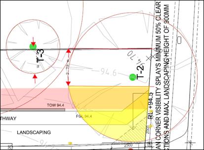


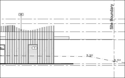
The
Planning Arborist commented further:
“Based on Figures 1 and 2,
it seems there will be a cut within the TPZ and SRZ. As mentioned above the
tree could be retained. However, in order to retain it, the plans must show no
encroachment greater than 10% of the TPZ, unless the applicant’s arborist
can show it will not be impacted as a result of a 36.3% encroachment.
To
determine if the tree will be adversely impacted Council must know the
following:
· Will
the cut encroach into the TPZ of this Tree #2?”.
Based on the above assessment, it
is considered that inadequate information is available to assess the potential
impact on Tree 2 and that this matter requires further resolution.
It is further noted that the proposal
includes the retention of Tree 5 (Syzygium paniculatum – Magenta
Cherry), Tree 8 (Cedrus deodara – Himalayan Cedar) & Tree 10 (Grevillea
robusta – Silky Oak) with the level of encroachment into the TPZ of
each tree being 1.6, 1.4 and 1.0 per cent respectively, which is considered
minor. However, the Council Planning Arborist raised the following
concerns with regard to the impact on these three trees:
“…, based on the
plans there must be more work within the TPZs. The plans show two gates within
the fence line in the TPZs of each tree (Figure 3). If there are gates there is
likely to be paths and level changes. In addition, the fence is being
constructed within the SRZs of trees #5 and #8.
To determine if the trees will be adversely impacted
Council must know the following:
· How
will the fence be constructed?
· Will
pathways be constructed within the TPZs / SRZs?
· Will
there be level changes within the TPZs / SRZs?”
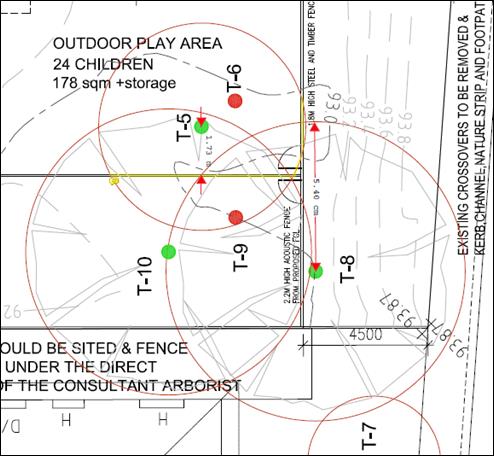
Figure 3. Shows the fence being constructed within the
TPZ and SRZ of trees #5 and #8, and TPZ of tree #10. In addition, shows the
gates within the fence line.
Based on the above assessment, it is
considered that inadequate information is available to assess the potential
impact on Trees 5, 8 and 10 and that this matter requires further resolution,
which can be achieved via a planning permit.
The relevant Design Guidelines of
Schedule 2 to the Significant Landscape Overlay requires Council to consider the
following matters against which an assessment of the proposal is provided.
Whether the
proposed building is set back a reasonable distance from the property
boundaries to provide for landscaping.
The proposed
building is setback a minimum of 13.15 metres from the front boundary but
generally exceeds 17 metres. Side setbacks of between 8.737 and
9.287 metres are provided to the west boundary where shared with the east
boundary of 1A Lagoona Court and the majority of the east boundary of 1 Lagoona
Court. Where adjoining the remainder of the east boundary to 1 Lagoona
Court, the proposed building is setback a minimum of 6.871 metres.
To the rear / north, a minimum setback of 9.055 metres is proposed and a
minimum setback of 4.4 metres is proposed to the east boundary of the site.
These setbacks
provide adequate space for landscaping, including large canopy trees though
potentially not to the extent required within under the Significant Landscape
Overlay provisions. In order to provide additional trees on the site, in
keeping with the Significant Landscape Overlay requirements, it is considered
necessary that that building footprint be reduced. As noted above, it was
originally intended that the proposal child care centre would cater to 130
children. However, given the recommended requirement for additional canopy tree
planting on the site and the necessary related reduction to the building
footprint (including the resultant decrease of the car parking area), a
reduction to 120 children is considered appropriate.
Whether the
proposed building or works retain an inconspicuous profile and do not dominate
the landscape.
The proposed
building has a maximum height of 5.334 metres, in keeping with the height range
of dwellings in the surrounding area. It is noted that a two storey
dwelling would generally exceed this maximum height.
The front of
the building is well-articulated, which would help to keep the building as
inconspicuous as possible. The addition of tree planting around the
building would also help to reduce its profile.
In addition,
the car parking area previously proposed to the front of the building has been
relocated to below the ground floor level of the building allowing for
additional landscaping within the front setback. A vehicle accessway /
ramp with a width of 5 metres is proposed to provide access to and from the car
parking area and a pedestrian accessway is also proposed to lead to / from the
building from the Canterbury Road frontage of the site.
No front fence
is proposed.
Given the
above, it is considered that the dominance of the building and works have been
improved from the first proposal submitted, however additional landscaping
would help to further reduce the dominance of the building. Should a permit be
granted by VCAT, conditions should require a detailed landscape plan that would
include this type of planting.
Whether a
reasonable proportion of the lot is free of buildings and available for tree
planting, landscaping and open space use.
The proposed site coverage of 35
per cent is considered reasonable given that a large portion of the remaining
site area is free of hard surfaces and includes landscaping however, additional
tree planting would be advantageous from the perspective of further reducing
the dominance of the building and the Bush Environment character of the site
and surrounds. It is recommended that this additional tree planting be
required as a condition of any permit issued and, in order to achieve this
additional planting, a reduction of the building footprint will be necessary. As
noted above, a resultant reduction in the total number of children using the
centre (from 130 to 120 children) would also be required.
The impact
of the proposed development on the conservation of trees.
The Council Planning
Arborist has carried out an assessment of the proposed development and
determined that the trees proposed for removal are of little retention
value. The Planning Arborist has also proposed tree protection
measures to reduce any potential impact on the trees to be retained on the site
and surrounding properties.
The amended
design response reflects an attempt to set the development back from portions
of the site containing trees that are worthy of retention. For instance,
the proposed development is shown to be setback an appropriate distance from
trees in the southwest, southeast, western and northern portions of the site
and surrounds which are considered of retention value.
The impact
of the proposed development on natural ground levels and drainage patterns
which may have a detrimental impact on the health and viability of surrounding
trees.
The Council
Planning Arborist has considered the impact of the proposed development on the
health and viability of surrounding trees and deemed it necessary that
additional information and/or Tree Management Plans be provided, where
necessary.
The
maintenance of an adequate buffer strip along watercourses, roads, rail lines
and other property boundaries.
It is
considered that the proposed side and rear setbacks provide reasonable buffer
to adjoining properties in terms of allowing additional planting on the site
and maintenance of existing planting on adjoining sites. Further to this,
Melbourne Water, as a referral authority have reviewed the proposal and have
not raised concerns regarding drainage or impacts to existing Melbourne Water
watercourses.
The species
of vegetation, its age, health and growth characteristics.
As noted above,
the Council Planning Arborist is satisfied with the proposed tree retention and
removal of the three trees, as outlined above.
The location
of the vegetation on the land and its contribution to the lot garden area,
neighbourhood and streetscape character.
As noted above,
the Council Planning Arborist is satisfied with the proposed tree retention and
removal.
Whether the
tree is isolated or part of a grouping.
As noted above,
the Council Planning Arborist is satisfied with the proposed tree retention and
removal.
The
potential to achieve an average density of one tree reaching a height of over
15 metres to each 150 square metres of site area.
It would be
difficult to achieve a density of 1 tree to each 150 square metres of site
area, or sixteen new (16) trees on the site as part of the proposed
development. As noted above, the proposal includes the provision of six
(6) trees of between eight (8) and eighteen (18) metres in height and it
appears possible to include only a few more trees of this height on the
site. It is also worth noting that the proposal includes the retention of
a number of large canopy trees on the site and, as a result, a good level of
vegetation coverage could be maintained on the site. Notwithstanding
this, given the Bush Environment character of the site and surrounds, the
provision of additional canopy tree planting would improve the response of the
proposal to the local context. This matter could be addressed through a
permit condition, which will inherently require a reduction to the building
footprint in order to provide the required canopy tree planting.
The
availability of sufficient unencumbered land to provide for replacement
planting.
As noted above,
the proposal allows for the retention of a significant number of canopy trees
on the site and on adjoining sites and it appears that there is remaining
potential for additional canopy tree planting on the site, though not to the
extent required to respond appropriately to the Bush Environment character of
the site and surrounding area.
Additional
unencumbered land could be provided on site to incorporate more canopy tree
planting if the footprint of the proposed building was reduced further.
It is recommended that a permit condition require additional large canopy tree
planting, which, as noted above, will inherently require a reduction to the building
footprint.
The impact
of the tree on the structural integrity of existing buildings including
foundations
The Planning
Arborist has not raised any concerns relating to the impact of any tree on the
structural integrity of existing buildings on adjoining sites.
Other
options for further planting on the site.
As noted above,
it would be possible to provide further additional planting on the site, though
not to the extent required to respond adequately to the Bush Environment
character of the area.
Vegetation
management requirements to reduce fire hazard, prevent erosion and maintain
flood control measures.
There are no
specific, relevant vegetation management requirements with regard to the
proposal.
Whether works
within 4 metres of a tree propose to alter the existing ground level or
topography of the land.
The Council Planning Arborist has
considered the impact of works within 4 metres of any tree requiring protection
under the Significant Landscape Overlay and made recommendations in this regard.
Conclusion
– Significant Landscape Overlay
Having consideration of the
previous VCAT decision P2261/2015 outlined above, which related primarily to
landscape and character considerations it is noted that, the current proposal
provides more space for the planting of large canopy trees as a result of a
reduced building footprint and significantly less hard surface area. This is
achieved mainly as a result of the car parking area being located under the
main floor of the building within a basement.
Taking into account the above
assessment and considering the landscape character objectives to be achieved in
the Blackburn Area, as outlined in the Significant Landscape Overlay, Schedule
2, it is considered that the dominance of vegetation cover on the site would
also be enhanced as a result of the proposed development with the addition of
the further planting of large, canopy trees, which would help to maintain the
tree-dominated landscape, ensure buildings and works retain an inconspicuous
profile and do not dominate the landscape and provide wildlife habitat.
Car
Parking (Clause 52.06)
The proposal is consistent with the
requirement of Clause 52.06 (Car parking) and, as noted above, the Council
Transport Engineering Department supports the proposal subject to one condition
relating to ramp grades.
The planning scheme requires 28 car
parking spaces based on a rate of 0.22 spaces to each child. The proposal
provides the required number of spaces.
Objector
Concerns not Previously Addressed
Resident/Property
Owner Objections
· Property
values are not a planning consideration; a matter that has consistently been
ruled upon by VCAT. .
· Issues
relating to traffic safety will be considered by VicRoads as part of its
assessment of the proposal.
· The
Bush Environment provisions take into account fauna-related concerns and have
therefore been considered in this assessment.
VicRoads
Objection
As noted outlined above (see
‘Referrals/External/VicRoads’) VicRoads have objected to the
proposal on the basis of the submitted traffic report not including information
required by VicRoads in order to determine the extent of impact of the proposal.
VicRoads are party to the subject
appeal and therefore their concerns will be worked through as part of the
associated process.
Council officers also note concern
regarding the potential for traffic exiting the site to travel in a western
direction may attempt less than desirable vehicle manoeuvres to the centre
right-hand-turn lane. This may also occur for vehicles attempting to enter the
site from Drummond Street.
CONCLUSION
The proposal for construction of
the use and development of land for a child care centre, associated tree
removal and works beneath trees and alterations to access to a road in a Road
Zone, Category 1 is generally an acceptable response that satisfies many of the
relevant provisions contained within the Whitehorse Planning Scheme, including
the State and Local Planning Policies, the Neighbourhood Residential Zone and
the Significant Landscape Overlay, Schedule 2. There is however, further need
to provide an improved response to the Bush Environment character of the site
and surrounds and this can be achieved through permit conditions relating to
planting of canopy trees.
It is noted that VicRoads have
refused the application based on the need for further information and
clarification. This matter is currently before VCAT and VicRoads are required
to substantiate their concerns in this forum, which may result in additional
conditions being imposed on any permit issued at the direction of VCAT.
A total of seventy-eight (78)
objections were received to the initial proposal and the matters raised in
these objections have been addressed in this report.
Attachment
1 Plans ⇨
2 Landscape Plan ⇨ 
3 Notice of
Amendment of an Application ⇨ 
4 Schedule of
Changes ⇨ 
5 VCAT Amended
Plans ⇨
Attendance
Cr Liu left the Chambers at 8.20pm, returning at 8.22pm
Ordinary Council Minutes 19
March 2018
Strategic
Planning
9.1.3 Strategic
Planning Update
FILE NUMBER: SF10/90
SUMMARY
This report outlines progress
with key strategic planning projects from September 2017 to date. The
report recommends that this update report be acknowledged.
background
Council’s Strategic Planning
Unit undertakes a range of projects that respond to the strategic planning
needs of Whitehorse, updates the Whitehorse Planning Scheme and manages
projects to proactively plan for future improvement, development opportunities
and protection of important features and places within the City.
DISCUSSION
The following is a summary of the
current status of key projects being undertaken through the Strategic Planning
Unit. The last update to Council was provided at its meeting on 18
September 2017.
Key planning scheme
amendments and their status include:
Amendment C175 – Box Hill
Metropolitan Activity Centre Built Form Guidelines
The draft Box Hill Metropolitan
Activity Centre Built Form Guidelines (the Guidelines) were prepared to
provide guidance on the built form and public realm in key areas of Box
Hill. Amendment C175 proposes to implement the findings of the Guidelines
by introducing a new Schedule 6 to the Design and Development Overlay and
applying it to various precincts within the Activity Centre, rezoning various
parcels of land as recommended in the Box Hill Transit City Activity Centre
Structure Plan adopted in 2007 (the Structure Plan) and making minor
changes to local planning policy to reference the Guidelines.
The draft Guidelines and Amendment
C175 were exhibited in February / March 2017. At the meeting on 15 May 2017,
Council resolved to request the Minister for Planning appoint an independent
Planning Panel to consider the Amendment and the submissions received. A Panel
Hearing was subsequently held from 24 July 2017 until 4 August 2017.
The Panel Report was received by
Council on 6 October 2017 and recommended that the proposed Design and
Development Overlay be abandoned. Council is currently reviewing the Panel
recommendations and discussing the Amendment with the Department of
Environment, Land, Water and Planning (DELWP) and will be presenting a report
to a future Council meeting prior to the end of this financial year.
Amendment C191 and C196
–Municipal Wide Significant Landscape Overlay
Trees are
the most significant determinant of the character of the various areas within
the City of Whitehorse, with tree canopy covering a significant proportion of
the municipality. Council undertook a municipal-wide tree study, as a key
initiative in the 2015/2016 budget. The Study investigated the importance
of vegetation, in particular tree cover, to the municipality, examined the
existing strategic framework for vegetation controls and scoped options to
protect and enhance tree canopy into the future.
Council adopted the Whitehorse Tree
Study Final Options Report on 18 July 2016 and sought authorisation from the
Minister for Planning to prepare and exhibit an amendment to the Whitehorse
Planning Scheme to implement the recommendations from the Tree Study.
Amendment C196 seeks to extend the
Significant Landscape Overlay to all residential land in the municipality on a permanent
basis. Amendment C191 seeks to apply the proposed Significant Landscape Overlay
on an interim basis while the permanent controls are being pursued. The
request for both the interim controls and the permanent controls was lodged
with the Minister for Planning in May 2017.
The Minister for Planning approved
Amendment C191 on 28 December 2017 and it came in effect when it was gazetted
into the Planning Scheme on 8 February 2018. The new tree protection
controls will expire after 31 December 2018.
All owners and occupiers of land
affected by the new interim tree protection controls have been individually
notified by mail and notices have appeared in the Leader Newspaper.
Council’s web site has been updated, an “on hold” message is
in place, and key community groups and local arborists and tree works companies
have been advised of the new controls.
Amendment
C192 –119 Surrey Road, Blackburn
Amendment C192 has rezoned the land
at 119 Surrey Road and 150-152B Springfield Road, Blackburn from the General
Residential Zone Schedule 1 to the Commercial 1 Zone and applied the Design and
Development Overlay Schedule 4 to the sites and an Environmental Audit Overlay
to 119 Surrey Road. The Amendment was gazetted on 21 December 2017.
Amendment C193 – 289-291
Morack Road, Vermont South
The amendment applies to land at
289-291 Morack Road, Vermont South. The amendment was on exhibition from 2
November until 4 December 2017 and seeks to:
· Rezone
a part of the site that is currently designated as Commonwealth Land to the
General Residential Zone (Schedule 5);
· Rezone
a part of the existing Urban Floodway Zone land to the General Residential Zone
– Schedule 5;
· Introduce
and apply the Design and Development Overlay- Schedule 10; and
· Apply
the Environmental Audit Overlay.
One submission was received
objecting to the amendment, but this was later withdrawn. The Amendment was
adopted by Council on 29 January 2018 and was subsequently submitted to the
Minister for Planning for approval.
Amendment C194 – Combined
Planning Scheme Amendment and Planning Permit for 517–521 Station Street
and 2-8 Oxford Street, Box Hill
The Amendment is a combined
planning permit application and planning scheme amendment under Section 96A of
the Planning and Environment Act 1987. The amendment proposes to rezone
the land at 517 and 519-521 Station Street Box Hill from the Public Use Zone to
the Mixed Use Zone and rezone the land at 2-8 Oxford Street Box Hill from the
Residential Growth Zone to the Mixed Use Zone. The amendment also proposes to
introduce an Incorporated Document for 517 and 519-521 Station Street, Box
Hill.
The draft Planning Permit for the
517 and 519-521 Station Street site is for building and works to construct
buildings of up to 18 storeys including rooftop plant plus up to 3 levels of
basement car parking. The proposal comprises retail premises, office,
restricted recreational facility (gymnasium), medical centre, accommodation,
serviced apartments, child care facility, a reduction in the standard
requirements for car parking facilities and alteration of access to a road in a
Road Zone, Category 1.
Having exhibited the Amendment
from 27 April until 29 May 2017, at its meeting on 17 July 2017 Council
resolved to request that the Minister for Planning appoint an independent
Planning Panel to consider the Amendment and the 53 submissions received.
The Panel hearing was held from 2 -
6 October 2017. The Panel report received by Council on 6 December 2017
recommended that the Amendment be adopted subject to minor changes to the
Incorporated Document and draft Planning Permit. Council considered the Panel
report and adopted the Amendment on 29 January 2018, then submitted the
Amendment to the Minister for Planning for approval.
Activity Centres
Officers continue to implement
actions from adopted structure plans and urban design framework plans for
activity centres in the municipality. A monitoring framework for
implementation of the plans has also been established and is periodically
updated.
Burwood Heights Activity Centre – Former Burwood
East Brickworks Site
The Development Plan Overlay (DPO)
that currently applies to the former brickworks site at 78 Middleborough Road,
Burwood East requires that a Development Plan be prepared to Council’s
satisfaction before planning permits can generally be granted for the
development. The Development Plan is intended to guide future planning
permit applications for each stage of this major development and assessment of
those applications.
At its meeting on 18 July 2016,
Council considered community comment and resolved to approve a Development Plan
for the site, subject to conditions. Council’s consideration of the
Development Plan was contested at VCAT by Frasers Property during January and
February 2018. These VCAT proceedings followed 1.5 years of negotiations with
Frasers to satisfy Council’s conditions of approval, with the majority addressed
before the VCAT proceedings commenced. The subsequent Orders handed down
by VCAT on 9 February 2018 directed that the Development Plan be approved by
Council with very minor changes.
The Development
Plan has now been approved in accordance with the VCAT Orders.
Parallel to this process, several
planning permit applications have been lodged with Council for
assessment. Applications must be generally in accordance with the
approved development plan and are exempt from third party notification.
Subject to approval of planning permit applications, Frasers Property will
progressively develop the site in stages.
Box Hill Metropolitan Activity
Centre (MAC)
Actions relating to the Box Hill
MAC are aligned with the Box Hill Structure Plan and other strategic documents
and include:
· Urban
design, landscape and strategic planning advice on major developments;
· Engagement
with relevant departments across the organisation and external stakeholders to
progress the Structure Plan;
· Preparation
of planning scheme amendments ; and
· Undertaking
further work to support implementation of the Structure Plan. Currently
this includes:
o Investigating a
potential developer contribution mechanism;
o Preparation of Public
Realm Treatment Guidelines for Box Hill to provide a strategic vision for
treatment of the public realm in response to new development in areas of the
MAC that are experiencing rapid change.
o A review of public open
space provision in Box Hill.
The
developer contribution feasibility and Public Realm Treatment Guidelines have
been funded by the Victorian Planning Authority’s Streamlining for
Growth Program.
Tally Ho Activity Centre
The former ATV-0 television studios
site at 104 – 168 Hawthorn Road in Forest Hill has been identified as a
key redevelopment site in the Whitehorse Planning Scheme for over a decade. The
site is located immediately beyond the Tally Ho Activity Centre. The
Development Plan Overlay approved for the land in 2015, requires that a
Development Plan be prepared for the site before future planning permits can be
granted.
The Forest Ridge Development
Plan was displayed from 17 July – 30 July 2017. An application
was subsequently lodged with VCAT on 15 August 2017 on behalf of the property
owner (Bazem Pty Ltd) under Section 149 of the Planning and Environment Act
1987 for review of the Development Plan on the basis that Council has not
made a decision within a reasonable period of time.
With the final decision on the
Development Plan to be contested at VCAT, Council considered the 101
submissions received from the community at its meeting on 18 September 2017 and
resolved to not support the Development Plan.
A mediation
meeting was held by VCAT on 19 October 2017. The subsequent VCAT
Orders handed down on 13 November 2017 directed that
the Development Plan be approved with changes including increasing the amount
of public open space, a reduction in the height of some building envelopes and
street wall heights, and increases in upper level building setbacks.
An updated
Development Plan was initially submitted on 23 January 2018 but has required
further correction to meet the VCAT orders. The latest update lodged on
13 March 2018 is currently being assessed against the VCAT Orders. All
submitters will be notified once the updated Development Plan is endorsed.
Heritage
Heritage Assistance Fund:
The Fund provides grants up to
$2,000 to eligible owners and occupiers to assist with the ongoing maintenance
of their heritage properties. The 63 applications for the 2017/2018 round
of funding were considered by the Heritage Steering Committee in October
2017. 21 applications were successful in receiving funding for the
maintenance of heritage properties.
Heritage Adviser:
Council’s Heritage Advisor
continues to provide specialist advice to the Strategic Planning Unit.
Responsibilities of the Advisor include responding to planning application
referrals from the Statutory Planning Unit, liaising with the community and
other departments of Council on heritage matters, undertaking heritage
investigations and helping to assess Heritage Assistance Fund
applications.
Other Major Projects
The Neighbourhood Project
The City of Whitehorse was selected
as one of three metropolitan Councils as part of the Neighbourhood Project; a
pilot project which is a practical program to make community-led placemaking
easier for councils and communities. The Neighbourhood Project is part of the
Resilient Melbourne Strategy.
Work is currently being undertaken using
the funds from the Neighbourhood Project, to review and refine Council’s
processes around place activation and community-led placemaking. The project
will provide a clear way forward for interested community members to initiate their
placemaking ideas and work with Council in an efficient and streamlined way.
Residential Corridors Study
Council has included funds in the
2017/2018 budget to undertake the Residential Corridors Built Form Study.
Consultants were appointed in late 2017 to undertake the Study.
The study aims to determine
appropriate built form guidelines and associated planning scheme controls for
those areas in the City of Whitehorse along key road corridors where land in
the Residential Growth Zone interfaces with land in the Neighbourhood
Residential Zone and the General Residential Zone. Such corridors include
Burwood Highway (between Springvale Road and Hanover Road) and Whitehorse Road
(between Elgar Road and Hood Street; between Mille Street and Whitehorse Reserve
and Middleborough Road and Williams Road).
The appointed consultants have
completed Stage 1 of the project, which included background analysis of the
study area such as the review of existing strategies and planning controls,
planning permit applications and VCAT decisions.
Student Accommodation Review
The City of Whitehorse is home to
two key tertiary institutions, the Box Hill Institute and Deakin University. A
number of local and international students reside in Whitehorse and require a
range of housing needs and resources. Council recognises the need to plan for
student accommodation, to ensure it meets the needs of students as well as
reducing potential amenity impacts on existing communities. To this end,
the Whitehorse Planning Scheme includes a Student Accommodation policy which
has been in place since 2009.
Council has included funds in the
2017/2018 budget to undertake a review of student accommodation to gain a
better understanding of issues associated with student accommodation, ascertain
solutions to these issues and determine methods of implementation.
Consultants have recently been
appointed and the review has commenced.
SMART Planning / VC Amendments
In July 2016 DELWP launched Smart
Planning, a two-year program to reform Victoria’s planning system. Smart
Planning’s objectives are to:
· Simplify
planning regulation to improve the quality consistency and efficiency of
planning decision making.
· Develop
digital systems that allow citizens, industry and government to more easily
access and understand planning rules and processes to boost activity,
participation and efficiency.
A major part of this program is
updating the Victorian Planning Provisions (VPP), with the aim to increase
their effectiveness and efficiency. In October 2017 DEWLP released the Reforming
the Victoria Planning Provisions discussion paper. Council made a
submission to the discussion paper, which was endorsed at the Council Meeting
on 20 November 2017.
The phase 1 planning scheme
amendment to implement the first round of changes to the VPP was gazetted on 16
January 2018 as Amendment VC142. The Amendment made changes to
approximately 40 different clauses in all Victorian planning schemes including
expanding permit exemptions, changing definitions and updating outdated policy.
Plan Melbourne Refresh
In March 2017,
the Minister for Planning released the ‘refreshed’ metropolitan
planning strategy, Plan Melbourne 2017 – 2050 and introduced the
new strategy to planning schemes in Victoria via Amendment VC134. Plan
Melbourne has a separate 5-year Implementation Plan.
The
Implementation Plan identifies that Land Use Framework Plans (LUFP) are to be
prepared for each of the six metropolitan regions. Whitehorse is located in the
Eastern Region and is represented on the region’s Economy and Planning
Working Group established by the State government to develop work plans to
implement Plan Melbourne including the preparation of the LUFP.
Preparation of the LUFP has commenced and is to be completed by the end of
2018. Council received a report on the LUFP at its meeting on 19 February 2018.
More
information about Plan Melbourne can be found on the State Government web site
at: http://www.planmelbourne.vic.gov.au/home
Fast Track
Government Land Service
The Fast Track
Government Land (FTGL) Service is project managing two Box Hill Institute
sites:
· 1000
Whitehorse Road (west of the Box Hill Town Hall), proposed to be rezoned to
Commercial 1 Zone
· 16
– 18 Spring Street (adjoining and including part of the BHI Nelson
Campus), proposed to be rezoned to the Mixed Use Zone and to apply a
Development Plan Overlay
The FTGL
process has been managed by the State Government and has involved:
· A
consultation period of 6 weeks (25 September – 3 November 2017) seeking
submissions;
· An
independent hearing conducted by the Government Land Standing Advisory
Committee, held on 28 November 2017.
Council made a
submission during the consultation period and also presented to the independent
hearing. A report by the Standing Advisory Committee was due to be presented to
the Minister for Planning in late December 2017 or early January 2018. Council
has not yet been informed about the report or the recommendations by the
Advisory Committee.
Bushfire
Management Overlay
The current
State government has updated bushfire mapping and policy in planning schemes
across the State in response to the recommendations of the 2009 Victorian
Bushfires Royal Commission. In the Victorian planning system, the Bushfire
Management Overlay (BMO) maps areas of Victoria that are at risk of extreme
bushfire. Amendment GC13, which came into effect on 3 October 2017,
applied the BMO to approximately 270 properties in Mitcham in the vicinity of
the Mullum Mullum Creek corridor.
CONSULTATION
Community consultation is an
integral part of all strategic planning projects. The level and type of
consultation will be extensive and varied, depending on the nature and
complexity of each project. While community consultation adds to the
depth of projects it can also extend their timeframe in some instances.
This update report on strategic
planning projects is prepared every six (6) months covering periods ending in
March and September. This is followed by a summary in the Whitehorse News
on a selection of projects of interest to the community.
FINANCIAL
IMPLICATIONS
All of the projects require
resources and funding for tasks including consultation, preparation, exhibition
and consideration of amendments, consultant advice and investigations,
including government processes e.g.: panel hearings etc. Typically, adequate
funding for the projects is provided in the recurrent budget.
However, notification to all owners
and occupiers affected by Amendment C191 which has applied the SLO on an
interim basis to all residential land in Whitehorse (not already covered by an
SLO) has posed a significant but necessary cost to Council of approximately
$84,000. In anticipation of the interim tree protection controls, Council
has budget in the 2017/2018 year for the resources required to manage and
enforce the new planning overlay.
POLICY IMPLICATIONS
The undertaking of strategic
planning projects is consistent with the Council Plan 2017 – 2021
in terms of project outcomes and the consultation involved.
conclusion
The report provides an update on
key strategic planning projects. It is recommended that Council
acknowledge the report.
Ordinary Council Minutes 19
March 2018
Engineering and Environmental
9.1.4 Council's
Approach to Becoming Carbon Neutral by 2022
FILE NUMBER: 18/33961
SUMMARY
Council set a target to be carbon neutral by 2022
(subject to a detailed review) as part of the Whitehorse Sustainability
Strategy 2016-2022.
While Council has taken a number
of actions towards achieving carbon neutrality including through various energy
efficiency upgrades and the purchase of GreenPower, the review carried out in
late 2017 shows significant opportunities including:
· Better
utilisation of existing Council finances to further improve energy efficiency
and implement more alternative energy options such as cost-effective renewables
to reduce risk, increase Council’s energy security and protect Council
against future utility cost increases.
The purpose of this report is to
summarise and discuss the review findings, and provide recommendations on
Council’s:
· Approach
for becoming carbon neutral by 2022 for corporate emissions
· Funding
model for future energy savings measures
· Actions
for the future
|
Motion
Moved by Cr Bennett,
Seconded by Cr Liu
That Council:
1. Voluntarily becomes carbon neutral for
corporate emissions in 2022 rather than pursuing formal accreditation, due to
the ongoing cost of accreditation;
2. From July 2018 no longer purchases GreenPower
for current purposes and instead purchase accredited carbon offsets to
continue to offset the current level of greenhouse gas emissions;
3. Diverts funds currently used to purchase
GreenPower to an Energy Management Fund over the next 3 years until 2021/22
for the implementation of an integrated program of additional energy
efficiency measures and renewable energy projects to accelerate
energy-efficiency in Council facilities. Measures implemented over 3 years
using this Fund will place Council in a better position to become carbon
neutral in 2022;
4. Develops suitable protocols and guidance for
the operation of the proposed Energy Management Fund in 2018/19, including a
review of the Fund and the funded project outcomes in 2021/22 before
proceeding to carbon neutral status;
5. Implements a Utilities Management project by
engaging a suitably qualified and specialist Utilities Management consultant
for a period up to 3 years, to identify energy cost savings and implement
process improvements in managing Council’s electricity, gas and water utilities.
|
|
Amendment
Moved by Cr Barker, Seconded
by Cr Cutts
That Council:
1.
Confirms its ambition to continue its move towards
carbon neutrality rather than pursuing formal accreditation, due to the
ongoing cost of accreditation;
2. From July 2018 no longer purchases GreenPower for current purposes
and instead:
a)
Diverts 25% of the funds used to
purchase Greenpower to undertake a carbon farming initiative through a
municipal tree and bush planting program, for the next three years, enabling
Council to apply for Australian Carbon Credit Units (per the Carbon Farming
Initiative Amendment Act 2014)
b) Diverts 25% of the funds used to purchase GreenPower for the
implementation of an integrated program of additional energy efficiency
measures and to accelerate energy-efficiency in Council facilities and the Implemention
of a Utilities Management project by engaging a suitably qualified and
specialist Utilities Management consultant for a period up to 3 years, to
identify energy cost savings and implement process improvements in managing
Council’s electricity, gas and water utilities.
3.
Develop a framework for the gateway assessment of energy
efficiency measures/projects so that an
internal rate of return IRR of no less 15% must apply to any project to
proceed through the gateway.
Lost
|
|
A Division was called.
Division
|
For
Cr
Barker
Cr
Davenport
|
Against
Cr
Bennett
Cr
Carr
Cr
Cutts
Cr
Ellis
Cr Liu
Cr
Massoud
Cr
Munroe
Cr
Stennett
|
On
the results of the Division the Amendment was declared lost
|
|
The Motion moved
by Cr Bennett, Seconded by Cr Liu was then put and CARRIED
|
|
A Division was called.
Division
|
For
Cr
Bennett
Cr
Carr
Cr
Cutts
Cr
Davenport
Cr
Ellis
Cr Liu
Cr
Massoud
Cr
Munroe
Cr
Stennett
|
Against
Cr
Barker
|
On
the results of the Division the Motion was declared carried
|
background
The Whitehorse City Council Sustainability Strategy
2016-2022 committed Council to:
· Become
Carbon neutral by 2022, subject to a detailed review
· Reduce
corporate emissions by 45 percent by 2022
· Progressively
increase the use of renewable energy by Council and the community
As committed, a detailed carbon
neutral review was conducted in late 2017 comparing and assessing different
approaches taken from other Victorian Councils. As part of this, telephone
interviews were conducted with officers from Councils who have successfully achieved
or are striving to achieve carbon neutrality. This highlighted what has worked
well and the challenges of different approaches.
Information was also gathered on
the methodology of becoming carbon neutral including steps required to gain
official certification.
Terminology
Carbon neutral is when net
greenhouse gas emissions are equal to zero. To achieve this organisations
calculate their emissions, reduce these where possible, and then purchase
carbon offsets for any residual emissions that cannot be reduced.
GreenPower is renewable
energy sourced from the sun, the wind, water and waste that is purchased by
electricity providers to supply to consumers. This enables customers (Council)
to voluntarily contribute financially to renewable energy generation from
accredited generators.
Carbon offsets are an
investment in an accredited project or activity that reduces greenhouse gas
emissions or takes carbon from the atmosphere. Accredited offsets can be
purchased in the voluntary market and used to compensate for emissions from an
organisation’s own activities.
Energy efficiency is an
energy saving measure which reduces the consumption of energy and production of
emissions required to power services delivered by Council.
Renewable energy as defined
above is energy sourced from sun, the wind, water and waste.
Federal and State Government
policy context
In December 2015 at the Paris
Climate Conference (United Nations COP21), Australia was one of 195 independent
nations that agreed to keep average global temperatures to well below 2°C
pre-Industrial temperatures and to aim to limit increase to 1.5°C. After
signing up to this Paris UN Agreement, the Australian parliament ratified a
target of 26-28 percent emission reduction (below 2005 levels) by 2030.
In 2016 the Victorian Government
announced a commitment for Victoria to become carbon neutral by 2050. An
interim target was announced in January 2017, to reduce greenhouse gas
emissions for the state by 15 to 20 percent (from 2005 levels) by the year
2020. They also set the target of reducing emissions from the operations of
their government departments by 30 percent (from 2005 levels) by 2020.
Corporate emissions vs community
emissions
Although Council supports and
encourages community emissions reduction through incentives, education and
policy regulation, essentially it has no control over overall increases or
decreases from community activities. Obtaining baseline emissions figures,
benchmarking and tracking progress is also problematic with no perceivable
benefit considering the amount of influence Council has in this area. Council
does, however, control corporate emissions from organisational operations,
services and assets utilised by the community. These emissions can be tracked,
analysed and controlled with the appropriate efficiencies and investment made
and progress monitored over time.
Where Council is positioned compared to other Councils
In May 2017 the Eastern Alliance for Greenhouse Action
(EAGA) completed a ‘Review of Victorian Local Government Emissions
Reductions Targets’. This identified 22 councils with a corporate carbon
neutral target. Represented below is the date by which each Council has
committed to become carbon neutral for its corporate emissions.
Contributors
to Council’s Corporate Emissions
Council’s corporate emissions comprise primarily of
electricity and gas use, and some transport emissions. Currently electricity
and gas consumption is calculated from power bills which Council pays. These
are mainly for Council buildings, recreational facilities and street lighting.
Although some work to mitigate vehicle emissions has been carried
out in the past through procurement and operation of 4-cylinder, hybrid and
electric vehicles, emissions tracking data is not currently collected.
Works to improve emissions tracking began in July 2017. Council engaged
a specialist contractor, Kinesis, to provide an Environmental Data Management
System for the next 3 years. This will assist Council to track energy and water
consumption in a more comprehensive and accurate manner than has previously been
possible. This system also has the capacity for further emissions reporting,
however it would require further data capture by Council and improvement to
current utility data management processes.
The engagement
of a dedicated Utilities Management consultant at other Councils has resulted
in major cost savings (in some cases more than $100k per annum) and
improvements to utility management practices that minimised wastage and billing
errors. Ensuring that Council’s energy consumption data is managed effectively
and the data is accurate will bring Council up-to-date with its emissions
reporting and provide a more comprehensive basis for verifying projects and
programs that are financially and environmentally beneficial.
From data that is currently available for 2016/2017, corporate
electricity and gas consumption was calculated at 90,319.56 GJ. This is a
reduction of 1 percent overall from 2015/2016 due to energy efficiencies
progressively implemented through Capital Works programs. Below is a summary of
data available on Council’s corporate energy consumption.
Increases in gas usage from 2012/13
were mainly to the redevelopment of Box Hill Aqualink and its return to full
operation over two financial years. Aquatic centres traditionally are high
users of energy for pool heating and large premises that have long operating
hours. Although designed with a number of energy-saving features, the expanded
facilities and increased usage of the centre by the community have seen an
overall increase in energy consumption.
Council’s
current emissions reduction efforts
In line with Council’s Sustainability strategies and budget,
Council has progressively been installing energy efficient heating, cooling,
lighting, office equipment and solar panels in Council owned buildings since
2008. This has tempered a trend in increasing emissions, however, it can be
anticipated that emissions might increase in some cases with new or renovated
buildings due to population growth in Whitehorse, larger facilities coming
online, and increased usage of facilities by the community.
The biggest trackable reduction in emissions to date has been the
Energy Efficiency Street Lighting Changeover Program which began in 2012/13 to
2017/18. All 80 Watt mercury vapour streetlights on local Council roads were
progressively changed over to energy efficient lights, resulting in a 2 percent
reduction in energy use since the program start. After the first phase of the
changeover of streetlights, Council’s electricity bill for streetlighting
reduced by more than $250,000 per annum. The full impact of the second
changeover is not yet measurable for a full year, but the electricity bill is
already $100,000 less in the year-to-date than for the same period last year.
Council resolved in 2009 to reduce
corporate emissions by purchasing GreenPower as follows: 100 percent for street
lighting, 50 percent from some large market sites (large Council buildings such
as Council’s Civic Offices, and Aqualinks) and 25 percent for small
market sites (such as Council community centres). These GreenPower percentages
have not entirely been reflected in the current Procurement Australia Energy
Contract, therefore greenhouse gas emissions associated to Council’s
energy consumption has been higher than anticipated, although Council is
currently purchasing a significant proportion of GreenPower.
DISCUSSION
Becoming carbon neutral
To become carbon neutral, Council is required to follow the
principles of the Carbon Management Hierarchy, demonstrated in Figure 3 below:
· Avoiding
creating emissions where possible
· Reducing
emissions through energy efficiencies
· Replacing
energy sources to renewables
· Offset
residual emissions that can’t be eliminated by avoiding, reducing or
replacing, through purchasing carbon offsets
|
|
How it can
be achieved
|
Benefits
|
|
Avoid
|
Behaviour change of staff and facilities users of
unnecessary energy consumption
Education and incentives for doing the right things
|
Improved staff morale and retention, and
attraction of quality employees
Improved perception of Council by the community
|
|
Reduce
|
Energy Sustainable Design (ESD) features implemented in
new and existing Council building e.g. natural light in buildings,
energy-efficient fittings and appliances.
Increased energy efficiency of current Council operations
|
Better environments for employees and community to be in.
Reputational credibility and leadership presented by
Council.
Investment in better and newer technologies
Reduction in cost of Council operations
|
|
Replace
|
Increased investment by Council in on-site renewables
such as solar power (directly rather than via GreenPower)
Purchase of energy-supply contracts based on renewable
power supply that over time will also be financially cheaper than purchasing
coal-fired power
|
Increased energy security for Council
and reduced risk
Greater controls for Council over costs
of the production of GreenPower
Greater resilience to impacts of rising
energy and fuel costs
|
|
Offset
|
Council
purchases Carbon Offsets. As with GreenPower, offsets have an annual
financial outlay and no direct return on investment to Council. However
offsets are recommended for emissions that can’t be addressed through
the other three priority areas above.
|
Investment in and encouraging accredited projects and activities
in reducing greenhouse gas emissions
Environmental benefits of reduced emissions
|
GreenPower and carbon offsets
As electricity consumption is a
large portion of Council’s emissions, Council will need to purchase
either GreenPower or Accredited Carbon Offsets in an effort to be carbon
neutral. Offsets will also be needed to nullify the non-electricity emissions
including fuel and gas.
Carbon offsets are from activities that reduce greenhouse
gas emissions or remove carbon from the atmosphere, such as renewable energy
projects or tree planting activities. Australia’s National Carbon Offset
Standard (NCOS) sets the requirements an offset must meet to be eligible for
use as part of a carbon neutral claim. This ensures an accredited offset under
NCOS represents a credible emission reduction, which demonstrates
additionality, permanency, measurability and transparency. Currently, most NCOS
offsets available, and particularly the more cost-effective ones, are generated
internationally through projects such as establishing wind or solar farms in
China or India. Many carbon offset projects deliver a range of positive
outcomes in addition to emission reductions including social, environmental and
economic benefits.
Council currently purchases GreenPower, and when doing so,
the corresponding amount of Australian renewable energy is purchased through
our utility supplier (AGL) which helps to stimulate financial investment in the
renewable energy industry. GreenPower however, is more expensive than
non-renewable electricity because it involves paying a premium that contributes
to increasing the amount of renewable energy in the grid.
To reduce emissions, it is more economical to offset any
remaining emissions with Accredited Carbon Offsets than with GreenPower. As of
2017, GreenPower was retailing at approximately $79 per MWh which is
approximately $74 per tonne of greenhouse gas emissions. This pricing along
with all electricity pricing is also expected to increase so may be even more
costly to Council. NCOS accredited offsets are around $1 - $15 per tonne of
greenhouse gas emissions, depending on the chosen offset generating project.
Changing the model for emissions reduction
Council could continue to meet its current emissions
reduction efforts which are effectively offsetting 100 percent of electricity
emissions from streetlights, 50 percent from some large market sites and 25
percent from small market sites by purchasing NCOS Accredited Carbon Offsets
instead of using the current purchase of GreenPower. Council can then divert
approximately $385,000 that would otherwise have been spent on GreenPower into
direct action to reduce greenhouse emissions, which will consequently reduce
the amount of emissions generated in the first place and will reduce the need for
purchasing as many offsets in the future.
To maintain Council’s net greenhouse gas emissions at
current levels, approximately 5,000 tonnes of CO2 will need to be
offset. Assuming an average of $10 per tonne to purchase accredited offsets,
the cost of maintaining current emission levels using accredited offsets
instead of purchasing GreenPower would be approximately $50,000 per annum. This
would leave about $335,000 per annum to invest directly to accelerate the
implementation of energy-saving measures in Council’s facilities.
If this level of direct investment in energy-saving measures
is maintained for the next 3 years until 2020/21, the total of greenhouse
emissions that will require offsetting will reduce, as will the cost of
purchasing accredited offsets.
In 2021/22, it is recommended that a review be conducted
that includes assessing the progress of greenhouse gas emission reduction at
Council facilities, to determine the actions and level of accredited carbon
offsets that would be required at that time to achieve full carbon neutral
status in 2022.
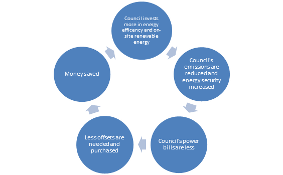
This direct action could include
installing on-site renewable infrastructure and energy efficient retrofits at
Council’s larger buildings. These are big energy consumers for Council
accounting for approximately 75 percent of Council’s total energy
consumption.
Large energy efficiency and
renewable programs could include Energy Performance Contracts (EPC), which
tackle these large energy consumers and ‘bundle together’ various
energy efficiency measures to make them more viable. Investing the GreenPower
savings in direct action energy-efficient measures should be considered for
assisting Council to retrofit Council owned-buildings and install renewable
energy, thereby generating economic and environmental benefits.
Emission reduction measures taken
early result in greater savings over time and reduces the impact of rising
energy prices. From July 2018 and over the next 2 to 3 years, electricity costs
are predicted to increase by 53 percent and gas prices by 42 percent. Council
currently spends approximately $1.36M per annum on electricity and gas bills
for its buildings. If these utility costs increase as predicted,
Council’s annual utility costs will rise to approximately $2M per annum,
adding over $600k per annum to current costs.
In addition to installing more energy-efficient devices in
Council facilities over the next 3 years, it is proposed to implement a
Utilities Management project that closely scrutinises every aspect of utility
bills, identifies and corrects billing errors, negotiates better tariffs with
suppliers, audits utility meters at all Council facilities, and streamlines
Council’s processes for managing our electricity, gas and water
utilities. The aim of this project is to achieve as a minimum a 4% to 5% annual
utility cost saving due to improved utility monitoring and correction of
billing errors, which would equate to a saving between $95k to $120k per annum
based on 2016/17 utility prices (even higher once tariff prices increase from
2018/19 onwards).
Council is considering future
electricity supply contract options that contain a strong mix of renewable
energy generation, which is likely to provide electricity at lower costs than
coal-fired electricity in future. This would provide both an economic and
environmental benefit to Council, and make a positive contribution towards
Council becoming carbon neutral.
It is recommended that Council
consider setting up a funding arrangement similar to that undertaken by
Maroondah City Council, Darebin City Council and Frankston City Council, where
a dedicated Carbon Neutral Fund was established to finance energy efficient and
renewable energy projects. Maroondah Council established a ‘Revolving
Fund’ which includes the annual funds previously spent on GreenPower now
directed to energy efficiency projects, which could serve as a useful model for
Council to follow. Savings from projects that reduce energy and associated
costs are also reinvested into the Revolving Fund enabling even more energy
efficiency projects to be implemented, accelerating the economic and
environmental benefits.
For Whitehorse City Council, a similar approach to Maroondah
is recommended, and that an Energy Management Fund be established for the
2018/19 financial year, initially comprising of funds that were previously
spent on GreenPower (around $385k per annum). The Fund could potentially be
boosted with capital funding currently used for energy efficiency ($100K per
annum), renewable energy ($50k every 2 years) and climate adaptation ($100k
every 2 years), if aggregation of funding would achieve a better outcome in any
particular year. Investing more overall funding each year towards energy
efficiencies and renewables over the next 3 years will assist Council to become
carbon neutral in 2022. The redirected GreenPower funding would be the seed
funding for initial energy efficiency projects.
In addition to this initial seed funding from ceasing
GreenPower, any savings over time arising from energy efficiency projects
implemented as a result of this fund should also be invested into this fund. It
is estimated that the energy savings from energy efficiency improvements to
Council buildings will result in an energy savings of around 30 percent. This
is based on estimates from Eastern Alliance for Greenhouse Action and from the
results of the Victorian Government Energy Performance Contracts which achieved
an average of over 37 percent savings in energy use for the 28 energy
efficiency projects they delivered.
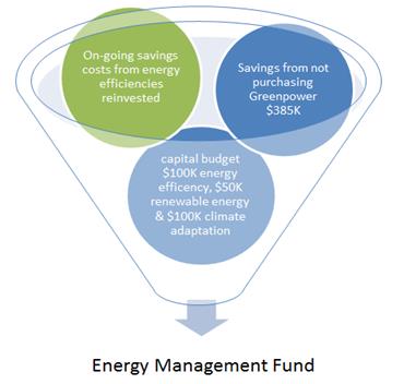

Guidelines establishing the fund
criteria and what types of projects should be funded should be established to
identify that:
· Projects
should be prioritised by the amount of greenhouse gas emissions they abate and
their relative cost effectiveness
· Projects
must have a maximum of a 10 year payback period i.e. the energy and maintenance
savings from the project will financially pay back the full cost of the project
within 10 years, and thereafter generate ongoing savings. Note that with
spiralling electricity and gas prices, an average return on investment of 7
years is likely;
· Projects
such as feasibility studies, energy audits, assessing energy procurement
options and evaluating renewable energy projects that are likely to result in
significant energy-savings in Council’s corporate energy consumption
could also be funded from the Energy Management Fund;
· Developing
a framework for deciding on which accredited offsets Council should purchase,
including (but not limited to) criteria about the source of offsets, location
of offset projects, verification levels and potential community benefits.
An Energy Management Fund will help Council to manage and
fund a range of projects all dedicated to reducing Council’s corporate
energy consumption which would subsequently reduce Council’s greenhouse
gas emissions. The dedicated fund will not be the sole source of funds for
every energy-efficiency project or program implemented by Council. Other
energy-saving measures that are built into Council’s ‘business as
usual’ operational programs and capital works projects will continue to
be funded through Council’s annual budget process. Rather, the Energy
Management Fund will serve as a mechanism to accelerate Council’s
energy-saving program and achieve more substantial energy reductions, which in
turn will reduce Council’s exposure to spiralling energy costs.
Carbon Neutral Certification
To achieve official carbon neutral certification Council
would be required to fulfil criteria under the Australian government’s
Carbon Neutral program This program provides carbon neutral certification
against the National Carbon Offset Standard (NCOS) in addition to an annual
licence fee of $18,000. (fee is based on 2017 prices, which is typically
adjusted upwards by 3 percent each year).
The NCOS was introduced in 2010 by the Australian Government
to provide a standard on how to account for emissions. NCOS sets minimum
requirements for calculating, auditing and offsetting the carbon footprint of
an organisation that is voluntarily seeking to be carbon neutral. The main
advantage of being certified carbon neutral is that it provides a legitimate
and visible stamp of approval on an organisation’s carbon neutral claim.
To achieve
certification under the NCOS, Council would need to:
1) Define
Council’s emission boundary and calculate corporate greenhouse gas emissions
2) Develop
and implement an emissions reduction strategy
3) Purchase
and cancel eligible offset units to offset remaining emissions
4) Prepare
an annual public report including the Council’s annual emissions,
emission reduction activities, and the quantity and type of offset units
cancelled. This report would need to be independently audited including an
audit of the base year carbon account, and once certified this audit is
required every second year.
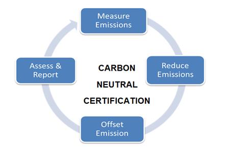
As mentioned, Council is currently working to improve
emissions-tracking however it still requires substantial work in order to meet
the requirements of NCOS. This would require significant extra resourcing to
what is already available and planned to accelerate the project. This, in
addition to overseeing audits of emissions, administering independent audits,
developing a strategy and complying with annual reporting, would require
significant investment on top of the annual licence fee.
As part of the 2017 review, feedback was sought from the
carbon neutral NCOS certified Victorian Councils. The general consensus was
certification is a complicated and time consuming process, due to the effort
required in collating the data for the comprehensive carbon inventory, as well
as the paperwork associated with certification.
Council can however, achieve carbon
neutrality following NCOS methodology. This includes having third party
certification by an independent auditor, but not be certified under NCOS.
Maribyrnong City Council has taken this approach after deciding the ongoing
cost of accreditation could be better spent on emission reduction efforts such
as energy efficiency projects and investing in on-site renewable energy. This
also provides them more flexibility in determining what emissions they could reasonably
and accurately measure and make this approach to Carbon Neutrality more
manageable and affordable.
Time
for action
A variety of factors in the energy
market is resulting in steep increases in energy costs over the next two years
at least. This presents a real opportunity for Council to increase its efforts
to reduce carbon emissions through energy efficiency and renewable energy. Any
investment by Council in efficiency upgrades will have a better return on
investment than in previous years. Subsequent reduced energy consumption from
current Council operations will ultimately decrease Council’s overall
energy costs. Renewable technology such as solar and energy storage is quickly
advancing and becoming more affordable so may more easily allow for better
energy storage options for Council.
Volatility in the energy pricing
market presents issues for Council budgeting purposes as costs are increasing,
but the level of increase can only be speculated. The only way to reduce these
issues and the risks associated with them is to increase Council’s energy
security. This reduces Council’s reliance on utilities providers to
provide power at a reasonable cost.
Other Councils are already looking
ahead in this space and opportunities for further savings from joint
procurement opportunities for energy efficiencies and renewables might be
missed if Council fails to act in a timely manner. Council ideally should be
responsible for leading the way and role modelling good practices for emissions
reduction to the community by addressing corporate emissions. With the current
approach Council is at a risk of falling behind other government departments
and in our own aspirations as outlined in our Council Vision 2013-2023: To be
enhancing our built environment to ensure a sustainable and liveable city
(Strategic Direction 2) and providing strategic leadership (Strategic Direction
4).
Continuing commitment to becoming
carbon neutral by 2022 provides stability, support and clear strategic
direction for energy and cost savings from efficiency improvements and
renewables. The new funding arrangement should help accelerate current
emissions reductions efforts. This also supports projects to improve
Council’s emissions tracking.
It is recommended that Council
divert funding previously spent on purchasing GreenPower to kick-start an
Energy Management Fund, set up the Fund on a revolving basis to provide ongoing
funding generated by energy-savings or grant funding, and possibly consolidate
energy-efficient capital funds from Council existing capital works funds.
Projects and measures to reduce Council’s energy consumption and
greenhouse emissions would then be implemented from this Fund through
Council’s normal capital works and operational processes. This includes consideration
of future energy-supply contracts consistent with the aim of reducing
greenhouse emissions and investing in renewable energy generation projects or
programs that help to reduce Council’s exposure to spiralling energy
supply costs.
Way forward to Carbon Neutrality
2022:
2018 to 2019:
· Council
accepts the recommendations of this report
· Council
continues to support improvements to emissions tracking.
· GreenPower
no longer continues to be purchased and instead equivalent offsets are
purchased from July 2018
· Accelerated
energy efficiency projects are progressively implemented from 2018/19,
initially using funds previously used for purchasing GreenPower.
· Audits
to be conducted at a range of Council buildings to identify priority energy
efficiencies over the next 3 years from 2018/2019 to 2021/2022, to form the
basis of an accelerated capital works program for budget consideration
· Energy
Management Fund protocols and guidance are developed in 2018/2019
· Prior
to expiry of Council’s current energy supply contract, evaluate long term
renewable energy supply contracts that provide beneficial financial and
environmental as the basis of possible future energy supply contracts
· Continue
to use an integrated approach to becoming carbon neutral through a combination
of measures such as (but not limited to) installing proven energy-efficient
fittings and fixtures in Council facilities, using Environmentally Sustainable
Design principles when developing new or upgraded Council and community assets,
investing in cost-effective renewables, and procuring energy supply contracts
that provide economic and environmental benefits
· Implement
a Utilities Management Project including the engagement of a suitably qualified
and specialist utilities management consultant for a period up to 3 years, to
comprehensively review and improve Council’s utilities data management
systems and identify cost savings
2019 to 2021:
· Energy
efficient projects funded from the Fund may require additional funding
depending on scale of the project, so consider New Budget Initiatives from
2019/20 onwards based on the outcome of building audits and emerging renewable
opportunities to continue to accelerate ongoing (permanent) reductions in
Council’s energy consumption
· Council
to seek external grants and funding to top up the Energy Management Fund where
possible
· Council
continues to seek best pricing for energy supply contracts including Power
Purchase Contracts extending to Renewables and exploring fixed pricing and the
new trends of progressive purchasing to mitigate increasing energy costs
· Exploring
investment options such as solar and Build/Own/Divest-Operate power stations
· Continue
to participate in regional partnerships such as EAGA through cost-effective
projects that help to reduce Council’s corporate energy consumption and
greenhouse emissions
· Undertake
a review in 2021/2022 of the Energy Management Fund and Council’s
approach to becoming carbon neutral, to ensure ongoing funding and
energy-efficiency measures continue to align with the Council Plan and
Council’s Sustainability Strategy.
2022:
· Based
on the outcome of the carbon neutral review, purchase sufficient accredited offsets
for any remaining carbon emissions to achieve carbon neutral status
Note that details of the type and location of
energy-saving or renewable projects to be implemented will be reflected in
Council’s annual operational and capital works budgets. All projects will
be subject to Council’s normal budget approval process.
CONSULTATION
Detailed consultation with other
Councils on their approach to becoming carbon neutral was sought in order to
provide recommendations for this report. This included collecting information
via desktop review and phone interviews. Information was sought from, City of
Melbourne, Moreland City Council, City of Yarra, Nillumbik Shire Council,
Maribyrnong City Council, City of Sydney, Banyule City Council, Bayside City
Council, Cardinia Shire Council, Colac Otway Shire, City of Darebin, Frankston
City Council, Glen Eira City Council, Hepburn Shire Council, Hobsons Bay City
Council, Manningham City Council, Maroondah City Council, Melton City Council,
Moonee Valley City Council, Mornington Peninsula Shire, Mount Alexander Shire
and City of Port Phillip.
Internal consultation around the
further need for funding Council’s energy efficiency measures has been
discussed at length between Sustainability, Finance, Assets & Capital Works
and Major Projects & Buildings.
FINANCIAL
IMPLICATIONS
Redirecting the funds currently
spent on purchasing GreenPower (approx. $385,000 per annum) for the next 3
years would result in $1,155,000 becoming available to transfer to an energy
revolving or Energy Management Fund for the implementation of a range of
energy-efficient and renewable energy projects. The cost of purchasing
equivalent accredited carbon offsets to maintain Council’s corporate
emissions at current levels over the next 3 years is estimated to be no more
than $150,000, leaving $1,005,000 in accumulated funding for new
energy-efficient and renewable capital works.
In 2022, the year by which Council
plans to become carbon neutral, the remaining emissions will be lower because
of the projects implemented to reduce Council’s energy consumption and
therefore greenhouse emissions. The lower remaining emission balance could be
then offset to zero using accredited offsets. Any additional projects funded if
energy savings from the projects implemented in the first 3 years are
reinvested into the Energy Management Fund will accelerate the rate of lowering
consumption and subsequent greenhouse emissions.
If Council supports the approach to
becoming carbon neutral as outlined in this report, more specific modelling of
how a revolving fund would work, the savings generated and the costs involved
is proposed to be conducted in 2018/19. Based on experience at other Councils
who invest heavily in energy-efficient projects, annual cost savings of around
$154,000 can be achieved for an investment of $1M assuming projects are
implemented with an average 7-year payback period. Proportionally, an
investment of $335,000 may achieve annual savings of around $50,000.
Reduction in energy consumption
will reduce Council’s electricity and gas bills, and if the price of
electricity and gas continues to spiral upwards over the next 3 years, average
payback periods will be even shorter than 7 to 10 years that are typically used
to guide the prioritisation of energy efficiency and renewable projects.
If Council wished to add the capital works funding
currently allocated towards energy efficiency, renewable energy and climate
adaptation, energy efficiencies could be implemented at more Council facilities
or more substantive works could be undertaken in any given year using
aggregated funds. While the current funds are part of Council’s existing
approach towards becoming carbon neutral, reallocating and committing these
funds into a single Energy Management Fund would improve measurement of
energy-efficient return on investment, accelerate energy savings, increase
Council’s energy security and reduce Council’s exposure to rising
energy prices.
|
|
Reallocated
funds (over 3 years to 2021/22)
|
Expenditure (over 3 years to 2021/22)
|
|
Seed funding over 3 years commencing in 2018/19:
|
|
|
|
Savings from not purchasing GreenPower
|
$1,155,000
|
|
|
Carbon Offsets for all Council’s corporate
emissions
|
|
$150,000
|
|
Utilities Management Project, including the
engagement of a specialist utilities management consultant
|
|
$330,000
|
|
Net accumulated funds available to transfer to an
Energy Management Fund:
|
$675,000
|
|
|
|
|
|
|
|
|
|
|
Possible additional transfer to Energy Management
Fund:
|
|
|
|
Capital Energy Efficiency budget ($100k per annum)
|
$300,000
|
|
|
Capital Renewable Energy budget ($50k per 2 years,
starting 2019/20)
|
$50,000
|
|
|
Capital Climate Adaptation budget ($100k per 2 years,
starting 2018/19)
|
$200,000
|
|
|
Subtotal
|
$550,000
|
|
|
|
|
|
|
Reinvestment of energy savings (2-years, assuming
year 1 commencement of projects)
|
$100,000
|
|
|
Savings from the Utilities Management project
(assumes $110k per annum average)
|
$330,000
|
|
|
Energy Management Fund: potential net funding over 3
years from 2018/19 =
|
$1,655,000
|
|
It is proposed to fund the
Utilities Management project from the Energy Management Fund over the next 3
years. The experience at other Councils that have engaged a specialist
consultant with a specific focus on achieving savings as a result of better
utility billing and process management is that significant savings are able to
be identified within the first year, and subsequent years continue to embed
further savings. The 4% to 5% savings per annum indicated in the table above is
considered to be realistic and achievable at Whitehorse.
Dedicated funding that targets the
implementation of more energy-efficient and renewable energy measures to reduce
Council’s energy consumption over the next 3 years will place Council in
a financial position that makes it cheaper to offset any remaining greenhouse
emissions in 2022 to become carbon neutral, but also will generate ongoing
permanent utility cost savings once the payback period is completed.
As indicated
earlier in this report, the dedicated fund will not be the sole source of funds
for every energy-efficiency project or program implemented by Council. Other
energy-saving measures will continue to built into Council’s
‘business as usual’ operational programs and capital works
projects, funded through Council’s annual budget process, to ensure that
there is a fully integrated approach and that Council’s energy
consumption and carbon footprint are reduced as quickly as possible
POLICY
IMPLICATIONS
Council’s aspirations to
becoming Carbon Neutral by 2022 helps to meet objectives of the Council
Plan 2017-2021 and is outlined in the Whitehorse Sustainability Strategy
2016-2022 subject to this review.
The approach outlined also relates
to Council’s Vision 2013-2023. To be enhancing our built
environment to ensure a sustainable and liveable city (Strategic Direction 2)
and providing strategic leadership (Strategic Direction 4).
Ordinary Council Minutes 19
March 2018
9.2 Corporate
Reports
9.2.1 Delegated
Decisions January 2018
SUMMARY
The following activity was undertaken by officers under
delegated authority during January 2018.
|
DELEGATION
|
FUNCTION
|
Number for January 2017
|
Number for January 2018
|
|
Planning and Environment Act
1987
|
Delegated Decisions
|
107
|
87
|
|
Strategic Planning Decisions
|
Nil
|
Nil
|
|
Telecommunications Act 1997
|
|
Nil
|
Nil
|
|
Subdivision Act 1988
|
|
13
|
12
|
|
Gaming Control Act 1991
|
|
Nil
|
Nil
|
|
Building Act 1993
|
Dispensations & Applications to
Building Control Commission
|
53
|
86
|
|
Liquor Control Reform Act 1998
|
Objections and Prosecutions
|
Nil
|
2
|
|
Food Act 1984
|
Food Act Orders
|
1
|
8
|
|
Public Health & Wellbeing
Act 2008
|
Improvement /
Prohibition Notices
|
2
|
1
|
|
Local Government Act 1989
|
Temporary Road Closures
|
5
|
2
|
|
Other Delegations
|
CEO Signed Contracts between $150,000 - $500,000
|
2
|
Nil
|
|
Property Sales and Leases
|
12
|
4
|
|
Documents to which Council seal affixed
|
2
|
1
|
|
Vendor Payments
|
917
|
1006
|
|
Parking Amendments
|
17
|
8
|
|
Parking Infringements written off (not
able to be collected)
|
371
|
313
|
DELEGATED DECISIONS MADE ON PLANNING APPLICATIONS JANUARY
2018
All decisions are the
subject of conditions which may in some circumstances alter the use of development
approved, or specific grounds of refusal is an application is not supported.
|
Appl
No.
|
Dec. Date
|
Decision
|
Street Address
|
Ward
|
Proposed Use or Development
|
Application
Type
|
|
WH/2016/311/B
|
12-01-18
|
Application Lapsed
|
23 Shady Grove Nunawading Vic 3131
|
Springfield
|
Amendment to Planning Permit WH/2016/3011 issued for
Construction of two dwellings (comprising of a double storey dwelling to the
rear of the existing dwelling, and a carport), to change plans for the rear
dwelling
|
Permit
Amendment
|
|
WH/2017/720
|
29-01-18
|
Application Lapsed
|
14 Penllyne Avenue Vermont Vic 3133
|
Morack
|
Buildings and works for a two storey extension to
existing dwelling and removal of 1 tree
|
Special
Landscape Area
|
|
WH/2017/826
|
31-01-18
|
Application Lapsed
|
173 Morack Road Vermont South Vic 3133
|
Morack
|
The construction of three (3) double storey dwellings
|
Multiple
Dwellings
|
|
WH/2017/874
|
31-01-18
|
Application Lapsed
|
141 Eley Road Blackburn South Vic 3130
|
Riversdale
|
Construction of two double storey dwellings
|
Multiple
Dwellings
|
|
WH/2017/884
|
12-01-18
|
Application Lapsed
|
845-851 Whitehorse Road Box Hill Vic 3128
|
Elgar
|
The display of business identification signage
|
Advertising
Sign
|
|
WH/2003/13990/D
|
25-01-18
|
Delegate Approval - S72 Amendment
|
Sign 880 Canterbury Road Box Hill South Vic 3128
|
Riversdale
|
Amendment To The Permit And Endorsed Plan To:
- Amend permit preamble to delete the approval of a
dwelling and include approval for a shop (second floor).
- Allow for a waiver of additional car parking and
loading and unloading requirements resulting from the above change.
- Delete Condition 9, which applies to dwellings and
is no longer required.
- Amend Condition 12 to substitute 15 years for 30
years (extending advertising signage expiry).
- Display of business identification signs associated
with the shop referred to above and shown on the attached plan.
|
Permit
Amendment
|
|
WH/2012/440/A
|
17-01-18
|
Delegate Approval - S72 Amendment
|
113/193-195 Springvale Road Nunawading Vic 3131
|
Springfield
|
Construction of a six storey building for a supermarket,
shop, cafe and 86 dwellings, use of the land for sale of liquor, and
reduction in car parking
|
Permit
Amendment
|
|
WH/2014/1180/A
|
08-01-18
|
Delegate Approval - S72 Amendment
|
125-135 Rooks Road Nunawading Vic 3131
|
Springfield
|
Use and construction of 31 warehouses, reduction in
car parking, and reduction in loading bay requirements
|
Permit
Amendment
|
|
WH/2014/299/A
|
22-01-18
|
Delegate Approval - S72 Amendment
|
75-79 Terrara Road Vermont South Vic 3133
|
Morack
|
Amend Planning Permit WH/2014/299 (Issued for a two
lot subdivision, buildings and works, and vegetation removal) to allow
Variation of Covenant PS739610B and relocate effulent disposal envelope
|
Permit
Amendment
|
|
WH/2014/772/B
|
08-01-18
|
Delegate Approval - S72 Amendment
|
80-80A South Parade Blackburn Vic 3130
|
Central
|
Buildings and works to extend existing restaurant,
reduction in car parking and waiver of loading bay
|
Permit
Amendment
|
|
WH/2015/715/C
|
09-01-18
|
Delegate Approval - S72 Amendment
|
12-14 Nelson Road Box Hill Vic 3128
|
Elgar
|
Construction of a Part 19, Part 20 storey building,
comprising dwellings, retail space and offices, with basement car park, use
of the building for accommodation (dwellings), and reduction of the parking
requirments of Clause 52.06 of the Whitehorse Planning Scheme to alter
configuration of apartments and parking layout.
|
Permit
Amendment
|
|
WH/2015/766/A
|
05-01-18
|
Delegate Approval - S72 Amendment
|
53 Beaver Street Box Hill South Vic 3128
|
Riversdale
|
Construction of two (2) double storey dwellings
including a front fence
|
Permit
Amendment
|
|
WH/2016/833/A
|
25-01-18
|
Delegate Approval - S72 Amendment
|
15 Taldra Street Box Hill North VIC 3129
|
Elgar
|
Construction of two (2) double storey dwellings.
|
Permit
Amendment
|
|
WH/2016/873/A
|
25-01-18
|
Delegate Approval - S72 Amendment
|
18 Foch Street Box Hill South Vic 3128
|
Riversdale
|
Construction of two (2) double storey dwellings
|
Permit
Amendment
|
|
WH/2017/464/A
|
11-01-18
|
Delegate Approval - S72 Amendment
|
19 Poplar Street Box Hill Vic 3128
|
Elgar
|
80 lot subdivision
|
Permit
Amendment
|
|
WH/2017/292
|
08-01-18
|
Delegate NOD Issued
|
22 Grange Street Mont Albert Vic 3127
|
Elgar
|
Construction of two double storey dwellings
|
Multiple
Dwellings
|
|
WH/2017/334
|
17-01-18
|
Delegate NOD Issued
|
396 Elgar Road Box Hill Vic 3128
|
Elgar
|
Construction of ten 3-4 storey dwellings above
basement and alteration of access to a road in a Road Zone, Category 1
|
Multiple
Dwellings
|
|
WH/2017/341
|
05-01-18
|
Delegate NOD Issued
|
22 Dunlavin Road Nunawading VIC 3131
|
Springfield
|
Multi-unit development and waiver of 1 visitor car
park
|
Multiple
Dwellings
|
|
WH/2017/366
|
09-01-18
|
Delegate NOD Issued
|
9 Hayward Court Vermont Vic 3133
|
Morack
|
construction of two dwellings on a lot and removal of
trees
|
Multiple
Dwellings
|
|
WH/2017/40
|
08-01-18
|
Delegate NOD Issued
|
12 Howard Street Box Hill Vic 3128
|
Elgar
|
Construction of four 3-storey dwellings with basement
|
Multiple
Dwellings
|
|
WH/2017/420
|
30-01-18
|
Delegate NOD Issued
|
15 Diana Drive Blackburn North Vic 3130
|
Central
|
Construction of an extension to the existing building
and change of use of the ground floor to educational centre (retain upper
floor as an office) and car parking reduction
|
Education
|
|
WH/2017/465
|
30-01-18
|
Delegate NOD Issued
|
37 Rostrevor Parade Mont Albert North Vic 3129
|
Elgar
|
Construction of three double storey dwellings
|
Multiple
Dwellings
|
|
WH/2017/504
|
09-01-18
|
Delegate NOD Issued
|
276 Elgar Road Box Hill South Vic 3128
|
Riversdale
|
Construction of two double storey dwellings &
access to a Road Zone Category 1
|
Multiple
Dwellings
|
|
WH/2017/516
|
23-01-18
|
Delegate NOD Issued
|
10 Farleigh Avenue Burwood Vic 3125
|
Riversdale
|
Construction of 3 double storey dwellings
|
Multiple
Dwellings
|
|
WH/2017/526
|
25-01-18
|
Delegate NOD Issued
|
27 Aberdeen Road Blackburn South Vic 3130
|
Central
|
Construction of three (3) double storey dwellings
|
Multiple
Dwellings
|
|
WH/2017/543
|
30-01-18
|
Delegate NOD Issued
|
36 Wolseley Crescent Blackburn Vic 3130
|
Central
|
Demolition of the existing dwelling, construction of
a double storey dwelling and an outdoor swimming pool, and removal of trees
|
Special
Landscape Area
|
|
WH/2017/595
|
25-01-18
|
Delegate NOD Issued
|
3 Shaun Avenue Blackburn South Vic 3130
|
Riversdale
|
Construction of two double storey dwellings
|
Multiple
Dwellings
|
|
WH/2017/649
|
18-01-18
|
Delegate NOD Issued
|
9 Esdale Street Blackburn Vic 3130
|
Central
|
Construction of two (2) double storey dwellings
|
Multiple
Dwellings
|
|
WH/2017/688
|
11-01-18
|
Delegate NOD Issued
|
31 Myrtle Grove Blackburn Vic 3130
|
Central
|
Building and Works for a front fence and driveway and
removal of one (1) tree
|
Special
Landscape Area
|
|
WH/2017/698
|
23-01-18
|
Delegate NOD Issued
|
25 Tiller Street Burwood East Vic 3151
|
Riversdale
|
Proposal for two new double storey dwelling with
associated landscaping, driveways and crossover
|
Multiple
Dwellings
|
|
WH/2017/744
|
04-01-18
|
Delegate NOD Issued
|
66 Main Street Blackburn Vic 3130
|
Central
|
Removal of trees
|
Special
Landscape Area
|
|
WH/2017/752
|
24-01-18
|
Delegate NOD Issued
|
7 Lewis Court Nunawading Vic 3131
|
Springfield
|
Development of two, two storey dwellings
|
Multiple
Dwellings
|
|
WH/2017/866
|
22-01-18
|
Delegate NOD Issued
|
32 Woodhouse Grove Box Hill North Vic 3129
|
Elgar
|
Construction of 2 double storey dwellings
|
Multiple
Dwellings
|
|
WH/2014/1067
|
03-01-18
|
Delegate Permit Issued
|
153-155 Rooks Road Vermont Vic 3133
|
Springfield
|
20 lot subdivision with removal of easements
|
Subdivision
|
|
WH/2016/1164
|
22-01-18
|
Delegate Permit Issued
|
32 Page Street Mitcham Vic 3132
|
Springfield
|
Development of Two (2) Double Storey Dwellings on a
Lot
|
Multiple
Dwellings
|
|
WH/2016/269
|
04-01-18
|
Delegate Permit Issued
|
2 Alice Street Burwood East Vic 3151
|
Morack
|
8 lot subdivision
|
Subdivision
|
|
WH/2017/1032
|
09-01-18
|
Delegate Permit Issued
|
1 Murray Drive Burwood Vic 3125
|
Riversdale
|
To build a pergola over an existing deck on a lot
under 300sqm
|
VicSmart
- General Application
|
|
WH/2017/377
|
10-01-18
|
Delegate Permit Issued
|
53 Broughton Road Surrey Hills Vic 3127
|
Riversdale
|
Construction of Two Double Storey Dwellings
|
Multiple
Dwellings
|
|
WH/2017/422
|
08-01-18
|
Delegate Permit Issued
|
12 Stanhope Street Mont Albert Vic 3127
|
Elgar
|
Partial demolition, addition and alteration to house
and outbuilding, associated fencing.
|
Heritage
|
|
WH/2017/431
|
09-01-18
|
Delegate Permit Issued
|
Opposite 219 Blackburn Road Burwood Hwy, Burwood east
Vic 3151
|
Riversdale
|
Display of two dual sided internally illuminated
promotion signs on existing tram shelters (Tram Stop 710)
|
Advertising
Sign
|
|
WH/2017/446
|
31-01-18
|
Delegate Permit Issued
|
13 Lexton Road Box Hill North Vic 3129
|
Elgar
|
Construction of five (5) double storey dwellings
|
Multiple
Dwellings
|
|
WH/2017/494
|
10-01-18
|
Delegate Permit Issued
|
290 Springfield Road Nunawading Vic 3131
|
Springfield
|
Two (2) lot subdivision
|
Subdivision
|
|
WH/2017/508
|
24-01-18
|
Delegate Permit Issued
|
18 Winfield Road Balwyn North Vic 3104
|
Elgar
|
Extension to an existing dwelling on a lot less than
500m2
|
Vegetation
Protection Overlay
|
|
WH/2017/521
|
23-01-18
|
Delegate Permit Issued
|
15 Joyhill Avenue Box Hill South VIC 3128
|
Riversdale
|
Construction of two (2) double storey dwellings
|
Multiple
Dwellings
|
|
WH/2017/533
|
24-01-18
|
Delegate Permit Issued
|
9 Ronald Street Box Hill North Vic 3129
|
Elgar
|
Construction of two double storey dwellings
|
Multiple
Dwellings
|
|
WH/2017/560
|
23-01-18
|
Delegate Permit Issued
|
21 Kildare Street Burwood Vic 3125
|
Riversdale
|
Construction of 2 double storey dwellings
|
Multiple
Dwellings
|
|
WH/2017/617
|
05-01-18
|
Delegate Permit Issued
|
23 Paul Avenue
Box Hill North Vic 3129
|
Elgar
|
Construction of Two (2) Double Storey Dwellings
|
Multiple
Dwellings
|
|
WH/2017/622
|
08-01-18
|
Delegate Permit Issued
|
948 Whitehorse Road Box Hill Vic 3128
|
Elgar
|
Buildings and works in the form of external
alterations to an existing shop front iand display a sign in the Heritage
Overlay
|
Heritage
|
|
WH/2017/634
|
02-01-18
|
Delegate Permit Issued
|
710 Whitehorse Road Mitcham Vic 3132
|
Springfield
|
Construction of two (2) double storey dwellings (including
the modification of the existing crossover).
|
Multiple
Dwellings
|
|
WH/2017/671
|
29-01-18
|
Delegate Permit Issued
|
1/2 Owen Street Mitcham Vic 3132
|
Springfield
|
Construction of a verandah associated with an
existing dwelling on a lot less than 500 square metres
|
Single
Dwelling < 300m2
|
|
WH/2017/725
|
02-01-18
|
Delegate Permit Issued
|
18 Bass Street Box Hill Vic 3128
|
Elgar
|
Demolition of existing building and construction of
an extension to existing dwelling
|
Neighbourhood
Character Overlay
|
|
WH/2017/746
|
05-01-18
|
Delegate Permit Issued
|
15 Hughes Street Burwood Vic 3125
|
Riversdale
|
Construction of Two (2) Double Storey Dwellings
|
Multiple
Dwellings
|
|
WH/2017/770
|
23-01-18
|
Delegate Permit Issued
|
Shop 9/477-479 Burwood Highway Vermont South Vic 3133
|
Morack
|
Use of the land for a licensed premises (packaged
liquor sales for consumption elsewhere issued after 2011)
|
Liquor
Licence
|
|
WH/2017/807
|
08-01-18
|
Delegate Permit Issued
|
108-110 Canterbury Road Blackburn South Vic 3130
|
Central
|
Business identification signage and reduction in car
parking requirements for use of the land as a supermarket
|
Business
|
|
WH/2017/809
|
23-01-18
|
Delegate Permit Issued
|
160 Springvale Road Nunawading Vic 3131
|
Springfield
|
Use of the land for a licensed premises (packaged
liquor sales for consumption elsewhere issued after 2011)
|
Liquor
Licence
|
|
WH/2017/818
|
06-01-18
|
Delegate Permit Issued
|
58 Quarry Road Mitcham Vic 3132
|
Springfield
|
Extension to existing dwelling
|
Special
Landscape Area
|
|
WH/2017/846
|
05-01-18
|
Delegate Permit Issued
|
7 Athol Court Blackburn Vic 3130
|
Central
|
Buildings and works associated with an existing
dwelling.
|
Other
|
|
WH/2017/865
|
16-01-18
|
Delegate Permit Issued
|
41 Fuller Street Mitcham Vic 3132
|
Springfield
|
Construction of an outbuilding (shed)
|
Special
Landscape Area
|
|
WH/2017/870
|
24-01-18
|
Delegate Permit Issued
|
22 Miniata Walk Vermont South Vic 3133
|
Morack
|
Proposed awning/canopy attached to the existing
residence in a Heritage Overlay.
|
Heritage
|
|
WH/2017/903
|
05-01-18
|
Delegate Permit Issued
|
406 Canterbury Road Forest Hill Vic 3131
|
Morack
|
Three (3) lot subdivision
|
Subdivision
|
|
WH/2017/918
|
10-01-18
|
Delegate Permit Issued
|
12 Peacock Street Burwood Vic 3125
|
Riversdale
|
2 lot subdivision (separate titles required prior to
construction)
|
Subdivision
|
|
WH/2017/928
|
10-01-18
|
Delegate Permit Issued
|
56 Hedge End Road Nunawading Vic 3131
|
Springfield
|
2 lot subdivision
|
Subdivision
|
|
WH/2017/930
|
19-01-18
|
Delegate Permit Issued
|
1 Hampshire Road Forest Hill Vic 3131
|
Morack
|
2 Lot Subdivision
|
Subdivision
|
|
WH/2017/931
|
19-01-18
|
Delegate Permit Issued
|
17 Middlefield Drive Blackburn North Vic 3130
|
Central
|
2 Lot Subdivision
|
Subdivision
|
|
WH/2017/942
|
22-01-18
|
Delegate Permit Issued
|
7 Skene Street Burwood East Vic 3151
|
Riversdale
|
Three lot subdivision
|
Subdivision
|
|
WH/2017/946
|
24-01-18
|
Delegate Permit Issued
|
31 Great Western Drive Vermont South Vic 3133
|
Morack
|
2 lot subdivision to coincide with development permit
|
Subdivision
|
|
WH/2017/954
|
24-01-18
|
Delegate Permit Issued
|
28 Glenmore Street Box Hill Vic 3128
|
Elgar
|
13 lot subdivision
|
Subdivision
|
|
WH/2017/962
|
22-01-18
|
Delegate Permit Issued
|
14 Esta Street Blackburn North Vic 3130
|
Central
|
2 lot subdivision
|
Subdivision
|
|
WH/2017/971
|
24-01-18
|
Delegate Permit Issued
|
18 Davison Street Mitcham Vic 3132
|
Springfield
|
2 lot subdivision
|
Subdivision
|
|
WH/2017/976
|
23-01-18
|
Delegate Permit Issued
|
4 Fankhauser Drive Vermont South Vic 3133
|
Morack
|
Two lot subdivision
|
Subdivision
|
|
WH/2017/981
|
29-01-18
|
Delegate Permit Issued
|
111 Junction Road Nunawading Vic 3131
|
Springfield
|
To remove part of the Drainage & Sewerage
Easement E-1 encumbering the western boundary of Lot 42 on LP66347
|
Subdivision
|
|
WH/2017/992
|
29-01-18
|
Delegate Permit Issued
|
11 Irvine Street Mitcham Vic 3132
|
Springfield
|
Two lot subdivision
|
Subdivision
|
|
WH/2018/12
|
22-01-18
|
Delegate Permit Issued
|
Shop 1/1A Charles Street Nunawading Vic 3131
|
Springfield
|
Reduction in Statutory Car Parking Rate in assocation
with use of land as a Medical Centre
|
VicSmart
- General Application
|
|
WH/2018/2
|
10-01-18
|
Delegate Permit Issued
|
1 Spencer Street Nunawading Vic 3131
|
Springfield
|
2 Lot subdivision
|
VicSmart
- Subdivision
|
|
WH/2018/29
|
24-01-18
|
Delegate Permit Issued
|
5 Swinborne Street Box Hill South Vic 3128
|
Riversdale
|
2 lot subdivision
|
VicSmart
- Subdivision
|
|
WH/2018/35
|
31-01-18
|
Delegate Permit Issued
|
30 Junction Road Blackburn North Vic 3130
|
Central
|
Removal of one protected tree in the Vegetation
Protection Overlay
|
VicSmart
- General Application
|
|
WH/2014/402/B
|
02-01-18
|
Delegate Refusal Issued
|
481 Middleborough Road Box Hill North Vic 3129
|
Elgar
|
Construction three double storey dwellings
|
Permit
Amendment
|
|
WH/2016/1137
|
04-01-18
|
Delegate Refusal Issued
|
26-32 McDowall Street Mitcham Vic 3132
|
Springfield
|
Construction of 30 dwellings including 28 triple
storey dwellings and 2 double storey dwellings and reduction in the statutory
car parking requirement
|
Multiple
Dwellings
|
|
WH/2017/109
|
08-01-18
|
Delegate Refusal Issued
|
55 Andrews Street Burwood Vic 3125
|
Riversdale
|
Construction of Four (4) Double Storey Dwellings
|
Multiple
Dwellings
|
|
WH/2017/357
|
31-01-18
|
Delegate Refusal Issued
|
33 Tyne Street Box Hill North Vic 3129
|
Elgar
|
Construction of four (4) double storey dwellings
|
Multiple
Dwellings
|
|
WH/2017/641
|
18-01-18
|
Delegate Refusal Issued
|
4/20 Harrison Street Mitcham Vic 3132
|
Springfield
|
Construction of twenty-four (24) dwellings and a
basement car park.
|
Multiple
Dwellings
|
|
WH/2017/648
|
31-01-18
|
Delegate Refusal Issued
|
103 Nelson Road Box Hill North Vic 3129
|
Elgar
|
Construction of Three (3) Double Storey Dwellings
|
Multiple
Dwellings
|
|
WH/2017/708
|
19-01-18
|
Delegate Refusal Issued
|
26 Newton Street Surrey Hills Vic 3127
|
Riversdale
|
Construction of two double storey dwellings
|
Multiple
Dwellings
|
|
WH/2017/959
|
18-01-18
|
No Permit Required
|
1/21-25 Redland Drive Mitcham Vic 3132
|
Springfield
|
Retrospective permit to operate a grocerry sales
business associated with the existing warehouse use
|
Industrial
|
|
WH/2016/743
|
15-01-18
|
Withdrawn
|
210 Burwood Highway Burwood Vic 3125
|
Riversdale
|
Removal of easement and development of land for a 4
storey building comprising of 13 dwellings with basement car park
|
Multiple
Dwellings
|
|
WH/2017/473
|
16-01-18
|
Withdrawn
|
9 Tucker Road Vermont Vic 3133
|
Morack
|
Construction of two double storey semi-detached
dwellings
|
Multiple
Dwellings
|
|
WH/2017/805
|
30-01-18
|
Withdrawn
|
89 Highbury Road Burwood Vic 3125
|
Riversdale
|
Use of the land for a food and drink premises,
buildings & works and signage
|
Industrial
|
|
WH/2017/887
|
08-01-18
|
Withdrawn
|
23 Dalmor Avenue Mitcham Vic 3132
|
Springfield
|
Removal of 4 trees in a SLO
|
Special
Landscape Area
|
BUILDING
DISPENSATIONS/APPLICATIONS JANUARY 2018
|
Address
|
Date
|
Ward
|
Result
|
|
1/12 Donald Street, Blackburn South
|
02-01-18
|
Central
|
Consent Granted R424
|
|
1/24 Tyrrell Avenue, Blackburn
|
08-01-18
|
Central
|
Consent Granted R414
|
|
29 Boyd Street, Blackburn South
|
12-01-18
|
Central
|
Consent Granted R409
|
|
41 Slater Avenue, Blackburn North
|
24-01-18
|
Central
|
Consent Granted R414
|
|
5 Peter Avenue, Blackburn North
|
15-01-18
|
Central
|
Consent Granted R415
|
|
66 Laurel Grove South, Blackburn
|
29-01-18
|
Central
|
Consent Granted R411, R414
|
|
7 Elder Street, Blackburn
|
11-01-18
|
Central
|
Consent Granted R414
|
|
8 Norfolk Street, Blackburn North
|
23-01-18
|
Central
|
Consent Granted R410, R414, R411, R415, R417, R409
|
|
9 Goodwin Street, Blackburn
|
23-01-18
|
Central
|
Consent Granted R415, R410
|
|
5 Peter Avenue, Blackburn North
|
15-01-18
|
Central
|
Consent Refused R410
|
|
65 Bindy Street, Forest Hill
|
16-01-18
|
Central
|
Consent Refused R424
|
|
66 Laurel Grove South, Blackburn
|
29-01-18
|
Central
|
Consent Refused R409, R417
|
|
22 Sussex Street, Blackburn North
|
22-01-18
|
Central
|
Plans mailed R424
|
|
5 Duckham Street, Blackburn
|
22-01-18
|
Central
|
Withdrawn R409, R414
|
|
109 Carrington Road, Box Hill
|
15-01-18
|
Elgar
|
Consent Granted R604
|
|
11 Toogoods Rise, Box Hill North
|
29-01-18
|
Elgar
|
Consent Granted R409, R410, R411
|
|
111 Carrington Road, Box Hill
|
15-01-18
|
Elgar
|
Consent Granted R604
|
|
13 Box Hill Crescent, Mont Albert North
|
30-01-18
|
Elgar
|
Consent Granted R414
|
|
13 Cunningham Street, Box Hill
|
11-01-18
|
Elgar
|
Consent Granted R420
|
|
4 Birkby Street, Box Hill North
|
12-01-18
|
Elgar
|
Consent Granted R425
|
|
6 Grenville Street, Box Hill North
|
24-01-18
|
Elgar
|
Consent Granted R409, R414
|
|
68 Boondara Road, Mont Albert North
|
05-01-18
|
Elgar
|
Consent Granted R414
|
|
9 Morris Avenue, Mont Albert North
|
29-01-18
|
Elgar
|
Consent Granted R409
|
|
17 Cameron Road, Box Hill North
|
16-01-18
|
Elgar
|
Consent Refused R409
|
|
826-828 Whitehorse Road, BOX HILL
|
08-01-18
|
Elgar
|
Expired R424
|
|
830-834 Whitehorse Road, BOX HILL
|
08-01-18
|
Elgar
|
Expired R424
|
|
13 Hawkins Avenue, Mont Albert North
|
19-01-18
|
Elgar
|
Plans emailed R424
|
|
27A Kenmare Street, Mont Albert North
|
22-01-18
|
Elgar
|
Plans emailed R426, R412, R431, R424
|
|
10 Catherine Street, Box Hill
|
17-01-18
|
Elgar
|
Plans mailed R415
|
|
8 Albion Road, Box Hill
|
19-01-18
|
Elgar
|
Plans mailed R409
|
|
40 Main Street, Box Hill
|
22-01-18
|
Elgar
|
Withdrawn R412
|
|
1-3 Mahoneys Road, FOREST HILL
|
11-01-18
|
Morack
|
Consent Granted R604
|
|
16 Cohuna Court, BURWOOD EAST
|
25-01-18
|
Morack
|
Consent Granted R409
|
|
25 Thornhill Drive, FOREST HILL
|
09-01-18
|
Morack
|
Consent Granted R426,R430
|
|
28 Marleigh Street, VERMONT
|
12-01-18
|
Morack
|
Consent Granted R418
|
|
31 Woodcrest Road, VERMONT
|
31-01-18
|
Morack
|
Consent Granted R410
|
|
34 Beddoe Road, VERMONT
|
23-01-18
|
Morack
|
Consent Granted R409, R414
|
|
39 Winswood Close, VERMONT SOUTH
|
29-01-18
|
Morack
|
Consent Granted R414
|
|
78 Terrara Road, VERMONT
|
17-01-18
|
Morack
|
Consent Granted R415
|
|
81 Sevenoaks Road, BURWOOD EAST
|
30-01-18
|
Morack
|
Consent Granted R409
|
|
17 Talarno Avenue, VERMONT SOUTH
|
17-01-18
|
Morack
|
Consent Refused R415
|
|
24 Marleigh Street, VERMONT
|
22-01-18
|
Morack
|
Consent Refused R424
|
|
26 Longbrae Avenue, FOREST HILL
|
05-01-18
|
Morack
|
Consent Refused R409
|
|
30 Newhaven Road, BURWOOD EAST
|
29-01-18
|
Morack
|
Consent Refused R417
|
|
1 Carver Street, BURWOOD EAST
|
16-01-18
|
Riversdale
|
Consent Granted R409
|
|
Address
|
Date
|
Ward
|
Result
|
|
19 Grange Road, BLACKBURN SOUTH
|
24-01-18
|
Riversdale
|
Consent Granted R414
|
|
32 Hill Street, BOX HILL SOUTH
|
04-01-18
|
Riversdale
|
Consent Granted R424
|
|
43 Beaver Street, BOX HILL SOUTH
|
12-01-18
|
Riversdale
|
Consent Granted R414, R415
|
|
51 Samuel Road, BLACKBURN SOUTH
|
11-01-18
|
Riversdale
|
Consent Granted R418
|
|
3 Joyhill Avenue, BOX HILL SOUTH
|
31-01-18
|
Riversdale
|
Consent Refused R416
|
|
58 Russell Street, SURREY HILLS
|
09-01-18
|
Riversdale
|
Expired R424
|
|
10 Inga Street, BURWOOD EAST
|
19-01-18
|
Riversdale
|
Plans emailed R409
|
|
1 Carter Avenue, NUNAWADING
|
29-01-18
|
Springfield
|
Consent Granted R409
|
|
11 Owen Street, MITCHAM
|
29-01-18
|
Springfield
|
Consent Granted R414
|
|
11 Trenham Court, MITCHAM
|
10-01-18
|
Springfield
|
Consent Granted R409
|
|
117 Rooks Road, NUNAWADING
|
29-01-18
|
Springfield
|
Consent Granted R427
|
|
19 Alwyn Street, MITCHAM
|
12-01-18
|
Springfield
|
Consent Granted R414, R411
|
|
20 Reserve Avenue, MITCHAM
|
19-01-18
|
Springfield
|
Consent Granted R414
|
|
30 Winifred Street, NUNAWADING
|
24-01-18
|
Springfield
|
Consent Granted R409
|
|
9 Haslemere Road, MITCHAM
|
08-01-18
|
Springfield
|
Consent Granted R411, R414
|
|
20 Reserve Avenue, MITCHAM
|
22-01-18
|
Springfield
|
Consent Refused R415
|
|
22 Sunshine Avenue, MITCHAM
|
19-01-18
|
Springfield
|
Plans emailed R414, R411
|
|
6 Forster Street, MITCHAM
|
22-01-18
|
Springfield
|
Plans emailed R411, R414, R409
|
DELEGATED
DECISIONS MADE ON STRATEGIC PLANNING MATTERS – JANUARY 2018
Under the Planning and Environment Act 1987 - Nil
REGISTER OF CONTRACTS SIGNED BY CEO DELEGATION JANUARY
2018
Nil
REGISTER OF PROPERTY DOCUMENTS
EXECUTED JANUARY 2018
|
Property Address
|
Document Type
|
Document
Detail
|
|
Land Transfers
|
|
|
|
91 Kenmare Street, Mont Albert North
|
Client Authorisation for Transfer of Land
|
Transfer of Land Act 1958
Section 189 Local Government Act 1989
|
|
91 Kenmare Street, Mont Albert North
|
Section 173 agreement
|
Section 173 Planning & Environment Act 1987
|
|
91 Kenmare Street, Mont Albert North
|
Goods Statutory Declaration
|
Duties Act 2000
|
|
Subdivision
|
|
|
|
526 Station Street, Box Hill
|
Client Authorisation for lodgement of Removal of Easement
|
Section 23 Subdivision Act 1988
|
REGISTER OF DOCUMENTS AFFIXED WITH THE COUNCIL SEAL
– JANUARY 2018
Instrument of Appointment of Authorised Officer under the
planning & Environment Act 1987 (Council Resolution 29.01.18)
PARKING RESTRICTIONS APPROVED BY DELEGATION JANUARY 2018
Address: Blackburn Road, Burwood East:
from 245m north of Burwood Highway to 270m north of
Burwood Highway – west side
Previously: 2 ‘Unrestricted’
parking spaces
Now: 2
‘No Stopping’
parking spaces
Address: Purches Street, Mitcham: from western boundary of 55 Purches
Street to eastern boundary of 55 Purches Street –
north side
Previously: 2 ‘Unrestricted’
parking spaces
Now: 2
‘Works Zone, 7am to 5pm, Monday to
Saturday (nature-strip only)’ parking spaces
Address: Lakeside Drive, Burwood East: from 9m west of the western boundary of 5a Lakeside Drive to 19m
west of the western boundary of 5a Lakeside Drive – south side
Previously: 2 ‘Unrestricted’ parking spaces
Now: 2
‘No Stopping’ parking spaces
Address: Lakeside Drive, Burwood East: from the western boundary of 4 Lakeside Drive to 10m east of the
eastern boundary of 4 Lakeside Drive – north side
Previously: 2 ‘Unrestricted’ parking spaces
Now: 2 ‘No Stopping’ parking spaces
Address: Beatrice Avenue, Surrey Hills: from Sydenham Lane to 30m north of Sydenham Lane – west side
Previously: 2 ‘No Stopping, 8.30am to 9am,
School Days’ parking spaces
Now: 2
‘No Stopping’ parking spaces
Address: Beatrice Avenue, Surrey Hills: from 10m north of Sydenham Lane to 30m north of Sydenham Lane
– east side
Previously: 4 ‘No Stopping, 8.30am to 9am,
School Days’ parking spaces
Now: 4
‘No Stopping, 8.15am to 9.15am, School Days’ parking spaces
Address: Citrus Street, Vermont South:
from 10m west of Hartland Road to 25m west of Hartland Road –
north side
Previously: 1 ‘Unrestricted’ parking space
Now: 1
‘No Stopping’ parking space
Address: Young Street, Box Hill: from
10m north of Prospect Street to 10m south of
Fairbank Lane – east side
Previously: 2 ‘Disabled' parking bay’
parking spaces
Now: 2
‘Loading Zone, 15 minute, 7am to 6pm, Monday to Saturday’ parking
spaces
VENDOR PAYMENT SUMMARY
– SUMS PAID DURING JANUARY 2018
|
Date
|
Total
Issued
|
Payments (direct debit, cheques or electronic funds
transfer)
|
Transaction Type EFT/CHQ/DD
|
|
04/01/2018
|
$1,834.20
|
6
|
EFC
|
|
04/01/2018
|
$5,699.00
|
30
|
CHQ
|
|
04/01/2018
|
$448,702.90
|
41
|
EFT
|
|
09/01/2018
|
$720.00
|
1
|
CHQ
|
|
11/01/2018
|
$5,888.15
|
5
|
EFC
|
|
11/01/2018
|
$44,713.17
|
64
|
CHQ
|
|
11/01/2018
|
$2,873,264.99
|
368
|
EFT
|
|
18/01/2018
|
$9,832.78
|
5
|
EFC
|
|
18/01/2018
|
$8,601.14
|
32
|
CHQ
|
|
18/01/2018
|
$261,879.82
|
30
|
EFT
|
|
18/01/2018
|
$401,784.39
|
43
|
EFT
|
|
25/01/2018
|
$15,086.28
|
20
|
EFC
|
|
25/01/2018
|
$41,422.77
|
41
|
CHQ
|
|
25/01/2018
|
$696,287.68
|
41
|
EFT
|
|
25/01/2018
|
$9,029.11
|
3
|
EFT
|
|
25/01/2018
|
$3,024,446.26
|
276
|
EFT
|
|
|
|
|
|
GROSS
|
$7,849,192.64
|
1006
|
|
|
|
|
|
|
Monthly
Lease Payments
|
$36,371.68
|
|
|
|
Direct
Debit Payments
|
$102,330.84
|
|
|
|
|
|
|
|
CANCELLED
PAYMENTS
|
-$282,505.26
|
-54
|
|
|
NETT
|
$7,705,389.90
|
952
|
|
Ordinary Council Minutes 19
March 2018
10 Reports
from Delegates, Special Committee Recommendations and Assembly of Councillors
Records
10.1 Reports
by Delegates
(NB: Reports only from Councillors
appointed by Council as delegates to community organisations/committees/groups)
|
10.1.1 Cr
Ellis reported on her attendance at the Eastern Region Affordable Housing
Alliance meeting held on 1 March 2018.
|
|
10.1.2 Cr Liu reported on her
attendance at the:
· Whitehorse Business Group
meeting held on the 15 March 2018.
·
Whitehorse
Manningham Regional Corporation meeting held on the 21 February 2018.
|
|
10.1.3 Cr
Barker reported on his attendance at the Visual Arts Committee meeting held
on the 21 February 2018.
|
|
10.1.4 Cr Bennett reported on his
attendance at the:
· Eastern Region Group of Councils
meeting held on 2 March 2018.
· Eastern Transport Coalition
meeting held on the 15 March 2018.
|
|
10.1.5 Cr
Carr reported on her attendance at the Visual Arts Committee meeting held on
the 21 February 2018.
|
|
10.1.6 Cr
Stennett reported on his attendance at the Audit Advisory Committee meeting
held on the 19 March 2018.
|
|
10.1.7 Cr Cutts reported on her
attendance at the:
·
Whitehorse
Manningham Regional Corporation meeting held on the 21 February 2018.
·
Whitehorse
Business Group meeting held on the 15 March 2018.
|
|
10.1.8 Cr
Massoud reported on her attendance at the Audit Advisory Committee meeting
held on the 19 March 2018.
|
|
10.1.9 Cr
Munroe reported on his attendance at the Metropolitan Transport Forum meeting
held on the 7 March 2018 where Jeremy Hanlin from Active Transport Victoria, presented
on the Victorian Bicycle Strategy 2018 – 2028 and Mina Nada, General
Manager SE Asia and ANZ, mobike, presented on The Spectrum of Bike Share.
|
|
10.1.10 Cr
Davenport reported on his attendance at Eastern Region Group of
Councils meeting held on the 2 March 2018.
|
Ordinary Council Minutes 19
March 2018
10.2 Recommendations
from the Special Committee of Council Meeting of 13 March 2018
|
10.2.1 Whitehorse
Matsudo Sister City Relationship
Special Committee of Council Resolution
Moved by Cr Stennett,
Seconded by Cr Ellis
That
Council:
1. Acknowledges our long
standing sister city relationship with Matsudo Japan.
2. Investigate producing a
written publication of the 50 years of the relationship, to mark the occasion
in May 2021.
3. Refer the
matter to the 2018/19 Council Budget for consideration.
Carried Unanimously
10.2.2 North
East Link Option A – Public Forum
Special Committee of Council Resolution
Moved by Cr Stennett,
Seconded by Cr Munroe
That Council
1. Having
opposed the north east link option A, organise a public forum to be held
prior to the next Victorian State Election, at a time and date and venue to
be determined.
2. Ensure
that the forum be chaired by the Mayor of the City of Whitehorse, and include
a panel of speakers including representatives of the North East Link
Association, local State Government MPs and preselected candidates from the
major parties, and other expert speakers on the topic.
3. Request
the advice and support of the Residents United Against North East Link Option
A to assist organising the forum.
4. Advertise
the forum in the Whitehorse News, Whitehorse Leader Council page and our
website, in a timely manner to the public, in particular local Whitehorse
residents that may be affected. Any further advertising would require Council
support.
5. Advise
all major media outlets of the forum by media release ahead of the forum.
CARRIED
UNANIMOUSLY
COUNCIL RESOLUTION
Moved by Cr Stennett, Seconded by
Cr Massoud
That the recommendations from
the Special Committee of Council Meeting of 13
March 2018 Items 10.2.1 and 10.2.2 (inclusive) be received and
adopted.
CARRIED
UNANIMOUSLY
|
Ordinary Council Minutes 19
March 2018
10.3 Record
of Assembly of Councillors
|
Meeting Date
|
Matter/s
Discussed
|
Councillors
Present
|
Officers Present
|
Disclosures of Conflict of Interest
|
Councillor
/Officer attendance following disclosure
|
|
15-02-18
7.00-8.30pm
|
2018 Mayoral Community Budget Briefing
· Know your
Council Website
· Budget
· Community
Grants Program
|
Cr Davenport (Mayor & Chair)
Cr Barker
Cr Bennett
Cr Carr
Cr Cutts
Cr Ellis
Cr Liu
Cr Massoud
Cr Munroe
Cr Stennett
|
N Duff
P Smith
S Cann
J Blythe
S Smith
D Hastas
R Hillis
|
Nil
|
Nil
|
|
19-02-18
6.30-7.00pm
|
Councillor Informal Briefing Session
· 9.1.1 2
Ferguson Street Mitcham (Lot 71 LP 8807)
· Budget
Meeting
|
Cr Davenport (Mayor & Chair)
Cr Barker
Cr Bennett
Cr Carr
Cr Cutts
Cr Ellis
Cr Liu
Cr Massoud
Cr Munroe
Cr Stennett
Cr Bennett arrived at 6.40pm
|
N Duff
J Green
P Warner
P Smith
A De Fazio
J Russell
H Rowlands
|
Cr Cutts declared an indirect
conflict of interest based on residential amenity relating to Item
9.1.1 2 Ferguson Street Mitcham (Lot 71 LP 8807).
|
Cr Cutts having declared an
indirect conflict of interest based on residential amenity relating to Item
9.1.1 2 Ferguson Street Mitcham (Lot 71 LP 8807) left the meeting at
6.35pm, returning at 6.40pm
|
|
26-02-18
6.30-
|
Council Budget Direction Meeting 4
· Review of Fees & Charges 2018/19
· Draft Budget Weekend Agenda
|
Cr Davenport (Mayor & Chair)
Cr Barker
Cr Bennett
Cr Carr
Cr Cutts
Cr Ellis
Cr Liu
Cr Massoud
Cr Munroe
Cr Stennett arrived at 6.40pm
|
N Duff
J Green
P Warner
P Smith
S Freud
A De Fazio
S Cann
J Blythe
|
Nil
|
Nil
|
|
05-03-18
5.00- 5.50pm
|
Census Data
|
Cr Davenport (Mayor & Chair)
Cr Bennett
Cr Carr
Cr Cutts
Cr Ellis arrived at 5.22pm
Cr Liu
Cr Massoud arrived at 5.25pm
|
N Duff
J Green
T Wilkinson
P Smith
A De Fazio
D Seddon
R Hood
|
Nil
|
Nil
|
|
Meeting Date
|
Matter/s
Discussed
|
Councillors
Present
|
Officers Present
|
Disclosures of Conflict of Interest
|
Councillor
/Officer attendance following disclosure
|
|
05-03-18
6.30 –11.00pm
|
Strategic Planning Session
· Residential Corridor Built Form Study
· Health
& Family Service Startegic Review
· Whitehorse
Community Facilities Project
· Finance
report as at 31 January 2018
· Capital
Works Update
·
Facilities
·
North East Link- Community
Liaison Group
|
Cr Davenport (Mayor & Chair)
Cr Barker
Cr Bennett
Cr Carr
Cr Cutts
Cr Ellis
Cr Liu
Cr Massoud
Cr Stennett
|
N Duff
J Green
P Warner
T Wilkinson
P Smith
A De Fazio
K Marriott
A Egan
V McLean
K Sinclair
D Seddon
T Johnson
S Adamson
S Hewett
S Cann
|
Nil
|
Nil
|
|
13-03-18
5.30-6.30pm
|
Waste Management Strategy
|
Cr Davenport (Mayor & Chair)
Cr Barker
Cr Bennett arrived at 5.40pm
Cr Carr
Cr Cutts
Cr Ellis
Cr Massoud arrived at 5.41pm
Cr Munroe
|
N Duff
J Green
P Warner
P Smith
A De Fazio
H Rowlands
I Kostopoulos
I Barnes
M Kerr
|
Nil
|
Nil
|
|
13-03-18
7.00 – 10.40pm
|
Councillor Briefing Session
· Special
Committee Agenda/other Business
· Draft
Council Agenda 19 March 2018
· State
Wide Cladding Audit
|
Cr Davenport (Mayor & Chair)
Cr Barker
Cr Bennett
Cr Carr
Cr Cutts
Cr Ellis
Cr Massoud
Cr Munroe
Cr Stennett
|
N Duff
J Green
P Warner
T Wilkinson
P Smith
A De Fazio
H Rowlands
J Russell
R Anania
K Marriott
J Hansen
I Kostopoulos
I Barnes
|
Nil
|
Nil
|
Ordinary Council Minutes 19
March 2018
Attendance
Cr Barker left the Chambers at 9.18pm,
returning at 9.19pm.
11 Reports on
Conferences/Seminars Attendance
11.1 Cr
Massoud reported on her attendance at the VLGA Local Government Bill 2018
Exposure Draft- Debrief Session held on the 2 March 2018.
11.2 Cr
Bennett reported on his attendance at the:
· Eastern Climate Change Solar
Savers Information night held on the 7 March 2018.
· City of Matsudo Students
Visitation held on the 15 March 2018.
11.3 Cr
Liu reported on her attendance at the MAV Power to the People Workshop held on
the 27 February 2018.
11.4 Cr
Ellis reported on her attendance at the VLGA Leading the Agenda Masterclass
held on the 15 March 2018.
PRESENTATION LETTERS
Cr Bennett presented the Mayor with
letters of acknowledgement from the Mayor of Matsudo and the President of the
Matsudo International Exchange Association on the occasion of the 35th
Youth Delegation from Matsudo with the Koonung Secondary College.
12 Close Meeting
Meeting closed at 9.23pm
Confirmed this 23th day
of April 2018
_______________________________
CHAIRPERSON