Ordinary
Council Meeting
To be held in the
Council Chamber
Whitehorse Civic Centre
379 Whitehorse Road Nunawading
on
Monday 18 March 2019
at 7:00pm
Members: Cr
Bill Bennett (Mayor), Cr Blair Barker, Cr Raylene Carr,
Cr Prue Cutts, Cr Andrew Davenport, Cr Sharon Ellis, Cr Tina
Liu,
Cr
Denise Massoud, Cr Andrew Munroe, Cr Ben Stennett
Ms Noelene Duff
Chief
Executive Officer
|
Recording of Meeting and Disclaimer
Please
note every Ordinary Council Meeting (other than items deemed confidential
under section 89(2) of the Local Government Act 1989) is being recorded and
streamed live on Whitehorse City Council’s website in accordance with
Council's Live Streaming and Recording of Meetings Policy. A copy of the
policy can also be viewed on Council’s website.
The recording will be archived and made publicly
available on Council's website within 48 hours after the meeting on
www.whitehorse.vic.gov.au for a period of three years (or as otherwise agreed
to by Council).
Live streaming allows everyone to watch and listen to
the meeting in real time, giving you greater access to Council debate and
decision making and encouraging openness and transparency.
All
care is taken to maintain your privacy; however, as a visitor in the public
gallery, your presence may be recorded. By remaining in the public gallery,
it is understood your consent is given if your image is inadvertently
broadcast.
Opinions expressed or
statements made by individual persons during a meeting are not the opinions
or statements of Whitehorse City Council. Council therefore accepts no
liability for any defamatory remarks that are made during a meeting.
|
Ordinary Council Meeting 18
March 2019
AGENDA
1 PRAYER
1a Prayer
for Council
We give thanks, O God, for the Men
and Women of the past whose generous devotion to the common good has been the
making of our City.
Grant that our own generation may build worthily on the foundations
they have laid.
Direct our minds that all we plan and determine, is for the
wellbeing of our City.
Amen.
1b Aboriginal
Reconciliation Statement
“In the spirit of reconciliation, Whitehorse City Council
acknowledges the Wurundjeri people as the traditional custodians of the land we
are meeting on. We pay our respects to their Elders past and
present.”
2 WELCOME
AND APOLOGIES
3 DISCLOSURE
OF CONFLICT OF INTERESTS
4 CONFIRMATION
OF MINUTES OF PREVIOUS MEETINGS
Minutes of the Ordinary Council Meeting 25 February
2019 and Confidential Ordinary Council Meeting 25 February 2019.
|
RECOMMENDATION
That the minutes of the Ordinary Council Meeting
25 February 2019 and Confidential Ordinary Council Meeting 25 February 2019
having been circulated now be confirmed.
|
5 RESPONSES
TO QUESTIONS
6 Notices
of Motion
7 Petitions
7.1 Car parking issues for the
users of Vermont South Community House
A petition signed by 129 signatories has been received
requesting Council consider improving the car parking conditions for the users
of Vermont South Community House located at 1 Karobran Drive, Vermont South.
|
RECOMMENDATION
That the petition be
received and referred to the General Manager City Development for appropriate
action and response.
|
8 Urgent
Business
Ordinary Council Meeting 18
March 2019
9 Council
Reports
9.1 City
Development
Statutory Planning
9.1.1 451- 453
Belmore Road, Mont Albert North (Lots 14 & 15 LP 29915): Use and
development of a childcare and associated removal of vegetation and alteration
of access to a road in a Road Zone Category 1
FILE NUMBER: WH/2018/1403
ATTACHMENT
SUMMARY
This is the second application
for a child care centre that Council has received for this site. VCAT
upheld Council’s refusal of the previous child care centre application.
This application was advertised, and a total of 38 objections were received.
The objections raise concerns regarding insufficient changes made in comparison
to the previous application, traffic congestion, on-street parking, amenity
impacts, and neighbourhood character. A Consultation Forum was held on 26
February, 2019, chaired by Councillor Liu, at which the issues were
explored, however no resolution was reached between the parties. This report
assesses the application against the relevant provisions of the Whitehorse
Planning Scheme, as well as the objector concerns. It is recommended that
the application be supported, subject to conditions.
|
RECOMMENDATION
That Council:
A. Being the Responsible Authority, having
caused Application WH/2018/1403 for 451-453 Belmore Road, MONT ALBERT NORTH
(LOTS 14 & 15 LP 29915) to be advertised and having received and noted
the objections is of the opinion that the granting of a Planning Permit for
the use and development of a child care centre and associated removal of
vegetation and alteration of access to a road in a Road Zone Category 1 is
acceptable and should not unreasonably impact the amenity of adjacent
properties.
B Issue a Notice of Decision to Grant a
Permit under the Whitehorse Planning Scheme to the land described as 451-453
Belmore Road, MONT ALBERT NORTH (LOTS 14 & 15 LP 29915) for the use and
development of a child care centre and associated removal of vegetation and
alteration of access to a road in a Road Zone Category 1, subject to the
following conditions:
1. Before the use and development starts,
or any trees or vegetation removed, amended plans (three copies in A1 size
and one copy reduced to A3 size) shall be submitted to and approved by the
Responsible Authority. The plans must be drawn to 1:100 scale, with
dimensions, and be generally in accordance with the plans submitted with the
application but modified to show:
a) The locations of Tree Protection Zones
described in Conditions 20 and 21, with all nominated trees clearly
identified and numbered on both site and landscape plans, and the
requirements of the tree management plan to be annotated on the development
and landscape plans.
b) The retention of Tree 18 (street tree) and
plans to show any alterations to the crossover location and/or construction
required to successfully retain Tree 18, in accordance with the requirements
of Condition 11.
c) The plans and elevations to show the location
and style of the metal picket front fence.
d) The provision of parking availability lights
above the car spaces and electronic indicator at the car park entrance
showing the number of available car spaces within the basement at any
time.
e) Provision of a swept path analysis, using an
industry recognised computer based program, which demonstrates satisfactory
access to and from car spaces 1, 11, 18, 19 and 27.
f) The ramp grade for the first 5 metres
into the basement car park to be shown on the plans as 1:10, and adjacent
ramp transitions provided.
g) Signage directing patrons to the basement car
park.
h) Remove advertising signs from the plans and
elevations.
i) The provision of lighting within the
car park to assist visibility of pedestrians and vehicles.
j) Elevations updated to show the location
of air conditioners and other plant equipment, and visual and acoustic
screening measures to this equipment.
k) The provision of full colour, finishes and
building materials schedule for all external elevations and driveways of the
development. This must include a light coloured roofing material.
l) The location of all service trenches to
serve the approved development (for example: gas, water, electricity,
stormwater, sewerage, telecommunications), including the extent of trenching
required in easements over adjoining lots (if any) and the locations of
protected trees within 4 metres of these trenches (if any). The service
trenches must be located and dug (including boring or hand digging) to ensure
that protected trees are not damaged, and details of required excavation
methods provided, all to the satisfaction of the Responsible Authority.
m) Development plans to reflect all sustainability
features indicated in the submitted, amended and approved Sustainability
Management Plan (SMP). Where features cannot be visually shown, include
a notes table providing details of the requirements (i.e. energy and water
efficiency ratings for heating/cooling systems and plumbing fixtures,
etc). The plans are to be generally in accordance with the plans
submitted with the application but modified to show:
i. All operable windows, doors, winter
garden openings and vents in elevation drawings.
ii. Any exterior building services equipment,
including any heating, cooling, ventilation and hot water systems.
iii. Include an annotation of the timber species
intended for use as decking or outdoor timber, noting that unsustainably
harvested imported timbers (such as Merbau, Oregon, Western Red Cedar,
Meranti, Luan, Teak etc.) must not be used.
iv. Where measures cannot be visually shown, include a
notes table providing details of the requirements (i.e. energy and water
efficiency ratings for heating/cooling systems and plumbing fittings and
fixtures, etc.).
n) Alterations to the plan required by the Waste
Management Plan, Landscape Plan and/or Sustainable Design Assessment, as
required.
o) Landscape Plan to be updated in
accordance with Condition 12, including the following:
i. The row of evergreen Magnolia
grandiflora “Exmouth” on the west elevation, amended to include a
wider diversity in tree species, including some deciduous trees for winter
sunlight.
ii. Overall the tree planting palette to be
expanded, for greater biodiversity, landscaping resilience and visual
interest.
iii. Dianella species to be removed from the species
list.
iv. Landscape Architect is to utilize plant species
that are unlikely to be harmful or tempting to eat (with the exception of
edible plants chosen for that purpose).
Location, construction and materials of
any shade structures proposed over the child play areas at ground and upper
levels.
v. Measures to manage the growth of trees within play spaces
and to manage potential hazards.
vi. Details of the green roof area (containerised plantings above
ground level), including:
· Soil volume of planting containers.
· Substrate: suitability for species selection in relation to nutrients
and irrigation requirements.
· Dead and live loads of green roof areas, allowing for mature plant
growth and potential flooding of containers.
· Plant species, including selection criteria and growth rate.
· Microclimate and effect on plant health.
· Ongoing maintenance procedures to ensure that the green roof areas
remain healthy and well-maintained to the satisfaction of the Responsible
Authority in accordance with the Landscaping Maintenance Plan required by
Condition 19.
All of
the above must be to the satisfaction of the Responsible Authority. Once
approved these plans become the endorsed plans of this permit.
2. The layout of the site and the size,
design and location of the buildings and works permitted must always accord
with the endorsed plan and must not be altered or modified without the
further written consent of the Responsible Authority.
3. The following reports to be amended or
endorsed as required will form part of the endorsed documentation:
a) Landscaping Maintenance Plan in accordance with
Condition 19.
b) Amended Waste Management Plan in accordance
with Condition 23.
c) Sustainable Design Assessment in accordance
with Condition 24.
d) Parking Management Plan in accordance with
Condition 33.
e) Construction Management Plan in accordance
with Condition 34.
Site
Operation
4. The approved use must not commence
until the approved buildings and works including site landscaping and paving
or car spaces and accessways has been completed to the satisfaction of the
Responsible Authority.
5. Unless with the prior written consent
of the Responsible Authority, not more than 128 children (clients) are
permitted on the premises at any one time.
6. Unless with the prior written consent
of the Responsible Authority, the hours of operation include:
· Monday
to Friday 6.30am to 6:30pm.
7. The amenity of the area must not be
detrimentally affected by the use or development, through:
a) Transportation of materials, goods or
commodities to or from the land,
b) Appearance of any building, works or materials,
c) Emission of noise, artificial light,
vibration, smell, fumes, smoke, vapour, steam, soot ash, dust, waste
water, waste products, grit or oil,
d) Presence of vermin
e) In any other way.
8. Alarms must be directly connected to a
security service and must not produce noise beyond the premises.
9. No external sound amplification
equipment or loudspeakers are to be used for the purpose of announcements,
broadcasts or playing of music.
10. All external lights must be of a limited intensity
to ensure no nuisance is caused to adjoining or nearby residents and must be
provided with approved baffles, so that no direct light or glare is emitted
outside the site.
Landscaping
and Tree Protection
11. Prior to the commencement of any building and or
demolition works on the land, a Tree Management Plan (TMP) and Tree
Protection Plan (drawing) for the street trees (Trees 6, 7, 17 and 18) must
be submitted to and approved and endorsed by the Responsible Authority.
The
Tree Management Plan must be specific to the street trees identified for
retention in the Greenwood Consulting Pty Ltd - Arboricultural Construction
Impact Assessment report, dated 28-03-2018 and these street trees must be
shown on the Tree Protection Plan (drawing).
The
Tree Management Plan must be prepared by a suitably qualified arborist
(minimum Level 5, Diploma qualification) and provide details of tree
protection measures that will be utilised to ensure all street trees to be
retained, remain viable post-construction. Stages of the development must be
specified, at which inspections are required, to ensure street tree
protection measures, are adhered to.
The
Tree Management Plan and Tree Protection Plan must be prepared in accordance
with AS4970-2009, be drawn to scale and provide the following details:
a) Tree Protection Zone and Structural Root Zone
for all street trees to be retained.
b) The location and type of Tree Protection Zone
measures to be utilised.
All
protection measures identified in the Tree Management and Protection Plans
must be implemented and development works undertaken in accordance with the
Tree Management and Protection Plans, to the satisfaction of the Responsible
Authority.
12. No building or works must be commenced (and no
trees or vegetation are to be removed) until a landscape plan prepared by a
suitably qualified and experienced person or firm has been submitted to and
endorsed by the Responsible Authority. This plan when endorsed will
form part of this permit. This plan shall show:
a) A survey of all existing vegetation, abutting
street trees, natural features and vegetation.
b) Buildings, outbuildings and trees in
neighbouring lots that would affect the landscape design.
c) Planting within and around the perimeter of
the site comprising trees and shrubs capable of:
i. Providing a complete garden scheme,
ii. Softening the building bulk,
iii. Providing some upper canopy for landscape
perspective,
d) A schedule of the botanical name of all trees
and shrubs proposed to be retained and those to be removed incorporating any
relevant requirements of condition No. 1.
e) The proposed design features such as paths,
paving, lawn and mulch.
f) A planting schedule of all proposed
vegetation (trees, shrubs and ground covers) which includes, botanical names,
common names, pot size, mature size and total quantities of each plant.
Landscaping
in accordance with this approved plan and schedule must be completed before
the building is occupied.
Once
approved these plans become the endorsed plans of this permit.
13. The garden areas and street plantings shown on the
endorsed plan and schedule shall only be used as gardens and must be
maintained in a proper, healthy and orderly condition at all times to the
satisfaction of the Responsible Authority. Should any tree or plant be
removed or destroyed it must be replaced by a similar tree or plant of
similar size and variety.
14. Only the following trees are allowed to be removed
or destroyed:
a) Tree
1 (Jacaranda mimosifolia), Tree 4 (Corymbia ficifolia), Tree 8 (Nerium
oleander), Tree 9 (Pittosporum eugenioides Tree 19 (Camellia sasanqua), Tree
20 (Camellia japonica), Tree 21 (Pittosporum undulatum Tree 22 (Acacia
implexa), Tree 23 (Rhododendron arboretum), Tree 24 (Camellia japonica), Tree
25 (Camellia sasanqua), Tree 26 (Pittosporum undulatum), and Tree 27 (Acmena
smithii).
15. No other vegetation on site, shown as an existing
tree or shrub on the endorsed plan, are to be destroyed, felled, lopped or
uprooted without the written consent of the Responsible Authority (other than
in accordance with a Notice given pursuant to the Local Government Act or
vegetation not protected by any Overlay control). The on-going
maintenance of the retained and planted trees must be undertaken to the
satisfaction of the Responsible Authority. If any planted trees die or are
removed, they must be replaced within two months and maintained to the
satisfaction of the Responsible Authority.
16. All service trenches to serve the approved
development (for example: gas, water, electricity, stormwater, sewerage,
telecommunications), including the extent of trenching required in easements
over adjoining lots (if any) must be located and dug (including boring or
hand digging) to ensure that protected trees are not damaged to the
satisfaction of the Responsible Authority, and any required Planning Permits
must be obtained in accordance with the Significant Landscape Overlay
Schedule 9 and Vegetation Protection Overlay Schedule 2.
17. Council's Planning Inspector must be advised of
the completion of all tree planting required by this permit so that a site
inspection can be carried out. A further inspection will be carried out
6 months after the completion of the landscaping to ensure that species has
been adequately maintained.
18. The on-going maintenance of the retained and
planted trees must be undertaken to the satisfaction of the Responsible
Authority. If any planted trees die or are removed, they must be replaced
within two months and maintained to the satisfaction of the Responsible
Authority.
19. Prior to the commencement of the development, a
Landscaping Maintenance Plan, prepared by a suitably qualified consultant,
must be submitted to the Responsible Authority. The landscaping maintenance
plan must include, but is not limited to:
a) On-going management of trees on the site to
ensure that they remain in good condition and to limit hazards, without
restricting their growth to mature height, including maintenance frequency
and objectives.
b) Irrigation system/program for ground level
landscape areas and containerised plantings above ground level, including
details of frequency and water delivery method.
c) Details of the ongoing maintenance procedures
to ensure that the green roof remains healthy and well maintained to the
satisfaction of the Responsible Authority. This must include:
a) Irrigation
frequency and delivery method.
b) Drainage.
c) Maintenance
frequency and procedures including how access will be achieved to the green
wall and roof plantings for maintenance purposes, and provision of safety anchor
points.
The
approved landscaping must be maintained in accordance with the Landscape
Maintenance Plan for the life of the use and development, to the satisfaction
of the Responsible Authority.
20. Prior to commencement of any building or demolition
works on the land, a Tree Protection Zones (TPZs) must be established on the
subject site and nature strip and maintained during, and until completion of,
all buildings and works including landscaping, around the following trees in
accordance with the distances and measures specified below, to the
satisfaction of the Responsible Authority:
a) Tree Protection Zone distances:
i.
Tree 2 (Eucalyptus leucoxylon) – 2.0 metre radius from the
centre of the tree base.
ii.
Tree 5 (Cercis siliquastrum) – 2.0 metre radius from the centre
of the tree base.
iii.
Tree 6 (Quercus palustris) – 10.0 metre radius from the centre
of the tree base.
iv.
Tree 7 (Platanus orientalis) – 2.2 metre radius from the centre
of the tree base.
v.
Tree 10 (Hakea salicifolia) – 2.0 metre radius from the centre
of the tree base.
vi.
Tree 11 (Hakea salicifolia) – 2.0 metre radius from the centre
of the tree base.
vii.
Tree 12 (Hakea salicifolia) – 2.5 metre radius from the centre
of the tree base.
viii.
Tree 13 (Hakea salicifolia) – 2.2 metre radius from the centre of
the tree base.
ix.
Tree 14 (Hakea salicifolia) – 2.0 metre radius from the centre
of the tree base.
x.
Tree 15 (Hakea salicifolia) – 2.4 metre radius from the centre
of the tree base.
xi.
Tree 16 (Acer palmatum) – 4.1 metre radius from the centre of
the tree base.
xii.
Tree 17 (Lophostemon confertus) – 4.6 metre radius from the
centre of the tree base.
xiii.
Tree 18 (Lophostemon confertus) – 5.5 metre radius from the
centre of the tree base.
xiv.
Tree A (Callistemon viminalis, location indicated in Appendix 1)
– 2.0 metre radius from the centre of the tree base.
xv.
Tree B (Eucalyptus mannifera, location indicated in Appendix 1)
– 6.2 metre radius from the centre of the tree base.
xvi.
Tree C (Eucalypts globulus, location indicated in Appendix 1) –
14.5 metre radius from the centre of the tree base.
b) Tree Protection Zone measures are to be
established in accordance with Australian Standard 4970-2009 and are to
include the following:
i. Erection
of solid chain mesh or similar type fencing at a minimum height of 1.8 metres
in height held in place with concrete feet.
ii. Signage
placed around the outer edge of perimeter the fencing identifying the area as
a TPZ. The signage should be visible from within the development, with the
lettering complying with AS 1319.
iii. Mulch
across the surface of the TPZ to a depth of 100mm and undertake supplementary
provide watering/irrigation within the TPZ, prior and during any works
performed.
iv. No
excavation, constructions works or activities, grade changes, surface
treatments or storage of materials of any kind are permitted within the TPZ
unless otherwise approved within this permit or further approved in writing
by the Responsible Authority.
v. All
supports and bracing should be outside the TPZ and any excavation for
supports or bracing should avoid damaging roots where possible.
vi. No
trenching is allowed within the TPZ for the installation of utility services
unless tree sensitive installation methods such as boring have been approved
by the Responsible Authority.
vii. Where
construction is approved within the TPZ, fencing and mulching should be
placed at the outer point of the construction area.
viii. Where
there are approved works within the TPZ, it may only be reduced to the
required amount by an authorized person only during approved construction
within the TPZ, and must be restored in accordance with the above
requirements at all other times.
21. During construction of any buildings, or during
other works, the following tree protection requirements are to be adhered to,
to the satisfaction of the Responsible Authority:
a) A project arborist must be appointed by the
applicant or builder and Council must be informed in writing of who the
project arborist is and their qualifications. Any Qualifications must read
‘Arboriculture’ for example ‘Diploma in Horticulture
(Arboriculture)’. The project arborist must have a minimum Diploma
qualification in arboricultural to be appointed as the project arborist. The
qualifications of the project arborist must be to the satisfaction of the
Responsible Authority (RA).
b) All buildings and works for the demolition of
the site and construction of the development (as shown on the endorsed plans)
must not alter the existing ground level or topography of the land within
greater than 10% of the TPZs of Trees 5-7, 17, 18 and A except where shown on
the endorsed plans.
c) For Trees 5-7, 10-18 and A, B and C, no roots
greater than 40mm in diameter are to be cut or damaged during any part of the
construction process.
d) The Project Arborist must supervise all
approved works either within the TPZs or in the vicinity of Trees 5-7, and
10-18 and Trees A, B and C. The project arborist must ensure that any
buildings and works (including site demolition) do not adversely impact the
health or stability of Trees 5-7, 10 – 18, A, B and C now or into the
future. The project arborist and builder must ensure that TPZ fencing
conditions are being adhered to throughout the entire building process,
including site demolition, levelling and landscape works.
e) Any tree pruning is to conform to AS4373-2007
Pruning of Amenity Trees and the work is to be performed by a suitably
qualified arborist (AQF Level 3, minimum).
Acoustic
Measures
22. The requirements of the endorsed Acoustic Report
must be demonstrated on the plans and elevations submitted for endorsement.
Once
submitted to and approved by the Responsible Authority, the Acoustic Report
will form part of the documents endorsed as part of this planning permit.
The
requirements of the Acoustic Report must be implemented in the building
construction and maintained for the life of the building by the site manager,
owners and occupiers of the site, to the satisfaction of the Responsible Authority.
Waste
Management
The
Waste Management Plan will form part of the documents endorsed as part of
this planning permit.
The
requirements of the Waste Management Plan must be implemented by the site
manager, owners and occupiers of the site, to the satisfaction of the
Responsible Authority.
23. All bins and receptacles must be kept in a storage
area screened from view and maintained in a clean and tidy condition and free
from offensive odour, to the satisfaction of the Responsible Authority.
Environmentally
Sustainable Development
24. Sustainable Design Assessment Prior to the
commencement of any buildings or demolition works, an amended Sustainable
Design Assessment (SDA) must be submitted to and approved by the Responsible
Authority. This SDA must be generally in accordance with the SDA
submitted with the application but amended to include the following changes:
a) A STORM Rating Report with a score of at
least 100% or equivalent, including a
rainwater tank capacity of at least 25,000 litres.
b) A complete, published BESS Report, with an
overall score that exceeds 50% and exceed the ‘pass’ marks in the
categories of Water, Energy Stormwater and Indoor Environment Quality (IEQ).
c) All east, north and west windows greater than
1.5 square metres, to be provided with exterior shading to shade at least 30%
from 11am to 3pm on 1 February.
d) Provide a Preliminary BCA Section J or JV3
Energy Efficiency Report including information regarding artificial lighting,
daylighting and ventilation.
e) Control car park ventilation with CO sensors.
f) Control car park lighting (at least 75%
of lighting fixtures) with motion sensors.
g) Commit to controlling all common, service and
lift area lighting with sensors/timers.
h) Commit to controlling common, service and lift
area ventilation with sensors/timers.
i) Commit to the inclusion of energy
efficient heating and cooling systems indicating the associated COP and EER
values and/or star ratings.
j) Commit to the inclusion of renewable
energy technologies including photovoltaic panels having specified a 5kW
solar photovoltaic system.
k) Commit to the inclusion of water efficient
fixtures and appliances indicating the associated WELS ratings.
l) Connect the rainwater tanks to all
toilet flushing, irrigation and bin wash-down areas.
m) Commit to diverting at least 80% of
construction/demolition waste from landfill.
n) Submit a water balance calculation justifying
the rainwater tank capacity, based on long-term average rainfall data,
collection areas and expected end uses, which is in compliance with the
AS/NZS 6400:2016 standard of 1 full- and 4 half-flushes per person per day
(providing 17.5 L/person/day for a 4 star WELS rated toilet). A
rainwater tank size should be selected based on calculations, ensuring adequate
reliability of supply is maintained given that the rainwater is proposed to
cater for all toilets and recommended to facilitate irrigative and bin
wash-down areas. The size of the rainwater tank is recommended to
increase to 25 kL or collection area increased (if possible), which would
enable a longer period of water security.
Once
submitted and approved to the satisfaction of the Responsible Authority, the
Sustainable Design Assessment will form part of the endorsed plans under this
permit.
The
requirements of the Sustainable Design Assessment must be demonstrated on the
plans and elevations submitted for endorsement, and the requirements of this
plan must be implemented by the building manager, owners and occupiers of the
site when constructing and fitting out the residential building, and for the
duration of the building’s operation in accordance with this permit, to
the satisfaction of the Responsible Authority.
Engineering
Assets
25. All stormwater drains and on-site detention
systems are to be connected to the legal point of discharge to the
satisfaction of the Responsible Authority prior to the occupation of the
building/s. The requirement for on- site detention will be noted on
your stormwater point of discharge report, or it might be required as part of
the civil plans approval.
26. Detailed stormwater drainage and/or civil design
for the proposed development are to be prepared by a suitably qualified civil
engineer and submitted to the Responsible Authority for approval prior to
occupation of the development. Plans and calculations are to be
submitted with the application with all levels to Australian Height Datum
(AHD). All documentation is to be signed by the qualified civil
engineer.
27. Stormwater that could adversely affect any
adjacent land must not be discharged from the subject site onto the surface
of the adjacent land.
28. Prior to works commencing the Applicant/Owner is
to submit design plans for all proposed engineering works external to the
site. The plans are to be submitted as separate engineering drawings
for assessment by the Responsible Authority.
29. The Applicant/Owner is responsible to pay for all
costs associated with reinstatement and/or alterations to Council or other
Public Authority assets as a result of the development. The
Applicant/Owner is responsible to obtain all relevant permits and consents
from Council at least 7 days prior to the commencement of any works on the
land and is to obtain prior specific written approval for any works involving
the alteration of Council or other Public Authority assets. Adequate
protection is to be provided to Council’s infrastructure prior to works
commencing and during the construction process.
30. The qualified civil engineer when undertaking
civil design must ensure that the landscape plan/s and drainage plan/s are
compatible. The stormwater drainage and on site detention system must
be located outside the tree protection zone (TPZ) of any trees to be
retained.
Car
Parking
31. A minimum of 28 car spaces must be available to staff
and visitors to the site during operating hours.
32. The car parking areas and accessways as shown on
the endorsed plans must be formed to such levels so that they may be used in
accordance with the plan, and must be properly constructed, surfaced, drained.
The car park and driveways must be maintained to the satisfaction of the
Responsible Authority.
33. The car spaces in the car parking area on the site
must be appropriately designed and must be suitably line marked (nominating
all tandem spaces as staff parking) at all times, to the satisfaction of the
Responsible Authority. Before the permitted use commences, a Parking
Management Plan must be submitted and approved by the Responsible
Authority. The Parking Management Plan must include (but not be limited
to) the following:
a) Procedures to direct patron parking as
follows:
i. Encourage
patrons to use the basement car park.
ii. Discourage
patron parking on street.
iii. Notify
patrons and staff of the availability of bicycle parking on site and encourage
sustainable transport usage, such as car pooling.
iv. Require
the use of parking availability lights above the car spaces.
v. Operation
of an electronic indicator at the car park entrance showing the number of
available car spaces at any time.
vi. Line
marking/labelling of car spaces.
vii. Security.
viii. Arrangements
to manage delivery services.
Measures to direct
patron parking should include instructing customers to not park on-street via
information sheets, promotional material, induction packs and on the website.
When approved, the Parking Management Plan will be
endorsed and form part of this permit. The Parking Management Plan must
be implemented to the satisfaction of the Responsible Authority. The
plan must not be modified unless with the further written consent of the
Responsible Authority.
Construction
Management
34. Prior to the commencement of buildings or works on
the land, a Construction Management Plan, detailing how the owner will manage
the environmental and construction issues associated with the development,
must be submitted to and approved by Council.
This plan is to be to the satisfaction of the Responsible
Authority and must be prepared in accordance with the City of Whitehorse
Construction Management Plan Guidelines and any requirements of VicRoads.
Once submitted to and approved by the Responsible
Authority the Construction Management Plan will form part of the documents
endorsed as part of this planning permit.
When approved the Construction Management Plan will form
part of this permit and must be complied with, to the satisfaction of the
Responsible Authority, to the extent that this is in the control of the owner
of the land. The owner of the land is to be responsible for all costs
associated with the works to be undertaken in accordance with the
requirements of the Construction Management Plan.
VicRoads
Condition
35. Prior to the commencement of the use or occupation
of the development, all disused or redundant vehicle crossings must be
removed and the area reinstated to the satisfaction of the Responsible
Authority (RA) and at no cost to VicRoads or the RA.
Expiry
36. This permit, as it relates to advertising signs,
expires fifteen years after the date it is issued.
37. This permit will expire if one of the following
circumstances applies:
a) The development is not commenced within two (2) years
from the date of issue of this permit;
b) The development is not completed within four (4) years
from the date of this permit.
c) The use does not commence within six (6) months of the
completion of the development.
The
Responsible Authority may extend the periods referred to if a request is made
in writing pursuant to the provisions of Section 69 of the Planning and
Environment Act 1987.
PERMIT
NOTES
A. The
design and construction of letterboxes is to accord with Australian Standard
AS-NZ 4253-1994.
VicRoads
B. The
work must not commence in, on, under or over the road reserve without all
necessary approvals under the Road Management Act 2004, the Road Safety Act
1986, and any other relevant acts or regulations created under those Acts.
Asset
Engineering
C. The
design and construction of the stormwater drainage system up to the point of
discharge from an allotment is to be approved by the appointed Building
Surveyor. That includes the design and construction of any required
stormwater on-site detention system. The Applicant/Owner is to submit
certification of the design of any required on-site detention system from a
registered consulting engineer (who is listed on the Engineers Australia
National Professional Engineer Register or approved equivalent) to Council as
part of the civil plans approval process.
D. The
requirement for on- site detention will be noted on your stormwater point of
discharge report, or it might be required as part of the civil plans
approval.
E. All
proposed changes to the vehicle crossing are to be constructed in accordance
with the submitted details, Whitehorse Council’s – Vehicle
Crossing General Specifications and standard drawings
F. Report
and consent – Any proposed structure, cut or fill in the easement is to
be approved by the Responsible Authority prior to approval of the building
permit. If Report and Consent contradicts with the Planning Permit, amendment
of the Planning Permit might be required.
G. The
Applicant/Owner is to accurately survey and identify on the design plans all
assets in public land that may be impacted by the proposed development. The
assets may include all public authority services (i.e. gas, water, sewer,
electricity, telephone, traffic signals etc.) and the location of street
trees or vegetation. If any changes are proposed to these assets then the
evidence of the approval is to be submitted to Council and all works are to
be funded by the Applicant/Owner. This includes any modifications to
the road reserve, including footpath, naturestrip and kerb and channel.
H. The
Applicant/Owner must obtain a certificate of hydraulic compliance from a
suitably qualified civil engineer to confirm that the on-site detention works
have been constructed in accordance with the approved plans, prior to
Statement of Compliance is issued.
I. There
is to be no change to the levels of the public land, including the road
reserve or other Council property as a result of the development, without the
prior approval of Council. All requirements for access for all-abilities
(Disability Discrimination Access) are to be resolved within the site and not
in public land.
J. No
fire hydrants that are servicing the property are to be placed in the road
reserve, outside the property boundary, without the approval of the Relevant
Authority. If approval obtained, the property owner is required to enter into
a S173 Agreement with Council that requires the property owner to maintain
the fire hydrant”.
K. The
legal point of discharge may be external to the site and if so the developer
must construct a stormwater drainage network within the easements through
downstream properties. This drainage network must be paid for by the
developer.
Waste Engineer
L. Council
issued bins will not be required for this development.
M. Bins
are to be collected internally by private waste collection contractors.
N. Waste
collection vehicles are to enter and leave the site in a forwards direction
O. Health
P. The
proprietor is required to register the kitchen under the Food Act 1984, and
detailed plans must be submitted to Council’s Health Department for
assessment.
Permit Appendix 1
Shows the approximate
locations of Trees A, B and C.
C
Has made this decision having particular regard to the requirements of
Sections 58, 59, 60 and 61 of the Planning and Environment Act 1987.
|
MELWAYS REFERENCE 47 A4
|
Applicant: Charter Hall Social Infrastructure Limited
Zoning: Neighbourhood
Residential Zone, Schedule 2
Overlays: Vegetation Protection Overlay Schedule 2
Significant
Landscape Overlay, Schedule 9 (SLO9)
Relevant Clauses:
Clause
11 Settlement
Clause
12 Environmental
and Landscape Values
Clause
15 Built
Environment and Heritage
Clause
22.02 Visual amenity and advertising signs
Clause
22.03 Residential
Development
Clause
22.04 Tree
Conservation
Clause
22.05 Non-Residential Uses in Residential Areas
Clause
32.09 Neighbourhood
Residential Zone, Schedule 2 (NRZ2)
Clause
42.02 Vegetation
Protection Overlay Schedule 2
Clause
42.03 Significant
Landscape Overlay, Schedule 9
Clause
52.06 Car
Parking
Clause
52.29 Land Adjacent to a Road Zone, Category 1
Clause 52.34 Bicycle
Facilities
Clause
55 Two
or More Dwellings on a Lot
Clause
65 Decision
Guidelines
Ward: Elgar
|
|
|
|
Subject site
|
|
38 Objector Properties
(6 outside of map)
|
é
North
|
background
History
Planning Permit Application
WH/2017/612 proposing the use and development of a child care centre (for 128
children) and associated alteration of access to a road in a Road Zone Category
1, tree removal and display of business identifications signs was advertised
last year and attracted 38 objections and a petition. Cr Liu chaired a
Forum on 29 March, 2018, and the application was refused by Council at its
meeting on 23 April, 2018, on grounds relating to neighbourhood character,
landscaping, tree removal, overlooking, noise, parking and traffic
concerns. Council’s refusal was appealed, and the Tribunal
determined to uphold Council’s refusal, on the ground that there were too
many (80%) tandem (one behind the other) car spaces provided.
The Tribunal also concluded that:
· The
use was appropriate in the NRZ;
· The
development would respond acceptably to the character of the neighbourhood;
· The
proposal would not have unacceptable impacts on the amenity of the adjoining
properties and area, and
· There
was no evidence to substantiate that resultant traffic would have an
unacceptable impact on the operation of McColl Road, Belmore Road or the
intersection.
The Site and Surrounds
The site comprises two lots and is
an irregular shape with a frontage to Belmore Road of 37.69 metres, a frontage
to McColl Road of 30.48 metres with a 5.02 metre splay at the intersection, and
an overall site area of 1548m2. A 2.44 metre wide drainage and
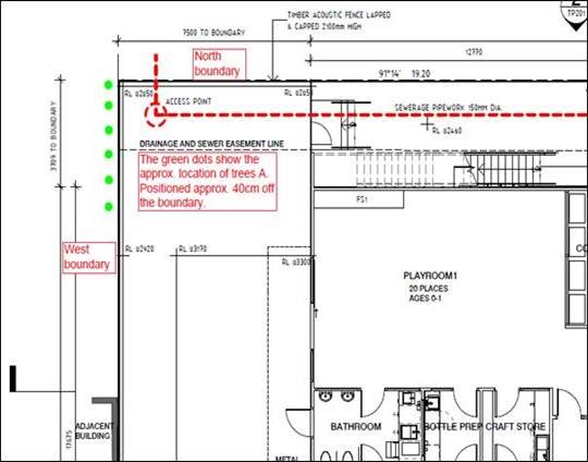
sewerage easement is located parallel to the northern boundary.
No. 451 Belmore Road has a high
timber paling front fence and has been cleared of buildings and works and most
trees. No. 453 Belmore Road contains a single storey detached brick
dwelling set within an established garden, including a number of trees around the
perimeter of the site. The subject site is relatively flat. One
existing crossover is provided to Belmore Road, which is within the Road Zone
Category 1 and one crossover connects to McColl Road.
An existing bus stop is located on
Belmore Road beside No. 451.
Surrounding development comprises a
mix of single and double storey dwellings, including a number of medium density
developments. The adjacent lot to the west accommodates a two storey
detached dwelling and the adjoining lot to the north accommodates a single
storey detached dwelling.
Planning Controls
Zone:
The site is within the
Neighbourhood Residential Zone Schedule 2 (NRZ2). The purpose of Clause
32.09 (Neighbourhood Residential Zone) includes:
· To
implement the State Planning Policy Framework and the Local Planning Policy
Framework, including the Municipal Strategic Statement and local planning
policies.
· To
recognise areas of predominantly single and double storey residential
development.
· To
manage and ensure that development respects the identified neighbourhood
character, heritage, environmental or landscape characteristics.
· To
allow educational, recreational, religious, community and a limited range of
other non-residential uses to serve local community needs in appropriate
locations.
Pursuant to Clause 32.09-2, a
planning permit is required for use of the land for a child care centre.
A planning permit is required for the buildings and works to construct the
child care centre pursuant to Clause 32.09-8.
Overlays:
A Vegetation
Protection Overlay, Schedule 2 (VPO2) at Clause 42.02 affects the precinct to
the north of Belmore Road and requires a planning permit to remove, lop or
destroy trees having a single trunk circumference of 1 metre or more at a
height of one metre above ground level. The vegetation protection objective to
be achieved by this overlay is:
· To
retain and protect large trees and maintain the dominance of exotic and native
vegetation cover.
· To
encourage the planting of native trees and vegetation that will contribute to
the tree canopy.
· To
protect vegetation of special significance, natural beauty, interest and
importance.
Only Trees 4
and 26 require planning approval to remove under the VPO2 in association with
the proposal.
The Significant Landscape Overlay Schedule
9 (SLO9) at Clause 42.03, also triggers planning approval to:
· Remove
six trees (Trees 1, 4, 9, 22, 26 and 27), as detailed in the table below.
· Undertake
buildings and works, or construct a front fence, within 4 metres of 13
protected trees, as detailed in the table below.
Clause 52.29 - Land Adjacent to
a Road Zone Category 1
The purpose of this provision is:
· To
ensure appropriate access to identified roads.
· To
ensure appropriate subdivision of land adjacent to identified roads.
Planning approval is required to
close the existing crossover from the subject site to Belmore Road.
PROPOSAL
The application proposes the use
and development of a child care centre, and associated removal of six trees and
alteration of access to a road in a Road Zone Category 1. The application
is summarised as follows:
Use:
A maximum of 128 places.
Staff:
The written submission provided
with the application indicated a maximum of 24 staff, however it is noted that
at the Forum the applicants indicated that a maximum of 27 staff would be on
site at any one time. For the purpose of this assessment, Council has
assumed a maximum of 27 staff is proposed.
Proposed
hours of operation:
Weekdays: 6:30am – 6:30pm.
Development:
Construction of
a new child care centre building comprising the following:
· Basement
level:
o The existing vehicle
crossover to McColl Road is proposed to be widened to provide a two way access
point to the basement car park which will accommodate a total of 28 parking
spaces including one disabled car space and six tandem car spaces (three pairs)
which are to be set aside for staff.
o Ten bicycle parking
spaces, pram and general storage.
o Allowance for a 6.4
metre long garbage truck to enter, collect waste within the basement and
manoeuvre to exit in a forwards direction.
· Ground
floor:
o Pedestrian entrance off
McColl Road.
o Four playrooms, kitchen,
office, laundry and bathroom facilities.
o Two rainwater tanks and
bin storage located on the north elevation.
o Front setback to Belmore
Road varying from 4.2 to 9 metres.
o Front setback to McColl
Road of 4 metres.
o Minimum north boundary
setback of 2.9 metres to be utilised as a service yard.
o Minimum west boundary
setback of 7.5 metres.
o 589m2 landscaped outdoor
play areas to the west and south of the building, with a 1.8 metre high black
metal picket fence on masonry plinths.
· First
floor:
o Two playrooms, staff
room, storage and bathroom facilities.
o A terrace on the east
elevation accessed from the staff room.
o 315m2 outdoor play areas
to the north, west and south surrounded by an opaque acoustic fence 1.8 metres
high.
o Areas of roof-top
landscaping to the north, east and south.
· Overall:
o A lift is provided to
all levels.
o Ground level to be clad
with horizontal composite cement sheeting and the upper level to be clad with
vertical composite cement sheeting.
o The upper level to have
a pitched corrugated metal roof with solar panels on the northern face.
o A 2.1 metre high timber
acoustic boundary fence is proposed along the residential interfaces to the
north and west boundaries.
· Advertising
Signs
o Two non-illuminated
business identification signs are proposed on the east elevation- one text
panel “littlelearningschool.com.au” (approximately 2.5m2)
above the car park entrance and one 1.2 x 1.2 metre (1.44m2) sign
panel beside the pedestrian entrance containing the text “Little Learning
School”.
In response to the Tribunal’s
direction on the previous planning permit application, the applicant has
amended the proposed basement car park layout to reduce the number of tandem
spaces to 21% (three pairs – 6 spaces). In association with the
alterations to the car park layout, the area of the basement has increased
marginally overall with slight alterations to the overall basement
footprint. Aside from these alterations, the proposed child care centre
is largely unchanged from the previous application, although the number of car
spaces provided has reduced from 31 car spaces (excess of three) previously
proposed, to 28 car spaces, which meets the Planning Scheme requirement.
As per the previous application, the proposed building is two storeys high and has
a basement car park accessed off McColl Road.
CONSULTATION
Public Notice
The application was advertised by
mail to the adjacent and nearby property owners and occupiers and by erecting
notices to the two frontages (one on each lot) facing Belmore Road and one
notice facing McColl Road. Following the advertising period 38 objections
were received, raising the following concerns:
· Previous
application and VCAT appeal:
o Insufficient changes
made in comparison to the previous application.
o VCAT concerns differed
from Council’s issues.
· Amenity
impacts:
o Overlooking from upper
level play spaces
o Overshadowing
o Commercial development
is inappropriate in a residential area.
o Noise impacts to
surrounding residents emanating from increased traffic, plant equipment and
children playing. The proposed two hours of outdoor play may not reflect
the actual duration of time that children play outside.
o Odour from bins
impacting on adjacent residents
o Increased litter.
· Neighbourhood
Character:
o Building bulk and form
and presentation are out of character with the neighbourhood
o Not in keeping with the
Bush Suburban character of the area.
o Non-residential uses
should not be allowed in residential areas
· Car
parking and traffic:
o Insufficient parking
provision on site for staff and parents/carers.
o Insufficient space to
manoeuvre within the car park.
o The six tandem car
spaces are not useable.
o Parents are unlikely to
park in the basement and will park on street and exacerbate existing parking issues.
· Increased
on-street parking on Belmore and McColl Roads. McColl Road is a narrow
street that already experiences high levels of on-street parking and traffic
congestion, due in part to the townhouses on the former primary school site to
the east. Parking restrictions already exist on the east side of McColl
Road. When cars park on both sides of McColl Road, it is narrowed to a
one-way street.
o Increased traffic
congestion.
o Impacts to vehicles
entering/exiting side streets from/to Belmore Road through increased queuing
and reduced visibility caused by parked cars.
o Increased on-street
parking will reduce or block residential driveway access and driver sight
lines.
o Impacts to 302/304
busses travelling along Belmore Road and the bus stop at the front of the site.
o Traffic safety impacts
on the street for vehicles and pedestrians
o Impacts on residential
waste collections.
o No bicycle parking
facilities proposed
o The submitted Traffic
Report does not reflect the local conditions.
· Landscaping:
o Removal of significant
trees
o Insufficient soft
landscaping.
o Loss of habitat for
fauna.
o Garbage trucks accessing
the site will damage the canopies of street trees.
· Statutory
requirements:
o Inconsistent with the
Whitehorse Planning Scheme requirements.
o The timing of notice
means that some residents may be on holiday.
· Non-planning
matters:
o Construction impacts on
pedestrian safety and traffic flow.
o There is no need for the
child care centre as there are numerous existing child care centres nearby, and
birth rates in the vicinity are decreasing
o Approving another child
care centre removes educational options and community building opportunities
provided to the community that may be offered by sessional kindergartens.
o Negative impact on
property values
Consultation Forum
A Consultation Forum was held on 26
February 2019, chaired by Councillor Liu and attended by Cr Barker. The
meeting was attended by approximately 28 objectors and four representatives for
the applicant attended the meeting.
At the Forum, the objectors
elaborated on the issues raised in the written submissions, with traffic and
on-street parking impacts highlighted as the key community concerns. The
applicant’s Traffic Engineer provided some explanation regarding the
findings in the submitted Traffic Report, and the objectors provided insight
into their existing experiences of traffic and parking in the area, and their
concerns about the impacts the proposed use and development would have on
traffic flows and accessibility in the vicinity.
The need for the proposed child
care centre was queried by residents, and amenity impacts such as noise were
also raised.
The objector concerns were not
resolved, but a better understanding of community concerns was reached.
Referrals
External
VicRoads
Consent, subject to one standard
condition.
Internal
Engineering and Environmental
Services Department
· Transport
Engineer
Council’s Transport Engineer
has noted that the proposal satisfies the Planning Scheme requirement for car
parking provision, but has required additional documentation confirming ramp
grades, vehicle swept paths and a parking management plan to be provided.
· Waste
Engineer
The Waste Management Plan submitted
is satisfactory, and provides for private waste collection within the basement
car park, with waste vehicles to exit in a forwards direction.
· Assets
Engineer
No objection, subject to standard
conditions.
Planning Arborist
No objection to the proposed tree
removal, and tree protection conditions recommended for retained trees.
Parkswide Arborist
No objection, subject to conditions
to protect street trees during the construction process.
ESD Advisor
Council’s ESD Advisor, has
indicated that the application has not addressed the ESD concerns raised with the
previous application, and as such does not meet Council’s ESD
standards. Conditions are recommended to be included on any planning
permit issued to ensure the proposal complies with Council’s policies.
Landscape Advisor
Limited alterations have been made
to the landscape plan from the previous proposal, and conditions are required
to amend species and planting layouts reflecting the review of the previous
landscape plan presented to VCAT, and also clarification of details for
containerised plantings and provision of a landscape management plan.
DISCUSSION
Application History
As discussed above, this is the
second application for a child care centre proposed for this site, and has been
lodged in response to the decision of VCAT on the first application (WH/2017/612).
The Tribunal found that the built form, landscaping, overlooking, noise,
traffic and parking impacts of previous proposal were acceptable, and the
Tribunal indicated only one ground for refusing the previous application, which
was an excessive proportion (80%) of tandem car spaces which the Tribunal felt
could cause parking difficulties in the basement.
Consequently, the current child
care centre proposal for the site has significantly reduced the number of
tandem car spaces, but is otherwise substantially the same as the previous
proposal. This report is mindful of the Tribunal’s direction in
this matter, and otherwise is broadly consistent with previous recommendation.
Consistency with State and Local
Planning Policies
Proposed child care centre use
State policy recognises the
importance of planning for social, community and physical infrastructure that
enables it to be provided in an efficient, equitable and timely manner. The
purposes of the Neighbourhood Residential Zone also recognise that non-residential
uses such as child care centres that serve local community needs are
appropriate, provided they occur in suitable locations.
Objectives contained within Clause
11.04-4 (Liveable Communities and Neighbourhoods), Clause 15.01-1 (Urban
Environment), Clause 21.06-7 (Non-Residential Uses) and Clause 22.05
(Non-Residential Uses in Residential Areas) stress the importance of ensuring
development, and particularly non-residential development, responds to its
context and is designed in a way that enhances the neighbourhood character and
streetscape of the area.
In terms of Clause 22.05
(Non-Residential Uses in Residential Areas Policy), key objectives of Clause
22.05 (Non-Residential Uses in Residential Areas) include:
· To
make provision for services and facilities demanded by local communities in a
way that does not detract from the amenity of the area;
· To
avoid the concentration of non-residential uses where it would:
o Have off-site effects
which are detrimental to residential amenity.
o Create a defacto
commercial area.
o Isolate residential
properties between non-residential uses; and
· To
ensure that the design, scale and appearance of non-residential premises
reflects the residential character and streetscape of the area.
The use of the site is supported by
the policy as the site has an interface with a main road (Belmore Road –
Road Zone, Category 1). Although it also abuts residential lots to the
north and west, and is located within a residential area, the size of the land
and the scale and presentation of the proposed building provide a development
which is considered to be compatible with the scale and character of the
surrounding residential area. In this way, the proposal responds to the
objectives of this policy and the key decision criteria.
This policy further requires
consideration of the ‘need’ for the provision of a non-residential
use in a residential area. Whitehorse
population statistics and trend projections indicate that the current number of
children in the municipality aged 0-5 years of age is 9,105 (based on 2016 ABS
data). That figure is forecast to increase by 1,471 or 16.2% over the next 10
years. About 4,000 children attend centre based child care services
representing a coverage rate of 44%.
An
expected increase in the supply of new larger sized child care centres over the
next 5-10 years will likely result in the rationalisation of smaller, older and
less cost efficient child care centres. In 2018, there were 18 applications for
new child care centres (representing a capacity of 1,885 additional places) in
the municipality that have been either approved and under construction,
approved and awaiting construction or awaiting a decision for approval. Overall
a significant net increase in child care places is predicted. If realised,
this will lead to an improvement in community access to child care centres
across the municipality with the child care coverage rate increasing from 44%
to 60% over the next 10 years.
In addition, information sourced
from independent property advisory firm Charter Keck Cramer included the following population demand
and child care centre supply analysis:
The Charter, Keck Cramer report
into the child care sector concluded that the demand for long day care centres
is driven by a number of demographic and economic factors including population
growth in the target cohort age, an increase in the female labour force
participation rate and a corresponding increase in the child participation rate
(percentage of children attending centre based child care). The report found
that between 2012 and 2017 there was a 29% increase in the number of additional centres in Victoria. It stated
that in considering the growth in supply it is important to factor in that new
centres are also replacing or rendering older centres obsolete and
uncompetitive.
The applicant has advised that
there is a shortfall of child care places in the Mont Albert North area. The
objectors to this and the previous application have raised doubts regarding the
‘need’ of the proposed child care centre within the immediate area,
however, its decision on the previous application, the Tribunal examined the
question of ‘need’ and found that child care centres may attract
patrons from a broader area, and that the idea of ‘community’
cannot be solely defined on a narrow geographic basis. Furthermore, it is
not the role of the planning process to assess commercial competition.
The predominant criterion for
assessment, other than the policy context, relates to the potential for any
off-site amenity impacts on the surrounding residential context.
The purpose (as relevant) of the
Neighbourhood Residential Zone (NRZ) states:
· To
allow educational, recreational, religious, community and a limited range of
other non-residential uses to serve local community needs in appropriate
locations.
It is considered that the use of
the land for a child care centre on the subject site is considered appropriate
given its surrounding context (explained in greater detail below under
‘design and built form’). The use is compatible with residential
uses (responding to the purpose contained within the NRZ) insofar as the
purpose of a child care centre is to service the needs of the families residing
within in and around the locality. It is not uncommon for child care centres to
be located within residentially zoned land, rather than commercially zoned
land. Importantly, the site also has a frontage to Belmore Road, which is a
larger feeder road, with a different residential context that can support
non-residential uses.
The following discussion will
consider the merits of the proposal against the abovementioned criteria.
Design and Built Form
Policy objectives, under
‘Design’ of Clause 22.05 (Non-Residential Uses in Residential
Areas) include:
· Existing
residential buildings are encouraged to be retained and converted to suit the
use in preference to a purpose-built premises.
· The
design, scale and appearance of the non-residential use are encouraged to
harmonise with the housing styles and general character of the area.
· Front
setbacks are encouraged to be consistent with abutting residences.
Whilst the Neighbourhood
Residential Zone states:
· To
manage and ensure that development respects the identified neighbourhood
character, heritage, environmental or landscape characteristics.
In considering the policy
objectives, both within Clause 22.05 and the Neighbourhood Residential Zone,
the context of the site and its immediate surrounds must be taken into account.
To the south of the site, Belmore
Road is a Road Zone, Category 1 that separates the site from properties to the
south. The proposed two storey child care centre building will have a
varied setback to Belmore Road of between 4.4 and 9 metres, with this setback
to be utilised for landscaped play areas. The adjacent dwelling to the
west includes a carport setback a minimum of 4 metres from Belmore Road, and in
this context the proposed 4 metre front setback is appropriate, noting that the
proposed building is set at an angle to Belmore Road, and the average front
setback is approximately 6.5 metres. The proposed upper level of the
child care centre is setback a minimum of 8.5 metres from Belmore Road.
A row of existing trees (Trees
10-16) located at the south-east corner of the lot along the Belmore Road
frontage are proposed to be retained, which will provide some immediate
softening of the front façade. There is not anticipated to be any
visual amenity detriment to the Belmore Road interface nor will the proposed
building be incongruous with the preferred neighbourhood character at this
interface.
The proposed building presents a
setback to the McColl Road frontage (to the east) of 4 metres at the ground
level, which exceeds the 2-3 metre setbacks that would be required for a
residential development in this location. This setback is utilised for
pedestrian and vehicular access, with the remaining areas landscaped. As
a residential street, like the Belmore Road interface, it is not considered
that there will be unreasonable amenity impacts to this public interface.
To the north, the subject site
abuts No. 1 McColl Road, which includes a driveway and carport along part of
the common boundary, a roofed pergola adjacent to the boundary to the rear, and
a single storey dwelling with an area of private open space within the rear
yard. The proposed child care centre will be setback a minimum of 2.9
metres at the ground level and 10.2 metres at the upper level, with the
elevated play area extending to within 4 metres of the northern boundary, and
raised planters and stair access setback a minimum of 2.9 metres from this
interface.
At the ground level, it is noted
that the northern setback has marginally increased from the previous proposal
presented to Council, and this setback is proposed to be utilised as a service
area and landscape buffer, with an upper level access stair, water tanks and
bin storage provided along this elevation behind a 4 metre high hedge planted
along the north boundary, and one feature Pyrus chanticleer tree with a
mature height of 10 metres.
The treatment of the northern
elevation and setback is considered acceptable, as it provides a transition of
building heights and forms and sufficient setbacks to ensure that the building
form does not overwhelm the adjoining dwelling and allows for the planting of
screening vegetation that will soften the views of this interface from the
adjacent residential lot to the north. There will be no overshadowing
impacts to the north.
To the west, the adjoining lot
accommodates a two storey dwelling which includes a shed located on the common
boundary to the rear of the lot, and a swimming pool in the rear yard.
The proposed child care centre building will be setback 7 metres from the west
boundary at the ground level and 13 metres at the upper level, with the upper
level play area extending to within 7.5 metres of the west boundary. The
proposed landscape plan offers screen planting within this interface to soften
the visual amenity impacts of the built form, including five trees with mature
heights of 8 metres to be planted in deep soil 2.2 metres wide and clear of the
basement car park.
The shadow diagrams demonstrate
that the 2.1 metre high acoustic fence on the west boundary will result in an
increase in morning shadows to the adjacent lot. The increased shadowing would
be compliant with the Requirements of ResCode Standard B21 (Overshadowing Open
Space Objective) which can be reasonably used as a guideline in this instance
(in the absence of other methods). The sensitive rear secluded private
open space will not be overshadowed.
Therefore, the decision guidelines
contained at Clause 32.09-12 become the relevant assessment criteria, which
requires Council to consider: In the local neighbourhood context:
· Whether
the use or development is compatible with residential use.
· Whether
the use generally serves local community needs.
· The
scale and intensity of the use and development.
· The
design, height, setback and appearance of the proposed buildings and works.
· The
proposed landscaping.
· The
provision of car and bicycle parking and associated accessways.
· Any
proposed loading and refuse collection facilities.
· The
safety, efficiency and amenity effects of traffic to be generated by the
proposal.
The proposed
child care centre will be clad with composite cement sheeting that has an
appearance similar to weatherboards, which is consistent with the cladding of
the adjacent dwelling to the north. The proposed pitched roof form echoes
the forms of many surrounding dwellings, however it is noted that there are
some flat roofed dwellings in the vicinity, notably adjacent to the west.
In order to help reduce the urban heat island effect, the roof will be required
to be a light colour.
The provision
of a basement car park limits the visibility of car parking within the site,
and allows for landscaped front setbacks to be provided in keeping with the
residential character of the area.
The
Neighbourhood Residential Zone Schedule 2 allows front fences of main roads to
be up to 1.8 metres in height, so the proposed 1.8 metre high front fence to
Belmore Road is acceptable. The use of metal picket fencing maintains an
open frontage setback that allows for views to the landscaped play areas that
surround the child care centre. The submitted plans and elevations do not
clearly show the location and style of this picket fence, and this will be
required to be clarified via a condition, should a permit issue.
In its previous
decision, the Tribunal found that the proposed built form and layout of the
earlier child care centre proposal for this site (WH/2017/612) “has a
restrained architecture and has been designed to reflect some of the elements
which characterise this neighbourhood” (at paragraph 15). The
VCAT decision also states (at paragraph 20) that “once mature, the
proposed planting will present as a suitable landscape setting for the
development and an outcome which responds in an acceptable manner to the
neighbourhood’s character.” The Tribunal was satisfied
that the previous proposal was an appropriate addition to the local
neighbourhood character, and the current proposal is almost unchanged at the
ground and upper levels. The landscape plan submitted with this
application includes a similar layout to the previous proposal, but
incorporated the planting of additional trees on the south, west and north
boundaries and an increase in the length of the landscape screen hedge to
extend almost the full length of the north boundary.
On balance, it
is considered that the proposed child care centre is compatible with the
surrounding neighbourhood context as the building scale and presentation
reflect the size and cladding materials of the surrounding dwellings, the site
will be landscaped in keeping with the context and the use will serve a
community need and facilitate social connection. Loading, car and bicycle
facilities will be considered below.
Tree Removal/Impacts
Two trees (Trees 4 and 26) require
planning approval to be removed under the VPO2. The application proposes
removal of six trees protected under the SLO9 and buildings and works within 4
metres of 13 protected trees, as summarised below:
Protected trees to be removed:
|
Tree No.
|
Botanical Name
|
Common Name
|
Height
|
Age
|
Amenity Value
|
|
1
|
Jacaranda mimosifolia
|
Jacaranda
|
8m
|
Mature
|
Low
|
|
4
|
Corymbia ficifolia
|
Flowering Gum
|
8m
|
Mature
|
Low
|
|
9
|
Pittosporum eugenioides
|
Tarata
|
7m
|
Mature
|
Low
|
|
22
|
Acacia implexa
|
Lightwood
|
5m
|
Mature
|
Low
|
|
26
|
Pittosporum undulatum
|
Sweet Pittosporum
|
8m
|
Mature
|
Low
|
|
27
|
Acmena smithii
|
Lilly Pilly
|
7m
|
Mature
|
Low
|
Protected trees to be retained
|
Tree No.
|
Botanical Name
|
Common Name
|
Height (m)
|
Age
|
Amenity Value
|
|
2
|
Eucalyptus
leucoxylon
|
Yellow Gum
|
5m
|
Mature
|
Low
|
|
6
|
Quercus
palustris
|
Pin Oak
|
15m
|
Mature
|
High
|
|
7
|
Platanus
orientalis
|
Plane Tree
|
6m
|
Mature
|
Low
|
|
10
|
Hakea
salicifolia
|
Willow Hakea
|
5m
|
Mature
|
Low
|
|
11
|
Hakea
salicifolia
|
Willow Hakea
|
5m
|
Mature
|
Low
|
|
12
|
Hakea
salicifolia
|
Willow Hakea
|
5m
|
Mature
|
Low
|
|
13
|
Hakea
salicifolia
|
Willow Hakea
|
5m
|
Mature
|
Low
|
|
14
|
Hakea
salicifolia
|
Willow Hakea
|
5m
|
Mature
|
Low
|
|
15
|
Hakea
salicifolia
|
Willow Hakea
|
5m
|
Mature
|
Low
|
|
16
|
Acer
palmatum
|
Japanese Maple
|
5m
|
Mature
|
Low
|
|
17
|
Lophostemon
confertus
|
Queensland Brush Box
|
8m
|
Mature
|
Low
|
|
18
|
Lophostemon
confertus
|
Queensland Brush Box
|
9m
|
Mature
|
Low
|
|
A
Identified by Council’s Arborist
|
Row of Callistemon viminalis located on the
adjoining lot to the west close to the north-west corner of the subject site
|
Bottlebrush
|
9m
|
-
|
Health-
good.
Structure-
fair
|
Note that Trees 5, 8, 19, 20, 21,
23, 24, 25, are not protected by the Significant Landscape Overlay Schedule
9. Tree 3 (6 metre Pittosporum undulatum
Sweet Pittosporum) shown on the plans
on the adjoining lot to the west has been removed.
Council’s Planning Arborist
has assessed the tree removal and impacts to trees on the subject site and
adjoining residential lots, and has not raised any concerns, subject to the
provision of tree protection measures. The increased basement area to the
north proposed with the current application has prompted Council’s
Planning Arborist to identify the two mature trees (Trees B and C identified in
the table below) located on the adjoining lot to the north as requiring tree
protection measures during construction. The proposal includes works
within the TPZs of these tree, although it is noted that the trees are over 4
metres away from the proposed development, and as such are not directly
protected by the Significant Landscape Overlay Schedule 9.
|
Tree No.
|
Botanical Name
|
Common Name
|
Height (m)
|
Age
|
Amenity Value
|
|
B Identified
by Council’s Arborist
|
Eucalyptus mannifera
|
Brittle Gum
|
20m
|
Mature
|
Health-
fair.
Structure- fair
|
|
C
Identified by Council’s Arborist
|
Eucalypts globulus
|
Tasmanian Blue Gum
|
24m
|
Mature
|
Health-
good.
Structure- fair
|
Council’s Parkswide Arborist has reviewed the proposed
impacts to street trees and advised that Tree 18, located to the north of the
extended crossover to McColl Road, could potentially be impacted, as the
proposed works encroach 13.3% into the TPZ of this tree, which is considered to
be a major encroachment. A Tree Protection Management Plan (TMP) will be
required to ensure Council street trees are protected and retained during
development.
Car Parking
Clause 22.05-3 Non-Residential Uses
in Residential Areas Policy requires:
o Adequate provision is
encouraged for on-site staff and visitor parking.
o Parking areas are
encouraged to maximise usage and to minimise on-street parking.
o Parking is
discouraged at the front of the site.
Parking policy and requirements
applicable to the development are specified in Clause 52.06 (Car Parking) of
the planning scheme. In accordance with Clause 52.06-2, before a new use
commences, the number of car parking spaces required under Clause 52.06-5 must
be provided to the satisfaction of the Responsible Authority.
A child care centre requires 0.22
car spaces per child, requiring 28 car spaces for the 128 children
proposed. The amended basement layout proposed with the current
application proposes total of 28 car parking spaces (including one disabled car
space) which meets the Planning Scheme requirement.
Although the previous proposal
included additional three on-site car spaces, the Tribunal refused the earlier
application on the ground (at paragraph 42) that the proportion of tandem car
spaces (80%) provided was excessive, and as such did not provide for easy and
efficient use as required by Clause 52.06. The Tribunal further stated
that “If tandem parking is provided, the number of car spaces in such
an arrangement should be in the minority and should, for practical reasons,
ideally be allocated solely for staff use (both the front and rear spaces
should be assigned to staff” (paragraph 43).
The current application has altered
the proposed basement layout to reduce the number of tandem car spaces to six
(three pairs), which are shown on the plans as allocated to staff. This
represents a proportion of 21% of car spaces in a tandem arrangement, and it is
considered that the proposed 21% proportion meets the Tribunal’s
direction in this matter.
The new car park layout includes
two blind aisles, and in order to assist patrons in locating available car
spaces and navigating the car park, the Traffic Report submitted with this
application recommends that car parking availability lights are installed above
parking spaces (similar to those used in some shopping centres) and an external
sign is also provided which displays the number of vacant spaces within the car
park. Staff parking within the tandem car spaces will be managed by the
operator, and it is acknowledged that the majority of staff will arrive and
depart from outside of the customer peak times.
The use of parking availability
lights above the car spaces and external to the building will be required as a
condition, should a permit issue, and the location of the external sign will be
required to be shown on the plans. Line marking within the basement car
park indicates pedestrian priority pathways which will assist with the movement
of patrons within the car park. The proposed vehicle access ramp to the
basement allows for two way vehicle movements, and with the assistance of the
car parking availability indicators, all vehicles should be able to manoeuvre
to exit in a forwards direction, however Council’s Transport Engineer has
advised that swept path diagrams are required to demonstrate satisfactory
access to and from car spaces 1, 11, 18, 19 and 27.
Further, Council’s Transport
Engineers have required the plans to show the ramp grade for the first 5 metres
into the basement car park consistent with the Traffic Report, which indicates
a ramp grade of 1:10 for the first 5 metres. A Parking Management Plan
will be required to detail how car parking will be managed. Traffic and additional
vehicle movements have been raised by objectors to this and the previous
application, and the Tribunal decision provided an overview of the Traffic
Expert Evidence presented at the previous VCAT Hearing. Paragraph 44 of
the decision included a summary of the findings as follows:
According to Mr Turnbull, the
use will generate 0.8 vehicle trip-ends per child during the morning peak hour
(102 movements) and 0.7 vehicle-trip ends per child during the evening peak
hour (90 vehicle movements). The residents are concerned about the impact
of this additional traffic on McColl Road, at the intersection with Belmore
Road. A SIDRA analysis of this intersection was undertaken and formed
part of the evidence. What the analysis shows is that the degree of
saturation will increase from 0.210 to 0.393. The evidence is that a
degree of saturation less than 0.8 is considered to represent good operating
conditions. The analysis also shows that the average delay at the
intersection will increase from 19.7 seconds to 23.1 seconds, and that the 95th
percentile queue will increase from 4.7 metres to 10.2 metres. In Mr
Turnbull’s opinion, a delay of up to 30 seconds when turning out onto a
main road is not a long delay. The average queue length was estimated to
be 1.5 vehicles, with the evidence being that a three-vehicle queue would be
necessary in order to (sic) the access into and out of the proposed car park to
be affected.
In conclusion (at paragraph 46) the
Tribunal found that “while there will be greater delays than what is
experienced at present, these will not be unreasonable or excessive”.
The site is located on an arterial
road (Belmore Road) and Council’s Transport Engineers have reviewed the
submitted Traffic Report and noted that the SIDRA intersection analysis
undertaken by the applicant’s traffic engineer is considered satisfactory
and the traffic generated by the proposal can be accommodated within the
surrounding road network. The intersection of McColl Road and Belmore
Road will continue to operate satisfactorily with the facility as proposed.
The Tribunal also noted in its
decision (at paragraph 45) that vehicles parking opposite the solid white line
on McColl Road at the intersection with Belmore Road are currently restricting
vehicles entering McColl Road from Belmore Road when there is a queue. It
is noted that the white line tailing from the intersection is 30 metres long,
parking is only prohibited by No Standing signs within 10 metres of this
intersection. The increase of the No Standing zone could be investigated
via a separate process. It is further noted that the application has been
referred to VicRoads, however they have not identified any concerns.
Bicycle
Parking
The bicycle parking requirements
for the subject site are identified in Clause 52.34 of the Whitehorse Planning
Scheme. The Planning Scheme does not specifically refer to parking requirements
for child care centres and therefore no bicycle parking is required.
However, it is noted that the plans
demonstrate the provision of five bicycle spaces within the basement car park.
Amenity
Noise
Many VCAT decisions have viewed
noise emanating from child care centres as being reasonable within a
residential area and particularly accepted as a necessary trade-off in
providing community facilities. The Tribunal decision of Petzierides v
Hobsons Bay CC (Red Dot) [2012] VCAT 686 (28 May 2012) identifies that
whilst the noise of children playing is reasonable, this does not mean that a
centre can obviate the need to act responsibly and appropriately by not
ensuring any noise impact is of an acceptable level.
The applicant has provided an
Acoustic Report with this application, which states that the proposed child
care centre will generally comply with the Association of Australian Acoustical
Consultants Child Care Centre Noise Assessment Technical Guideline play
criterion at the nearest residential properties, as 1.8 metre high acoustic
fencing is provided to the play areas at ground and first floor levels to
shield potential noise emissions. The report concluded that the proposed
child care centre presents a low risk of exceeding the requirements of State
Environment Protection Policy (Control of Noise from Commerce and Industry) No.
N-1. Waste collection and is proposed to be from within the basement car
park, which will limit off-site noise emissions.
The submitted plans show the
required acoustic screening, and the Tribunal noted (at paragraph 29) that an
acoustic report and the required noise attenuation measures could be required
as a condition of Permit. On this basis, it is considered that the
potential acoustic impacts to the surrounding dwellings from the proposed child
care centre, including the ground and first floor play areas, will not be
unreasonable, and a condition will be imposed to ensure that the appropriate
acoustic barriers are installed in accordance with the Acoustic Report.
Overlooking
It is noted that the outdoor play
area at the upper level is provided with opaque 1.8 metre high acoustic fencing
around its perimeter, which will screen potential overlooking into the
adjoining properties within 9 metres to the north and west from this play
area.
Advertising Signs
The plans show two non-illuminated
business identification signs on the east elevation, however primary consent is
required for advertising signs, and the application form did not seek specific
approval for the display of signs. As a result, the removal of the
advertising signs will be required via conditions. The applicant can make
a separate planning permit application for advertising signs.
Objectors Concerns not
Previously Addressed-
· Noise
impacts to surrounding residents emanating from increased traffic, plant
equipment and children playing. The proposed two hours of outdoor play
may not reflect the actual duration of time that children play outside.
The development includes acoustic
screening to play areas and along boundaries adjacent to residential lots, and
the application was accompanied by an Acoustic Report indicating that the
screening measures complied with the relevant standards.
· Odour
from bins impacting on adjacent residents.
The bins will be stored within and
collected from the basement.
· Parents
are unlikely to use the basement carpark and will park on street
Sufficient car parking is provided
on-site with direct access into the centre via a lift. Basement car
parking is becoming a common feature in modern child care centres and many
other buildings. Those parents that will become frequent users can be
reasonably expected to acquaint themselves with the operation of the basement
car park.
· Garbage
trucks accessing the site will damage the canopies of street trees.
Street trees should be pruned to
clear vehicles and trucks where the canopies overhang streets and accessways.
· The
timing of notice means that some residents may be on holiday.
The Planning and Environment Act
1987 does not allow for the giving of notice to cease over holiday periods and
imposes statutory timeframes on assessment of applications, however
Council’s Planning Department made some allowance for key holiday periods
around the New Year. The proposal was advertised in mid-January, and
signs were placed on site for two weeks, which is considered suitable notice.
· Construction
impacts on pedestrian safety and traffic flow
A Construction Management Plan will
be required should a permit issue, and the land owner will be required to meet
relevant Building and EPA regulations regarding construction practices to
ensure these impacts are mitigated.
· Negative
impact on property values
The Victorian Civil and
Administrative Tribunal has generally found subjective claims that a proposal
will reduce property values are difficult, if not impossible to gauge and of no
assistance to the determination of a planning permit application. It is
considered the impacts of a proposal are best assessed through an assessment of
the amenity implications rather than any impacts upon property values. This
report provides a detailed assessment of the amenity impact of this proposal.
CONCLUSION
The proposal for use and
development of a child care centre and associated alteration of access to a
road in a Road Zone Category 1, tree removal and display of business
identification signs is an acceptable response that satisfies the relevant
provisions contained within the Whitehorse Planning Scheme, including the State
and Local Planning Policies, and the Neighbourhood Residential
Zone. Further, the current application has responded to the
direction VCAT gave in its refusal of the previous proposal (WH/2017/612).
It is considered that the proposal
is capable contributing to the supply of community infrastructure in the
municipality, offering a complementary non-residential land use which will not
prejudice the amenity of the locality or the character of the area.
A total of 38 objections were
received as a result of public notice and all of the issues raised have been
discussed as required.
It is considered that the
application should be approved.
Attachment
1 Plans ⇨ 
Ordinary Council Meeting 18
March 2019
Strategic
Planning
9.1.2 Strategic
Planning Update
FILE NUMBER: SF10/90
SUMMARY
This report outlines progress
with key strategic planning projects from September 2018 to date and recommends
that this update report be acknowledged.
|
RECOMMENDATION
That Council acknowledge
the report on progress of Strategic Planning projects.
|
background
Council’s Strategic Planning
Unit undertakes a range of projects that respond to the strategic planning
needs of Whitehorse, updates the Whitehorse Planning Scheme and manages
projects to proactively plan for future improvement, development opportunities
and protection of important features and places within the City.
DISCUSSION
The following is a summary of the
current status of key projects being undertaken through the Strategic Planning
Unit. The last update to Council was provided at its meeting on 17
September 2018.
Key planning scheme
amendments and their status include:
Amendment C191, C196 and C214
–Municipal Wide Significant Landscape Overlay (SLO9) – Tree
Protection Controls
Council adopted the Whitehorse Tree
Study Final Options Report on 18 July 2016 and sought authorisation from the
Minister for Planning in May 2017 to commence an amendment to the Whitehorse
Planning Scheme to implement the recommendations from the Tree Study.
Amendment C196 sought to extend the
Significant Landscape Overlay to all residential land in the municipality on a permanent
basis. Amendment C191 sought to apply the proposed Significant Landscape
Overlay on an interim basis while the permanent controls were being
pursued.
The Minister for Planning approved
Amendment C191 which came in effect on 8 February 2018. The interim tree
protection controls were due to expire after 31 December 2018, however an
extension to the interim controls to 30 June 2019 was gazetted on 21 December
2018 via Amendment C214.
The Minister for Planning refused
Council’s request to commence Amendment C196 and directed Council to
undertake further strategic work to justify the controls on a permanent basis.
The additional work to support the introduction of permanent controls has been
completed and will be the subject of a separate report to Council. Subject to
Council’s consideration of the additional work, a new request to the
Minister for authorisation to commence an amendment for permanent controls will
be lodged. If authorised, it is anticipated that the amendment will commence
exhibition in the coming months and will be a full planning scheme amendment
including a statutory exhibition period where the community will be able to
make submissions. Updates will be provided on Council’s web site
at:
http://www.whitehorse.vic.gov.au/Planning-Scheme-Amendments.html
http://www.whitehorse.vic.gov.au/TreeStudy.html
Amendment C215 and C216 – 42-48 Glenburnie Road,
Mitcham
Under delegation, Council officers lodged a
request with the Minister for Planning to apply an interim Heritage Overlay
(HO) to the property at 42-48 Glenburnie Road, Mitcham via Amendment C215 to
the Whitehorse Planning Scheme. At the same time, officers sought authorisation
from the Minister to prepare an amendment to apply the HO to the site on a
permanent basis through Planning Scheme Amendment C216 to conserve and
enhance buildings of identified local heritage significance and to ensure that
future development does not adversely affect this heritage significance.
The urgent request for interim heritage
protection arose from an application for report and consent under Section 29A
of the Building Act 1993 to demolish the dwelling and outbuildings.
Council is currently awaiting authorisation from the Minister to exhibit the
amendment.
Activity Centres
Officers continue to implement
actions from adopted structure plans and urban design framework plans for
activity centres in the municipality. A monitoring framework for implementation
of the plans has also been established and is periodically updated.
Burwood Heights Activity Centre – Former Burwood
East Brickworks Site
The Development Plan Overlay (DPO)
that currently applies to the former brickworks site at 78 Middleborough Road,
Burwood East requires that a development plan be prepared to Council’s
satisfaction before planning permits can generally be granted for the
development. The development plan is intended to guide future planning
permit applications for each stage of this major development and assessment of
those applications. A development plan was endorsed by Council on 28
February 2018.
Several planning permit
applications have been granted by Council and construction has commenced.
Applications must be generally in accordance with the approved development plan
and are exempt from third party notification.
In October 2018, an update to the
development plan to add entertainment-related uses (such as a cinema) to the
potential mix of uses in the retail centre was placed on display. Submissions
received were considered by Council at its meeting on 10 December 2018. Council
approved the changes to the development plan which was subsequently endorsed on
27 December 2018.
Box Hill Metropolitan Activity
Centre (MAC)
Actions relating to the Box Hill
MAC are aligned with the adopted Box Hill Structure Plan and other strategic
documents, and include:
· Urban
design, landscape and strategic planning advice on major developments;
· Engagement
with relevant departments across the organisation and external stakeholders to
progress the Structure Plan; and
· Preparation
of planning scheme amendments.
Further work is also being undertaken to progress longer
term strategic work for the MAC. At the Council meeting on 25 June 2018
Council resolved to abandon an amendment to implement the Box Hill Built Form
Guidelines. As a major budget initiative in 2018/2019, Council has subsequently
initiated a review of the Vision for Box Hill, including 3D modelling for the MAC
and updating parts of the Structure Plan. The project has commenced.
Community consultation to gather ideas for the future of
Box Hill took place in February with an online survey and publicity on
Council’s web site, on social media and in the Whitehorse Leader. A
‘pop-up’ consultation session was held in the mall on 11 February
2019 and a Stakeholder Reference Group (SRG) has been formed comprising State
Government, key landowner, community group and agency representatives.
The SRG had its first meeting on 5 March 2019. Updates on the project
will be on the project web page at:
http://www.whitehorse.vic.gov.au/BoxHill.html
Tally Ho Activity
Centre – Review of Commercial 1 Zone
As part of the 2018/2019 budget
funding was allocated to do a review of the Commercial 1 Zone in the Tally Ho
Activity Centre to determine whether the Commercial 1 Zone is the most
appropriate zone to achieve the vision for the centre into the future.
Consultants have recently been appointed to assist Council in determining
whether this zone is still appropriate or whether there is a more suitable
planning tool available.
Nunawading Mitcham MegaMile
Structure Plan Background Review
The Nunawading/MegaMile Major Activity
Centre and Mitcham Neighbourhood Activity Centre Structure Plan had been in
operation since 21 April 2008, when Council formally adopted the
document. As part of the 2017/2018 budget, a comprehensive background
review of key policy changes and development trends that have occurred since
adoption of the Structure Plan was completed. The background review will
inform and guide the process for the update of the Structure Plan proposed to
commence in the 2018/2019 year.
Heritage
Heritage Assistance Fund
A total of $40,000 was allocated to the
Heritage Assistance Fund for the 2018/2019 financial year. The Fund provided
grants up to $2,000 from the funding pool to eligible owners and occupiers of
properties in the Heritage Overlay to assist with the ongoing maintenance of
their heritage properties. Applications were open from 6 August to 12 September
2018. Of the 48 applications received 22 were successful in securing funding,
which will assist with various heritage preservation works including external
painting, repairs and restorative works.
Heritage Advisor
Council’s Heritage Advisor
continues to provide specialist advice to the Strategic Planning Unit.
Responsibilities of the Advisor include responding to planning application
referrals from the Statutory Planning Unit, liaising with the community and
other departments of Council on heritage matters, undertaking heritage
investigations and helping to assess Heritage Assistance Fund applications.
The Heritage Advisor existing
contract has recently been extended for another 12 months.
Other Major Council Projects
The Neighbourhood Project
The City of Whitehorse was selected
as one of three metropolitan Councils as part of the Neighbourhood Project; a
pilot project which is a practical program to make community-led placemaking
easier for Councils and communities. The Neighbourhood Project is part of the
Resilient Melbourne Strategy.
The Place Activation Guidelines
(PAGs) are the final stage of the Neighbourhood Project and focussed on
reviewing and refining our processes across Council to ensure that interested
community members can work with Council in an efficient and streamlined manner.
The project was a cross-Department collaboration.
The Draft PAGs are currently being
piloted as part of the This Space, Your Place activation project in Box
Hill. Learnings from this project will be used to refine the PAGs as needed.
Built Environment Awards (BEA)
The Built Environment Awards are
part of the wider Built Environment Education and Awards Program, with an education
event and the awards program being held on alternate years. The Built
Environment Awards will take place as part of Sustainable Living Week in June
2019. The Awards showcase the best in design and recognise the
people who contribute to good design and sustainable practice within the City
of Whitehorse.
Award categories are:
· Single
House Project – New Dwelling
· Single
House Project – Renovated Dwelling
· Multi-Residential
Project
· Commercial
or Retail Project
· Institutional
Project
· Landscape
Design Project
· Heritage
Project
In addition, the following awards will be selected from all
shortlisted projects:
· Sustainability
Award - recognises a project which demonstrates commitment to sustainable
principles
· Innovation
Award - recognises a project which displays exemplar use of innovative design
elements, technology, materials and/or processes
· People’s
Choice Award - Open to public vote and reflects the community values and
aspirations
· Mayor
Award - Chosen by the Mayor and recognises an exemplar project which reflects
Council’s values and initiatives.
Nominations were open between 1
February and 15 March 2019. Up to three projects will be shortlisted for each
category. The shortlisted projects will be announced on 26th April
and the judging will take place on in May 2019. The Awards event will take
place on 6th June 2019 at Deakin University which sponsors the
event.
Residential Corridors Study
The study provides built form
guidelines and recommends planning scheme controls for those areas in the City
of Whitehorse along key road corridors where land in the Residential Growth
Zone interfaces with land in the Neighbourhood Residential Zone and the General
Residential Zone. The corridors include Residential Growth Zone land generally
along Burwood Highway and Whitehorse Road.
Phase 1 of the community
consultation in March/April 2018 attracted approximately 400 survey
responses. Phase 2 in July/August 2018 provided the opportunity to
comment on the Draft Built Form Guidelines and proposed planning controls and
Council received 59 submissions. Council considered the community feedback at
its meeting on 29 January 2019 and decided to adopt the Guidelines and the
proposed planning controls. In summary, Council proposes to seek:
· A
mandatory building height limit (6 storey)
· Mandatory
front, side and rear building setbacks
· Guidance
for the pedestrian interface to new development, shadowing of open space, the
wind impact of buildings and site landscaping expectations.
The proposed amendment will be sent
to the Minister for Planning in the coming months for authorisation to start
the planning scheme amendment process. The community will have a further
opportunity to make submissions on the proposed controls during that process.
Voluntary Affordable Housing
Grant
In June 2018 changes were made
to the Planning and Environment Act 1987 (the Act) to support and encourage the
development of more affordable housing. A voluntary framework was established
under the Act to enable Councils to work with land owners, developers and other
partners to agree affordable housing provision as part of development projects.
The Victorian government
recognised that Councils may need support with affordable housing policy
development, legal advice and negotiation of these agreements and established
the Voluntary Affordable Housing Agreements Grants Program. The program
provides a total of $500,000 during the 2018/19 financial year to support
councils to advance their work in this area, with a maximum of $50,000 provided
to successful applicants.
A grant submission was prepared and
Council was successful in securing funding towards this important work and
consultants have recently been appointed to assist Council with the project. It
is anticipated that the work will result in the development of an affordable
housing local planning policy in the planning scheme.
State Government Projects
SMART Planning - Planning Policy
Framework
As part of the Smart Planning
reforms by the State government following the Reforming the Victoria
Planning Provisions Discussion Paper in late 2017, Planning Schemes across
Victoria are proposed to be rewritten to align with the new thematic policy
structure introduced as part of State Amendment VC148 that provided the
structure to integrate State, Regional and Local content of planning
schemes. For Whitehorse City Council it is intended that this will
largely be a policy translation of the planning scheme to remove unnecessary
duplication in policy content within each theme and to streamline operation of
policy.
Reform of the Planning Policy
Framework will be undertaken by DELWP in consultation with Council’s
across Victoria in stages. It has not yet been confirmed when work on the
Whitehorse Planning Scheme will commence. It is anticipated that the
project will involve considerable officer time to liaise with the DELWP and to
ensure that important content of the Whitehorse Planning Scheme is not
misinterpreted, diluted or removed.
Plan Melbourne
The
Implementation Plan that accompanies the metropolitan planning strategy, Plan
Melbourne 2017 – 2050, identifies preparation of Land Use Framework
Plans (LUFP) for each of the six metropolitan regions. Whitehorse is located in
the Eastern Region and is represented on the region’s Economy and Planning
Working Group established by the State government to develop work plans to
implement Plan Melbourne including the preparation of the LUFP.
Preparation of the LUFP is in progress and has included workshops with Councils
in the eastern region. Draft plans are expected from State Government in the
coming months.
More
information about Plan Melbourne can be found on the State Government web site
at: http://www.planmelbourne.vic.gov.au/home
16-18 Spring
Street, Box Hill
The Fast Track
Government Land (FTGL) Service facilitated Amendment C197 to change the
planning controls relating to two Box Hill Institute (BHI) sites:
· 1000
Whitehorse Road (west of the Box Hill Town Hall), which has been rezoned to
Commercial 1 Zone
· 16
– 18 Spring Street (adjoining and including part of the BHI Nelson
Campus), which has been rezoned to the Mixed Use Zone and applied a Development
Plan Overlay.
The Amendment
was approved by Minister for Planning and came into effect on 27 April
2018. Since the amendment:
· 1000
Whitehorse Road has been largely demolished (except for the former Box Hill
Girls Technical college building which is protected by a Heritage Overlay) to
make way for a proposal by the Salvation Army to relocate from its current site
in Nelson Road, Box Hill.
· A
development plan as required under the Development Plan Overlay was lodged for
16-18 Spring Street in September 2018. Revised documents and further
information for the development plan were submitted in January 2019 and these
are currently being assessed. The development plan will be the subject of a
future report to Council.
CONSULTATION
Community consultation is an
integral part of all strategic planning projects. The level and type of
consultation will be extensive and varied, depending on the nature and
complexity of each project. While community consultation adds to the
depth of projects it can also extend their timeframe in some instances.
This update report on strategic
planning projects is prepared every six (6) months covering periods ending in
March and September. This is followed by a summary in the Whitehorse News
on a selection of projects of interest to the community.
FINANCIAL
IMPLICATIONS
All of the projects require
resources and funding for tasks including consultation, preparation, exhibition
and consideration of amendments, consultant advice and investigations,
including government processes e.g.: panel hearings etc. Funding for the
projects discussed in this report was either provided in the recurrent budget
or via specific budget line items as new budget initiatives.
POLICY IMPLICATIONS
The undertaking of strategic
planning projects is consistent with the Council Plan 2017 – 2021
in terms of project outcomes and the consultation involved.
Ordinary Council Meeting 18
March 2019
9.1.3 Healesville
Freeway Reservation: Request for comment on Removal of Public Acquisition
Overlay
FILE NUMBER: SF15/719
SUMMARY
This report seeks Council’s comment
on proposed removal of the Public Acquisition Overlay, Schedule 3 that covers
the Healesville Freeway corridor between Springvale and Boronia Roads in the
Whitehorse Planning Scheme. The Overlay was applied in 1969 in favour of
the Roads Corporation / VicRoads to reserve the land for future road
purposes. The State Government declared the land surplus to road network
requirements in 2009 and, as an outcome of the 2015 State Election,
subsequently decided to revert most of the land to the Crown for use primarily
as open space for the community. The Public Acquisition Overlay on the corridor
is therefore no longer necessary. There are however related land use zoning
considerations which Council can seek to be addressed by the State Government.
|
RECOMMENDATION
That Council:
1. Support removal of the Public Acquisition
Overlay, Schedule 3, as shown in Figure 1, which covers the Healesville
Freeway corridor between Springvale and Boronia Roads from the Whitehorse
Planning Scheme.
2. Request that VicRoads and the Department of
Environment, Land, Water and Planning appropriately zone the Healesville
Freeway corridor for its future use as open space and address the residential
zoning of residual parcels as outlined in this report.
3. Write
to VicRoads to advise of its decision.
|
background
The Healesville Freeway Reservation (HFR),
as it first existed from near the Riversdale Road/Station Street to
Healesville, was first included in Box Hill and the Nunawading (now Whitehorse)
Planning Scheme in 1969. During the 1980s, part of the HFR between Riversdale
Road/Station Street to Springvale Road was removed from the Planning Schemes
and the land developed for a diversity of uses including Council’s
Operations Centre, public and private housing, commercial buildings and open
space.
In 2009 VicRoads identified nearly all of the remaining
Healesville Freeway Reservation (HFR) being 35 hectares of undeveloped land between Springvale Road and Boronia Road, as surplus to road
network requirements. This section of the HFR is 3.3 kilometres long and
varies in width from 75 metres to 300 metres. In the
Whitehorse Planning Scheme the reservation is covered by the Public Acquisition Overlay, Schedule 3
(PAO3).
In 2012, under the previous Liberal
State Government, VicRoads commenced the structure planning process for the
Healesville Freeway Reservation Renewal Project (HFRRP) which assumed inclusion
of substantial parts of the HFR for future housing.
During the 2015
State Government election the Labor party committed to retaining the HFR for
open space and to construct a shared path along its length. After the election
the State Government commenced a process for most of the HFR to transfer to
Crown Land, with Parks Victoria intended to be responsible for the day to day
management and maintenance of the land, and indicated the sale of select
parcels of land to fund the development of the HFR.
Council has an
interest in a number of parcels of land along the HFR that are currently used
for community recreation and as parkland. Council is also firmly
committed to advocating for the best outcome possible for the local and
regional community for this significant corridor of open space.
It is anticipated
that Parks Victoria will prepare a master plan for future improvement of the
HFR now that the Crown Land transfer is completed. While the timing of
the master planning process is not yet known, Council has consistently raised:
a variety of recreational, environmental and heritage considerations; site
conditions; funding concerns; community engagement expectations; and project
coordination matters.
VicRoads has
written to Council to advise that it intends to apply to the Minister for
Planning to remove the redundant sections of PAO3 covering the HFR from the
Whitehorse Planning Scheme. The affected land is highlighted yellow in
Figure 1 below. It is noted that there are two minor areas of land at
Dandenong Creek (outlined in blue) that will remain in the PAO3.
VicRoads proposes
that the amendment be undertaken by the Minister, without exhibition, via a
prescribed amendment under Section 20A (4) of the Planning and Environment
Act 1987 (the Act). A prescribed amendment can be used for specific
classes of amendments to correct obvious or technical errors, remove duplicate
and redundant clauses, and to clarify provisions and the like. As the land
affected by the PAO3 is no longer required for road network purposes, VicRoads
considers a prescribed amendment is an appropriate mechanism.
Figure
1 Proposed removal of PAO3 (shaded yellow)
DISCUSSION
The Minister is required to consult
with Council when preparing a prescribed amendment. In effect, VicRoads
is seeking Council’s comment and it is understood that this process will
meet the Minister’s requirement to consult.
As the land acquired by VicRoads
under the reservation is surplus to road network requirements and in view of
the State Government’s decision to dedicate the HFR to open space, it is
appropriate that the PAO3 should be removed. The Overlay is superfluous
and may unnecessarily trigger the need for a planning permit for certain
activities the state government may want to undertake to implement the future
open space vision. For example, a planning permit is required for
demolition of structures, for buildings and works, and for vegetation removal
unless the activity is consistent with the purpose for which the land is
reserved – which in this instance is for road purposes, not open
space. It is anticipated that the future agreed master plan by Parks
Victoria, with input from the community, will suitably guide future improvement
of the corridor.
A legacy from the previous state
government was Amendment C200 which was gazetted after the election on 27
November 2014. This amendment put into effect the Liberal
Government’s commitment to rezone two significant areas to the Public
Park and Recreation Zone, being: east of Terrara Road to Morack Road through
Bellbird; and the Davy Lane Reserve precinct.
Just prior to Amendment C200, the
remainder of the HFR was rezoned by the Minister for Planning primarily to the
General Residential Zone at the same time he approved Council’s request
for the new residential zones across the municipality via Amendment C160
(gazetted on 14 October 2014). Council did not request rezoning of the HFR
to the General Residential Zone and due to VicRoads’ concurrent structure
planning process had deliberately omitted the corridor from Council’s Housing
and Neighbourhood Character Review (2014) that informed the new residential
zones.
While removal of the PAO3 is important,
it is considered equally important to resolve the remaining land use
zones. In particular:
1. The
boundaries of the future park need to be confirmed and rezoned appropriately
for parkland.
2. Land
outside the future park boundary needs to be reviewed to be consistent with
neighbouring residential areas. In the case of land east of Morack Road
shown in Figure 2, Neighbourhood Residential Zone would be consistent with the
adjoining residential areas.
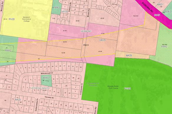
Figure
2 Land use zones in the PAO (east of Morack Road)
CONSULTATION
VicRoads is seeking Council’s
comment on a proposal to remove the PAO3 from the majority of the HFR and has
given Council 28 days to respond. VicRoads proposes that the amendment to
the Whitehorse Planning Scheme be through a prescribed amendment by the
Minister under section 20A (4) of the Act. A prescribed amendment is not
exhibited and public comment is not sought.
FINANCIAL
IMPLICATIONS
There are no financial implications
for Council in providing comment on the proposed amendment.
POLICY IMPLICATIONS
The amendment will facilitate
delivery of the HFR as open space and is therefore consistent with the Council
Plan 2017-2021, Direction 3: Protect and enhance our opens spaces and
natural environments. Specifically, Goal 3.1.2 Continue to retain,
enhance and increase the amount of open spaces to meet the needs of our diverse
community with amenities that encourage opportunities for shared use.
Ordinary Council Meeting 18
March 2019
9.1.4 Permanent
Significant Landscape Overlay Control, Schedule 9 (SLO9): Consideration of
further strategic work
FILE NUMBER: SF18/1688
ATTACHMENT
SUMMARY
In 2017 Council requested the Minister for Planning apply
an interim Significant Landscape Overlay (SLO) Schedule 9 across all
residential land in the municipality (excluding land already covered by an
existing SLO). Council concurrently sought Ministerial approval to exhibit
permanent SLO controls on the same basis. The Minister for Planning approved
the SLO9 on an interim basis for a period of 12 months as well as directing
Council to undertake further strategic work before seeking to re-apply the SLO
on a permanent basis.
This report outlines the recommendations of the further
strategic work undertaken and seeks Council’s adoption of the work before
submitting it to the Minister for Planning along with an application to apply
the SLO on a permanent basis.
|
RECOMMENDATION
That Council:
1. Adopt
the further strategic work as requested by the Minister for Planning as shown
in Attachment 1 to support the application of the Significant Landscape
Overlay on a permanent basis.
2. Provide
the further strategic work to the Minister for Planning with a new request to
prepare and exhibit an amendment to the Whitehorse Planning Scheme to apply
the Significant Landscape Overlay on a permanent basis and make associated
policy updates, generally in accordance with the draft planning controls in
Attachment 2.
|
background
In December 2015 Council engaged
planning consultants to undertake the Whitehorse Municipal Wide Tree Study
(the Study). The aim of the project was to strengthen the effectiveness of the
City of Whitehorse in protecting and enhancing canopy tree cover on private
property.
At the meeting on 18 July 2016
Council resolved, amongst other things, to:
Seek authorisation from the
Minister for Planning to prepare and exhibit an amendment to the Whitehorse
Planning Scheme to implement Scenario B – Extend the Significant
Landscape Overlay to all residential zoned land in the municipality.
On 26 May 2017 Council submitted a
request to the Minister for Planning (the Minister) to approve an amendment to
the Whitehorse Planning Scheme (Planning Scheme) to include all residential
land in the Significant Landscape Overlay (SLO) on an interim basis (Amendment
C191). Council also sought authorisation to prepare and exhibit Amendment C196
to include all residential land in the SLO on a permanent basis. The
amendments related to residential land not already included in a permanent SLO
via schedules 1 – 8 of Clause 42.03.
On 28 December 2017 the Minister
approved Schedule 9 to the SLO on an interim basis until 31 December 2018 (as
Amendment C191). The Minister refused Council’s request to prepare and
exhibit Amendment C196 and directed Council to undertake further strategic work
before submitting a new request to apply the same controls on a permanent
basis. The further strategic work includes undertaking a strategic assessment
of the landscape character of the municipality to demonstrate that the
application of the proposed tree controls was across areas considered
significant.
On 18 December 2018 the Minister
for Planning extended the lapse date for the interim SLO by 6 months until 30
June 2019 (as Amendment C214). If needed, a request can be made to the Minister
for Planning to further extend the lapse date of the interim SLO to allow the
completion of the amendment process.
In August 2018 Council engaged
planning consultants Ethos Urban to assist Council in undertaking the further
strategic work. This work has now been completed and is being presented to
Council for adoption (refer Attachment 1).
DISCUSSION
The purpose of the further work is
to strategically justify the broader application of permanent tree protection
provisions under the SLO. As a result the key objectives are to:
· Strengthen
the strategic framework to support canopy tree retention in Whitehorse
· Demonstrate
that additional tree controls will not unduly impact on the ability of
Whitehorse to provide additional housing stock
· Minimise
the administrative burden of the new tree controls and ensure they make
appropriate use of the Victoria Planning Provisions.
The further work builds on the
Municipal Wide Tree Study adopted by Council in 2016 and seeks to analyse
and address potential issues, and to reinforce the strategic justification for
the tree controls. In particular the Study responds to the Minister’s
request to undertake a strategic assessment of the landscape character of the
municipality, as well as demonstrate that Whitehorse can continue to adequately
provide for projected housing demand.
The further work has involved the
following:
· Reviewing
and analysing the strategic context for tree controls including the Local
Planning Policy provisions and Whitehorse Urban Forest Strategy
· Reviewing
and analysing the statutory controls that currently apply
· Analysing
the administration of SLO9, VCAT decisions and stakeholder and community
feedback
· Reinforcing
the importance of canopy trees in Whitehorse as well as the benefits of canopy
trees in an urban environment
· Undertaking
a landscape assessment to demonstrate the importance of canopy trees and which
species make the most significant contribution to different areas of Whitehorse
· Analysing
housing growth and vegetation protection including population and development
projections, spatial distribution of current and projected development and the
implications for housing capacity in Whitehorse
· Modelling
the potential effect of tree retention of the ability to develop different
residential lots and create various housing typologies
· Discussing
the mechanisms available to enhance canopy coverage including existing
mechanisms and alternative mechanisms
· Investigating
the impact of State Government reforms on housing capacity in comparison to
vegetation protection
· Examining
the use of alternative planning scheme provisions to provide an appropriate
outcome
· Analysing
whether tree controls can be rationalised
· Revising
the interim controls to expand the permit exemptions available
· Analysing
a simplified permit assessment process.
Assessment of landscape
character
The further work included a
landscape assessment by Ecology and Heritage Partners. This included analysis
of existing characteristics and preferred character statements from the
Whitehorse Neighbourhood Character Study and undertaking a field assessment of
selected precincts.
The landscape assessment found that
the existing characteristics and preferred character statements, in terms of
canopy trees and species, generally aligned well with the trees identified
during the assessment. The landscape assessment also found that the residential
areas of Whitehorse have a strong and desirable neighbourhood character,
largely influenced by the presence of canopy trees.
A detailed review of the dominant
tree species in the Bush Suburban and Garden Suburban Character Precincts
confirms that these Neighbourhood Character Areas are appropriately defined and
that canopy trees do make a substantial contribution to neighbourhood
character. Bush Suburban areas generally contain more native species, while
Garden Suburban areas are more diverse and contain a mix of native and exotic
trees.
A number of areas are identified as
having a high level of discernibly consistent canopy trees, which further
emphasises the dominant contribution of canopy trees to neighbourhood character
throughout the municipality.
The assessment highlighted that
tree retention alone will not achieve the 30% target of the Interim Urban
Forest Strategy, and that greater emphasis needs to be placed on residential
development achieving canopy cover through the establishment of new canopy
trees. Tree canopy cover across the municipality is currently at approximately
21% based on tree height starting at 3 metres (DELWP, 2018).
Impact on housing capacity
The further work looked at the
housing capacity and future development assumptions from the 2014 Housing
and Neighbourhood Character Review, existing tree canopy cover and the
proposed application of the SLO within the Residential Growth, General
Residential and Neighbourhood Residential Zones. The further work has
concluded that introduction of the permanent SLO is not expected to have an
unreasonable impact on the City’s capacity to accommodate projected
population and dwelling growth in the residential zones. Noting that the proposed
SLO does not apply to other zones such as the Commercial and Mixed Use Zones
where significant higher density housing growth is also directed. Attachment 1
provides further detail on this analysis.
Recommendations from further
work
The further work makes the
following recommendations regarding the permanent statutory controls:
· Modify
the Municipal Strategic Statement to strengthen its emphasis on tree canopy
protection and enhancement, and include reference to the Urban Forest Strategy
and its 30% tree canopy target.
· Amend
Clause 21.05 (Environment) of the Planning Scheme to:
o Provide support for the
application of permanent SLO9
o Exclude land within SLO9
from the minimum lot size policy that applies to other SLO schedules
· Amend
Clause 22.04 (Tree Conservation) of the Planning Scheme to:
o Strengthen references to
canopy trees in the policy basis
o Strengthen the
objectives to ensure that new development provides sufficient space for new and
replacement trees
o Clarify the relationship
between vegetation controls and ResCode planting requirements by:
§ prioritising tree retention
over planting requirements
§ placing emphasis on achieving
equivalent canopy through offset planting
§ allowing zone tree planting
requirements to be taken into account when calculating offsets
o Refine the provisions
relating to buildings and works near existing trees to provide for a minimum
setback of 3m in SLO9 rather than the 4m that applies to SLOs 1-8
o Refine the provisions
relating to tree regeneration to provide for a minimum area of 35sqm in SLO9
rather than the 50sqm that applies to SLO1-8
o Clarify the
circumstances under which an arborist report is required and ensure that
reports, when required, address all aspects of the local policy
· Amend
Schedule 9 to the SLO to:
o Strengthen the landscape
character objective to include reference to replacement trees
o Introduce new vegetation
removal exemptions providing for the removal, destruction or lopping without a
permit for:
§ Trees located less than 3
metres from the wall of a dependent person’s unit, dwelling including a
garage attached to a dwelling (aligning the provision with the local policy
setback requirement)
§ Trees located less than 3
metres from an in-ground swimming pool
§ Environmental weeds (see further
discussion below)
§ Trees around public utilities
including powerlines, services within easements and the like (see further
discussion below)
§ Street trees in line with
Council’s Street Tree Policy.
o Add a note clarifying
that the exemption provisions do not authorise the removal, destruction or
lopping of trees required by existing planning permits.
o Add a table containing a
list of environmental weeds.
o Add a provision to allow
approved planning permits granted prior to the introduction of the interim SLO9
controls on 8 February 2018 to be exempt from the tree removal trigger.
· Amend
the planning scheme maps and associated schedules to remove the area-based
Vegetation Protection Overlay Schedules 2 and 4 from properties (as per
Amendment C196) as they would duplicate tree controls for these areas.
The draft planning controls that
are intended to form the basis of the new planning scheme amendment request are
included in Attachment 2 (with changes tracked).
Permit trigger – tree size
It is intended to retain the
planning permit triggers that are currently in the interim SLO9. That is,
a planning permit is required to remove, lop or destroy a tree that is 5 metres
or more in height and/or with a trunk circumference of greater
than 1 metre measured at 1 metre above the ground. Trees under this
height and trunk circumference are exempt from the need for a
planning permit. This is intended to protect taller trees with narrower trunks
(for newly establishing trees / future canopy) and shorter trees with wider
trunks (which have reached maturity and contribute to the neighbourhood
character).
Environmental weeds
The further work has identified
that VCAT has generally not attributed retention value to trees designated as
environmental weeds. Although it is acknowledged that some environmental weeds
may contribute to neighbourhood character and canopy cover in some parts of the
municipality, Council does discourage their planting because of their
propensity to invade native bushland. Therefore the further work recommends
that an exemption be created for trees identified as environmental weeds, which
is consistent with neighbouring municipalities.
It is recommended that the
following environmental weeds be exempt from needing a permit to remove:
· Box
Elder (Acer negundo)
· Cape
Wattle (Paraserianthes lopantha)
· Cherry
Plum (Prunus cerasifera)
· Cootamundra
Wattle (Acacia baileyana)
· Cotoneaster
(Cotoneaster spp.)
· Desert
Ash (Faxinus angustifolia)
· Hawthorn
(Crategus monoyna)
· Mirror
Bush (Coprosma repens)
· Privet
(Ligustrum spp.)
· Radiata
or Monterey Pine (Pinus radiata)
· Sallow
Wattle (Acacia longifolia)
· Sweet
Pittosporum (Pittosporum undulatum)
· Willow
(Salix spp.)
These species of environmental
weeds have potential to grow in excess of 5 metres and have been identified as
species that can affect native or indigenous species located in Whitehorse.
State legislated “noxious weeds” are already exempt under the
broader provisions of the SLO. Council’s ParksWide department has reviewed
the recommended weeds list and support the inclusion of the above species.
Public assets - powerlines,
easements and street trees
Concerns have been raised about
trees which could affect powerlines or utilities within easements or
right-of-ways. It is recommended that an exemption from the need for a planning
permit apply to trees in these instances (which are included in the definition
of ‘utility installation’ under the Planning Scheme).
For example:
To remove, destroy or lop the
minimum extent of vegetation necessary to maintain public utility services for
the transmission of water, sewage, gas, electricity, electronic communications
or the like.
Street trees should also be exempt
from the need for a planning permit as their management is subject to other
well established Council processes, such as Council’s Street Tree Policy
which is proposed to be reviewed.
Non-statutory mechanisms
Aside from the statutory controls
outlined above, awareness and education of the importance of trees has
consistently been identified as a key component which underpins the protection
and enhancement of tree canopy. Council currently undertakes a tree education
and awareness program which aims to raise awareness about the benefits of trees
in an urban environment. The municipal wide canopy target of 30% will not be
reached unless there are additional trees planted on private land. The tree
education program will assist with promoting tree planting and retention.
Future work
The further strategic work also discussed
the mechanisms available to enhance canopy coverage given that the municipal
wide canopy target of 30% will not be reached unless there are additional trees
planted on private land. The work recommends investigating further the merits
of introducing a “Tree Planting Area” for private land.
The Tree Planting Area concept aims
to ensure sufficient space for existing and / or new trees on development sites
toward achieving the municipal wide tree canopy target as discussed in
Council’s Urban Forest Strategy. The Tree Planting Area proposes
that canopy tree planting relate to the development site overall by setting
aside a percentage of the site for the purpose of retaining or establishing
trees instead of on a per dwelling basis. It is intended that the Tree Planting
Area could align with the existing mandatory Garden Area provisions introduced
more broadly into the General and Neighbourhood Residential Zones by the state
government.
The Interim Urban Forest Strategy
needs to be finalised to determine how the municipal wide canopy target can be
applied across the municipality, how this would relate to private development
on a per lot basis and how ideas such as a Tree Planting Area could assist. The
Tree Planting Area concept also requires further consideration of the existing
tree planting requirements contained in the schedules to the residential zones
in the planning scheme and the performance of these requirements with the
recently introduced Garden Area requirements. This did not form part of the
current scope for the further strategic work and therefore requires additional
work to be conducted in the future.
CONSULTATION
The Municipal Wide Tree Study
included community consultation and Council invited feedback on the draft study
in April and May 2016. The community consultation undertaken for the Tree Study
included:
· Notification
in the Whitehorse Leader for four weeks between late April and mid-May. This
notification included advertising the project webpage, drop in sessions and how
to comment on the draft report;
· Three
drop in sessions (held at Sportlink, Box Hill Mall and Blackburn Lake Visitor
Centre);
· Project
webpage for the life of the project which is still active today and includes
the documents associated with the project; and
· Three
project bulletins over the life of the project (which are available on the
project webpage).
Council received a variety of
feedback which was incorporated into the Final Options and Recommendations
Report.
All owners and occupiers of land
included in the Neighbourhood Residential Zone, General Residential Zone,
Residential Growth Zone and Low Density Residential Zone that was not already
covered by the Significant Landscape Overlay were sent a letter when the
interim controls were first introduced via Amendment C191 in February 2018.
Information was also made available on Council’s website or on a flyer
which could be accessed online or at Council’s Customer Service Centres.
Council did not seek submissions
regarding the controls as interim controls do not proceed through the normal
statutory exhibition process. Council received numerous phone and counter
inquiries where residents were seeking clarification regarding the interim
controls. Council also received approximately 70 written inquiries or feedback
which officers responded to and provided information where requested.
If the Minister for Planning
approves the preparation of the permanent controls, Council anticipates that a
full planning scheme amendment process would follow and at that stage, the
community will have an opportunity to make formal comment on the amendment
during the exhibition process. Council may have the opportunity to apply for an
extension to the interim SLO9 if needed.
FINANCIAL
IMPLICATIONS
Planning scheme amendment costs can
include statutory fees of approximately $3000, preparation of the amendment and
notification documents and an independent planning panel. $50,000 has been
allocated in the 2019/20 budget to undertake the amendment. However additional
fees may arise if there is a lengthy planning panel process and/or if direct
notification is used during the exhibition period.
The extension of the SLO will
result in more planning permit applications as more tree removals may require a
planning permit. This would result in the need for additional resources for
assessment of applications, as well as monitoring and enforcement. The Council
Report in July 2016 noted that additional staff will include up to 3 arborists,
up to 2 enforcement officers and 1 administrative officer, which would cost
approximately $499,000 pa (plus 12.5% on costs such as superannuation) for
salaries (based on arborists, rather than planning staff). There will be
$163,000 upfront capital costs which would include overheads such as office
space and fleet vehicles etc. These costs were adopted as part of the 2017/18
budget process, noting that the costs associated with additional staff will be
ongoing. As part of the Planning Scheme Amendment Process, the independent
Planning Panel will seek assurances that Council has the ability to resource
the implementation of the proposed controls. A commitment by Council to the
funding outlined above is therefore critical.
POLICY IMPLICATIONS
Extending the SLO controls on a
permanent basis to the remaining residential areas not already covered by SLO1
– SLO8 will create new permit requirements for these areas. However it is
proposed to only apply the requirements to trees considered canopy trees under
the definition contained in the revised Schedule 9 to the SLO. The further work
has recommended clarifying the permit exemptions previously included in the
interim controls. Exemptions such as those relating to environmental weeds will
clarify the permit requirements for landowners and remove the administrative
burden for the removal of identified environmental weeds.
The further work also recommends
improving planning policy within the LPPF irrespective of any other tools and
mechanisms that could be put in place to protect trees. By undertaking an
amendment to the Planning Scheme, the MSS would be amended to strengthen the
discussion about the roles and values of vegetation within Whitehorse. It is
also proposed to amend the MSS to include reference to the Urban Forest
Strategy and its tree canopy target.
It is recommended to amend Clause
22.04 (Tree Conservation) to strengthen the objectives to enhance tree canopy
cover across the municipality and provide further refinement to provisions
relating to buildings and works. I.
Additionally, Direction 6.4 of Plan Melbourne 2017-2050 is
to ‘Make Melbourne cooler and greener’. This direction outlines the
benefits of urban greening and notes that Melbourne needs to maintain its urban
forest of trees and vegetation on properties. Additionally Policy 6.4.1 is to
‘Support a cooler Melbourne by greening urban areas, buildings, transport
corridors and open spaces to create an urban forest’. This policy notes
that “residential development provisions must be updated to mitigate
against the loss of tree canopy cover and permeably surfaces as a result of
urban intensification”.
CONCLUSION
There has been a concern that the
neighbourhood character of Whitehorse will be diminished if trees are removed
or lopped and therefore Council undertook the Municipal Wide Tree Study.
Council subsequently sought an amendment to the Planning Scheme to implement
the recommendations of the Study.
The Minister approved a new
schedule to the SLO on an interim basis and requested Council undertake a
strategic assessment of the landscape character of the municipality to support
applying the same controls on a permanent basis.
This report discusses the
comprehensive work undertaken as part of the further strategic work, including
the financial implications to Council as well as the benefits of implementing
further planning controls. The further work has also undertaken a landscape
assessment as requested by the Minister and looked to reconcile housing growth
and vegetation protection across the municipality.
The further strategic work
reiterates that the SLO is the only tool within the Victoria Planning
Provisions that can protect canopy trees for their collective aesthetic value
and relate their contribution to neighbourhood character. The further work
recommends revising Schedule 9 to the SLO to include additional permit
exemptions to simplify the permit process. The further work also recommends
amending the local planning policy at Clause 22.04 to reinforce the importance
of retaining canopy trees in Whitehorse. The consultants believe that this will
support the application of the controls on a permanent basis and balance the
parallel policy objectives of vegetation protection and housing growth.
This report recommends that Council
adopt the further work undertaken by Ethos Urban and present this to the
Minister for Planning as part of a new request to prepare and exhibit an
amendment to the Planning Scheme to apply the SLO controls across the
municipality on a permanent basis.
Attachment
1 Municipal Wide
Tree Study: Part 2 Additional Analysis (Final Report) ⇨ 
2 Draft Planning
Controls for permanent SLO9 amendment request (with tracked changes) ⇨
Ordinary Council Meeting 18
March 2019
Engineering
and Environmental
9.1.5 North East
Link: Submission to Inquiry and Advisory Committee
SUMMARY
Council has resolved to oppose the
alignment of North East Link and to strongly advocate for improved outcomes for
the Whitehorse community. An independent Inquiry and Advisory Committee
(IAC) will be appointed to hear submissions regarding the project, prior to
being considered for final approval by the Minister for Planning. This
report outlines the process for Council presenting its position to the IAC and
the budget implications.
|
RECOMMENDATION
That Council:
1. Note the process for presenting Council’s
position to the North East Link Inquiry and Advisory Committee.
2. Approve
budget expenditure of $200,000 in 2018/19 as part of the overall project
expenditure of $550,000 to ensure Council is appropriately represented during
the Inquiry and Advisory Committee phase.
|
background
Council resolved on 11 December
2017 to oppose the State Government’s decision to select the alignment of
North East Link (NEL). At its meeting on 15 October 2018, Council further
resolved to advocate strongly to the State Government, opposition and the North
East Link Authority for improved outcomes for the Whitehorse community,
particularly relating to open space, transport, noise and health and wellbeing.
A wide range of advocacy activities
have been undertaken to ensure the State Government are aware of
Council’s position regarding North East Link. These activities
include meetings, written correspondence, participation in community and
technical committees, letters to Members of Parliament, community forums and a
community survey.
NEL is a declared project under the
Major Transport Projects Act. It has been declared that an Environmental
Effects Statement (EES) must be approved by the Minister for Planning prior the
project proceeding to the construction phase.
The EES looks at the:
· Proposed
project design
· The
positive and negative changes the project will make to the existing conditions
· Approach
to mitigating negative impacts
· How
input from community and stakeholders has been considered
An independent Inquiry and Advisory
Committee (IAC) will be appointed to:
· Review
the EES documents
· Consider
written submissions from professional and community stakeholders
· Hear
verbal presentations from professional and community stakeholders
· Make
recommendations to the Minister for Planning
DISCUSSION
Council’s involvement in the
upcoming assessment of the EES involves the following process:
· Review
the EES documents when released on public exhibition. The documents will
be on exhibition for 30 business days.
· Make
a written submission regarding the EES documents
· Make
verbal presentations to the IAC’s hearing
To ensure Council is appropriately
represented through this EES phase, it is recommended that legal and technical
experts are appointed. Similar to a VCAT hearing, Council will be
expected ensure representations fit within the defined scope of the NEL project
and the scope of the IAC.
CONSULTATION
Preliminary verbal legal advice has
been received. Discussion regarding the recommended approach has been
held with the Manager Engineering and Environmental Services, General Manager
City Development and the Chief Executive Officer.
FINANCIAL
IMPLICATIONS
A New Budget Initiative (NBI) for $550,000 has been
submitted for consideration during the preparation of the draft 2019/20
budget. This funding is to cover legal and technical services associated
with making a written EES submission and representing Council at the IAC
hearing. The EES is likely to go on public exhibition prior to the 2019/20
financial year and it is expected that expenditure on these items will be
required during 2018/19. There is no approved budget in the current
2018/19 financial year for legal and technical services associated with NEL.
Council approval is requested for officers to access
$200,000 of the $550,000 NBI during 2018/19, if required. Funding
unexpended during 2018/19 will be carried over to 2019/20.
POLICY IMPLICATIONS
The NEL project
has implications for a wide range of Council strategies, including:
· Council
Plan
· Open
Space Strategy
· Sport
and Recreation Strategy
· Sustainability
Strategy
· Integrated
Transport Strategy
· Cycling
Strategy
· Urban
Forest Strategy
· Health
and Wellbeing Plan
· Whitehorse
Planning Scheme
Ordinary Council Meeting 18
March 2019
9.2 Corporate
9.2.1 Proposed
Road Discontinuance and Sale of Land Rear 24 Kangerong Road, Box Hill
SUMMARY
To commence the statutory
procedures for the proposed discontinuance and sale of part of the unmade right
of carriageway (road) at the rear of 24 Kangerong Road, Box Hill. The
section of road proposed to be discontinued and sold is shown hatched on Plan A
below.
|
RECOMMENDATION
That Council:
1. Being
of the opinion that the section of road at the rear of 24 Kangerong Road, Box
Hill, shown hatched on the plan below, is not reasonably required as a road
for public use, commence procedures under section 206 and clause 3 of
schedule 10 of the Local Government Act 1989 (“the Act”) to
discontinue and sell the road.
2. In
accordance with sections 82A, 207A and 223 of the Act give public notice of
the proposed discontinuance and sale in The Age newspaper and on Council’s
website.
3. Pursuant
to section 223 (1) of the Act, Council’s Special Committee hear any
person who in their written submission to Council has requested that they be
heard in support of their written submission.
4. Authorise
the Manager of Property and Rates to give public notice and to carry out the
necessary administrative procedures to enable the Council or its Special
Committee to meet and to carry out its functions under section 223 of the Act
on Monday 13 May 2019.
|
background
There are numerous laneways throughout the municipality,
some of which are constructed and actively used for access. Others are
unconstructed and used for access by abutting properties, whilst others are
unconstructed and not used for access or may have become subject to long term
occupation by abutting property owners.
The laneways were originally created as right of
carriageways (roads) on older plans of subdivision, usually for the purpose of
enabling night carts to collect night-soil from those properties. This practice
became obsolete when septic tanks or sewerage systems became installed.
The registered proprietor of the land title to the laneway
usually remains the original sub-divider, often a deceased person or dissolved
company. Unconstructed laneways are not included on Council’s
Register of Public Roads as their use is considered more private than
reasonably required for general public use, and as such are not owned or
maintained by Council.
Council has the authority under
the Local Government Act 1989 to discontinue a road, road includes a
right of way or a laneway, where Council forms the opinion that the right of
way is “no longer reasonably required for public use”.
Following Council undertaking a road discontinuance, it is only then that the
land vests in Council, and Council is then able to sell the road land.
In regard to the laneway in this report, Council received an
application from the owner of 24 Kangerong Road, Box Hill, for the
discontinuance and sale of the small section of road at the rear of the
property shown hatched on the plan below.
The remainder of the road at the rear of the property is
open and used for access and is not part of this proposal.
A recent site inspection has confirmed that the section of
road is enclosed within the rear of 24 Kangerong Road, Box Hill, and a
situation which appears to have prevailed for many years. Aerial photography
indicates the relevant part of the road has been occupied by 24 Kangerong Road
for in excess of 44 years. As such the section of road no longer appears used
for access.
The proposed discontinuance and sale of the land from the
road does not affect the remaining part of the laneway. Discontinuance and sale
of the land will simply bring the remaining width of the road line with the
rent of the laneway.
A Letter of Offer has been secured from the owner of 24
Kangerong Road, Box Hill, to purchase the section of land if discontinued.
Plan A below shows the extent of
the part of the road proposed for road discontinuance, as shown hatched.
Plan B below shows the proposed
allocation of the land to the abutting property owner.
Plan C below shows an aerial photo
and photo of the section of road proposed for discontinuance. The section
proposed for discontinuance is shown coloured red in the aerial photo.
DISCUSSION
The land is unencumbered and has been valued at $49,000
excluding GST. In accordance with Council’s “Discontinuance and
Sale of Unnecessary Roads Policy”, the purchase price qualifies for a 50%
discount due to long term occupation of the land for a period of 15 years or
longer.
The owner of 24 Kangerong Road, Box Hill, has confirmed
their interest in purchasing the 23m2 of land from the road that
they occupy in accordance with Councils policy, and on the basis of a purchase
price of $24,500 plus GST.
CONSULTATION
All necessary service authorities have been consulted in
respect to the proposal with no objections to the proposed
discontinuance.
There are no assets (stormwater or sewer pipes) located in
the section of road proposed to be discontinued.
The statutory procedures under the Local Government Act
1989 require Council to give public notice of its intention to discontinue
and sell the road and invite submissions from affected parties under section
223 of the Local Government Act 1989.
Public notice of the proposed discontinuance will be given
in The Age newspaper and published on Council’s website. In
addition, all abutting property owners will be advised of the proposal in
writing and informed of their right to make a submission under section 223 of
the Local Government Act 1989.
Submitters may request to be heard by Council’s
Special Committee prior to a decision being made to proceed or otherwise with
the proposal.
Key processes that are proposed if agreed by Council are:
1. Thursday
March 21: Public
Notice advertisement
2. Wednesday
April 17: Public
Notice submissions close
3. Monday
May 13: Special
Committee to hear any submission/s (if required)
4. Monday
May 27 : Report
to Council for consideration
FINANCIAL
IMPLICATIONS
After expenses, the
net proceeds to Council will be approximately $18,870 inclusive of GST.
IMPLICATIONS
The recommendations are made in accordance
with Council’s “Discontinuance and Sale of Unnecessary Roads and
Reserves” policy.
PLAN A
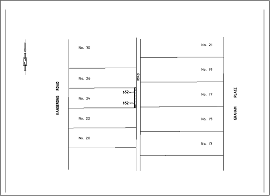
PLAN B

PLAN C
Aerial photo
overview of the part of road proposed for discontinuance
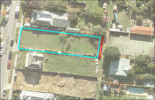
Photo of occupied
part of laneway enclosed within fence line of 24 Kangerong Rd
Ordinary Council Meeting 18
March 2019
9.2.2 Junction
Road Nunawading
FILE NUMBER: SF19/202
SUMMARY
The Crown Land known as Junction Road
Reserve is located at 161 Junction Road, Nunawading currently does not have an
appointed Committee of Management. On 11 January 2019 the Department of
Environment, Land, Water and Planning (DELWP) wrote to Council requesting that
Council explore the option of assuming the Committee of Management function for
Junction Road Reserve.
|
RECOMMENDATION
That Council:
1. Formally advise the Department of
Environment, Land, Water and Planning (DELWP) that Whitehorse City Council
would consider being the Crown Land Committee of Management for the Junction
Road Reserve at the completion of the North East Link construction works and
after the North East Link Authority have fully vacated the Junction Road
Reserve.
2. Also
advise the Department of Environment, Land, Water and Planning (DELWP) that
Council’s offer to consider becoming the Crown Land Committee of
Management for the Junction Road Reserve is subject to appropriate funding
being provided by the State Government.
|
background
On 16 April 2012 the State
Government announced that the former VicRoads freehold land at 161 Junction
Road, Nunawading (the subject property) had been surrendered to Crown
Land. Refer Plan 1:
Plan 1: Aerial image of 161
Junction Road, Nunawading
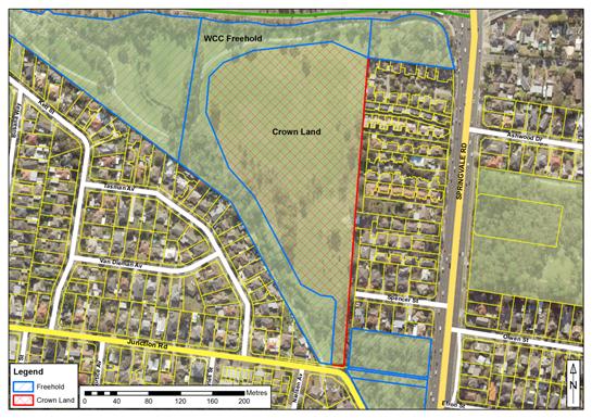
At the completion of the Eastern
Freeway construction works the subject property was deemed to be surplus by
VicRoads and the land was surrendered to the then Department of Sustainability
and Environment (DSE) who completed the conversion to Crown Land process.
The subject property is a large
sloping allotment with a land area of approximately 4.58 hectares and forms
part of the larger Koonung Creek Parklands corridor.
The subject property is zoned
Public Parks Recreation Zone (PPRZ) in accordance with the Whitehorse Planning
Scheme.
On 1 November 2012 DSE wrote to
Council advising that the subject property had become unreserved Crown Land
with no formal land manager, and that DSE were attempting to find a formal land
manager. In essence DSE’s role was to appoint a Committee of
Management (COM) for the subject property.
At Council’s Ordinary meeting
dated 18 March 2013 Council resolved the following:
“That Council:
1. Subject to appropriate funding being provided by the
State Government for the preparation of a landscape plan and the development of
the land support, in principle, becoming the committee of management of the
4.579 hectares of Crown Land on Junction Road, Nunawading.
2. Authorise the Chief Executive Officer to negotiate the
arrangements, for Council to be the committee of management of the Crown Land.
CARRIED
UNANIMOUSLY”
The issue of appropriate funding
referred to in resolution 1 above was discussed in the “Financial
Implications” section of the 18 March 2013 Council Report and this
section states the following:
“Appropriate management
and development of the land being sought by the community requires a
significant level of capital and recurrent funding. Improvements required to
improve the appearance and useability of the land could have an estimated cost
of more than $2 million over the next four years. A landscape plan should be
developed to confirm the details of improvements to the land. Generally, works
required include: car park and vehicle access/egress at Spencer Street,
fencing, signs, paths, planting of vegetation, public toilets, pedestrian
bridge, waterway/stormwater improvements, playground, lighting and water to
establish grass coverage. Base maintenance of existing conditions is $50,000
per annum.
Part of any agreement for
Council to become the committee of management should require the State
Government to provide funding for the Council to implement works that are
necessary for the area to provide the level of service that has been sought by
the community for more than a decade.”
In April 2013 DSE advised Council
that there were no funds available for the development of a landscape plan and
subsequent works. Since 2013 the subject property has remained Crown Land
with State Government contractors completing basic maintenance such grass
slashing.
In accordance with the 13 March
2013 resolution 2, the Department of Environment, Land, Water and Planning
(DELWP) wrote to Council on 11 January 2019, requesting that Council explore
the option of assuming the COM function for Junction Road Reserve.
Council, as a courtesy,
acknowledged receiving the DELWP letter and advising that the request contained
within the letter required further assessment by Council Officers.
DISCUSSION
While completing the assessment of
DELWP’s request for Council to be appointed the Crown Land COM, it was
verbally confirmed by DELWP that the North East Link Authority had made a
formal request to DELWP to occupy the subject property as a works area during
the five year construction of the North East Link road project.
It was also verbally confirmed by
DELWP that the subject property would most likely be exclusively occupied by
the North East Link Authority for the full five years and therefore unavailable
to the community.
Given that the North East Link
Authority exclusively occupancy would be for the whole construction period,
there is little incentive for Council to be appointed the COM.
It recommended that Council
formally advise DELWP that Council may consider being the COM for the subject
property once the North East Link Authority have ceased occupying the subject
property and the subject property is returned to its current state.
Additionally, in the same advice to
DELWP it is recommended that Council reaffirm its earlier 18 March 2013
resolution; that if Council were, at a future date, to be appointed the COM
that Council’s appointment would be subject to appropriate funding being
provided by the State Government for the preparation of a landscape plan and
the development of the land.
CONSULTATION
Limited discussions between
Council’s Manager Property & Rates and staff at DELWP’s Port
Phillip regional office have occurred since 11 January 2019.
FINANCIAL
IMPLICATIONS
Nil
POLICY IMPLICATIONS
Nil
Ordinary Council Meeting 18
March 2019
9.2.3 Appointment
of Authorised Officer under the Planning and Environment Act 1987
SUMMARY
The purpose of this report is to recommend
that Council resolve to appoint the named officer as an Authorised Officer
under the Planning and Environment Act 1987 and approve the execution of the
Instrument of Appointment.
|
RECOMMENDATION
That Council resolve to appoint John Guilfoyle and
Alan Harrison as Authorised Officers pursuant to the Planning
and Environment Act 1987 and that the Council Common Seal be affixed to the
Instrument of Appointment (provided as Appendix 1).
|
background
Part 6 of the Planning and Environment Act 1987 (“the
Act”) provides for the enforcement of planning schemes, planning permits
and agreements entered in accordance with Section 173 of the Act.
Investigative powers are vested in individuals appointed as
“Authorised Officers”, such as the power to enter land, apply for
an enforcement order, and file a charge and summons.
As Section 188(2) of the Act, prohibits authorisations being
made under delegation, it is up to Council to directly appoint persons as
“Authorised Officers” for the purpose of enforcing the Planning and
Environment Act 1987.
DISCUSSION
The attached Instrument of
Appointment has been prepared following advice received from Council’s
solicitors Maddocks and is similar to that used by many Victorian Councils.
The Instrument of Appointment will
come into force once Council’s Common Seal is affixed to the document.
CONSULTATION
Consultation with the General Manager City Development and
the Manager Planning and Building has been undertaken in the preparation of
this report.
FINANCIAL
IMPLICATIONS
There are no financial implications rising from the
preparation of this report.
POLICY IMPLICATIONS
There are no policy implications
arising from the preparation of this report.
APPENDIX 1
Instrument of Appointment and Authorisation
(Planning and Environment Act 1987)
In this instrument "officer" means -
· John
Guilfoyle
· Alan
Harrison
By this instrument of
appointment and authorisation Whitehorse City Council -
1. Under
section 147(4) of the Planning and Environment Act 1987 - appoints the
officer to be an authorised officer for the purposes of the Planning and
Environment Act 1987 and the regulations made under that Act; and
2. Under
section 232 of the Local Government Act 1989 authorises the officer
generally to institute proceedings for offences against the Acts and
regulations described in this instrument.
It is declared that this
instrument -
a) Comes into force immediately upon its
execution;
b) Remains in force until varied or
revoked.
This instrument is authorised by a resolution of the Whitehorse
City Council on 18 March
2019.
THE COMMON SEAL OF THE )
WHITEHORSE CITY COUNCIL )
was hereunto affixed
this day of )
March 2019 in the presence of: )
__________________________
Councillor
__________________________
Chief Executive Officer
Date:
/ /
Ordinary Council Meeting 18
March 2019
9.2.4 Delegated
Decisions January 2019
SUMMARY
The following activity was undertaken by officers under delegated
authority during January 2019.
|
RECOMMENDATION
That the report of decisions made by officers under
Instruments of Delegation for the month of January 2019 be noted.
|
|
DELEGATION
|
FUNCTION
|
Number for January 2018
|
Number for January 2019
|
|
Planning and Environment Act
1987
|
Delegated Decisions
|
87
|
78
|
|
Strategic Planning Decisions
|
Nil
|
Nil
|
|
Telecommunications Act 1997
|
|
Nil
|
1
|
|
Subdivision Act 1988
|
|
12
|
11
|
|
Gaming Control Act 1991
|
|
Nil
|
Nil
|
|
Building Act 1993
|
Dispensations & Applications to
Building Control Commission
|
86
|
56
|
|
Liquor Control Reform Act 1998
|
Objections and Prosecutions
|
2
|
Nil
|
|
Food Act 1984
|
Food Act Orders
|
8
|
2
|
|
Public Health & Wellbeing
Act 2008
|
Improvement /
Prohibition Notices
|
1
|
Nil
|
|
Local Government Act 1989
|
Temporary Rd. Closures
|
2
|
3
|
|
Other Delegations
|
CEO Signed Contracts between $150,000 - $750,000
|
Nil
|
9
|
|
Property Sales and Leases
|
4
|
2
|
|
Documents to which Council seal affixed
|
1
|
Nil
|
|
Vendor Payments
|
1006
|
1174
|
|
Parking Amendments
|
8
|
3
|
|
Parking Infringements written off (not
able to be collected)
|
313
|
232
|
DELEGATED DECISIONS MADE ON PLANNING APPLICATIONS JANUARY
2019
All decisions are the subject of conditions which may in some
circumstances alter the use of development approved, or specific grounds of
refusal is an application is not supported.
|
Appl No.
|
Date
|
Decision
|
Street Address
|
Ward
|
Proposed Use
|
Appl Type
|
|
WH/2014/1171/B
|
31-01-19
|
Delegate Approval - S72 Amendment
|
28 Junction Road Blackburn North Vic 3130
|
Central
|
Amendment to Planning Permit WH/2014/1171
(Issued for buildings and works to construct a double storey dwelling to the
rear of the existing dwelling) for modifications to the design and layout of
the garage and car space to Dwelling 2
|
Permit Amendment
|
|
WH/2014/280/A
|
03-01-19
|
Delegate Approval - S72 Amendment
|
208 Blackburn Road Blackburn South Vic
3130
|
Central
|
Construction of two double storey
dwellings and one single storey dwelling
|
Permit Amendment
|
|
WH/2014/559/B
|
04-01-19
|
Delegate Approval - S72 Amendment
|
99 Morack Road Vermont South Vic 3133
|
Morack
|
Development of the land for 16 dwellings
and removal of native vegetation
|
Permit Amendment
|
|
WH/2014/761/B
|
23-01-19
|
Delegate Approval - S72 Amendment
|
647 Canterbury Road Vermont Vic 3133
|
Springfield
|
Construction of five dwellings comprising
four double storey dwellings and one single storey dwelling
|
Permit Amendment
|
|
WH/2015/794/B
|
17-01-19
|
Delegate Approval - S72 Amendment
|
367-369 Mont Albert Road Mont Albert Vic
3127
|
Elgar
|
Use of land for sale and consumption of
liquor and reduction in the standard car parking requirements (for a
restaurant use)
|
Permit Amendment
|
|
WH/2016/481/A
|
23-01-19
|
Delegate Approval - S72 Amendment
|
1087 Riversdale Road Surrey Hills Vic
3127
|
Riversdale
|
Construction of four attached double
storey dwellings above basement and alteration of access to a road in a Road
Zone Category 1 and associated removal of protected trees and construction of
buildings and carrying out of works within 4 metres of trees protected under
the Significant Landscape Overlay Schedule 9
|
Permit Amendment
|
|
Appl No.
|
Date
|
Decision
|
Street Address
|
Ward
|
Proposed Use
|
Appl Type
|
|
WH/2016/626/A
|
29-01-19
|
Delegate Approval - S72 Amendment
|
9 Esta Street Blackburn North Vic 3130
|
Central
|
Construction of two (2) double storey
dwellings
|
Permit Amendment
|
|
WH/2017/782/A
|
11-01-19
|
Delegate Approval - S72 Amendment
|
21 Graham Place Box Hill Vic 3128
|
Elgar
|
The construction of two (2) double storey
dwellings and tree removal
|
Permit Amendment
|
|
WH/2017/92/A
|
29-01-19
|
Delegate Approval - S72 Amendment
|
395 Middleborough Road Box Hill Vic 3128
|
Elgar
|
Buildings and works to construct a fence,
pedestrian path and asphalt internal road and vegetation removal
|
Permit Amendment
|
|
WH/2011/486/A
|
11-01-19
|
Delegate NOD Issued
|
117 Springfield Road Blackburn North Vic
3130
|
Central
|
Buildings and works for extension to
existing medical centre, a waiver of parking requirements associated with
increasing practitioner numbers from 2 to 4 and tree removal
|
Permit Amendment
|
|
WH/2017/906
|
25-01-19
|
Delegate NOD Issued
|
58 Mount Pleasant Road Nunawading Vic
3131
|
Springfield
|
Construction of Two (2) Double Storey
Dwellings
|
Multiple Dwellings
|
|
WH/2018/1059
|
09-01-19
|
Delegate NOD Issued
|
16 Walwa Street Mitcham Vic 3132
|
Springfield
|
Construction of two (2) double storey
dwellings with vegetation removal and buildings and works within 4 metres of
protected vegetation
|
Multiple Dwellings
|
|
WH/2018/254
|
03-01-19
|
Delegate NOD Issued
|
26 Stanley Grove Blackburn Vic 3130
|
Central
|
Construct two double storey dwellings,
tree removal and buildings and works within Special Building Overlay
|
Multiple Dwellings
|
|
WH/2018/602
|
04-01-19
|
Delegate NOD Issued
|
87 Benwerrin Drive Burwood East Vic 3151
|
Riversdale
|
Construction of two (2) double storey
dwellings on a lot & buildings and works within 4 metres of protected
vegetation
|
Multiple Dwellings
|
|
WH/2018/645
|
04-01-19
|
Delegate NOD Issued
|
1 Bundarra Court Vermont South Vic 3133
|
Morack
|
Construction of two (2), two storey
dwellings and associated buildings and works within trees protected under the
Significant Landscape Overlay Schedule 9 (SLO9)
|
Multiple Dwellings
|
|
Appl No.
|
Date
|
Decision
|
Street Address
|
Ward
|
Proposed Use
|
Appl Type
|
|
WH/2018/76
|
24-01-19
|
Delegate NOD Issued
|
636-642 Whitehorse Road Mitcham Vic 3132
|
Springfield
|
Use of the land for industry including
construction of buildings and works and alteration of access to a Road Zone
Category 1
|
Business
|
|
WH/2018/830
|
29-01-19
|
Delegate NOD Issued
|
27 Rostrevor Parade Mont Albert North Vic
3129
|
Elgar
|
CONSTRUCTION OF TWO (2) DOUBLE STOREY
DWELLINGS ON A LOT AND REMOVAL OF VEGETATION
|
Multiple Dwellings
|
|
WH/2018/860
|
16-01-19
|
Delegate NOD Issued
|
18 Lawford Street Box Hill North Vic 3129
|
Elgar
|
The development of the land for buildings
and works to existing dwelling (carport addition) and construction of a
double storey dwelling to the rear including associated buildings and works
within 4 metres of protected trees and tree removal
|
Multiple Dwellings
|
|
WH/2018/886
|
24-01-19
|
Delegate NOD Issued
|
14 Wattle Valley Road Mitcham Vic 3132
|
Springfield
|
Removal of two (2) protected SLO6 Trees
|
Special Landscape Area
|
|
WH/2018/929
|
04-01-19
|
Delegate NOD Issued
|
70 Hedge End Road Nunawading Vic 3131
|
Springfield
|
Construction of two (2) double storey
dwellings on a lot with buildings and works within 4 metres of protected
vegetation
|
Multiple Dwellings
|
|
WH/2018/937
|
09-01-19
|
Delegate NOD Issued
|
1/1-3 Glen Ebor Avenue Blackburn
Vic 3130
|
Central
|
Vegetation removal
|
Special Landscape Area
|
|
WH/2016/795/B
|
17-01-19
|
Delegate Permit Issued
|
22 Sandy Street Nunawading Vic 3131
|
Springfield
|
Construction of two double storey
dwellings with an existing dwelling
|
Permit Amendment
|
|
WH/2017/817
|
09-01-19
|
Delegate Permit Issued
|
929 Station Street Box Hill North Vic
3129
|
Elgar
|
Buildings and works within 4m of
protected trees and tree removal, alteration of road access to a Category 1
Road Zone, and business identification signage in association with a medical
centre.
|
Business
|
|
WH/2018/1051
|
25-01-19
|
Delegate Permit Issued
|
7 Uganda Street Burwood Vic 3125
|
Riversdale
|
Construct a front fence on a land lot
size less than 300 square metres
|
Single Dwelling < 300m2
|
|
Appl No.
|
Date
|
Decision
|
Street Address
|
Ward
|
Proposed Use
|
Appl Type
|
|
WH/2018/1115
|
03-01-19
|
Delegate Permit Issued
|
385-395 Burwood Highway Vermont South Vic
3133
|
Morack
|
1 x pylon 6m x 2m internally illuminated with
2.45sqm LED screen on one side only
|
Advertising Sign
|
|
WH/2018/1169
|
17-01-19
|
Delegate Permit Issued
|
12 Kildare Street Burwood Vic 3125
|
Riversdale
|
Buildings and works within 4 metres of
protected SLO9 trees and vegetation removal
|
Special Landscape Area
|
|
WH/2018/1209
|
07-01-19
|
Delegate Permit Issued
|
12 Simon Street Blackburn North Vic 3130
|
Central
|
Vegetation removal
|
Special Landscape Area
|
|
WH/2018/1214
|
23-01-19
|
Delegate Permit Issued
|
23a Tiller Street Burwood East Vic 3151
|
Riversdale
|
2 lot subdivision
|
Subdivision
|
|
WH/2018/1272
|
09-01-19
|
Delegate Permit Issued
|
47 Victoria Crescent Mont Albert Vic 3127
|
Elgar
|
Construction of front fence within 4m of
a protected and street tree and tree protected under SLO9
|
VicSmart - General Application
|
|
WH/2018/1273
|
03-01-19
|
Delegate Permit Issued
|
18 Aberdeen Road Blackburn South Vic 3130
|
Central
|
Buildings and works within 4 metres of a
protected tree
|
VicSmart - General Application
|
|
WH/2018/1283
|
09-01-19
|
Delegate Permit Issued
|
1/639 Canterbury Road Vermont Vic 3133
|
Springfield
|
The construction of a 1200mm high street
front fence, within 3 metres of a street in Road Zone Category 1, on a lot
less than 300sqm in NRZ3 and SBO.
|
VicSmart - General Application
|
|
WH/2018/1284
|
17-01-19
|
Delegate Permit Issued
|
Flat 2 Beresford Street Mont Albert Vic
3127
|
Elgar
|
Removal of three (3) trees &
buildings and works within 4 metres of protected vegetation
|
Special Landscape Area
|
|
WH/2018/1390
|
04-01-19
|
Delegate Permit Issued
|
1a Deanswood Road Forest Hill Vic 3131
|
Central
|
Buildings and works (construct a front
fence) within 4 metres of protected vegetation
|
VicSmart - General Application
|
|
WH/2018/1393
|
08-01-19
|
Delegate Permit Issued
|
3/1 Morden Court Nunawading Vic 3131
|
Springfield
|
Buildings and works (construct a roof
over existing deck) on a land lot size less than 500 square metres
|
VicSmart - General Application
|
|
WH/2018/1418
|
22-01-19
|
Delegate Permit Issued
|
1a/194-196 Whitehorse Road Blackburn Vic
3130
|
Central
|
Building and works for the construction
of a first-floor mezzanine
|
VicSmart - General Application
|
|
WH/2018/178
|
03-01-19
|
Delegate Permit Issued
|
5 Russell Street Nunawading Vic 3131
|
Springfield
|
Construction of two double storey
townhouses on a lot
|
Multiple Dwellings
|
|
Appl No.
|
Date
|
Decision
|
Street Address
|
Ward
|
Proposed Use
|
Appl Type
|
|
WH/2018/255
|
29-01-19
|
Delegate Permit Issued
|
2 Elmhurst Road Blackburn Vic 3130
|
Central
|
The construction of two double storey
dwellings, buildings and works within 4 metres of vegetation and vegetation
removal.
|
Multiple Dwellings
|
|
WH/2018/261
|
02-01-19
|
Delegate Permit Issued
|
1a Abelia Street Nunawading Vic 3131
|
Springfield
|
Construction of a two storey dwelling in
Heritage Overlay (HO112)
|
Heritage
|
|
WH/2018/287
|
17-01-19
|
Delegate Permit Issued
|
7 Second Avenue Box Hill North Vic 3129
|
Elgar
|
Construction of Two (2) Double Storey
Dwellings on a Lot and Removal of Vegetation
|
Multiple Dwellings
|
|
WH/2018/298
|
09-01-19
|
Delegate Permit Issued
|
463-465 Whitehorse Road Mitcham Vic 3132
|
Springfield
|
Construction of four, two storey
dwellings and associated removal of trees within the Significant Landscape
Overlay Schedule 9 (SLO9) and alteration of access to a Road Zone, Category 1
|
Multiple Dwellings
|
|
WH/2018/526
|
23-01-19
|
Delegate Permit Issued
|
112 Surrey Road Blackburn North Vic 3130
|
Central
|
Development of the land for two (2)
double storey dwellings, creation of access to a road zone category 1,
buildings and works within 4 metres of protected trees and tree removal
|
Multiple Dwellings
|
|
WH/2018/529
|
17-01-19
|
Delegate Permit Issued
|
68 Vanbrook Street Forest Hill Vic 3131
|
Morack
|
The construction of a dwelling at the
rear of the existing dwelling on a lot, buildings and works within 4 metres
of vegetation and vegetation removal.
|
Multiple Dwellings
|
|
WH/2018/555
|
03-01-19
|
Delegate Permit Issued
|
36 Davison Street Mitcham Vic 3132
|
Springfield
|
Buildings and works within 4 metres of
vegetation and vegetation removal.
|
Special Landscape Area
|
|
WH/2018/638
|
29-01-19
|
Delegate Permit Issued
|
15 Beddows Street Burwood Vic 3125
|
Riversdale
|
Construction of Three (3) Double Storey
Dwellings on a Lot and Vegetation Removal
|
Multiple Dwellings
|
|
WH/2018/661
|
03-01-19
|
Delegate Permit Issued
|
8 Orloff Court Burwood East Vic 3151
|
Riversdale
|
Buildings and works within 4 metres and
removal of trees protected under the SLO9
|
Special Landscape Area
|
|
Appl No.
|
Date
|
Decision
|
Street Address
|
Ward
|
Proposed Use
|
Appl Type
|
|
WH/2018/693
|
08-01-19
|
Delegate Permit Issued
|
388 Station Street Box Hill South Vic
3128
|
Riversdale
|
Development of two double storey
dwellings, tree removal and construction of a front fence within 4 metres of
protected trees.
|
Multiple Dwellings
|
|
WH/2018/720
|
09-01-19
|
Delegate Permit Issued
|
40 Dunlavin Road Nunawading Vic 3131
|
Springfield
|
Construction of two double storey
dwellings
|
Multiple Dwellings
|
|
WH/2018/755
|
09-01-19
|
Delegate Permit Issued
|
928 Whitehorse Road Box Hill Vic 3128
|
Elgar
|
Construct and display business
identification signs within a heritage overlay
|
Advertising Sign
|
|
WH/2018/794
|
23-01-19
|
Delegate Permit Issued
|
1a Rose Street Box Hill Vic 3128
|
Elgar
|
Construct or extend one dwelling on a lot
of less than 300sqm.
|
Single Dwelling < 300m2
|
|
WH/2018/896
|
31-01-19
|
Delegate Permit Issued
|
25 Mall Court Blackburn North Vic 3130
|
Central
|
Construction of two dwellings and tree
removal
|
Multiple Dwellings
|
|
WH/2018/961
|
03-01-19
|
Delegate Permit Issued
|
160 Whitehorse Road Blackburn Vic 3130
|
Central
|
Construction and display of illuminated
Major Promotion signage
|
Advertising Sign
|
|
WH/2018/983
|
25-01-19
|
Delegate Permit Issued
|
2/731-733 Whitehorse Road Mont Albert Vic
3127
|
Elgar
|
Change of Use and Development of an
Education Facility
|
Education
|
|
WH/2018/985
|
08-01-19
|
Delegate Permit Issued
|
17-23 Stevens Road Vermont Vic 3133
|
Morack
|
Change of Use to a 48 place Childcare
Centre, buildings and works, business identification sign and reduction to
the required car parking rate
|
Residential (Other)
|
|
WH/2019/16
|
18-01-19
|
Delegate Permit Issued
|
51 Lemon Grove Nunawading Vic 3131
|
Springfield
|
Removal one (1) tree
|
VicSmart - Tree
|
|
WH/2019/26
|
22-01-19
|
Delegate Permit Issued
|
15 Oliver Avenue Blackburn Vic 3130
|
Central
|
Vegetation removal
|
VicSmart - Tree
|
|
WH/2019/27
|
22-01-19
|
Delegate Permit Issued
|
14 Laughlin Avenue Nunawading Vic 3131
|
Springfield
|
Vegetation removal (Tree 1 Fraxinus
angustifolia – Desert Ash)
|
VicSmart - Tree
|
|
WH/2019/29
|
29-01-19
|
Delegate Permit Issued
|
14 Laughlin Avenue Nunawading Vic 3131
|
Springfield
|
Removal of 1 tree Eucalyptus botryoides -
Southern Mahogany
|
VicSmart - Tree
|
|
WH/2019/30
|
29-01-19
|
Delegate Permit Issued
|
14 Laughlin Avenue Nunawading Vic 3131
|
Springfield
|
Vegetation removal
|
VicSmart - Tree
|
|
WH/2019/33
|
25-01-19
|
Delegate Permit Issued
|
4 Meadow Court Blackburn South Vic 3130
|
Riversdale
|
Removal of one (1) tree in an SLO9
|
VicSmart - Tree
|
|
Appl No.
|
Date
|
Decision
|
Street Address
|
Ward
|
Proposed Use
|
Appl Type
|
|
WH/2019/40
|
30-01-19
|
Delegate Permit Issued
|
6 Goddard Court Mont Albert North Vic
3129
|
Elgar
|
Removal of one tree
|
VicSmart - Tree
|
|
WH/2019/48
|
30-01-19
|
Delegate Permit Issued
|
13 Susanne Avenue Nunawading Vic 3131
|
Springfield
|
Removal of one (1) tree
|
VicSmart - Tree
|
|
WH/2019/5
|
21-01-19
|
Delegate Permit Issued
|
41 Marchiori Road Blackburn North Vic
3130
|
Central
|
Buildings and works (construct a front
fence) with 4 metres of protected vegetation
|
VicSmart - General Application
|
|
WH/2019/58
|
30-01-19
|
Delegate Permit Issued
|
46 Churinga Avenue Mitcham Vic 3132
|
Springfield
|
Removal of one (1) tree
|
VicSmart - Tree
|
|
WH/2019/6
|
22-01-19
|
Delegate Permit Issued
|
31 Fowler Street Box Hill South Vic 3128
|
Riversdale
|
Two lot subdivision
|
Subdivision
|
|
WH/2019/7
|
23-01-19
|
Delegate Permit Issued
|
28a Park Road Surrey Hills Vic 3127
|
Riversdale
|
Construction of front fence within 4
metres of an SLO9 tree
|
VicSmart - General Application
|
|
WH/2018/1138
|
03-01-19
|
Delegate Refusal Issued
|
80 Severn Street Box Hill North Vic 3129
|
Elgar
|
Proposed nine three-storey dwellings and
removal of trees within SLO9
|
Multiple Dwellings
|
|
WH/2018/374
|
24-01-19
|
Delegate Refusal Issued
|
25 Watts Street Box Hill Vic 3128
|
Elgar
|
Construction of seven terrace houses,
each unit has three storeys with basement parking, buildings and work, and associated
tree removal
|
Multiple Dwellings
|
|
WH/2018/824
|
30-01-19
|
Delegate Refusal Issued
|
11 Branksome Grove Blackburn South Vic
3130
|
Central
|
Construction of two (2) double storey
Dwellings and removal of trees
|
Multiple Dwellings
|
|
WH/2018/922
|
11-01-19
|
Delegate Refusal Issued
|
52 Parkmore Road Forest Hill Vic 3131
|
Morack
|
The development of land for buildings and
works to existing dwelling and construction of a double storey to the rear of
existing dwelling, including associated buildings and works within 4 metres
of protected trees and tree removal
|
Multiple Dwellings
|
|
WH/2019/28
|
29-01-19
|
Delegate Refusal Issued
|
14 Laughlin Avenue Nunawading Vic 3131
|
Springfield
|
Removal of 1 tree Brachychiton
acerifolius - Illawarra Flame Tree
|
VicSmart - Tree
|
|
WH/2019/32
|
25-01-19
|
Delegate Refusal Issued
|
4 Meadow Court Blackburn South Vic 3130
|
Riversdale
|
Removal of one (1) tree in an SLO9
|
VicSmart - Tree
|
|
Appl No.
|
Date
|
Decision
|
Street Address
|
Ward
|
Proposed Use
|
Appl Type
|
|
WH/2019/34
|
30-01-19
|
Delegate Refusal Issued
|
5 The Mews Vermont Vic 3133
|
Morack
|
Removal of one tree
|
VicSmart - Tree
|
|
WH/2019/53
|
30-01-19
|
Delegate Refusal Issued
|
1 Greenglade Court Blackburn North Vic
3130
|
Central
|
Removal of one (1) tree within SLO9
|
VicSmart - Tree
|
|
WH/2018/1386
|
03-01-19
|
No Permit Required
|
127 Blackburn Road Blackburn Vic 3130
|
Central
|
Buildings and works within 4m of
protected trees (demolition of inground swimming pool)
|
VicSmart - General Application
|
|
WH/2010/455/E
|
09-01-19
|
Withdrawn
|
247 Middleborough Road Box Hill South Vic
3128
|
Riversdale
|
Use and development of land for
restricted retail, warehouse, restricted recreation facility (gymnasium and
children's play centre), convenience shop, and food and drinks premises,
reduction in car parking and alteration of access to a road in a road zone
category 1
|
Permit Amendment
|
|
WH/2018/1205
|
30-01-19
|
Withdrawn
|
32 Woodhouse Grove Box Hill North Vic
3129
|
Elgar
|
2 lot subdivision
|
Subdivision
|
|
WH/2018/1412
|
18-01-19
|
Withdrawn
|
5 Dalroy Crescent Vermont South Vic 3133
|
Morack
|
Two lot subdivision
|
Subdivision
|
|
WH/2018/1414
|
08-01-19
|
Withdrawn
|
5 Moray Grove Vermont South Vic 3133
|
Morack
|
Removal of a single tree
|
VicSmart - Tree
|
BUILDING
DISPENSATIONS/APPLICATIONS JANUARY 2019
|
Address
|
Date
|
Ward
|
Result
|
|
27 Shawlands Avenue, Blackburn South
|
14-Jan-2019
|
Central
|
Consent Granted 79
|
|
34 Jessie Street, Blackburn North
|
16-Jan-2019
|
Central
|
Consent Granted 76
|
|
41 Marchiori Road, Blackburn North
|
09-Jan-2019
|
Central
|
Consent Granted 89
|
|
82 Laurel Grove South, Blackburn
|
24-Jan-2019
|
Central
|
Consent Granted 79,76
|
|
98 South Parade, Blackburn
|
22-Jan-2019
|
Central
|
Consent Granted 116
|
|
14 Faulkner Street, Blackburn South
|
07-Jan-2019
|
Central
|
Consent Refused 89
|
|
18 Sussex Street, Blackburn North
|
24-Jan-2019
|
Central
|
Consent Refused 89
|
|
2 Wellington Avenue, Blackburn
|
17-Jan-2019
|
Central
|
Consent Refused 74
|
|
34 Jessie Street, Blackburn North
|
22-Jan-2019
|
Central
|
Consent Refused 74
|
|
39 Mitta Street, Box Hill North
|
24-Jan-2019
|
Elgar
|
Consent Granted 74,79
|
|
39 Windsor Crescent, Mont Albert
|
16-Jan-2019
|
Elgar
|
Consent Granted 74
|
|
4 Louise Avenue, Mont Albert
|
17-Jan-2019
|
Elgar
|
Consent Granted 92
|
|
5 Paisley Street, Box Hill North
|
07-Jan-2019
|
Elgar
|
Consent Granted 74,79,89
|
|
62 Windsor Crescent, Surrey Hills
|
10-Jan-2019
|
Elgar
|
Consent Granted 74,75,80,79
|
|
84 Harrison Street, Box Hill North
|
16-Jan-2019
|
Elgar
|
Consent Granted 81
|
|
896 Station Street, Box Hill North
|
14-Jan-2019
|
Elgar
|
Consent Granted 92
|
|
13 Hawkins Avenue, Mont Albert North
|
30-Jan-2019
|
Elgar
|
Consent Refused 89
|
|
43 Court Street, Box Hill
|
30-Jan-2019
|
Elgar
|
Consent Refused 80
|
|
8 Grace Street, Mont Albert
|
14-Jan-2019
|
Elgar
|
Consent Refused 74
|
|
155 Mahoneys Road, Forest Hill
|
25-Jan-2019
|
Morack
|
Consent Granted 74
|
|
17 Carrington Court, Burwood East
|
29-Jan-2019
|
Morack
|
Consent Granted 76
|
|
31 Woodcrest Road, Vermont
|
17-Jan-2019
|
Morack
|
Consent Granted 80
|
|
54 Sevenoaks Road, Burwood East
|
29-Jan-2019
|
Morack
|
Consent Granted 76
|
|
6 Ashmore Road, Forest Hill
|
17-Jan-2019
|
Morack
|
Consent Granted 74
|
|
6 Ellad Close, Vermont
|
24-Jan-2019
|
Morack
|
Consent Granted 76
|
|
77 Vanbrook Street, Forest Hill
|
24-Jan-2019
|
Morack
|
Consent Granted 79,74
|
|
6 Ellad Close, Vermont
|
24-Jan-2019
|
Morack
|
Consent Refused 74,79
|
|
11 Fletcher Parade, Burwood
|
30-Jan-2019
|
Riversdale
|
Consent Granted 85
|
|
2 Inga Street, Burwood East
|
24-Jan-2019
|
Riversdale
|
Consent Granted 89
|
|
21 Faelen Street, Burwood
|
31-Jan-2019
|
Riversdale
|
Consent Granted 75, 80, 79
|
|
25 Clifton Street, Box Hill South
|
07-Jan-2019
|
Riversdale
|
Consent Granted 80
|
|
26 Waratah Avenue, Burwood
|
04-Jan-2019
|
Riversdale
|
Consent Granted 89
|
|
34 Samuel Road, Blackburn South
|
24-Jan-2019
|
Riversdale
|
Consent Granted 79
|
|
21 Faelen Street, Burwood
|
31-Jan-2019
|
Riversdale
|
Consent Refused 74
|
|
29 Meldan Street, BURWOOD
|
21-Jan-2019
|
Riversdale
|
Consent Refused 74
|
|
12 Salvana Avenue, MITCHAM
|
25-Jan-2019
|
Springfield
|
Consent Granted 74
|
|
14 Howard Street, MITCHAM
|
15-Jan-2019
|
Springfield
|
Consent Granted 76
|
|
20 Tortice Avenue, NUNAWADING
|
14-Jan-2019
|
Springfield
|
Consent Granted 89,91
|
|
2B Winchester Road, NUNAWADING
|
15-Jan-2019
|
Springfield
|
Consent Granted 74, 85
|
|
46 Churinga Avenue, MITCHAM
|
25-Jan-2019
|
Springfield
|
Consent Granted 79
|
|
5 Milgate Court, FOREST HILL
|
21-Jan-2019
|
Springfield
|
Consent Granted 79,80
|
|
2 Ashwood Drive, NUNAWADING
|
24-Jan-2019
|
Springfield
|
Consent Refused 80
|
DELEGATED DECISIONS
MADE ON STRATEGIC PLANNING MATTERS JANUARY 2018
Under the Planning and Environment Act 1987 – Nil
REGISTER OF CONTRACTS
SIGNED BY CEO DELEGATION JANUARY 2019
|
Contract
Number
|
Service
|
|
30106
|
Printing
of Whitehorse News
|
|
30113/2
|
Mahoneys
Reserve Mid Drainage and Irrigation - Irrigation Installation
|
|
30136
|
Website
Hosting
|
|
30071/1
|
Environmental
Health Services
|
|
30071/2
|
Environmental
Health Services
|
|
30071/3
|
Environmental
Health Services
|
|
30071/4
|
Environmental
Health Services
|
|
30071/5
|
Environmental
Health Services
|
|
30126
|
Terrara
Park Pavilion Redevelopment
|
REGISTER OF PROPERTY
DOCUMENTS EXECUTED JANUARY 2019
|
Property Address
|
Document Type
|
Document Detail
|
|
Licences
|
|
|
|
Vending machine at Aqualink Box Hill -
Choclatte Pty Ltd
|
Licence
|
Surrender of Licence (Vending Machine)
|
|
Land Transfers
|
|
|
|
Part of 47 Rochdale Drive, Burwood East
|
Client Authorisation for creation of
easement
|
Creation of Easement document Section 45
Transfer of Land Act 1958
|
REGISTER OF DOCUMENTS AFFIXED
WITH THE COUNCIL SEAL JANUARY 2019
PARKING
RESTRICTIONS APPROVED BY DELEGATION JANUARY 2019
Address: Williams
Road, Blackburn: from 45m north of Athol Court to 60m south of the northern
boundary of 6/53-55 Williams Road –
east side
Previously: 7
‘Unrestricted’ parking spaces
Now: 7
‘2-Hour, 8am to 6pm, Monday to Friday’ parking spaces
Address: Whitehorse
Road, Mont Albert: from west boundary 801 Whitehorse Road to Kingsley Crescent – north side
Previously: 9 ‘1-Hour, 8,30am to 4.30pm, Monday to Friday & Clearway,
4.30pm to 6.30pm, Monday to Friday’
parking spaces
Now: 9
‘Works Zone, 7am to 4.30pm, Monday to
Friday & Clearway, 4.30pm to 6.30pm, Monday to Friday’ parking spaces
Address: Central
Road, Blackburn: from
western property boundary of 28 Central Road
to Eastern property boundary of 28 Central Road – south side
Previously: 1
‘1-Hour, 8am to 6pm, Monday to Saturday’ parking space
Now: 1
‘No Stopping, 8am to 9.15am and 3pm to
4pm, School Days' parking space
VENDOR PAYMENT SUMMARY
– SUMS PAID DURING JANUARY 2019
|
Date
|
Total
Issued
|
Payments
(direct debit, cheques or electronic funds transfer)
|
Transaction Type EFT/CHQ/DD
|
|
02/01/2019
|
$154,179.99
|
1
|
EFT
|
|
03/01/2019
|
$3,778.60
|
4
|
CHQ
|
|
03/01/2019
|
$199,609.68
|
39
|
EFT
|
|
03/01/2019
|
$2,695.23
|
16
|
EFC
|
|
03/01/2019
|
$720.00
|
1
|
CHQ
|
|
04/01/2019
|
$1,000.56
|
1
|
EFT
|
|
09/01/2019
|
$672.89
|
1
|
EFT
|
|
10/01/2019
|
$3,486.32
|
28
|
EFC
|
|
10/01/2019
|
$32,089.08
|
40
|
CHQ
|
|
10/01/2019
|
$1,911,040.66
|
324
|
EFT
|
|
10/01/2019
|
$30,000.00
|
1
|
EFC
|
|
17/01/2019
|
$7,268.88
|
36
|
EFC
|
|
17/01/2019
|
$23,680.86
|
24
|
CHQ
|
|
17/01/2019
|
$1,028,604.02
|
65
|
EFT
|
|
17/01/2019
|
$300.00
|
1
|
CHQ
|
|
17/01/2019
|
$600.00
|
1
|
CHQ
|
|
24/01/2019
|
$10,816.13
|
19
|
EFC
|
|
|
|
|
|
GROSS
|
$9,824,021.53
|
1174
|
|
|
|
|
|
|
Monthly
Lease Payments
|
$37,765.76
|
|
|
|
Direct
Debit Payments
|
$172,376.76
|
|
|
|
CANCELLED
PAYMENTS
|
-$35,472.25
|
-32
|
|
|
NETT
|
$9,998,691.80
|
1142
|
|
Ordinary Council Meeting 18
March 2019
10 Reports
from Delegates, Special Committee Recommendations and Assembly of Councillors
Records
10.1 Reports
by Delegates
(NB: Reports only from Councillors
appointed by Council as delegates to community organisations/committees/groups)
|
RECOMMENDATION
That
the reports from delegates be received and noted.
|
10.2 Recommendation
from the Special Committee of Council Meeting of 12 March 2019
|
10.2.1 Public
Submission 12 March 2019
Special Committee of Council ReCOMMENDATION
Moved by Cr
Davenport, Seconded by Cr Barker
That
Council notes the public submissions made at the 12 March 2019 Special
Committee meeting
Carried
RECOMMENDATION
That the recommendations
from the Special Committee of Council Meeting of 12 March 2019 Items 10.2.1 be received and adopted.
|
Ordinary Council Meeting 18
March 2019
10.3 Record
of Assembly of Councillors
|
Meeting Date
|
Matter/s
Discussed
|
Councillors
Present
|
Officers Present
|
Disclosures of Conflict of Interest
|
Councillor
/Officer attendance following disclosure
|
|
25.02.18
6:30-7:00pm
|
Councillor Informal Briefing Session
· 9.1.1
2-4 Bruce Street, Box Hill (Lot 1 LP 9063, Lot 2 LP 9063, Lot 1 TP 551888,
Lot 1 TP 954306)
· 9.1.2
26 Salisbury Avenue, Blackburn (lot 48 LP 9968)
· 9.1.3
Extension of Council’s Kerbside Waste & Recycling Contracts
· 9.2.3
Chief Executive Officer Recuitment
· 9.2.5
Councillor Appointments to Organisations & Community Bodies
· 12.2
Proposed Development 2
· 12.1
Proposed Development 1
|
Cr Bennett
(Mayor & Chair)
Cr Barker
Cr Carr
Cr Cutts
Cr Davenport
Cr Ellis
Cr Liu
Cr Massoud
Cr Munroe
Cr Stennett
|
N Duff
J Green
N Brown
T Wilkinson
P Smith
S Freud
A De Fazio
J Russell
|
Nil
|
Nil
|
|
04.03.19
6:30-10:30pm
|
Strategic Planning Session
· Financial
Report as at 31 January 2019
· Capital
Works Update
· North
East Link Project
· Box
Hill Vision
· 2019/20
Fees & Charges Review
· Confidential
Matter
|
Cr Bennett
(Mayor & Chair)
Cr Barker
Cr Carr
Cr Cutts
Cr Davenport
Cr Ellis
Cr Liu
Cr Massoud
Cr Munroe
Cr Stennett
|
N Duff
J Green
N Brown
(AGMHS) D Seddon
P Smith
S Freud
A De Fazio
K Marriott
A Egan
V McLean
S Cann
S Hewett
J Blythe
L Mcguiness
K Sinclair
J Chambers
|
Nil
|
Nil
|
|
06.03.19
5:00-6:00pm
|
Advisory Committee for the CEO’s Development
|
Advisory Committee
Members
Cr Bennett
(Mayor & Chair)
Cr Davenport
Cr Massoud
Cr Munroe
Others Present
Cr Barker
Cr Carr
Cr Cutts
Cr Ellis
Cr Liu
Cr Stennett
|
P Bennett
|
Nil
|
Nil
|
|
06.03.19
6:15- 8:15pm
|
Major Projects Councillor Reference Group: Finance:
Capital Work
|
Cr Bennett
(Mayor & Chair)
Cr Barker
Cr Carr
Cr Cutts
Cr Davenport
Cr Ellis
Cr Liu
Cr Massoud
Cr Munroe
Cr Stennett
|
N Duff
J Green
N Brown
(AGMHS) D Seddon
P Smith
A De Fazio
S Hewett
S Cann
|
Nil
|
Nil
|
|
12.03.19
6:30-9:00pm
|
Councillor Briefing Session
· Aqualink
Box Hill
· Special Committee Agenda 12 March 2019
· Other Business Motions
· Draft Council Agenda 18 March 2019
|
Cr Bennett
(Mayor & Chair)
Cr Barker
Cr Carr
Cr Cutts
Cr Davenport
Cr Ellis
Cr Liu
Cr Massoud
Cr Munroe
Cr Stennett
|
N Duff
J Green
N Brown
(AGMHS) D Seddon
P Smith
S Freud
A De Fazio
K Marriott
J Hansen
A Egan
V McLean
T Peak
S Hewett
T Curtis
P Warner
|
Nil
|
Nil
|
|
RECOMMENDATION
That the record of Assembly
of Councillors be received and noted.
|
11 Reports on
Conferences/Seminars Attendance
|
RECOMMENDATION
That the record of reports on
conferences/seminars attendance be received and noted.
|
12 Confidential
Reports
13 Close Meeting