Ordinary
Council Meeting
To be held in the
Council Chamber
Whitehorse Civic Centre
379 Whitehorse Road Nunawading
on
Monday 15 May 2017
at 7.00pm
Members: Cr
Denise Massoud (Mayor), Cr Bill Bennett,
Cr Raylene Carr, Cr Prue Cutts, Cr Andrew Davenport,
Cr
Sharon Ellis, Cr Tina Liu, Cr Andrew Munroe,
Cr
Ben Stennett
Ms Noelene Duff
Chief Executive Officer
Ordinary Council Meeting 15
May 2017
TABLE OF CONTENTS
1. PRAYER. 3
2. Oath
of Office By Newly Elected Councillor. 3
3. WELCOME
AND APOLOGIES. 3
4. DISCLOSURE
OF CONFLICT OF INTERESTS. 3
5. CONFIRMATION
OF MINUTES OF PREVIOUS MEETINGS. 3
6. RESPONSES
TO QUESTIONS. 3
7. Notices
of Motion.. 3
8. Petitions. 3
9. Urgent
Business. 3
10. Council
Reports. 4
10.1 City Development. 4
Statutory
Planning
10.1.1 801-805 Whitehorse Road, Mont
Albert & 1 Kingsley Crescent, Mont Albert (LOTS 7-9 LP 6264 ECSS, LOT 1 TP
222392, LOT 2 TP 222392) – Construction of a part three and part five
storey (plus two basement levels) apartment and townhouse development and
associated alteration of access to a road in a Road Zone Category 1 4
10.1.2 163-165 and 175 Central Road,
Nunawading (PC 352693N)– Extension of an existing residential building,
buildings and works to use and develop a retirement village and associated tree
removal and waiver of bicycle parking requirements. 31
10.1.2A 1-3 Kinkora Road, Blackburn (Lot 1 LP 97058
and Lot 1 TP 190433) for the construction of four double storey dwellings. 61
Strategic
Planning
10.1.3 56, 58 - 74 Station Street,
Nunawading - Former Daniel Robertson Brickworks Development Plan 76
10.1.4 Amendment C175 and Box Hill
Metropolitan Activity Centre Built Form Guidelines - consideration of
exhibition period and submissions. 93
10.2 Infrastructure. 135
10.2.1 Tender Evaluation Report
(Contract 20012) Provision of Consultancy Services: Structural & Civil
Engineers 135
10.3 Human Services. 137
10.3.1 Tender Evaluation Report
(Contract 20026) Management and Operation of the Morack Public Golf Course 137
10.4 Corporate Reports. 139
10.4.1 Quarterly Performance Report
for the quarter ended 31 March 2017. 139
10.4.2 Provision of Internal Audit
Services. 141
10.4.3 Supplementary Valuation
Quarterly Report- 1 January 2017 to 31 March 2017. 143
10.4.4 Delegated Decisions March 2017. 145
11. Reports from
Delegates, Special Committee Recommendations and Assembly of Councillors
Records 166
11.1 Reports
by Delegates. 166
11.2 Recommendations
from the Special Committee of Council Meeting of 8 May 2017. 166
11.3 Record
of Assembly of Councillors. 168
12. Reports on
Conferences/Seminars Attendance. 169
13. Confidential
Reports. 169
13.1 Council
Owned Land. 169
13.2 Council
Owned Land Box Hill. 169
13.3 Environmental
Land Management Update. 169
14. Close Meeting.. 169
Ordinary Council Meeting 15
May 2017
AGENDA
1.
PRAYER
1a Prayer
for Council
We give thanks, O God, for the Men and Women of the past whose
generous devotion to the common good has been the making of our City.
Grant that our own generation may build worthily on the foundations
they have laid.
Direct our minds that all we plan and determine, is for the
wellbeing of our City.
Amen.
1b Aboriginal
Reconciliation Statement
“In the spirit of reconciliation, Whitehorse City Council
acknowledges the Wurundjeri people as the traditional custodians of the land we
are meeting on. We pay our respects to their Elders past and present.”
2.
Oath of Office By Newly Elected Councillor
3.
WELCOME AND APOLOGIES
4.
DISCLOSURE OF CONFLICT OF INTERESTS
5.
CONFIRMATION OF MINUTES OF PREVIOUS MEETINGS
Minutes of the Ordinary Council Meeting 18 April
2017, Confidential Ordinary Council Meeting 18 April 2017, and Special Council
Meeting 2017/18 Council Budget and Council Plan 24 April 2017.
|
RECOMMENDATION
That the minutes of the Ordinary Council
Meeting 18 April 2017, Confidential Ordinary Council Meeting 18 April 2017,
and Special Council Meeting 2017/18 Council Budget and Council Plan 24 April
2017 having been circulated now be confirmed.
|
6.
RESPONSES TO QUESTIONS
7.
Notices of Motion
8.
Petitions
9.
Urgent Business
Ordinary Council Meeting 15
May 2017
10.
Council Reports
10.1 City Development
Statutory Planning
10.1.1 801-805 Whitehorse Road,
Mont Albert & 1 Kingsley Crescent, Mont Albert (LOTS 7-9 LP 6264 ECSS, LOT
1 TP 222392, LOT 2 TP 222392) – Construction of a part three and part five
storey (plus two basement levels) apartment and townhouse development and
associated alteration of access to a road in a Road Zone Category 1
FILE
NUMBER: WH/2016/622
ATTACHMENT
SUMMARY
This application was advertised,
and a total of 15 objections were received. The objections raised issues with
amenity impacts, infrastructure, parking, traffic, neighbourhood character and
landscaping. A Consultation Forum was held on 28 February 2017 chaired
by ex-Councillor Tescher, at which the issues were explored, however no
resolution was reached between the parties. This report assesses the
application against the relevant provisions of the Whitehorse Planning Scheme,
as well as the objector concerns. It is recommended that the application
be supported, subject to conditions.
|
RECOMMENDATION
That Council:
A Being the Responsible Authority, having
caused Application WH/2016/622 for 801-805 Whitehorse Road, MONT ALBERT &
1 Kingsley Crescent, MONT ALBERT (LOTS 7-9 LP 6264 ECSS, LOT 1 TP 222392, LOT
2 TP 222392) to be advertised and having received and noted the objections is
of the opinion that the granting of a Planning Permit for the Construction of
a part three and part five storey (plus two basement levels) apartment
and townhouse development and associated alteration of access to a road in a
Road Zone Category 1 is acceptable and should not unreasonably impact the
amenity of adjacent properties.
B Issue a Notice of Decision to Grant a
Permit under the Whitehorse Planning Scheme to the land described as 801-805
Whitehorse Road, MONT ALBERT & 1 Kingsley Crescent, MONT ALBERT (LOTS 7-9
LP 6264 ECSS, LOT 1 TP 222392, LOT 2 TP 222392) for the Construction of a
part three and part five storey (plus two basement levels) apartment
and townhouse development and associated alteration of access to a road in a
Road Zone Category 1, subject to the following conditions:
1. Before the development starts, amended
plans and documents (two full size copies and one A3 size copy) must be
submitted to and approved by the Responsible Authority. The plans must
be drawn to scale, with dimensions, and be generally in accordance with the
amended plans prepared by Clarke Hopkins Clarke Architects, dated 09/03/2017
and plans submitted with the application dated 30/08/2016, but modified to
show:
a) Apartments 213 and 214
consolidated into one Apartment (Apt 213), with an increased setback to the
east boundary of 7.8m respectively (previously 4.12m) and the provision of
highlight windows to the east facing bedroom windows.
b) Slight reconfiguration of
Apartments 310, 311 & 312, including removal of east balcony to Apartment
311, increased setbacks of Apartment 311 to east boundary of 10.85m (previously
9.82m) and increased setback of bedroom of Apartment 312 to east boundary of
10.42m (previously 9.8m)
c) Apartments 407 and 408
consolidated into one apartment - Apartment 409, with increased setback to
east boundary of 14.2m (previously 9.80m), removal of east facing balcony and
reduction in length of north facing balcony.
d) Amended shadow diagram to
reflect altered floor plans, including no additional shadows to rear of 3 and
3a Kingsley Crescent.
e) Basement Level 2, to now
include 46 car spaces (previously 47), storage beneath the townhouses, and a
ramp to new Basement Level 3, including 47 car spaces (previously basement
level 2).
f) The locations of Tree
Protection Zones described in condition 5, with all nominated trees clearly
identified and numbered on both site and landscape plans, and the
requirements of conditions 5 and 6 to be annotated on the development and
landscape plans.
g) The fence line at Kingsley
Crescent is extended at the easternmost interface to the site’s
boundaries, to prevent vandalism of the sheer wall.
h) Townhouse 1 amended to include
either additional east-facing windows to Kingsley Crescent (including
highlight windows) or revised balcony orientation to achieve improvement to
passive surveillance at this interface.
i) Cross-section diagrams
demonstrating how screening is achieved of downwards views within 9
horizontal metres from 1st floor planters.
j) The provision of
communal clotheslines in locations that are not visible from surrounding
streets.
k) The habitable room windows of
all dwellings to be double glazed or have similar acoustic protection
qualities.
l) A detailed schedule and
samples of all external materials, colours and finishes, including:
i. The use of light coloured roofing
material.
ii. All obscured glazing is manufactured
obscured glass. Obscure film being applied to clear glazing will not be
accepted.
iii. Remove all ‘black’ finishes from the
proposal, and change dark finishes to ‘dark grey’ or similar.
iv. The first two storeys (as a minimum) of the townhouses
are to be amended in terms of materials and colour treatment, so that lighter
materiality is adopted.
m) All service piping (excluding
downpipes), ducting and heating/cooling appliances above the ground floor
storey of the townhouses and apartment buildings to be concealed from view
where possible.
n) The location of all services
within the front setback, such as substation, and fire fighting connections.
o) Detailed elevations for
screening of the services within the front setback. The finished materials
should integrate with the apartment building.
p) The garage internal parking
areas are to be in accordance with the Clause 52.06 of the Whitehorse
Planning Scheme.
q) No doors are to open into the
clear internal dimensions of the garage as required by Clause 52.06-8 of the
Planning Scheme.
r) The garage door openings
are to be in accordance with the requirements of Section 5.4 of AS 2890.1.
s) Development plans updated to
include all of the relevant requirements of the Parking Management Plan required
by Condition 14.
t) Development plans to
reflect all sustainability features indicated in the Sustainability
Management Plan required by Condition 11. Where features cannot be
visually shown, include a notes table providing details of the requirements
(i.e. energy and water efficiency ratings for heating/cooling systems and
plumbing fittings and fixtures, etc.). These features must include, unless
otherwise agreed with the Responsible Authority:
i. All operable windows, doors &
vents shown on elevations.
ii. Shadows as per actual sun angles on all
elevation drawings.
iii. Provision of insect screens and security locks
for all operable windows and balcony doors.
iv. Exterior shading for all east, north, and west
windows greater than 1.5 square metres, to shade at least 30% from 11am to
4pm on 1 February.
v. Hot water system equipment.
vi. Heating and cooling system equipment.
vii. Water-sensitive urban design measures as required to
achieve a valid STORM Rating 100% or greater, including but not limited to a
rainwater tank sized for all toilet flushing, irrigation and bin area wash
down.
u) A Landscape Plan in accordance
with Condition 3 to show:
i. The proposed landscaping
in the front setback to Whitehorse Road must not reach a height at maturity
capable of unreasonably obscuring outlook from Ground Floor habitable rooms
to the Whitehorse Road public realm.
v) The following reports to be
amended or endorsed as required will form part of the endorsed documentation:
i. Sustainability
Management Plan in accordance with Condition 11.
ii. Parking Management Plan in
accordance with Condition 14.
iii. Construction Management Plan in
accordance with Condition 15.
All
of the above must be to the satisfaction of the Responsible Authority. Once
approved these plans and documents become the endorsed plans of the permit.
2. The layout and
operation of the site and the size, design and location of the buildings and
works permitted must always accord with the endorsed plans and documents, and
must not be altered or modified without the further written consent of the
Responsible Authority.
Landscaping
and Tree Protection
3. No
building or works shall be commenced (and no trees or vegetation shall be
removed) until a landscape plan prepared by a suitably qualified and
experienced person or firm has been submitted to and endorsed by the
Responsible Authority.
Landscaping in
accordance with this approved plan and schedule must be completed before the
building is occupied.
Once approved these
plans become the endorsed plans of this permit.
4. The garden areas and
street plantings shown on the endorsed plan and schedule shall only be used
as gardens and must be maintained in a proper, healthy and orderly condition
at all times to the satisfaction of the Responsible Authority. Should
any tree or plant be removed or destroyed it must be replaced by a similar
tree or plant of similar size and variety.
5. Prior to the commencement of any
building and or demolition works on the land, a Tree Protection Zone (TPZ) must
be established and maintained on the subject land during and until completion
of all buildings and works including landscaping, around the following trees
in accordance with the distances and measures specified below, to the
satisfaction of the Responsible Authority:
a) Tree Protection Zone
distances:
i. Tree
1 – 2.0 metre radius from the centre of the tree base.
ii. Tree
2 – 2.0 metre radius from the centre of the tree base.
iii. Tree
3 – 2.0 metre radius from the centre of the tree base.
iv. Tree
4 – 3.6 metre radius from the centre of the tree base.
v. Tree
5 – 2.0 metre radius from the centre of the tree base.
b) Tree Protection Zone measures are to be
established in accordance to Australian Standard 4970-2009 and including the
following:
i. Erection
of solid chain mesh or similar type fencing at a minimum height of 1.8 metres
in height held in place with concrete feet.
ii. Signage
placed around the outer edge of perimeter the fencing identifying the area as
a TPZ. The signage should be visible from within the development, with the
lettering complying with AS 1319.
iii. Mulch
across the surface of the TPZ to a depth of 100mm and undertake supplementary
watering in summer months as required.
iv. No
excavation, constructions works or activities, grade changes, surface
treatments or storage of materials of any kind are permitted within the TPZ
unless otherwise approved within this permit or further approved in writing
by the Responsible Authority.
v. All
supports and bracing should be outside the TPZ and any excavation for
supports or bracing should avoid damaging roots where possible.
vi. All
sub surface utilities and utility connection points, inspection pits and
associated infrastructure trenching and installation are to be designed so
that they are located outside the TPZs of retained trees, to the satisfaction
of the Responsible Authority. Utility conduits can be located beneath
TPZs but must be installed using trenchless excavation (e.g.: boring) and
installed to a minimum depth of 0.6 metres below natural grade.
vii. Where
construction is approved within the TPZ, fencing and mulching should be
placed at the outer point of the construction area.
viii. Where
there are approved works within the TPZ, it may only be reduced to the
required amount by an authorised person only during approved construction
within the TPZ, and must be restored in accordance with the above
requirements at all other times.
6. During the construction of any
buildings or works, the following tree protection requirements must be
carried out to the satisfaction of the Responsible Authority:
a) All buildings and works for the
demolition of the site and construction of the development (as shown on the
endorsed plans) must not alter the existing ground level or topography of the
land within 1.8m of the north boundary fence where within the TPZ of Tree #
1.
b) All buildings and works for the
demolition of the site and construction of the development (as shown on the
endorsed plans) must not alter the existing ground level or topography of the
land within 4.0m of the east boundary fence where within the TPZs of Trees #
2, # 3, # 4 and #5.
c) All buildings and works (soft
landscaping allowable), including soil level changes, must be setback 4.0m
from the east boundary fence where within the TPZs of Trees # 2, # 3, # 4 and
# 5.
7. The existing street
trees must not be removed or damaged, without the prior written consent of
Council (refer Permit Notes).
Building
Services
8. The apartment buildings must provide
the capacity for television signal distribution to each dwelling unit and any
satellite dish, antenna or similar structure must be designed and located at
a single point to the satisfaction of the Responsible Authority.
9. All building plant and equipment on
the roofs, balcony areas, common areas, or public thoroughfares are to be
concealed to the satisfaction of the Responsible Authority. Noise emitting
plant equipment such as air conditioners, must be shielded with acoustic
screening to prevent the transmission of noise having detrimental amenity
impacts. The construction of any additional plant, machinery or other
equipment, including but not limited to all service structures, aerials,
satellite dishes, air-conditioners, equipment, ducts, flues, all exhausts
including car parking and communication equipment must include appropriate
screening measures to the satisfaction of the Responsible Authority.
10. All mechanical exhaust systems for the car park
hereby approved must be located and sound attenuated to prevent noise and
general nuisance to the occupants of the surrounding properties, to the
satisfaction of the Responsible Authority.
Environmentally
Sustainable Development
11. Prior to the commencement of any
buildings or works, an amended Sustainability Management Plan must be submitted
to and approved by the Responsible Authority. This SMP must be generally in
accordance with the SMP submitted with the application, but amended to
include the following changes:
a) Include a preliminary sample set of NatHERS scores for at
least 10% of the apartments as per Guide to NatHERS Sample Sizes.
b) A STORM Rating Report with a valid score of 100% or
greater.
c) A STEPS Report with valid energy and a water scores of no
less than 40 each, or a complete BESS Report that exceeds minimum standards;
the overall score to exceed 50% and the categories of energy, water,
stormwater and IEQ to exceed ‘pass’.
d) Include the associated COP and EER values associated with
the heating and cooling system performance commitments specified in SMP and
STEPS. These values must be consistent with AS/NZS 3823.2-2011.
e) Submit a water balance calculation justifying the
rainwater tank capacity, based on long-term average rainfall data, collection
areas and expected end uses, which is in compliance with the AS6400 standard
of 1 full- and 4 half-flushes per person per day (giving 16.5 L/person/day
for 4 star WELS rated toilet). A new rainwater tank size should be selected
based on the revised calculations, ensuring adequate reliability of supply is
maintained. Alternately, increase the size of the rainwater tank to 70 kL, which
would enable a longer period of water security.
f) Commitment to control common, service and lift area
ventilation with timers and other sensors.
g) Commit to diverting at least 80% of construction/
demolition waste from landfill.
Once submitted and approved
to the satisfaction of the Responsible Authority, the Sustainability Management Plan will form part of
the endorsed plans of this permit.
12. All works must be undertaken in
accordance with the endorsed Sustainability Management Plan to the satisfaction
of the Responsible Authority, and the approved uses and building must operate
in accordance with this Plan, to the satisfaction of the Responsible
Authority. No alterations to the Sustainability Management Plan may
occur without the written consent of the Responsible Authority.
Car Parking
13. The car parking areas and
accessways as shown on the endorsed plans must be formed to such levels so
that they may be used in accordance with the plan, and shall be properly
constructed, surfaced, drained and line-marked (where applicable). The
car park and driveways shall be maintained to the satisfaction of the
Responsible Authority.
14. Prior to the occupation of the
building, a Parking Management Plan, detailing how car and bicycle parking
areas, and accessways will be allocated and managed, must be submitted to and
approved by Council.
This
plan is to be to the satisfaction of the Responsible Authority and must
include, but is not limited to, the following:
a) Allocation of all parking
spaces (except visitor spaces) to individual dwellings.
b) Detail the signing and line
marking of parking spaces.
c) Detail how access to the
proposed parking spaces will be secured for residential and visitor use; and
d) Detail any access controls to
the parking area, such as boom gates which shall take into account the
required queue length required as per section 3.4 of AS 2890.1.
Once
submitted to and approved by the Responsible Authority the Parking Management
Plan will form part of the documents endorsed as part of this planning
permit.
When
approved the Parking Management Plan will form part of this permit and must
be implemented to the satisfaction of the Responsible Authority.
Construction
Management Plan
15. Prior to the
commencement of buildings or works on the land, a Construction Management
Plan, detailing how the owner will manage the environmental and construction
issues associated with the development, must be submitted to and approved by
Council.
This plan is to be to
the satisfaction of the Responsible Authority and must be prepared in
accordance with the City of Whitehorse Construction Management Plan
Guidelines.
Once submitted to and
approved by the Responsible Authority the Construction Management Plan will
form part of the documents endorsed as part of this planning permit.
When approved the
Construction Management Plan will form part of this permit and must be
complied with, to the satisfaction of the Responsible Authority, to the
extent that this is in the control of the owner of the land. The owner of the
land is to be responsible for all costs associated with the works to be
undertaken in accordance with the requirements of the Construction Management
Plan.
Asset Engineering
16. All stormwater
drains must be connected to a point of discharge to the satisfaction of
Responsible Authority.
17. Prior to the
commencement of works, detailed plans and computations for stormwater on-site
detention (if required) and connection to the legal point of discharge must
be prepared by a consulting engineer and submitted for approval by the
Responsible Authority.
18. Stormwater
connection to the nominated point of discharge and stormwater on-site
detention (if required) must be completed and approved to the satisfaction of
the Responsible Authority prior to the occupation of the buildings.
19. Stormwater that
could adversely affect any adjacent land shall not be discharged from the
subject site onto the surface of the adjacent land.
20. The
Applicant/Owner shall be responsible to meet all costs associated with
reinstatement and/or alterations to Council or other Public Authority assets
deemed necessary by such Authorities as a result of the development.
The Applicant/Owner shall be responsible to obtain an "Asset
Protection Permit" from Council at least 7 days prior to the
commencement of any works on the land and obtain prior specific written
approval for any works involving the alteration of Council or other Public
Authority assets.
21. If any works are to be undertaken in the road
reserve related to the project, the applicant is required to obtain the
Consent to Undertake Works in the Road Reserve (Road Opening Permit) from
Relevant Authority for any new, altered or deleted vehicle crossing, water or
drain tapping or other opening within a road reserve or laneway. Please note
that this is a separate process to the Asset Protection Permit.
Expiry
22. This permit will expire if one of
the following circumstances applies:
a) The
development is not commenced within three (3) years from the date of issue of
this permit;
b) The
development is not completed within three (3) years from the commencement of
the development.
The Responsible
Authority may extend the periods referred to if a request is made in writing
in accordance with Section 69 of the Planning and Environment Act 1987.
VicRoads
23. Prior to the commencement of the use of the
development hereby approved, the access lanes, driveways, crossovers and
associated works must be provided and available for use and be:
a) Constructed
to the satisfaction of the Responsible Authority and at no cost to the Roads
Corporation (VicRoads);
b) Formed
to such levels and drained so that they can be used in accordance with the
plan;
c) Treated
with an all-weather seal or some other durable surface.
24. Driveways must be maintained in a
fit and proper state so as not to compromise the ability of vehicles to enter
and exit the site in a safe manner or compromise operational efficiency of
the road or public safety.
PERMIT
NOTES
A. The design and construction of letterboxes
is to accord with Australian Standard AS-NZ 4253-1994.
B. The lot/unit numbers on the “Endorsed
Plan” are not to be used as the official street address of the
property. All street addressing enquiries can be made by contacting our
Property Team on 9262 6470.
Waste
Collection
C. Waste collections for the development will
be undertaken by private contractors.
D. Council issued waste bins will not be
supplied for this development.
Asset
Engineering
E. Soil erosion control measures must be
adopted at all times to the satisfaction of the Relevant Authority during the
construction stages of the development. Site controls and erosion
minimisation techniques are to be in accordance with the EPA (Environment
Protection Authority) Victoria “Environmental Guidelines for Major
Construction Sites”. The works during and after construction must
comply with the above guidelines and in potentially high erosion areas a
detailed plan may be required to indicate proposed measures and methodology.
F. The property owner/builder is to obtain the
relevant permits and consents from Council in relation to asset protection,
drainage works in easements and works in the road reserve prior to the
commencement of any works.
G. All stormwater drainage within the
development site and associated with the building(s) (except for an on-site
detention system and connection to the nominated legal point of discharge
within the site) must be approved and completed to the satisfaction of the Building
Surveyor prior to the occupation of the building(s), in accordance with the
provisions of the Building Regulations (2006) section 610.
H. The surface treatment and design of all
crossovers and driveways shall be of materials submitted to and approved by
the Responsible Authority and must be constructed in accordance with the
submitted details.
I. Access to the development must be
resolved within the development site. No provision for access and/or
Disability Discrimination Act (DDA) compliance will be permitted external to
the site being within any adjacent road reserve, right of way, reservation or
other land owned managed by the Responsible Authority as may be applicable.
J. No alteration to existing interface
levels will be permitted other than to maintain or introduce adequate and
consistent road reserve crossfall and longitudinal fall all to the
satisfaction of the Responsible Authority.
K. The proposed vehicle crossing must adhere to
Whitehorse Council’s – Vehicle Crossing General Specifications.
L. Any services that need to be removed and
relocated due to the location of the proposed vehicular crossing must be
financed by the developer.
Car
Parking
M. Residents of this development and their
visitors will not be eligible for Residential Parking Permits.
Environmentally Sustainable Development
N. Suggested additional ESD measures include:
· Rainwater
from terraces, balconies, paving and other trafficable areas can be collected
for garden irrigation in separate tanks from that used for toilet flushing.
· Consider
small skylights on top floor common areas and dwellings for natural daylight.
· Further
enhance ventilative cooling by incorporating ceiling fans as an add-on
feature.
· Consider
having a shut-down switch for each dwelling unit near each entry area.
· To
aid passive ventilation and exhaust in car park, also consider a permeable
garage door.
VicRoads
O. The proposed development requires works
within road reserve (construction of crossover). Separate approval under the
Road Management Act for this activity may be required from VicRoads (the
Roads Corporation). Please contact VicRoads prior to commencing any works.
C Has made this decision having particular regard to the
requirements of Sections 58, 59, 60 and 61 of the Planning and Environment
Act 1987.
|
MELWAYS REFERENCE 47 A9
|
Applicant: Terrain
Consulting Group Pty Ltd
Zoning: Residential
Growth Zone, Schedule 2
Overlays: No
Overlays
Relevant Clauses:
Clause 11 Settlement
Clause 12 Environmental
and Landscape Values
Clause 15 Built
Environment and Heritage
Clause 18 Transport
Clause 19 Infrastructure
Clause 21.05 Environment
Clause 21.06 Housing
Clause 22.03 Residential
Development
Clause 22.04 Tree
Conservation
Clause 32.07 Residential
Growth Zone Schedule 2
Clause 52.06 Car
Parking
Clause 52.27 Land
Adjacent to a Road Zone Category 1
Clause 52.34 Bicycle
Facilities
Clause 52.35 Urban
Context Report and Design Response for Residential Development of Four or
More Storeys
Clause 55 Two
or More Dwellings on a Lot or Residential Buildings
Clause 65 Decision
Guidelines
Ward: Elgar
|
|
|
|
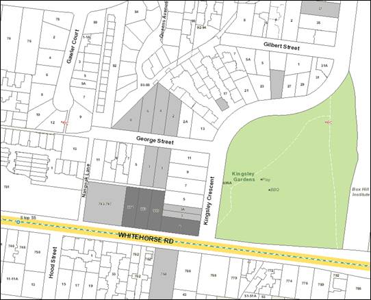
Subject site
|
|
15 Objector Properties
(2 outside of map)
|
é
North
|
BACKGROUND
History
There is no relevant planning
permit history for the subject sites.
The Site and Surrounds
The
subject site comprises four adjoining allotments located on the north-west
corner of the intersection of Whitehorse Road and Kingsley Crescent, Mont
Albert. The parcels of land are No. 801, 803, and 805 Whitehorse Road, and No.
1 Kingsley Crescent, Mont Albert. The site is irregular in shape, with the
combined Whitehorse Road boundary being 91.44 metres, the side (western)
boundary being 48.77 metres, the Kingsley Crescent (eastern) boundary being
18.29 metres, and a total site area of 3,036m2.
The site
is currently vacant, and slopes toward the north-west corner, and toward the
Kingsley Crescent frontage. The natural ground level of the site is higher than
the adjoining public footpath and road surface level. Consequently, a 1.2 metre
high rendered brick retaining wall extends along the majority of the Whitehorse
Road frontage. The boundary to Kingsley Crescent is unfenced.
The
immediate context comprises:
South
· Land
on the southern side of Whitehorse Road generally consists of medium density
housing.
· The
land adjacent to Whitehorse Road is contained within the Residential Growth
Zone, Schedule 2, with properties to the south and west located in the
Neighbourhood Residential Zone Schedule 5.
· The
land at 33 Zetland Road (across the road) is developed with ten single storey
units, arranged around a shared central driveway. The frontage to Whitehorse
Road includes a high timber paling fence that is recessed behind a rock
retaining wall.
· The
land at 762 Whitehorse Road is developed with eight 1970s era double storey
brown brick dwellings with hip and gable tiled roof with eaves. The site is
elevated above the road level. A loose volcanic rock retaining wall with garden
beds on top containing large shrubs is presented to Whitehorse Road, together
with a set of cement stairs in the centre of the site. Vehicle access is gained
via a shared central driveway from Zetland Road to the rear.
· Number
764 Whitehorse Road contains a 1960s era cream brick double storey apartment
building with hip and gable tiled roof with eaves. The site is elevated above
Whitehorse Road. A large masonry and stone retaining wall extends along the
Whitehorse Road frontage, with stair access up to the main entrance.
· A
recently constructed two storey apartment building with semi-basement car parking
is located at 766 Whitehorse Road. The central accessway is flanked by garden
beds containing established landscaping, including small trees. The
façade is treated with brick veneer, several render treatments, and flat
roof profile, with clear glass balustrading to balconies at the second level.
West
· Number
793-797 Whitehorse Road is occupied by a Caltex service station. It includes a
single storey brick building that is setback 3.0 metres from the common
boundary with the subject site, with centrally located canopy covering petrol
bowsers. A large freestanding sign is located close to the site’s
south-eastern corner, and a wide crossover to Whitehorse Road adjoins the
common boundary with the site.
East
· On
the opposite side of Kingsley Crescent, is Kingsley Gardens. This is a large
open space area containing walking tracks, a children’s playground,
sheltered barbeque facilities, tables and seats, and numerous trees providing a
shaded garden area.
North
· Immediately
abutting the subject site to the north is a 3.0 metre wide paved ROW that
extends on an east-west axis, originating from Nangnak Lane (to the west of the
site).
· On
the opposite side of the ROW, there are three properties which front George
Street. These properties are located within the General Residential Zone,
Schedule 4.
· Number
1 George Street contains a post-war double fronted weatherboard dwelling, with
a tiled hip and gable roof with eaves. A detached garage is located in the rear
of the site, accessed via a crossover and driveway located in the north-western
corner of the frontage. A rendered low brick fence extends across the frontage.
Secluded private open space adjoins the ROW.
· Number
3 George Street is developed with a post war single storey weatherboard dwelling
with a tiled hip and gable roof. An informal gravel driveway is accessed via a
crossover in the north-eastern corner of the lot. Secluded private open space
adjoins the ROW.
· Number
5 George Street is developed with a single storey weatherboard dwelling with a
tiled gable roof. The frontage of the site contains a 1.0 metre high white
picket fence, with established garden beyond. A large carport is located
adjacent to the rear, southern boundary of the site, and appears to be accessed
via the ROW.
· To
the north of the portion of the site that fronts Kingsley Crescent is a dual
occupancy development at 3 and 3A Kingsley Crescent, comprising two attached
double storey dwellings in a side by side layout. The dwellings are
conservative in design, with ground floor brick, lightweight cladding in render
finish at the first floor, with tiled hip and gable roof.
Whitehorse Road is a VicRoads
declared Arterial Road and Road Zone Category 1 under the Planning Scheme.
Whitehorse Road is aligned in an east-west direction, typically provides two
traffic lanes in each direction and accommodates tram tracks. Kerbside parking
is permitted along Whitehorse Road outside of Clearway and No Stopping times.
Clearway restrictions apply to the
north side of Whitehorse Road between 4:30pm-6:30pm Mon-Fri and along the south
side west of High Street between 7am-9am Mon-Fri. No stopping restrictions
apply along the south side of Whitehorse Road, east of High Street between
7am-9am Mon-Fri.
Kingsley Crescent is an access road
under the City of Whitehorse road management. It is aligned in a north-south
direction between Whitehorse Road to the south and Victoria Crescent to the
north. It is approximately 7.1 metres wide, which accommodates one shared
traffic lane and parallel parking along both sides. On street parking is
generally a mixture of short term (2P) and Permit Zone parking.
Planning Controls
The site is within the Residential
Growth Zone Schedule 2 (RGZ2). The purpose of Clause 32.07 (Residential
Growth Zone) includes:
· To
provide housing at increased densities in buildings up to and including four
storey buildings.
· To
encourage a diversity of housing types in locations offering good access to
services and transport including activities areas.
· To
encourage a scale of development that provides a transition between areas of
more intensive use and development and areas of restricted housing growth.
Pursuant to the RGZ2, planning
approval is required for the proposed buildings and works for more than one
dwelling. A preferred maximum building height of 14.5 metres applies to
dwellings and residential buildings.
Particular Provisions:
· Clause
52.06 Car Parking deals with a new use on site and deals with car parking
provision and design. Under Clause 52.06-2, a planning permit is required
for a reduction in car parking. The proposal provides compliant resident
and visitor car parking.
· Clause
52.29 Land adjacent to a Road Zone, Category 1 applies to land abutting a Road
Zone Category 1. A permit is required to alter (remove) the existing
access arrangement to Whitehorse Road..
· Clause
52.34 Bicycle Facilities applies to residential developments of four or more
storeys and encourages cycling as a mode of transport through requiring the
provision of suitable bicycle facilities. The proposal provides
sufficient on site bicycle spaces.
· Clause
52.35 Urban Context Report and Design Response for Residential Development of
Five or More Storeys deals with building design and amenity considerations.
(Note: Amendment VC136 introduced on 13/04/2017 provides new provisions for
apartment developments. Transitional provisions enable a planning permit lodged
before 13/04/17 to be considered under the provisions in force immediately
before the approval date.)
PROPOSAL
The application seeks approval for
the development of the land for a part three and part five storey apartment
building comprising 62 dwellings and 8 three-storey townhouses, in addition to
two basement car parking levels extending below all buildings. The main pedestrian
access is located at the Whitehorse Road frontage with vehicle access into the
basement level also provided via Whitehorse Road.
The key features of the proposal
are detailed as follows:
Building form
· The
apartment building comprises 12 one-bedroom apartments, 48 two-bedroom
apartments and 2 three-bedroom apartments (a total of 62 apartments).
· The
townhouses comprise 8 three-bedroom dwellings with two bathrooms.
· The
ground level comprises 12, two bedroom apartments (including one over two
levels) with access to outdoor terraces for each apartment varying between 17
and 143 square metres in size.
· Centrally
located pedestrian entry off Whitehorse Road and lobby.
· Levels
1 and 2 comprises 15 apartments.
· Level
3 comprises 12 apartments.
· Level
4 comprises 8 apartments.
· Each
dwelling has the benefit of a balcony varying in size between 8 and 15m2.
Townhouses all comprise an open
plan kitchen/ dining/ living area to each at ground floor, together with a rear
courtyard, and front door directly facing Whitehorse Road. First floor
incorporates two bedrooms with a shared bathroom, and a small balcony facing
Whitehorse Road. Second floor incorporates a master bedroom with ensuite
bathroom and walk in robe, together with study alcove.
Vehicle access and basement
levels
· The
existing vehicle crossover to Whitehorse Road will be modified to a 6.1 metre
wide crossover located towards the south-western corner of the boundary.
The existing crossover to Kingsley Crescent will be removed and kerb and
channel reinstated.
· 47
resident car parking spaces are provided within the lower basement level.
· 17
resident car parking spaces and 14 visitor car spaces are provided within the
upper basement level. This level also comprises the bin storage
room.
· 24
bicycle parking spaces
· Both
levels comprise storage areas for residents and a lift to the upper levels
· 8
car spaces within secure garages which are attached to the 8 townhouse style
dwellings at upper basement level. Each of these garages will include direct
pedestrian access to the associated dwelling. Given each of these townhouses
require 2 parking spaces, the second spaces for each are located within the
open basement carparking area.
Landscaping
· The
proposal allows for substantial landscaping around the perimeter of the site,
given the benefit of the basement level setback from all site
boundaries. A concept landscaping plan has been submitted with the application.
General
· The
materials include predominantly brick veneer, painted sheet cladding, timber
look sheet cladding, metal battens and framing for privacy, various types of
metal cladding, glass louvered windows and feature render finishes. Planter boxes
to maximise amenity to private open spaces and provide visual interest and
softening to the façade.
· The
development has been designed with two separate building components, each with
its own unique built form and street presentation, but linked by complementary
and similar materials and colour palette.
· The
apartment building features a clearly identifiable recessed front entry with
angled white canopy over, feature angled rendered element forming basement
entry, wrapping across to some first floor balconies. This feature element
repeats on the top level balustrades, with angled glazed inserts. The third and
fourth levels are recessed.
· Within
the apartment building, recessed front fences to ground floor apartments in a
combination of vertical metal battens and brick with generous landscaping in
front and behind to soften the POS of these apartments from Whitehorse Road.
· The
townhouse component has been designed so there is a clear delineation between
each dwelling, using an alternating rhythm in the façade treatment.
· Townhouses
2, 4, 6 and 8 feature two level timber look boxes with recessed top level.
Openings in the timber boxes will form windows to ground floor and first floor.
Vertical battened screening to provide privacy facing Whitehorse Road.
· Townhouses
1, 3, 5, and 7 feature two level clad boxes with recessed top level. Recessed
two level brick wall, tying into the brick used in the apartment building.
Solid balustrades at first floor with tinted glazed inserts to maximise
privacy. Use of planter boxes at first and second floor. Top levels reference
the pitched roofs prevalent in the surrounding area.
· The
site coverage is 57%, with a permeability of 37%.
CONSULTATION
Public Notice
The application was advertised by
mail to the adjacent and nearby property owners and occupiers and by erecting
five notices to the street frontages. Following the advertising period 15
objections were received.
The issues raised are summarised as follows:
· Amenity
impacts:
o Overlooking
o Overshadowing, including
winter shadows
o Increased noise
o Emission of dust and
dirt on the road impacting the adjacent car detailing business
o Reduced safety
o Increased pollution
· Neighbourhood
character:
o Building height is out
of keeping with the neighbourhood
o The five storey built
form is too close to General Residential Zoned dwellings to the north
o Inadequate setbacks and
transitions provided to surrounding residential lots
· Internal
Amenity:
o Insufficient private and
communal open space
· Car
parking and traffic:
o Increased traffic
o Insufficient on site car
parking – one car per apartment is insufficient
o Visitors to apartments
will not typically utilise basement parking provided
o Increased on-street
parking
o Car parking entry off
Whitehorse Road will cause traffic conflict
o Increased traffic along
Nangnak Lane and surrounding residential streets
o Traffic and pedestrian
safety impacts on the street
o Removal trucks will park
on Whitehorse Road, causing traffic congestion
· Landscaping:
o Insufficient landscape
screening
· Compliance
with planning controls
· Drafting
concerns
· Non-planning
matters
o Loss of views
o Construction impacts
o Negative impact on
surrounding property values
o Increased pressure on
local infrastructure (such as playgrounds)
Consultation Forum
A Consultation Forum chaired by
ex-Councillor Tescher was held on 28 February 2017. A total of seven
registered objectors, five representatives for the applicant and the Planning
Officer attended this Forum.
The Chair facilitated discussions
around the themes raised in objections. The applicant provided a brief
overview of some of the key features of the application to participants towards
the end of the forum. No consensus was reached, however the applicant
offered to undertake the following:
· Prepare
a 2pm shadow diagram to demonstrate that overshadowing will not unreasonably
affect No.3 and 3A Kingsley Crescent.
· Update
plans to provide an additional basement level for car parking provision, in
order to exceed resident parking requirements.
· Visitor
parking access to be facilitated by intercom.
· Provide
updated plans showing improved landscaping and overlooking screening details.
Subsequently to the Forum, on 10 March, 2017, the applicant
provided additional plans to Council for discussion purposes including the
following changes:
· Provision
of an additional 46 on-site car spaces within a third basement level.
· Increase
in building setbacks at the north-east corner on levels 2-4, in order to ensure
that no additional shadows are cast on the private open spaces of 3 and 3A
Kingsley Crescent between 9am and 3pm.
Referrals
External
VicRoads
The application was referred to
VicRoads in accordance with Section 55 of the Planning and Environment Act
1987. VicRoads have advised that they do not object to the proposal, subject to
the inclusion of conditions on any planning permission issued. These conditions
relate to the construction of access lanes, driveways, crossovers and
associated works prior to the commencement of the use or development, and their
maintenance in good condition.
Internal
Engineering and Environmental
Services Department
· Transport
Engineer
Consent subject to conditions.
· Waste
Engineer
The submitted Waste Management Plan, prepared by Leigh
Design and dated June 2016, is approved. It is noted that waste
collections for the development will be undertaken by private
contractors. Waste will be collected onsite, within the development’s
basement Level 1 car park driveway. The collection contractor will
transfer bins between the waste areas and the truck.
· Assets
Engineer
Consent subject to conditions.
Planning Arborist
The proposal was referred to
Council’s Arborist. The arborist noted that no dedicated report was
submitted with this application. The arborist recommended that the plans be
amended to show Trees # 1 to # 5 inclusive, together with their respective Tree
Protection Zones (TPZ) and Structural Root Zones (SRZ).
The plans do not show any
encroachment into the TPZ of Tree # 1 by hard surface works, however they do
show a planter box on the boundary, within the TPZ. A tree protection condition
should be included on any planning permission issued.
Trees # 1 to # 5 inclusive can be retained
as part of the proposed development.
ParksWide Arborist
The street tree is a Fastigiated
Quercus (Oak tree). The tree displays good structure and good health. It is a
tree that is valued within the existing streetscape and is within an avenue of
similar species. A clearance distance of 2.4 metres is required. Any excavation
within the TPZ should be undertaken by hand, hydro excavation or air spading.
ESD Advisor
The proposal was referred to
Council’s ESD Advisor. The proposal incorporates a number of
Environmentally Sustainable Development (ESD) initiatives including the
provision of some daylight to corridors, timer or motion sensor controls for
lighting of common areas, and 40 kL rainwater collection for toilet
flushing. However, this application does not fully meet Council's
Environmentally Sustainable Development Policy for a development of this size,
however the outstanding matters can be resolved via any conditions of
approval. Further details and ESD commitments are required before the Sustainability
Management Plan can be endorsed, and these will be included as conditions.
Landscape Advisor
The proposal was referred to
Council’s Landscape Advisor. The proposal is generally satisfactory, with
setbacks for planting considered satisfactory. The planting schedule should
incorporate upright species along the north-eastern boundary adjacent to the
townhouses and the south-western boundary where the basement is set back
1500mm. The remainder of the western boundary must be replanted with canopy trees.
DISCUSSION
Consistency with State and Local
Planning Policies
The State Planning Policy Framework
aims to increase the supply of housing in existing urban areas, and to
encourage well-designed infill housing which respects the identified existing
and preferred neighbourhood character, improves housing choice, makes better
use of existing infrastructure and improves energy efficiency of housing.
In accordance with Plan Melbourne 2017-2050:Metropolitan Planning
Strategy, Clause 11.06-2, Housing Choice, includes the objective to provide a
diversity of housing in defined locations that cater for different households
and are close to jobs and services. Increasing housing supply near
services and public transport is encouraged to reduce the cost of living and
facilitate the supply of affordable housing.
Clause 15 (Built Environment and Heritage), identifies that planning
should ensure all new land use and development appropriately responds to valued
built form and cultural context.
At Clause 15.01-2 (Urban design
principles), the objective is to:
“To achieve architectural
and urban design outcomes that contribute positively to local urban character
and enhance the public realm while minimising detrimental impact on
neighbouring properties.”
Clause 16 (Housing) of the State planning policy framework also
strongly advocates the need to provide substantial new housing, in a diversity
of new housing types, ensuring that developments are integrated with
infrastructure and services.
Clause 21.06 (Housing) identifies the site as being within a
Substantial Change Area. This policy recommends that development is
facilitated within Substantial Change Areas as these have been identified as
being able to sustain higher density development based on environmental and infrastructure
considerations, and will make a significant contribution to increases in
housing stock. Apartment style building forms are encouraged within
Substantial Change Areas, however it is noted that buildings interfacing
sensitive areas should have a scale and massing appropriate to the character
and scale of their context, and higher density building forms should be located
away from sensitive interfaces.
From a policy perspective, Clause 21.06 locates the site within a
‘Substantial Change Area’ where housing growth and increased
densities are to be anticipated in achievement of a future character.
Clause 16.01-2
(Location of Residential Development), encourages new housing to be located in
or close to activity centres, employment corridors, services and
transport. This is to be achieved by increasing the proportion of housing
in Metropolitan Melbourne to be developed within the established urban area, to
reduce the pressure for fringe development. In addition, Clause 16.01-4,
Housing Diversity, recommends the provision of a range of housing types to meet
increasingly diverse needs by widening housing choice, particularly in the
middle and outer suburbs.
Clause
18 (Transport) has objectives to encourage higher land use densities and mixed
use developments near railway stations, major bus terminals, transport
interchanges and tramways (the Principal Public Transport Network). Pursuant to the State Transport Policy, Clause 18.02-1 also promotes
the use of sustainable personal transport, including walking
and cycling, whilst Clause 18.02-5 requires that an adequate supply of car
parking is provided, that is appropriately designed and located to protect
amenity of residential precincts.
Clause 19.01
(Renewable Energy) promotes renewable energy use in developments and Clause
19-03-05 seeks to minimise waste and encourage recycling within new
development.
Clause 22.03 (Residential Development) identifies the subject site
as included within the Garden Suburban Precinct 11. The following future
character outcome is sought:
“A variety of well articulated dwelling styles will sit within
compact garden settings. Infill development will be common, however new
buildings and additions will be setback at upper levels to minimize dominance
in the streetscape. The consistent front setbacks and spacing between dwellings
will be retained, with buildings setback or appearing setback from at least one
side boundary. Low or open style front fences will provide a sense of openness
along the streetscape, and allow views into front gardens.”
Clause 22.04 (Tree
Conservation), seeks to encourage the retention and regeneration of significant
vegetation. The development site is vacant and does not contain any significant
vegetation. The submitted development plans include substantial in-ground
landscaping areas made available along the boundaries to enhance the tree
coverage and landscape character.
The strategic
planning directions in both State and Local Planning Policy Frameworks identify
the subject site as suitable for high density housing, which will widen
housing choice and make better use of existing infrastructure. The proposed development achieves this overarching strategic
objective to provide a greater range and intensification of residential
development. The site is within walking distance of public transport
(train station, trams and buses) and parks.
The proposal is
consistent with the purpose of the Residential Growth Zone which seeks to
provide housing at increased densities, to encourage a diversity of housing
types in locations offering good access to services and transport, and to a
transition of building scales between areas of more intensive development and
areas of restricted housing growth. It is noted that the purpose also
references building forms up to four storeys, however there is no height limit
specified in Schedule 2 of the Residential Growth Zone and the preferred
building height in the zone provision is discretionary, allowing Council to
take into account site circumstances when deciding on appropriate building
height.
Urban Design Principles
Clause 15.01-2 Urban Design
Principles of the Whitehorse Planning Scheme, and the Design Guidelines for
Higher Density Residential Development (Department of Sustainability and
Environment, 2004) require design principles to be referred to when
assessing development proposals for residential development of five or more
storeys, including:
Context
and the public realm
The site has a
commercial interface with a service station to the west, a direct interface
with the rear secluded private open space of detached dwellings fronting George
Street to the north (across a narrow 3.0 metre wide ROW), and, where not
directly fronting Kingsley Crescent to the east, a direct eastern interface
with the rear secluded private open space of semi-detached and detached
dwellings at 3 and 3A and 5 Kingsley Crescent respectively. The site has direct
abuttal to the route 109 tram which runs along Whitehorse Road and is in close
proximity to the core of the Box Hill Metropolitan Activity Centre (MAC). Mont
Albert train station is located 560 metres south-west of the site, and Kingsley
Gardens is located immediately east (across Kingsley Crescent).
The existing
physical context of the subject site is diverse, with the low-set detached
residential character of Kingsley Crescent (and George Street to the
site’s north) contrasted against the transformative built form occurring
further east of the subject site in the Box Hill MAC.
This portion of
Whitehorse Road is also undergoing change, as demonstrated by a number of
existing and emerging higher density infill developments (766 Whitehorse Road,
and 775-791 Whitehorse Road, in the order of 3 to 5 storeys).
The diversity
in the surrounding character is a result of the planning framework applicable
to the broader area. The entirety of the subject site is located within the Residential
Growth Zone Schedule 2 which specifically seeks to encourage a future built
form character which adopts diverse housing options including buildings up to
four storeys in height. The Residential Growth Zone Schedule 2 also seeks to
encourage a scale of development that transitions between areas of more
intensive development and areas of restricted housing growth.
All adjoining
properties to the north of the subject site, facing George Street, are
contained within the General Residential Zone Schedule 4 which seeks to
facilitate more modest residential development that responds to existing
character.
An existing
street tree located in proximity to the proposed vehicle crossover cannot
reasonably be retained in association with the development, and the amenity
value of this tree must be paid to Council’s Parkswide Department in
order to facilitate the removal and replacement of this tree.
Safety
The proposed
development will create an urban environment where personal safety and property
security is enhanced, and where people feel safe to live, by providing secure
access and passive surveillance of and interaction with the public realm.
Landmarks,
views and vistas
Given the location of the subject
site and the scale of the development, the proposed building will be visually
prominent, which is an appropriate response at this Whitehorse Road location,
as part of an approved residential growth corridor. The proposal will not
block any identified significant views or vistas.
Pedestrian
spaces
The proposal concentrates a single
vehicle access point at the Whitehorse Road frontage with the pedestrian
entrance also to the Whitehorse Road frontage. A single vehicle access
arrangement leaves the majority of the street frontages with uninterrupted
pedestrian movement.
The existing retaining wall along
the Whitehorse Road frontage will be removed, and replaced with a predominantly
1.5 metre high metal batten fence (with 50% transparency), which is intended to
be set back behind a modest landscaping reserve that varies in width between
approximately 2.0 metres (apartment building) and 0.7 metres (townhouses). The
height and transparency of the proposed fence is fully compliant with the
expectations of the Residential Growth Zone (where adjoining a RDZ1).
At Kingsley Crescent, the eastern
most townhouse proposes to present with a fence line and sheer boundary wall
set back 3.0 metres behind publically accessible landscaping. The Urban Design
Report, prepared by David Lock and Associates, which accompanied the application,
has recommended that the fence line be extended at this interface to the
site’s boundaries to preclude perpetual vandalism of the sheer wall
(particularly given the accessibility of this interface from the neighbouring
park). This will form a condition on any planning permit issued.
Light and
shade
The proposed building will cast
shadows to the south across Whitehorse Road and to some commercial frontages,
such as the service station to the west of the site. However, neither of these
are sensitive areas. The shadow diagrams (9am to 3pm on September 22nd)
demonstrate that the overshadowing implications are acceptable, having regard
to the preferred built form character and streetscape vision for the site and
the surrounding area.
It is noted that amended plans
dated 09/03/2017 ensure that there would be no additional overshadowing to 3
and 3A Kingsley Crescent and negligible overshadowing of 5 Kingsley
Crescent’s secluded private open space.
The proposed development provides
for good solar and daylight access to habitable rooms.
Energy
and resource efficiency
The orientation of the building on
the lot has maximised available solar access. The use of shared roofs, floors
and walls also promotes energy and resource efficiency.
A Sustainability Management Plan
was submitted with the application, and Council’s ESD Officer has advised
that the development can achieve an acceptable level of energy efficiency,
subject to some amendment of the submitted Sustainability Management Plan.
It is noted that there are a number
of single aspect south facing dwellings. Whilst this is not ideal, it is
an acceptable outcome for the apartment building typology, and it is noted that
a large common open space area is provided at the top level which will provide
for additional solar access and outdoor living space for residents.
Architectural
quality
The proposed development achieves
an appropriate architectural and urban design response. Rooftop plant
equipment is located centrally to the building footprint, and will have limited
visibility from surrounding areas.
Landscape
architecture
Clause 22.04 (Tree Conservation)
acknowledged the importance of trees in enhancing the character of the
municipality and seeks to minimise the loss of vegetation as a result of development.
Clause 22.03-5 (Residential Development – Garden Suburban Precinct 11)
seeks to ensure that new development fronting Whitehorse Road provides area for
large trees and gardens.
The site layout provides acceptable
setbacks and perimeter landscaping to all sides, including minimum 5.2 metre
setbacks to the sensitive residential interface to the north, and 4.2 metre
setbacks to the east.
Planting along narrow spaces to the
north of the townhouses and west of the apartment building will require upright
tree species. The remainder of the western boundary must be planted with canopy
trees. This will form a condition on any planning permit issued.
Along the south boundary, the
basement car parking area achieves a boundary setback of between 3.0 and 4.0
metres from the boundary, and to the west the setback achieved is 4.5
metres. The indicative landscaping shown on the development plans provides
for perimeter planting of canopy trees and shrubs and it is considered that the
extent of landscaping proposed will assist in softening views towards the new
apartment building.
Ground level
apartments, together with the eight townhouses, are provided with open spaces
fronting the streetscape, side, or rear boundaries. A predominantly 1.5 metre
high metal batten fence (with 50% transparency), to be set back behind a modest
landscaping reserve, varies in width between approximately 2.0 metres
(apartment building) and 0.7 metres (townhouses). The main pedestrian entrance
into the apartment building, together with the individual entrances to the
townhouses also assist in breaking the façade presentation and providing
for a relationship from the street to these dwellings.
No services,
such as a substation, or fire fighting connection, have been shown on the
submitted plans. A planning permit condition will require that the location of
these services is shown on the plans, and elevation plans will be required to
be provided to ensure the services are treated with appropriate materials to
ensure they can successfully integrate into the streetscape.
The siting and
design detailing of the apartment building otherwise represents a contemporary
design utilising modulated forms and recessed upper levels with a variety in
finished materials, providing an appropriate response to the public
realm.
Guidelines for Higher Density
Development
The Guidelines for Higher Density
Development require applications to be assessed against six key urban design
principles as detailed below:
Element 1 Urban Context
The Urban Context Report submitted with the application detailed
opportunities and constraints of the site, identified the policy direction and
planning scheme objectives for the site, including the expected impact of
future development. Given the location of the site within a Substantial
Change Area, higher density development is encouraged.
Element 2 Height and Massing
The proposal
consists of a five storey apartment complex within the west of the site
(approximately 15.2m at the highest point) and a row of three storey townhouses
within the east of the site (approximately 9.2m at the highest point).
Regarding the
apartment building, the RGZ2 encourages higher density development of up to and
including four storeys and Clause 21.06 anticipates this in the form of
apartment buildings in Substantial Change Areas. As viewed directly from
Whitehorse Road, the height of the apartment building has been massed so as to
read as a predominantly three storey form with recessive double storey upper
‘cap’. Recessing the upper levels is consistent with GS11 (Garden
Suburban area 11) massing guidance, and results in similar visual outcomes to a
sheer four storey apartment building without upper setbacks (which is
consistent with the form envisaged by the RGZ). Importantly, the use of upper
storey setbacks and the promotion of a three storey base is cognisant of the
form of recent proximate developments on Whitehorse Road (refer 766 Whitehorse
Road), which is consistent with Design Suggestions 2.2.1 and 2.2.2 of the Guidelines
for Higher Density Development. Finally, the overall height of the apartment
building will be visible in longer, oblique views along Whitehorse Road where
it will contribute to a comfortable built form transition to and from the more
intensive development occurring in the Box Hill MAC (including directly east of
Kingsley Gardens).
With respect to the proposed
townhouses, the RGZ2 allows a maximum height of 14.5 metres. The proposed
9.2 metre height is compliant with the zone, the height of the townhouses more
importantly perpetuates the established street wall height existing in
Whitehorse Road (as well as by the proposed apartment building within the west
of the subject site) which is consistent with existing character and therefore
compliant with the objective of Clause 55.03-2. As viewed from Kingsley
Crescent, the height of the townhouses will effect a height transition from
Whitehorse Road toward the existing double storey development at 3 and 3A
Kingsley Crescent, which will ‘mark’ the street corner with taller
form.
The consolidation of the three lots has enabled the notion
of preserving equitable development rights to be readily achieved through the
ability to achieve appropriate setbacks. This concept is an important
issue in such development scenarios particularly within Substantial Change
Areas where there is a reasonable expectation that the adjoining lot to the
west may, in time, be redeveloped.
Street Setbacks
The setback of buildings from a street edge affects how
uses relate to the public space of the street. Front setbacks, or the absence
of them, are also an important aspect of neighbourhood character.
The apartment building is proposed to be setback from
Whitehorse Road between 6.0 metres and 8.9 metres (entry lobby), whilst the
proposed townhouses will be setback 6.0 metres. At Kingsley Crescent the
easternmost townhouse proposes to be setback 3.0 metres.
Objective 2.4 of the Guidelines for Higher Density
Development seeks to ensure street setbacks respond
to existing or preferred street character, and – with respect to the
townhouses – the RGZ2 street setback variations apply only to boundary
walls.
Importantly, the preferred future character statement for
GS11 precincts anticipates ‘compact garden settings’ and consistent
front setbacks.
The prevailing street setback character of newer
development in the RGZ2 portion of Whitehorse Road is approximately 6.0 metres,
and the proposed setbacks at this interface directly respond to this. At 3.0
metres, the proposed setback to Kingsley Crescent is consistent with the side
street provisions of Standard B6 of Clause 55.
Side and Rear Setbacks
The proposed apartment building will be incrementally
setback from the western boundary between 2.0 – 10.1 metres (ground
floor) and 5.0 – 10.33 metres (Level 4), incrementally from the north
between 5.46 – 9.05 metres (ground floor) and 7.0 – 10.86 metres
(Level 4), and incrementally from the east 4.22m – 12.02 metres (ground
floor) and 7.0 – 12.02 (Level 4). The proposed townhouses are to be setback
from the north 4.82 metres (ground floor), 3.86 metres (Level 1) and 4.37
metres (Level 2).
Objective 2.5 of the Guidelines for Higher Density
Development seeks to ensure that building separation
supports amenity and reinforces neighbourhood character.
From a character perspective, the proposed western setback
of the apartment building achieves an appropriate built form separation that is
reflective of the prevailing side setback character of newer development in the
surrounding RGZ2 portion of Whitehorse Road. Equitable development also drives
the setback, and this is discussed later in this report. At the north and east,
the proposed apartment building is staggered to achieve a legible built form
transition to adjoining residential properties as per the objectives of the
RGZ2 seeking built form transition to areas of more limited growth.
With respect to the proposed townhouses, the proposed rear
setback will result in an appropriate level of built form separation as viewed
from Kingsley Crescent commensurate with the existing character of the RGZ2
portion of this streetscape.
The inter-building separation between the proposed
apartment building and townhouses is sufficient for the proposal to
‘read’ as two distinctive components from Whitehorse Road. Further,
no aspect of the proposal seeks to make use of on-boundary construction
(including the basement), which ensures availability of deep soil and space for
meaningful landscaping in accordance with the preferred future character
statement for the Garden Suburban Precinct 11.
Element 3 Street
Pattern and Street-Edge Quality
Local street patterns and the size
of the building blocks are important to the liveability of the local area. This
element seeks to encourage increased pedestrian use through appropriate
building layout. The building’s frontage to Whitehorse Road creates
a transition between public and private space. The careful design of this
street edge zone will contribute to the liveliness, interest, comfort and
safety of the street for those who use it.
The proposal seeks to address the
existing level difference between the subject site and Whitehorse Road through
the removal of the existing retaining wall and replacement with a predominantly
1.5 metre high metal batten fence (with 50% transparency), which is intended to
be set back behind a modest landscaping reserve that varies in width between
approximately 2.0 metres (apartment building) and 0.7 metres (townhouses). The
height and transparency of the fence is compliant with the expectation of the
RGZ2 (where adjoining a RDZ1) and will facilitate an appropriate level of
public realm activation given the proposed ground floor dwellings behind.
The proposed landscape setback will
widen the public realm and be generally commensurate with more recent
development in proximity of the site. However, the Urban Design Report,
prepared by David Lock and submitted with the application, suggests that
Council should satisfy itself that the proposed landscaping will not reach a
height at maturity capable of unreasonably obscuring outlook from Ground Floor
habitable rooms to the Whitehorse Road public realm. A condition can be
included on any planning permission issued, to this effect.
Building Entries
The development is well designed to
achieve the objectives of this element. The primary pedestrian entry to
the apartment building is located along the site’s frontage to Whitehorse
Road, and is clearly identifiable. Similarly, all proposed townhouses will have
direct access to Whitehorse Road which will appropriately activate Whitehorse
Road.
As discussed above, the apartments
at ground level are orientated towards Whitehorse Road and provide for direct
pedestrian access, which maintains a physical connection to the street.
This arrangement assists in providing a ‘fine grain’ pattern to the
façade and increased activity and security to the streetscape. The
arrangement of the apartments provides for living areas and bedrooms orientated
towards the streetscapes at all levels. This design feature is directly
encouraged at Objective 2.8 of the Guidelines for Higher Density Development as
it provides surveillance, connectivity and activation.
In terms of the townhouses, it is
considered that additional east-facing windows to Kingsley Crescent (including
highlight windows) or revised balcony orientation to achieve the same
improvement to passive surveillance at this interface is required. This
requirement can form a condition on any planning permission issued.
Element 4 Circulation
and Services
The basement car park entrance is
located via a single entrance point on Whitehorse Road, with basement parking
provided over two levels. Within the car park, entry points to the
building (stairs and lift) are clearly visible and centrally located. The
visitor spaces are located near the entrance and directly adjacent to the
lift. Council’s Transport Engineers are satisfied that the basement
provides for appropriate circulation, subject to minor alterations.
The entrance lobby to the apartment
building, together with corridor widths has generous dimensions (between 1.6
and 2.4 metres) and proportions enabling equitable access for residents and
visitors.
Mechanical plant and other related
mechanical service units are generally located within the basement, or on the
roof in a central location.
Waste disposal and recycling is
proposed via a centrally located waste room, accessed via vertical chutes on
each floor of the apartment building, and located centrally. Townhouse
residents will also utilise this waste room, accessed via the shared basement.
Element 5 Building
Layout and Design
The proposed dwellings are
predominantly two bedroom, with all townhouses and two apartments containing
three bedrooms and therefore providing a diverse housing choice. All habitable
rooms have direct access to daylight and ventilation in accordance with Objective
5.4 of the Guidelines for Higher Density Development. It is noted that
the shape of the site has resulted in a proportion of the proposed apartments
being oriented southwards, where solar access will be limited but access to
daylight is sufficient.
Externally accessible, secure
storage space is provided within both basement levels.
Design Detail
There is a clear, contemporary
architectural concept underpinning the design. The use of face brickwork, light
finished concrete and darker metal cladding provides an appropriate level of
visual interest, and the application of these materials throughout the proposal
unites the two separate components of the proposal. In particular, the use of
light coloured rendered finishes at the base of the apartment building (with
darker materiality for the upper cap) promotes the form of the street wall as
the principal visual reference as viewed from Whitehorse Road.
Whilst the materiality of the
proposal indicates use of a range of darker finishes for metal cladding and
rendered finishes (‘Domino’, ‘Charcoal’,
‘Monument’), the renders convey an overtly ‘dark’
finished outcome for the proposed townhouses and it is recommended in the David
Lock and Associates Urban Design Report that greater use of lighter materiality
be employed at the first two storeys. It is also recommended that all proposed
dark finishes are ‘dark grey’ at most and not ‘black’.
These requirements can be included as planning permit conditions.
The façade of the proposed
apartment building employs a series of framing elements to south facing Level 2
balconies, which greatly assist in articulating the façade of the
proposal as viewed from Whitehorse Road and are supported from an urban design
perspective.
A condition of the permit will
require cross-section diagrams demonstrating how screening is achieved of
downwards views within 9 horizontal metres from first floor planters as this is
currently not satisfactory.
As the subject site is located
beside Whitehorse Road, the proposed dwellings may be impacted by traffic
noise, and so acoustic protection measures will be required for all habitable
room windows.
Element 6 Open Space
and Landscape Design
It is
considered that sufficient allowance for landscaping has been provided in
accordance with the requirement of Clause 22.03 and Garden Suburban Precinct 11
precincts, which will assist in softening the proposal – particularly at
the proposal’s interface with Kingsley Garden, where the proposal will be
most visible in longer views from further east along Whitehorse Road.
Common areas
are easily identifiable, including car parking, vehicular and pedestrian
access. All ground floor apartments and townhouses are provided with generous
proportions of open space at ground level, while apartments at Level 1, 2, 3
and 4 are provided with balconies equal to or over the required 8m2
in area.
The proposed
landscaping will provide for engaging and functional spaces for residents and
will contribute to the Garden Suburban neighbourhood character.
Vehicle Access Arrangements and
Car Park Layout
A number
of the objections raised concern with the lack of appropriate on-site car
parking for the development. As set out above, the statutory car parking
requirement is 94 spaces (80 resident spaces and 14 visitor spaces).
This is inclusive of 8 car spaces provided with secure garages which are
attached to the 8 townhouses. Each of these garages includes direct pedestrian
access to the associated dwelling.
Statutory Assessment
|
Usage
|
Number
|
Rate
|
Required Spaces
|
|
Dwellings
|
|
|
|
|
· 1 & 2 bedroom dwellings
|
60
|
1 space
per dwelling
|
60
|
|
· 3+ bedroom dwellings
|
2
|
2 spaces
per dwelling
|
4
|
|
3 bedroom townhouse
|
8
|
2 spaces per dwelling
|
16
|
|
· Visitor
parking
|
70
|
1 space per 5 dwellings
|
14
|
|
|
Total
spaces required
|
94
|
The proposed parking provision of
94 parking spaces meets the planning scheme requirements is therefore
considered satisfactory.
Traffic Generation
Council’s Transport Engineers
have confirmed that it is unlikely that there will be a significant impact upon
the local road network or nearby intersections. VicRoads has also not raised
any concerns with traffic generation.
Bicycle Facilities
The number of bicycle parking
spaces are required as per Clause 52.34 of the planning scheme.
|
Usage
|
Number
|
Resident
Rate
|
Visitor Rate
|
Required
Spaces
|
|
Dwellings
(4+ storeys)
|
70
|
1 space per 5 dwellings
|
1 space per 10 dwellings
|
21
|
|
|
|
Total spaces
required
|
21
|
The proposed development generates
a requirement for 14 resident bicycle spaces and 7 visitor spaces. Within
the basement level 1 car park is a bicycle compound containing 24 racks.
A further 4 bike racks are located at ground level adjacent to the lobby
entrance. The provision of bike spaces therefore exceeds the statutory
requirement.
Council’s Transport Engineer
has required a parking management plan to be submitted which will include
allocating parking spaces to individual properties, signing of parking spaces,
line marking of parking spaces and detail how access will be achieve by
visitors i.e. an intercom and how parking will be secured. Minor
alterations to the proposed internal dimensions for the garages within the
basement are also required, and a condition will require these to be 3.5m wide
by 6m long as required under Clause 52.06 of the Whitehorse Planning
Scheme. In addition, no doors are to open into the clear internal
dimensions of the garage as required by Clause 52.06-8 of the Planning Scheme,
and the garage door openings are to be in accordance with the requirements of
Section 5.4 of AS 2890.1.
Access to
the car parking is provided via a 6.1 metre wide crossover to Whitehorse Road
located near the site’s western boundary (modifications to the existing
crossover). The existing crossover to Kingsley Crescent will be removed and
kerb and channel reinstated to the satisfaction of Council.
A Traffic
Engineering Assessment was submitted with the application, and prepared by
Traffix Group (dated June 2016). This Assessment found that, post development,
12 on street car spaces would be available on the site’s frontage to
Whitehorse Road subject to ‘1P 8:30am – 4:30pm Mon-Fri, Clearway
4:30pm-6:30pm Mon-Fri’ restrictions (net loss of one car parking space).
No stopping restrictions apply along the site’s frontage to Kingsley
Crescent and as such there is no change to on street parking availability.
The
Assessment also concluded that the proposal is fully compliant with the on-site
car parking requirements of Clause 52.06 Car Parking of the Whitehorse Planning
Scheme. Notwithstanding this, the report also found that on street parking is
readily available in nearby areas (including the 12 on street spaces to
Whitehorse Road) and accordingly any visitors can be easily accommodated.
Additionally larger vehicles (such as removalist trucks) or tradesmen would be
easily accommodated on street.
Council’s Transport Engineers
support the above assessment.
Public Transport Access
The site is well-serviced by a
number of public transport services, including train, tram, and bus services
located within walking distance of the site. The Box Hill MAC and bus terminus
is located approximately 800 metres east of the site and provides access to a
number of bus services that link the site to a variety of destinations.
Tram route 109, travelling between
Box Hill and Port Melbourne, extends along Whitehorse Road and is adjacent to
the subject site. Bus route 284, travelling between Doncaster Park and Ride and
Box Hill, also extends along Whitehorse Road. Mont Albert railway station is
located approximately 600 metres south-west of the site, and Box Hill railway
station us located 900 metres east of the site.
Whitehorse Road itself has
substantial access to a number of main north-south metropolitan roads
including; Elgar Road, Station Street, and Union Road.
Objectors Concerns not Previously Addressed
· Increased
noise
The consideration of this planning
application is confined only to the construction of the dwellings. The
residential use of the dwellings does not require a planning permit and is not
a planning matter. Residential noise associated with a dwelling is considered
normal and reasonable in an urban setting. Any future issues of amenity, if
they arise, can be pursued as a civil matter.
· Negative
impact on property values
The Victorian
Civil and Administrative Tribunal and its predecessors have generally found
subjective claims that a proposal will reduce property values are difficult, if
not impossible to gauge and cannot be considered in the
determination of a planning permit application. It is considered the impacts of
a proposal are best assessed through an assessment of the amenity implications
rather than any impacts upon property values. This report provides an
assessment of the amenity impact of this proposal.
· Construction
impacts including excavation, safety, noise and dust
A Construction Management Plan will address these matters.
CONCLUSION
The proposed construction of a five
storey apartment building and three storey townhouses is considered to be
generally consistent with the relevant provisions contained within the
Whitehorse Planning Scheme, including the State and Local Planning Policies,
the Residential Growth Zone Schedule 2, Clause 52.06 Car Parking, and the
Guidelines for Higher Density Residential Development.
A total of 15 objections and one letter of support were
received as a result of public notice and all of the issues raised have been
discussed in this report.
It is considered that the application should be approved.
Attachment
1 Advertised
Development Plans ⇨ 
Ordinary Council Meeting 15
May 2017
10.1.2 163-165
and 175 Central Road, Nunawading (PC 352693N)– Extension of an existing
residential building, buildings and works to use and develop a retirement
village and associated tree removal and waiver of bicycle parking requirements
FILE NUMBER: WH/2016/650
ATTACHMENT
SUMMARY
This application was advertised,
and a total of 25 objections were received. The objections raised issues with
amenity, neighbourhood character, car parking, traffic and landscaping. A
Consultation Forum was held on 2 March, 2017 chaired by Councillor Stennett,
at which the issues were explored, however no resolution was reached between
the parties. This report assesses the application against the relevant
provisions of the Whitehorse Planning Scheme, as well as the objector
concerns. It is recommended that the application be supported, subject to
conditions.
|
RECOMMENDATION
That Council:
A Being the Responsible Authority, having
caused Application WH/2016/650 for 163-165 and 175 Central Road, Nunawading
(PC 352693N) to be advertised and having received and noted the objections is
of the opinion that the granting of a Planning Permit for the extension of an
existing residential building, buildings and works to use and develop a
retirement village and associated tree removal and waiver of bicycle parking
requirements is acceptable and should be supported.
B Issue a Notice of Decision to Grant a
Permit under the Whitehorse Planning Scheme to the land described as 163-165
and 175 Central Road, Nunawading (PC 352693N) for the Extension of an
existing residential building, buildings and works to use and develop a
retirement village and associated tree removal and waiver of bicycle parking
requirements, subject to the following conditions:
1. Before
the development starts, or any trees or vegetation removed, amended plans
(three copies in A1 size and one copy reduced to A3 size) shall be submitted
to and approved by the Responsible Authority. The plans must be drawn to
1:100 scale, with dimensions, and be generally in accordance with the plans
submitted with the application but modified to show:
a) The
locations of Tree Protection Zones described in Condition 9, with all
nominated trees clearly identified and numbered on both site and landscape
plans, and the requirements of Conditions 9 and 10 to be annotated on the
development and landscape plans.
b) Cross-sections
showing how the buildings and works will comply with the requirements of
Condition 10 b), c), d), and e).
c) The
car park layout amended in accordance with the Amended Car Park Layout Plan
included at Attachment 1, and Tree 25 to be retained.
d) New
car parking areas to utilise permeable paving to support the surrounding
trees.
e) The
location of all service trenches to serve the development (for example: gas,
water, electricity, stormwater, sewerage, telecommunications), including the
extent of trenching required in easements over adjoining lots (if any) and
the locations of protected trees within 4 metres of these trenches (if any),
in order to demonstrate that no protected trees will be impacts by utility
works.
f) Plans
to show whether the existing front fence along Central Road is to be retained
or removed.
g) Provide
light coloured roofing material.
h) A
detailed schedule and samples of all external materials, colours and
finishes.
i) Provision
of designated staff smoking areas in appropriate locations on site.
j) Development
plans updated to include all of the relevant requirements of the Lighting Strategy
and Parking and Access Management Plan.
k) Development
plans to reflect all sustainability features indicated in the amended
Sustainability Management Plan (SMP). Where features cannot be visually
shown, include a notes table providing details of the requirements (ie.
energy and water efficiency ratings for heating/cooling systems and plumbing
fixtures, etc). The plans are to be generally in accordance with the plans
submitted with the application but modified to show:
i. Shadows
as per actual sun angles on all elevation drawings.
ii. Exterior
shading for all east, north and west windows greater than 1.5 square metres,
to shade at least 40% from 10am to 2pm on 1 February.
iii. All
operable windows, doors, winter garden openings & vents in elevation drawings.
iv. Where
residential aged care double loaded corridors are included, they are to be
openable windows to the outside, spaced no greater than 16.5 metres apart, to
enable access to cross ventilation and daylight.
v. Water-sensitive
design measures as required to achieve a STORM Rating 100% or greater (or
equivalent) and a BESS water score of greater than 50%, including but not
limited to a 60 kL rainwater tank - connected to all toilet flushing,
laundry, irrigation and general wash down – and a 60 square metre rain
garden to treat any remaining impervious areas.
vi. All
rainwater tank and rain garden information (as per above) to be noted in
plans.
l) Landscape
Plan in accordance with Condition 5, including the following:
i. Use
of predominantly indigenous and native species around the perimeter of the
site except for the central courtyard sensory garden.
ii. Planting
of at least 42 new trees. These trees are to have a minimum height of
1.5 metres at the time of planting, and should be planted clear of easements,
a minimum 3 metres away from buildings and a minimum 2 metres from property
boundaries. Tree species should be chosen from the Recommended Tree
Species List included in the Permit Notes.
iii. Planting
of perimeter screening landscaping including tall trees.
iv. Planting
of at least one tree with a minimum mature height of 8 metres plus
understorey plantings including shrubs in front of each of independent living
units 1 and 2.
v. Provision
of screening landscaping around the new car park areas, including shade trees
to shade parked cars.
vi. Provision
of visual and landscape screening, including two trees, to the bin store for
the independent living units on the Central Road frontage.
vii. Details
of any hardstand areas should comprise of pavers set on sand and crushed rock
unless otherwise agreed to by Melbourne Water
viii. Fencing
details including footings/posts in accordance with Melbourne Water
requirements.
m) Landscaping
Maintenance Plan in accordance with Condition 6.
n) Amended
Sustainability Management Plan in accordance with Condition 18.
o) Lighting
Strategy in accordance with Condition 21.
p) Parking
and Access Management Plan in accordance with Condition 24.
q) Amended
Waste Management Plan in accordance with Condition 26.
r) Construction
Management Plan in accordance with Condition 28.
All of the above must be
to the satisfaction of the Responsible Authority. Once approved these plans
become the endorsed plans of this permit.
2. The
layout and operation of the site and the size, design and location of the
buildings and works permitted must always accord with the endorsed plans and
documents, and must not be altered or modified without the further written
consent of the Responsible Authority.
3. The
use of the land for accommodation as approved must not commence until all of
the buildings and works and landscaping hereby approved are completed to the
satisfaction of the Responsible Authority.
4. Only
Trees 5, 8-11, 18, 20-24 and 29 (1 tree only out of this group of three trees
that comprise Tree 29) are allowed to be removed.
Landscaping and Tree
Protection
5. No
building or works must be commenced (and no trees or vegetation shall be
removed) until a landscape plan prepared by a suitably qualified and
experienced person or firm has been submitted to and endorsed by the
Responsible Authority. This plan when endorsed shall form part of this
permit. This plan shall show:
a) Location
of all SRZ and TPZ of trees to be retained.
b) A
survey of all existing vegetation, abutting street trees, natural features
and vegetation.
c) A
concentration of landscaping with the setback between Central Road and the
car parking area.
d) Planting
within and around the perimeter of the site comprising trees and shrubs
capable of:
i. Providing
a complete garden scheme,
ii. Softening
the building bulk,
iii. Providing
some upper canopy for landscape perspective,
iv. Minimising
the potential of any overlooking between habitable rooms of adjacent
dwellings.
e) A
schedule of the botanical name of all trees and shrubs proposed to be
retained and those to be removed incorporating any relevant requirements of
condition No. 1.
f) The
proposed design features such as paths, paving, lawn and mulch.
g) A
planting schedule of all proposed vegetation (trees, shrubs and ground
covers) which includes, botanical names, common names, pot size, mature size
and total quantities of each plant.
Landscaping in
accordance with this approved plan and schedule shall be completed before the
addition to the building is occupied.
Once approved these
plans become the endorsed plans of this permit.
6. Prior
to the commencement of the development, a Landscaping Maintenance Plan,
prepared by a suitably qualified consultant, must be submitted to the
Responsible Authority. The landscaping maintenance plan must include,
but is not limited to:
a) Irrigation system for new trees and
landscape areas including details of frequency and water delivery method.
b) Details of the ongoing maintenance
procedures to ensure that the garden areas remain healthy and well maintained
to the satisfaction of the Responsible Authority. This must include:
i. Irrigation frequency and delivery
method.
ii. Drainage.
iii. Pruning and mulching.
7. The
garden and recreation areas shown on the endorsed plan and schedule must only
be used as gardens and recreational areas and must be maintained in a proper,
healthy and orderly condition at all times to the satisfaction of the
Responsible Authority. If any planted trees die or are removed, they
must be replaced within two months and maintained to the satisfaction of the
Responsible Authority.
8. Council's
Planning Inspector must be advised of the completion of all buildings and
works and landscaping required by this permit so that a site inspection can
be carried out. A further inspection will be carried out 6 months after
the completion of the landscaping to ensure that species has been adequately
maintained.
9. Prior
to commencement of any building or demolition works on the land, a Tree
Protection Zone (TPZ) must be established on the subject site and nature
strip and maintained during, and until completion of, all buildings and works
including landscaping, around the following trees in accordance with the
distances and measures specified below, to the satisfaction of the
Responsible Authority:
a) Tree
Protection Zone distances:
i. Tree
3 (Fraxinus angustifolia)– 4.2 metre radius from the centre of the tree
base.
ii. Tree
4 (Ulmus glabra ‘Lutescens’)– 8.2 metre radius from the
centre of the tree base.
iii. Tree
12 (Syzygium paniculatum)– 5.4 metre radius from the centre of the tree
base.
iv. Tree
13 (Syzygium smithii)– 3.8 metre radius from the centre of the tree
base.
v. Tree
14 (Syzygium smithii)– 4.2 metre radius from the centre of the tree
base.
vi. Tree
16 (Eucalyptus melliodora)– 8.4 metre radius from the centre of the
tree base.
vii. Tree
19 (Eucalyptus melliodora)– 9.6 metre radius from the centre of the
tree base.
viii. Tree
25 (Eucalyptus nicholaii)– 9.6 metre radius from the centre of the tree
base.
ix. Tree
26 (Eucalyptus cephalocarpa)– 6.2 metre radius from the centre of the
tree base.
x. Tree
27 (Pinus radiata)– 8.4 metre radius from the centre of the tree base.
xi. Tree
28 (Eucalyptus ovata)– 6.0 metre radius from the centre of the tree
base.
xii. Tree
29 (Paulowina tormentosa)– 3.2 metre radius from the centre of the tree
base.
xiii. Tree
30 (Eucalyptus cephalocarpa)– 4.9 metre radius from the centre of the
tree base.
xiv. Tree
31 (Eucalyptus melliodora)– 4.9 metre radius from the centre of the
tree base.
xv. Tree
32 (Eucalyptus melliodora)– 6.2 metre radius from the centre of the
tree base.
xvi. Tree
33 (Acer negundo)– 4.8 metre radius from the centre of the tree base.
xvii. Tree
34 (Fraxinus angustifolia)– 5.3 metre radius from the centre of the
tree base.
xviii.Tree
35 (Eucalyptus polyanthemos ssp vestita)– 3.5 metre radius from the
centre of the tree base.
xix. Tree
36 (Eucalyptus melliodora)– 4.1 metre radius from the centre of the
tree base.
xx. Tree
37 (Eucalyptus polyanthemos ssp vestita)– 5.9 metre radius from the
centre of the tree base.
xxi. Tree
38 (Eucalyptus polyanthemos ssp vestita)– 3.1 metre radius from the
centre of the tree base.
xxii. Tree
39 (Eucalyptus polyanthemos ssp vestita)– 3.0 metre radius from the
centre of the tree base.
xxiii.Tree
40 (Eucalyptus polyanthemos ssp vestita)– 6.0 metre radius from the
centre of the tree base.
xxiv.Tree
42 (Eucalyptus cephalocarpa)– 8.7 metre radius from the centre of the
tree base.
xxv. Tree
43 (Pinus radiata)– 7.8 metre radius from the centre of the tree base.
xxvi.Tree
44 (Pinus radiata)– 4.3 metre radius from the centre of the tree base.
xxvii.Tree
45 (Eucalyptus cephalocarpa)– 6.0 metre radius from the centre of the
tree base.
xxviii.Tree
46 (Eucalyptus cephalocarpa)– 4.9 metre radius from the centre of the
tree base.
b) Tree
Protection Zone measures are to be established in accordance with Australian
Standard 4970-2009 and are to include the following:
i. Erection
of solid chain mesh or similar type fencing at a minimum height of 1.8 metres
in height held in place with concrete feet.
ii. Signage
placed around the outer edge of perimeter the fencing identifying the area as
a TPZ. The signage should be visible from within the development, with the
lettering complying with AS 1319.
iii. Mulch
across the surface of the TPZ to a depth of 100mm and undertake supplementary
provide watering/irrigation within the TPZ, prior and during any works
performed.
iv. No
excavation, constructions works or activities, grade changes, surface
treatments or storage of materials of any kind are permitted within the TPZ
unless otherwise approved within this permit or further approved in writing
by the Responsible Authority.
v. All
supports and bracing should be outside the TPZ and any excavation for
supports or bracing should avoid damaging roots where possible.
vi. No
trenching is allowed within the TPZ for the installation of utility services
unless tree sensitive installation methods such as boring have been approved
by the Responsible Authority.
vii. Where
construction is approved within the TPZ, fencing and mulching should be
placed at the outer point of the construction area.
viii. Where
there are approved works within the TPZ, it may only be reduced to the
required amount by an authorized person only during approved construction
within the TPZ, and must be restored in accordance with the above
requirements at all other times.
10. During
construction of any buildings, or during other works, the following tree
protection requirements are to be adhered to, to the satisfaction of the
Responsible Authority:
a) All
buildings and works for the demolition of the site and construction of the
development (as shown on the endorsed plans) must not encroach into greater
than 10% TPZs of Trees 16, 26, 27, 29 (1 of the 3), 30 to 33, 37 to 39, 41,
43 and 44 (soft landing allowable).
b) All
buildings and works for the demolition of the site and construction of the
development (as shown on the endorsed plans) must not alter the existing
ground level or topography of the land within greater than 10% of the TPZ of
Tree 42.
c) All
buildings and works for the demolition of the site and construction of the
development (as shown on the endorsed plans) must not alter the existing
ground level or topography of the land within 3.0 metres of the east boundary
fence where within the TPZ of Tree 3 and 2.0 metres of the east boundary
fence where within the TPZs of Trees 12, 13 and 14.
d) The
car park area where is within the TPZs of Trees 33 and 34 must be constructed
at the existing soil grade using porous materials that allows water to
penetrate through the surface and into the soil profile. No roots greater
than 40mm in diameter are to be cut or damaged during any part of the
construction process.
e) The
path where is within the TPZ of Tree 4 must be constructed at the
existing soil grade using porous materials that allows water to penetrate
through the surface and into the soil profile. No roots greater than 40mm in
diameter are to be cut or damaged during any part of the construction
process.
f) Any
tree pruning is to conform to AS4373-2007 Pruning of Amenity Trees and the
work is to be performed by a suitably qualified arborist (AQF Level 3,
minimum).
Amenity
11. The
amenity of the area shall not be detrimentally affected by the use or
development, through:
a) Transportation
of materials, goods or commodities to or from the land,
b) Appearance
of any building, works or materials,
c) Emission
of noise, artificial light, vibration, smell, fumes, smoke, vapour, steam,
soot ash, dust, waste water, waste products, grit or oil,
d) Presence
of vermin
e) In
any other way.
12. The
site shall be so ordered and maintained so it will not prejudicially affect
the amenity of the locality by reason of appearance.
13. Alarms
must be directly connected to a security service and must not produce noise
beyond the premises.
14. Service
and/or delivery trucks must access the site only between 7am and 5pm on any
day (emergency vehicles excepted).
Building
Services
15. The
development must provide the capacity for television signal distribution to
each independent living unit and bedsit. Any satellite dish, antenna or
similar structure must be designed and located at a single point to the
satisfaction of the Responsible Authority.
16. The
development and use of the site shall not cause nuisance or be detrimental to
the amenity of the neighbourhood by the emission of noise. In this
regard the emission of noise shall comply with the provisions of the
Environment Protection Act 1970 (as amended) and the policies of the
Environment Protection Authority.
17. All
building plant and equipment is to be located at the lowest possible level,
in order to limit noise emissions. Where plant equipment is required to
be located on the roof (such as exhaust flues), it is to be concealed to the
satisfaction of the Responsible Authority. Noise emitting plant
equipment must be shielded with acoustic screening to prevent the transmission
of noise having detrimental amenity impacts. The construction of any
additional plant, machinery or other equipment, including but not limited to
all service structures, down pipes, aerials, satellite dishes,
telecommunication facilities, air-conditioners, equipment, ducts, flues, and
communication equipment must include appropriate screening measures to the
satisfaction of the Responsible Authority.
Environmentally
Sustainable Development
18. Prior
to the commencement of any buildings or demolition works, an amended
Sustainability Management Plan (SMP) must be submitted to and approved by the
Responsible Authority. This SMP must be generally in accordance with the SMP
submitted with the application, but amended to include the following changes:
a) A
complete BESS Report that exceeds 50% or ‘pass’ no less than six
categories, including the categories of Water, Energy, Stormwater and Indoor
Environment Quality.
b) Include
a preliminary sample set of NatHERS scores for at least six of the
independent living units including units 1, 9 and 14.
c) Rainwater
end uses to include all toilet flushing, laundry, irrigation and general wash
down.
d) Submit
a water balance calculation justifying the rainwater tank capacity, based on
long-term average rainfall data, collection areas and expected end uses,
which is in compliance with the AS6400 standard of 1 full- and 4 half-flushes
per person per day (giving 16.5 L/person/day for 4 star WELS rated toilet). A
new rainwater tank size should be selected based on the revised calculations,
ensuring adequate reliability of supply is maintained.
e) Water
efficient fixtures to have efficiencies of or exceeding 4 WELS stars for
toilets, 5 stars for basin, kitchen and laundry taps and 3 stars 6-7.5 litres
per minute for showerheads.
f) A
STORM Rating Report or equivalent with a score of 100% or greater to the
satisfaction of the Responsible Authority.
The requirements of the
above Sustainability
Management Plan must be illustrated (as appropriate) on the plans and
elevations submitted for endorsement.
Once submitted and
approved to the satisfaction of the Responsible Authority, the
Environmentally Sustainable Development Management Plan will form part of the
endorsed plans of this permit.
19. All works must be undertaken in
accordance with the endorsed Sustainability Management Plan to the satisfaction of the Responsible Authority,
and the approved buildings must operate in accordance with this Plan, to the
satisfaction of the Responsible Authority. No alterations to the
Sustainability Management Plan may occur without the written consent of the
Responsible Authority.
20. Prior to the occupation of any building
approved under this permit, a report from the author of the Sustainability
Management Plan report, approved pursuant to this permit, or similarly
qualified person or company, must be submitted to the Responsible
Authority. The report must be to the satisfaction of the Responsible
Authority and must confirm that all measures specified in the Sustainability
Management Plan have been implemented in accordance with the approved plan.
Lighting Strategy
21. Prior
to the commencement of the development, a Lighting Strategy must be prepared
to the satisfaction of the Responsible Authority. The Lighting Strategy
must:
a) Provide
details of proposed external lighting on the site.
b) Be
prepared in accordance with the Safety By Design Guidelines.
c) Baffle
and/or shield external lighting to ensure no light spill to surrounding
residential properties.
d) to
the satisfaction of the Responsible Authority.
Once submitted to and
approved by the Responsible Authority the Lighting Strategy will
form part of the documents endorsed as part of this planning permit.
This lighting must be
maintained and operated for the life of the buildings in accordance with the Lighting
Strategy, to the satisfaction of the Responsible Authority.
Car Parking &
Traffic
22. A minimum of 92 car parking spaces are to be provided on the
retirement village site.
23. The
car parking areas and accessways as shown on the endorsed plans must be
formed to such levels so that they may be used in accordance with the plan,
and shall be properly constructed, surfaced, drained and line-marked (where
applicable). The car park and driveways must be maintained to the
satisfaction of the Responsible Authority.
24. Prior to the commencement of buildings or works on the land, a
Parking and Access Management Plan, detailing how car and bicycle parking
areas, and accessways will be allocated and managed, must be submitted to and
approved by Council.
This plan is to be to the satisfaction of the Responsible
Authority and must include, but is not limited to, the following:
a) Details of signage and/or alternate measures to be
utilised to deter resident/visitor access to the service area, and to direct
service/delivery vehicles to the service area.
b) Signing of car spaces.
c) Line marking of parking spaces.
Once submitted to and approved by the Responsible
Authority the Parking and Access Management Plan will form part of the
documents endorsed as part of this planning permit.
When approved the Parking and Access Management Plan will
form part of this permit and must be implemented to the satisfaction of the
Responsible Authority.
25. The
unloading/loading of vehicles must only be carried out on the site to the
satisfaction of the Responsible Authority.
Waste Management Plan
26. Prior
to the commencement of any buildings or demolition works, an amended Waste
Management Plan (WMP) must be submitted to and approved by the Responsible
Authority. This WMP must be generally in accordance with the WMP submitted
with the application, but amended to address the following requirements:
a) Bedsit
redevelopment:
i. This
part of the redevelopment will be serviced by private waste collection
contractors.
ii. Council
issued waste bins will not be required to be supplied.
iii. Waste
collection vehicles are to enter and leave the development in a forwards
direction.
iv. Swept
path diagrams are required to demonstrate waste collection vehicle movements.
b) Independent
Living Unit (ILU) redevelopment:
i. Waste
collections for the development are to be completed by Council’s waste
collection contractors.
ii. Mobile
Garbage Bin (MGB) usage is based on individual usage by residents of the
development.
iii. Council
issued waste bins will be required to be supplied.
iv. 80L
MGBs for comingled recycling as specified in the submitted Waste Management
Plan are not available. The minimum bin size would normally be 240L for
a fortnightly collection. It is suggested that 120L comingled recycling
MGBs be used/evaluated to see if they “fit” the intended use of
this type of development. If they do not work, revert to 240L MGBs.
v. Location
of MGBs for collection: Plans as part of the Waste Management Plan indicate
the area for bin placement on Central Road and the bins have adequate space
for the proposed collection service and will not cause any obstruction to any
infrastructure or cause any danger to traffic/pedestrians or the collection
vehicle during collections. Bins are not to be placed within 1 metre of
any infrastructure and are to have a height clearance of 4 metres.
Required width per MGB is approximately 1 metre.
vi. If
the criteria for Council based collection services are unable to be met and renders
this inoperable, then the waste management system for the development is to
revert to a private waste collection service and an updated Waste Management
Plan be resubmitted to Council to confirm this.
The requirements of the
above Waste Management Plan
must be illustrated (as appropriate) on the plans and elevations submitted
for endorsement.
Once submitted and
approved to the satisfaction of the Responsible Authority, the Waste Management Plan will form part of the
endorsed plans of this permit.
27. The
requirements of the Waste Management Plan must be implemented by the building
manager, owners and occupiers of the site for the duration of the
building’s operation in accordance with this permit, to the
satisfaction of the Responsible Authority.
Construction
Management Plan
28. Prior
to the commencement of buildings or works on the land, a Construction
Management Plan (CMP), detailing how the owner will manage the environmental
and construction issues associated with the development, must be submitted to
and approved by Council.
The Construction Management
Plan must be prepared and managed by a suitably qualified person who is
experienced in preparing Construction Management Plans.
This plan is to be to
the satisfaction of the Responsible Authority and must be prepared in
accordance with the City of Whitehorse Construction Management Plan
Guidelines.
The CMP must address;
any demolition, bulk excavation, management of the construction site, land
disturbance, hours of construction, noise, control of dust, public safety,
traffic management, construction vehicle road routes, soiling and cleaning of
roadways, discharge of any polluted water, security fencing, disposal of site
waste and any potentially contaminated materials, location of site offices,
redirection of any above or underground services, and site security lighting.
The CMP must include
suitable washing facilities are to be provided and utilised on site for the
cleaning of all construction vehicles prior to them existing the designated
property so as to prevent any grease, oil, mud, clay or other substances to
fall or run off a vehicle onto a road, or into any drain under the road.
Once submitted to and
approved by the Responsible Authority the Construction Management Plan will
form part of the documents endorsed as part of this planning permit.
When approved the
Construction Management Plan will form part of this permit and must be
complied with, to the satisfaction of the Responsible Authority, to the
extent that this is in the control of the owner of the land. The owner of the
land is to be responsible for all costs associated with the works to be
undertaken in accordance with the requirements of the Construction Management
Plan.
Drainage and Assets
29. All
stormwater drains must be connected to a point of discharge to the
satisfaction of Responsible Authority.
30. Detailed
plans and computations for stormwater on-site detention (if required) and
connection to the legal point of discharge must be prepared by a consulting
engineer and submitted for approval by Responsible Authority prior to the
commencement of any works.
31. Stormwater
connection to the nominated point of discharge and stormwater on-site
detention (if required) must be completed and approved to the satisfaction of
the Responsible Authority prior to the occupation of the buildings.
32. Stormwater
that could adversely affect any adjacent land shall not be discharged from
the subject site onto the surface of the adjacent land.
33. The
Applicant/Owner shall be responsible to meet all costs associated with
reinstatement and/or alterations to Council or other Public Authority assets
deemed necessary by such Authorities as a result of the development.
The Applicant/Owner shall be responsible to obtain an "Asset Protection
Permit" from Council at least 7 days prior to the commencement of any
works on the land and obtain prior specific written approval for any works
involving the alteration of Council or other Public Authority assets.
Melbourne Water
Requirements
34. Finished
floor levels of the building must be constructed a minimum of 300mm above the
applicable flood level of to Australian Height Datum (AHD) at any point of
the site.
35. The
proposed car park surface levels should not be altered without the prior
consent of Melbourne Water.
36. Prior
to the commencement of works a separate application, direct to Melbourne
Water, must be made and approved for any new or modified storm water
connection to Melbourne Water's drains or watercourses.
37. Details
of any landscaping to be located within close proximity to the stormwater
drain must be forwarded to Melbourne Water for approval.
Public Transport
Victoria Requirements
38. The
permit holder must take all reasonable steps to ensure that disruption to bus
operation along Central Road is kept to a minimum during the construction of
the development. Forseen disruptions to bus operations and mitigation
measures must be communicated to Public Transport Victoria fourteen days (14)
prior.
Expiry
39. This
permit will expire if one of the following circumstances applies:
a) The
development is not commenced within three (3) years from the date of issue of
this permit;
b) The
development is not completed within three (3) years from the commencement of
the development.
c) The
accommodation use has not commenced within one year of the completion of the
development.
The Responsible Authority may
extend the periods referred to if a request is made in writing in accordance
with Section 69 of the Planning and Environment Act 1987.
Permit
Notes:
A. The relocation of the sewerage easement
required by this development requires further planning approval. Yarra
Valley Water must be consulted in regards to relocation of the sewerage
easement.
B. Aside
from retention or removal of existing fences, any alteration to the existing
front fencing or fencing within the Environmental Significance Overlay
Schedule 1 or Special Building Overlay may require additional planning
approval.
Tree
Plantings:
C. Recommended Tree Species
List:
Medium sized trees
· Allocasuarina
littoralis - Black She-Oak (Indigenous to area)
· Acacia
implexa – Lightwood (Indigenous to area)
· Waterhousea
floribunda - Weeping Lilly pilly (Native)
· Callistemon
saligna – Pink Tips (Native)
· Fraxinus
excelsior 'Aurea' – Golden Ash (Exotic)
· Betula
pendula - Silver Birch (Exotic)
· Pyrus
calleryana, cultivars - 'Aristocrat', 'Capital' or 'Chanticleer'
(Exotic)
· Corymbia
citriodora 'Scentuous' – Lemon Scented Gum (Cultivar)
· Zelkova
serrata - Japanese Zelkova
· Tilia
cordata – Small Leaf Lime
· Ulmus
parvifolia 'Reflection' - Chinese Elm (Cultivar)
· Eucalyptus
leucoxylon subsp. 'Euky Dwarf'
Small trees
· Acer
buergerianum - Trident Maple (Exotic)
· Acer
palmatum – Japanese Maple (Exotic)
· Callistemon
viminalis – Weeping Bottlebrush (Native)
· Agonis
flexuosa 'Burgundy' - (Native)
· Lagerstroemia
indica – Crape Myrtle (Exotic)
· Corymbia ficifolia
'Baby Scarlet' – Dwarf Flowering Gum (Native)
Engineering
Assets
D. Soil erosion control measures must be adopted
at all times to the satisfaction of the Relevant Authority during the
construction stages of the development. Site controls and erosion
minimisation techniques are to be in accordance with the EPA (Environment
Protection Authority) Victoria “Environmental Guidelines for Major
Construction Sites”. The works during and after construction must
comply with the above guidelines and in potentially high erosion areas a
detailed plan may be required to indicate proposed measures and methodology.
E. The property owner/ builder is to obtain the
relevant permits and consents from Council in relation to asset protection,
drainage works in easements and works in the road reserve prior to the
commencement of any works.
F. All stormwater drainage within the
development site and associated with the building(s) (except for an on-site
detention system and connection to the nominated legal point of discharge
within the site) must be approved and completed to the satisfaction of the
Building Surveyor prior to the occupation of the building(s), in accordance
with the provisions of the Building Regulations (2006) section 610.
G. The surface treatment and design of all
crossovers and driveways shall be of materials submitted to and approved by
the Responsible Authority and must be constructed in accordance with the
submitted details.
H. No alteration to existing interface levels
will be permitted other than to maintain or introduce adequate and consistent
road reserve crossfall and longitudinal fall all to the satisfaction of the
Responsible Authority.
I. Access to the development must be
resolved within the development site. No provision for access and/or Disability
Discrimination Act (DDA) compliance will be permitted external to the site
being within any adjacent road reserve, right of way, reservation or other
land owned managed by the Responsible Authority as may be applicable.
J. Any services that need to be removed
and relocated due to the location of the proposed vehicular crossing must be
financed by the developer.
K. Any services that need to be removed and
relocated due to the location of the proposed vehicular crossing must be
approved by the Responsible Authority prior to endorsement of the plans.
L. Any trees that need to be removed due to the
location of the proposed vehicle crossing must be approved by Parkswide prior
to endorsement of the plans.
M. Report and consent land liable to flooding dated
15 April 2016 must be adhered to.
N. Report and consent – building over the
easement must be approved prior to approval of the building permit.
Melbourne
Water
O. The property contains Melbourne Water’s
Lake Road Drain, an underground stormwater drain, a 1575mm diameter drain,
constructed in 1989. For operational reasons Melbourne Water cannot relocate
this asset.
P. It is the developer's responsibility to avoid
the inappropriate siting of a new/modified land use or development that would
adversely impact upon the underground drain. Such impacts may arise from the
construction of below ground floor levels or construction activity that
involves pile driving / ground anchors. The location of the underground drain
may be obtained by using the 'Melbourne One Call' service, telephone 1100.
Q. Prior to accepting an application for
stormwater connection, evidence must be provided demonstrating that Council
considers that it is not feasible to connect to the local drainage system.
R. Preliminary land and flood level information
available at Melbourne Water indicates that the above property is subject to
overland flooding from the Lake Road Drain. For a storm event with a 1%
chance of occurrence in any one year, the applicable flood level for the
property grades from 104.34 metres to Australian Height Datum (AHD) to 101.7
metres to AHD.
S. The proposed floor levels of the building
meet Melbourne Water's minimum floor level requirements.
Environmental
Health
T. Separate approval is required from
Council’s Environmental Health Unit for the new kitchen and servery
areas.
C Has made this decision having particular regard to the
requirements of Sections 58, 59, 60 and 61 of the Planning and Environment
Act 1987.
|
MELWAYS REFERENCE 48 D11
|
Applicant: AdventCare
Whitehorse
Zoning: Neighbourhood Residential Zone, Schedules 1 and 3
Overlays: Part
Special Building Overlay
Part Significant Landscape Overlay
Schedules 2 and 5
Part Environmental Significance
Overlay Schedule 1
Relevant Clauses:
Clause 12 Environment
and Landscape Values
Clause 15 Built
Environment and Heritage
Clause 16 Housing
Clause 21.05 Environment
Clause 21.06 Housing
Clause 22.03 Residential
Development
Clause 22.04 Tree
Conservation
Clause 32.09-3 Neighbourhood Residential Zone, Schedule 3
Clause 44.05 Special
Building Overlay
Clause 42.03 Significant
Landscape Overlay Schedules 2 and 5
Clause 42.01-1 Environmental
Significance Overlay Schedule 1
Clause 52.06 Car
Parking
Clause 52.07 Loading
and Unloading of Vehicles
Clause 52.34 Bicycle
Facilities
Clause 52.35 Urban
Context Report and Design Response for Residential Development
of Four or More Storeys
Clause 65 Decision
Guidelines
Ward: Springfield
|
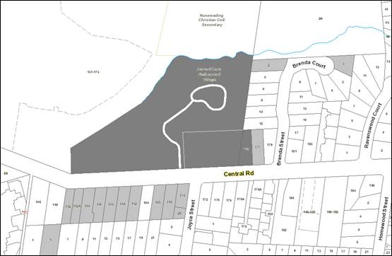
|
|
|
Subject site
|
|
25 Objector Properties
(2 objections each from eight
properties, and 2 properties outside of map)
|
é
North
|
BACKGROUND
History
· Planning permit NUN/2303 was issued 8 June, 1984, allowing
erection of buildings and works to be used as elderly persons units, a
community centre and off-street car parking areas.
· Planning permit NUN/4556 was issued 12 January, 1990,
allowing the development and use of the land for extensions and renovations to
the existing retirement village to provide an additional 19 hostel beds and 25
replacement hostel beds.
· Planning Permit WH/2007/79 was issued 12 August 2008,
allowing buildings and works to alter and extend the existing aged care
facility, associated tree removal, reduction of car parking requirements and
waiver of bicycle facilities requirements.
The Site and Surrounds
The subject site is located on the
north side of Central Road, east of the intersection with Cromwell Court.
The site comprises two lots known as 163-165 and 175 Central Road, Nunawading
being the existing retirement village to the rear of the Seventh Day Adventist
Church, plus one adjacent residential lot to the east at 175 Central
Road. It is an irregular shaped parcel of land with an area of
approximately 2.6 hectares.
The lot at 163-165 Central Road
comprises the existing residential aged care facility with ancillary
independent living units and associated infrastructure. The lot at 175
Central Road previously accommodated a single storey brick dwelling, which was
recently demolished, along with a number of trees that existed on this site.
Planning Enforcement Officers have issued a Planning Infringement Notice for
the removal of protected trees from this lot without a Planning Permit.
The site is undulating and has an
overall fall of approximately 3 metres from the south-east corner to the
north-west corner.
The subject site forms part of a
wider site (located at 131-173 Central Road), with the subject site located
within the south-east corner. The overall site comprises the Nunawading
Christian College in the northern portion and the AdventCare residential aged
care facility and the Seventh Day Adventist Church in the southern
portion.
The overall site fronts Central
Road to the south and backs onto the Belgrave / Lilydale train line to the
north. Residential land abuts the site to the east and west.
Blackburn Lake Sanctuary is located to the southwest of the site and the
Nunawading ‘Mega Mile’ shopping strip is located further north of
the railway line.
The existing retirement village has
an area of approximately 2.5ha (25,000m2), and is within the
Neighbourhood Residential Zone Schedule 3. The existing residential lot at 175
Central Road is within the Neighbourhood Residential Zone Schedule 1, and
covered by the Significant Landscape Overlay Schedule 2.
A Special Building Overlay covers part
of the site along the northern boundary, following the existing waterway which
is partly covered by a barrel drain. The Environmental Significance
Overlay Schedule 1 and Significant Landscape Overlay Schedule 5 both apply to
the north and western edge of the site.
Planning Controls
The site is within the
Neighbourhood Residential Zone Schedule 3 (NRZ3). The purpose of Clause
32.09 (Neighbourhood Residential Zone) includes:
· To
recognise areas of predominantly single and double storey residential development.
· To
limit opportunities for increased residential development.
· To
manage and ensure that development respects the identified neighbourhood
character, heritage, environmental or landscape characteristics.
· To
implement neighbourhood character policy and adopted neighbourhood character
guidelines.
· To
allow educational, recreational, religious, community and a limited range of
other non residential uses to serve local community needs in appropriate
locations.
Pursuant to the NRZ, planning approval
is required for the proposed buildings and works to extend and develop the
existing retirement village.
Clause 32.09-8
deals with maximum building height requirements and sets a maximum requirement
for 9 metres. However, this does not apply to an ‘extension of
an existing building that exceeds the specified building height provided that
the extension does not exceed the existing building height’.
Advice was provided by lawyers for the applicant, which sets out how the
proposed extension would not breach the maximum building height. Overall
the highest point of the existing building is constructed to RL 116.53.
From natural ground level the existing residential aged care building has an
overall building height of 15.3 metres. Irrespective of this, the maximum
relative building height has been measured as being 10.82 metres and has been
applied to the proposed extension.
Planning approval is also required
by Clause 32.09-1 to use the existing residential lot at 175 Central Road for
the purpose of a retirement village.
Pursuant to Clause 42.03
(Significant Landscape Overlay Schedules 2 and 5), and Clause 42.01-1
(Environmental Significance Overlay Schedule 1), planning approval is required
for tree removal. There is no Native Vegetation requiring removal under
Clause 52.27 affected by the proposal.
Pursuant to Clause 52.34 Bicycle
Facilities, the proposal needs a waiver of bicycle parking requirements.
The land is floodprone, and the
applicant has obtained minimum floor levels from Council’s Engineering
and Environmental Services Department.
The site is not an area of Cultural
Heritage Sensitivity, as the waterway to the north of the site is unnamed, and
therefore does not trigger Cultural Heritage legislation, as confirmed by legal
advice from Council’s lawyers.
PROPOSAL
The application involves the
extension of the existing retirement village, including the extension of the
use over the adjacent residential lot at 175 Central Road, and associated
removal of trees and waiver of bike parking requirements.
The key features of the proposal
include:
· Demolition
of 15 existing independent living units, part of the existing dementia ward and
aged care facility.
· The
extension of the existing residential aged care facility will provide 60 beds
over two levels at a maximum height of 10.72 metres. The facility will
also be refurbished internally, including the removal of 12 bedsits, which will
be replaced within the proposed extension, resulting in an overall increase of
48 beds. Combined, the refurbished existing residential aged care
facility and the extension will provide a total of 182 bedsits.
· The
existing ancillary independent living units will be demolished, relocated and
reconstructed with a total of 14 (10 x 1 bedroom and 4 x 2 bedroom) to be
provided. Each unit will be provided with private open space in the form
of a terrace and a car space located within a carport. The units will be
built to a maximum height of 5.3 metres.
· Part
of the existing residential aged care facility and dementia ward buildings will
be demolished and redeveloped with a main entrance, offices and ambulance drop
off space. An internal courtyard will be provided to the main residential
aged care facility building, and kitchen and service areas will be redeveloped.
· A
total of 93 at-grade car spaces will be provided and will comprise the retained
and relocated existing 48 spaces, plus a new car park at the west of the site
(45 new car spaces). These will be located in the south-west corner of
the site.
· Removal
of 17 trees. Trees 24 and 29 require a permit for removal under the SLO5
applicable to the north-western portion of the site. The other trees to
be removed are located outside of the SLO areas, or do not have sufficient
trunk sizes to warrant protection, and thus do not require a permit for
removal. It is noted that Trees 1, 2, 6 and 7 protected by the SLO2 have
recently been removed from 175 Central Road.
· The
application seeks to waive the requirement for the provision of 7 bicycle
spaces.
· The
sewer easement will require relocation from the west boundary of 175 Central
Road, to the east boundary of this lot as indicated on the plans. The
applicant has advised this will be subject to a further planning application,
and any tree protection measures required for the relocated sewer, such as
boring the pipe below the TPZs of protected trees, will be required in
association with that application.
CONSULTATION
Public Notice
The application was advertised by
mail to the adjacent and nearby property owners and occupiers and by erecting
three large notices on the Central Road frontage. Following the
advertising period 25 objections were received.
The issues raised are summarised as
follows:
· Amenity
impacts:
o Paved car park areas
will generate heat
o Increased noise of
delivery and service trucks
o Increased noise of plant
equipment especially at night
o Increased traffic noise
from cars and trucks.
o Increased glare from
headlights of cars exiting the car park
o Light spill from the car
park.
o Loss of privacy
o Staff smoking on
surrounding streets and dropping cigarette butts
· Neighbourhood
Character:
o Building footprint, bulk
and three storey form are out of keeping with the neighbourhood character
o Excessive paving and
insufficient landscaping
o Expansion of an existing
institutional use over an existing residential lot
o Development on 175
Central Road is not in keeping with the SLO2
o Bin store on the Central
Road frontage
o Impacts of multiple
planning applications on the site should be considered
o Western car park will be
too close to the Central Road and the waterway
· Planning
Scheme:
o More than two dwellings
on a lot does not comply with the NRZ
· Fire
Safety
o The Gate 1 access does
not allow multiple fire trucks to exit forwards.
o MFB fire truck ladders
could not reach across the proposed courtyard
· Car
parking and traffic:
o Increased on-street
parking
o Insufficient vehicle
manoeuvring areas on site
o Cars on site could drive
through property boundary fences
· Landscaping:
o Tree removal,
compounding previous loss of vegetation
o Insufficient tree
planting along the eastern boundary and Central Road
o Loss of mature native
trees near Gate 3
· Non-planning
matter:
o Increased problems with
electricity supply to the area.
Consultation Forum
A Consultation Forum was held on 2
March, 2017, chaired by Councillor Stennett with Councillor Cutts
observing. Five objectors, seven representatives for the applicant and
owners and planning officers attended the meeting.
The Chair facilitated discussions
around the themes raised in objections, and the applicant and owner
representatives responded to the issues raised. Key points agreed
include:
· Objectors
seeking assurance that EPA requirements for noise emissions will be met, and
the applicant agreed to conditions to this effect.
· The
applicant advised that the proposed site layout will enable fire trucks to
access the site via the main entrance.
· Objectors
sought light spill from car park and site lighting to be shielded, and the
applicant agreed to comply with conditions to ensure this.
· The
applicant advised that service/delivery trucks would access the site between
7am and 5pm.
· The
applicant advised that, where possible, plant equipment is proposed to be
located at the lowest level, which is well below street level, in order to
limit noise emissions, noting that some plant, such as exhaust flues, are
required to be located on the roof. In addition, the upgrades to service
areas and associated plant are expected to significantly lower noise emissions
as a result of improved acoustic standards for new equipment.
· The
applicant advised that 49% of the site remains permeable, which is little
change from the existing conditions.
· The
applicants agreed to permit conditions requiring predominantly indigenous
plantings (except for the central courtyard which is to be a sensory garden for
residents), planting of perimeter screening landscaping including tall trees,
and for the new car park to the west of the site to be landscaped with shade
trees to screen the visual impact of the paved area and shade parked cars.
· The
applicant agreed that new car parking areas can be conditioned to utilise
permeable paving to support the surrounding trees.
· The
applicant advised that the bin store for the independent living units located
on the Central Road frontage was the best option for this facility, taking into
account resident mobility, site operations and constraints. The applicant
agreed to conditions requiring visual and landscape screening of this store.
· New
designated smoking areas will be created on site to discourage staff from
smoking on the street.
Subsequent to the Forum, the
Applicant provided the following response to the possible solutions discussed:
Amenity
Specific concern regarding amenity
related to:
· Noise
from the kitchen –the kitchen will be upgraded with new appliances which
will significantly reduce the noise, and will have to comply with SEPP-N1
requirements
· Significant
mass of buildings close to Central Road – the aged care building is
setback a minimum of 60m from Central Road, with only the rooftop visible, with
the overall building footprint slightly reduced to what currently exists. The
proposed ILUs are single storey in nature.
· Expansion
will result in more deliveries – the overall number of beds is only
increased by 48, with the existing delivery vehicles able to cater for this
increase.
· Fire
truck access and the use of ladders – any development is required to be
signed off by a building surveyor prior to occupation, so has to be designed
accordingly. Given the residents, the fire protection measures are above and
beyond what would be found in a dwelling or two storey building.
· Tree
removal – the proposal allows for significant tree planting, with the
opportunity to provide planting within the car park setback and potentially
throughout the car park
· Light
spill – can be addressed via a permit condition
· Overlooking
– the aged care building is significantly setback from Central Road and
any neighbouring dwellings with no potential for overlooking. The ILUs can be
appropriately screened, with landscaping opportunities provided along the
interface with 177 Central Road.
· Setbacks
– the aged care building is significantly setback. The ILUs are setback a
minimum of 7m from Central Road and is appropriate for the site, it’s
intended use and the neighbouring properties. The location of the bin enclosure
was considered significantly prior to lodgement, with the proposed location
determined the most appropriate to suit the needs of elderly residents. The
enclosure will be screened and landscaped as appropriate.
Neighbourhood Character
· The
site provides for sufficient planting and has approximately 50% permeability
–landscaping will be provided throughout the development
· Opportunity
for planting in western end of car park
Fire safety
· There
is no requirement in the planning scheme for the proposal to be referred to the
MFB. Irrespective of this, before the building can be occupied, a building
surveyor has to sign off on it, so relevant fire standards will have to be met.
Car parking & traffic
· Whilst
the additional parking will not stop people parking along Central Road, for
activities not associated with this proposal, the proposed parking will enable
staff to park off street as well as visitors and will improve safety at night
with appropriate lighting to be provided. The number of car parks proposed will
encourage people to use the car park and help reduce the perceived on-street
parking problem.
· An
Amended Car Park Layout Plan (attached) provides significant opportunity for
landscaping within the front setback to reduce visibility as well as potential
planting throughout the car park area. The topography of the land also reduces
car parking visibility, and Tree 25 (15 metre high Eucalyptus nicholii
within the SLO5) is able to be retained. This proposed car parking plan
would reduce the number of proposed new car spaces by one, to a total of 50 new
additional spaces in comparison to the existing conditions, and overall parking
provision of 92 spaces.
· Only
the garbage will be collected from Central Road, with staff to place and remove
bins from Central Road on collection days. Recycling will be stored internally
and picked up via a private contractor
· The
applicant offered a number of suggested changes to the advertised plans as a
means of addressing the concerns raised, many of which have been considered and
included within the assessment section of this report.
The applicant also provided a
further response to the Blackburn Village Residents’ Group concerns
expressed by the Blackburn Village Residents’ Group as follows:
· The
proposal is not required to provide a 9 metre setback as Rescode is not
applicable to the Independent Living Units (ILUs). Irrespective of this, the
proposal has been designed to provide a minimum 7 metre front setback to
complement the existing area yet still provide for future resident
capabilities.
· The
development is not for apartments but ILUs and therefore the requirements
differ. As indicated, the bins will be collected via Council with staff to
remove the bins once rubbish has been collected. The bins will be the small
size. Given the age of the future residents, it may be that not all bins will
be collected each collection.
· The
residents have different requirements to those who live in dwellings. The ILUs
have been designed to encourage socialisation amongst residents. The sunlight
access afforded to the north and west facing ILUs is considered appropriate
given the nature of the use. The bin enclosure will be enclosed and will have to
comply with any relevant standards. It is therefore considered that there will
be no smell from the bin enclosure area.
Referrals
External
Melbourne Water
No objection, subject to conditions
relating to finished floor and surface levels and stormwater management.
Public Transport Victoria
No objection, subject to a
condition requiring disruptions to bus services to be minimised.
Internal
Engineering and Environmental
Services Department
· Transport
Engineer
|
Usage
|
Number/Area
|
Rate
|
Required Spaces
|
|
Residential
aged care facility
|
48
|
0.3 spaces per lodging room
|
14
|
|
Residential
Village
|
|
|
|
|
· 1 & 2 bedroom dwellings
|
-1
|
1 space
per dwelling
|
-1
|
|
|
Total
spaces required
|
13
|
Clause 52.06 of the Whitehorse
Planning Scheme requires the following parking provision for the proposed
development:
The proposed parking provision is for 45 additional parking
spaces, therefore the proposal provides over and above the planning scheme
parking requirements and is considered satisfactory.
As detailed in the traffic impact assessment report
submitted by the applicant, it is unlikely that there will be a significant
impact upon the local road network or nearby intersections, therefore there is
no objection to the proposal based on traffic impact.
· Waste
Engineer
The submitted Waste Management Plan
is approved, subject to conditions relating to bin size, placement and waste
truck movements.
· Assets
Engineer
Consent, subject to conditions
Planning Arborist
Trees to be Removed:
The following trees are shown on the
plans to be removed:
· Trees
5, 8, 9, 10, 11, 18, 20 (x5 trees), 21, 22, 23, 24, and 29 (1 tree only out of
the group of three trees).
All of these trees are either good
to fair in health or structure. They are generally small to medium sized trees,
ranging from 6 to 12 metres in height. As single specimens and due to their
locations, they do not contribute to the broader landscape character of the SLO
(where applicable).
However, they provide some amenity
to the site by way of breaking up bulk form. Whilst the trees do have a
function, there is no objection to their removal. The reason for this is
because their removal will not impact the SLO, and they can be replaced once
the project has been completed.
It is recommended the replacement
trees contain a mix of species from the Recommended Tree List, and two for one
replacement planting is undertaken.
Tree protection conditions are
required for a number of retained trees, and these will ensure that there are
no adverse impacts to these trees as a result of the proposed buildings and
works.
ESD Advisor
Council’s ESD Advisor has
reviewed the commitments in the submitted Sustainability Management Plan, and
recommended further improvements to sustainability measures, in particular to
water management requirements, which will be included as conditions.
Building Surveyor
The Registered Building Surveyor
will be required to provide Fire Precautions in accordance with Clause E1.9 of
the Building Code of Australia.
Environmental Health
Noted that separate approval is required
by Council’s Environmental Health Unit for the new kitchen and servery
areas.
DISCUSSION
Consistency with State and Local
Planning Policies
Plan Melbourne acknowledges that the
demand for new housing will be influenced by the ageing population and a desire
for people to age in place. It is noted that by 2051 the number of Victorian
residents aged 65 or older will have increased nearly three-fold.
The Whitehorse Housing Strategy 2014 states that the
population of Whitehorse is currently ageing at a greater rate than
metropolitan Melbourne, with 17.3% of the City’s population aged over 65
years in 2011, compared to 13.1% in Greater Melbourne. The Strategy notes
that the age group within Whitehorse forecast to have the largest proportional
increase, relative to its current population size, by 2031 is residents over 65
years.
Clause 15, Built Environment and Heritage, identifies that planning
should ensure all new land use and development appropriately responds to valued
built form and cultural context.
Clause 16.01-1 Integrated Housing seeks to ensure that the planning
system supports the appropriate quantity, quality and type of housing,
including the provision of aged care facilities.
Clause 16.01-4 Housing Diversity seeks to ensure housing stock matches
changing demand by widening housing choice, particularly in the middle and
outer suburbs.
Clause 16.01-5 Housing Affordability directs that choice and housing
type, tenure and cost should be increased to meet the needs of households as
they move through life cycle changes and to support diverse communities.
Clause 16.02-3 Residential Aged Care Facilities requires the timely
development of residential aged care facilities to meet existing and future
needs. The relevant strategies are as follows:
· Ensure
local housing strategies, precinct structure plans, and activity centre
structure plans provide for residential aged care facilities.
· Encourage
planning for housing that:
· Delivers
an adequate supply of land or redevelopment opportunities for residential aged
care facilities.
· Enables
older people to live in appropriate housing in their local community.
Clause
16.02-4 Design and location of residential aged care facilities encourages the
provision of well-designed and appropriately located facilities. The relevant
strategies are as follows:
· Recognise
that residential aged care facilities contribute to housing diversity and
choice, and are an appropriate use in a residential area.
· Recognise
that residential aged care facilities are different to dwellings in their
purpose and function, and will have a different built form (including height,
scale and mass).
· Provide
for a mix of housing for older people with appropriate access to care and
support services.
· Ensure
that residential aged care facilities are located in residential areas,
activity centres and strategic redevelopment areas, close to services and
public transport.
· Ensure
that:
· Residential
aged care facilities are designed to respond to the site and its context.
· Residential
aged care facilities aspire to high urban design and architectural standards.
The local
planning policy framework identifies a need for such types of alternative
accommodation and given its inherent nature, will have little off-site amenity
impacts.
Design and Built Form
The subject
site is a large parcel of land set within an established residential area,
comprising single and double storey dwellings. The site itself adds to
the character, noting it contains a spacious landscape setting with a mixture
of buildings, which vary in scale, with the most notable building being the
Seventh Day Adventist Church.
The subject
site is included within a Garden Suburban Precinct 11 area. Part of the
northern section of the site and 175 Central Road is located within the Bush
Environs Precinct. Neighbourhood character is also guided by the
SLO2 (affecting 175 Central Road) and SLO5 (affecting 131-173 Central
Road).
The development
provides appropriate built form outcomes as follows:
· The
extension primarily sits deep within the site where the existing residential
aged care building is positioned. The extended residential aged care
facility will be setback a minimum of 70 metres from Central Road and will be
located behind the existing church and the proposed independent living
units. The remainder of the works are located within the western portion
of the site and comprise at-grade parking.
· The
extension is incorporated over two levels at a maximum height of 10.72
metres. Although it may appear on the plans that the proposed
lift-overrun us above the allowed height, it is noted that the elevations show
the height of the building from NGL at that cross-section. The lift overrun is
located further behind this cross-section, with the NGL (at that point) higher.
The matter of building height is
also discussed above noting the extension is not greater than the existing
10.82 metre height of the current building. The Neighbourhood Residential
Zone at Clause 32.09-9 allows residential buildings to exceed the usual
building height restrictions where it replaces an immediately pre-existing
building and the new building does not exceed the building height or contain a
greater number of storeys than the pre-existing building. As such, the
proposed building height is acceptable.
· The
design of the extension is articulated through the application of a range of
building materials and finishes that are of high quality, durable and low
maintenance. The external materials include a mix of black and white
bricks, metal and timber cladding.
· The
ILUs are setback approximately 7.3 metres from the Central Road boundary and a
minimum of 3 metres from the eastern boundary. Units 9 to 14 are located
a similar depth in site to the proposed residential aged care facility
extension and will also be positioned behind units 1 to 8. They are also
a minimum of 4 metres from the east boundary. The overall height of the
units is a maximum of 4.9 metres. This height will assist the units in
integrating into the site with little off-site visual impact. The
external materials offer a domestic feel and include timber cladding, designed
as a skin wrapping around the façade with white bricks interspersed
throughout with glazing to the large floor to ceiling windows. This
design response offers a reflection of the established residential character
and the front setback will provide for landscaping opportunities commensurate
with the Bush Environment character of the area.
· Overall,
the proposed building footprint will be similar to the existing conditions, and
the proposed buildings are no higher than the existing aged care
facility. The proposal will allow 49% of the site to remain
permeable. Whilst it is acknowledged that this exceeds the preferred 40%
maximum building coverage required by Schedule 3 to the Neighbourhood
Residential Zone, it is noted that the overall building coverage proposed is
similar to the existing building coverage 24.47% (0.92% increase).
· Council
and submitters have concerns with the advertised car parking layout at the
western corner of the site being visually prominent to the Central Road
frontage. The Amended Car Park Layout Plan (attached) submitted by the
applicant as a result of the Forum discussions incorporates a significant
reduction in the car parking area along the Central Road frontage, which is
balanced by increased car spaces proposed over the existing lawn area along the
western portion of the north boundary.
· This
amended plan allows for the retention of the 15 metre high Tree 25 at the site
frontage and will not impact on any other trees. The amended car park
layout provides an increase in the front setback to the paved parking areas
from 1 to 4 metres minimum, and a reduced length of car parking facing Central
Road, which will allow for increased landscaping to screen and soften the
presentation of the car parks to Central Road.
· In
addition, it is noted that there is a fall of approximately 1 metre from
Central Road to the front of the car parking area, with this topography
reducing the overall visual prominence of the paving. As such, the
proposed amended car park layout and retention of Tree 25 represent a
significant improvement to the overall site presentation and conditions will
require the plans to be amended accordingly. As agreed with the applicant,
there will be a concentration of landscaping within the setback between Central
Road and the car park area to be addressed through a condition of the
permit.
· The
proposed buildings and works have limited interface with the open waterway
along the eastern portion of the north site boundary, and are located towards
the west of the site where the waterway has been covered over in a barrel
drain. As such, there will be no detrimental impact on the waterway as a
result of the proposed works. Importantly, Melbourne Water has imposed
conditions to protect their assets.
· There
are two existing crossovers serving the extended aged care building, which will
maintain the existing on-street car parking provision. The two crossovers
will each serve a separate purpose. The southernmost crossover will
provide access to the staff parking area with the middle crossover providing
access to the visitor parking area. Presently staff, visitors, emergency
services, waste collection and deliveries use the same access points with no
direction as to which entry / car park to use. The proposed separation of
visitor and service entrances to the car parks will improve the overall
efficiency of traffic movement, reduce confusion and improve safety outcomes
throughout the site.
· As
demonstrated in the landscape concept, there will be the significant planting
within the site and along the site boundaries to maintain the primary garden
suburban character of the site whilst allowing the development to sit secondary
within the landscape. The landscape concept also incorporates a
playground, which is available for use by visitors to the site and the
adjoining church. The development will ensure it will maintain an
existing garden suburban character in accordance with Clause 22.03 and Clause
22.04.
· It
is not clear from the plans whether the existing low cyclone mesh fence along
the south (front) boundary is to be retained or removed, and a condition will
require this to be clarified on the plans, noting that any increase in height
of the front fence or loss of permeability would not be supported, and
alterations to fencing may require additional planning approval. No
fencing is proposed along the west or north boundaries.
· The
proposed bin enclosure within the front setback of the ILUs will be a low scale
structure within the streetscape. The applicant has advised that various
options for the bin enclosure location were explored, and given the age of the
residents and their limited mobility, and the operational constraints of the
site, the proposed frontage location was the best solution. The low scale
structure will be required to be screened with landscaping and screening
materials, including the planting of two trees in front of the enclosure, to
limit the visibility of this structure within the streetscape.
· A
full colours and materials schedule, including provision of a light coloured
roof for energy efficiency, will be conditioned.
· Overall,
the proposal achieves an acceptable level of compliance with the objectives of
Clause 55 for a residential building, which, despite strictly not being
applicable, do serve as a useful guide in assessing built form outcomes in a
residential area.
Amenity
The development provides
appropriate amenity outcomes as follows:
· There
is currently and will continue to be, limited visibility of the facility from
the streetscape with landscaping along this interface to be enhanced.
· The
ILUs are setback a minimum of 3 metres from adjacent residential lots, are
single storey and built to a height of 4.9 metres.
· A
1.8 metre high existing fence is along the east boundary to maintain a level of
privacy to adjacent residential lots.
· There
is limited opportunity for overlooking, with this being restricted to the
bedrooms at the eastern and western ends of the building. To reduce the
opportunity for overlooking, the new rooms have been designed to have the room
slightly setback from the edge of the external façade. It is also
noted that many residents will not be able to perceive overlooking over great
distances.
· The
ILUs have been specifically designed to encourage social interaction between
residents, which have the benefit of preventing social isolation of residents
and provides a sense of belonging.
· Large
windows have been provided to all ILUs to provide sufficient access to natural
light and ventilation. The orientation of the units ensure the private
open space and communal areas maintain access to northern light.
· As
discussed at the Forum, the applicant will be updating much of the existing
plant equipment on site, and intends to locate equipment to minimise off-site
noise emissions. Compliance with EPA noise requirements will be required.
· Light
spill to surrounding residential lots will be required to be shielded.
· Existing
conditions have resulted in delivery vehicle noise impacts to residents.
The applicant has advised that service/delivery trucks access may be restricted
to between 7am and 5pm. Furthermore, the proposed service yard and bin
store will be located approximately two metres below ground level, and the
retaining walls around this area will provide some acoustic screening for
delivery noise.
· The
applicant advised that the bin store for the ILUs located on the Central Road
frontage was the best option for this facility, taking into account resident
mobility, site operations and constraints. The applicant agreed to
conditions requiring visual and landscape screening of this store.
· The
existing aged care facility currently has a ban on smoking on the site,
resulting in staff smoking on the street, and causing concern to
residents. In order to discourage this, the applicant has agreed to
provide designated staff smoking areas on site.
Tree Removal
The application proposes the
removal of trees from the subject site as follows:
|
Tree No.
|
Species
|
Common Name
|
Retention Value
|
Permit Trigger?
|
Status
|
|
5
|
Jacaranda mimosifolia
|
Jacaranda
|
Low
|
|
3m high
|
|
8
|
Schefflera actinophylla
|
Umbrella Tree
|
Low
|
|
6m high
|
|
9
|
Callistemon viminalis
|
Weeping Bottlebrush
|
Low
|
|
3m high
|
|
10
|
Cupressocyparis leylandii
|
Leyland Cypress
|
Low
|
|
14m high
|
|
11
|
Picea pungens Glauca group
|
Blue Spruce
|
Low
|
|
7m high
|
|
18
|
Cupressus glabra
|
Blue Spruce
|
Low
|
|
6m high
|
|
20
|
Pyrus calleryana (5 trees)
|
Callery Pear
|
Medium
|
|
8m high
|
|
21
|
Eucalyptus leucoxylon
|
Yellow Gum
|
Low
|
|
6m high
|
|
22
|
Liquidambar styraciflua
|
Liquidamber
|
Medium
|
|
12m high
|
|
23
|
Cupressus
sempervirens Stricta Group
|
Pencil Pine
|
Medium
|
|
12m high
|
|
24
|
Liquidambar styraciflua (2
trees)
|
Liquidamber
|
Medium
|
SLO5
|
9m high
|
|
29
|
Paulownia tomentosa (southern
tree of a group)
|
Empress Tree
|
Medium
|
SLO5
|
7m high
|
The Significant Landscape Overlay
Schedule 5 and Environmental Significance Overlay Schedule 1 apply to the
north-western boundary of the site, requiring planning approval for the removal
of Trees 24, and 29.
Overall the application proposes
the removal of 17 trees listed above. Council’s Arborist has
reviewed these trees and has consented to the proposed removal as none of these
trees have a high retention value, and they do not make a significant contribution
to the landscape character of the area. Replacement planting at a ratio
of two to one (total 42 trees) will be required, including a mix of indigenous,
native and exotic species, in order to maintain and enhance the landscape
character of the area in accordance with Clause 22.04 Tree Conservation Policy,
and to ensure the site maintains the values of the surrounding SLO areas.
It is noted that four trees
protected by the Significant Landscape Overlay Schedule 2 were recently removed
from the residential lot at 175 Central Road. These trees were: Tree 1 (Acacia
melanoxylon), Tree 2 (Acer negundo), Tree 6 (Photinia
serratifolia), and Tree 7 (Chamaecytisus palmensis). Planning
Enforcement has issued an infringement notice for the unauthorised removal of
these trees.
Significant Landscape Overlay
Schedules 2 and 5 and Environmental Significance Overlay Schedule 1
The following table outlines the
areas where there is a permit trigger for the independent living units at 175
Central Road in accordance with Significant Landscape Overlay Schedule 2 at
Clause 42.03 of the Scheme:
|
SLO2
|
Permit
Trigger
|
Proposal
|
|
Setback
from the frontage
|
Less
than 9 metres for a single storey building or 11 metres for any upper floor
setback
|
Minimum
front setback 7.1 metres
|
|
Setback
from side boundary
|
Less
than 1.2 metres for buildings with wall heights less than 3.6 metres
|
West
elevation- part zero setback
|
|
Maximum
Hard Surface Area
|
Hard surfaced areas (excluding buildings) over 17% of
the site area
|
Approximately
47% (within SLO2 area)
|
|
Maximum
hard surface & building coverage
|
Maximum of 50%
|
Approximately
79% (within SLO2 area)
|
|
Buildings
and works within 4 metres of protected trees
|
Works or
alter the topography within 4 metres of any protected trees
|
Works
within 4 metres of Trees 3, 4, 12, 13 and 14.
|
The following table outlines the
areas where there is a permit trigger for the car park at the west of the site
in accordance with Significant Landscape Overlay Schedule 5 at Clause 42.03 of
the Scheme:
|
SLO5
|
Permit
Trigger
|
Proposal
|
|
Construct
a fence
|
Fence on Central Road or 4 metres from protected
trees
|
Unclear-
condition to clarify
|
|
Removal
of protected trees
|
Remove a
tree with a circumference of 0.5 metre at a height of 1 metre above ground
|
Removal
of Trees 24 and 29.
|
The
proposed independent living units have a low scale, single storey built form,
and their front setbacks of 7.1-7.7 metres provide a transition between the 9.6
metre front setback of the dwelling to the east and the 6.6 metre front setback
of the Church to the west. As such, the reduced front setback is
appropriate, and allows for tree planting in the frontage to contribute to the
Bush Environment character of the Significant Landscape Overlay precinct.
It is
noted that 175 Central Road is located at the edge of the Significant Landscape
Overlay Schedule 2, and is proposed to be incorporated into the existing
Seventh Day Adventist Retirement Village site. Overall, the Retirement
Village provides for a campus style site layout that allows extensive opportunities
for landscaping and tree planting to contribute to the surrounding Significant
Landscape Overlay areas. The loss of one detached dwelling will be
off-set by the provision of improved aged care provision on this site, which
will support Whitehorse’s ageing population.
The side
boundary interface to the east of the independent living units includes 1-2.5
metre landscaping areas which are required to support screening
vegetation. The proposed car park to the rear of the independent living
units includes zero boundary setbacks to paved areas adjacent to residential
lots to the north and east and extensive hard surface coverage to 175 Central
Road, which is acceptable in this instance given the low anticipated usage of
this car park by independent living unit residents, the location of the site at
the edge of the Significant Landscape Overlay, and the broader strategic
objectives to improve aged care accommodation opportunities in
Whitehorse. This minor extension to an established retirement village represents
a minor incursion into the Significant Landscape Overlay which can be balanced
by additional tree planting within the streetscape and throughout the balance
of the subject site, which has an overall permeable area of 49%.
The
proposed ILUs include some minor site cuts along the eastern boundary, within
the TPZs of Trees 3, 4, 12, 13 and 14, which have been assessed by
Council’s Planning Arborist who has required tree protection conditions
to limit excavation within some TPZ areas in order to ensure the on-going
health of these trees.
The applicant has not advised the
locations of any service trenches required for the proposed buildings and
works. In order to ensure that the excavation associated with provision
of utility services to the site will not impact on any trees protected by the
Significant Landscape Overlays, a condition will require details of service
trenching.
The Environmental Significance
Overlay Schedule 1 at Clause 42.01 applies to the same area as the Significant
Landscape Overlay Schedule 5 and requires planning approval to remove, destroy
or lop native vegetation and to construct a fence. Aside from the trees
discussed above, there will not be any impacts to protected native vegetation.
As discussed above, it is unclear
whether the existing front fence along Central Road is to be retained or
removed, and either is allowed under the applicable overlays, and a condition
will require this to be clarified. Any alteration to the existing front
fence aside from removal, or fencing within the Environmental Significance
Overlay Schedule 1 will require additional planning approvals.
Landscaping
The subject site is bordered to the
east, north and west be Significant Landscape Overlay Schedules 2 and 5 and the
Environmental Significance Overlay Schedule 1, and the submitters expressed a
desire for the subject site to contribute to the Bush Environment
characteristics of the Blackburn Lake precinct.
At the Forum, the applicant agreed
to provide predominantly native and indigenous plantings for new landscaping
areas, with the exception of the central courtyard, which is to be a sensory
garden for residents. It was further agreed that perimeter screening
landscaping including tall trees would be provided, and the new car parks to
the west of the site would be landscaped with shade trees to screen the visual
impact of the paved area and shade parked cars. In addition, it was
agreed that new car parking areas would utilise permeable paving to support the
surrounding trees on the subject site and neighbouring residential lots.
All of these requirements will be included as permit conditions.
Car Parking
Clause 52.06
applies to a new use and an increase in the floor area of an existing use and
seeks to ensure the provision of an appropriate number of car parking
spaces. The development has a statutory requirement for 13 car
spaces. Council’s Transport Engineers have advised that the
original proposal to provide an additional 45 spaces exceeds the statutory
requirement. It is noted that the Amended Car Park Layout Plan will
reduce the number of additional car spaces provided to 44 (providing a total of
92 spaces including 14 new spaces for the independent living units), which is
acceptable as it continues to exceed the required car parking provision.
As part of the
redevelopment across the site, the existing car park will be relocated to the
new car park to better control vehicle movement and create an overall safer
environment. The ILUs will use the existing church crossover which is
also currently used by those who attend the church.
As identified
in the traffic assessment, it is expected that the proposal will generate a
total of approximately 100 vehicle trips per day, being 96 for the residential
aged care facility and 3.4 for the units. In peak hour, it is estimated
that there will be a total of 10 and 0.4 vehicle movements for the residential
aged care facility and units respectively. This number of trips is
considered negligible and can easily be accommodated within the surrounding road
network and intersection without any adverse impacts.
A loading bay is provided within
the service yard in the vicinity of the waste bin storage area. Swept
path diagrams contained within the Traffic Assessment show that an 8.8 metre
MRV design vehicle is able to service this area and turn around with one
corrective manoeuvre.
A Parking and Access Management
Plan will be required to provide details of car park line marking and signage
to ensure visitors and service/staff vehicles are directed to the appropriate
car parks.
Clause 52.34 Bicycle Facilities
Under Clause 52.34-2 a permit is
sought to waive the bicycle requirement and is considered appropriate as:
· General
nature of the trips to the site is likely to be a vehicle.
· General
age and mobility of the residents.
· Shift
work of staff where car is a more suitable alternative for safety.
Special
Building Overlay
A minimal
portion of the site is subject to flooding. The sections of the
development within the overlay is the car park and part of the proposed main
entry. The application has been referred to Melbourne Water who are
satisfied that the development will not obstruct the overflow path, subject to
conditions.
Objectors Concerns not
Previously Addressed
· Increased
traffic noise from cars and trucks.
Residential noise is considered
normal and reasonable in an urban setting. Any future issues of amenity, if
they arise, should be pursued as a civil matter. Some noise and other off site
impacts are inevitable when any construction occurs. The developer will
be required to meet relevant Building and EPA regulations regarding
construction practices to ensure these impacts are mitigated, and on-going
delivery/service vehicle noise has been discussed above.
· Increased
glare from headlights of cars exiting the car park
Conditions will require improved
perimeter landscaping which will mitigate some headlight glare, although this
is considered to be a normal occurrence within an urban setting.
· Impacts
of multiple planning applications on the site should be considered
Each application is assessed on its
own merits and in the context of existing and approved developments in the
vicinity. Whilst there have been numerous applications for development on
the broader Seventh Day Adventist site in recent years, each has been assessed
in relation to the applicable planning controls, and overall increased building
form and utilisation of the site has been balanced with protection of the most
significant areas of remnant native vegetation and requirements to improve the
tree coverage and landscaping of the overall site.
· Increased
problems with electricity supply to the area.
This will be
assessed by the electricity company in association with the building process.
CONCLUSION
The proposal for construction of extension
of an existing residential building, buildings and works to use and develop a
retirement village and associated tree removal and waiver of bicycle parking
requirements is an acceptable response that satisfies the relevant provisions
contained within the Whitehorse Planning Scheme, including the State and Local
Planning Policies, the Neighbourhood Residential Zone Schedules 1 and 3,
Special Building Overlay, Significant Landscape Overlay Schedules 2 and 5 and
Environmental Significance Overlay Schedule 1.
Overall the proposed expansion of
the existing retirement village is considered appropriate on this existing
institutional site as it will provide additional accommodation to support
Whitehorse’s ageing population. And importantly, the overall
building height and building footprint remain consistent with the existing
conditions and the landscaping and tree coverage of the site will be enhanced.
A total of 25 objections were
received as a result of public notice and all of the issues raised have been
discussed as required.
It is recommended that the
application be approved subject to conditions.
Attachment
1 Amended Car
Park Layout Plan ⇨ 
2 Advertised
Development and Landscape Plans ⇨ 
Ordinary Council Meeting 15
May 2017
10.1.2A 1-3
Kinkora Road, Blackburn (Lot 1 LP 97058 and Lot 1 TP 190433) for the
construction of four double storey dwellings
ATTACHMENT
SUMMARY
This
application was advertised, and a total of 15 objections have been received.
The objections raise issues with neighbourhood character, traffic and parking,
loss of vegetation, and impacts on amenity. A Consultation Forum was held
on 28 September 2016, chaired by Council Officers on behalf of the Ward
Councillors during the care taker period, at which the issues were explored,
however no resolution was reached between the parties. This report
assesses the application against the relevant provisions of the Whitehorse
Planning Scheme, as well as the objector concerns. It is recommended that
the application be supported, subject to conditions.
|
RECOMMENDATION
That Council:
A. Being
the Responsible Authority, having caused Application WH/2016/149 for 1 and 3
Kinkora Road, BLACKBURN (Lot 1 LP 97058 and Lot 1 TP 190433) to be advertised
and having received and noted the objections is of the opinion that the
granting of a Planning Permit for the development of four
double storey dwellings is acceptable and should be supported.
B. Issue
a Notice of Decision to Grant a Permit under the Whitehorse Planning Scheme
to the land described as 1-3 Kinkora Road,
BLACKBURN (Lot 1 LP 97058 and Lot 1 TP 190433P) for the construction of four double storey dwellings,
subject to the following conditions:
1. Before the
development starts, or any trees or vegetation are removed, amended plans
(three copies) shall be submitted to and approved by the Responsible
Authority. The plans must be drawn to scale, with dimensions, and be
generally in accordance with the submitted received on 4 July 2016, but
modified to show:
a) The locations of Tree
Protection Zones described in condition 5, with all nominated trees clearly
identified and numbered on both site and landscape plans, and the
requirements of conditions 5 and 6 to be annotated on the development and
landscape plans.
b) Alterations to the Dwellings 3 and 4, and the
accessway to enable vehicles to access and egress both car spaces in the
garages in a forward facing direction, in accordance with Clause 52.06 of the
Whitehorse Planning Scheme, with no reduction of any building setbacks.
c) Declare all hard surface areas in the service
yards and review the permeability figures accordingly.
d) Notation on site plans indicating that
all obscured glazing be manufactured from obscured glass. Obscure film being
applied to clear glazing will not be accepted.
e) A detailed schedule of all external
cladding colours, textures, finishes, and materials.
f) A Landscaping Plan in accordance
with Condition 3.
All of
the above must be to the satisfaction of the Responsible Authority. Once
approved these plans become the endorsed plans of the permit.
2. The layout of the
site and the size, design and location of the buildings and works permitted
must always accord with the endorsed plan and must not be altered or modified
without the further written consent of the Responsible Authority.
3. No building or works shall be
commenced (and no trees or vegetation shall be removed) until a landscape
plan prepared by a suitably qualified and experienced person or firm has been
submitted to and endorsed by the Responsible Authority. This plan when
endorsed shall form part of this permit. This plan shall show:
a) A
survey of all existing vegetation, abutting street trees, natural features
and vegetation.
b) Buildings,
outbuildings and trees in neighbouring lots that would affect the landscape
design.
c) Planting
within and around the perimeter of the site comprising trees and shrubs
capable of:
i. Providing
a complete garden scheme,
ii. Softening
the building bulk,
iii. Providing
some upper canopy for landscape perspective,
iv. Minimising
the potential of any overlooking between habitable rooms of adjacent
dwellings.
d) A
schedule of the botanical name of all trees and shrubs proposed to be
retained and those to be removed incorporating any relevant requirements of
condition No. 1.
e) The
proposed design features such as paths, paving, lawn and mulch.
f) A
planting schedule of all proposed vegetation (trees, shrubs and ground
covers) which includes, botanical names, common names, pot size, mature size
and total quantities of each plant.
Landscaping
in accordance with this approved plan and schedule shall be completed before
the building is occupied.
Once
approved these plans become the endorsed plans of this permit.
4. Landscaping in accordance with an
approved Landscape Plan must be completed before the development is
occupied. The garden areas shown on the endorsed plan and schedule
shall only be used as gardens and shall be maintained in a proper, tidy and
healthy condition to the satisfaction of the Responsible Authority.
Should any tree or shrub be removed or destroyed it may be required to be
replaced by a tree or shrub of similar size and variety. Prior to the
commencement of any building and or demolition works on the land, a Tree
Protection Zone (TPZ) must be established and maintained during and until
completion of all buildings and works including landscaping, around the
following trees in accordance with the distances and measures specified
below, to the satisfaction of the Responsible Authority:
a) Tree protection zone
distances:
i. Tree 7 Betula pendula
– 2.0 metre radius from the centre of the tree base.
ii. Tree 8 Camellia
Japonica– 2.0 metre radius from the centre of the tree base.
iii. Tree
11 Pittosporum tenuifolium – 2.0 metre radius from the centre of the
tree base.
iv. Tree
17 Fraxinus angustifoila – 2.5 metre radius from the centre of the tree
base.
b) Tree protection zone
measures are to be established in accordance to Australian Standard 4970-2009
and including the following:
i. Erection
of solid chain mesh or similar type fencing at a minimum height of 1.8 metres
held in place with concrete feet.
ii. Signage
placed around the outer edge of perimeter fencing identifying the area as a
TPZ. The signage should be visible from within the development, with the
lettering complying with AS 1319.
iii. Mulch
across the surface of the TPZ to a depth of 100mm and undertake supplementary
watering in summer months as required.
iv. No
excavation, constructions works or activities, grade changes, surface
treatments or storage of materials of any kind are permitted within the TPZ
unless otherwise approved within this permit or further approved in writing
by the Responsible Authority.
v. All
supports and bracing should be outside the TPZ and any excavation for
supports or bracing should avoid damaging roots where possible.
vi. No
trenching is allowed within the TPZ for the installation of utility services
unless tree sensitive installation methods such as boring have been approved
by the Responsible Authority.
vii. Where
construction is approved within the TPZ, fencing and mulching should be
placed at the outer point of the construction area.
viii. Where
there are approved works within the TPZ, it may only be reduced to the
required amount by an authorised person only during approved construction
within the TPZ, and must be restored in accordance with the above
requirements at all other times.
5. During the construction of any
buildings or works, the following tree protection requirements must be
carried out to the satisfaction of the responsible Authority:
a) The driveway where
within the TPZs of Trees 7 - Betula pendula and 8 - Camellia Japonica must be
constructed at the existing soil grade using porous materials that allow
water to penetrate through the surface and into the soil profile. No roots
are to be cut or damaged during any part of the construction process.
b) All buildings and
works for the demolition of the site and construction of the development (as
shown on the endorsed plans) must not alter the existing ground level or
topography of the land within 0.5m of the south boundary fence where within
the TPZ of Tree 11 - Pittosporum tenuifolium.
6. The existing street tree must not be
removed or damaged unless with the further written consent of the Responsible
Authority. Tree protection fencing must be erected prior to any
demolition and commencement of any buildings and works.
7. All external lights must be of a
limited intensity to ensure no nuisance is caused to adjoining or nearby
residents and must be provided with approved baffles, so that no direct light
or glare is emitted outside the site.
8. The car parking areas and accessways
as shown on the endorsed plans must be formed to such levels so that they may
be used in accordance with the plan, and must be properly constructed,
surfaced and drained. The car park and driveways must be maintained to
the satisfaction of the Responsible Authority.
9. All stormwater drains must be
connected to a point of discharge to the satisfaction of Responsible
Authority.
10. Prior to any works, design plans and
specifications of the civil works within the site associated with the
development are to be prepared by a registered consulting engineer (who is
listed on the Engineers Australia National Professional Engineer Register),
and submitted to the Responsible Authority. Certification by the consulting
engineer that the civil works have been completed in accordance with the
design plans and specifications must be provided to the Responsible
Authority.
11. Detailed civil plans and computations for
stormwater on-site detention (if required) and connection to the legal point
of discharge must be prepared by a suitably experienced and qualified
professional, and submitted to and approved by the Responsible Authority
prior to the commencement of any works.
12. Stormwater connection to the nominated point of
discharge and stormwater on-site detention (if required) must be completed
and approved to the satisfaction of the Responsible Authority prior to the
occupation of the buildings.
13. Stormwater that could adversely affect any
adjacent land must not be discharged from the subject site onto the surface
of the adjacent land.
14. The Applicant/Owner must be responsible to meet
all costs associated with reinstatement and/or alterations to Council or
other Public Authority assets deemed necessary by such Authorities as a
result of the development. The Applicant/Owner shall be responsible to
obtain an "Asset Protection Permit" from Council at least 7 days
prior to the commencement of any works on the land and obtain prior specific
written approval for any works involving the alteration of Council or other Public
Authority assets.
15. No street trees are to be damaged or removed
unless with the further written consent of the Responsible Authority.
16. All treatments to prevent overlooking must not
include ‘Translucent film’ on windows and must be in accordance
with Standard B22 of Clause 55.
17. The development must be provided with external
lighting capable of illuminating access to each garage and car parking
space. Lighting shall be located, directed and shielded and of limited
intensity that no nuisance or loss of amenity is caused to any person within
and beyond the site. Prior to the occupation of the development, all
boundary walls must be constructed, cleaned and finished to the satisfaction
of the Responsible Authority.
18. No equipment, services and architectural
features other than those shown on the endorsed plan is permitted above the
roof level of the building unless otherwise agreed to in writing by the
Responsible Authority.
19. This permit will expire if one of the following
circumstances applies:
a) The development is not commenced within two
(2) years from the date of issue of this permit;
b) The development is not completed within four
(4) years from the date of this permit.
20. The Responsible Authority may
extend the periods referred to if a request is made in writing pursuant to
the provisions of Section 69 of the Planning and Environment Act 1987.
PERMIT
NOTES:
1. Soil
erosion control measures must be adopted at all times to the satisfaction of
the Relevant Authority during the construction stages of the
development. Site controls and erosion minimisation techniques are to
be in accordance with the EPA (Environment Protection Authority) Victoria
“Environmental Guidelines for Major Construction Sites”. The
works during and after construction must comply with the above guidelines and
in potentially high erosion areas a detailed plan may be required to indicate
proposed measures and methodology.
2. The
property owner/ builder is to obtain the relevant permits and consents from
Council in relation to asset protection, drainage works in easements and
works in the road reserve prior to the commencement of any works.
3. All
stormwater drainage within the development site and associated with the
building(s) (except for an on-site detention system and connection to the
nominated legal point of discharge within the site) must be approved and
completed to the satisfaction of the Building Surveyor prior to the
occupation of the building(s), in accordance with the provisions of the
Building Regulations (2006) section 610.
4. The
surface treatment and design of all crossovers and driveways shall be of
materials submitted to and approved by the Responsible Authority and must be
constructed in accordance with the submitted details.
5. Any
proposed vehicle crossing must adhere to Whitehorse Council’s –
Vehicle Crossing General Specifications.
6. Any
services that need to be removed and relocated due to the location of the
proposed vehicular crossing/s must be financed by the developer.
7. Any
services that need to be removed and relocated due to the location of the
proposed vehicular crossing must be approved by the relevant Authority prior
to commencement of works.
8. No
trees are permitted to be planted within the easement on the eastern boundary
of the property.
C Has
made this decision having particular regard to the requirements of Sections
58, 59, 60 and 61 of the Planning and Environment Act 1987.
|
MELWAYS REFERENCE 47 H/J9
|
Applicant: West
Urban Group
Zoning: General
Residential Zone, Schedule 1 (GRZ1)
Overlays: No
Overlays
Relevant Clauses: Clause
11 Settlement
Clause
12 Environment and Landscape
Values
Clause
15 Built Environment and
Heritage
Clause
16 Housing
Clause 21.05
Environment
Clause 21.06
Housing
Clause 22.03
Residential Development
Clause 22.04
Tree Conservation
Clause 32.08
General Residential Zone, Schedule 1
Clause 52.06
Car Parking
Clause
55 Two or More Dwellings on a Lot
and Residential Buildings
Clause
65 Decision Guidelines
Ward: Central
|
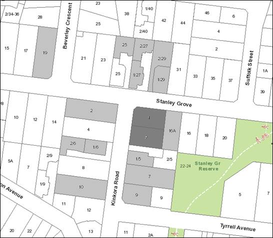
|
|
|
Subject site
|
|
15 Objector Properties
One outside the map
|
é
North
|
BACKGROUND
History
There is no record of previous
permit applications on these sites.
The Site and Surrounds
The subject site comprises two lots
located on the south-east corner of Stanley Grove and Kinkora Road. The
combined lots provide a frontage of 28 metres to Stanley Grove, 33.3 metres to
Kinkora Road with a splayed corner of approximately 4.2 metres. The lots
provide an overall site area of 1,131.9 square metres.
Each lot currently contains a
single storey weatherboard dwelling with associated outbuildings. An
arborist report, titled ‘Arbor Report Victoria, June 2016’,
provides an assessment of 20 trees including 14 trees within the site, three
street trees and 3 trees within the adjoining lot to the south. Trees
within the site are predominantly mature exotic species.
The site has a cross fall of
approximately 2.47 metres from the north-west corner to the south-east. A
2.3 metre wide easement extends across the east boundary to 3 Kinkora Road and
terminates in the south-east corner of 1 Kinkora Road.
Both lots are affected by a
Restrictive Covenant that states:
‘ That no soil
sand clay stone or gravel shall be dug or removed or allowed to be dug or
removed from the said lot hereby transferred or any portion thereof except in
the way of excavating for the foundation of any building or laying out gardens
to be occupied therewith and no bricks tiles clay or cement shall be
manufactured or burnt or allowed to be manufactured or burnt upon the said
lot…
… Will not use or permit
to be used the said lot or any portion thereof for any dangerous noisy or
offensive trade – business or occupation in any way which may be or
become a damage nuisance grievance or annoyance…’
The City of Whitehorse
Neighbourhood Character Study, 2014 describes Precinct 13 as containing
predominantly post-war to 1960’s cream brick dwellings, with a
significant number of 1980’s to contemporary infill. Within the
immediate setting, a single storey brick dwelling, at 16A Stanley Grove,
adjoins the site to the east. A dual occupancy development, comprising
two single storey brick dwellings, adjoins the site to the south at 5 Kinkora
Road. Development within Kinkora Road and Stanley Grove is predominantly
single storey set within spacious garden settings comprising exotic vegetation
and canopy trees. Older style, single storey units are common within the
area.
The site is well serviced by
commercial and community facilities including the Blackburn Shopping Centre,
700 metres to the east, Box Hill Hospital 2.9 km to the west, Blackburn Station
1.1 km to the south, Stanley Grove Reserve 65 metres to the east, and
Cootamundra Walk park 850 metres to the east.
Planning Controls
The State Planning Policies at
Clauses 11 (Settlement), 12 (Environmental and Landscape Values), 15 (Built
Environment and Heritage) and 16 (Housing) aim to encourage consolidation of
existing urban areas while respecting neighbourhood character, and facilitate
sustainable development that takes full advantage of existing settlement patterns
through encouraging higher density development near public transport routes.
The Local Planning Policies at
Clauses 21.06 (Housing) and 22.03 (Residential Development) have identified the
subject site as being located in a Natural Change Area. The Natural Change Area
is expected to make a modest contribution to increases in housing stock.
The Local Planning Policies have also identified the site being located in
Garden Suburban Precinct 13.
Clause 22.04 (Tree Conservation)
outlines the importance of retaining significant trees within a development
where it is practical to do so, the minimum distances between trees and
buildings/hard surfaces, and suggested design responses for hard surface areas
close to retained trees.
A permit is
required under Clause 32.08-4 (General Residential Zone) to construct two or
more dwellings on a lot. The relevant purposes of Clause 32.08 includes
to ‘encourage development that respects the neighbourhood character of
the area’ and to provide a ‘diversity of housing types and
moderate housing growth in locations with good access to services and
transport’. Schedule 1 to the zone varies a number of the
standards in Clause 55 (Two or more dwellings on a lot) of the Whitehorse
Planning Scheme (ResCode).
Clause 52.06 (Car parking) seeks to
ensure the provision of an appropriate number and the efficient use of car
parking spaces that are of a high standard, creates a safe environment for
users, and enables easy and efficient use without adversely affecting the
amenity of the locality.
Clause 55 (ResCode) is the primary
assessment tool to ensure that developments of two or more dwellings provide
reasonable standards of amenity for existing and new residents.
Clause 65 provides guidelines that
must be considered before deciding on an application to ensure the proposal
will produce acceptable outcomes. These guidelines include the State and
Local Planning Policy Framework, the purpose of the zone, the orderly planning
of the area and the effect on the amenity of the area.
PROPOSAL
The application involves the
demolition of the two existing dwellings and the construction of four double
storey dwellings, each containing four bedrooms. Dwelling 1 has an
upstairs retreat that can potentially be used a fifth bedroom. Dwellings 1
and 3 provide a frontage to Kinkora Road with a setback of 5.4 metres.
Dwelling 2 provides a frontage to Stanley Grove with a minimum setback of 3
metres and Dwelling 4 is located to the rear of Dwellings 2 and 3.
Each dwelling proposes individual
street access resulting in three single crossovers to the Kinkora Road frontage
with a single crossover to the Stanley Grove frontage (utilising the existing
crossing). Dwellings 1, 2, and 3 are proposed to be provided with a
single garage and tandem vehicle space, and Dwelling 4 is proposed to be
provided with a double garage.
External materials comprise face
brickwork at ground level with lightweight cladding and render finish at first
floor level. All roof forms are hipped with eaves, finished with dark
coloured concrete tiles. The maximum overall height is 7.5 metres.
Each dwelling will be provided with
secluded private open space varying between 35 and 47.4 square metres with
dimensions of 5 metres (or greater). The secluded private open space area
to Dwelling 1 requires a 1.8 metre high paling fence along the Stanley Grove
frontage (in part). The remaining street frontages do not propose any
front fencing.
All trees within the site are to be
removed except for tree 17, a Fraxinus angustifolia – Narrow
Leafed Ash, located in the north west corner of the site.
The proposed site coverage is 46%
and the proposed permeable area is 37%.
CONSULTATION
Public Notice
The application was advertised by
mail to the adjacent and nearby property owners and occupiers and the erection
of three (3) public notice signs. Following the advertising period there
have been 15 objections received from 14 objector properties. The issues raised
are summarised as follows:
Neighbourhood Character
· The
double storey design is inconsistent with the character of the area.
· Sets
a precedent for future development.
· Overdevelopment
of the land.
· Does
not meet the minimum 300 to 320 square lot size requirements.
· Preference
for three dwellings.
· Impacts
to streetscape as a result of the design.
· Limited
tree planting opportunities.
Bulk and Massing
· The
development results in an overbearing and imposing built form.
· Visual
bulk impacts.
Traffic Impacts
· Increased
reliance on on-street car parking which may cause a traffic hazard.
· Exiting
the existing residential houses is already difficult.
· Revision
of traffic management is required.
· Additional
traffic impacts which present a hazard to children, teenagers and elderly
members of the community who walk in the area.
· Limited
action taken by Council to enforce parking restrictions within the area.
Amenity
· Overlooking
· Overshadowing
· Impacts
to views
Environmental concerns
· Loss
of existing trees and impact to wildlife.
Environmentally sustainable design
· Absence
of north facing windows and poor protection for the late summer afternoon sun.
· High
front fencing will result in internal overshadowing.
Waste Management
· Increased
car parking numbers will have flow on effects to waste management and waste
collection trucks.
Infrastructure and utility services
· Inadequate
infrastructure to cope with additional dwelling demand.
Other
· Devaluation
of property values
· The
advertising board should have specified four (4) bedrooms to each
dwelling.
Consultation Forum
A Consultation Forum, chaired by
Council officers, was held on 28 September 2016. A total of 12 registered
objectors, the applicant, and officers attended this forum.
The Chair facilitated discussions
around the themes raised in objections. The applicant provided a brief overview
of some of the key features of the application to participants. All
objector issues were reviewed. No consensus was reached.
Referrals
External
No external referrals were
required.
Internal
Engineering and Environmental
Services Department
Transport Engineer
The proposal was reviewed by
Council’s Transport Engineers who advised the following:
· The
distance of the crossover from the intersection is satisfactory.
· The
three crossovers to Kinkora Road will result in the loss of one on street car
space, and whilst not ideal is no different an outcome than would be achieved
if the properties had been developed separately. It is preferred for two
separate crossovers serving Dwellings 1 and 3 to be one double crossover.
· Turning
manoeuvres for Dwelling 4 require alteration to facilitate access and egress in
a ‘convenient and efficient’ manner as encouraged by Clause 52.06.
· Traffic
generation is not considered to be an issue as the area can absorb movements
from two additional dwellings.
· The
fencing for Dwelling 1 along the streetscape is acceptable as the corner of the
lot has a splay and visibility will be maintained.
Assets Engineer
The proposal was reviewed by
Council’s Asset Engineers who offered no objection subject to inclusion
of standard drainage conditions and notes. No infrastructure capacity
issues have been identified.
Planning Arborist
The applicant’s arborist
report was reviewed by Council’s Consulting Arborist who offers no objection
to the proposal subject to tree protection conditions being implemented to
protect trees on adjoining properties.
DISCUSSION
State and Local Planning Policy
The proposal is consistent with
State and Local Planning Policies which seek to ensure housing stock matches
changing demand by widening housing choice; encourage the development of
well-designed medium-density housing that makes better use of existing
infrastructure; and that new development respects the neighbourhood character
and appropriately responds to its landscape, valued built form and cultural
context.
Clause 22.03 (Residential
Development) identifies the site as being in a Garden Suburban Area in which
natural change is expected to occur. The clause also identifies the site as
being in Neighbourhood Character Precinct Garden Suburban 13 in the Whitehorse
Neighbourhood Character Study 2014. Within the precinct the preferred character
statement for natural change properties anticipates that infill development
including multi dwelling developments will be common, with existing pattern of
front and side setbacks being maintained, upper levels will be setback, with
low/open front fencing.
The site has a number of attributes
that make it suitable to absorb increased residential densities. It is a
large consolidated corner site location that is generally unencumbered.
The development represents an increase of one dwelling per allotment and is
reflective of a number of medium density housing developments in the
area.
The site is also located in an
established area within proximity to a number of commercial and educational
facilities and local recreational reserves. In this regard, the
development meets the State and Local Planning Policy Framework.
Design and Built Form
The zone and
local planning policy framework provide clear direction that the level of
development and degree of change will be ‘natural’ with a
‘modest increase’ in housing densities. These policies do not
seek to retain an existing character; rather promote new development that is
respectful to the preferred character. It is considered that the proposal
with an increase in the total overall number of dwellings by two across two
lots is a ‘modest increase’.
Whilst the
established character in the immediate vicinity of the subject site is
predominantly single storey, the introduction of four double storey dwellings
will not represent an unreasonable response to the area. The preferred
character statement envisions a double storey built form provided upper levels
are setback to ‘minimise the dominance to the streetscape’.
The upper levels of the proposal are well recessed from the ground floor
footprint below, consistent with the preferred character objectives.
Upper level separation is also acceptable allowing the development to nestle
into the residential setting without any unreasonable visual impact. The
setbacks around the proposed building envelopes, and separation between the
first floors of the dwellings will allow for views of the skyline through the
site and maintain a rhythm of spacing between built form consistent with the
streetscape, and the existing and preferred character, and will not result in
excessive building bulk.
The overall
height is 7.5 metres with Dwelling 2 and 4 stepped down within the site
allowing these building structures to sit lower and providing for a transition
with the neighbouring single storey dwellings to the east and south east,
following the slope of the land.
Dwellings 1, 2
and 3, as they front each streetscape, are detached and provide setbacks to the
front and side boundaries that are consistent with those commonly found within
the area. The dwellings fronting Kinkora Road provide a setback that is
reflective of the adjoining development to the south and other setbacks evident
within the street. Standard B6, as varied by the schedule to the zone
requires any new wall on a boundary to be setback at least 12 metres from the
front boundary. The garage wall to Dwelling 2 is adjacent to the east
boundary, however as Stanley Grove is considered the ‘side street’,
this requirement does not apply. The provision of a minimum of 3 metres,
with the built form stepping back to 6.2 metres where adjacent to 16A Stanley
Street, meets the ResCode standard and provides for a staggering of the
façade that is consistent with the intent of the preferred streetscape
presentation.
The design is
contemporary, yet reflects the more traditional housing stock within the area
through the utilisation of face brickwork, rendered upper levels and tiled
hipped roof forms. The development is designed to provide an engaging
interface with both streetscapes with front porches and pedestrian access
clearly defined. Well-proportioned windows also assist with the
articulation and provide a strong level of surveillance across both
streetscapes.
As encouraged by the preferred
character statement, the development will generally achieve a sense of openness
along the streetscape through the absence of front fencing. The only
fencing proposed is to enclose the area of secluded private open space to
Dwelling 1. This will require fencing across the Stanley Grove frontage
for a length of 11 metres. This is considered acceptable, is fairly
typical for corner allotments, and will not impact on the ability to achieve a
predominantly open garden setting.
The preferred character statement
provides an emphasis on providing large trees, particularly as a
‘backdrop’ to dwellings. Whilst most vegetation across the
site is proposed to be removed, the development retains Tree 17 within the
front setback to Dwelling 1, with areas of secluded private open space which
incorporate sufficient area and dimension to allow for the planting of canopy
trees which will, in time, contribute to the landscape character. The
clustering of open space areas to Dwellings 2 and 4 will enable trees within
these areas to visually break up the built form. The location of open
space to Dwelling 1 will enable the canopy of any new tree to make a positive
contribution to the streetscape setting.
The application proposes a building
site coverage of 46%, with a permeability of 37%. Clarification of hard
surfacing to service yards can be required by condition of any approval issued,
however it is considered that the standard will still be achieved. This
meets Standard B8 and B9 as varied by the Schedule to the zone and demonstrates
that the proposal has sufficient space to accommodate landscaping with the
ability to assist the development to nestle into the garden suburban setting.
Offsite Amenity
Standard B22
(Overlooking) of Clause 55.04-6 of the Whitehorse Planning Scheme seeks to
limit views into existing secluded private open space and habitable room
windows within adjoining residential lots. At ground level, the east facing
habitable room windows of Dwellings 2 and 4, and the outdoor areas of open
space will be adequately screened by the proposed 2 metre high timber paling
fence. There are no south facing habitable room windows of Dwelling 4 at
ground level. The first floor habitable room windows have been designed
to be either highlight windows or contain obscure glazing to 1.7 metres above
finished floor level. The development meets the requirements of Standard B22.
Standard B21
(Overshadowing) of Clause 55.04-5 of the Whitehorse Planning Scheme seeks to
ensure buildings do not significantly overshadow existing secluded private open
space within adjoining residential lots. The application includes shadow
diagrams, which demonstrate compliance with Standard B21. The shadow
diagrams demonstrate no impact to the secluded private open space areas of the
adjoining properties to the south with very little impact at 3pm within the
area of secluded private open space of the adjoining lot to the east (at 16A
Stanley Grove).
Standard B20
(North Facing Windows) of Clause 55.04-4 of the Whitehorse Planning Scheme
applies if there are north facing windows within three (3) metres of a boundary
on an abutting lot. Whilst the adjoining dwelling to the south has a
number of north facing windows oriented towards the subject site, they are
located a minimum approximately 6 metres from the common boundary. This
separation ensures these windows will retain adequate northern light.
Onsite Amenity
Standard B28
(Private Open Space) of Clause 55.05-2 of the Whitehorse Planning Scheme, as
varied by the Schedule to the General Residential Zone, requires a dwelling to
have private open space consisting of 80 square metres with at least one part
consisting of 35 square metres with a minimum dimension of 5 metres. Each
dwelling has an area of secluded private open space varying in size between 35
and 47 square metres (with a minimum dimension of 5 metres) with total open
space areas varying between 85.6 and 119 square metres demonstrating compliance
with the Standard.
Standard B29
(Solar Access to Open Space) of Clause 55.05-3 of the Whitehorse Planning
Scheme encourages areas of private open space to be located on the north side
of the dwelling. The area of secluded private open space to Dwellings 1
and 4 are located to the north. The areas of secluded private open space
to Dwellings 2 and 3 are affected by buildings to their north; therefore access
to northern sunlight is reduced. The setbacks coupled with well-recessed
upper levels, ensure that these open space areas achieve compliance with
Standard B29 and gain appropriate solar access. It is noted that these
dwellings also have alternative areas of open space within their front setback
that gain access to northern light.
Each dwelling is
designed and sited to have north-facing habitable room windows. Each
dwelling has a primary living room with sufficient north facing windows at
ground level with each upper level provided with a north-facing bedroom (except
for dwelling 3). Dwelling 3 has been designed to locate its windows to the west
to ensure it provides an engaging streetscape presence.
Tree Loss and landscaping
A number of the objections received
raised concern with the loss of vegetation across the site, impacting the
landscape character and local ecological values. The subject site and
surrounding properties are not affected by any tree protection controls.
The development proposes to retain Tree 17, a Fraxinus angustifolia
– Narrow Leafed Ash with all other vegetation to be removed. The
arboriculture report identifies most trees across the site as generally having
poor structure and low arboricultural value; this has not been challenged by
Council’s Consulting Arborist.
Whilst in the short term there will
be a loss of vegetation, over time new trees and complementary shrubs and
groundcovers will see the regeneration of the landscape tree canopy over the
site. This will complement the garden character of the area.
Car Parking and Traffic
Under Clause 52.06, the parking requirement for the proposed
development is 8 car spaces. Dwellings 1 to 3 are provided with a single
garage and tandem vehicle space with Dwelling 4 provided with a double garage
with an overall provision of 8 spaces, meeting Clause 52.06. A visitor space is
not required to be provided for four dwellings.
The layout of the development
provides for three vehicle crossovers along Kinkora Road and one crossover to
Stanley Grove. The Precinct Guidelines encourage the provision of a
single crossover per typical street frontage. Whilst this is achieved to
Stanley Grove, the number of crossovers proposed to 3 Kinkora Road exceeds this
requirement. Although not a preferred outcome, the crossovers will not
result in an unreasonable character outcome given the depth of the Kinkora Road
frontage at 33 metres with the crossovers well spaced allowing street tree
retention. Council’s traffic engineer has recommended a double
crossover to Dwellings 1 and 3 and whilst this can be achieved by way of
conditions it will result in a loss of separation between the dwellings at the
ground level and increase the prominence of hard paved surfaces across the
street frontage. This is not consistent with the preferred character
objectives in terms of rhythm of dwelling spacing and breaking up of driveways
with landscaping and therefore has not been recommended as a condition of
approval.
Individual access to each dwelling
will reduce on site vehicle conflict and manoeuvring between each
dwelling. Whilst dwellings 1, 2 and 3 will require reversing onto each
street, this is no different from existing vehicles movements and, with the
crossovers well removed from the intersection, this is not considered likely to
result in unacceptable traffic impacts. Council’s Transport Engineers
do not have any concerns with the proposal relating to reversing vehicles or
additional traffic movements on either Kinkora Road or Stanley
Grove.
The reversing area for Dwelling 4
is at a maximum of 6.24 metres, which will require a corrective vehicle movement
to allow the dwelling to exit in a forwards direction. A condition of any
approval issued will require the applicant to revisit this matter to the
satisfaction of Council’s Transport Engineers.
Issues raised by objectors
not previously addressed.
Sets a precedence for future
development – The development of two dwellings per lot is not an
uncommon occurrence within the area with a number of existing lots developed
with multi dwellings. The zoning of the land also supports a modest
increase in dwellings, provided it respects the neighbourhood character of the
area. This development is not considered to set any unreasonable
precedence.
The development should only be
three dwellings – The site is located in a ‘natural
change’ area, which is reflected in its zoning and the proposal for four
dwellings is consistent with both the preferred character of the area as
expressed by the zone and local planning policy. The proposal is not
considered an overdevelopment and achieves compliance with Clause 55 (ResCode)
requirements.
Does not meet the minimum 300 to
320 square lot size requirements – The zoning of the land does not
set a minimum lot size. The Precinct Guidelines seeks to ‘ensure
the spacing and density of dwellings is managed to accord with housing
objectives’ and the Guidelines do not set a preferred
‘density’. The report details how the proposal meets
Council’s housing objectives of modest housing growth that meets a
preferred character.
Increased reliance on on-street
car parking which may cause a traffic hazard/Additional traffic impacts which
present a hazard to children, teenagers and elderly members of the community
who walk in the area. – Council Transport Engineers have offered no
objection based on traffic safety grounds. Appropriate pedestrian sight
lines can be achieved to all the driveways. Onsite parking provision
satisfies the requirements of Clause 52.06 (Car Parking) of the Whitehorse
Planning Scheme.
Limited action taken by Council
to enforce parking restrictions within the area. – This is not a
relevant planning consideration.
Rubbish collection – the
development will not restrict the ability for Council waste collection
vehicles to collect bins. The vehicle crossovers are adequately spaced to
allowing for the siting of bins without any restrictions.
Impact to views – the
development offers appropriate setbacks from front, side and rear boundaries
with upper levels sufficiently recessed to ensure viewlines from adjoining lots
are not impacted. The adjoining development to the south has its
habitable windows well setback from the common boundary with the adjoining
dwellings to the east featuring limited habitable windows oriented towards the
subject site.
Devaluation of property values
– this is not a valid planning consideration and cannot be taken into
account when making a decision on the planning merits of this
application.
The advertising board should
have specified four (4) bedrooms to each dwelling – There is no
requirement under the Planning and Environment Act 1987 to put the
number of bedrooms on the public notice. Notice of the application was
given in accordance with the Act.
CONCLUSION
The proposal for the construction
of four double storey dwellings is an acceptable response that satisfies the
relevant provisions contained within the Whitehorse Planning Scheme, including
the State and Local Planning Policies, the General Residential Zone, Schedule
1, Clause 22.03 and 22.04 and Clause 55 (ResCode).
A total of 15 objections were
received as a result of public notice and the issues raised have been discussed
above.
It is considered that the
application should be approved.
Attachment
1 Advertised
Plans ⇨ 
10.1.3 56, 58 - 74 Station Street, Nunawading
- Former Daniel Robertson Brickworks Development Plan
ATTACHMENT
SUMMARY
Planning
& Property Partners has lodged a development plan for part of the 4.823
hectare former Daniel Robertson brickworks as required under the Development
Plan Overlay that applies to the land. Preparation of the development plan is
intended to advance the overall concept plan for this strategically significant
site. If approved, the development plan will be used to guide future planning
permit applications for each stage of the development and their assessment, and
will exempt applications that are generally in accordance with the development
plan from the usual notice and review processes under the Planning and
Environment Act 1987.The Development Plan is currently subject to a review at
the Victorian Civil and Administrative Tribunal. Council has displayed the
Development Plan for community comment; these comments are considered as part
of this report. The purpose of this report is to consider the comments received
from the community and to form a position on the Development Plan for the VCAT
hearing. This report recommends that the Development Plan be approved subject
to changes.
|
RECOMMENDATION
That Council:
1. Support
the Development Plan (April 2017) for the former Daniel Robertson brickworks
site at 56, 58 -74 Station Street, Nunawading at Attachments 2 - 11, once the
following matters have been addressed to the satisfaction of the Responsible
Authority:
a) A geotechnical report for the
land on which public assets are proposed to demonstrate that the land is
suitable for the proposed public infrastructure and improvements.
b) An updated Traffic
Engineering Assessment that reflects the requirement for a 7.6m carriageway
on Secondary Roads.
c) A statement in the development
plan that stormwater drainage and management is subject to further detail and
must be to the satisfaction of Council.
d) The proposed water quality
treatment infrastructure relocated to be within the Communal Open Space or
other owner’s corporation land and not within the Public Open Space.
e) A statement in the
Development Plan that requires the provision of one canopy tree per dwelling
to be provided on each lot.
f) A
statement in the Development Plan requiring a subsidence risk agreement with
Council under Section 173 of the Planning and Environment Act 1987 to manage
potential matters associated with development (including subdivision) on land
that has been filled and to ensure that development occurs in accordance with
an appropriate geotechnical framework.
2. The
Manager of Planning & Building is given the delegated authority to
negotiate an outcome with the applicant which is generally consistent with
the above recommendation.
|
|
Zoning: Residential
Growth Zone - Schedule 2
Mixed
Use Zone
Overlay: Environmental
Audit Overlay
Development
Plan Overlay - Schedule 7
Heritage
Overlay (HO78)
Relevant Clauses: Multiple
clauses of the State Planning Policy Framework (SPPF) –
Clause 9 Plan
Melbourne;
Clause 11.01 Activity
Centres;
Clause 11.02 Urban
Growth;
Clause 11.03 Open
Space;
Clause 11.04 Metropolitan
Melbourne;
Clause 13.02 Soil
Degradation;
Clause 14.02 Water;
and
Clause 15.01 UrbanEnvironment.
Multiple clauses of the Municipal
Strategic Statement (MSS) and Local Planning Policy Framework (LPPF) -
Clause 21.04 Strategic
Directions (MSS);
Clause 21.06
Housing (MSS);
Clause 21.07 Economic
Development (MSS);
Clause 22.01-
Heritage Buildings and Precincts;
Clause 22.03 Residential
Development (LPPF);
Clause 22.06 Activity
Centres (LPPF);
Clause 22.15 Public
Open Space Contribution (LPPF);and
Clause 22.10 Environmental
Sustainable Design.
Ward: Springfield
|
background
Existing Site
The site is known as the Daniel Robertson
Brickworks and is located on the corner of Station Street and Norcal Road,
Nunawading. The site is approximately 4.823 hectares in area, with a frontage
of 164 metres to Station Street and 390 metres to Norcal Road.
The site was used as a brickworks since
the late 1800’s. However clay reserves on the site were eventually
exhausted and backfilling of the quarry pits started in approximately 2002,
using controlled fill from the East Link project. The site was sold in 2014 and
the new owners requested a rezoning to allow redevelopment of the site
primarily for residential purposes.
The site has two land use zones; part of
the site is covered by the Mixed Use Zone (MUZ) with the remainder being
Residential Growth Zone Schedule 2 (RGZ2) as outlined in Figure 1 below.
The front portion of the site is
currently occupied by a brick building formerly used for display/
administration purposes (central to the Station Street frontage) and a large
chimney which is covered by a Heritage Overlay. Two filled quarries are located
towards the southern boundary.
The site is mainly cleared and has been
undergoing rehabilitation in accordance with the rehabilitation plan as
required by the Extractive Industry Work Authority No. 192 with the Department
of Economic Development, Jobs, Transport and Resources.

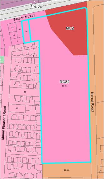
Figure 1 -
Zoning
Surrounding Development
Industrial land on the eastern side of
Norcal Road, opposite the site, is occupied by a large warehouse. Industrial
land uses including a sheet metal works adjoin the southern site boundary.
Land abutting the western boundary is
used for housing, with generally medium density developments of 4 - 6 dwellings
per lot. Typically the private open space area of the rear unit in these
developments abuts the western boundary of the brickworks site. The railway
line is located north of the site, on the north side of Station Street, with
associated commuter parking and the rear elevations of Home HQ in Whitehorse
Road/ Mega Mile.
Strategic Context
Nunawading Megamile Major Activity Centre
and Mitcham Neighbourhood Activity Centre Structure Plan
The site and surrounding area is covered
by the Nunawading Megamile Major Activity Centre and Mitcham Neighbourhood
Activity Centre Structure Plan (adopted by Council on 21 April 2008)
(Structure Plan). The Structure Plan identifies the brickworks as a
‘key’ development site. The Structure Plan supports the
site’s redevelopment as a mixed use precinct with open space, a component
of higher density housing and a component of commercial development.
Implementation strategies include facilitating redevelopment of the site,
managing zone interfaces, developing higher density housing, retaining the
brickworks chimney and protecting view lines to the chimney from Station
Street.
The Structure Plan shows the potential
for a combination of one and two storey town houses, a six storey apartment
building with basement car parking, and three to four storey commercial
development, all surrounded by areas of open space.
Whitehorse Industrial Strategy
The Whitehorse Industrial Strategy (Strategy)
assessed the current market indicators, examined the economic drivers and
attributes for eight industrial precincts in the municipality, summarised the
existing planning frameworks applicable, commented on urban design issues and
proposed a recommended economic‐driven strategy for each precinct.
The Strategy recognised the need to
manage the interface between industrial precincts and residential areas.
The Strategy identifies the Daniel Robertson brickworks as a strategic site for
future residential / office development in the Structure Plan and that rezoning
to Mixed Use could be a potential outcome.
Amendment C155
On 24 November 2014 Council authorised
the exhibition of Amendment C155 to the Whitehorse Planning Scheme (Amendment).
The Amendment was supported by a preliminary
concept plan submitted with the rezoning request and proposed a layout which included
higher density residential with commercial uses fronting Station Street and
medium density residential across the majority of the site.
The Amendment was exhibited from 30 April
to 1 June 2015. Council then considered a report on the submissions at its
meeting of 20 July 2015 and resolved to refer the submissions to an independent
panel for further consideration. A panel hearing was held on 14 and 15
September 2015. Council considered the panel’s report at its meeting on
23 November 2015 and adopted the Amendment with changes recommended by the
panel. The Amendment was approved by the Minister for Planning and came into
effect on 10 March 2016.
The Amendment resulted in the rezoning of
the land at 56 and 58-74 Station Street Nunawading to part Mixed Use Zone (MUZ)
and part Residential Growth Zone Schedule 2 (RGZ2) to allow primarily for
residential redevelopment. The amendment also introduced two new overlays to
the site – an Environmental Audit Overlay and Development Plan Overlay
Schedule 7 (DPO7). Consequential changes were also made to the Local Planning
Policy Framework in the planning scheme.
The Development Plan Overlay
(DPO)
DPO7 requires that a ‘development
plan’ is prepared to the
satisfaction of the responsible authority
generally before a permit can be granted to use or
subdivide land,
remove or create easements, construct a building or construct or carry out works. A development plan may be prepared
and implemented in stages.
DPO7 specifies conditions and requirements for permits,
and requirements for a development plan including the information that the plan
needs to contain. Importantly, the Development Plan is to include measures to
be taken relating to the proposed residential areas in order to minimise
amenity impacts from the existing industrial areas located in close proximity.
The Development Plan must be generally in accordance with the Concept Plan
shown in Figure 2. The
Development Plan will be primarily assessed against the requirements of
Schedule 7 to the DPO (Attachment 1) and the decision guidelines at Clause 65
of the planning scheme.
Planning permits must be generally in accordance with the approved development plan. The development plan will therefore guide future planning permit applications for each stage of the development and needs to contain sufficient information for Council to assess these applications. Planning
permit applications that are
generally in
accordance with
an
approved development plan will be exempt from the usual notice and review processes under
the Planning and Environment
Act 1987. Hence the Development
Plan needs to be carefully considered by Council before a decision is
made
whether to approve the development plan or not.
In order to assist Council in this
process, clause
3 in DPO7 requires the display of a development plan (or a substantial
amendment to an approved plan) for public comment for a period of
at least 14 days. Council must consider any comments received in response to display of the
plan
before making a
decision whether to approve the plan.
Therefore, in most instances, it is anticipated that display of the development
plan will be the final
opportunity for the community to make comment on the proposed development.

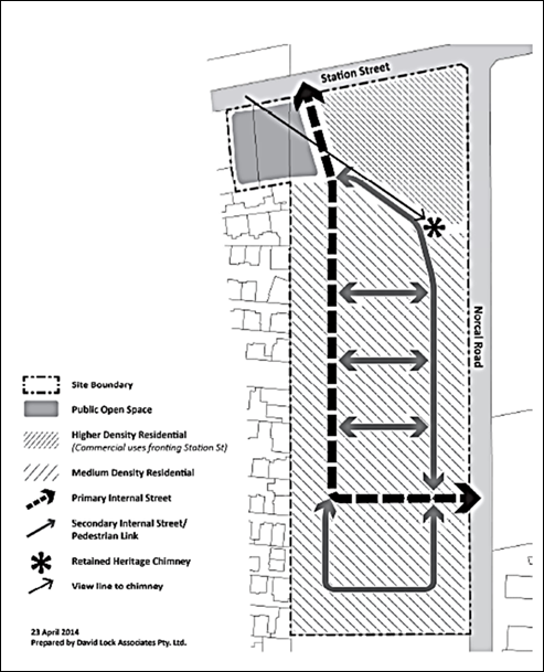
Figure 2 -
Concept Plan contained in DPO7
The
request to approve the Development Plan
A Development Plan was lodged on 21 July 2016 by Planning
& Property Partners on behalf of Norcal Station Developments Pty Ltd for
consideration by Council (Attachments 2 - 11).
The Development
Plan is proposed to be undertaken in 4 stages. The Development Plan before
Council is for the RGZ2 component of the site and encompasses stages 1 - 3. The
MUZ portion of the site (stage 4) will be subject to a separate development
plan which is allowable under the Development Plan Overlay.
The Development Plan submitted comprises the following
documents:
Development Plan Report: (Planning & Property Partners, April 2017)
The Development Plan Report includes relevant background
of the application with reference to the Specialist Reports contained within
the Appendices.
Appendices – Specialist Reports:
Appendix
A Copy of Titles;
Appendix
B Design Response - Stage 1 Development Plan
(Conrad Architects Pty Ltd);
Appendix
C ESD Response (Lid Consulting Pty Ltd);
Appendix
D Traffic Engineering Assessment (Traffix Group Pty
Ltd);
Appendix
E Landscape Design Report (Tract Consultants Pty
Ltd);
Appendix
F Management Plan (Planning & Property
Partners Pty Ltd);
Appendix
G Waste Management Response (Lid Consulting Pty Ltd);
Appendix
H Acoustic Report Addressing DPO Requirements
(SLR Consulting Australia Pty Ltd);
Appendix
I Geotechnical Site Investigation
(Civil Test Pty Ltd).
The Development Plan is supported by a Design Response
(Figure 3 below) that has been prepared by Conrad Architects. The Development
Plan proposes the following:
· An
internal road system (Primary Roads and Secondary Roads proposed by the
proponent to become Council’s responsibility) with one main vehicle
access from Station Street and Norcal Road.
· Stages
1, 2 and 3 are proposed to comprise 173 dwellings. The proposed dwelling
typology comprises 30 two-storey dwellings (indicatively 3 - 4 bedroom
dwellings) along the western boundary with frontage to an internal road. The
remainder of the Development Plan as shown in Figure 3 comprises 143
three-storey townhouses (indicatively 2, 3 and 4 bedroom dwellings) with a
maximum overall height of 9.5 metres. All indicative dwellings are subject to
Council’s satisfaction.
· Proposed
lots ranging in size from 73.8m2 to 225m2.
· Public
open space of 3000m2 with direct frontage to Station Street
which is proposed to be transferred to Council.
· “Mews”
style Communal Open Space is proposed to front 55 dwellings and is available to
all the proposed dwellings. These spaces are estimated to range between 300m2
and 685m2 with a total Communal Open Space area of approximately
2400m2.
· The
significant heritage chimney which is protected by a Heritage Overlay in the
Whitehorse Planning Scheme will be retained within communal open space. The
chimney is proposed to be restored and managed by an owner’s corporation.
· Private
open space for each dwelling in the form of courtyards and / or balconies
ranging in size from 22.7m2 to 49.3m2.
· Landscaping
of all public areas.
· A
designated shared cycling/pedestrian path and pedestrian paths through the
site.
· Resident
and visitor parking will meet the Planning Scheme requirements.
· An
acoustic wall at the southern boundary interface with industrial uses.
· A
landscaped buffer between the proposed residential development and the Norcal
Road interface.
Officers have
reviewed the Development Plan. This assessment is outlined in the
Discussion below.

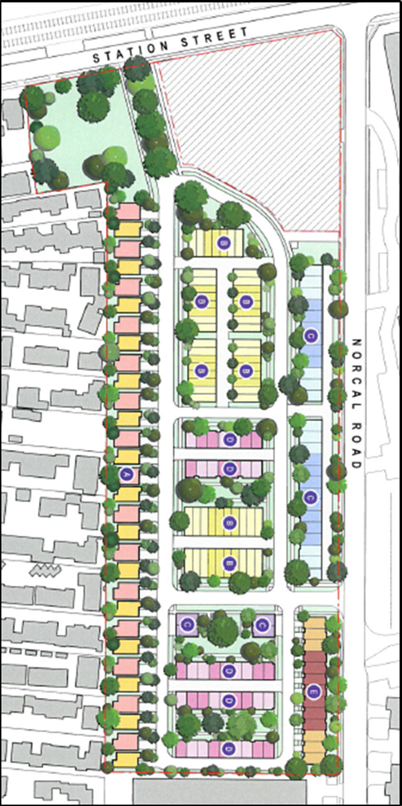
Figure 3 -
Development Plan Application – Design Response
Victorian
Civil and Administrative Tribunal Proceedings
The Development Plan was assessed by
Officers and supplementary information was requested. The applicant provided
the further information. In line with Council’s standard practice,
officers were progressing to prepare a report to Council with a recommendation
to display the Development Plan as required under DPO7 subject to the
appendices being updated to incorporate the supplementary information and to
ensure the Development Plan was consistent.
The applicant did not agree to
update the information and subsequently lodged an application for review under
s149 1(a) of the Planning and Environment Act 1987 with the Victorian
Civil and Administrative Tribunal (VCAT).
A practice day hearing was held before
the Tribunal between the applicant and Council on 17 March 2017. Substantiative
orders from the practice day hearing were received by Council on 29 March 2017
and indicated Council should display the Development Plan. An updated
Development Plan was subsequently resubmitted by the applicant for Council to
display.
Officers subsequently prepared the Development Plan for
display and invited the community to provide comment from 10 April 2017 to 28
April 2017.
The Tribunal has listed the matter for a compulsory
conference on 29 June 2017 and for a three day hearing commencing on 23 August
2017.
DISCUSSION
Officer
Review of Development Plan
The Development Plan has been
reviewed by officers against the requirements of the DPO7 and the relevant
requirements of the Whitehorse Planning Scheme.
Overall, the Development
Plan’s design response is considered to be generally in accordance with
the DPO7 Concept Plan (Figure 2). The indicative dwelling typology shows a
variety of dwelling sizes and layouts that are below the discretionary height
limit of four storeys in the RGZ2. However, there remain some concerns
that officers consider that the proponent ought to address for approval of the
Development Plan:
Private Open Space
Officers note that the proposed private open space ranges
from 22.7m2 to 49.3m2. A number of the proposed housing
typologies are under the 40m2 requirement for private open space of
the RGZ2. However, the development proposes five communal open spaces which
will supplement the private open space requirements and therefore on balance is
considered an acceptable outcome.
Officers also require a guideline within the Development
Plan that demonstrates the provision of one tree on private land per dwelling
to meet the requirements of the RGZ2.
Action:
Include a statement in the Development Plan that demonstrates the provision of
one canopy tree on private land per dwelling to be provided on each lot.
Public Open Space
Officers consider the proposed public open space will be
a good addition as it will provide a prominent play and recreational space that
will not only serve new residents but be accessible to the surrounding
community.
Officers consider that the proposed bio retention asset
should not form part of the proposed public open space, as currently shown. Any
bio retention or other water quality treatment infrastructure (refer Stormwater
discussion below) should be located on communal open space and be managed by an
owner’s corporation. It is considered that the Development Plan should be
updated to show this.
Action:
Provide amended plans that clearly demonstrate that the any proposed water
quality treatment infrastructure does not form part of the Public Open Space
and will be located in Communal Open Space or other owner’s corporation
land.
Engineering Servicing and Stormwater
Management
A report was lodged with the original Development Plan
application in regards to Engineering Servicing and Stormwater Management.
Officers were not satisfied with the proposed onsite detention and had informed
the proponent that Council will not maintain the on-site detention systems as
proposed and that the proposed layout of the drainage assets was not
acceptable.
Additionally, as part of the Stormwater Management for
the site, the proponent proposed the stormwater bio retention basin, as noted
above. The proponent proposed that Council take on the ongoing maintenance of
this asset. Officers consider that all stormwater retention and stormwater
treatment assets are to be maintained by an owner’s corporation and not
Council. Council does not maintain stormwater treatment assets as it does not
possess the equipment or expertise to maintain these types of assets within its
current operational budget.
It is noted that subsequent to the Victorian Civil and
Administrative Tribunal practice day hearing, the Engineering Servicing and
Stormwater Management Report was not included in the updated Development Plan
documentation submitted for display. Officers consider this to be an important
report, which is required as part of the general provisions in the Planning
Scheme under Clause 65 Decision Guidelines.
The proponent is of the view that options for site-wide
stormwater retention systems, bio retention basins and individual dwelling
stormwater management have been provided for within the Stage 1 Development
Plan and will be further resolved in consultation with Council, the relevant
water authority, the Environment Protection Authority and Department of Health
and Human Services (as appropriate) as part of any future planning permit
application(s).
Officers consider it more appropriate to condition the
approval of the Development Plan on the basis that an updated Engineering
Servicing and Stormwater Management Plan be prepared subject to Council’s
satisfaction.
Action: Include a statement in the
development plan that stormwater drainage and management is subject to further
detail and must be to the satisfaction of Council.
Transport
The Traffic Engineering Assessment outlines the proposed
road network layout and road reserves in the Development Plan. The Traffic
Engineering Assessment proposes that Council will take on future maintenance
and responsibility of Primary and Secondary Roadways, with Access Lanes being
owned and maintained by an owner’s corporation. Officers note that
subsequent planning permit applications for the site will be required to be
accompanied by a detailed traffic impact assessment and there will be the
potential for mitigating works on the surrounding transport network.
Officers have reviewed the proposed road network layout
and road reserves. Overall, Officers are mostly satisfied with the proposed
internal road network layout and believe that it can sufficiently accommodate
the expected traffic volumes, Council service vehicles and emergency vehicles
subject to the requirement to prohibit parking along sections of roads where
service and delivery vehicle access is required.
However, Officers have concerns with the proposed
secondary road 7.3m wide carriageway. Council Transport Officers require a 7.6m
wide carriageway on secondary roads in order to ensure that there is sufficient
width for service and delivery vehicles, and to allow Council to take on future
ownership and maintenance of these roads.
Action:
Applicant to provide an updated Traffic Engineering Assessment that reflects
the requirement for a 7.6m carriageway on Secondary Roads.
Geotechnical
Report for Public Assets
The Development Plan was accompanied by a Geotechnical
Site Investigation for Residential Slabs and Footings. The Geotechnical Site
Investigation (Appendix 11) that was
submitted in support of the Development Plan application provides commentary on
recommendations for additional work. The recommendation of the report states: “It
is understood that in addition to the townhouses, a recreational park and
internal access roads are also proposed for the site. For these infrastructure
developments, further site specific investigations are required, and we will
require a site layout plan showing the proposed development in detail.”
Officers consider that the Development Plan should
provide a geotechnical investigation of land proposing to contain any future
public assets and this information is a requirement of the DPO7. Without
knowing this level of detail, Council officers cannot assess whether it is
appropriate for the proposed public assets to be transferred to Council and
what are the likely liabilities Council is likely to inherit by acquiring these
assets as a result of geotechnical issues.
Action:
Applicant to provide a geotechnical report for land on which public assets are
proposed to demonstrate that the land is suitable for the proposed public
infrastructure and improvements.
Future Agreements
There are various
agreements under section 173 of the Act that may be required. For
example:
· A
subsidence agreement may be required to address the inherent risk of settlement
on future infrastructure and dwellings located on filled land. This may require
a Geotechnical Framework as part of the agreement including measures for managing
the risk of settlement. Any such Agreement should be a condition of any
planning permit. A provision should be included in the Development Plan to this
effect.
· Agreements
may also be needed in relation to responsibility for future public assets such
as:
· Roads and accessways;
· Stormwater
assets;
· Public
open space areas and related infrastructure;
· Maintenance
agreements and asset management;
Decisions are yet to be made on future
responsibility for any assets and infrastructure which requires detail on the
development with future planning permit applications.
Analysis
of Community Submissions
During the display period (10 April – 28 April 2017),
fourteen (14) submissions were received. The submissions are discussed under
the following broad themes:
· Traffic
and Car Parking
· Ownership
of Assets
· Sustainable
Transport
· Environmentally
Sustainable Development (ESD)
· Built
Form
· Other
Matters
Traffic and Car Parking
The impact of traffic, including
volume and impacts on the surrounding network generated by the proposed
development and associated car parking, was raised by six submissions. The
submissions raised the issue of the increased traffic movements on the surrounding
road network and also questioned the impact the development would have on the
nearby intersections with Springvale Road, Rooks Road, Whitehorse Road and
Canterbury Road.
Increased car parking pressures on
surrounding streets was mentioned by one submitter, who is concerned about a
lack of car parking for existing residents and suggested incorporating a
multi-storey car park within the development to provide for the additional
number of residents using the Nunawading train station.
One submission raised concerns in
regards to the off street car parking for the indicative dwellings. The
submission was concerned that the indicative plans would only accommodate two
small vehicles; the submitter also raised concerns with the arrangement of
private car parking. Finally, two submissions were concerned that the
proposed parking for residents and their visitors was inadequate.
Officer
Response:
The Stage 1 Development Plan
proposes vehicular access via two main access points; one located in the north
of the site to Station Street and the other on the south-eastern boundary with
Norcal Road. These access points are generally in accordance with the Concept
Plan of DPO7.
The Development Plan is accompanied
by a Traffic Engineering Assessment, which concluded that the traffic predicted
to be generated by the proposed development will be accommodated on the
surrounding road network and intersections without any adverse impacts, and
mitigation works to the external road network are not required at this stage.
All dwellings are provided with the
required number of on-site car parking spaces, which satisfies the resident car
parking requirements in Clause 52.06 (Car parking) of the Planning Scheme. The
Development Plan provides 97 indicative on-street visitor car parking spaces,
which exceeds the 86 visitor car parks required in Clause 52.06.
Additionally, Officers note that
submissions raised concerns in regard to high demand for the existing on street
car parking in the surrounding local streets due to commuter demand at the
Nunawading train station. However, the Development Plan is not the mechanism to
address concerns with the existing provision of car parking in the surrounding
local streets.
Detailed traffic and car parking
requirements can be further addressed at the planning permit stage. The final
car parking provision, layout, any traffic mitigation measures and design is
subject to Council approval as part of any future planning permit
application(s).
Ownership of Assets
One
submission raised the future ownership and maintenance of the proposed public
open space that fronts Station Street.
Officer
Response:
The
open space fronting Station Street is proposed to become Council’s
responsibility, subject to Council being satisfied with the detailed design and
implementation of the proposed open space improvements.
Sustainable Transport
There were concerns raised by three
submissions about the proposed shared path design. The submitters outlined that
the shared path proposed along West and Central Drive should be improved for
safety and connectivity purposes. They proposed relocating the shared path to
North and East Drive. It was also considered by the submitters that the
proposal fails to link to the wider cycling network in Whitehorse. The
submissions proposed that the shared path should be made to link with the Box
Hill to Ringwood Trail via a railway crossing.
Two
submissions said that the development fails to meet its requirements in the
provision of bicycle parking.
Officer
Response:
Officers consider that the proposal
to reconfigure the shared path along West and Central Drives to North and East
Drive has some merit, as it will reduce the total number of potential conflict
points between vehicles and pedestrians/cyclists. However, the current
alignment is located within a wider road verge and may offer greater landscape
design opportunities and amenity for the path user.
It is considered that
reconfiguration of the shared path is not essential to progress approval of the
Development Plan and officers note that there is scope to negotiate this with
the applicant either through the VCAT proceedings or in future planning permit
applications.
The development demonstrates the
provision of bicycle parking in line with the requirements of DPO7 and any
future commercial/retail uses for the MUZ component of the site will be
required to meet these requirements as set out in the Planning Scheme.
Environmentally
Sustainable Development
The ESD techniques proposed as part
of the development was considered by two submissions to be insufficient. One
submission raised concerns that a number of proposed dwellings will have insufficient
solar access.
One submitter proposed that the
development could put in place increased sustainability features to set an
example for further developments. This included incorporating a grey water
treatment plant, a worm farm and solar battery storage facility to provide
lighting and power for common roads, paths and BBQ areas.
Officer
Response:
The Development Plan shows that the
indicative dwellings have been positioned and oriented to ensure an appropriate
level of solar access and cross ventilation which can assist to reduce the
reliance on mechanical heating and cooling methods.
The application is accompanied by
an ESD Response and outlines a range of ESD objectives and Water Sensitive
Urban Design initiatives that address the requirements of DPO7.
Officers consider that a number of
ESD requirements will be addressed during the planning permit stage and will be
subject to Council approval and assessment against the ESD policy at Clause
22.10 of the planning scheme as part of any future planning permit
application(s).
Built Form
The proposed built form was raised
as a concern by three submissions. One submitter questioned how the density of
the multi-storey dwellings will complement the established residential area to
the west of the subject site. The submission objects to two storey buildings
along the western boundary and considers that three storey dwellings should
only present to Station Street and Norcal Road to improve the aesthetic
impact. The submission also considers that three storey buildings will be
out of character for the surrounding area and would dominate properties located
on Mount Pleasant Road.
There is concern from the submitter
about the impact of the proposed development on the local neighbourhood and its
amenity, including overlooking of existing properties to the west. The
submission outlines that the proposal should include frosted windows to prevent
overlooking and a 1.7m high fence/ screen.
Submissions also raised concerns
with the proposed setbacks and landscaping along the western boundary. The
submissions considered that the lower level building setback of 3m from the
western boundary was insufficient. The submissions also raised concerns that
the indicative plant palette along the western boundary was inappropriate and
would reach mature heights that were dangerous.
Officer
Response:
The Development Plan responds to the
existing neighbourhood character by providing dwellings along the western
boundary that do not exceed two-storeys in height. Officers consider this is an
appropriate response within the discretionary height requirement (13.5m) of the
RGZ2 and consider that this approach provides an appropriate transition between
the mostly single-storey development of adjoining residential areas and the
proposed three-storey built form on the subject site.
Officers consider that the proposed
layout and arrangement of dwellings along the western boundary will achieve
compliance with the requirements of Clause 55 (Standard B17 – Side and
Rear Setbacks) of the Planning Scheme at the future planning permit stage.
It is also considered that any
future planning permit application(s) will be capable of complying with the
requirements of Standard B22 (Overlooking) of Clause 55 in the Planning Scheme
and will not result in any unreasonable overlooking of neighbouring private
open space or habitable room windows.
Officers also consider that the
provision of substantial screen planting along the western boundary will assist
in softening the visual impact of the development. Officers also note that the
Indicative Plant Palette requires refinement and will be subject to approval at
the planning permit(s) stage.
Other Matters
Two submissions outline that the
Development Plan needs to be accessible for residents as well as the wider
community. The submissions comment that there should be accommodation with
lifts and accommodation options on ground level to ensure there are dwellings
capable of being accessed by a wheelchair. One submission also outlined that
the Development Plan should explore the provision of social housing.
Submissions raised concerns in
regards to the potential noise impacts during the construction phase. The
submissions also express concerns about potential work outside of nominated
working hours.
A number of submissions raised
queries in regards to the fencing along the western boundary. The queries
included, whether the fencing will be replaced so as to restore privacy of the
tenants; who will be responsible for replacing the fence; and if the fence is
replaced, at what stage of the project will this be completed?
A submission also raised concerns as
to what drainage will be installed to prevent water flooding the new dwellings
located down the embankment along Norcal Road.
A number of comments were made in
regard to potential commercial/retail spaces.
Officer
Response:
Clause 21.06 (Housing) of the
Planning Scheme encourages the provision of well designed, adaptable and
accessible housing and promotes the use of the Liveable Housing Design
Guidelines to developers. While the indicative dwellings propose a multi-level
built form, there is discretion in decision making if a single level typology
was proposed at the planning permit stage(s). Officers do note that the MUZ
portion of the site can accommodate a built form (such as apartments) which
would anticipate the provision of lift access and single level living
accommodation.
It is acknowledged that there is a
need for additional social housing in the eastern metropolitan region,
including Whitehorse. However, there are no requirements under the DPO7 that
set out the requirement to provide social housing.
Officers acknowledge that improving
the fencing along the western interface may be beneficial in delivering an
improved amenity outcome. However, there is no requirement under the DPO7 to
replace/improve the fencing along the western boundary. Boundary fencing
between private properties is outside the scope of the development plan,
however officers will convey these concerns to the applicant.
Officers suggest that a statement be
inserted in the development plan that stormwater drainage and management is
subject to further detail and must be to the satisfaction of Council. This will
ensure that any inundation risks are adequately addressed before approval.
There
are no commercial or retail spaces proposed as part of this Development Plan.
CONSULTATION
As noted above, clause 3.0 of the DPO7 requires display
of a development plan for public comment for a period of at least 14
days. Council must consider any comments received in response to display
of the plan before making a decision whether to approve the plan.
The Development
Plan for the former Daniel Robertson brickworks was placed on display as
required under the DPO7, The Development Plan was placed on display from 10
April to 28 April 2017. Although there was no statutory obligation to do so,
Officers extended the display of the Development Plan to 19 days given there
were three public holidays that fell within the display period. The Development
Plan was displayed by:
· Publishing
a copy of the Development Plan a on Council’s website;
· Making
a copy of the Development Plan available for inspection, at Council’s
service centres and the four municipal libraries;
· Publishing
two advertisements in the Whitehorse Leader on 10 April and 24 April 2017; and
· Sending
484 letters and an information flyer to owners and occupiers in the surrounding
area.
A total of 14
submissions were received and are discussed above. Following consideration of
the community comment, Council can make a decision on the Development Plan..
FINANCIAL
IMPLICATIONS
Community consultation expenses will be recouped from the
proponent.
To date, Council has required limited assistance from
external consultants (e.g. Acoustic advice). However, Council will incur future
costs associated with engaging consultants to peer review the required
geotechnical reports for proposed public assets. It is anticipated this cost
can be covered within operational budgets. Internal officer expertise has been
committed from Departments across Council to review the development plan.
Ongoing internal officer input will be required to
finalise the development plan and to assess future planning, and building and
works approvals, etc. Resourcing required for future planning permit
approvals will be partly offset by notice exemptions in the Development Plan
Overlay.
There will be future cost implications to Council if it
assumes ownership and / or responsibility for future maintenance and management
of any public infrastructure. This would include ongoing operational
budget for maintenance and management of matters such as open space, roads,
drains, lighting, street trees, and waste collection, as well as capital works into
the future to improve and replace public assets. Further detail on the
development during subsequent planning permit applications is needed for
Council to estimate these costs.
As outlined in Appendix
F of the Development Plan, an owner’s corporation will have a future role
in maintenance (e.g. of communal open space and private laneways).
Infrastructure needed for the development will be provided or required as part
of the development at the applicant’s cost.
POLICY IMPLICATIONS
The Council Plan 2016 - 2020 and relevant Council
strategies have all informed Council’s approach to the future of this
strategic development site.
The Development Plan is consistent with Strategic
Direction 2 in the Council Plan which seeks to maintain and enhance our built
environment to ensure a liveable and sustainable city. In particular Strategy
2.1.4 is to support and promote greater housing diversity balanced with
preserving the heritage, landscape, cultural and natural environments.
Key policies
in the Whitehorse Planning Scheme include:
· Clause 21.04 Strategic Directions includes the site as a
Strategic Redevelopment Site; and
· Clause 22.06 Activity Centres facilitates the
redevelopment of a key site within the Nunawading activity centre such as the
former Daniel Robertson brickworks.
CONCLUSION
A development plan has been prepared by Planning &
Property Partners on behalf of Norcal Station Developments Pty Ltd as required
under Clause 43.04-1 of the DPO. Clause 3.0 of Schedule 7 to the
DPO requires that the Development Plan be placed on display for public comment
for a period of 19 days. Having placed the Development Plan on display to
satisfy VCAT orders, this report considers the community feedback received and
assesses the Draft Development Plan against the planning scheme requirements.
Most of the outstanding matters from Council’s
feedback to date have now been adequately addressed in the updated Development
Plan. As a consequence, Council’s remaining requirements in order to
progress the Development Plan are set out in the recommendation of this report.
Subject to the changes and conditions outlined in this
report, it is recommended that the Development Plan be supported for subsequent
endorsement.
Attachment
1 Development
Plan Overlay Schedule 7 ⇨
2 56-74 Station
Street Stage 1 Development Plan Report ⇨ 
3 Appendix A Copy
of Titles ⇨ 
4 Appendix B
Stage 1 Development Plan Conrad Architects ⇨
5 Appendix C ESD
Response Lid Consulting ⇨
6 Appendix D
Traffic Engineering Assessment Traffix Group ⇨
7 Appendix E
Landscape Design Report - Tract Consultants ⇨
8 Appendix F
Management Plan - Planning and Property Partners ⇨
9 Appendix G
Waste Management Response - Lid Consulting ⇨ 
10 Appendix H Acoustic Report
- SLR Consulting ⇨
11 Appendix I Geotechnical
Site Investigation - Civil Test Pty Ltd ⇨ 
Ordinary Council Meeting 15
May 2017
10.1.4 Amendment
C175 and Box Hill Metropolitan Activity Centre Built Form Guidelines -
consideration of exhibition period and submissions
ATTACHMENT
SUMMARY
Amendment C175 and the draft Box
Hill Metropolitan Activity Centre Built Form Guidelines were on public
exhibition from 16 February until 17 March 2017. 105 submissions, 74 proformas
and three anonymous proformas were received about the Amendment during the
exhibition period. 12 submissions, 10 proformas and two anonymous proformas
were received after the exhibition period. A total of 206 submissions and
proforma responses were received.
This report discusses the issues raised during the
exhibition period and recommends that the Amendment and the submissions be
referred to an independent Planning Panel for consideration.
|
RECOMMENDATION
That Council:
1. Being
the Planning Authority, having considered the submissions in relation to
Amendment C175, request the Minister for Planning appoint an Independent
Panel to consider the Amendment and the submissions in accordance with the
Planning and Environment Act 1987;
2. Authorises
officers to update the Guidelines and Design and Development Overlay with the
recommended changes included in this report;
3. Advise
all submitters of the request for an Independent Planning Panel; and
4. Continue
advocating to the State Government about upgrading the Box Hill Transit
Interchange as a result of the ongoing designation of Box Hill as a
Metropolitan Activity Centre
|
background
Box Hill Metropolitan Activity
Centre
Box Hill has been considered a
significant centre since at least the 1950’s, when it was designated as a
District Business Centre in the 1954 Melbourne Metropolitan Planning Policy.
Box Hill has also been designated as a Principal Activity Centre and a Transit
City.
Box Hill has been designated as a
place of significance in the release of the updated metropolitan planning
strategy Plan Melbourne 2017-2050 in March 2017 and has been designated
as a Metropolitan Activity Centre (MAC) and a Health and Education Precinct.
Through both designations, Box Hill is confirmed to be the focus of substantial
development and investment. Box Hill is one of nine MACs in the Melbourne
metropolitan region. As stated in Plan Melbourne, MACs
“are critical to growth across a regional catchment – giving
communities good access to a range of major retail, community, government,
entertainment, cultural and transport services”. The policy also notes
that MACs “will be hubs for public transport services and play a major
service delivery role, attracting broad investment in education, health and
housing at higher densities” and “all activity centres have the capacity to continue to grow and diversify the range of
activities they offer” (p37).
Plan Melbourne states that “major health and education precincts across
metropolitan Melbourne have been identified for further services and jobs
growth” and “these precincts stimulate innovation, create employment
and are of fundamental importance to the emerging knowledge economy and
surrounding communities” (p34). The policy recognises that co-location of health and education facilities is important
and will make better use of existing infrastructure, such as public transport,
and support the growth of associated businesses and industries.
Box Hill
Transit City Activity Centre Structure Plan
The Box Hill
Transit City Activity Centre Structure Plan (June 2007) (‘the
Structure Plan’) has been the primary guiding document for Council,
stakeholders and the community seeking to ensure coordination in development
and enhancement of the Box Hill MAC to the year 2030. The Structure Plan was
adopted by Council in 2007 and became a reference document in the Whitehorse
Planning Scheme (‘the Planning Scheme’). The Structure Plan was
first inserted into the Planning Scheme on an interim basis in July 2009 as
part of Planning Scheme Amendment (Amendment) C100 and then gazetted in the
Planning Scheme on a permanent basis via Amendment C144 in December 2011.
The Structure Plan
identifies a number of precincts within Box Hill to guide implementation,
including Land Use and Built Form Precincts.
Figure 1 – Box Hill Structure Plan
Land Use precincts
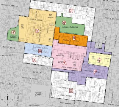
|
Precinct
|
Precinct Name
|
Preferred Land
Uses
|
|
A
|
Box Hill Transport and Retail
|
Retail,
complemented by entertainment, hospitality, commercial and other uses with
extended hours
|
|
B
|
Prospect Street
|
Primary office
precinct
|
|
C
|
Civic and Eastern TAFE
|
Cultural,
community and educational facilities
|
|
D
|
Hospital and western TAFE
|
Growth and
enhancement of educational and medical institutions and support for related
business and services, plus high density residential (including student
housing)
|
|
E
|
Box Hill Gardens
|
Significant high
to medium density residential growth with small scale offices, limited retail
and community services and retail to activate ground level street frontages
|
|
F
|
Southern and Eastern
|
Mix of office and
retail uses along Whitehorse Road and Station Street frontages and mixed use
as a transition to purely residential precincts
|
|
G
|
Box Hill Gardens and Kingsley
|
Access to high
quality public open space and recreational opportunities
|
|
H
|
Residential
|
Residential role
and amenity protected but medium density residential development encouraged
|
Figure 2 – Box Hill Structure Plan
Built Form precincts
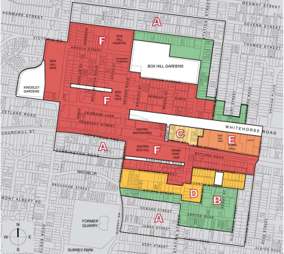
|
Precinct
|
Precinct Name
|
Preferred Built
Form
|
|
A
|
Peripheral residential
|
New development
supporting higher densities but consistent with area’s existing built form
character
|
|
B
|
Low rise higher density residential
|
3 storey height
limit with reduced setback requirements enabling increased residential
densities while maintaining a transitional building scale
|
|
C
|
Traditional town centre
|
Existing built
form character and 2 to 3 storey scale of the precinct retained including
listed heritage buildings as well as complementary buildings
|
|
D
|
Mid-rise commercial and mixed use
|
4 storey height
limit supporting increased density, with no (or minimal) front and side
setbacks to create active frontages onto streets
|
|
E
|
Town Hall
|
Civic buildings
give visual emphasis and the significance of heritage buildings and related
spaces protected. Heights to be determined on case-by-case basis and may vary
across each site. Nominal height is 4-6 storeys.
|
|
F
|
Major Development
|
Taller buildings
permitted, enabling increased density. Heights must not cause overshadowing
of Key Open Spaces, Residential Precincts A or B or residential areas beyond
the study area. Transitional heights to be provided at edges of the precinct
to respect the scale of neighbouring precincts.
NB: There is no
expressed preferred building height guideline in the commercial areas of
Precinct F and limited guidance in the remainder of this precinct.
|
Current
planning controls
Figure 3
illustrates the current land use zoning in the Structure Plan area. The
Commercial 1 Zone (C1Z) applies to a large part of the Structure Plan area,
predominately on the southern side of Whitehorse Road. The C1Z also applies to
the properties fronting the northern side of Whitehorse Road via recent
Amendment C186. The purpose of the C1Z is “to create vibrant mixed
use commercial centres for retail, office, business, entertainment and
community uses” and “to provide for residential uses at densities
complementary to the role and scale of the commercial centre”. The
C1Z does not have a mandatory height limit.
Parcels of land on Nelson Road, Shipley Street, Bruce Street and
Elland Avenue are included in the Mixed Use Zone (MUZ) via recent Amendment
C186. The purpose of the MUZ is “to provide for a range of residential,
commercial, industrial and other uses which complement the mixed-use function
of the locality, to provide for housing at higher densities” and
“to encourage development that responds to the existing or preferred
neighbourhood character of the area”. The MUZ does not have a
mandatory height limit.
The Residential Growth Zone (RGZ) was applied largely to
non-commercial areas of the MAC as part of the introduction of the reformed
residential zones via Amendment C160 in 2014. The RGZ this has an objective of
4 storeys and a discretionary height of 13.5m. This is not consistent with the
scale of development that is occurring.
Figure 3 - Current land use zoning
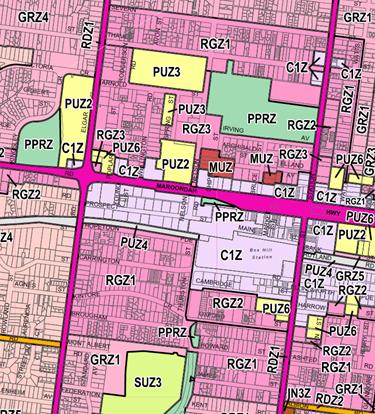
Built Form
Guidelines and Amendment C175
As a result of the
current planning controls and subsequent scale and intensity of development
occurring in the Box Hill MAC, and in particular Built Form Precinct F,
principles around the built form across the activity centre and between precincts
and residential areas were identified as being required. As identified by the
current zoning, in the commercial areas of the Box Hill MAC there are currently
no mandatory height limits. This has had the desired effect of establishing the
basis for development in the Box Hill MAC, but also identifies the need for
further guidance on built form.
The draft Box Hill
MAC Built Form Guidelines (the Guidelines) were prepared in response to the
identified need to provide guidance and direction on the built form and
qualities of future development and the public realm in key areas of the Box
Hill MAC.
The Guidelines
consider building outcomes such as setbacks and frontages, view lines, heights
and relationship to the public realm and building qualities such as
articulation, depth, separation, overshadowing, landscaping and pedestrian and
vehicle access. The Guidelines address these outcomes and qualities for Built
Form Precincts C and F of the Structure Plan in the form of sub-precincts
C/F1-F9 as shown in Figure 4.
Figure 4 – Built Form Guidelines
sub-precincts
The scope of the
Guidelines does not include provisions addressed by other Council documents,
the Planning Scheme or relevant State Planning Policy. The Guidelines form the
basis for the typical design response and have been set out to clearly address
matters that relate to overall urban form consideration for the Box Hill MAC.
The Guidelines seek to provide clarity and achieve a degree of consistency of
built form in a planning environment where discretionary, performance based
controls are preferred.
The Guidelines do
include a contextual analysis of the Box Hill MAC, including development
trends, access and movement, public realm and environment, but do not provide a
response to issues such as traffic and car parking, public transport, active
transport or open space. These issues are considered in the Planning Scheme
(e.g. car parking provisions) and/or other complementary Council (e.g. Open
Space Strategy) or State Government policy (e.g. Plan Melbourne). The
Guidelines are designed to work alongside other relevant documents, but are not
intended to duplicate provisions relating to issues outside the built form and
the public realm. The scope of the Guidelines also did not include capacity
analysis or infrastructure provision.
Council recognises
that there is parallel work and projects that are required to progress the
development of the Box Hill MAC. Additional work may be contingent on the
Council budget, commitments by State and Federal Government or public
authorities, or further advocacy work by Council. Additional projects are
expressed later in the report where the submission themes are discussed.
Amendment C175 proposes to
implement the Guidelines by introducing a new Schedule 6 to Clause 43.02 Design
and Development Overlay (DDO) into the Planning Scheme and applying it to
Precincts B, C, D, E and F within the Structure Plan. The Amendment aims to
introduce additional discretionary controls around aspects of the built form,
such as building heights. The amendment also proposed to rezone various
properties in the Structure Plan area broadly in line with the recommendations
of the Structure Plan. The Structure Plan originally proposed rezoning
properties around Shipley Street, Bruce Street, Irving Avenue and Elland Avenue
to the MUZ. The Structure Plan originally proposed rezoning properties around
Poplar Street, Wellington Road and Spring Street to the Priority Development
Zone. This zone is no longer available in the suite of zones in the Victoria
Planning Provisions and therefore it is proposed to include these properties in
the MUZ.
The Amendment also proposes to make
minor changes to Clause 21.07 (Economic Development) and Clause 22.07 (Box Hill
Metropolitan Activity Centre) in the Planning Scheme to reference the
Guidelines.
At its meeting on 19 September
2016, Council resolved to endorse the Guidelines for community consultation and
seek authorisation from the Minister for Planning to prepare and exhibit
Amendment C175 to the Planning Scheme to implement the Guidelines.
Public notice
Exhibition of the Amendment
occurred in the form prescribed by the Planning and Environment Act 1987.
Exhibition took place from Thursday 16 February 2017 until Friday 17 March
2017. Exhibition involved the direct notification of owners and occupiers of
properties within the Structure Plan area and surrounding streets, totalling
9,592 letters. The notification of properties in the area included a cover
letter explaining the Amendment, and how to obtain further information and make
a submission, and the statutory notice of the Amendment.
Relevant Ministers, bodies and
referral authorities were also notified, together with the publication of the
Notice of Preparation of Amendment in the Whitehorse Leader and the Government
Gazette at the commencement of exhibition. A notice also appeared in each
subsequent week of the Whitehorse Leader until the end of the exhibition period
and an article was published in the February and March editions of the
Whitehorse News. The articles included information about the Amendment, where
to locate further information and how to make a submission.
During the exhibition period
Council officers received over 50 phone calls and counter inquiries regarding
the Amendment C175 and the draft Guidelines. The inquiries included questions
about the Guidelines, the rezoning proposed by the Amendment and the
development potential of properties.
Council officers presented the
Guidelines to Elgar Contact and the Box Hill Retailers meetings. Drop in
information sessions were also held on Saturday 25 February in the Box Hill
Mall and on Tuesday 7 March at the Box Hill Town Hall. The drop in information
sessions were advertised in the Whitehorse Leader and Whitehorse News, on the
project webpage and in the Council endorsed flyer.
For the duration of the exhibition
period copies of the Amendment documents, including the Guidelines, were
available for viewing on Council’s website and in hardcopy at
Council’s Civic Centre in Nunawading, Council’s Box Hill and Forest
Hill Service Centres and the libraries in Whitehorse.
Proformas
A flyer which was not endorsed by
Council, nor part of the official Amendment documentation, was distributed to
an unknown number of properties and people in an unidentified area within the
municipality around the time of exhibition of the Amendment. It was prepared
and distributed by the Elgar Ward Councillors. The responses received to the
flyer are largely from outside the area that Council sent the official
Amendment mail out and are predominantly from the area west of Elgar Road.
The flyer was titled “Have
your say – Height Limits on towers in Box Hill” and included
information about the preferred maximum building heights proposed in each
sub-precinct. The flyer did not include information about any other aspects of
the Guidelines or Amendment.
The flyer included a proforma
template which asked respondents to nominate their preferred height in storeys
for each sub-precinct. The flyer also included space for general comments,
contact details of Council officers, web links and photos and contact details
of the Ward Councillors. Officers were not aware of the distribution of the
flyer or proforma template until they were received by officers, via members of
the community, during the exhibition period.
The flyer did not discuss any other
aspect of the Guidelines and the Amendment documentation beyond preferred
height limits. Some recipients of the flyer did contact Council officers to
clarify the content of the flyer and the Amendment and, prima facie, some recipients
thought that the flyer and proforma was a genuine part of the Amendment and
that the Amendment and Guidelines were increasing height limits in the
Structure Plan area. The proforma responses nominate heights for each
sub-precinct in the Guidelines, ranging from 1 storey to 30 storeys.
The following diagram highlights key words from the proforma
responses.
Given the above concerns with the
content of the flyer, legal advice received and advice from Planning Panels
Victoria was that these proforma responses should be treated and categorised
differently to other submissions.
Submissions
During the exhibition period 105
submissions, 74 proformas and 3 anonymous proformas were received to the
Amendment. After the exhibition period 12 submissions, 10 proformas and 2
anonymous proformas were received. A total of 206 submissions and proforma
responses were received.
The submissions were received from
local residents, landowners and business owners/operators in the Box Hill MAC.
No submissions were received from public authorities or agencies. The following
diagram highlights key words from the submissions.
DISCUSSION
In the discussion
below, submission reference numbers are included in brackets. A summary of the
submissions is shown in Attachment 1.
Support for the
Amendment
Two submissions
(4, 116) provided outright support for the Guidelines and Amendment. One
submitter noted that the proposed changes would help Box Hill become a vibrant,
modern and prosperous city, encouraging business growth and employment and that
the Amendment is consistent with encouraging increasing population density and
improving supply of affordable housing.
There were also
many submissions supporting the intent of the Guidelines and Amendment but
objecting to how it related to specific properties and/or sub-precincts.
Objection to
the Amendment
The majority of the proforma
responses and submissions received were objecting to some, or all, of the
Guidelines and Amendment.
Submission themes
The submissions are discussed under
the following broad themes.
· Consultation
process and Amendment documents
· Structure
Plan
· Building
heights and setbacks
· Public
transport
· Traffic
and car parking
· Active
transport
· Amenity
· Open
space
· Community
infrastructure
· Heritage
· Society
and culture
· Planning
permits
· Specific
sites
· Other
issues
Consultation process and
Amendment documents
Ten submissions specifically raised
issues with the public exhibition process and/or the documents that were on
display during the exhibition period.
Several of the submitters felt that
the consultation process was inadequate (35), resident unfriendly (27) or
Council did not do enough to advertise the opportunity to comment on the height
of buildings in Box Hill (66). One submitter (66) stated that this was
“the first opportunity to comment on the Guidelines”.
Several of the submitters stated
that the notice sent to residents was bureaucratic (25), tokenistic (44), fake
consultation (27), did not provide any information about the proposed height
limits and only included a black and white map with no explanation about what
was being proposed (25).
One submitter (45) stated that they
regularly read the local paper and Council publications; however they were only
notified about the Amendment through their local Councillor and there were no
articles in the local paper or Council publications.
Several submitters (27, 43)
requested that Council hold a referendum on development occurring in Box Hill,
while another submitter (32) asked when Council was going to meet with
residents about the Guidelines and Amendment.
One submitter (25) stated that they
did not recall any consultation about high rise buildings such as the ATO and
twin towers on Whitehorse Road, and that further towers have been approved
without regard for ratepayer’s views.
Three submitters raised concern
about the documents; one submitter (43) stated that Council needs to develop an
easily understood planning document; one submitter (42) stated that it is hard
to visualise the impacts of the height limits and a 3D model would assist in
considering the Amendment and one submitter (64) stated that the document needs
a glossary to explain the terms in the document.
One submitter (1) suggested changes
to the Guidelines (and therefore the draft DDO) to update Figures in the
document to reflect the correct location of bus stops, tram route and street
trees as well as suggested grammatical and word changes.
Officer response
The exhibition of the Guidelines
and Amendment occurred in the form prescribed by the Planning and
Environment Act 1987 (the Act) and took place from Thursday 16 February
2017 until Friday 17 March 2017.
Exhibition involved the direct
notification, on 9 February 2017, of owners and occupiers of properties within
the Structure Plan area and surrounding streets, totalling 9,592 letters. The
notification included a cover letter explaining the Amendment and the statutory
notice of the Amendment.
The letter included a map outlining
the area of the Amendment. The map was intended to give recipients of the
letter a general understanding of the extent of the Amendment and provided a
website and contact details for Council to find further information or
clarification if required. The website included all of the documentation
associated with the Guidelines and Amendment. The letter did not provide any
detailed information about the proposed preferred height limits because the
scope of the Guidelines was not limited to building heights. Additionally, it
was advertised that for the duration of the exhibition period copies of the
Amendment documents were available for viewing at Council’s Customer
Service Centres and libraries in Whitehorse.
Information about the Amendment was
published in the Whitehorse Leader on Monday 13 February and the Government
Gazette on Thursday 16 February. A notice about the Amendment was also
published in each subsequent week of the exhibition period in the Whitehorse
Leader and an article about the Amendment was published in the February and
March editions of the Whitehorse News. The articles included information about
the Amendment, where to locate further information and how to make a
submission.
Council officers met with residents
to present and discuss the Guidelines at the Elgar Contact and the Box Hill
Retailers meetings. Drop in information sessions were also held on Saturday 25
February in the Box Hill Mall and on Tuesday 7 March at the Box Hill Town Hall.
The drop in information sessions
were advertised in the Whitehorse Leader and Whitehorse News, in the Council
endorsed flyer and on the project webpage. Officers and the consultant were
available to discuss the Guidelines and Amendment and approximately 70 people
attended across the two sessions.
Council decided to exhibit the
Guidelines and Amendment simultaneously to streamline the planning scheme
amendment process and progress the built form direction to ensure that the
guidance on building qualities and form is introduced in a timely manner to
provide certainty to the community and development industry. The Guidelines
provide background information; however the DDO is largely a direct translation
of the Guidelines, with minor additional information from the existing
Structure Plan.
Council notes the submissions about
referendums. Referendums are not a mechanism by which Council seeks community
participation during the statutory exhibition of planning scheme amendments.
Council advertises planning permit
applications in accordance with Section 52 of the Act. Unless there are
notice exemptions for an application, the Act directs Council to give notice of
an application where Council is not satisfied that that the granting of the
planning permit would not cause material detriment to any person. The towers on
Whitehorse Road, the ATO and further tower developments have all been
advertised during the consideration of the planning permit applications.
Officers do not believe that a
glossary of terms is required. Officers acknowledge that planning terms can be
complex, however the Guidelines are largely translated into the DDO, which is a
statutory planning scheme document that must use terminology guided by the
Victoria Planning Provisions, which provide both definitions and guidance on interpretation.
Contact details of Council officers were provided during the exhibition period
if submitters required further clarification from Council about the Guidelines
and/or Amendment.
Officers agree with the suggested
grammatical, word and map changes to the Guidelines proposed by Submission 1
and recommend that these changes are made to the Guidelines and DDO.
Box Hill Transit City Activity
Centre Structure Plan
Sixteen submissions specifically
raised the Structure Plan, including requests for changes to the boundaries of
the Built Form Precincts and/or concern that the Structure Plan boundaries will
change.
One submission (3) supported Built
Form Precinct B being included in Built Form Precinct D or F as Box Hill is
growing. One submission (69) suggested rezoning Built Form Precinct B to the
MUZ.
Two submissions (11, 12) suggested
including two further properties to the north along Station Street to the
laneway between 718 and 720 Station Street in sub precinct F2 as the laneway is
a natural dividing line. The submissions stated that this would alleviate
confusion and inconsistency between the Guidelines that apply to a property
zoned MUZ and those included in Built Form Precinct B.
One submission (33) recommended
that Built Form Precinct F be changed to Precinct D for the area west of Elgar
Road. One submission (99) suggested that Built Form Precincts A and B should be
removed from the Structure Plan study area boundary.
One submission (9) raised concerns
that there is a plan to rezone more areas for high rise and one submission (53)
believes that there is no confidence for existing residents that development
will not creep outside the higher density zones. One submission (50) was
alarmed at the ‘enormous and extended area’ of Built Form Precinct
F.
A further submission (43) stated
that Council wants to extend the northern boundary of the Structure Plan and
another submission (19) suggests that expansion of the Structure Plan is
foreseen and creep of the Structure Plan boundary will inevitably occur. One
submission (67) is concerned that development is crossing Elgar Road into
sub-precinct F9, and wants a guarantee that no high rise will be built west of
Elgar Road. One submission (38) stated that height restrictions and size of
buildings should not be altered in other Built Form precincts.
One submission (31) was concerned
that the Structure Plan boundary will expand into residential areas and another
submission (16) inquired about the regulations that control Built Form Precinct
A and another submission asked what steps Council is taking to protect the
neighbourhood character of surrounding suburbs from the expansion of Box
Hill. One submission (114) is disappointed that the Guidelines
don’t address problems occurring at periphery of Built Form Precinct A
where the recommended density and height is not being respected by development.
Officer response
The purpose of the Guidelines is to
provide more detailed information and guidance on preferred future built form
outcomes in the Box Hill MAC to improve planning certainty for the community
and developers. The purpose of the Amendment is to implement the Guidelines
into the Planning Scheme.
The study area for the Guidelines
was defined as Built Form Precincts F and C within the existing Structure Plan.
It was anticipated and expected that the Guidelines considered the relationship
to other areas within the Box Hill MAC and the immediate vicinity, including
the peripheral residential areas. The Amendment also includes built form
guidance from the Structure Plan for Built Form Precincts B, D and E.
Council is satisfied with the
Structure Plan and its operation and therefore the scope of Guidelines did not
include reviewing the boundaries of the Built Form Precincts or
reducing/increasing the size of the Structure Plan boundary.
The Amendment does not intend to
alter the Structure Plan or Built Form Precinct boundaries or rezone additional
areas outside the Structure Plan to facilitate higher density development. With
regards to development west of Elgar Road, Box Hill institute, Kingsley Gardens
and 811 and 813-823 Whitehorse Road were included within the Structure Plan
when it was originally adopted in 2007.
Built Form Precinct A is designated
as the Peripheral Residential Precinct and is largely included within the
Residential Growth Zone. Guidance on built form in this precinct, as well as
for other areas outside Precinct F and Precinct C, is drawn from the existing
Structure Plan and Planning Scheme. As a result of the recent reforms to the
residential zones, officers will monitor the operation of the Residential
Growth Zone in the peripheral areas of the Box Hill MAC.
Building heights and setbacks
Concerns around building heights
and setbacks were raised by many of the phone calls, counter inquiries and
attendees at the Drop-in information sessions.
Additionally, all of the responses
to the non-Council flyer and proforma raised the issue of building heights due
to the flyer including a proforma template which asked respondents to nominate
their preferred height in storeys for each sub-precinct and the flyer was
titled “Have your say – Height Limits on towers in Box Hill”.
The responses received included nominations of height from 1 storey through to
30 storeys, with a variety of heights nominated for each sub-precinct.
Justification for the nominated
height limits was not included on some of the proforma responses, whereas other
proforma responses cited amenity impacts, society and culture concerns, lack of
infrastructure or personal preference as the justification for the nominated
heights included in the response.
Finally, the majority of
submissions raised concerns, or objected to, the preferred building heights and
setbacks proposed in the Guidelines and included in the DDO. All of the
specific site submissions also raised concerns with the preferred height limits
proposed.
Officer response
The purpose of the Guidelines was
to provide more detailed information and guidance on preferred future built
form outcomes in the Box Hill MAC to improve planning certainty for the
community and developers. The tone of the non-Council flyer gave the impression
that Council was seeking to increase building heights in the Box Hill MAC. In
the absence of any existing mandatory height limit in the commercial or mixed
use areas of the Box Hill MAC, in particular Built Form Precinct F, the
Guidelines are seeking to provide direction in the Planning Scheme on the
preferred maximum building heights and setbacks for each sub-precinct where
this is currently lacking.
The recommended sub-precincts,
preferred buildings heights and setbacks are based on the contextual analysis
of the Box Hill MAC and have been primarily influenced by:
Existing Conditions
· The
Metropolitan Activity Centre and Health/Education Precinct designation for Box
Hill (Plan Melbourne & Plan Melbourne 2017-2050);
· The
Structure Plan vision which directs high density within the Box Hill MAC,
primarily Built Form Precinct F (refer to page 61 of the Structure Plan);
· Recent
development trajectory (approved and constructed); and
· Consideration
of key urban design elements which influence development capacity in each
precincts such as:
o Strategic
context, including proximity to the centre of Box Hill and public transport;
o Subdivision
patterns;
o Heritage
attributes;
o Topography;
o Amenity
impact;
o Street
width/wall ratio and pedestrian scale.
Preferred Future Directions
· Urban
Form Propositions and supporting Key Directions/ Principles to achieve these
(page 27 of the Guidelines) including:
o Substantial development
opportunity along Whitehorse Road (in precincts F4 and F5) to define the
emerging ‘urban core’ for Box Hill MAC where larger allotment sizes
are conducive to supporting higher density development, in absence of immediate
sensitive residential abuttal, or key open space/ heritage protection. It is
also within close proximity to the TAFE and public transport node/ Vicinity.
o Moderate development
capacity behind the Whitehorse Road spine, to provide the necessary transition
between the emerging ‘urban core’ and modest residential precincts
to the north and south around the periphery of the Box Hill MAC.
o Variation in street wall
expectation (up to 10 storey in precincts F2, F3, F7) reinforces the
distinction between precincts where ‘podium- tower’ response is
appropriate (within the urban core), and where the contextual attributes are
more supportive of ‘infill’ (attached format) response.
Box Hill has been considered a
significant centre since at least the 1950’s, when it was designated as a
District Business Centre in the 1954 Melbourne Metropolitan Planning Policy.
Box Hill was later designated as a Principal Activity Centre and Transit City,
and is now confirmed to be the focus of substantial development and investment
as a MAC in Plan Melbourne.
Clause 22.07 of the Planning
Scheme, Box Hill Metropolitan Activity Centre, was first included in the
Planning Scheme in 2009 and notes that “Box Hill has the scope to
accommodate substantial growth, as well as the potential for improved amenity
to support this growth”. This policy has several objectives, including
“that Box Hill accommodates a more intensive and diverse range of
activities that increase choices and opportunities, support synergies between
different uses, encourage use of sustainable transport and complement
surrounding areas”. Therefore both State and Local planning policy has
continued to direct investment and development to Box Hill due to its
designation as a MAC and its location adjacent to major road corridors and
public transport routes.
Many of the submissions cite issues
such as amenity, infrastructure and society and culture as reasons for their
objection to the proposed preferred height limits. These are discussed in
further submission themes.
Public transport
Thirty-four of the submissions
discussed public transport, including train, bus and tram services and the Box
Hill interchange.
Nine submissions (96, 102, 107-113)
mentioned that there is over crowding on trains and trams, four submissions
(20, 45, 83, 92) commented that existing public transport and the Box Hill
interchange cannot cope with the current population and one submission (58)
considered that existing public transport is already out dated. One submission
(61) commented that there is a need to improve bus and train connections and
tram priority, while another submission (55) remarked that the Amendment needs
to demonstrate how public transport can be developed and enhanced.
One submission (19) mentioned that
the transport infrastructure is unlikely to withstand rapid increase in
population and another submission (92) commented that the Amendment will have a
significant effect on the Box Hill transport system. This submission also
stated that “Council is abrogating its responsibility to advocate for a
complete overhaul of the existing public transport system” and transport
chaos will result if the current rail and tram infrastructure is not reviewed
and improved.
Several submissions (6, 10, 18 and
91) remarked that public transport is crowded, not convenient, suitable or
realistic and that it is dirty, unsafe or there is standing room only on
services. One submission (9) said that Council should be insisting that each
apartment is allotted at least 2 car parking spaces as using public transport
is not attractive or viable.
One submission (20) commented that
access to the train station is inadequate and two submissions (28, 38)
mentioned that there must be better and more frequent public transport. One
submission (19) stated “that there is no obvious planning for longer term
capacity” of the train network, including capacity of trains and
additional tracks and a further submission (90) suggested that the Amendment
should not be implemented until analysis has been done to address
infrastructure.
One submission (5) is concerned
about the infrastructure required for new development, including the train and
bus interchange and another submission (17) stated that “Council should
greatly increase the number of required car parking spaces unless it can
successfully lobby for the duplication of the rail line from Box Hill to the
city and a new tram line along Canterbury Road”. Two submissions (15,
104) asked if there are any plans to upgrade the Box Hill interchange. Other
comments about the interchange include:
· “Infrastructure
should include major investment in Box Hill Transport hub” (14)
· “Where
is the state government investment in the current plans, including expansion
and upgrading of infrastructure and utilities, roads and circulation, school
and kindergarten and the tired public transport interchange” (50)
· “Lack
of results from Council advocating to upgrade the interchange is ominous”
(50)
· “More
consideration needs to be given to the public transport precinct, and
developers should be made to contribute to the upgrading this hub” (53)
· “Council
needs to achieve a substantial upgrade in public transport by the State
Government” (58)
Finally, one submission (94) stated
it was “difficult to comment on the Guidelines without knowing the
capacity of the public transport system to expand at peak times”.
Officer response
The purpose of the Guidelines was
to provide more detailed information and guidance on preferred future built
form outcomes in the Box Hill MAC to improve planning certainty for the
community and developers. Notwithstanding this, Council recognises that public
transport, and access to public transport, is an important element of progressing
the Box Hill MAC as a hub for retail, community, government, entertainment and
cultural uses as well as a centre that accommodates education, health and
housing.
The Whitehorse Integrated
Transport Strategy (2011) “recognises that the adoption of safe,
sustainable and active modes of transport have a range of health, environmental
and community benefits and this strategy seeks to encourage a shift toward the
use of sustainable transport modes, including walking, cycling and public
transport”.
Additionally “significant
state government and Council strategies and policies have been
developed…with an increased focus on sustainability and the future
development of land use”. The Strategy specifically discusses more
intensive development around the Box Hill MAC transport networks. One of the
objectives of the Strategy is to encourage an increased shift towards public
transport by advocating for the provision of improved
infrastructure and services, in combination with information to the community
regarding transport choices available throughout the municipality and education
about the benefits.
The benefits of public transport
has been consistently demonstrated in both the Australian and overseas context
and include, but are not limited to, reducing private vehicle emissions, better
health for public transport patrons and creating a critical mass for increased
public transport services. Council therefore encourages the use of public
transport for access to, from and across, the Box Hill MAC.
Council has consistently advocated
to State and Federal governments about investing in Box Hill and in particular,
upgrading the Box Hill transit interchange. The most recent advocacy work
involved meeting with Federal and State Government MPs in Box Hill in April 2017
to present the preliminary business case for the redevelopment of the Box Hill
Transport Interchange and Town Centre, on behalf of the Box Hill First
stakeholder group.
Box Hill First with the
assistance of Dr Chris Hale, one of Australia’s leading transport
infrastructure thinkers, have undertaken an early stage analysis and appraisal
of the economic benefits and holistic planning and urban renewal opportunities
available in Box Hill. This work has revealed an extremely compelling case for
Government investment and action. Council continues to reiterate that upgrading
the Box Hill transit interchange will bring a multitude of benefits to Box
Hill, including the creation of jobs, achieving optimal shared outcomes for the
Box Hill MAC. Council is advocating for improvements
to the bus interchange and wider Box Hill MAC to include:
· Improved
bus passenger waiting facilities in terms of comfort, information, security,
functionality and amenity;
· Better
links to the railway station, including better ‘way-finding’
signage;
· Improved
pedestrian and cycling facilities (e.g. wider footpaths, safer options to cross
busy roads, better lighting, more seating, and reduced speed limits);
· Relocated
taxi zones and/or improved signage.
The Victorian Government established
a Ministerial Advisory Group to provide recommendations to the Minister for
Public Transport on options for the Box Hill transit interchange. The Advisory
Group has established working groups and a program for developing options for
the future of the interchange. Recommendations to the Minister for Public
Transport about the options for the interchange are currently pending.
Traffic and car parking
Thirty-seven submissions
specifically mention traffic and car parking issues. Nine submissions (19, 20,
34, 37, 40, 44, 58, 59, 96) mentioned that the roads and local streets are
already congested with cars and this will get worse. One submission (92) stated
that the existing roads are inadequate to cope with an increase in population;
a similar submission (61) stated that congestion has flow on effects along
local streets and a further submission (60) stated that the height limits in
all precincts will cause an enormous increase in traffic.
One submission (83) noted that
there is a significant infrastructure deficit which is increasing traffic
congestion and car parking issues, while two other submissions (62, 64) are
concerned about the impact of traffic and lack of car parking spaces.
Six submissions (31, 34, 59, 61,
66, 101) said that car parking is already a problem. One submission (59)
remarked that there is an overflow to surrounding areas and another submission
(101) suggested that the parking and traffic study is now obsolete. Nine
submissions (91, 102, 107-113) stated that towers bring “appalling
congestion”, “traffic jams”, “vehicle exhaust
fumes” and “lack of car parking”.
One submission (105) said that
children are not able to safely walk and ride to school by themselves due to
traffic and another submission (87) is concerned about the potential for
increased traffic congestion on Whitehorse Road and other main north-south
routes.
One submission (5) was concerned
about the infrastructure required for new development, including car parking
and a further two submissions (28, 38) said that infrastructure needs to be
sufficiently wide enough to carry additional traffic and there must be
sufficient parking for new residents of new towers.
One submission (44) stated that
“Council has not had detailed discussion about the consequences in terms
of traffic” and a further two submissions (55, 88) said that the
Amendment does not give consideration to how road and public transport can be
enhanced or how to face issues such as noise, road safety and emissions.
One submission (70) stated that
“Council needs to mandate higher levels of off street car parking for
developments” and a further submission (90) suggested that the Amendment
should not be implemented until adequate analysis has been done to address hard
infrastructure issues such as traffic. A final submission (104) asked if there
was an infrastructure plan to address the associated impact of traffic and car
parking.
Officer response
The purpose of the Guidelines was
to provide more detailed information and guidance on preferred future built
form outcomes in the Box Hill MAC to improve planning certainty for the
community and developers. Nevertheless, Council acknowledges that traffic and
car parking is a concern for submitters and also that it is important that
traffic and car parking are appropriately managed.
Council undertook the preparation
of the Box Hill Car Parking Strategy (‘the Strategy’) in
2014. The aim of the Strategy was to study and respond to matters associated
with car parking in the Box Hill MAC (then the Central Activities Area). The
Strategy included identifying existing and potential future car parking
availability, and recommended actions to address any constraints and
shortfalls, balanced with broader objectives of sustainability, community
enhancement and economic vitality.
The Strategy was adopted by Council
at its meeting of 23 June 2014 and was implemented into the Planning Scheme
through Amendment C158. Amendment C158 was exhibited in October and November
2014 and included 7,500 letters to owners and occupiers of affected properties
as well as those within the surrounding study area. Council received twenty
four submissions and considered these at its meeting of 27 January 2015. The
Minister for Planning approved Amendment C158 and it came into effect on 3
December 2015.
The Amendment introduced Clause
45.09 Parking Overlay into the Planning Scheme, applied Schedule 1 to the
Parking Overlay to the Box Hill MAC, and made consequential changes to Clause
21.08 Infrastructure, Clause 22.07 Box Hill Central Activities Area and Clause
61.03 to implement the car parking rates and sustainable transport directions
from the Strategy.
The schedule introduced parking
objectives and set out particular car parking provision rates for new office
and residential uses within the Box Hill MAC. The Amendment was an integral
part of the overall parking strategy for the centre, which included a suite of
measures to encourage sustainable transport use and manage parking demand in
Box Hill into the future.
In particular, Council encourages
the use of public transport and active transport to and from Box Hill to
progress towards a sustainable and liveable MAC. Additionally, it should be
noted that not all residents or visitors will travel by private vehicle to and
from the Box Hill MAC and that alternative modes of vehicle transport, such as
Uber and car sharing schemes such as GetGo, are now more mainstream and reduce
the number of vehicles on the road network and the cars competing for car
parking spaces.
Additionally, Council encourages
motorists not visiting sites within the Box Hill MAC to use other arterial
roads, such as Elgar and Middleborough Roads, instead of Station Street to
traverse Box Hill north to south.
Car parking surveys that were
undertaken as part of the Box Hill Car Parking Strategy found that of all
on-street and off-street car parking facilities within the Box Hill MAC, an
overall average of 64 per cent of spaces were occupied at the peak time of 1:00pm
Thursday. This is below the theoretical 'full capacity' of 85 per cent.
However, it is acknowledged that
there are some instances where Council has limited influence over the parking
provision of others, particularly hospital and education developments which are
under the control of Federal and State Governments, and that this creates
pressure on other areas in the centre. Similarly, the provision of drop off
areas should be made within sites generating significant demand. In
summary, it is considered that existing car parking infrastructure can be
better utilised through a range of measures recommended in the Strategy.
Funding is proposed in the 2017-18
Council budget to progress the implementation of the outstanding
recommendations in the Strategy. Recommendations include, but are not limited
to, actions such as way-finding signage, management strategies for short and
long term car parking, fee structure for on-street car parking, conversion of
short term spaces to long term spaces and vice versa in various locations in
the Box Hill MAC and promotion of active and public transport.
Funding has also been obtained from
the Victorian Planning Authority as part of the State Government’s
‘Streamlining for Growth’ program to investigate the potential for an
infrastructure contributions mechanism in the Box Hill MAC. Stage One of the
funding will include undertaking:
· A
gap analysis of community infrastructure, transport infrastructure, public open
space and the public realm. The gap analysis will consider what further
infrastructure may be needed.
· A
framework to inform subsequent Stages of the project and progress the necessary
strategic justification to implement a contributions mechanism for the Box Hill
MAC.
Active transport
Twenty-two submissions included
reference to active transport, including walking and cycling. One submission
(8) stated that walking and cycling needs to be encouraged and car travel
minimised, while another submission (43) asked how we can get people out of
cars and using active transport.
Five submissions (27, 50, 51, 90,
92) stated that the Guidelines made no provision for walking or cycle paths and
lanes and they do not provide any proposals that could implement strategies
around sustainable transport, walking and cycling. One submission (55) stated
that the Amendment needs to make explicit provision for cyclists and
pedestrians. One of these submissions (90) also suggested that the Guidelines
should not be implemented until adequate analysis has been done to address
issues such as cycling and walking infrastructure.
One submission (8) asked if the
Guidelines can provide for increased bike storage while another submission (95)
suggested that safe bicycle storage facilities should be installed at all
active transport destinations and that safe pedestrian and cyclist connectivity
needs to be provided between different land uses and areas.
One submission (27) stated that
pedestrian traffic is congested and another submission (16) suggested that
pedestrian and vehicle traffic should be grade separated over Whitehorse Road.
A further submission (43) suggested that setbacks are needed to ensure
pedestrians do not feel overwhelmed and that wide footpaths and separated bike
lanes need to be integrated into the development. This submission also noted
that there is no east-west or north-south bike riding route through Box Hill or
the transport hub and it is not possible to ride to Aqualink Box Hill from the
north. One submission (94) stated that pedestrian links are needed off Thurston
Street and in/out of the train station and the crossing Whitehorse Road is not
possible in one complete movement.
One submission (84) supported the
walking objective in Clause 22.07-2 of the Local Planning Policy for the Box
Hill MAC, but noted that footpaths need to be widened where possible and that a
front setback of 0.5 metres needs to be mandated to allow for better pedestrian
access. The submission also supported the cycling objective, but stated that
more bicycle parking facilities are needed in narrow streets or in front of
buildings, not just in underground car parks.
One submission (95) stated that
safe access to open space by pedestrians and cyclists is problematic due to
major road and rail barriers and that these major barriers need to be designed
out of the future pedestrian and cycle network. Ten submissions (96, 98,
102, 107-113) stated that Council should require developers to allow generous
space for bike paths.
Officer response
The purpose of the Guidelines was
to provide more detailed information and guidance on preferred future built
form outcomes in the Box Hill MAC to improve planning certainty for the
community and developers. Notwithstanding this, Council recognises that active
transport, and associated facilities and infrastructure, is an important
element of progressing the Box Hill MAC.
The Whitehorse Integrated
Transport Strategy (2011) “recognises that the adoption of safe,
sustainable and active modes of transport have a range of health, environmental
and community benefits and this strategy seeks to encourage a shift toward the
use of sustainable transport modes, including walking, cycling and public
transport”. Two relevant objectives of the Strategy include:
· To
encourage walking for all members of the community through a range of operational
and educational programs, and by providing a safe, attractive, connected and
well designed pedestrian environment; and
· To
maintain and improve the cycling network through the municipality in accordance
with the Whitehorse Bicycle Strategy 2007, while continuing to promote cycling
as a practical alternative to the private motor car for local trips, commuting
and recreation.
Walking is beneficial for health
and wellbeing but can also play an important role in improving quality of life
as it helps protect the living environment and natural resources when built
into transport systems. The walking actions in the Strategy aim to
reinforce and maintain the positive aspects of the walking environment that
currently exist within Whitehorse, while also addressing a number of areas
identified for improvement. Most of the issues associated with pedestrian
safety and accessibility are located in the Box Hill MAC due to high pedestrian
numbers and difficulties when crossing busy arterial roads.
Along with being popular for
recreation and sport, cycling is an environmentally-friendly form of transport
that can reduce reliance on car-based transport. Fundamental elements of the
Strategy include the provision of quality spaces and places for commuter and
recreational cyclists.
Council therefore encourages
walking and cycling to access land uses within the Box Hill MAC and will
continue to progress the actions and recommendations in the Integrated
Transport Strategy that are relevant to the Box Hill MAC.
Amenity
Forty-nine submissions raise issues
about the amenity of Box Hill. Six submissions (23, 25, 45, 58, 62 and 97)
commented that the Amendment will destroy, or result in a loss of, the amenity,
integrity and character of the area and stated that not enough has been done to
protect the amenity of the area. One submission (54) asked Council to reject
applications to retain the character of the city.
Fifteen submissions (8, 10, 17, 23,
37, 53, 57, 59, 67, 84, 88, 95, 101, 106, and 114) stated that the tall buildings
create, or exacerbate wind tunnels and many asked what can be done to minimise
the wind tunnel effects like that experienced outside the ATO building on
Whitehorse Road.
Several submissions (92, 100, 101,
102, 107-113) are unhappy about the towers intruding into the surrounding
neighbourhoods, with particular reference to Box Hill and Mont Albert. One
submission (19) asked about the steps that Council is taking to protect the
neighbourhood character of surrounding suburbs from the expansion of Box Hill.
One submission (46) stated that
encroachment of tall buildings outside the central precinct will decrease the
ambience of the suburban area, and impact on the values of surrounding
properties and a further submission (44) stated that Council has not had
detailed discussion about the consequences in terms of impact of aesthetic
appreciation of nearby residential areas. One submission (13) commented that
the proposal of 20 and 30 storeys buildings will significantly impact the
quality of life in the area, the buildings will be very visible and change the
family character of the area.
Four submissions (10, 59, 64, 114)
stated the Amendment and proposed heights will create areas with little, or no,
access to sunlight. Two submissions (58, 64) discussed vistas and impairment of
view lines and questioned how these can be protected.
Sixteen submissions (22, 23, 27,
44, 47, 52, 53, 58, 59, 64, 67, 84, 86, 95, 106, 114) had concerns about
overshadowing and/or stated that the heights should be reduced to prevent
overshadowing of pedestrian areas and/or residential precincts. One submission
(53) was concerned about overlooking into private properties.
Five submissions (14, 27, 52, 58,
64) commented that the cladding on existing buildings is highly reflective and reflects
onto other buildings, pedestrians and vehicles. Several submissions (25, 27,
96) stated that the new towers intrude into homes and are highly visible from
backyards.
Three submitters (18, 47, 105)
commented on rubbish, vermin, litter, dumped trolleys and/or the upkeep of
apartment blocks, which they felt would get worse. A further submission (101)
stated that local residents bear the brunt of high rise buildings that are
largely unattractive and many have balconies displaying mattresses and other
household furniture. One submitter (37) stated that tall buildings are an eye
sore, while four other submissions (20, 92 102, 106) stated that Box Hill will
become an ugly concrete jungle.
Two submissions (17, 70) discuss
the landscape of the area, including loss of greenery and how canopy trees can
be planted. Other comments about the impact of higher density development
on amenity include poor TV reception (52), concerns about personal safety (59),
impact on privacy of existing residents (70), noise (88) and use of air
conditioning (64).
Officer response
The purpose of the Guidelines was
to provide more detailed information and guidance on preferred future built
form outcomes in the Box Hill MAC to improve planning certainty for the
community and developers. The Guidelines recognise that the quality of the
public realm and the amenity of the area are critical to the development of the
Box Hill MAC as a sustainable and liveable centre. Box Hill has been designated
as a MAC and Health/ Education Precinct in Plan Melbourne 2017-2050 and
the Structure Plan vision directs higher density development within the Box
Hill MAC, primarily Built Form Precinct F. It is therefore anticipated that
higher density development will occur in the Box Hill MAC; however it will be
contained within the confines of the Box Hill MAC.
There is no evidence that increased
densities in a MAC contribute to a decrease in property values in surrounding
residential areas. Conversely, Box Hill and the surrounding residential areas
have been experiencing strong growth in the housing market with record figures
for some real estate transactions.
The Structure Plan promotes design
excellence for development as well as encouraging development to enhance the
public realm and sense of place. The Guidelines also reiterate the promotion of
design excellence and enhancing the quality of the public realm for the comfort
and enjoyment by all.
The Guidelines discuss how
buildings relate to the street, including street frontages, weather protection,
architecture and building articulation and access. In addition, Council
produced the Urban Realm Vision in 2016, which was a project that
intended to provide strong strategic direction in the planning, design,
development, activation and management of the public realm across the
municipality.
The Guidelines specifically address
overshadowing, access to sunlight and overlooking, which are then translated
into the DDO. In the General Guidelines, objectives include:
· To
ensure buildings achieve adequate access to daylight and ventilation;
· To
assist with the provision of visual separation between buildings to increase
privacy and to reduce noise transfer;
· To
reduce overshadowing impact on the lower levels of buildings;
· To
ensure sufficient daylight into living rooms and private open spaces is
achieved;
· To
minimise the shadow impact of buildings on the living spaces and private open
spaces in adjoining buildings.
Clause 22.03 (Residential
Development) of the Planning Scheme has several objectives relating to the
protection of amenity in residential areas, including to:
· Ensure
development contributes to the preferred neighbourhood character where
specified;
· Provide
certainty to the community about the areas targeted for and protected from
increased development;
· Ensure
that new development does not detract from the natural environment and
ecological systems;
· Ensure
that new development provides adequate vegetation and gardens consistent with
the preferred neighbourhood character.
· Accommodate
the population increases in the municipality in the areas identified as being
able to sustain higher density based on environmental and infrastructure
considerations.
· Facilitate
development in areas of substantial change.
Remedial works are planned for the ATO building to correct
the wind issues, including changes to building materials. Council officers
recommend that requirements for wind testing could be included as an additional
point within the proposed DDO as a Decision Guideline. Furthermore, planning applications
include the assessment of wind as part of the consideration of the application.
The Better Apartment Design
Standards were released in late 2016 to provide uniform standards that aim to
improve the liveability and sustainability of apartments in Victoria. The
Standards were introduced into the Planning Scheme on 13 April 2017 through
Amendment VC136. This Amendment introduces Clause 58 into the Planning Scheme
and requires applications to provide an urban context report which must give an
accurate description of a range of issues that may impact on amenity of
surrounding properties, including, but not limited to:
· The
location and height of existing buildings on the site and surrounding
properties;
· The
use of surrounding buildings;
· The
location of private open space of surrounding properties and the location of
trees;
· Solar
access to the site and surrounding properties; and
· Views
to and from the site.
The Standards state that the
“design response must be appropriate for the urban context and the
site” and the “proposed design must respect the existing or
preferred urban context and response to the features of the site”.
The Guidelines discuss landscaping
and tree planting, including the following objectives:
· To
ensure landscaping supports the urban character of the Box Hill MAC;
· To
ensure high quality landscaped streetscapes are provided for safety, visual
amenity and weather protection;
· To
encourage street trees that provide deep shade in summer and allow solar
penetration in winter
These objectives are translated
into the DDO and are reinforced in each sub-precinct. Clause 22.04 (Tree
Conservation) of the Planning Scheme notes the importance of tree conservation
and aims to ensure new development does not detract from the natural environmental
and ecological systems.
Clause 22.10 (Environmentally
Sustainable Development) of the Planning Scheme provides a framework for early
consideration of environmental sustainability of a building to achieve a
variety of efficiencies and benefits, including integrated water management,
reduction of costs and a more environmentally sustainable urban form. In
particular the policy considers energy performance, and reducing the total
operating greenhouse gas emissions and energy peak demand through particular
design measures.
For several developments in Box
Hill, Council has requested a percentage of dwellings be provided for
affordable housing. Social and affordable housing is not a statutory
requirement for developments in Victoria, however Council seeks to explore
options to encourage development outcomes which deliver community benefits
negotiated between Council, prospective developers and community
representatives. Therefore Council officers intend to facilitate ongoing
discussions with developers about the provision of affordable housing in the
Box Hill MAC.
Issues around TV reception, or any
concern about public utilities, should be directed to the relevant utility
provider or State Government department.
Issues around noise, rubbish
dumping and public risk relating to private property should be directed to
Council’s Local Laws or Planning Enforcement officers, or the Victoria
Police, for investigation.
Open space
Several submissions (61, 64)
commented that the current provision of open space is inadequate and that
Council needs to ensure that new open space is provided for active and passive
recreation, as well as for resident’s and employee’s wellbeing and
relaxation in the high rise area.
Many of the submissions (15, 53,
66, 67, and 83) which included commentary about open space commented that the
Guidelines do not include any new open space and/or there is a lack of open
space or green space in the Guidelines. One submission (40) specifically stated
that the Amendment is only about built form and shows no areas allocated for
open space.
The submissions (50) suggest that
more open space should be mandated and that developers (57, 58) could be
required to provide more green and open space. One submission (2) stated the
need for land on the southern side of Box Hill and three submissions (92, 94,
and 95) recommend that Council should purchase and regenerate the Federation
Street Brickworks for public parkland.
One submission (8) asked if there
will be controls to prevent overshadowing on the Mall, which they consider to
be a Key Open Space. One submission suggested that open spaces with different
horticultural styles be developed and another submission (16) stated that
broader open space, such as Whitehorse Road, be protected.
One submission (84) said that the
area between Harrow Street and Ellingworth Parade is shown as key open space
link, however it is a car park, while Pioneer Park at the corner of Harrow
Street and Station Street needs to be shown on the map.
Officer response
The purpose of the Guidelines was
to provide more detailed information and guidance on preferred future built
form outcomes in the Box Hill MAC to improve planning certainty for the
community and developers. The purpose of the Guidelines was not to allocate
additional open space within the Box Hill MAC. Nonetheless, Council recognises
the importance of providing quality open space to encourage passive and active
recreation within the Box Hill MAC. The Whitehorse Open Space Strategy
(2007) is the key document guiding the provision and development of open space
within the municipality. The vision for this Strategy is to “continue to provide a diverse linked network of open space
with people of all ages recreating, socialising and enjoying the outdoor space,
and bushland reserves brimming with indigenous flora and fauna”.
Existing
open space in, and around, the Box Hill MAC includes the Box Hill Gardens,
Kingsley Gardens, Linsley Park, Ashted Park and part of the Victoria Glenmore
Chain. Ancillary open space includes the Box Hill Mall and Young Street
Closure.
In
addition to these, Surrey Park and Surrey Dive are located to the south of the
railway. The Strategy anticipated there will
be an expansion to the commercial, business and residential activity in the
Centre, but it also notes that the Box Hill MAC spans some major roads and the
railway which are barriers to pedestrian access to open space. Box Hill Gardens
and Surrey Park are currently well-used areas of open space and the increase in
use generated by the increased population will necessitate ongoing upgrade to
facilities in these reserves, particularly given Box Hill Gardens is a major
garden for the City and is currently well used.
To the south of Whitehorse Road, it is anticipated that the
increased residential and worker populations will use Victoria Glenmore Chain,
Surrey Dive and Surrey Park. There is an existing gap area for open space
within the Box Hill MAC immediately south of the railway and east of Elgar Road
and opportunities to provide some Local or Small Local open space in this area
are to be investigated. The central commercial and business precinct, as well
as nearby residents will continue to utilise the Box Hill Mall as a major
linking and outdoor space.
The
Strategy specifically mentions the Federation
Street brickworks as a potential strategic site. The brickworks site includes a
former landfill which has been capped, which will limit development on this
part of the site for at least 15 years. There are also industrial buildings on
the land. In 2007, Council rezoned part of the land to Residential 1 on the
northern areas of the site, outside the restricted former landfill area. This
part of the site is now included in the General Residential Zone as a result of
the new residential zones introduced in 2014 and the remainder of the site is
included in the Special Use Zone.
A
development of about 79 dwellings was anticipated on the rezoned land however
this has not eventuated. Notwithstanding this, the balance of the site is
unlikely to develop within the lifespan on this Strategy and the environmental
issues make this site undesirable for Council to assume as open space in the
medium to longer-term.
The
Schedule to Clause 52.01 (Public Open Space Contribution and Subdivision) of
the Planning Scheme requires that a minimum contribution of 4% is made to
Council for public open space. This can be used towards purchase of land and
open space improvements as needed.
The Guidelines seek to ensure that
key public space, squares, plazas and parks receive adequate sunlight and
therefore buildings must not cast additional overshadow on key open spaces and
plaza (including the Mall) between 11am-2pm on 22 June.
Council officers note the
suggestion for open spaces with different horticultural styles. The Box Hill
community gardens located at the Box Hill Community Arts Centre provide
residents with an opportunity to cultivate a dedicated garden space whilst
being part of a social, supportive community.
Council has also been exploring the
use of public space for this purpose. As an example, as part of the recent
Neighbourhood Project, raised garden beds with a variety of edible herbs and
vegetables were installed temporarily as a demonstration project for the community
to experience small-space gardening. Council has also held workshops to provide
information about edible gardening in small spaces. This project had the
support of 27 local businesses.
Council officers note the comments
about the area between Harrow Street and Ellingworth Parade, as well as Pioneer
Park. Harrow Street and Ellingworth Parade are identified in the Whitehorse
Open Space Strategy as proposed/potential open space. Pioneer Park is shown as
an existing park on the context maps in the Guidelines.
Community infrastructure
Twelve submissions raise issues
around the provision of community infrastructure such as schools and sporting
facilities.
One submission (62) said that
community infrastructure has been ignored and several submissions (19, 53, 66,
100 and 104) all agreed that schools are already at capacity and asked what is
being done to cater for schools in the area. One submission (40) specifically
said that the Amendment is only about built form and shows no areas allocated
for education.
Two submissions (92, 95) remarked
that the Guidelines pay little attention to catering for new
residents/workers/hotel guests by not providing for schools/kinder, medical
centres or active sporting facilities. One submission (14) suggested that
infrastructure should include new schools/child care, new sporting/recreational
facilities and health/community services and one submission (50) asked where is
the state government investment in the current plan, including expansion and
upgrading of schools and kindergartens.
One submission (17) said that
Council needs to know, per storey, the additional number of people that it will
bring to the resident or employee population in Box Hill and what proportion
each storey will need in the provision of waste disposal, libraries, health and
schools and if this can’t be provided now or when the building process is
finished then Council needs to restrict development.
Officer response
The purpose of the Guidelines was
to provide more detailed information and guidance on preferred future built
form outcomes in the Box Hill MAC to improve planning certainty for the
community and developers. The scope of the Guidelines and Amendment did not
include the designation of land for education, sporting facilities, medical
facilities or other specific community land uses. Furthermore, the
consideration of additional education facilities (primary, secondary and
tertiary) sits within the purview of the state government.
As mentioned previously, funding
has been obtained from the Victorian Planning Authority as part of the
Streamlining for Growth program to investigate the potential for an
infrastructure contributions mechanism in the Box Hill MAC.
The Land Use precincts map in the
Structure Plan outlines the preferred location for different land uses. Council
cannot dictate particular land uses in developments if they are allowed under
the Planning Scheme. Additionally, relevant State Government Departments,
such as the Department of Education and Training, undertake their own assessment
of demand for uses and services.
Heritage
One submitter (47) raised concerns
about the application of the heritage overlay to their property. The submitter
states that rezoning of the property and the southern neighbours to RGZ will
create the likelihood of high density, large development to the south and the
proposed Amendment will mean the property is bordered by large bulky
developments.
One submitter (53) remarked that
the Amendment remains silent on the protection of existing buildings,
particularly those of heritage or local significance. One submitter (60) stated
that development to the heights contained in the Amendment close to Churchill
Street will completely negate the aim of the heritage overlay.
One submitter (64) suggested that
the Box Hill commercial heritage precinct needs major enhancement to enable it
to be more prominent and that this should include the removal of business
signage and one submitter (13) feels that the proposed heights near the
heritage precinct are inappropriate.
One submitter (83) stated that the
Guidelines “have removed height limits from part of the Box Hill
commercial heritage precinct and no rationale has been provided for doing
this”.
One submitter (98) felt that the
Amendment will have a direct impact on the quiet, leafy suburbs of Mont Albert
which is a heritage protected area and one submitter (20) said that the
heritage and character of Box Hill should be protected.
The submission from the Box Hill
Historical Society (86) put forward that the preferred height limit in the
traditional town centre is not supported as it is a substantial and excessive
increase to the current situation and could lead to potential overshadowing,
wind concentration and lack of direct sunlight. This submission also
recommended that the former Box Hill Post Office at 957 Whitehorse Road, and
the Payne and Boyland building at 959-963 Whitehorse Road be given heritage
protection and that the latter should also be considered a contributory
building.
Officer response
The purpose of the Guidelines was
to provide more detailed information and guidance on preferred future built
form outcomes in the Box Hill MAC to improve planning certainty for the
community and developers.
Clause 22.01 (Heritage buildings
and precincts) of the Planning Scheme provides some measure of control over the
scale and setbacks required for new developments immediately adjacent to
properties included in the HO. The significance of the individual property in
its own right will not be affected although it is acknowledged that its setting
and context may change.
Heritage was a key consideration
when preparing the Guidelines and forms one of the urban design objectives for
the Built Form controls. The Guidelines sought to determine the appropriate
extent of new development behind and above the existing heritage properties in
sub-precinct C/F1, without dominating the traditional street wall and heritage
forms.
The Guidelines also discourage lot
consolidation where transitional fine grain allotments are highly valued and
should be protected. Within the sub-precinct Guidelines, the objectives of the
precinct are to recognise the presence of the individually significant heritage
buildings, to maintain a sense of openness around the listed heritage buildings
and to frame view lines to heritage forms along Whitehorse Road and Station
Street.
The heritage listed buildings are
included in the C1Z and therefore currently there is no mandatory height limit
on these properties. Therefore the Guidelines have not removed height limits
from part of the heritage precinct, and instead Council has proposed preferred
height limits. The protection of existing
buildings is also adequately covered through the Heritage Overlay and
Council’s ongoing review of places of potential heritage significance.
Whilst not all ‘old’ buildings will be protected, the process seeks
to identify and protect those regarded as being of significance at a local
level. The Guidelines for each Sub-Precinct identify each existing heritage
property within the area and notes Precinct Objectives and Built Form Responses
appropriate to the heritage place.
The nearest area (sub-precinct F4)
to Churchill Street that is covered by the Guidelines is a section of the east
side of Elgar Road between Hopetoun Parade and Whitehorse Road and effectively
only to the north of the railway line. This area is already occupied by
3-storey commercial buildings and is both physically and visually separated
from Churchill Street by the railway embankment and bridge. It is not
considered that development within this precinct will impact directly on the
heritage values of the Churchill Street Heritage Precinct, and it does not
“negate the aim of the heritage overlay” which is primarily to
conserve, enhance heritage places of natural or cultural significance.
The Box Hill Commercial Precinct is
considered to be of heritage significance due to its commercial nature as
exhibited in the surviving buildings that date from the late Victoria era until
WW2. By its nature, this includes commercial signage and advertising. As the
Heritage Overlay has only been in place for a relatively short time, the
control of signage through the planning permit process has had little impact.
This will change over time, but it is expected that the general scale of
signage will remain for some time.
With respect to the potential
height of new development in the precinct, consideration was given to
accommodating future development consistent with the anticipated growth
pressure on Box Hill, whilst retaining the predominately 2-storey scale along
the south side of Whitehorse Road. A 10 metre setback has been proposed to
ensure that new development will be set well back from the street frontage and
to assist in the retention of the major portion of the original buildings. The
intention is to allow future growth in the Box Hill MAC, which is another stage
in its historical development, to continue whilst maintaining a link to the
scale of the pre-WW2 development period.
Mont Albert is sufficiently removed
from the Box Hill commercial area for there to be no physical impact on the
suburb. Any impact will be limited to views to the high-rise buildings from
within the precinct which is not inconsistent with numerous suburban heritage
precincts throughout metropolitan Melbourne.
The submission from the Historical
Society is acknowledged. It is considered that the proposed Guidelines are an
appropriate form to guide development in the Box Hill MAC, particularly
heights, and give due consideration to the existing heritage overlays. It is
acknowledged that the growth of Box Hill is inevitable due to State Planning
policy, its location relative to transport and the city of Melbourne and
natural development pressures. This is regarded as another phase in the
development of the city and in particular the commercial centre and whilst in
the past, such development would have been limited only by the ambition of the
businesses at the time, now there are controls to protect the significant
elements of past development phases.
Council’s Heritage Advisor notes
that the former Box Hill Post Office has been investigated at least twice, and
on both occasions was not considered to be of sufficient values to be included
in the Heritage Overlay. The Payne and Boyland building is not considered to be
of sufficient integrity to warrant inclusion in the Heritage Overlay.
Society and culture
Eight submissions specifically
mention issues surrounding the culture of Box Hill, and include anti-Asian or
racist sentiments, either subtly or overtly.
One submission (27) stated that
“Council is allowing Box Hill to become a dumping ground for unwelcome,
high concentrations of people” and that “Box Hill is not Hong
Kong”. This submission also stated that “Asian developers would
like it to become Hong Kong”, that no other MAC has allowed the same pace
and scale of development and that the Government needs to cut immigration or
develop a decentralisation policy for regional areas.
Two submissions (43, 49) stated
that the shopping centre and train station is an “Asian ghetto”,
while another submission (64) said “the identity and culture of Box Hill
is confused by demographic changes”.
One submission (32) asked what
proof exists that the apartments will be lived in by locals or sold to
international buyers, while a further submission (83) said that the nature of
private investment in Box Hill raises a lack of cultural and racial
inclusiveness. This submission also states that “the inflow of foreign
investment from China for high rise tower developments which are primarily being
marketed to Chinese residents cuts across the traditional concept of Australian
cities, and particularly Melbourne, as being culturally and ethnically
diverse.” This submission further comments that this raises questions
about the diversity of the Box Hill MAC and accessibility to different
demographics, cultures and traditions.
Another submission states that the
bulk of residents in the Box Hill MAC place little value on trees, gardens,
nature strips and amenity, while an additional submission (94) states that the
marketing of residential development is focused on a single cultural group and
that longer established residents from other backgrounds find it hard to relate
to the centre.
Almost 20% of the proforma
responses and one of the anonymous proforma responses also included anti-Asian
commentary. Specific comments include:
· “Shanghai
style skyscrapers”
· Should
not be a clone or defacto suburb of Hong Kong or Shanghai
· “Third
world structure”
· “Ban
all Asian signs on buildings”
· “Dubious
driving standards/abilities of Asian people in Box Hill”
· “Europeans
won’t live there”
· “Mix
of people is terrible”
Officer response
The City of Whitehorse is home to a
richly diverse community. Approximately 34 percent of Whitehorse residents
were born overseas, with the top five countries of birth in Whitehorse being
China, the United Kingdom, India, Malaysia and Vietnam (Australian Bureau of
Statistics, 2011). Council is proud of this diversity and the vibrancy it
brings to community life.
The Diversity
Policy and Action Plan 2012-2016 outlines the ways Council will
support, promote and celebrate diversity in the municipality. It
articulates how Council will ensure our community is inclusive, recognises our
differences and similarities, and is a place that welcomes everyone.
This Policy also recognises that
while Council is responsive to the needs of the local community it also has
obligations to be responsive to federal and state legislation and policies,
including the Racial Discrimination Act (1975).
The Racial Discrimination Act
(1975) focuses on the elimination of all forms of discrimination on the
basis of a person’s race, colour or national ethnic origin and that all
members of the Australian community, including public authorities such as
Council’s have obligations to eliminate discrimination under this Act.
Council officers do not condone
comments based on a person’s race, colour or ethnic origin.
Planning permits
One submitter (24) wants an
investigation into the approval of the current high rises and how it was
demonstrated that this is what residents want and another submitter (64) asked
who was responsible for approving a sprawl of opportunistic developments.
Officer response
Council’s Statutory Planning
officers assess planning permit applications against the current Planning
Scheme, including applicable zones and overlays. As mentioned previously, there
is currently no mandatory height limit in the commercial areas of the Box Hill
MAC where the majority of the applications have been located. Additionally, Box
Hill is designated as a Metropolitan Activity Centre in Plan Melbourne
which is reflected in Clause 22.07 of the Planning Scheme and therefore forms
part of the planning permit assessment.
Council advertises planning permit
applications in accordance with Section 52 of the Act. Any objections
received during advertising of a planning permit application are taken into
consideration prior to making a determination of the application.
Specific sites
Submissions were received on behalf
of individual sites, as illustrated in Figure 5. It should be noted that the
intention of the Guidelines is to provide an additional layer of information to
support the Structure Plan vision. The Guidelines provide generic/typical
directions addressing built form elements required to inform building envelope
and may not be fully applicable on each and every site in the Box Hill MAC.
Site specific response will
continue to be guided by individual context appreciation and response and the
Guidelines have not sought to eliminate any development opportunity of sites
within the Box Hill MAC. The Guidelines also do not preclude variation to the
built form parameters sought provided it is well justified and fits
contextually.
Figure 5 – Location of submissions from specific
sites
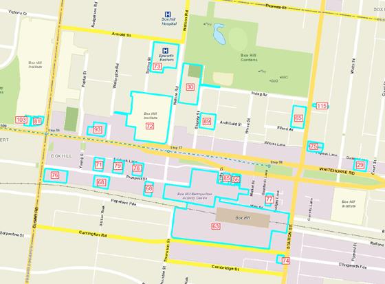
Where the site specific submissions seek changes to the
Amendment these are addressed in the table below and/or referred to submission themes
above. The submission number is bracketed.
|
Site
|
Summary of submission
|
Office response and recommendation
|
|
1011-1023 Whitehorse Road, Box Hill (29)
|
Requests
that the property be included in Built Form Precinct F.
Request
that the property be included within Activity Precinct A of the Structure
Plan and within Precinct F3 in the Guidelines/DDO.
|
Purpose
of Amendment is to implement Built Form Guidelines. Council is satisfied with
operation of Structure Plan and therefore scope of Guidelines did not include
reviewing boundaries of the Structure Plan.
Refer
also to Officer Response under submission theme “Box Hill Transit City
Activity Centre Structure Plan”.
|
|
16-28 Nelson Road, Box Hill (30)
RSL
|
Seeks
change to the front setback provisions (adopt a zero front setback).
Given
the disparity, there is a case to include the east side of Nelson Road in a
different Precinct or Sub-Precinct to recognise the particular issues.
Seek
a change to the preferred height limit to 20 storeys.
|
Refer
to Officer Response under submission theme “Building Heights and
setbacks”.
The
Guidelines seek to provide greater clarity in terms of level of anticipated
growth given interface conditions, allotment size and configuration and
accessibility. The site is situated adjacent to the Box Hill Gardens and
therefore the heights and setback requirements are acceptable because of this
context but can be varied if well justified and meets the objectives and
requirements of the DDO.
For
finer grain and smaller lots, there is scope to consider variations to the
setback requirements where the development meets the objectives of the DDO.
In
Table 8 of DDO (Sub-precinct F6) under Precinct Objectives for Street Walls
and preferred maximum heights, replace “To establish continuous
belt of landscaping” with “To encourage continuous belt of
landscaping”
The
preferred height in this sub-precinct is to provide for a transition from the
core of the Box Hill MAC to the Box Hill Gardens.
|
|
Box Hill institute (72)
|
Elgar
and Nelson campuses
Discretionary
height limit should be increased to accord with the strategic direction for a
higher density outcome.
Site
coverage, setback and building separation requirements are inconsistent with
existing built form pattern and development within this precinct, where
commercial and institutional buildings are built to boundaries and frontages.
“Campus
style” needs to be clarified.
Precinct
E
Not
clear if controls within DDO6 apply to Precinct E when looking at Maps 1 and
2 - would be better for both maps to be consolidated to eliminate confusion
over the application of the DDO and where sub precinct built form
requirements apply.
|
Refer
to Officer Response under submission theme “Building Heights and
setbacks”.
The
Guidelines seek to achieve higher densities.
Development
trajectory was a consideration in the preparation of the Guidelines. The
Guidelines seek to provide greater clarity in terms of level of anticipated
growth given interface conditions, allotment size and configuration and
accessibility. The heights and setback requirements can be varied if well
justified and meets the objectives and requirements of the DDO.
Reference
to ‘campus style’ will be deleted from the DDO and Guidelines as
there are sufficient objectives to address ‘landscape’ and
‘building separation’ requirements in the DDO.
Planning
Scheme Maps 1 & 2 are split in this location by the State Government. Map
provided with the Amendment document was consolidated to show coverage of
DDO. The DDO applies to all precincts except Built Form Precinct A at the
periphery of the Box Hill MAC. There are minor references to Precinct E based
on the information contained in the Structure Plan, however the focus of the
DDO is Precinct C and F. References to Precinct E are made under the design
objectives and requirements for Street Frontages, Pedestrian Access, Building
Separation and Heights in the DDO.
|
|
Site
|
Summary of submission
|
Office response and recommendation
|
|
Epworth Eastern (73)
|
No
justification for low density campus style built form typology.
Delete
the objective for taller forms with smaller footprints and generous
separation as this constrains interconnecting buildings in a hospital
setting.
Revise
the site coverage to 80% to allow for efficient and functional hospital floor
plates, would still allow for open space and setbacks.
Requirement
for 10m building separation to apply to residential development only.
Remove
or reduce landscaping buffer from 8 to 6m as it impedes the use of land for
hospital use.
Crossovers
and drop off areas should be able to be included within landscaped areas.
|
Refer
to Officer Response under submission theme “Building Heights and
setbacks”.
Delete
reference to ‘campus style’. There is sufficient objective to
address landscaping on the ground level and building separation to address
the intent.
The
Epworth hospital is located within Sub-precinct F6 with preferred maximum
building height up to 15 storeys. The objectives of the Guidelines are to
reinforce the vision of the urban structure as per the Structure Plan that is
to reinforce the role of Whitehorse Road as the main road and for built form
to transition down as they approach peripheral residential/ open space
precincts. 15 storey building height is considered to be a balanced outcome
to realise development potential, maintaining the desired urban structure
befitting the northern edge of Built Form Precinct F and within proximity to
the Box Hill Gardens.
The
heights, site coverage and setback requirements can be varied if well
justified and meets the objectives and requirements of the DDO.
Noted.
Crossovers and drop off areas can be considered during the consideration of a
planning permit application.
|
|
902-911 Whitehorse Road, Box Hill (56)
|
Adjust
maximum height of F4 as it is the most suitable to be the area with the
highest built form.
The
site should be identified as the most significant location and it has the
potential to become a new landmark.
Flexible
and more adaptive building setbacks should be introduced as the current
setbacks are onerous, will likely result in an undesirable style and can
stifle innovative architectural design.
A
reasonable building setback should be able to be negotiated with positive
contribution to the community, including provision of amenities and
activation of street level.
A
negotiable and more practical overshadow policy should be introduced.
Suggest
a removal of standard building height, setbacks and shadow restrictions on
the site and other socially important locations.
|
Refer
to Officer Response under submission theme “Building Heights and
setbacks”.
The
Guidelines do not support the identification of single land mark sites for
height. Instead the Guidelines seek to encourage a range of building scales
and types to reinforce the natural topography and urban structure ambition.
The
Guidelines seek to provide greater clarity in terms of level of anticipated
growth given interface conditions, allotment size and configuration and
accessibility. The setback requirements can be varied if well justified and
meets the objectives and requirements of the DDO.
Variations
that meet the objectives can be discussed during the pre-application stage
and considered when assessing a planning permit. The overshadowing
requirements are intended to protect and enhance, where possible, the amenity
of surrounding residential precincts and key open space.
The
core of the Box Hill MAC is of critical importance, as it contains a key open
space and pedestrian public space. The Guidelines seek to protect the amenity
and quality of these areas.
|
|
Site
|
Summary of submission
|
Office response and recommendation
|
|
Box Hill Central (63)
|
Preferred
heights for F2 and F4 do not respond to the opportunity of the MAC nor do
they reflect the context of established and improved developments and greater
height can be considered without off side amenity impacts.
Degree
of flexibility should be retained for setbacks to allow for different design
outcomes, they could be referenced as preferred.
No
guidance on what constitutes a positive contribution and surety is required
around the plot ratio concept.
Overshadowing
requirements are different between Structure Plan and Guidelines and
requirements are not clear for Carrington Road.
Application
of the Better Apartment standards and their requirements is more useful than
requirements that are open to interpretation, such as "to Council
satisfaction" for cross ventilation.
Request
Guidelines and DDO be updated to reflect both north and south shopping centre
sites be reflected as Strategic Development sites as they are currently in
different sub precincts which could constrain outcomes.
Request
that Council amend the documentation to reflect the ownership of the centre
and their names - Box Hill Central (North) and Box Hill Central (South).
|
Refer
to Officer Response under submission theme “Building Heights and
setbacks”.
The
Guidelines seek to provide greater clarity in terms of level of anticipated
growth given interface conditions, allotment size and configuration and
accessibility. The controls allow for flexibility provided the objectives and
requirements of the DDO can be met.
Recommended
to make reference to ‘design excellence’ as it is commonly
referred to in design controls elsewhere.
Overshadowing
requirement of Carrington Road is consistent with the Structure Plan to
‘protection of key open space at 11.00-14.00 on 22 June’. The
Guidelines also require that key open space and peripheral residential areas
are not overshadowed.
Amendment
VC136 introduced Better Apartment standards into planning scheme as discretionary
controls to be considered. Guidelines will be updated to match the
requirements of the Standards about cross ventilation.
Guidelines
and DDO will be updated to reflect both sites as Strategic Development sites.
Guidelines and DDO will be updated to reflect ownership and names of centre.
Guidelines
to include both properties in Sub-precinct F2. Inclusion of both properties
in Sub-precinct F2 and designation as a Strategic Development sites will
allow consideration of a greater development scale subject to a positive
contribution to the local context.
|
|
709-713 Station Street, Box Hill (65)
|
Request
that Council reviews the content of DDO-Table 4-sub-precinct F2 guidelines -
Station Street in the "Street Walls and preferred maximum heights"
section under "Built Form Response" and remove wording under the
5th dot point that refers to "subject to a separate design brief
for built for and urban design".
This
refers to property over 1,500m2 but should only refer to 519-521
Station Street in the 7th dot point.
No
need to apply a requirement for a separate design brief for built form and
urban design though feel that the site should be given the same opportunities
for development as 519-521 Station Street.
|
Refer
to Officer Response under submission theme “Building Heights and
setbacks”.
Clarification
of the requirement for a separate design brief for built form and urban
design for 519-521 Station Street only will be explained in Guidelines.
Officers
disagree about matching the development scale at 709-713 Station Street to
the southern end of Station Street. The objectives of the Guidelines is to
reinforce the vision of the urban structure as per the Structure Plan, that
is to reinforce the role of Whitehorse Road as the main road and for built
form to transition down as they approach lower order residential/ open space
precincts.
The
north leg of Station Street is primarily shaped by mid-rise recent
developments of less than 15 storeys and greatly influenced by the Box Hill
gardens, whilst the south leg of Station Street is primarily influenced by
the station precinct with anticipated high rise Sky one development.
A
different transitional approach is therefore warranted to achieve a balanced
outcome in realising development potential, maintaining the desired urban
structure befitting the northern edge of Precinct F (built form) and
approaching the Box Hill Gardens.
|
|
Site
|
Summary of submission
|
Office response and recommendation
|
|
13 Prospect Street, Box Hill and 31-35 Prospect
Street, Box Hill (68)
|
Do
not support the proposed preferred maximum height for F4 as it is
inappropriate and will detrimentally impact the development of the land in
the precinct.
Preferred
maximum height of properties on the southern side of Prospect Street should
be removed or the properties should be included in F5.
The
proposed minimum setback from site boundaries will create a wedding cake
approach and stifle innovative and site responsive design.
Clarification
is required as to whether the 30 degree setback profile for buildings above
15 storeys is required for properties separated by the train line from
residential uses in Built Form precinct A.
The
reference to a 1.5 m setback from a laneway for vehicle access should be
removed for clarity as there is no reference to the requirement in the
Guidelines.
The
reference to heights should be in metres to avoid confusion between
retail/commercial developments and residential developments having different
floor to ceiling heights.
|
Refer
to Officer Response under submission theme “Building Heights and
setbacks”.
The
Guidelines seek to provide greater clarity in terms of level of anticipated
growth given interface conditions, allotment size and configuration and
accessibility.
The
heights seek to encourage a range of building scales and types to reinforce
the natural topography and urban structure ambition, and transition height
away from Whitehorse Road outwards towards the peripheral residential areas.
The
minimum setback from site boundaries seeks to protect the pedestrian experience
and provide building separation at upper levels.
Properties
in sub-precinct F4 are required to include a 30 degree angled setback above
15 storeys to ensure no overshadowing on properties in Built Form Precinct A.
The
reference to a 1.5m setback from a laneway is identified on page 45 of the
Guidelines.
The
Guidelines have provided both storeys and metres on page 29 to provide
flexibility in building floor to ceiling outcomes.
|
|
535 Station Street, Box Hill (74)
|
Council
may consider incorporating performance criteria that demonstrates a public
benefit.
Building
height guideline should be rephrased to be 15 storeys where it can be
demonstrated that site characteristics and location do not negatively impact
on the area. 20-25 storeys should be contemplated on larger sites.
Building
height should be demonstrated by design response not solely by the site size
and therefore maximum height above 15 storeys on sites greater than 1500sqm
should be removed.
Side
and rear setback requirements is inappropriate for residential development
but could apply to commercial office developments.
Setbacks
above 10-15 storeys should be subject to amenity implications and if it can
be demonstrated there are no negative impacts, then setbacks should not be a
requirement.
|
Refer
to Officer Response under submission theme “Building Heights and
setbacks”.
The
Guidelines seek to provide greater clarity in terms of level of anticipated
growth given interface conditions, allotment size and configuration and
accessibility. The height and setback requirements can be varied if well
justified and meets the objectives and requirements of the DDO.
Guidelines
are providing direction about built form; land use is outside the scope of
the Guidelines. Built form requirements are also relevant irrespective of
land use.
|
|
Site
|
Summary of submission
|
Office response and recommendation
|
|
6-10 Shipley Street (89)
|
Amendment
should be varied having regard to the preferred height for the site and
precinct on the basis that the site can accommodate a taller building without
unreasonable offsite amenity impact.
Site
where higher scale development might be contemplated, as proposal is too low.
Similar
development opportunity warranted to 20 storey permit at 12-14 Nelson Road.
If
higher heights not accepted then request being nominated as a strategic
development site.
|
Refer
to Officer Response under submission theme “Building Heights and
setbacks”.
There
is only one strategic development site nominated within the study area and it
relates to its role as a transit oriented development/ public accessibility.
The site in review does not have the same strategic opportunity, therefore
not deemed a strategic development site.
Additionally,
the site is located in the sub-precinct adjacent to the Box Hill Gardens,
where heights are to transition down as they approach the Gardens to protect
the amenity of a key open space.
|
|
34-36 Prospect Street, Box Hill (71)
|
Setbacks
in table 7 are considered excessive and will limit development, should be
replaced with a performance based approach to building separation contained
within the Better Apartment Design Standards.
Objects
to the proposed preferred minimum front setback and the identification of a
defined physical setback as this can be achieved by various ways and with
lesser setbacks.
Seeks
deletion of policy relating to overshadowing of Built Form Precinct A and
residential land and open space as this should be on a case by case basis, as
there is no analysis of the built form impacts of the shadowing controls.
Protection
of front gardens and balconies does not provide for occupier amenity and is
inappropriate where it affects the development potential in a MAC.
Policy
guideline about widening laneways should be deleted or clarified as to what
laneways it applies to as it has not been demonstrated that widening of
Fairbank Lane is required.
Matters
covered by the Better Apartment Design Guidelines, such as internal amenity,
cross ventilation, borrowed light, building adaptability and light wells,
should not be replicated by the Guidelines.
|
Refer
to Officer Response under submission theme “Building Heights and
setbacks”.
The
Guidelines seek to provide greater clarity in terms of level of anticipated
growth given interface conditions, allotment size and configuration and
accessibility. The height and setback requirements can be varied if well
justified and meets the objectives and requirements of the DDO. Variations
can be discussed during the pre-application stage and considered when
assessing a planning permit.
Overshadowing
controls required to the south of the railway line as the Structure Plan
clearly anticipates protection of amenity in surrounding low rise precincts.
Removal
of protection of front gardens and balconies do not provide greater amenity
outcomes, particularly where public open space provisions are limited within
a MAC context.
Laneway
widening is required, as precinct F4 and F5 are where the highest development
capacity are directed and it is critical that these developments do not
result in unsightly car parking access provided within the street frontage.
Properties fronting Whitehorse Road will also have limited vehicular access
off the main road, thus likely to rely on rear laneways for access.
Amendment
VC136 introduced Better Apartment standards into planning scheme as
discretionary controls to be considered. Officers agree that these standards
should not be replicated. Timing of Guidelines and Standards implementation
was outside the control of the project team. Guidelines will be amended to
reflect the status of the Standards and ensure consistency, where relevant.
|
|
Site
|
Summary of submission
|
Office response and recommendation
|
|
702-706 Station Street, Box Hill (75)
|
Council
may consider incorporating performance criteria that demonstrates a public
benefit.
Street
wall guideline should be rephrased to read "street wall should be
responsive to site context and not exceed 5 storeys".
Preferred
maximum height proposed is inappropriate and should be rephrased to be 15
storeys where it can be demonstrated that site characteristics and location
do not negatively impact on the area.
Building
height should be demonstrated by design response not solely by the site size
and this guideline should be removed.
Side
and rear setback requirements is inappropriate for residential development
but could apply to commercial office developments.
Setbacks
above 10-15 storeys should be subject to amenity implications and if it can
be demonstrated there are no negative impacts, then setbacks should not be a
requirement.
Site
responsive approach to built form based on amenity outcomes is appropriate.
|
Refer
to Officer Response under submission theme “Building Heights and
setbacks”.
Officers
agree about contextual influence to street wall height, but disagree with
street wall not exceeding 5 storeys as the Guidelines are seeking to
encourage varied built form typology and not to encourage the implantation of
‘podium – tower’ development on all sites.
The
Guidelines seek to provide greater clarity in terms of level of anticipated
growth given interface conditions, allotment size and configuration and
accessibility. The height and setback requirements can be varied if well
justified and meets the objectives and requirements of the DDO.
Guidelines
are providing direction about built form; land use is outside the scope of
the Guidelines. Built form requirements are also relevant irrespective of
land use.
|
|
436 Elgar Road, Box Hill (76)
|
Council
may consider incorporating performance criteria that demonstrates a public
benefit.
Rephrase
guideline about street wall to read "street wall height to achieve a preferred
1:1 ratio, or a 5 storey street wall where the height does not exceed the 1:1
ratio".
Rephrase
guideline about setback above podium to read "preferred minimum setback
of 5m above podium to all site boundaries" reduced setback may be
appropriate where it can be demonstrated that site characteristics and
location do not negatively impact on the amenity of surrounding area.
Rephrase
guideline about building height to include reference that higher built form
may be appropriate if it can be demonstrated that site characteristics and
location do not negatively impact the amenity of the surrounding area.
30
degrees angled setback profile should be removed as this control is more
appropriately regulated by over shadowing guidelines.
Minimum
setback requirement above 6-20 storeys would be redundant if previous setback
above podium is rephrased.
Site
responsive approach to built form is more appropriate.
|
Refer
to Officer Response under submission theme “Building Heights and
setbacks”.
Officers
agree about contextual influence to street wall height, but disagree with
street wall not exceeding 5 storeys as the Guidelines are seeking to
encourage varied built form typology and not to encourage the implantation of
‘podium – tower’ development on all sites.
The Guidelines
seek to provide greater clarity in terms of level of anticipated growth given
interface conditions, allotment size and configuration and accessibility. The
height and setback requirements can be varied if well justified and meets the
objectives and requirements of the DDO.
The
angled setback is required to establish a sense of transition on sites with a
direct residential interface and also those outside the Box Hill MAC. It
reinforces the overshadowing requirements to protect the amenity and quality
of sensitive land uses.
|
|
Site
|
Summary of submission
|
Office response and recommendation
|
|
28 Main Street, Box Hill (77)
|
Council
may consider incorporating performance criteria that demonstrates a public
benefit.
Rephrase
guideline about building height to include reference that higher built form
may be appropriate if it can be demonstrated that site characteristics and
location do not negatively impact the amenity of the surrounding area.
Rephrase
guideline about minimum 10 m setback to read "preferred minimum setback
of 10 metres above the street wall for additional levels".
No
guideline as to the preferred street wall height at the Main Street frontage,
suggest a 4 storey street wall is appropriate as it would create a 1:1 street
wall width ratio.
|
Refer
to Officer Response under submission theme “Building Heights and
setbacks”.
Officers
agree about contextual influence to street wall height, but disagree with
street wall not exceeding 5 storeys as the Guidelines are seeking to
encourage varied built form typology and not to encourage the implantation of
‘podium – tower’ development on all sites.
The
Guidelines seek to provide greater clarity in terms of level of anticipated
growth given interface conditions, allotment size and configuration and
accessibility. The height and setback requirements can be varied if well
justified and meets the objectives and requirements of the DDO.
The
street wall should be consistent with existing street wall to protect the
heritage properties and pedestrian realm. Therefore a 1-2 storey street wall,
as preferred for Whitehorse Road and Station Street in the same sub-precinct,
is the preferred street wall height for the Main Street frontage.
|
|
18-20 Prospect Street, Box Hill (78)
|
Council
may consider incorporating performance criteria that demonstrates a public
benefit.
Rephrase
guideline about street wall to read "street wall height to achieve a
preferred 1:1 ratio, or a 5 storey street wall where the height does not
exceed the 1:1 ratio".
Rephrase
guideline about building height to include reference that higher built form
may be appropriate if it can be demonstrated that site characteristics and
location do not negatively impact the amenity of the surrounding area.
Rephrase
no setback from side and rear up to 5 storeys to read "no setback from
side and rear boundaries at podium levels".
Rephrase
guideline about minimum setback above podium to read "preferred minimum
setback of 5m above the podium on all sides".
Setbacks
above 21-30 storeys should be subject to amenity implication - if it can be
demonstrated that there are no negative amenity impacts then setbacks should
not be a requirement of the building design.
|
Refer
to Officer Response under submission theme “Building Heights and
setbacks”.
The Guidelines
seek to provide greater clarity in terms of level of anticipated growth given
interface conditions, allotment size and configuration and accessibility. The
height and setback requirements can be varied if well justified and meets the
objectives and requirements of the DDO.
|
|
Site
|
Summary of submission
|
Office response and recommendation
|
|
26-28 Prospect Street, Box Hill (79)
|
Council
may consider incorporating performance criteria that demonstrates a public
benefit.
Rephrase
guideline about street wall to read "street wall height to achieve a
preferred 1:1 ratio, or a 5 storey street wall where the height does not
exceed the 1:1 ratio".
Rephrase
guideline about building height to include reference that higher built form
may be appropriate if it can be demonstrated that site characteristics and
location do not negatively impact the amenity of the surrounding area.
Rephrase
no setback from side and rear up to 5 storeys to read "no setback from
side and rear boundaries at podium levels".
Rephrase
guideline about minimum setback above podium to read "preferred minimum
setback of 5m above the podium on all sides".
Setbacks
above 21-30 storeys should be subject to amenity implication - if it can be
demonstrated that there are no negative amenity impacts then setbacks should
not be a requirement of the building design.
|
Refer
to Officer Response under submission theme “Building Heights and
setbacks”.
The
Guidelines seek to provide greater clarity in terms of level of anticipated
growth given interface conditions, allotment size and configuration and
accessibility. The height and setback requirements can be varied if well
justified and meets the objectives and requirements of the DDO.
|
|
813-823 Whitehorse Road, Mont Albert (81)
|
Development
of 15 storeys on the site would provide a more appropriate outcome.
Front
setback requirements will unreasonably reduce development on site and has
been inappropriately applied considering context and zone.
Should
be greater discretion to vary setbacks between buildings.
Site
should be included in F4 which will allow for greater height, 100% site
coverage to facilitate active frontage and canopy and will facilitate
appropriate built form separation to achieve amenity, equitable development
and visual objectives.
|
Refer
to Officer Response under submission theme “Building Heights and
setbacks”.
The
Guidelines seek to provide greater clarity in terms of level of anticipated
growth given interface conditions, allotment size and configuration and
accessibility. The site is located west of Elgar Road, and does not enjoy
similar strategic capacity as precinct F4 and F5.
It is
also situated within proximity to Kingsley Gardens and immediately north of
more sensitive residential land (outside the Box Hill MAC) to the south. The
setback requirement is discretionary and can be varied if well justified and
meets the objectives and requirements of the DDO.
|
|
874-878 Whitehorse Road, Box Hill (85)
|
Further
guidance should be provided to identify circumstances where variation to
height and setbacks could be acceptable.
Consider
strict adherence to side and rear setbacks would unreasonably stifle
development opportunities.
Submit
that Clause 2.0 of the proposed DDO be amended to identify a wider range of
performance based considerations to respond to unique constraints and
opportunities for each site.
|
Refer
to Officer Response under submission theme “Building Heights and
setbacks”.
The
Guidelines seek to provide greater clarity in terms of level of anticipated
growth given interface conditions, allotment size and configuration and
accessibility. The height and setback requirements can be varied if well
justified and meets the objectives and requirements of the DDO.
Clause
2.0 of the DDO provides an adequate range of performance based considerations
to assist developments with meeting the objectives of DDO.
|
|
Site
|
Summary of submission
|
Office response and recommendation
|
|
843 Whitehorse Road, Box Hill (93)
|
Council
may consider incorporating performance criteria that demonstrates a public
benefit.
Rephrase
guideline about street wall to read "street wall height to achieve a
preferred 1:1 ratio, or a 5 storey street wall where the height does not
exceed the 1:1 ratio".
Rephrase
guideline about building height to include reference that higher built form
may be appropriate if it can be demonstrated that site characteristics and
location do not negatively impact the amenity of the surrounding area.
Rephrase
no setback from side and rear up to 5 storeys to read "no setback from
side and rear boundaries at podium levels".
Rephrase
guideline about minimum setback above podium to read "preferred minimum
setback of 5m above the podium on all sides".
Setbacks
above 21-30 storeys should be subject to amenity implication - if it can be
demonstrated that there are no negative amenity impacts then setbacks should
not be a requirement of the building design.
Site
responsive approach to built form amenity is appropriate and should not be
curtailed by definitive controls about height and or setback requirements.
|
Refer
to Officer Response under submission theme “Building Heights and
setbacks”.
The
Guidelines seek to provide greater clarity in terms of level of anticipated
growth given interface conditions, allotment size and configuration and
accessibility. The height and setback requirements can be varied if well
justified and meets the objectives and requirements of the DDO.
This
site is provided with ample development opportunity, but must demonstrate
that any development does not negatively impact on the surrounding area.
|
|
811 Whitehorse Road, Mont Albert (103)
|
Maximum
height of 8m will not provide a staggered transition in heights.
Conflict
between requirements in Street Wall and preferred maximum heights which
require a minimum 8m landscape setback and in requirements in Landscape which
requires a 5m landscaping setback.
Difficult
to achieve 10m separation between buildings if the proposed 18 storey
building on the adjacent site is approved and constructed.
Not
clear what landscaping elements are to be incorporated into the
façade.
Suggested
a new sub-precinct for 811 and 813 Whitehorse Road, Mont Albert.
Suggested
100% site coverage, 15 storeys, landscape setback of 5m.
|
Refer
to Officer Response under submission theme “Building Heights and
setbacks”.
The
Guidelines seek to provide greater clarity in terms of level of anticipated
growth given interface conditions, allotment size and configuration and
accessibility. The site is located west of Elgar Road, and does not enjoy
similar strategic capacity as precinct F4 and F5.
It is
also situated within proximity to Kingsley Gardens and immediately north of
more sensitive residential land (outside the Box Hill MAC) to the south. The
height and setback requirements can be varied if well justified and meets the
objectives and requirements of the DDO.
Landscaping
elements could include green walls and would be discussed at the planning
permit application stage.
|
|
Site
|
Summary of submission
|
Office response and recommendation
|
|
722 Station Street, Box Hill (115)
|
Proposed
building height of 3 storeys does not provide an appropriate transition
between Precinct B and F2.
More
appropriate height for Precinct B needs to be considered.
|
Purpose
of Amendment is to implement Built Form Guidelines for Built Form Precincts C
and F. Council is satisfied with operation of Structure Plan and therefore
scope of Guidelines did not include reviewing other Built Form Precincts of
the Structure Plan.
The
heights proposed are to provide a transition to the peripheral residential
areas to the north and east and the Box Hill Gardens which is a key open
space.
Refer
also to Officer Response under submission theme “Box Hill Transit City
Activity Centre Structure Plan”.
|
Other issues
Some submissions and proforma
responses raise issues about population growth, immigration policies and land
banking of sites by private developers. These are issues outside the remit of
Council and are controlled by the State or Federal Governments.
Recommended changes to Amendment
C175
As a result of the consideration of
submissions, officers recommend the following changes to the Guidelines, and
consequential changes to the DDO:
· Grammatical
and spelling corrections;
· Acknowledgement
of the Better Apartment Design Standards status;
· Amend
Guidelines to be consistent with Better Apartment Design Standards relating to
cross ventilation;
· Sub-precinct
F2 - Amend Guidelines to reflect ownership of Box Hill Central and inclusion of
both properties in Precinct F2;
· Sub-precinct
F2 - amend mapping to include the entire property at 712 Station Street in the
sub-precinct;
· Sub-precinct
F2 - Clarification of the requirement for a separate design brief for built
form and urban design for 519-521 Station Street only;
· Sub-precinct
F2 - Subdivision Pattern – Built form Response: Delete reference to
‘plot ratio approach’ and ‘positive contribution’ and
replace it with ‘Box Hill Central Site as a Strategic Development Site
where greater development scale can be considered and subject to future
detailed analysis for urban design, built form, public accessibility and
community benefit’;
· Sub-precinct
F6 and sub-precinct F9 - Subdivision Pattern – Precinct Objective: Delete
reference to ‘campus style’. There is sufficient objective to
address ‘landscape’ at ground and ‘building separation’
to address the intent;
· Sub-precinct
F6 - Street Walls and preferred maximum heights - Precinct Objectives: Delete
“To establish continuous belt of landscaping along all street
frontages” and replace it with “To encourage continuous belt of
landscaping along all street frontages;”
· Sub-precinct
F9 - Making changes to setback guidelines to ensure consistent setback of 8m
and to correct an inconsistency;
· All
precincts - Delete reference to ‘Positive contribution to its local
context’ and replace with ‘design excellence’.
It is recommended that
these changes are made to the Guidelines and Amendment prior to an independent
planning panel.
Additional recommendations
The following additional
recommendations are outside the scope of the Guidelines and Amendment C175, but
are recommended to progress the development of the Box Hill MAC:
· Ongoing
advocacy to the State and Federal Governments about upgrading key public
transport infrastructure in Box Hill, including the Box Hill interchange;
· Meeting
with public authorities and utility providers to discuss infrastructure
planning for the future population of Box Hill.
CONSULTATION
Exhibition of the Guidelines and Amendment
is discussed in more detail in the Background and Discussion sections of this
report.
FINANCIAL
IMPLICATIONS
Council will be required to pay for
all costs associated with the independent Planning Panel hearing, including any
expert witnesses and/or representation in support of Council at the Panel
hearing. Given the community and property owner interests in this amendment it
is anticipated that the hearing could run for several days.
The costs associated with the
Planning Panel can be funded from the current budget. It is anticipated that
Council will be represented at the Panel hearing by legal counsel. Council will
also call an expert witness in planning and urban design to assist Council and
the legal representation at the Panel Hearing. Funding for the expert witness
is proposed in the 2017-18 budget.
POLICY IMPLICATIONS
The preparation of the Guidelines
and Amendment C175 is consistent with the Planning and Environment Act 1987
and State Planning Policy. The Guidelines and Amendment are particularly
consistent with Plan Melbourne, which continues to recognise the
importance of Box Hill and designates it as a Metropolitan Activity Centre and
Health and Education Precinct.
The Guidelines and Amendment will
assist the Box Hill MAC to provide the local and wider community with good
access to retail, entertainment, health, and education and transport services.
The Amendment will rezone land in line with the Structure Plan to provide
opportunities for mixed use development comprising retail and office space with
residential accommodation. This will contribute to the 20 minute neighbourhood
concept in Plan Melbourne, which seeks to provide communities with
various services and land uses within a 20 minute walk or public transport
trip.
The preparation of the Guidelines
and Amendment is also consistent with Local Planning Policy and in particular
Strategic Direction 2 in the Council Plan 2015-2019 which seeks to “maintain
and enhance our built environment to ensure a liveable and sustainable city”
(page 11).
The Guidelines will provide much
needed direction in relation to the built form outcomes sought by Council and
the community in the major development precinct of the centre. The built form
objectives and rezoning included in the Amendment will complement the Structure
Plan and give statutory strength to the objectives within both the new and
previous work through new provisions in the Whitehorse Planning Scheme.
CONCLUSION
Amendment C175 proposes to
implement the Box Hill Metropolitan Activity Centre Built Form Guidelines by
introducing a new Schedule 6 to Clause 43.02 Design and Development Overlay
into the Planning Scheme and applying it to Built Form Precincts B, C, D, E and
F as identified in the Structure Plan. The Amendment also proposes to rezone
various properties in the Structure Plan area broadly in line with the
recommendations of the Structure Plan and to make minor changes to Clause 21.07
(Economic Development) and Clause 22.07 (Box Hill Metropolitan Activity Centre)
in the Planning Scheme to reference the Guidelines.
The submissions received during the
exhibition period were from local residents in the municipality and landowners
and business owners/operators in the Box Hill MAC. The submissions raised a
diverse range of themes including amenity, traffic and transport, building
heights and setbacks, car parking, the Structure Plan, heritage, open space and
issues relating to specific individual sites.
The proforma submissions were
received in response to a flyer distributed to an unknown number of residents.
The flyer only discussed the preferred height limits proposed by the Amendment
and did not discuss any other aspect of built form included in the Guidelines
or Amendment. All of the responses to the proformas objected to the proposed preferred
building heights.
A large majority
of the submissions raised issues outside the scope of the Guidelines and
Amendment and/or issues that are discussed and contained within other Council
or State Government policy.
The Guidelines
consider building outcomes such as setbacks and frontages, view lines, heights
and relationship to the public realm and building qualities such as
articulation, depth, separation, overshadowing, landscaping and pedestrian and
vehicle access. The Guidelines seek to provide clarity and achieve a degree of
consistency of built form in a planning environment where discretionary,
performance based controls are preferred.
The Guidelines do
not provide a response to issues such as traffic and car parking, public
transport, active transport or open space. These issues are considered in the
Planning Scheme and/or other complementary Council or State Government policy.
Council recognises that key strategic documents such as the Planning Scheme,
Open Space Strategy and Transport Strategy must work in tandem to progress the
development of the Box Hill MAC.
In considering submissions Council
can change the Amendment in the manner requested, refer the submissions and
Amendment to an independent Planning Panel or abandon the Amendment. As there
are submissions that seek changes to the Amendment which cannot be supported,
the first option cannot be considered.
While the Amendment can be
supported on a strategic basis and there are submitters that do not object to
the Amendment, it should not be abandoned.
If the Amendment is abandoned,
there will be limited guidance or direction in the commercial areas of the Box
Hill MAC available to the community or land owners about qualities of buildings
and the public realm in the Box Hill MAC.
Specifically, there will be limited
guidance about building qualities such as setbacks, frontages and heights.
Building heights was raised as a key issue by submitters and proforma responses
and therefore the limited information about preferred building heights in the
commercial areas will cause further uncertainty in the community about the
preferred building heights in the Box Hill MAC.
Accordingly, the most transparent
and fair method to enable all parties to have their comments assessed is for
all named submissions and the Amendment to be referred to an independent
Planning Panel for its consideration.
Therefore it is recommended that
the Amendment is referred to an independent Planning Panel and that all
submitters are advised accordingly.
Attachment
1 Attachment 1 -
Summary of submissions and proformas ⇨
Ordinary Council Meeting 15
May 2017
10.2 Infrastructure
10.2.1 Tender
Evaluation Report (Contract 20012) Provision of Consultancy Services:
Structural & Civil Engineers
SUMMARY
Most building projects
undertaken by Council require structural and civil engineering information and
design to deliver the new, upgraded or refurbished facilities.
The purpose of this tender
process is to appoint a new panel of Structural & Civil Engineering
consultants to provide Council with design and technical consultancy services
for a range of planned future building projects.
Following the public tender
process, a comprehensive evaluation and assessment was undertaken and five
Structural & Civil Engineering consultants are now recommended for
appointment to form a Preferred Supplier Panel.
|
RECOMMENDATION
That Council:
1. Accept the tenders and sign
the formal contract documents for Contract 20012 for the Provision of
Consultancy Services: Structural & Civil Engineers received from:
· Fenton
Partners Pty Ltd of Suite 2, 35 Ellingworth Parade, Box Hill, VIC, 3128 (ABN:
76 092 711 012).
· GHD
Pty Ltd of 180 Lonsdale Street, Melbourne, VIC, 3000 (ABN: 39 008 488 373).
· JJ
Ryan Consulting Pty Ltd of 16/79 Manningham Road, Bulleen, VIC, 3105 (ABN: 69
145 797 726).
· Kennedy
Bell Infrastructure Pty Ltd of Suite 1A, 150 Chestnut Street, Richmond, 3121
(ABN: 56 154 718 117).
· W
& G Engineers Victoria Pty Ltd of Level 2, 31 Market Street, South
Melbourne, VIC,
3205 (ABN: 59 127 466 997).
on
a Schedule of Rates basis for a period of 3 years commencing on 29 May 2017.
2. Authorise
the Chief Executive Officer to award an extension of this contract, subject
to a review of the Contractor’s performance and Council’s
business needs, at the conclusion of the initial three year contract.
|
BACKGROUND
Council own a large number of
buildings and is responsible for maintaining these buildings to ensure the
level of service delivered meets community and user expectations. Funding for
these capital projects is allocated from the annual Capital Works Program. Most
projects require the services of a range of consultants including Structural
& Civil Engineers to deliver the new, upgraded or refurbished facilities.
A panel of Structural & Civil
Engineering consultants was first established in 2011 with an initial three
year contract followed by a further two year contract extension. The purpose of
this tender is to appoint a new panel of Structural & Civil Engineering
consultants to provide Council with structural & civil engineering services
for a range of planned future building upgrade projects located throughout the
municipality.
The establishment
of a new panel of Structural & Civil Engineers will
continue to facilitate the timely delivery of building capital works projects
and enable Council to comply with the requirements of the State
Government’s “best value” purchasing legislation and
Council’s Procurement Policy.
It is planned to let a three year
Contract, with the option for a two year extension to be exercised at the Chief
Executive Officer’s discretion.
DISCUSSION
Tenders were advertised in The Age
newspaper on Saturday 3 December 2016 and closed on Friday 6 January 2017.
Fourteen tenders were received.
The tenders were evaluated against
the following criteria:
· Financial
benefit to Council;
· The
Tenderer’s experience in the provision of similar services;
· The
Tenderer’s capacity to provide the Services;
· The
Consultants internal review processes to ensure efficient design solutions and
value engineering;
· Occupational
Health & Safety and Equal Opportunity (Pass/Fail) and
· Financial
viability (Pass/Fail).
The previous contract comprised a
panel of four Structural & Civil Engineering consultants. Based on Council
Officers use of the previous panel and reviewing the forward Capital Works Program,
it has been determined that a panel of five Structural & Civil Engineering
consultants will be required to adequately service Council needs.
Following a
comprehensive evaluation of the tenders, including business viability checks,
referee checks and interviews with the selected Structural & Civil
Engineers, the tenders received from structural &
civil engineers Fenton Partners Pty Ltd, GHD Pty Ltd, JJ Ryan
Consulting Pty Ltd, Kennedy Bell Infrastructure Pty Ltd and W & G Engineers
Victoria Pty Ltd are considered to provide the best service
and value for money for this Contract.
References for the
selected Structural & Civil Engineers have been
checked and confirmed as having the relevant skills and experience required for
this contract. The preferred tenderer’s business viability has
been checked and meets Councils requirements.
CONSULTATION
Relevant staff from the Building
Project Management, Facilities Maintenance and Engineering Works teams has been
consulted regarding the selection of consultants to form the Preferred Supplier
Panel.
FINANCIAL IMPLICATIONS
The contract for the Provision of
Consultancy Services: Structural & Civil Engineers is based on a Schedule
of Rates for services required. The tendered rates will be subject to rise and
fall adjustments based on the Melbourne All-groups index numbers at each
anniversary date of the Contract.
Structural & Civil
Engineers are engaged on a percentage rate for each stage of a construction
project which can have up to six stages. The assessment of the financial
criteria was based on the total percentage rate for projects with a value of
$300k, $1m and $5m. The total percentage rate was then applied to the project
values and the fees were aggregated and applied as the tendered sum.
Based on the Council’s
forward Capital Works Program, the estimated expenditure under this contract
over the initial 3 year contract term is $240,000 including GST. This
expenditure will increase to approximately $400,000 including GST if the option
to extend the contract for a further two years is exercised.
Expenditure incurred under this
contract will be drawn annually from project budgets approved by Council as
part of the annual Capital Works Program. Contract administration and project
financial management will be undertaken by the Building Project Management team
within the Built Infrastructure Department.
Ordinary Council Meeting 15
May 2017
10.3 Human Services
10.3.1 Tender
Evaluation Report (Contract 20026) Management and Operation of the Morack
Public Golf Course
SUMMARY
To consider tenders received for the Management and
Operation of Morack Public Golf Course and to recommend the acceptance of the
tender received from Golf Services Management Pty Ltd, for 75% of annual green fee and driving range
revenue, and 5% of all other annual turnover revenue generated at the Golf
Course.
|
RECOMMENDATION
That Council:
1. Accept the tender and sign
the formal contract document for Contract 20026 for
the Management and Operation of Morack Public Golf Course received from Golf Services Management Pty Ltd (ABN 93 007 395 904), of P.O Box 89 Black Rock
Victoria 3139, for 75% of annual green fee and driving range revenue, and 5%
of all other annual turnover revenue generated at the Golf Course commencing
on the 1 July 2017 for a period of 2 years.
2. Authorise
the Chief Executive Officer to award an extension of this contract for a
further three x 1 year periods, subject to a review of the Contractor’s
performance and Council’s business needs, at the conclusion of the
initial 2 year contract term.
|
BACKGROUND
Morack Public Golf Course is a
Council owned 18 hole (par 70) golf course located in Vermont South. The course
is irrigated by an automatic system and sustained by an on course dam. The
facility also features a pro shop and kiosk facilities, 17 bay floodlit driving
range, two practice putting greens and a sealed car park.
In addition, there is a small
timber clubhouse facility, situated adjacent to the pro shop that accommodates
five resident golf clubs – Creekside Golf Club, Morack Ladies Blue,
Morack Ladies, Morack Seniors Club and Waverley Life Activities.
The Morack Golf Course has
historically been managed by an external contractor with a comprehensive
Agreement which divides the revenue streams into two categories, ‘Golf
Fee’ consisting of green fees and driving range income, and
‘Turnover Revenue’ consisting of all other
income.
The Agreement provides a high level
of accountability and reporting including audited financial statements,
preparation and submission of annual business plans and budgets. A number of
key performance indicators are incorporated within the agreement to provide
Council with an objective measure to assess the contractor’s performance.
The responsibility for the
Management and Operation of the golf course has been externally contracted for
the past eight years to Golf Services Management Pty Ltd (GSM). GSM also
operate Kingston Links Golf Course, Ranfurlie Golf Course at Cranbourne,
Peregian Golf Course in Queensland, and St Andrews Beach and Bay Views Golf
Courses on the Mornington Peninsula.
The current contract is due to expire on June 30, 2017.
DISCUSSION
Tenders were advertised in The Age
newspaper on Saturday 4 February 2017 and were closed on Wednesday 1 March
2017. A total of three tenders were received.
The tenders were evaluated against the following criteria:
· Financial
Return to Council
· Service
Delivery
· Financial
Viability
· Service
Quality Systems
· Demonstrated
Experience; and
· Occupational
Health & Safety, Equal Opportunity and Business Viability (Pass/Fail).
The term of the contract will be
for two years with an option to extend for a further three by one year periods.
The rationale for the short term
nature of the contract is due to Council currently considering the strategic
direction for the golf course. Council has notionally allocated funds in its 10
year capital works program for implementation of the Strategic Plan and this
will require formal budget approval on an annual basis. The multiple 1 year
options gives Council maximum flexibility in terms of the direction it may
choose to take with regards to future improvements and the potential impact on
the operation of the pro shop, driving range and golf course.
After conducting an initial review
of the tender submissions, two companies were shortlisted and interviewed.
Referee checks and a final evaluation were undertaken.
The preferred tenderer is Golf
Services Management Pty Ltd (GSM) who currently has responsibility for the
management and operation of Morack Public Golf Course. The performance of GSM
over the term of the current contract has met Council’s expectation in
terms of service delivery having developed good relationships with the key
stakeholders and regular patrons, program innovation and the overall marketing
and promotion of the golf course.
GSM have at all times been
responsive to Council requests and demonstrated flexibility in their approach
to the management of the golf course. GSM have also shown a willingness to
invest in the business and in service improvements through upgrades to the
driving range bays, pro shop retail area and inclusion of a fleet of motorised
carts that have proven popular with golfers.
The tender received from Golf
Services Management Pty Ltd is considered to provide the best value for money
for this Contract.
CONSULTATION
Maddocks Lawyers undertook a review
of the Agreement which they had previously supplied and is in use with the
current contract. They also provided the tender documentation that was reviewed
by the Procurement and Contracts Unit.
FINANCIAL IMPLICATIONS
The preferred tenderer will deliver
a 75% return to Council of the Golf Fee (green fees and driving range
revenue), and a 5% return to Council of Turnover Revenue (all other
revenue including food and beverage, merchandise sales, tuition, equipment
hire, etc).
A revenue model based on the
2015/16 financial reports was used to calculate the expected revenue return to
Council to enable a fair comparison of the financial return to Council. Based
on the above percentage returns nominated by the preferred tenderer, Council
can expect to generate an operating income of $1,049,740. The revenue model was
reviewed by the Finance and Corporate Performance Department.
This management arrangement is the
most cost effective in terms of the service delivery at Morack Golf Course and
has provided a good return for Council in the form of operating surpluses
ranging from 200K to 400K per annum over the past 8 years of the Agreement.
The preferred tenderer’s
business viability has been carefully examined.
Ordinary Council Meeting 15
May 2017
10.4 Corporate Reports
10.4.1 Quarterly Performance Report
for the quarter ended 31 March 2017
FILE NUMBER: 17/64327
ATTACHMENT
SUMMARY
The purpose of this report is to brief
Council on the performance against the Council Plan 2013-2017 and the Annual
Budget 2016/17 for the period ended 31 March 2017.
|
RECOMMENDATION
That Council notes the Quarterly Performance
Report for the quarter ended 31 March 2017 as attached.
|
background
This Quarterly
Performance Report for the quarter ended 31 March 2017 provides a detailed
report on performance against the major initiatives and initiatives as
identified in the Annual Budget 2016-17. These major initiatives and
initiatives contribute to the achievement of the Council Plan 2013-17, and
therefore this report reviews Council performance against the Council Plan and
the Annual Budget, pursuant to sections 131(3)(a)(ii)
and 138 of the Local Government Act 1989.
The financial section of this report has been
prepared on an accrual basis to ensure accurate matching of income and
expenditure, both operating and capital, for the year to date ended 31 March
2017. Furthermore, the report is prepared on the basis of year-to-date,
year-end projection, cash and key balance sheet items and analysing trends
against budget.
DISCUSSION
Performance against Council Plan
The Annual Plan,
which is a part of the Annual Budget 2016/17, identified 29 major initiatives
and initiatives which contribute to the achievement of the Strategic Objectives
and Strategies identified in the Council Plan 2013-2017. Of the 29 major
initiatives and initiatives in the Annual Budget 2016/17, 5 are complete, 21
are on track, and 3 are below their quarterly target of 75% completion.
Highlights for the quarter
included:
§ Nunawading Community Hub:
Council appointed the Cost Planner and Building Surveyor for the project
through the tendering process. The user/stakeholder consultation process is
continuing with two workshops for all groups held.
§ Whitehorse Centre
redevelopment: A detailed facility and site assessment was conducted for the
purpose of presenting Council with a final report for consideration of Option A
or Option B at its meeting on 10 April 2017.
§ Health and Wellbeing Plan:
The development of the new Municipal Public Health and Wellbeing Plan has
commenced. A working group has been established and consultants appointed.
§ Elgar Park north sports
pavilion redevelopment: Council appointed the preferred builder. Site
mobilisation commenced including temporary fencing, builders sheds, storage
containers and temporary facilities for Club use.
§ New “Pipetrack”
shared path: Construction works were completed and the path was opened to users
in February 2017.
§ Energy efficient street
lighting changeover: Installation of the energy efficient street lights has
commenced. This project is over two financial years and is expected to be
completed in September 2017.
Performance against Annual
Budget
The year-to-date
financial result at 31 March 2017 is favourable to budget by $12.02m.
The year-end result is forecast to
be a $34.93m surplus, $10.91m favourable to budget.
The capital works expenditure to
the end of March 2017 was $19.1m compared to a year-to-date expenditure
forecast of $23.5m. The year-to-date expenditure represents 53% of the total
capital works program. The full year capital works expenditure, including
carry-over projects, is forecast to be $36.1m.
Attachment
1 Quarterly
Performance Report for the quarter ended 31 March 2017 ⇨
Ordinary Council Meeting 15
May 2017
10.4.2 Provision
of Internal Audit Services
SUMMARY
To consider tenders received for the provision of
internal audit services and to recommend the acceptance of the tender received
from Crowe Horwath (Aust) Pty Ltd (trading as Crowe Horwath) for the amount of
$274,312.50 including GST for a period of 3 years with an option to extend for
up to 3 further years.
|
RECOMMENDATION
That Council:
1. Accept the tender and sign the formal
contract document for Contract 20030 for the provision of internal audit
services from 2017 to 2020, received from Crowe Horwath (Aust) Pty Ltd (ABN
84 006 466 351), of Level 17, 181 William Street, Melbourne VIC 3000, trading
as Crowe Horwath, for the tendered amount of $274,312.50, including GST.
2. Authorise
the Chief Executive Officer to award an extension of this contract, subject
to a review of the Contractor’s performance and Council’s
business needs, at the conclusion of the initial 3 year contract term.
|
BACKGROUND
Council has committed itself to providing
responsible leadership and governance by conducting its affairs openly and with
integrity, reflecting the highest level of good management and governance.
Internal
auditing provides a mechanism for Council to enhance the transparency of its
decision-making, strengthen its internal controls and continue to develop a
culture of strong internal controls and risk awareness.
Council’s
internal audit strategy is driven by Council’s Audit Advisory Committee.
The chair of the Audit Advisory Committee acted in an advisory capacity to the
tender evaluation panel. The selected consultant will provide services under
the guidance of the Audit Advisory Committee for a period of 3 years, until 30
June 2020 with an option to extend for up to 3 further years.
DISCUSSION
Tenders were advertised in the Age
newspaper on Saturday 4 March 2017 and were closed on Monday 27 March 2017.
Seven tender submissions were received.
The
tenders were evaluated against the following criteria:
· Experience in the provision of similar Internal Audit
services;
· Demonstrated knowledge in Local Government internal
auditing practices;
· Price; and
· Qualifications and experience of key personnel.
Tenders were also evaluated in accordance with the following
criteria on a Pass/Fail basis:
· Tenderer’s
record, policies and attitude towards Equal Employment Opportunity.
· Tenderer’s
record, policies and attitude towards Occupational Health and Safety.
Tenderers
were asked to provide a proposal for the provision of up to 650 hours per annum
plus 15 hours per annum for attendance at Audit Advisory Committee meetings.
The
tender evaluation panel consisted of the Manager Finance and Corporate
Performance, the Management Accountant and the Financial Accountant. The chair
of the Audit Advisory Committee acted in an advisory capacity.
Following
the preliminary evaluation which was based on the set criteria, two tenderers
were short listed for interview. Interviews were conducted on 24 April 2017 at
the council offices. The interview panel consisted of the evaluation panel and
the chair of the Audit Advisory Committee.
Following
the interviews a preferred tenderer was decided and a series of reference
checks were conducted.
The panel
formed the view that the tender received from Crowe Horwath is considered to be
the most beneficial to Council for this contract.
Crowe
Horwath is a large accounting firm that provides business advisory services
with access to a wide range of specialist skills. It has significant
accumulated and current experience in Local Government auditing and has
nominated a team of highly experienced professionals to meet Council’s
internal auditing requirements.
CONSULTATION
No
consultation was required for this report.
FINANCIAL IMPLICATIONS
The lump sum tendered by Crowe Horwath is allocated as follows:
|
|
Expenditure
|
|
2017/18 Financial Year
(excluding GST)
|
$83,125.00
|
|
2018/19 Financial Year
(excluding GST)
|
$83,125.00
|
|
2019/20 Financial Year
(excluding GST)
|
$83,125.00
|
|
Sub-total
|
$249,375.00
|
|
GST
|
$24,937.50
|
|
Total Expenditure (including
GST)
|
$274,312.50
|
The tendered lump sum allows for
650 hours of internal auditing work plus 15 hours for the attendance of four
meetings per year. Additional services requested by Council will be charged in
accordance with a schedule of rates.
An allowance will be made in
Council’s recurrent budgets for the provision of internal audit services
for the next 3 years to cover the expected expenditure.
Ordinary Council Meeting 15
May 2017
10.4.3 Supplementary
Valuation Quarterly Report- 1 January 2017 to 31 March 2017
FILE NUMBER: SF16/746
SUMMARY
This report
presents supplementary valuations and recommends adjustment of rate records.
The supplementary valuations have been carried out on properties in accordance
with Section 13DF of the Valuation of Land Act 1960.
|
RECOMMENDATION
That Council:
1. Note and accept the supplementary valuations
undertaken during the period commencing 1 January 2017 to 31 March 2017.
2. Authorise
the rate records being adjusted to take account of the supplementary
valuations returned.
|
background
Item 1.11 of the
Schedule of Powers contained within the Chief Executive Officer’s
Instrument of Delegation adopted by Council on 18 May 2015 states the
following:
“The
delegate must not determine the issue, take the action or do the act or thing
if the issue, action, act or thing is an issue, action, act or thing which
involves:
· The return of the general valuation and any supplementary
valuations.”
This report
relates to supplementary valuations undertaken by Council in accordance with
the Valuation of Land Act 1960 for the period from 1 January 2017 to 31
March 2017.
DISCUSSION
Supplementary
valuations are conducted regularly throughout the financial year to maintain
the equity and accuracy of Council’s rating valuation base.
Supplementary
valuations are primarily due to construction, subdivision and/or planning
activities.
The supplementary
valuations undertaken during the period are summarised
in Table #1 below.
Table # 1:
Supplementary Valuations completed between 1 January 2017 and 31 March 2017
|
Supplementary Valuation Reference
|
Number of Assessments
|
SITE VALUE
|
C.I.V.
|
N.A.V.
|
|
January 2017
|
37
|
-$ 1,464,000
|
-$ 1,983,000
|
-$ 93,100
|
|
February 2017
|
11
|
-$ 5,000
|
-$ 1,290,000
|
-$ 44,150
|
|
March 2017
|
736
|
-$ 965,000
|
$199,102,000
|
$8,290,950
|
|
Supplementary Valuations Total
|
784
|
-$2,434,000
|
$195,829,000
|
$8,153,700
|
CONSULTATION
The legislative
requirement for Council to complete supplementary valuations is contained
within the Valuation of Land Act 1960. All supplementary
valuations contained in this report have been undertaken in accordance with the
2016 Valuation Best Practice Specifications Guidelines.
The supplementary valuations
completed during January, February and March have been certified by the
Valuer-General’s office (VGV) as being “suitable for use” by
Council. These valuation adjustments include the resolution of valuation
objections. Please note that Councils may use supplementary
valuations prior to VGV certification.
FINANCIAL
IMPLICATIONS
The total change
to the Capital Improved Value (CIV) caused by the supplementary valuations
undertaken is an increase of $195,829,000. This change in CIV has generated an
additional $73,427 of supplementary rate income.
A summary of
Council’s valuation totals for all rateable and
non-rateable properties is shown below in Table #2, Table #3 and Table
#4.
Table #2: Valuation
Totals as at 31 December 2016
|
BREAKDOWN
|
Number of Assessments
|
SITE VALUE
|
C.I.V.
|
N.A.V.
|
|
Rateable
|
71,530
|
$47,385,814,700
|
$64,332,073,500
|
$ 3,326,740,850
|
|
Non Rateable
|
1,077
|
$3,110,868,000
|
$3,521,105,500
|
$198,123,450
|
|
Municipal Total
|
72,607
|
$50,496,682,700
|
$67,853,179,000
|
$3,524,864,300
|
Table#3: Change to
valuation totals due to supplementary valuations from 1 January 2017 to 31
March 2017
|
Supplementary Valuations
|
Number of Assessments subject to
Supplementary Valuation
|
Change to
Site Value
|
Change to CIV
|
Change to NAV
|
|
|
784
|
-$2,434,000
|
$195,829,000
|
$8,153,700
|
Table #4: Valuation
Totals as at 31 March 2017
|
NEW BREAKDOWN
|
Number of Assessments
|
SITE VALUE
|
C.I.V.
|
N.A.V.
|
|
New Rateable
|
71,888
|
$47,380,848,700
|
$64,525,335,500
|
$ 3,334,758,100
|
|
New Non Rateable
|
1,081
|
$3,113,400,000
|
$3,523,672,500
|
$198,259,900
|
|
New Municipal Total
|
72,969
|
$50,494,248,700
|
$68,049,008,000
|
$3,533,018,000
|
NB:
Supplementary valuations on non-rateable properties are
recorded on Council’s rating system and their totals are included in the
supplementary valuation reports. This is because non-rateable properties may incur a fire service property levy in accordance
with the Fire Services Property Levy Act 2012.
POLICY IMPLICATIONS
The
Valuations have been undertaken in accordance with the legislative requirements
of the Valuation of Land Act 1960.
Ordinary Council Meeting 15
May 2017
10.4.4 Delegated
Decisions March 2017
SUMMARY
The following activity was undertaken by officers under delegated
authority during March 2017.
|
RECOMMENDATION
That the report of decisions made by officers under
Instruments of Delegation for the month of March 2017 be noted.
|
|
DELEGATION
|
FUNCTION
|
Number for March
2016
|
Number for March 2017
|
|
Planning and Environment Act
1987
|
Delegated Decisions
|
122
|
174
|
|
Strategic Planning Decisions
|
1
|
Nil
|
|
Telecommunications Act 1997
|
|
Nil
|
Nil
|
|
Subdivision Act 1988
|
|
Nil
|
16
|
|
Gaming Control Act 1991
|
|
Nil
|
Nil
|
|
Building Act 1993
|
Dispensations & Applications to
Building Control Commission
|
53
|
81
|
|
Liquor Control Reform Act 1998
|
Objections and Prosecutions
|
2
|
Nil
|
|
Food Act 1984
|
Food Act Orders
|
1
|
9
|
|
Public Health & Wellbeing
Act 2008
|
Improvement /
Prohibition Notices
|
Nil
|
3
|
|
Local Government Act 1989
|
Temporary Road Closures
|
8
|
10
|
|
Other Delegations
|
CEO Signed Contracts between $150,000 -
$500,000
|
1
|
1
|
|
Property Sales and Leases
|
6
|
4
|
|
Documents to which Council seal affixed
|
Nil
|
2
|
|
Vendor Payments
|
1239
|
1381
|
|
Parking Amendments
|
6
|
8
|
|
Parking Infringements written off (not
able to be collected)
|
213
|
378
|
DELEGATED DECISIONS MADE ON PLANNING APPLICATIONS MARCH
2017
All decisions are the
subject of conditions which may in some circumstances alter the use of
development approved, or specific grounds of refusal is an application is not
supported.
|
Appl No.
|
Dec. Date
|
Decision
|
Street
Address
|
Ward
|
Proposed Use or Development
|
Application
Type
|
|
2
|
29-03-17
|
Application Lapsed
|
85 Watts St, Box Hill North
|
Elgar
|
Construction of two (2) double storey
dwellings on a lot
|
Multiple Dwellings
|
|
23
|
01-03-17
|
Application Lapsed
|
1/17 Oxford St, Box Hill
|
Elgar
|
Construction of a new front fence
|
VicSmart - General Application
|
|
49
|
28-03-17
|
Application Lapsed
|
18 High St, Mont Albert
|
Elgar
|
Buildings and works in HO102
|
Heritage
|
|
1015
|
22-03-17
|
Application Lapsed
|
61 Stanley Grv, Blackburn
|
Central
|
Construction of three double storey
dwellings and associated works generally in accordance with the submitted
plans
|
Multiple Dwellings
|
|
1085
|
10-03-17
|
Application Lapsed
|
111 Carrington Rd, Box Hill
|
Elgar
|
Promotional signage
|
Advertising Sign
|
|
4
|
01-03-17
|
CMP Approved
|
115 Burwood Hwy, Burwood East
|
Riversdale
|
Construction of a three storey building
plus basement for 30 dwellings, alteration of access to a road in a Road Zone
Category 1 and reduction in car parking
|
CMP Process
|
|
18
|
07-03-17
|
CMP Approved
|
761 Station St, Box Hill North
|
Elgar
|
Construction of six attached three storey
dwellings
|
CMP Process
|
|
11
|
27-03-17
|
Delegate Approval - S72 Amendment
|
31 Ashley St, Box Hill North
|
Elgar
|
Construction of three (3) double storey
dwellings
|
Permit Amendment
|
|
39
|
10-03-17
|
Delegate Approval - S72 Amendment
|
58 Belgravia Ave, Mont AlbertNorth
|
Elgar
|
Construction of four dwellings,
comprising one single storey dwelling and three double storey dwellings
|
Permit Amendment
|
|
52
|
21-03-17
|
Delegate Approval - S72 Amendment
|
14 Ferris Ave, Box Hill North
|
Elgar
|
Construction of one (1) single storey
dwelling to the rear of the existing dwelling
|
Permit Amendment
|
|
Appl No.
|
Dec. Date
|
Decision
|
Street
Address
|
Ward
|
Proposed Use or Development
|
Application
Type
|
|
88
|
27-03-17
|
Delegate Approval - S72 Amendment
|
1/4 Lilac Crt, Blackburn North
|
Central
|
Construction of two double storey
dwellings
|
Permit Amendment
|
|
208
|
28-03-17
|
Delegate Approval - S72 Amendment
|
1/952 Station St, Box Hill North
|
Elgar
|
Construction of a double storey dwelling
to the rear of an existing dwelling
|
Permit Amendment
|
|
213
|
03-03-17
|
Delegate Approval - S72 Amendment
|
15 Station St, Blackburn
|
Central
|
Amendment to plans for construction of a
three storey building comprising six dwellings to change windows, reduce rear
setbacks and change colours/materials
|
Permit Amendment
|
|
285
|
30-03-17
|
Delegate Approval - S72 Amendment
|
103-107 Koonung Rd, Blackburn North
|
Central
|
Amendment to plans for development and
use of land as a child care centre
|
Permit Amendment
|
|
408
|
07-03-17
|
Delegate Approval - S72 Amendment
|
313 Middleborough Rd, Box Hill South
|
Riversdale
|
Amendment to Planning Permit WH/2015/408
to change the type of Indoor Recreation Facility to swimming pool, buildings
and works for a mezzanine floor and reduction in statutory car parking
requirements
|
Permit Amendment
|
|
449
|
16-03-17
|
Delegate Approval - S72 Amendment
|
131-173 Central Rd, Nunawading
|
Springfield
|
Use and development for a retirement
village with associated convenience shop, food and drink premises (cafe) and
place of assembly, removal of vegetation, car parking reduction and waiver of
loading bay requirements
|
Permit Amendment
|
|
Appl No.
|
Dec. Date
|
Decision
|
Street
Address
|
Ward
|
Proposed Use or Development
|
Application
Type
|
|
456
|
24-03-17
|
Delegate Approval - S72 Amendment
|
31-39 Norcal Rd, Nunawading
|
Springfield
|
Buildings and works for a warehouse
development, use of the land for a food and drink premises and offices,
intenally illuminated signage, reduction in the standard car parking
requirement and native vegetation removal
|
Permit Amendment
|
|
467
|
16-03-17
|
Delegate Approval - S72 Amendment
|
692 Whitehorse Rd, Mont Albert
|
Elgar
|
Demolition of buildings and development
of a part 2 storey and 3 storey building comprising dwellings with basement
carpark and alteration to access to a road in a Road Zone Category 1
|
Permit Amendment
|
|
575
|
21-03-17
|
Delegate Approval - S72 Amendment
|
26 Dunlavin Rd, Nunawading
|
Springfield
|
Construction of a two (2) storey dwelling
and carport to the rear of an existing dwelling
|
Permit Amendment
|
|
636
|
02-03-17
|
Delegate Approval - S72 Amendment
|
61 Kenmare St, Mont AlbertNorth
|
Elgar
|
Amendment to proposed landscaping
|
Permit Amendment
|
|
638
|
07-03-17
|
Delegate Approval - S72 Amendment
|
395 Canterbury Rd, Vermont
|
Springfield
|
Use of land as an Education Centre in
association with the Baha'i Center of Learning for Victoria
|
Permit Amendment
|
|
687
|
27-03-17
|
Delegate Approval - S72 Amendment
|
49 Maple St, Blackburn
|
Central
|
Construction of two (2) double storey
side by side dwellings
|
Permit Amendment
|
|
875
|
30-03-17
|
Delegate Approval - S72 Amendment
|
50 Kitchener St, Box Hill South
|
Riversdale
|
Construction of a double storey dwelling
to the rear of the existing dwelling
|
Permit Amendment
|
|
Appl No.
|
Dec. Date
|
Decision
|
Street
Address
|
Ward
|
Proposed Use or Development
|
Application
Type
|
|
964
|
31-03-17
|
Delegate Approval - S72 Amendment
|
639 Canterbury Rd, Vermont
|
Springfield
|
Construction of five dwellings including
four double storey and one single storey and alteration of access to a road
in a Road Zone (Category 1)
|
Permit Amendment
|
|
1074
|
30-03-17
|
Delegate Approval - S72 Amendment
|
1 Graham Place Box Hill
|
Elgar
|
Amendment to Planning Permit WH/2014/1074
(Issued for double storey building to be used as VCE learning centre, college
maintenance facility and car park at 1 Graham Place, Box Hill) to increase
the site cut, lower finished floor level, internal alterations and
alterations to northern windows
|
Permit Amendment
|
|
1157
|
28-03-17
|
Delegate Approval - S72 Amendment
|
9 Chestnut St, Surrey Hills
|
Riversdale
|
Construction of two (2) double storey
side by side dwellings and the subdivision of the land into two (2) lots
|
Permit Amendment
|
|
1202
|
08-03-17
|
Delegate Approval - S72 Amendment
|
1 Sergeant St, Blackburn
|
Central
|
Construction of three 4-5 storey
apartment buildings and reduction in car parking
|
Permit Amendment
|
|
13
|
07-03-17
|
Delegate NOD Issued
|
14 Stanley Grv, Blackburn
|
Central
|
Construction of three double storey
dwellings
|
Multiple Dwellings
|
|
132
|
09-03-17
|
Delegate NOD Issued
|
27 Summit Rd, Burwood
|
Riversdale
|
Construction of three (3) double storey
dwellings
|
Multiple Dwellings
|
|
206
|
06-03-17
|
Delegate NOD Issued
|
29 Romoly Drv, Forest Hill
|
Central
|
Amended application for construction of a
double storey dwelling to the rear of the existing dwelling to provide access
for both dwellings from Romoly Drive
|
Multiple Dwellings
|
|
Appl No.
|
Dec. Date
|
Decision
|
Street
Address
|
Ward
|
Proposed Use or Development
|
Application
Type
|
|
248
|
10-03-17
|
Delegate NOD Issued
|
78 Dorking Rd, Box Hill North
|
Elgar
|
Construction of three double storey
dwellings
|
Multiple Dwellings
|
|
285
|
24-03-17
|
Delegate NOD Issued
|
14 La Frank St, Burwood
|
Riversdale
|
Construction four double storey dwellings
|
Multiple Dwellings
|
|
324
|
01-03-17
|
Delegate NOD Issued
|
14 Delany Ave, Burwood
|
Riversdale
|
Construction of three double storey
dwellings
|
Multiple Dwellings
|
|
376
|
10-03-17
|
Delegate NOD Issued
|
543 Middleborough Rd, Box Hill North
|
Elgar
|
Construction of two (2) double storey
dwellings
|
Multiple Dwellings
|
|
455
|
28-03-17
|
Delegate NOD Issued
|
603 Springvale Rd, Vermont South
|
Morack
|
Construction of two double storey
dwellings on a lot
|
Multiple Dwellings
|
|
538
|
10-03-17
|
Delegate NOD Issued
|
18 Nandina St, Forest Hill
|
Springfield
|
Buildings and works associated with the
construction of (2) double-storey part triple-storey dwellings
|
Multiple Dwellings
|
|
539
|
30-03-17
|
Delegate NOD Issued
|
14 Wridgway Ave, Burwood
|
Riversdale
|
Construction four double storey dwellings
|
Permit Amendment
|
|
546
|
21-03-17
|
Delegate NOD Issued
|
65 Katrina St, Blackburn North
|
Central
|
Construction of a three (3) storey
mixed-use building comprising one shop, three dwellings, a rooftop terrace
and a basement level and the waiver of loading bay requirements
|
Business
|
|
562
|
06-03-17
|
Delegate NOD Issued
|
11 Peacock St, Burwood
|
Riversdale
|
Construction of three (3) double storey
dwellings
|
Multiple Dwellings
|
|
568
|
28-03-17
|
Delegate NOD Issued
|
18 Patricia Rd, Blackburn
|
Central
|
Construction of two double storey dwellings
|
Multiple Dwellings
|
|
573
|
17-03-17
|
Delegate NOD Issued
|
38 Roslyn St, Burwood
|
Riversdale
|
Development of two double storey
dwellings
|
Multiple Dwellings
|
|
580
|
28-03-17
|
Delegate NOD Issued
|
62-64 Dunlavin Rd, Nunawading
|
Springfield
|
Construction of five double storey
dwellings
|
Multiple Dwellings
|
|
583
|
07-03-17
|
Delegate NOD Issued
|
1 Lindau Drv, Vermont South
|
Morack
|
Part demolition of an existing dwelling
and addition of a second dwelling
|
Multiple Dwellings
|
|
Appl No.
|
Dec. Date
|
Decision
|
Street
Address
|
Ward
|
Proposed Use or Development
|
Application
Type
|
|
640
|
17-03-17
|
Delegate NOD Issued
|
150 Elgar Rd, Box Hill South
|
Riversdale
|
Change of use to a Medical Centre, the
construction of buildings and works to the existing dwelling associated with
a Section 2 Use, and a reduction of the car parking rate pursuant to Clause
52.06-3.
|
Residential (Other)
|
|
653
|
06-03-17
|
Delegate NOD Issued
|
60 Heatherdale Rd, Mitcham
|
Springfield
|
Construction of two dwellings and a two
lot subdivision
|
Multiple Dwellings
|
|
676
|
01-03-17
|
Delegate NOD Issued
|
8 Alexander St, Mitcham
|
Springfield
|
Construction of two double storey
dwellings
|
Multiple Dwellings
|
|
696
|
27-03-17
|
Delegate NOD Issued
|
25 Dewrang Cres, Blackburn
|
Central
|
Construction of three double storey
dwellings
|
Multiple Dwellings
|
|
699
|
20-03-17
|
Delegate NOD Issued
|
78 Burwood Hwy, Burwood East
|
Riversdale
|
The construction of six (6) three storey
dwellings access and altering access to a road in Road Zone category 1
|
Multiple Dwellings
|
|
702
|
27-03-17
|
Delegate NOD Issued
|
57 Lexton Rd, Box Hill North
|
Elgar
|
Development and use of the land for three
warehouses, two caretaker's houses and a place of worship
|
Industrial
|
|
704
|
27-03-17
|
Delegate NOD Issued
|
41 Shafer Rd, Blackburn North
|
Central
|
Consruction of two double storey
dwellings
|
Multiple Dwellings
|
|
705
|
06-03-17
|
Delegate NOD Issued
|
2 Springfield Rd, Blackburn
|
Central
|
Use and development of the land for a
convenience restaurant, advertising signage, the partial removal of easement
E-1 as shown on PC360555F, a reduction to the required bicycle facilities and
alteration of access to a road in a Road Zone (Category 1)
|
Residential (Other)
|
|
Appl No.
|
Dec. Date
|
Decision
|
Street
Address
|
Ward
|
Proposed Use or Development
|
Application
Type
|
|
712
|
07-03-17
|
Delegate NOD Issued
|
5 Horfield Ave, Box Hill North
|
Elgar
|
Construction of two double storey
dwellings
|
Multiple Dwellings
|
|
713
|
08-03-17
|
Delegate NOD Issued
|
20 Edwards St, Burwood
|
Riversdale
|
Development of three double storey
dwellings
|
Multiple Dwellings
|
|
716
|
17-03-17
|
Delegate NOD Issued
|
44 Pendle St, Box Hill
|
Elgar
|
Construction of two double storey
dwellings
|
Multiple Dwellings
|
|
728
|
06-03-17
|
Delegate NOD Issued
|
11 Haros Ave, Nunawading
|
Springfield
|
Construction of six double storey
dwellings
|
Multiple Dwellings
|
|
732
|
24-03-17
|
Delegate NOD Issued
|
89 Koonung Rd, Blackburn North
|
Central
|
Construction of three double storey
dwellings
|
Multiple Dwellings
|
|
756
|
27-03-17
|
Delegate NOD Issued
|
13 Malvern Rd, Mont Albert
|
Elgar
|
Construction of two double storey
dwellings
|
Multiple Dwellings
|
|
786
|
30-03-17
|
Delegate NOD Issued
|
12 McComas Grv, Burwood
|
Riversdale
|
Construction of three double storey
dwellings
|
Multiple Dwellings
|
|
845
|
30-03-17
|
Delegate NOD Issued
|
1 Banksia St, Blackburn
|
Central
|
Construction of two double storey
dwellings
|
Multiple Dwellings
|
|
862
|
21-03-17
|
Delegate NOD Issued
|
938 Canterbury Rd, Box Hill South
|
Riversdale
|
The construction of two (2) double storey
dwellings, use of the land for a dwelling under the Public Acquisition
Overlay Schedule 4, and alteration of access to a road in a Road Zone,
Category 1.
|
Multiple Dwellings
|
|
866
|
17-03-17
|
Delegate NOD Issued
|
15 McKeon Rd, Mitcham
|
Springfield
|
Alterations and additions to construct a
three (3) storey mixed-use building comprising an existing medical centre and
two dwellings
|
Business
|
|
868
|
22-03-17
|
Delegate NOD Issued
|
3 Farleigh Ave, Burwood
|
Riversdale
|
Construction of three (3) double storey
dwellings
|
Multiple Dwellings
|
|
887
|
17-03-17
|
Delegate NOD Issued
|
11 Farleigh Ave, Burwood
|
Riversdale
|
Construction of three (3) double-storey
dwellings
|
Multiple Dwellings
|
|
893
|
10-03-17
|
Delegate NOD Issued
|
3 The Ave, Blackburn
|
Central
|
Buildings and works to extend a dwelling
|
Special Landscape Area
|
|
Appl No.
|
Dec. Date
|
Decision
|
Street
Address
|
Ward
|
Proposed Use or Development
|
Application
Type
|
|
928
|
30-03-17
|
Delegate NOD Issued
|
1093 Riversdale Rd, Surrey Hills
|
Riversdale
|
Construction of three double storey
dwellings above basement and alteration of acces to a road in a Road Zone,
Category 1
|
Multiple Dwellings
|
|
940
|
21-03-17
|
Delegate NOD Issued
|
1 Orient Ave, Mitcham
|
Springfield
|
Two lot subdivision and tree removal in
accordance with the attached plans
|
Subdivision
|
|
1069
|
20-03-17
|
Delegate NOD Issued
|
150 Central Rd, Nunawading
|
Springfield
|
Removal of vegetation
|
Special Landscape Area
|
|
1148
|
24-03-17
|
Delegate NOD Issued
|
39 Harrow St, Box Hill
|
Elgar
|
Construction of a four storey building
with basement and a front fence
|
Multiple Dwellings
|
|
1169
|
22-03-17
|
Delegate NOD Issued
|
141 Canterbury Rd, Blackburn
|
Central
|
Works for a new car park (to the rear),
the display of business identification signage and the alteration of access
to a road in a Road Zone Category 1, associated with the use of the
land for a medical centre (dental clinic)
|
Other
|
|
19
|
08-03-17
|
Delegate Permit Issued
|
201 Mahoneys Rd, Forest Hill
|
Morack
|
The development of two church bell towers
|
Residential (Other)
|
|
20
|
07-03-17
|
Delegate Permit Issued
|
7 Linum St, Blackburn
|
Central
|
Removal of two trees
|
Special Landscape Area
|
|
36
|
06-03-17
|
Delegate Permit Issued
|
2 Main St, Blackburn
|
Central
|
The construction of a new commercial
range hood exhaust fan and new window to facade
|
Business
|
|
39
|
06-03-17
|
Delegate Permit Issued
|
1/29 Salisbury Ave, Blackburn
|
Central
|
Alterations and additions to six (6)
existing units
|
Residential (Other)
|
|
46
|
06-03-17
|
Delegate Permit Issued
|
39 Boisdale St, Surrey Hills
|
Riversdale
|
Development of two double storey
dwellings
|
Multiple Dwellings
|
|
Appl No.
|
Dec. Date
|
Decision
|
Street
Address
|
Ward
|
Proposed Use or Development
|
Application
Type
|
|
47
|
28-03-17
|
Delegate Permit Issued
|
337 Blackburn Rd, Burwood East
|
Morack
|
Use of land for a veterinary centre,
buildings and works, an illuminated sign and floodlit business identification
sign
|
Residential (Other)
|
|
50
|
31-03-17
|
Delegate Permit Issued
|
462-468 Middleborough Rd, Blackburn
|
Central
|
Construction of 27 two and three storey
dwellings and the alteration of access to a road in a Road Zone
Category 1.
|
Permit Amendment
|
|
65
|
27-03-17
|
Delegate Permit Issued
|
1 Elland Ave, Box Hill
|
Elgar
|
Display of one illuminated advertising
sign
|
Advertising Sign
|
|
74
|
08-03-17
|
Delegate Permit Issued
|
14 Sheehans Rd, Blackburn
|
Central
|
Removal of vegetation and construction of
spa and decking in Significant Landscape Overlay
|
Special Landscape Area
|
|
76
|
21-03-17
|
Delegate Permit Issued
|
55-65 Railway Rd, Blackburn
|
Central
|
Use of the land for sale and consumption
of liquor associated with a restaurant
|
Liquor Licence
|
|
79
|
31-03-17
|
Delegate Permit Issued
|
109 Carrington Rd, Box Hill
|
Elgar
|
Fifty (50) lot subdivision
|
Subdivision
|
|
110
|
02-03-17
|
Delegate Permit Issued
|
31 Williamson Rd, Mont AlbertNorth
|
Elgar
|
Removal of one protected tree in a
Vegetation Protection Overlay
|
VicSmart - General Application
|
|
116
|
23-03-17
|
Delegate Permit Issued
|
18-18A Laburnum St, Blackburn
|
Central
|
Two (2) lot subdivision
|
Subdivision
|
|
125
|
24-03-17
|
Delegate Permit Issued
|
24 Bennett St, Burwood
|
Riversdale
|
Three (3) lot subdivision
|
Subdivision
|
|
126
|
24-03-17
|
Delegate Permit Issued
|
14 Gunyah Rd, Blackburn North
|
Central
|
Two (2) lot subdivision
|
Subdivision
|
|
127
|
28-03-17
|
Delegate Permit Issued
|
1 Simla St, Mitcham
|
Springfield
|
Three (3) lot subdivision
|
Subdivision
|
|
128
|
28-03-17
|
Delegate Permit Issued
|
23 Orchard Cres, Mont AlbertNorth
|
Elgar
|
Two (2) lot subdivision
|
Subdivision
|
|
129
|
30-03-17
|
Delegate Permit Issued
|
5 Olympiad Cres, Box Hill North
|
Elgar
|
Three (3) lot subdivision
|
Subdivision
|
|
Appl No.
|
Dec. Date
|
Decision
|
Street
Address
|
Ward
|
Proposed Use or Development
|
Application
Type
|
|
132
|
06-03-17
|
Delegate Permit Issued
|
5/10-40 Burwood Hwy, Burwood East
|
Riversdale
|
Addition of the flue for the exhaust
canopy
|
VicSmart - General Application
|
|
133
|
31-03-17
|
Delegate Permit Issued
|
6 Eve Crt, Forest Hill
|
Central
|
Four (4) lot subdivision
|
Subdivision
|
|
134
|
31-03-17
|
Delegate Permit Issued
|
23 Shady Grv, Nunawading
|
Springfield
|
Two (2) lot Subdivision
|
Subdivision
|
|
135
|
17-03-17
|
Delegate Permit Issued
|
27 Landale St, Box Hill
|
Elgar
|
Demolition and construction of front
fence
|
VicSmart - General Application
|
|
145
|
27-03-17
|
Delegate Permit Issued
|
40 Albany Cres, Surrey Hills
|
Elgar
|
Shed and pool
|
VicSmart - General Application
|
|
148
|
27-03-17
|
Delegate Permit Issued
|
820-824 Whitehorse Rd, Box Hill
|
Elgar
|
Display of illuminated advertising
signage
|
Advertising Sign
|
|
149
|
21-03-17
|
Delegate Permit Issued
|
22 Frank St, Box Hill South
|
Riversdale
|
Two (2) lot subdivision
|
VicSmart - Subdivision
|
|
151
|
29-03-17
|
Delegate Permit Issued
|
820-824 Whitehorse Rd, Box Hill
|
Elgar
|
Display of real estate advertising signs
on construction hoarding.
|
Advertising Sign
|
|
157
|
15-03-17
|
Delegate Permit Issued
|
11 Rishon Ave, Blackburn South
|
Riversdale
|
Two (2) lot Subdivision
|
VicSmart - Subdivision
|
|
164
|
22-03-17
|
Delegate Permit Issued
|
12 Clare St, Blackburn
|
Central
|
Construction of a front fence on a lot
less than 300m2
|
VicSmart - General Application
|
|
175
|
07-03-17
|
Delegate Permit Issued
|
2 Premier Ave, Vermont
|
Springfield
|
Construction of two (2) double storey
side by side dwellings and the subdivision of the land into two (2) lots
|
Multiple Dwellings
|
|
176
|
31-03-17
|
Delegate Permit Issued
|
47 Canterbury Rd, Blackburn
|
Central
|
Two (2) lot subdivision
|
Subdivision
|
|
191
|
27-03-17
|
Delegate Permit Issued
|
9 Wellesley St, Mont Albert
|
Elgar
|
Construction of two double storey
dwellings
|
Multiple Dwellings
|
|
194
|
29-03-17
|
Delegate Permit Issued
|
5 Christina St, Burwood
|
Riversdale
|
Two (2) lot Subdivision
|
Subdivision
|
|
195
|
29-03-17
|
Delegate Permit Issued
|
30 Pine St, Surrey Hills
|
Riversdale
|
Two (2) lot subdivision
|
Subdivision
|
|
197
|
30-03-17
|
Delegate Permit Issued
|
2 Aberdeen Rd, Blackburn South
|
Central
|
Two (2) lot subdivision
|
Subdivision
|
|
206
|
30-03-17
|
Delegate Permit Issued
|
5 Willcyrus St, Surrey Hills
|
Elgar
|
Two (2) lot subdivision
|
Subdivision
|
|
207
|
30-03-17
|
Delegate Permit Issued
|
41 Piedmont St, Box Hill South
|
Riversdale
|
Two (2) lot subdivision
|
VicSmart - Subdivision
|
|
211
|
30-03-17
|
Delegate Permit Issued
|
934-940 Whitehorse Rd, Box Hill
|
Elgar
|
Buildings and works for alteration to the
shop front
|
VicSmart - General Application
|
|
Appl No.
|
Dec. Date
|
Decision
|
Street
Address
|
Ward
|
Proposed Use or Development
|
Application
Type
|
|
213
|
30-03-17
|
Delegate Permit Issued
|
521 Belmore Rd, Mont AlbertNorth
|
Elgar
|
Buildings and works to extend existing shed
(for storage of miniature railway equipment) and removal of native vegetation
|
Other
|
|
217
|
31-03-17
|
Delegate Permit Issued
|
66 Rostrevor Pde, Mont AlbertNorth
|
Elgar
|
Two (2) lot subdivision
|
VicSmart - Subdivision
|
|
227
|
20-03-17
|
Delegate Permit Issued
|
18 Gordon St, Mont Albert
|
Elgar
|
Construction of two (2) double storey
side by side dwellings
|
Permit Amendment
|
|
349
|
27-03-17
|
Delegate Permit Issued
|
17 Blenheim Ave, Mont Albert
|
Elgar
|
Alterations and additions to the existing
dwelling for an upper level addition
|
Heritage
|
|
360
|
16-03-17
|
Delegate Permit Issued
|
13 Wolseley Close Mont Albert
|
Elgar
|
Addition of a carport and garage in a
HO102
|
Heritage
|
|
367
|
08-03-17
|
Delegate Permit Issued
|
28 High St, Mont Albert
|
Elgar
|
Alterations and Additions to an existing dwelling
within a Heritage Overlay (HO102)
|
Heritage
|
|
380
|
16-03-17
|
Delegate Permit Issued
|
64 Luckie St, Nunawading
|
Springfield
|
Construction of two dwellings on a lot
comprising a new dwelling to the rear of the existing dwelling, and
associated subdivision of the land into two lots
|
Multiple Dwellings
|
|
387
|
28-03-17
|
Delegate Permit Issued
|
11 Johnston St, Burwood
|
Riversdale
|
Construction of three double storey
dwellings and front fence
|
Multiple Dwellings
|
|
415
|
15-03-17
|
Delegate Permit Issued
|
78 Middleborough Rd, Burwood East
|
Riversdale
|
Creation and alteration of access to
roads in a road Zone Category 1
|
Other
|
|
511
|
06-03-17
|
Delegate Permit Issued
|
5 Anthony Crt, Burwood East
|
Morack
|
Construction of two double storey
dwellings
|
Multiple Dwellings
|
|
512
|
21-03-17
|
Delegate Permit Issued
|
39 Katrina St, Blackburn North
|
Central
|
Construction of a double storey dwelling
to the rear of an existing single storey dwelling
|
Multiple Dwellings
|
|
552
|
09-03-17
|
Delegate Permit Issued
|
27 Pembroke St, Surrey Hills
|
Riversdale
|
Construction of two (2) double storey
dwellings
|
Multiple Dwellings
|
|
Appl No.
|
Dec. Date
|
Decision
|
Street
Address
|
Ward
|
Proposed Use or Development
|
Application
Type
|
|
585
|
28-03-17
|
Delegate Permit Issued
|
904 Station St, Box Hill North
|
Elgar
|
Construction of two dwelllings and
alteration of access to a Road Zone
|
Multiple Dwellings
|
|
628
|
06-03-17
|
Delegate Permit Issued
|
293 Elgar Rd, Surrey Hills
|
Riversdale
|
Construction of two double storey
dwellings and access to a road in a Road Zone Category 1
|
Multiple Dwellings
|
|
648
|
30-03-17
|
Delegate Permit Issued
|
692 Whitehorse Rd, Mont Albert
|
Elgar
|
Display of advertising signage
|
Advertising Sign
|
|
674
|
27-03-17
|
Delegate Permit Issued
|
32 The Mews Vermont
|
Morack
|
Alterations and additions to the existing
dwelling
|
Special Landscape Area
|
|
707
|
28-03-17
|
Delegate Permit Issued
|
8 Sunnyside Ave, Nunawading
|
Springfield
|
Construction of two (2) double storey
dwellings on a lot
|
Multiple Dwellings
|
|
730
|
30-03-17
|
Delegate Permit Issued
|
8 Lawford St, Box Hill North
|
Elgar
|
Construction of two double storey
dwellings
|
Multiple Dwellings
|
|
738
|
20-03-17
|
Delegate Permit Issued
|
6 Edwards St, Burwood
|
Riversdale
|
Four townhouse development
|
Multiple Dwellings
|
|
760
|
27-03-17
|
Delegate Permit Issued
|
22 Gerald St, Blackburn
|
Springfield
|
Buildings and works to construct a double
storey dwelling and tree removal
|
Special Landscape Area
|
|
761
|
24-03-17
|
Delegate Permit Issued
|
77 Elgar Rd, Burwood
|
Riversdale
|
Use and development for student
accommodation reduction in car parking requirements and alteration of access
to a road in a road zone category 1
|
Multiple Dwellings
|
|
772
|
06-03-17
|
Delegate Permit Issued
|
4 Fankhauser Drv, Vermont South
|
Morack
|
Construction of two dwellings
|
Multiple Dwellings
|
|
781
|
20-03-17
|
Delegate Permit Issued
|
2 Pickford St, Burwood East
|
Morack
|
The construction of four double storey
dwellings
|
Multiple Dwellings
|
|
785
|
21-03-17
|
Delegate Permit Issued
|
37 Boondara Rd, Mont AlbertNorth
|
Elgar
|
Construction of three double storey
dwellings
|
Multiple Dwellings
|
|
789
|
28-03-17
|
Delegate Permit Issued
|
80 Heatherdale Rd, Mitcham
|
Springfield
|
Construction of two dwellings
|
Multiple Dwellings
|
|
791
|
06-03-17
|
Delegate Permit Issued
|
42 Robinlee Ave, Burwood East
|
Morack
|
Construction of two double storey
dwellings
|
Multiple Dwellings
|
|
Appl No.
|
Dec. Date
|
Decision
|
Street
Address
|
Ward
|
Proposed Use or Development
|
Application
Type
|
|
806
|
06-03-17
|
Delegate Permit Issued
|
16 Cadorna St, Box Hill South
|
Riversdale
|
Construction of two double storey
dwellings on a lot
|
Multiple Dwellings
|
|
808
|
21-03-17
|
Delegate Permit Issued
|
9 Rotherwood Ave, Mitcham
|
Springfield
|
Construction of two double storey
dwellings and removal of three trees
|
Multiple Dwellings
|
|
813
|
06-03-17
|
Delegate Permit Issued
|
8 Norris Crt, Blackburn
|
Central
|
Buildings and works comprising
alterations and additions to an existing dwelling and the removal of
vegetation
|
Special Landscape Area
|
|
814
|
08-03-17
|
Delegate Permit Issued
|
17 Pendle St, Box Hill
|
Elgar
|
Construction of two double storey
dwellings
|
Multiple Dwellings
|
|
826
|
21-03-17
|
Delegate Permit Issued
|
390 Mont Albert Rd, Mont Albert
|
Elgar
|
Construction of one (1) double storey
dwelling to the rear of the existing dwelling
|
Multiple Dwellings
|
|
834
|
02-03-17
|
Delegate Permit Issued
|
35 Boondara Rd, Mont AlbertNorth
|
Elgar
|
Construction of two double storey, side
by side dwellings
|
Multiple Dwellings
|
|
838
|
08-03-17
|
Delegate Permit Issued
|
19 Royton St, Burwood East
|
Riversdale
|
Alterations and additions to construct a
two storey mixed-use building comprising an existing shop and one dwelling
above
|
Business
|
|
844
|
21-03-17
|
Delegate Permit Issued
|
482 Springvale Rd, Forest Hill
|
Morack
|
Installation of light box signage
|
Business
|
|
881
|
21-03-17
|
Delegate Permit Issued
|
17 Mont Crt, Vermont South
|
Morack
|
Double storey dwelling at the back of
existing property
|
Multiple Dwellings
|
|
882
|
28-03-17
|
Delegate Permit Issued
|
26 Rochdale Drv, Burwood East
|
Riversdale
|
Construction of two (2) double-storey
dwellings
|
Multiple Dwellings
|
|
938
|
28-03-17
|
Delegate Permit Issued
|
3 Gillies St, Mitcham
|
Springfield
|
Construction of one new dwelling (to
replace existing)
|
Single Dwelling < 300m2
|
|
950
|
06-03-17
|
Delegate Permit Issued
|
2/11 Birdwood St, Box Hill South
|
Riversdale
|
Construction of a dwelling on a lot less
than 500 square metres
|
Single Dwelling < 300m2
|
|
982
|
17-03-17
|
Delegate Permit Issued
|
11-13 Moncrief Rd, Nunawading
|
Springfield
|
Buildings and works and reduction in car
parking
|
Industrial
|
|
Appl No.
|
Dec. Date
|
Decision
|
Street
Address
|
Ward
|
Proposed Use or Development
|
Application
Type
|
|
990
|
06-03-17
|
Delegate Permit Issued
|
14 Langford Ave, Mitcham
|
Springfield
|
Two unit development
|
Multiple Dwellings
|
|
997
|
17-03-17
|
Delegate Permit Issued
|
10 Clydesdale St, Box Hill
|
Elgar
|
Extension to dwelling
|
Heritage
|
|
1005
|
31-03-17
|
Delegate Permit Issued
|
10 Monomeeth Drv, Mitcham
|
Springfield
|
Construction of 18 warehouses and
reduction in car parking and loading bay widths
|
Industrial
|
|
1019
|
06-03-17
|
Delegate Permit Issued
|
653-661 Elgar Rd, Mont AlbertNorth
|
Elgar
|
Alterations of existing pavilion and the
construction of a new pavilion and waiver of bicycle facilities requirements
|
Public Open Space
|
|
1035
|
31-03-17
|
Delegate Permit Issued
|
452 Whitehorse Rd, Mitcham
|
Springfield
|
To store and sell used vehicles and new
cars
|
Business
|
|
1063
|
22-03-17
|
Delegate Permit Issued
|
15 Irving Ave, Box Hill
|
Elgar
|
Ninety-six (96) lot subdivision of
existing building
|
Subdivision
|
|
1078
|
01-03-17
|
Delegate Permit Issued
|
9 Bottle Bend Forest Hill
|
Morack
|
Construct a verandah at rear. The
overall height to be 3.4 m. The roof will be similar to property next
door
|
Single Dwelling < 300m2
|
|
1095
|
10-03-17
|
Delegate Permit Issued
|
Shop G 31/172-210 Burwood Hwy, Burwood
East
|
Riversdale
|
Application for a lcense for the sale and
consumption of alcohol to accompany our food offer
|
Liquor Licence
|
|
1096
|
22-03-17
|
Delegate Permit Issued
|
Shop M 2-5/1 Main St, Box Hill
|
Elgar
|
Display of business identification
signage
|
Advertising Sign
|
|
1126
|
21-03-17
|
Delegate Permit Issued
|
1 Charlnet Drv, Vermont South
|
Morack
|
Display Advertising Sign
|
Advertising Sign
|
|
1188
|
22-03-17
|
Delegate Permit Issued
|
1115 Riversdale Rd, Surrey Hills
|
Riversdale
|
Display of one double sided internally
illuminated advertising sign
|
Advertising Sign
|
|
1191
|
31-03-17
|
Delegate Permit Issued
|
7 Boyd St, Blackburn South
|
Central
|
Construction of a building and carrying
out of works in a Significant Landscape Overlay, removal of vegetation in a
Significant Landscape Overlay
|
Special Landscape Area
|
|
Appl No.
|
Dec. Date
|
Decision
|
Street
Address
|
Ward
|
Proposed Use or Development
|
Application
Type
|
|
654
|
24-03-17
|
Delegate Refusal - S72 Amendment
|
20 Tyrrell Ave, Blackburn
|
Central
|
Construction of four dwellings on the lot
|
Permit Amendment
|
|
58
|
28-03-17
|
Delegate Refusal Issued
|
Opposite, 171
Burwood Hwy, Burwood
(Bus Shelter)
|
Riversdale
|
One (1) single sided illuminated
electronic promotion sign on an existing bus shelter (stop id 30846)
|
Advertising Sign
|
|
71
|
24-03-17
|
Delegate Refusal Issued
|
1/39 Victoria Cres, Mont Albert
|
Elgar
|
New carport and internal alterations
|
Single Dwelling < 300m2
|
|
530
|
21-03-17
|
Delegate Refusal Issued
|
35 Hay St, Box Hill South
|
Riversdale
|
Construction of nine triple storey
dwellings
|
Multiple Dwellings
|
|
586
|
22-03-17
|
Delegate Refusal Issued
|
47 Percy St, Mitcham
|
Springfield
|
AMENDMENT TO WH/2014/586 (ISSUED FOR
CONSTRUCTION OF TWO DOUBLE STOREY DWELLINGS) TO ALTER SIDE SETBACKS
|
Permit Amendment
|
|
654
|
30-03-17
|
Delegate Refusal Issued
|
9 Cresswell Cres, Mitcham
|
Springfield
|
Construction of two double storey
dwellings
|
Multiple Dwellings
|
|
682
|
09-03-17
|
Delegate Refusal Issued
|
21 Renown St, Burwood
|
Riversdale
|
Construction of six (6) double storey
dwellings
|
Multiple Dwellings
|
|
737
|
20-03-17
|
Delegate Refusal Issued
|
129A Canterbury Rd, Blackburn
|
Central
|
Reduction in car parking for use as a
medical centre (dentist) and alteration of access (intensification) to a road
in a Road Zone, Category 1
|
Business
|
|
776
|
24-03-17
|
Delegate Refusal Issued
|
19 View St, Mont Albert
|
Elgar
|
Construction of a single storey dwelling
to the side of an existing double storey dwelling and two lot subdivision
|
Multiple Dwellings
|
|
784
|
08-03-17
|
Delegate Refusal Issued
|
7 Davor Crt, Burwood East
|
Morack
|
Construction of two (2) double-storey
dwellings.
|
Multiple Dwellings
|
|
1002
|
27-03-17
|
Delegate Refusal Issued
|
21 Howard St, Box Hill
|
Elgar
|
Construction of a multi-dwelling
development (five attached dwellings)
|
Multiple Dwellings
|
|
1114
|
22-03-17
|
Delegate Refusal Issued
|
32 Royton St, Burwood East
|
Riversdale
|
Installation of satelitte Dish
|
Residential (Other)
|
|
Appl No.
|
Dec. Date
|
Decision
|
Street
Address
|
Ward
|
Proposed Use or Development
|
Application
Type
|
|
518
|
31-03-17
|
Permit Corrected
|
1 Linden St, Blackburn
|
Central
|
Construction of two double storey
dwellings and subdivision
|
Multiple Dwellings
|
|
3
|
07-03-17
|
Withdrawn
|
1 Graham Place Box Hill
|
Elgar
|
Double storey building to be used as VCE
Learning Centre, College Maintenance facility and car park at 1 Graham Place,
Box Hill
|
CMP Process
|
|
759
|
5-03-17
|
Withdrawn
|
5 Fuchsia St, Blackburn
|
Central
|
Construction of a dwelling
|
Single Dwelling < 300m2
|
|
846
|
30-03-17
|
Withdrawn
|
22 Dunlavin Rd, Nunawading
|
Springfield
|
Construction of 3 double storey dwellings
|
Multiple Dwellings
|
|
937
|
09-03-17
|
Withdrawn
|
12 Molleton St, Blackburn
|
Central
|
Buildings and works for the construction
of two (2) dwellings on a lot
|
Permit Amendment
|
BUILDING
DISPENSATIONS/APPLICATIONS MARCH 2017
|
Address
|
Date
|
Ward
|
Result
|
|
1 Queen Street, BLACKBURN
|
03-03-17
|
Central
|
Consent Granted R604
|
|
1/18 Ellison Street, BLACKBURN
|
31-03-17
|
Central
|
Consent Granted R415, R414, R420
|
|
13 Marchiori Road, BLACKBURN NORTH
|
06-03-17
|
Central
|
Consent Granted R411
|
|
16 Simon Street, BLACKBURN NORTH
|
17-03-17
|
Central
|
Consent Granted R409
|
|
19 Edinburgh Road, BLACKBURN SOUTH
|
30-03-17
|
Central
|
Consent Granted R415
|
|
22 Shawlands Avenue, BLACKBURN SOUTH
|
27-03-17
|
Central
|
Consent Granted R411, R414, R420
|
|
29 Canora Street, BLACKBURN SOUTH
|
21-03-17
|
Central
|
Consent Granted R414, R411
|
|
31 Deanswood Road, FOREST HILL
|
31-03-17
|
Central
|
Consent Granted R414
|
|
31 Faulkner Street, BLACKBURN SOUTH
|
21-03-17
|
Central
|
Consent Granted R411
|
|
40 Indra Road, BLACKBURN SOUTH
|
10-03-17
|
Central
|
Consent Granted R414
|
|
48 Koonung Road, BLACKBURN NORTH
|
03-03-17
|
Central
|
Consent Granted R414
|
|
5 Kalang Street, BLACKBURN
|
27-03-17
|
Central
|
Consent Granted R411, R414
|
|
55 Holland Road, BLACKBURN SOUTH
|
10-03-17
|
Central
|
Consent Granted R414, R409, R411
|
|
65 Koonung Road, BLACKBURN NORTH
|
03-03-17
|
Central
|
Consent Granted R409
|
|
8 Harris Street, BLACKBURN NORTH
|
03-03-17
|
Central
|
Consent Granted R416
|
|
12 Clare Street, BLACKBURN
|
03-03-17
|
Central
|
Consent Refused R424
|
|
19 Edinburgh Road, BLACKBURN SOUTH
|
30-03-17
|
Central
|
Consent Refused R410
|
|
33 Koonung Road, BLACKBURN NORTH
|
06-03-17
|
Central
|
Consent Refused R409
|
|
14 Gordon Street, MONT ALBERT
|
24-03-17
|
Elgar
|
Amendment Approved R409
|
|
1 Regan Street, BOX HILL NORTH
|
03-03-17
|
Elgar
|
Consent Granted R427, R408
|
|
Address
|
Date
|
Ward
|
Result
|
|
1/9 Box Hill Crescent, MONT ALBERT NORTH
|
17-03-17
|
Elgar
|
Consent Granted R409, R420
|
|
1A Agnes Street, MONT ALBERT
|
21-03-17
|
Elgar
|
Consent Granted R410
|
|
24 Peter Street, BOX HILL NORTH
|
17-03-17
|
Elgar
|
Consent Granted R414, R415
|
|
26 Serpentine Street, MONT ALBERT
|
06-03-17
|
Elgar
|
Consent Granted R411
|
|
34A Rostrevor Parade, MONT ALBERT NORTH
|
29-03-17
|
Elgar
|
Consent Granted R414
|
|
38 Valda Avenue, MONT ALBERT NORTH
|
29-03-17
|
Elgar
|
Consent Granted R414, R411
|
|
511A Belmore Road, MONT ALBERT NORTH
|
03-03-17
|
Elgar
|
Consent Granted R414, R409
|
|
545-563 Station Street, BOX HILL
|
17-03-17
|
Elgar
|
Consent Granted
|
|
8 Halifax Street, MONT ALBERT NORTH
|
01-03-17
|
Elgar
|
Consent Refused R415
|
|
15 Lusk Drive, VERMONT
|
21-03-17
|
Morack
|
Consent Granted R411, R414, R418
|
|
20 Beddoe Road, VERMONT
|
21-03-17
|
Morack
|
Consent Granted R409
|
|
28 Ansett Crescent, FOREST HILL
|
29-03-17
|
Morack
|
Consent Granted R411, R424
|
|
35 Cosgrove Street, VERMONT
|
27-03-17
|
Morack
|
Consent Granted R414, R411
|
|
5 Weron Court, VERMONT SOUTH
|
31-03-17
|
Morack
|
Consent Granted R414
|
|
73 Vanbrook Street, FOREST HILL
|
17-03-17
|
Morack
|
Consent Granted R410, R415, R409
|
|
8 Beaumont Street, VERMONT
|
31-03-17
|
Morack
|
Consent Granted R409
|
|
8 Crawley Court, VERMONT SOUTH
|
10-03-17
|
Morack
|
Consent Granted R415
|
|
9 Hylton Crescent, FOREST HILL
|
29-03-17
|
Morack
|
Consent Granted R409
|
|
104 Roslyn Street, BURWOOD
|
31-03-17
|
Riversdale
|
Consent Granted R415
|
|
11 Glenice Avenue, BLACKBURN SOUTH
|
29-03-17
|
Riversdale
|
Consent Granted R414
|
|
13 Rochdale Drive, BURWOOD EAST
|
30-03-17
|
Riversdale
|
Consent Granted R411
|
|
16 Park Road, SURREY HILLS
|
20-03-17
|
Riversdale
|
Consent Granted R414, R415
|
|
370 Station Street, BOX HILL SOUTH
|
17-03-17
|
Riversdale
|
Consent Granted R415
|
|
12 Scott Grove, BURWOOD
|
03-03-17
|
Riversdale
|
Consent Refused R424
|
|
2 Warrina Court, BURWOOD EAST
|
20-03-17
|
Riversdale
|
Consent Refused R409
|
|
370 Station Street, BOX HILL SOUTH
|
17-03-17
|
Riversdale
|
Consent Refused R410
|
|
41 Fuller Street, MITCHAM
|
24-03-17
|
Springfield
|
Amendment Approved R416
|
|
12 Evandale Avenue, NUNAWADING
|
08-03-17
|
Springfield
|
Consent Granted
|
|
15 Howard Street, MITCHAM
|
10-03-17
|
Springfield
|
Consent Granted R414
|
|
16 Owen Street, MITCHAM
|
29-03-17
|
Springfield
|
Consent Granted R414
|
|
21 Mountainview Road, NUNAWADING
|
17-03-17
|
Springfield
|
Consent Granted R414
|
|
3 Alern Court, NUNAWADING
|
29-03-17
|
Springfield
|
Consent Granted R415
|
|
40 Carinya Road, VERMONT
|
29-03-17
|
Springfield
|
Consent Granted R411
|
|
589 Canterbury Road, VERMONT
|
08-03-17
|
Springfield
|
Consent Granted R409
|
|
6 Browns Road, NUNAWADING
|
17-03-17
|
Springfield
|
Consent Granted R409, R414
|
|
61 Alwyn Street, MITCHAM
|
29-03-17
|
Springfield
|
Consent Granted R415
|
|
4 Erskine Street, NUNAWADING
|
03-03-17
|
Springfield
|
Consent Refused R414
|
|
40 Carinya Road, VERMONT
|
29-03-17
|
Springfield
|
Consent Refused R409
|
DELEGATED
DECISIONS MADE ON STRATEGIC PLANNING MATTERS – MARCH 2017
Under the Planning and Environment Act 1987
Nil
REGISTER OF CONTRACTS SIGNED BY CEO DELEGATION MARCH 2017
|
Contract
|
Service
|
|
20013
|
Local Newspaper Advertising
Services
|
REGISTER OF PROPERTY DOCUMENTS EXECUTED MARCH 2017
|
Property Address
|
Document Type
|
Document
Detail
|
|
Leases
|
|
|
|
63-65
Pakenham Street, Blackburn - Blackburn Bowls Club Incorporated
|
Lease
|
Whitehorse City Council as Landlord (expires 28-Feb-2026)
|
|
16A
King Street, Blackburn - Nicholas Papastergiadis
|
Deed of Renewal of Lease
|
Whitehorse City Council as Landlord (expires 26-Mar-2022)
|
|
Licences
|
|
|
|
Part
1228 Riversdale Road, Box Hill South - Eastern Health
|
Licence
|
Whitehorse City Council as Licensor (expires 31-Dec-2017)
|
|
Rateability Changes
(Section 154 of Local Government Act 1989
|
|
|
|
44
Salisbury Avenue, Blackburn
|
Exempt - Minister's Residence
|
This Property is now occupied by a minister of religion. (Owned by
the Baptist Union of Victoria)
|
REGISTER
OF DOCUMENTS AFFIXED WITH THE COUNCIL SEAL – MARCH 2017
Instrument
of Sub-Delegation CEO to Staff (Resolution 20-03-17)
Instrument
of Appointment of Authorised Officer under the Planning & Environment Act
1987 (Resolution 20-03-17)
PARKING RESTRICTIONS APPROVED BY DELEGATION MARCH 2017
Address: Shepherd Street, Surrey Hills: from 15m
west of Elgar Road to 20m west of Elgar Road – south side
Previously: 1
‘Unrestricted’ parking space
Now: 1
‘No Stopping, 8am to 9.15am and 3pm to 4pm,
School Days’ parking space
Address: Irving Avenue, Box Hill: from 52m east of
Shipley Street to northern boundary of 88m east of Shipley Street – north
side
Previously: 6
‘P, Ticket, 8.30am to 6pm, Monday to Saturday’ parking space
Now: 6
‘Works Zone, 7am to 5pm, Monday to Saturday’ parking space
Address: Irving Avenue, Box Hill: from western
boundary of 17 Irving Avenue to eastern boundary of 15 Irving Avenue –
south side
Previously: 4
‘2-Hour, 7.30am to 7.30pm, Monday to Friday’ parking spaces
Now: 4
‘Works Zone, 7am to 5pm, Monday to Saturday’ parking spaces
Address: Carrington Road, Box Hill: from the west
side of 111 Carrington Road to east side of 109 Carrington Road – south
side
Previously: 4
‘2-Hour, 7.30am to 7.30pm, Monday to Saturday’ parking spaces
Now: 4
‘Works Zone, 7am to 5pm, Monday to Saturday’ parking spaces
Address: Wellington Road, Box Hill: from southern boundary of 6-8 Wellington Road to northern
boundary of 6-8 Wellington Road – east side
Previously: 4
‘Works Zone, 7am to 5pm, Monday to Saturday’ parking spaces
Now: 4
‘2-Hour, Ticket, 8.30am to 9pm, Monday to Saturday’ parking spaces
Address: Whitehorse Road, Box Hill: from west side
of 1045 Whitehorse Road to east side of 1047 Whitehorse Road – south side
Previously: 2
‘2-Hour, 7.30am to 7.30pm, Monday to Friday’ parking spaces
Now: 2
‘Works Zone, 7am to 5pm, Monday to Saturday’ parking spaces
Address: Thames Street, Box Hill North: from West
boundary of 120 Thames Street to East boundary of 120 Thames Street –
north side
Previously: 2
‘Works Zone, 7am to 5pm, Monday to Saturday’ parking spaces
Now: 2
‘2-Hour, Ticket, 8.30am to 9pm, Monday to Saturday’ parking spaces
Address: Peacock Street, Burwood: from north
boundary of 34 Peacock Street to 4m south of the southern boundary of 34
Peacock Street – west side
Previously:
1 ‘1/2-Hour, 8am to 6pm, Monday to Friday'
parking restriction’ parking spaces
Now: 1
‘No Stopping’ parking spaces
VENDOR PAYMENT SUMMARY
– SUMS PAID DURING MARCH 2017
|
02/03/2017
|
$6,997.96
|
11
|
EFC
|
|
02/03/2017
|
$243,590.23
|
66
|
CHQ
|
|
02/03/2017
|
$651,403.23
|
49
|
EFT
|
|
03/03/2017
|
$165.00
|
1
|
CHQ
|
|
09/03/2017
|
$55,287.46
|
1
|
EFT
|
|
09/03/2017
|
$13,823.20
|
20
|
EFC
|
|
09/03/2017
|
$56,500.25
|
57
|
CHQ
|
|
09/03/2017
|
$3,389,888.27
|
383
|
EFT
|
|
16/03/2017
|
$13,963.59
|
15
|
EFC
|
|
16/03/2017
|
$13,963.59
|
15
|
EFC
|
|
16/03/2017
|
$93,248.32
|
29
|
CHQ
|
|
16/03/2017
|
$431,504.10
|
32
|
EFT
|
|
16/03/2017
|
$1,100.00
|
1
|
EFT
|
|
17/03/2017
|
$12,292.89
|
14
|
EFC
|
|
23/03/2017
|
$5,667.80
|
11
|
EFC
|
|
23/03/2017
|
$30,905.14
|
22
|
CHQ
|
|
23/03/2017
|
$6,958,637.25
|
1
|
EFT
|
|
23/03/2017
|
$454,281.11
|
52
|
EFT
|
|
24/03/2017
|
$3,080.00
|
1
|
EFT
|
|
24/03/2017
|
$8,384.84
|
1
|
EFT
|
|
30/03/2017
|
$6,787.41
|
16
|
EFC
|
|
30/03/2017
|
$1,382,046.33
|
1
|
EFT
|
|
30/03/2017
|
$5,841,541.71
|
489
|
EFT
|
|
30/03/2017
|
$52,113.68
|
93
|
CHQ
|
|
Monthly
Lease
|
$73,000.00
|
|
DD
|
|
|
|
|
|
GROSS
|
$19,800,173.36
|
1381
|
|
|
CANCELLED
PAYMENTS
|
-$47,294.53
|
-55
|
|
|
NETT
|
$19,752,878.83
|
1326
|
|
Ordinary Council Meeting 15
May 2017
11.
Reports from Delegates, Special Committee
Recommendations and Assembly of Councillors Records
11.1 Reports
by Delegates
(NB: Reports only from Councillors
appointed by Council as delegates to community organisations/committees/groups)
|
RECOMMENDATION
That
the reports from delegates be received and noted.
|
11.2 Recommendations
from the Special Committee of Council Meeting of 8 May 2017
|
11.2.1 Major Projects Councillor Reference Group
Moved by Cr Davenport,
Seconded by Cr Cutts
1. That Council
establish a Major Projects Councillor Reference Group, to be chaired by the
Mayor, comprising all Councillors, for the currently approved projects,
including the Whitehorse Centre and the Nunawading Community Hub.
2. That the purpose of the Major Projects
Councillor Reference Group be to:
· Monitor progress on overall implementation against approved
project plans
· Provide strategic and financial oversight
· Receive reports on approved project expenditure including
contingency allocations
· Receive updates on project risks including the impact on existing
tenants and relocation plans
3. That the Councillor Reference Group meet at least quarterly and
receive reports on the projects as outlined above.
Carried Unanimously
11.2.2 Interim Extension to Significant Landscape Overlay
Moved by Cr Ellis, Seconded by
Cr Carr
That
Council request the Minister for Planning to approve an amendment, without
exhibition, to extend the Significant Landscape Overlay to all residential
zoned land in the municipality on an interim basis while Council pursues
permanent controls to protect trees in the municipality in accordance with
Council’s resolution at its meeting on 18 July 2016.
CARRIED
11.2.3 Municipal and Industrial Landfill Levy
Moved
by Cr Bennett, Seconded by Cr Davenport
That Council:
a) Write to the Minister for Energy,
Environment and Climate Change requesting that funding generated through the
collection of the Municipal and Industrial Landfill Levy be constrained to
the purposes for which the Levy was introduced;
b) Copy the letter to Members of
Eastern Metropolitan Region, and the Member for Burwood, Forest Hill,
Ringwood and Box Hill;
c) Issue a media release to the local
newspapers outlining the impact on Whitehorse ratepayers, by not having funds
available for landfill management within the City of Whitehorse
d) Write and publish a story on
Council's website and the Whitehorse News on the topic raised in (c).
Carried Unanimously
RECOMMENDATION
That the recommendations
from the Special Committee of Council Meeting of 8 May 2017 Items 11.2.1-11.2.3 (inclusive) be received and
adopted.
|
11.3 Record
of Assembly of Councillors
|
Meeting Date
|
Matter/s Discussed
|
Councillors Present
|
Officers Present
|
Disclosures of Conflict of Interest
|
Councillor /Officer attendance following disclosure
|
|
18-04-17
6.30-7.00pm
|
Councillor Informal Briefing Session
· Item 9.1.1 182-186 Burwood Highway, Burwood
· Item 9.1.2 229-231 Blackburn Road, Blackburn South
· Item 3.1 Petition – 229-231 Blackburn Road
Blackburn South
· Heatherdale Community Action Group
meeting
|
Cr Massoud (Mayor & Chair)
Cr Bennett
Cr Carr
Cr Cutts
Cr Davenport
Cr Ellis
Cr Liu
Cr Munroe
Cr Stennett
|
N Duff
J Green
P Warner
T Wilkinson
P Smith
A De Fazio
S Freud
J Russell
|
Nil
|
Nil
|
|
24-04-17
6.00- 6.44pm
|
Councillor Informal Briefing Session
· 2017/18 Council Budget and Council Plan
|
Cr Massoud (Mayor & Chair)
Cr Bennett
Cr Carr
Cr Cutts
Cr Davenport
Cr Ellis
Cr Liu
Cr Munroe
Cr Stennett
|
N Duff
J Green
P Warner
T Wilkinson
P Smith
A De Fazio
S Freud
J Blythe
D Cavanagh
M Tate
|
Nil
|
Nil
|
|
01-05-17
6.30-9.00pm
|
Strategic Planning Session
· Box Hill Affordable Housing Project
· Capital Works
· Plan Melbourne 2017-2050 Update
· Amendment C175
|
Cr Massoud (Mayor & Chair)
Cr Bennett
Cr Carr
Cr Cutts
Cr Davenport
Cr Ellis
Cr Liu
Cr Munroe
Cr Stennett
|
N Duff
J Green
P Warner
T Wilkinson
P Smith
A De Fazio
D Seddon
J White
D Comazzetto
V McLean
|
Nil
|
Nil
|
|
08-05-17
6.30-9.30pm
|
Councillor Briefing Session
· Confidential Agenda Items
· Quarterly Performance Report
· Special Committee Agenda/Other Business
· Draft Council Agenda 15 May 2017
|
Cr Massoud (Mayor & Chair)
Cr Bennett
Cr Carr
Cr Cutts
Cr Davenport
Cr Ellis
Cr Liu
Cr Munroe
Cr Stennett
|
N Duff
J Green
P Warner
T Wilkinson
P Smith
A De Fazio
S Freud
J Russell
A Egan
J Hansen
V McLean
T Peak
L Hall
A Ghastine
K Kwong
S Cann
J White
|
Nil
|
NIl
|
|
RECOMMENDATION
That the record of Assembly of Councillors be
received and noted.
|
12.
Reports on Conferences/Seminars Attendance
|
RECOMMENDATION
That the record of reports on
conferences/seminars attendance be received and noted.
|
13.
Confidential Reports
|
RECOMMENDATION
That in
accordance with Section 89 (2) (d), (e) and (h) of the Local Government Act
1989 the Council should resolve to go into camera and close the meeting to
the public as the matters to be dealt with relate to contractual matters,
proposed developments and any other matter which the Council or special
committee considers would prejudice the Council or any person.
|
13.1 Council
Owned Land
13.2 Council
Owned Land Box Hill
13.3 Environmental
Land Management Update
14.
Close Meeting